

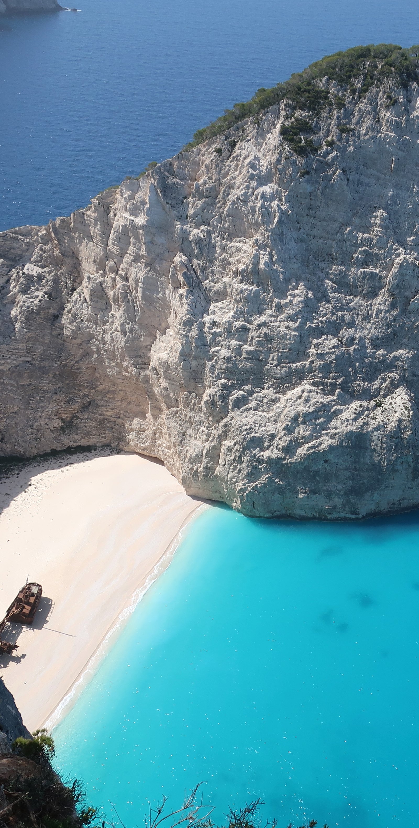
The only way to get to Shipwreck Beach is from the water. The cliffs that surround it are too sheer for a path. In season a flotilla of tourist boats come from all over Zakynthos: from the northern tip next to the lighthouse, where a small-boat boarding-point promises departures every ten minutes; from Porto Vromi, just down the coast; from Agios Nikolaos in the northeast and Agios Sostis/Laganas in the far south.
They get as close as they can then leave their passengers to splash through the last few metres of electric blue water. The object, for visitors, is to take photos of the rusting hulk of the merchant ship on the lovely white sand, with the sheer white cliffs behind and themselves in there too, alongside or in front. The complication is in trying to find an angle for the shot in which there aren’t too many other people – ideally no-one else – taking photos of the rusty ship and the sheer white cliffs and themselves.
The shipwreck has only been there since 1980. It might have been a smuggler’s ship, they say, lending it a rakish air. It has even been suggested it was deliberately beached by the local municipality as a tourist ploy. The idea is far-fetched, but visionary.
According to the internet – hardly reliable – people have fallen to their deaths while taking selfies from the clifftops. We were there in early April when there were no boats, so the beach was empty. The only other people looking down on the picture-perfect scene were a young Greek couple, standing unnervingly close to the edge, taking selfies.
Shipwreck Beach features on internet bucket lists of places to visit before you die and has been described as one of the most beautiful beaches in Greece, even the world.
At the lookout-point next to the car park above the beach, we were careful not to lean any weight against the railings because the drop is terrible. It is leg-weakeningly, gut-clenchingly, head-swimmingly terrible.
It must be a paradigm of some sort, this way in which places can be so transformed by the effects of mass tourism that they become other than what they are, or what they purport to be. It’s a sort of magic.
***
Zakynthos is shaped like a tipping-over lunar landing module. The east and most of the south are flat, the west and north are lumpy, with a high-point of seven hundred and fifty metres. There are cliffs along much of the west coast. There are no proper hiking paths. Nowhere did we hear the sound of goat or sheep bells in the hills. We saw almost no patches of spike plant – burnet, spurge, thistle – few beehives and no donkeys. All these things that make Greek islands Greek islands.
The tourists – there are a lot of tourists – come in on charter flights and stay at resorts all along the beaches of the flat parts of the island. The most popular resort is Laganas, a Greek island hotspot for nightlife and fun, they say.
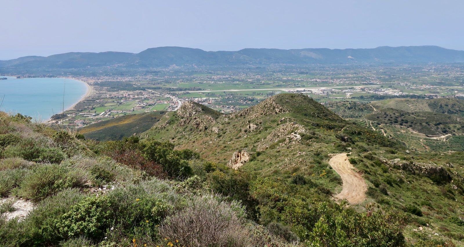
Early April though, as elsewhere, and even when the weather is bright and warm and the hills are full, absolutely full, of wild flowers, is pre-season. At Louxa, a pretty stone village in the middle of the island, we met two Dutch women, enthusiastically out walking, shorts and tee-shirts, bowled over by the loveliness of it all, but confused. Where are the people? They wanted to know. And, Where are you staying? Is anything open there?
Never having been to a Greek island before, let alone a Greek island out of season, they flew in, were picked up at the airport and plopped down in their accommodation at Keri beach in the southwest, where the shutters were closed, the holiday accommodation was empty, the tavernas were boarded over. It’s nice, they said, but not like the photos. Apart from us there are just a few old people.
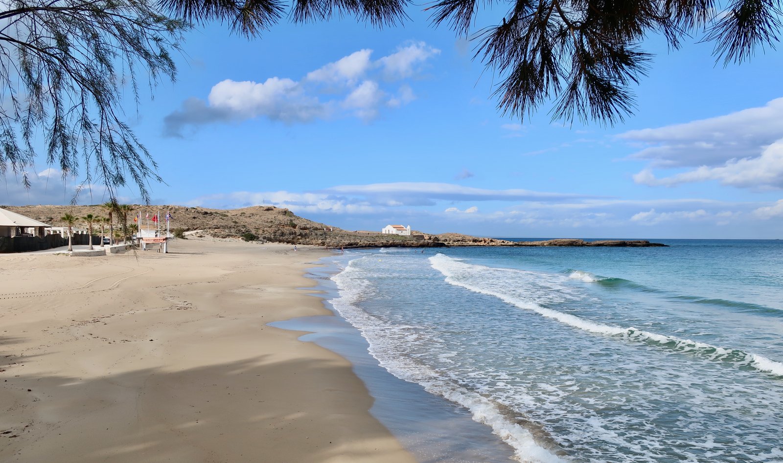
There are very many beaches on Zakynthos. If, rather than hike all over islands, you were of a mind to visit all the beaches instead, where visit means swim at, or lie on for a while, or play bat and ball at the water’s-edge, there’s a full holiday’s complement on Zakynthos. Some we saw in the far southeast are exceptionally picture-book beachy.
There are also more monasteries than on most islands. Because Zakynthos belonged to Venice from 1482 until the end of the eighteenth century, architecturally these monasteries are Italian rather than Aegean Greek. The map we used marks a dozen of them, with no information as to whether or not they are inhabited. Very near Shipwreck Beach we called in to the Agios Georgiou Krimnon Monastery, which like many Greek monasteries, in the recent past was abandoned but now, unlike most abandoned Greek monasteries, has been revived by a dozen or so young Orthodox monks. Several of them were outside digging, swashbuckling with their good looks, their jacked-up robes tucked into their waistbands. They were happy to talk about their lives, to elaborate the list of five or six different nationalities gathered together there. This is one of the very, very few times during countless island-monastery visits that we’ve encountered animation.
A few kilometres further south is the Anafonitria Monastery, similarly Venetian, similarly constructed around a central defensive tower, a local specificity within which the monks would retreat if under attack. It too is beautiful, but sits empty, awaiting its own cohort of rock-star monks with mobile phones in their pockets for ringing home to America, or Poland, or Lithuania.
***
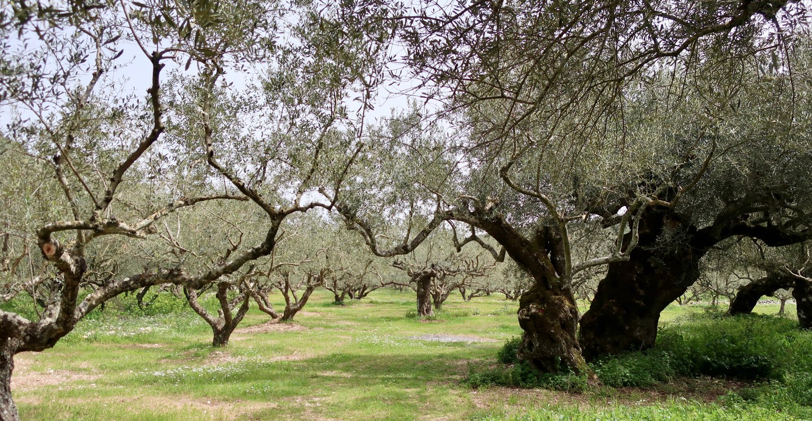
The Ionians, all of them, are a haven for olive trees. Because the islands on this side of the Greek mainland weren’t directly involved in the Greek War of Independence, they weren’t subject to the scorched earth tactics of the Ottoman and Egyptian forces, during which a large percentage of Aegean olive trees were razed.
The main town and ferry port, called Zakynthos, called, as elsewhere, the Chora – the place, the land, the country, the town – is unremarkable. Forty thousand people live on Zakynthos. The Chora is a proper small town with shops and services. It doesn’t depend entirely on tourism, so doesn’t close up for the winter.
The body of St Dionysios, who was born on Zakynthos, is preserved inside the town church that bears his name. On special days he’s taken around the streets in procession. Sometimes, when church officials try to open the tomb, they can’t manage. On these occasions, Dionysios is not in the tomb but out performing miracles. When the tomb can be opened again, seaweed is often found at his feet. The slippers of St Dionysios get so much wear, they need to be replaced from time to time.
This story we were told, without a hint of wryness, by the guy from whom we rented our apartment.
There is another miniature port in the north, called Agios Nikolaos, from where small ferries skip across to Kefalonia in season.
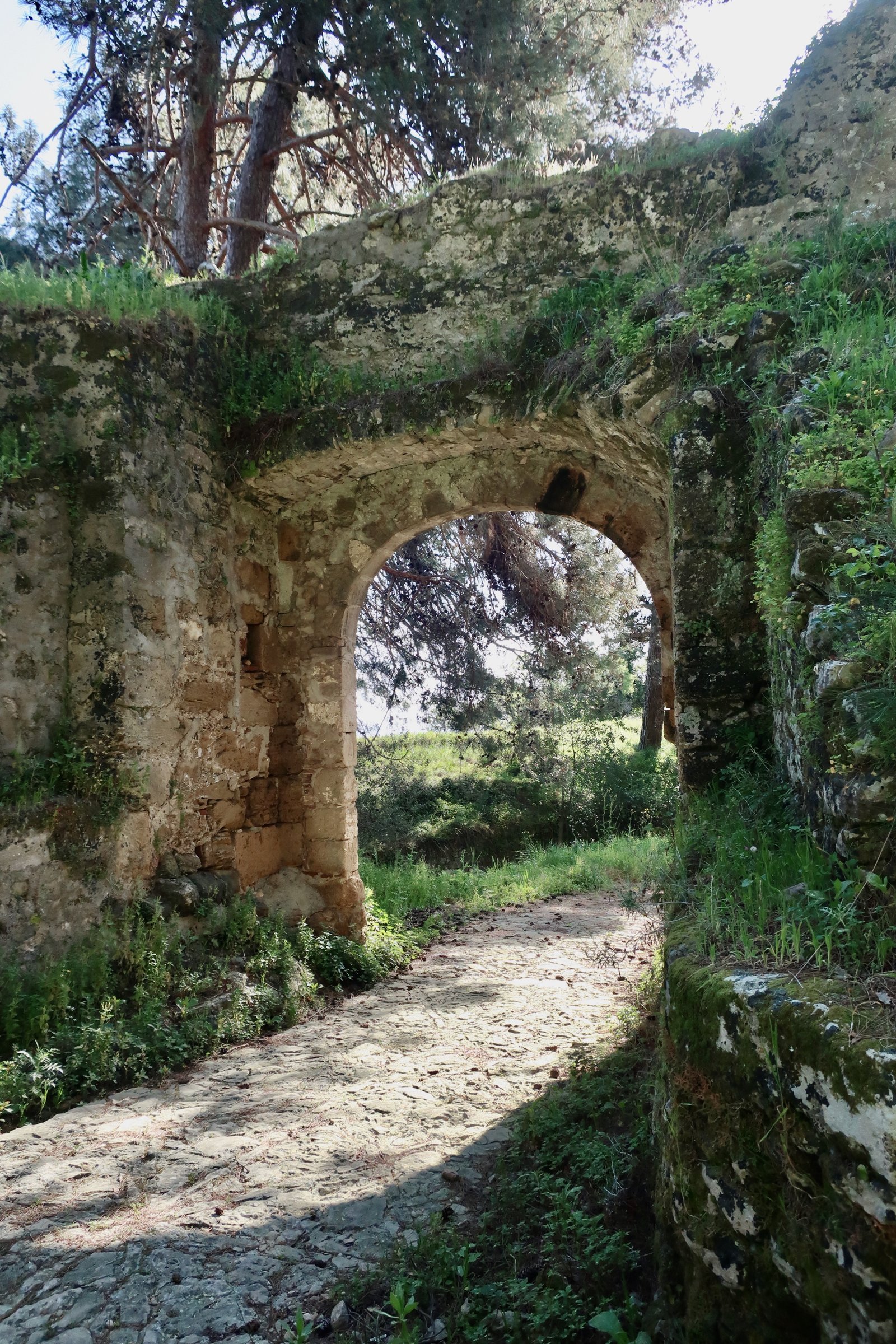
Above the Chora on a hill is the Bochali neighbourhood and an old Venetian fort, that before it was Venetian was Byzantine, and before that classical Greek. (According to Homer, among the hundred or so suitors vying for the hand of Penelope, wife of Odysseus, twenty were nobles from Zakynthos.) There’s an arched stone entrance but little left within the complete circuit of defensive walls – some vestiges of church, barracks, prison, that have been left to melt away probably since the departure of the British in 1864. (The Ionians didn’t become part of Greece until 1864, when the British, who had taken them from the French, who had taken them from the Venetians, finally sailed away.) Nowadays it’s a pine-forested meadow, with panoramic views down over Zakynthos town and out to sea. In Spring it’s thick with wild asparagus.
***
In September 1943, the commander of the occupying German force called in the mayor and the bishop of the island and told them to draw up a list of all the Jews of Zakynthos, with a view to rounding them up and deporting them to the camps in Poland. At the time two hundred and seventy-five Jews lived on the island. The mayor and bishop got word to the Jewish population and arranged for them to be hidden in the hill villages. When the Germans demanded the names, the mayor and bishop handed over a piece of paper with only two names on it, their own.
During the second world war, over eighty per cent of the Jewish population of Greece was murdered. Almost all the Jews of Zakynthos survived.
HIKING
There don’t appear to be any proper hiking trails on Zakynthos. Various maps of the island have routes marked as hiking trails, but these are roads, lanes, narrow lanes and dirt tracks, with only occasionally a small section actually path or trail. At time of writing – April 2022 – there are no signposts on these routes. For those wanting to do them, it’s map and GPS.
The fact that the marked routes are almost all not hiking trails doesn’t mean they aren’t worth doing. The track from Louxa to the Iperagathou monastery, for example, is lovely.
Although in a general sense we favour the smaller paths – best of all old stone-laid paths, then up in rough order through unpaved tracks, narrow tarmac lanes and finally main tarmac roads – it isn’t always so clear. On Zakynthos we walked on narrow tarmac lanes through olive groves, with spring flowers lining the roadsides, and zero traffic, and it was great. We also uncomfortably scuffed our way along the quite un-lovely dirt and stone track that leads from Kalamaki 1 Beach in the far southeast up towards the Panagia Skopiotissa Monastery, and were less impressed.
Even if you do only map-marked walks, you’ll experience Zakynthos differently from most tourists, who generally stay close to the resorts, or in rental cars/on rental mopeds and quad bikes between points A and B. But the whole of the island, and in particular the western, hilly half, is a scrawl of lanes and tracks. Some will be great, most will be interesting. Almost everything is interesting.
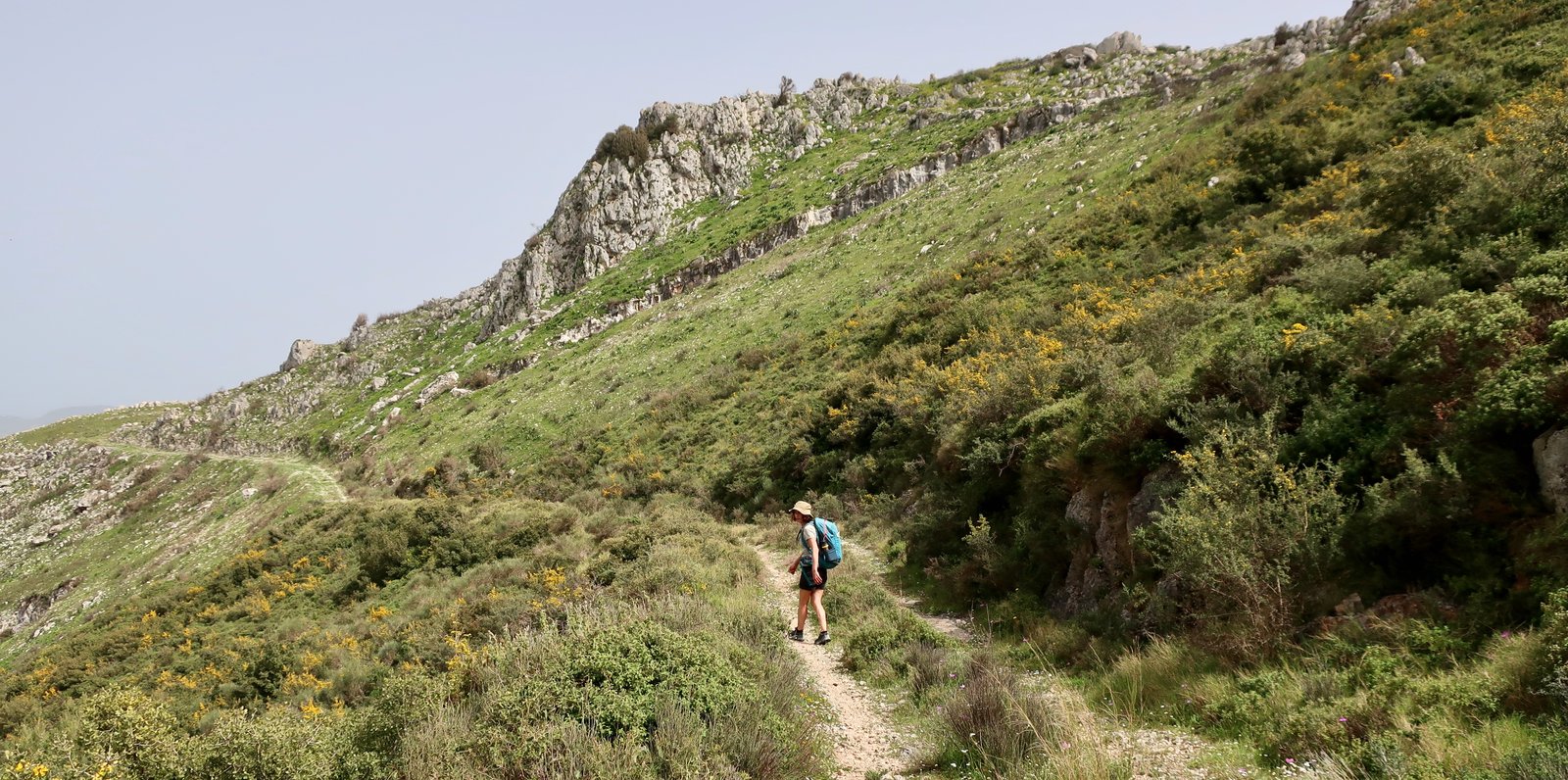
We used a Nakas road cartography map, which claims also to be a Hiking Map. On it there are half a dozen marked trails. One in the north, one in the west, one in the south west and three in the centre, in the highlands. All of them, bar a couple of very short sections, are strolls on wide dirt tracks, lanes or roads.
Because of the size of Zakynthos and the limitations of public transport, without a rental car or moped, access to these routes is complicated. On one day we took the early school bus from the Chora and combined a couple of the highland routes to make a very long walk from Alikes beach back to town. On another day we did a fairly long walk in the south east, circularly from Zakynthos town.
HIKE 1
Circular, 26/27 kms, from Zakynthos town to Argassi, Kalamaki 1 Beach, the Panagia Skopiotissa Monastery, down to the east coast, back past Argassi and home.
From Zakynthos town along the coast to Argassi. Right turn at the entrance to Argassi, by the bakery. Past the old stone aqueduct, up and over the low hill in the direction of Kalamaki. Very easy, gentle walking, on a tarmac lane, mostly between olive groves.
Optional diversion down to Kalamaki 1 Beach on the south coast, for coffee or a pause, or for a swim if the weather and water are right. Afterwards, anticlockwise on a wide dirt track, mostly uncomfortably stony and not at all pretty, more like a building-site-entrance than a trail. It goes to the top of Skopos hill, 492 metres but feels like less. The pretty, abandoned Panagia Skopiotissa Monastery is hidden behind the antennae on the hilltop. More asparagus, in season. More olive trees.
After the diversion to the monastery, the way continues on down the other side, to the coast at Kokiareika, then it’s all along the uninspiring holiday build-up on the road back to town. It’s not the best stretch of coastline, but again is swimmable if the weather’s okay. South of Kokiareika, the other direction, there’s Gerakas Bay, famous as a turtle-nesting site. In this direction there are some very nice bays and beaches – Nikolaos and Porto Zoro, for example – but the diversion would be too much to add on if doing this circular route from town.

HIKE 2
From Alikes Beach (having taken the early morning school bus from Zakynthos town) – back to Zakynthos town via Louxa and Kiliomenos in the highlands, on the W2 and W4 trails. From Kiliomenos back to town on roads or lanes of choice. Roughly 40 kms.
We don’t make a point of such long hikes, but have never regretted it when we’ve done one. At the end of the day legs are working on automatic. Just occasionally – and the northern end of Karpathos comes to mind – a forty kilometre walk is the only solution, and is extraordinary, exhilarating. On other long days we quite often spend the last few hours of a hike not so much hiking as getting home the quickest way possible, because this is the only way to do this or that walk in the time we have available. Or because for one reason or other we’ve made the decision to do it this way.
Get off the school bus in Alikes. Walk north along the beach or near the beach and after a couple of kilometres dive inland towards the Ioanni Prodromoi monastery. The dirt lane that begins just behind the monastery and winds its way up to the top of the range of hills, the peak of which is about 750m, leads all the way to Louxa. Except that at some point it ceases to be a dirt lane and turns into a brand new tarmac road through the hills, which, when we were there, was not yet even open. Seven hundred metres is a reasonable climb. There are views. But this is not in any sense proper hiking.
The route goes through the small and lovely old stone village of Louxa, almost completely empty of people in early April. After crossing the main road, there is a wide country track, which continues all the way to Kiliomenos, passing by the Iperagathou Monastery, open only in the morning. It’s easy to forget the track is at mostly around 500m altitude. It’s farming land, a lot of vines, olives, fruit trees.
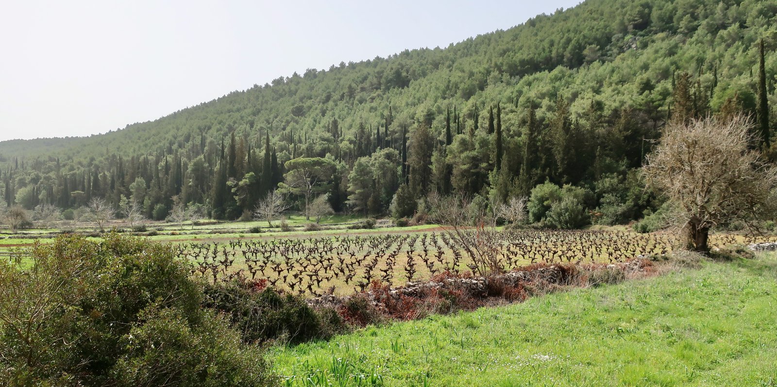
There are old stone walls and agricultural buildings, many of them crumbling now, stone terraces with just the perfect patina of age and half-use, and pine trees and cypresses around the edges of the cleared, farmed land. In April it was all wild flowers, impressionistic reds and whites and blues and yellows and pinks and purples.
A kilometre and a half after Kiliomenos, we took a left on a small track, clearly marked on the map, for a slightly more direct route towards Lagopodo. This too was through olives and vines and stone walls. It descends towards the plain below, with, depending on the route you choose, several larger villages to pass through, and the town of Zakynthos in the far distance.
Having reached the wide, fertile plain of Zakynthos, which must have made the wealth of the island in the past, there are still ten kilometres to go. It’s flat agricultural land, mostly olive groves and citrus orchards, and is resonant with the barking of dozens and dozens of dogs – chained, behind gates, and if wandering free either friendly or slothful – that will hear you coming or sniff you coming or just be thrilled to take up the chorus of excitement at this unlikely intrusion – hikers! – into otherwise predictable days.