

A friend spent time on Patmos in 1975, renting a small house in Skala, the port. In those far off days it was a sleepy place with almost no tourist infrastructure. When he wanted to wash he had to put a large basin on the roof, fill it by hand and wait for the sun to heat it.
Who could have imagined the last fifty years? Today there is no shortage of accommodation in Skala, nor in the narrow streets of the Chora or in the south around Grikos, where new-builds are filling out the waterfront and creeping up the hill behind. Even in the north there are small clusters around Pano Kampos and Kampos beach. There are cafes and bars and tavernas, and shops that cater exclusively to tourists, with their white and pastel summer island clothes and Greek-themed knick-knacks. Boats do trips around the coast and further to the outlying islands of Marathos, Stroggili, Arkoi. There are cruise ships.
Patmos has become a regional centre for religious tourism. Oh, if only we had something like it on Leros, said the guy we stayed with there, imagining how much better business might be if they too had a theme. It is taken for granted that crowds will never come for the handful of art deco buildings constructed in Leros by the Italians in their brief, early twentieth century imperial incarnation.
In 1981 the Greek parliament officially designated Patmos a Holy Island. It was there that John the Theologian was said to have written the Book of Revelations. This John, who may or may not have been the apostle John – he would have been an improbable one hundred years old – wrote it in a cave halfway up the hill to the Chora. The cave, the Chora and the great Monastery of St John are jointly listed as a UNESCO World Heritage Site.

There are other holy islands in the Aegean. Foremost is Delos, belonging to the earlier tradition of Olympian gods. There’s also notably Tinos, to which Greek Orthodox believers come four times a year, there to venerate a miraculous icon of the Virgin Mary. And then all the other islands that are dusted with more or less hallowed sites. The sacred geography of Ancient Greece, where every village, city, state had its own holy places – temples and groves, water sources and caves – has morphed into the modern Greece of miracles, icons, pilgrimage. Perhaps the gods have changed, but the landscape is still held together by a magical network. Not only the great centres like Patmos, or Tinos, or Panormitis on Symi, but all the thousands of small churches and lesser monasteries are glue, sites of power. The islands are inconceivable without them.
Most cruise ships are too big for the bay. They anchor outside and the tenders get to work, a small fleet of them buzzing back and forth. Once on land, the visitors are siphoned onto buses that take them up the hill.
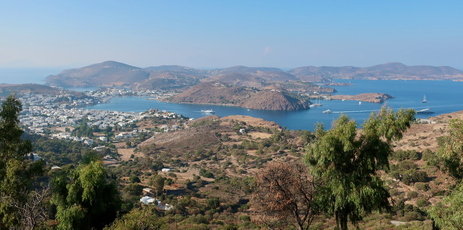
Elsewhere we have talked about cruise ships, implicit their propensity for harm, but seeing them in Patmos I am not sure we have not exaggerated their import. We watched them come in, the passengers ebbing and flowing, and even with our preconceptions the island seemed little disturbed by these ephemeral visitors. But then this is Patmos, not Santorini or Mykonos. Overall tourist figures are hard to establish, but perhaps 25000 actual overnight visitors, while a much larger number, around 150000, come and go on the same day, are efficiently sucked in by the island and just as efficiently regurgitated.
The cruise ships aside – and there is anyway some disagreement about how much economic benefit they bring – it is not at all certain that the relative tourist success of Patmos is entirely down to its holiness. Even if they would not quite put it like this, many people come because Patmos has style.
Style: some uncertain combination of simple prettiness and a sort of harmony. Hydra, Folegandros, Alonissos and Sifnos have it. Symi perhaps. Chalki and Donoussa in a sort of minor key. Ithaka too. And Paxos. There are probably others.
Islands-with-style are not necessarily good to visit. (Neither are they not good.) And style has nothing to do with hiking. But in this age of communication, where information and images spread and multiply with hitherto unimagined speed, style works.
Skala, the port, is a sweet little town, with its lanes and squares, churches, meandering seafront, animation. The Chora is exceptional, historical, all twisting alleys, arches and stonework, at its heart the fortress-like monastery of St John, looming not just over the Chora but over the whole island. It is one of the great castle-monasteries of the Aegean. To the south, Grikos, in the process of being developed, may have it all in a touristic sense – it sits on a huge, sheltered bay, there are beaches, the little port is attractive, it even has the island of Tragonisi plopped into the middle of the bay for picturesque effect.
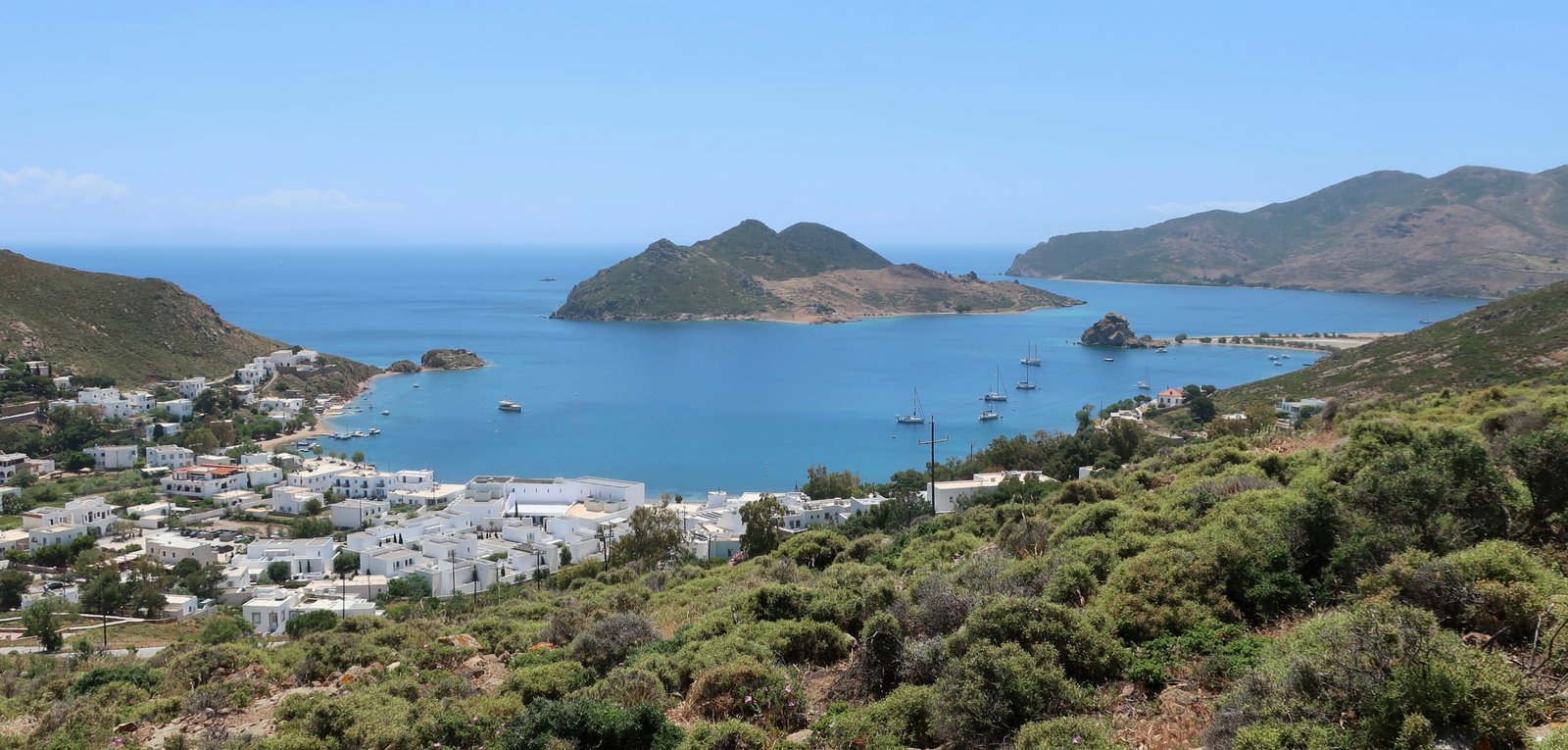
Further south still the beach of Psili Ammos, by reputation one of the best in the Aegean, is accessible only by boat or a short stroll around the coast, this latter less than two kilometres but having the effect of magnifying the reputation of the beach as not just a place of style but also somewhat secret, rarefied.
***
All this of course is tending away from the Patmos visited 50 years ago. The simplicity of those days, the lack of artifice, but still the same beauty, the same history, even the same trails, of which Patmos has a number, stone-laid, stylish.
It’s not for us to weigh the merits of a bare, subsistence agricultural economy against this blooming of Zorba tavernas and cruise ships. But we cannot not see this new island-world of education and health care, and wonder what realistic alternatives there are for now.
Come back in one thousand years and there will probably once more be a recent past during which everything was somehow better, more authentic. Isn’t that how it’s always been? Isn’t it really about the loss of youth, our individual centrality in the cosmos, the inevitable awareness of our own mortality, the piling up of complication in life that has us moving from freedom and idealism to something slower, more reasonable, less expansive?
And yet, even knowing that, the evocation of that Greece of fifty years ago carries with it a feeling of loss that at times is almost an ache.
HIKING

You could easily go to Patmos for two weeks and spend four or five days of it hiking. Autumn would be perfect, the water still warm for swimming, days less hot for walking. Spring would be perfect, the water cold but the land green and thick with wild flowers. Winter, a lottery, may even be best of all if you’re lucky with the weather; the delight of being in the islands when no-one else is there and life has settled into a sort of pre-tourism purity, albeit without the timeless rhythm of agricultural work.
For hiking, Skala, roughly in the middle of the island, is the obvious place to stay. All paths can be done on foot from a base there. Patmos is a small island, no more than 12 kms from top to bottom, even if straight-line measurements are something of an illusion in the islands where little is straight, and much is up and down. It would also be possible to stay in the Chora and still do all the paths circularly. Trail 7 in the north would be a little long, but you could always take a bus one way, to the beach at Kampos – which is what we did from Skala anyway.
The only paper map we had was the Terrain edition from 2009, now out of date. There is apparently a better 2022 Anavasi version. But rather than either of these we mostly made reference to the Greek Paths of Culture site, which lists 7 hikes for a total of 30 kms. (https://www.monopatiapolitismou.gr/?p=60&lang=en) Except that the 30 kms are actually significantly more if you choose to make everything circular from Skala.
The paths, their waymarking, has not been maintained since the initial project by Paths of Culture in 2012/2013. Much of the signing is no longer visible and the paths are at times difficult to find.
According to an article from 2025, Paths of Culture are planning to come back to refresh their original work, and at the same time add a couple more routes. As of May 2026 this hasn’t yet been done.
The seven trails they mention can be done in various different ways, in smaller sections, or by combining them into long, or even very long routes. The length of each trail is given on the website, plus the time it takes. Trail times are often exaggerated on island hiking sites, (or on the signs themselves). Unusually, here the estimations they give are quite accurate, they don’t leave time for dawdling.
We did three hikes. One very long, that began and ended in Skala and took in their Trails 1, 4, 6, 8, 5 and 2, in that order. A second, starting at Kampos beach, where the bus from Skala dropped us, began with their Trail 7, and then, having returned first to Kampos beach then walked up to Kampos centre, went north from there on the road before taking minor dotted trails in the northwest of the island and eventually heading back to Skala.
The third hike was simply Paths of Culture Trail 3. It begins and ends in Skala, and goes up to Kastelli, the hilltop above the port on which there was once a significant classical settlement.
For information, our Hike 1 was about 26 kms, Hike 2 was roughly 28 kms, and Hike 3 was short, 4 or 5 kms.
Below, rather than strictly detailing the hikes we did, I have tried rather to divide the hiking into logical, mostly smallish, pieces. Hopefully this will be more useful.
ONE
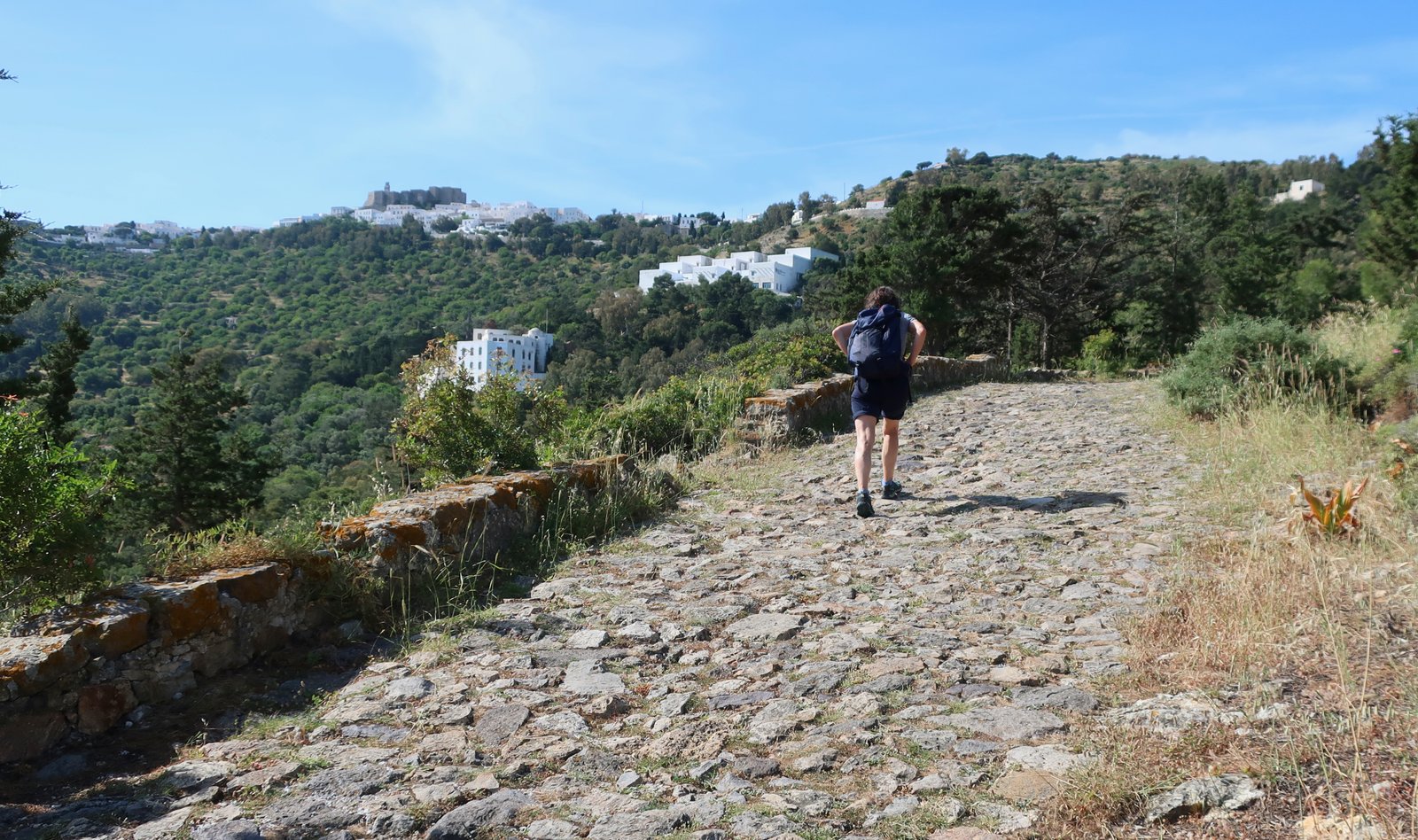
Culture Paths Trail 1 and Trail 2, from Skala to the Chora and back down to Skala.
About 4kms, including a possible stop at the Cave of the Apocalypse. Plus: any amount of wandering around the Chora and the monastery.
Trail 1, the old main path linking the port to the Chora/Monastery, is an easy stroll, less than 2 kms with a total altitude gain of 200 metres. The Cave of St John is practically on the path, about halfway up. For perhaps half of the way this is still an original, wide cobbled road, of the sort found on many islands connecting monastery, port and main settlement. When the cobbled road first hits the main tarmac road, a narrow track diverts off to the left, just below the road, and for a while slips through pine and cypress woodland.
The route down, Trail 2, must once have been almost as important as Trail 1. Much of the cobbled surface is extant, although rarely as wide and grand as on the other side. It might even be more fun to do than Trail 1 – there’s more variety, a more diverse environment.
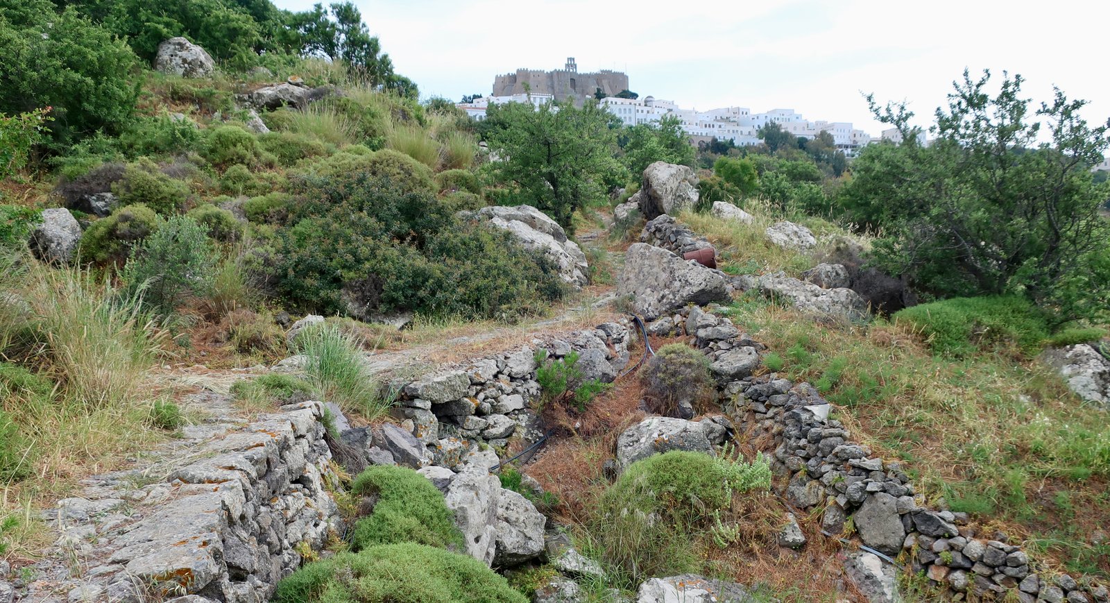
In May 2026 when we did this path it was becoming overgrown at the bottom, near Skala. You have to push your way between encroaching bushes.
If you do nothing else, try these two short, easy trails. Between them they give some idea of what life was like for hundreds, if not thousands, of years, before tarmac and motorised vehicles came to change everything.
TWO
Culture Paths Trail 3 – Skala – Kastelli – Skala.
Maybe 4 kms from the dock in the middle of the seafront and back
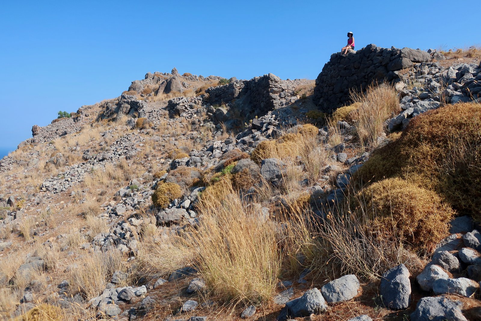
A short walk, two hours maximum, to the hilltop overlooking Skala on which, beginning two and a half thousand years ago, there was a classical settlement. The total altitude gain is less than 200 metres. It doesn’t matter which way the path is done, clockwise or anticlockwise. There are a couple of churches, either on the way up or down, depending on direction, and various alternative paths, dotted through the middle of the Culture Paths lasso-shaped walk.
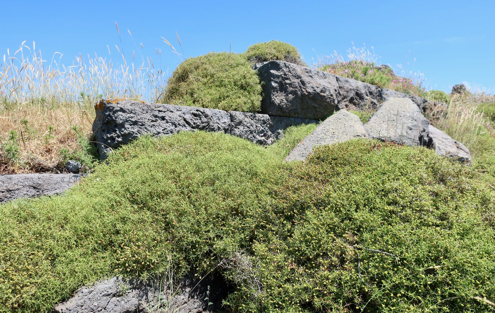
Kastelli hilltop is littered with remnants. There are stone steps, coigns, odd bits of wall. Much of the shape of the settlement can be followed. In places huge, grey rectangular stones, the building blocks of the city’s defensive walls, are drowning in a sea of spiny spurge.
THREE
Culture Paths Trail 6 circular path beginning and ending in Diakofti/Stavros.
6 kms
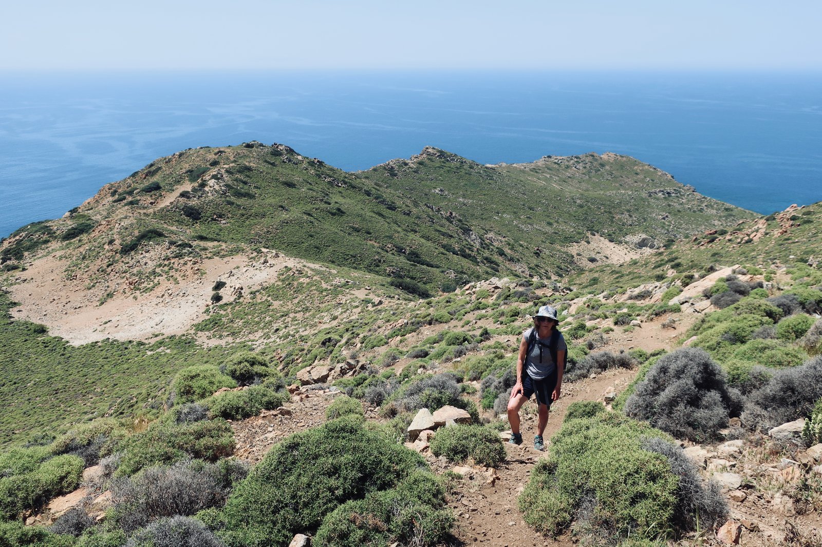
Apart from a small agricultural incursion at the neck, the bulbous southern peninsula of Patmos is barren, shadeless, empty of people. If it wasn’t for Psili Ammos beach, no-one but the very occasional hiker would go. Even on a small, relatively popular, island like Patmos, the used-for-tourism areas of the island make only a small percentage of the whole. Everywhere south of Grikos, the far north, the long seahorse-shaped promontory east of Kampos, all are largely uninhabited with only a few residual pockets of agriculture and a beach or two.
Culture Paths gives a time of 3.5 hours for this trail, which seems slow, but is probably accurate. Although not as long as Trail 7, because of the bad signing and some rough terrain, it’s the most difficult path on Patmos. We’ve done it twice, once in May and once in August. In May it was hot, in August a furnace. Given the current state of the trail and the waymarking, it is almost inevitable that anyone hiking it will at some point go astray.
The anti-clockwise version is easier: the path to Psili Ammos beach is clearly-defined, a little over a kilometre long. In season there will probably be someone moving one way or the other along it. At other times of the year, you’ll likely have it to yourselves. In mid-May 2026 the taverna wasn’t yet open. There were three people on the beach.
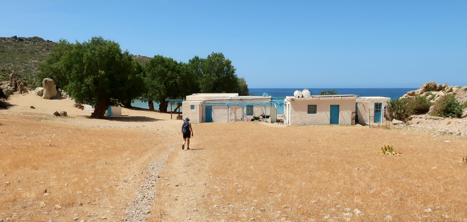
Several years previously in August the taverna had been full, music playing, most of the shady spots under the tamarisks occupied.
The trail continues from the far end of the beach, driving straight inland through a wide, sandy gorge. There are no markers. Follow the gorge then bear left in the fold of the valley. A couple of hundred metres further on there’s a right turn, 90 degrees up and out of the bed of the stream. At the turning-point there is a marker, and several more on the slope on the way up. These markers, that were once a red 6 on a white background, are now sun-bleached, numberless, white on white.
Uphill to the top, then left along the ridge. Most of the way is on or near this ridge. Looking back from distance – from Profitis Ilias for example, the highest point on the island about three kilometres away as the crow flies – it all seems clear and obvious. Close-up, things are rarely simple.
From the beach all the way to Diakofti there’s rarely a clear path to walk on. When we first did this trail in the other, clockwise, direction, we got completely lost. Expect it to be awkward. Look out for the old markers, use the ridge and a map. It isn’t a long walk and the visibility is mostly good, so that it’s possible to maintain a fair notion of where you are and where you need to go. The descent to Diakofti is steep, rubbly, slightly uncomfortable.
It is a Greek island specificity that you can be close to a well-frequented spot – popular beach, here – and wholly lost in rugged terrain. The unused portion of any island is often deeply inhospitable.
FOUR
Culture Paths Trail 7 that begins between Kampos beach and Vagia, clockwise around the loop back to the same point. Then a wandering around the northwest before heading back to Skala, as detailed below.
Approx 28 kms, but there are endless variations on this. (The basic Trail 7 is 10 kms long.)
A bus from Skala, by the main dock, to Kampos Beach.
Trail 7 takes in much of the remote northeast of the island. Use the Culture Paths online guide, (or perhaps the 2022 Anavasi map), ideally not the out-of-date Terrain Map. Again, the suggested time from Culture Paths of 5 hours for just over 10 kilometres seems excessive, but isn’t. The waymarking may have been good a dozen years ago, not any more.
The first section, that leaves the road halfway between Kampos Beach and Vagia Beach, begins with a nice thin trace through low vegetation. By the time it reaches the church of Agios Demetrios the path has more or less disappeared, or there are competing possible paths. But the church is an easy destination.
After the church it’s not clear which way the trail goes, but again, as long as you have the map and a fair sense of logic you can’t go too far wrong. In less than a kilometre both the Terrain and the Culture Paths maps pass through an obvious col. From there the trail goes behind (north of) the high point on this end of the island, a peak marked at 228m, and heads towards Cape Zarroi.
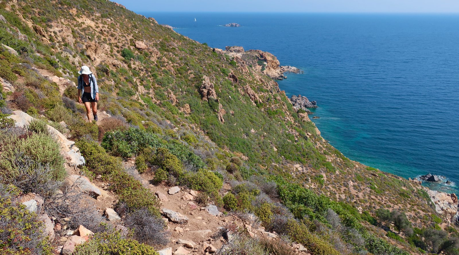
This is a nice trail but you really have to find the right way, not an approximation. It’s thin, pretty straight, and marked by a series of prominent stone cairns.
There is nothing out here, not even a lonely church.
After Zarroi beach a slender trail traverses a steep, rocky slope a couple of dozen metres above the water, before coming out on a narrow lane, then joining the main road leading to the eastern tip of the island.
The return to Vagia/Kampos goes along the coast, past at least seven or eight beaches. At the first of them, Geranou, or Alykes – the maps name them differently – a sandbank has created a large shallow pool, one hundred metres long, thirty or forty wide, in which the water will be somewhere between warmer-than-elsewhere and soupy, depending on the time of year. A very safe place for children to swim, soft and oozy underfoot.
Along the coast there is no actual path. The way follows right on or close to the water all the way, with a couple of short sections on the road.

***
The Culture Paths map features a dozen or so dotted, unmarked trails in the north and northwest. At least one of these and maybe more will in theory soon be incorporated into the Culture Paths network.
With some success and some failure, we used a combination of the Culture Paths and Terrain maps to get around the northwest and eventually back to Skala.
From Kampos centre, the junction point of five roads where there’s a church and a bar, a tarmac road goes more or less due north. After taking a left-hand turn, there’s a dotted path on both maps heading roughly to the north of Lefkes Bay. This path at least exists, faintly. It traverses a shallow slope, goes around the end of the hill, and joins a small dirt track that heads north towards a small settlement/few houses. From here, on the Terrain Map, there’s a dotted path that leads south along the coast down to Lefkes Bay.
The first section of this doesn’t seem to exist, the second half does. Through gates, around the hillside a few dozen metres above the water with many goats for company. At Lefkes Bay there’s an odd, incongruous mansion that looks as if it has been transported from somewhere in northern Italy.
We strolled up to a tiny church on the southern slopes above Lefkes beach, then decided that we could go on from there around the headland and join up with the road that leads down the west coast, and eventually into Skala. The road is no more than 500 or 600 metres away. What could go wrong?
Lots, of course. Getting around the headland is difficult enough. The land is progressively more and more steep, and what seemed to be a path – we thought we could see it from the church – soon faded, or separated, into competing goat-trails.
Having forced a slightly uncomfortable passage around the headland, it turns out that the road we were looking for was the road to a quarry, and the municipal dump. Cliffs on one side and high fences the other prevented us from reaching it. (‘High fences’: we’re used to climbing over all manner of fence where necessary. This one is a different thing entirely, impossibly high.
We were very lucky not to have to go all the way back to Lefkes beach and lucky there were no dogs in the smallholding we had to go through. Do not go this way. Instead leave Lefkes Bay on the road. There are many possible alternatives from there back to Skala, all roughly the same length.
FIVE
Culture Paths Trails 4, 8 and 5. From the Chora to Grikos and Stavros on Trail 4. Up to Profitis Ilias on the road. Trail 8 almost back to the Chora. A loop on Trail 5 down to the coast and back to the Chora.
Approx 11 kms, plus, if you’re in Skala, up to the Chora and down again on Trails 1 and 2, (see HIKE 1 above), an additional 4 kms for a total of about 15 kms
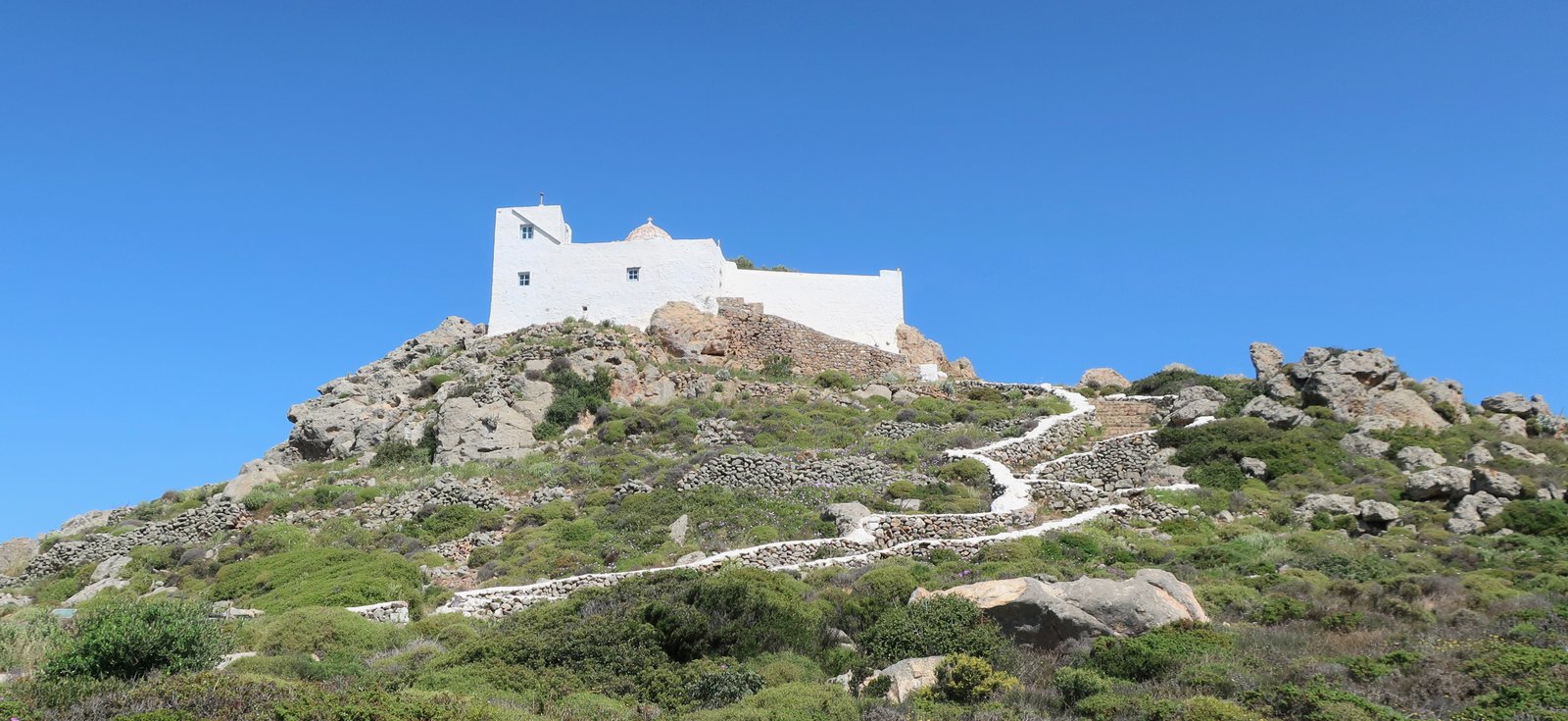
This hike, if you do it all, including the stroll up to the Chora from Skala and back down again, takes in all the cobbled paths in the heart of the island.
Trail 4 is the linking path between the Chora and Grikos and all the south/southeast. Most of it is still paved, although never as grand as Trail 1. Having reached Grikos, or the road just above Grikos, the rest of Trail 4 runs along the bay and the beaches Grikos – Petra – Stavros.
The way up to Profitis Ilias is a road-walk. In May there was zero traffic. Profitis Ilias itself is an elegant hilltop church, and dominates this end of the island. It seems to be unvisitable without a permit from the monastery of St John in the Chora. No idea how to go about this. It might be straightforward and might be impossible.
There is a tiny, narrow footpath (Trail 8) leading down from behind the church towards the Chora. It’s sinuous and nice and without maintenance will soon disappear.
The monumental Monastery of the Annunciation is at the top of Trail 5, from where the loop down to the coast and back can be done in either direction. The monastery is huge, incredibly well kept, has shady inner courtyards in which to sit and doesn’t quite have either the charm of many of the lesser, more remote monasteries all over the islands, or the architectural style and intricacy/age of the Monastery of St John. We only did one side of Trail 5, a partly-paved path down to a garden church, then came back up the same way.
***
