
Early morning halfway along the seafront in Livadia, low-key ferry port and main settlement on Tilos. It’s the last week of May and ordinarily, on a small, out-of-the-way island, we’d have the place to ourselves. But here there’s a hum of conversation, gentle jazz playing, a routine of purposeful activity.
A deeply suntanned barrel-shaped twosome on a morning constitutional march past at speed, hand in hand on the long promenade that runs behind the beach. An elderly English couple glide side by side through the flat water, she doing breast stroke, he a one-armed crawl. A lady in a wide-brimmed blue hat makes stately progress through the chill water. People know people, they greet each other in passing.
Another elderly couple, first to settle on the beach, are tenderly rubbing in sun cream, helping each other reach those places they don’t bend so well into any more.
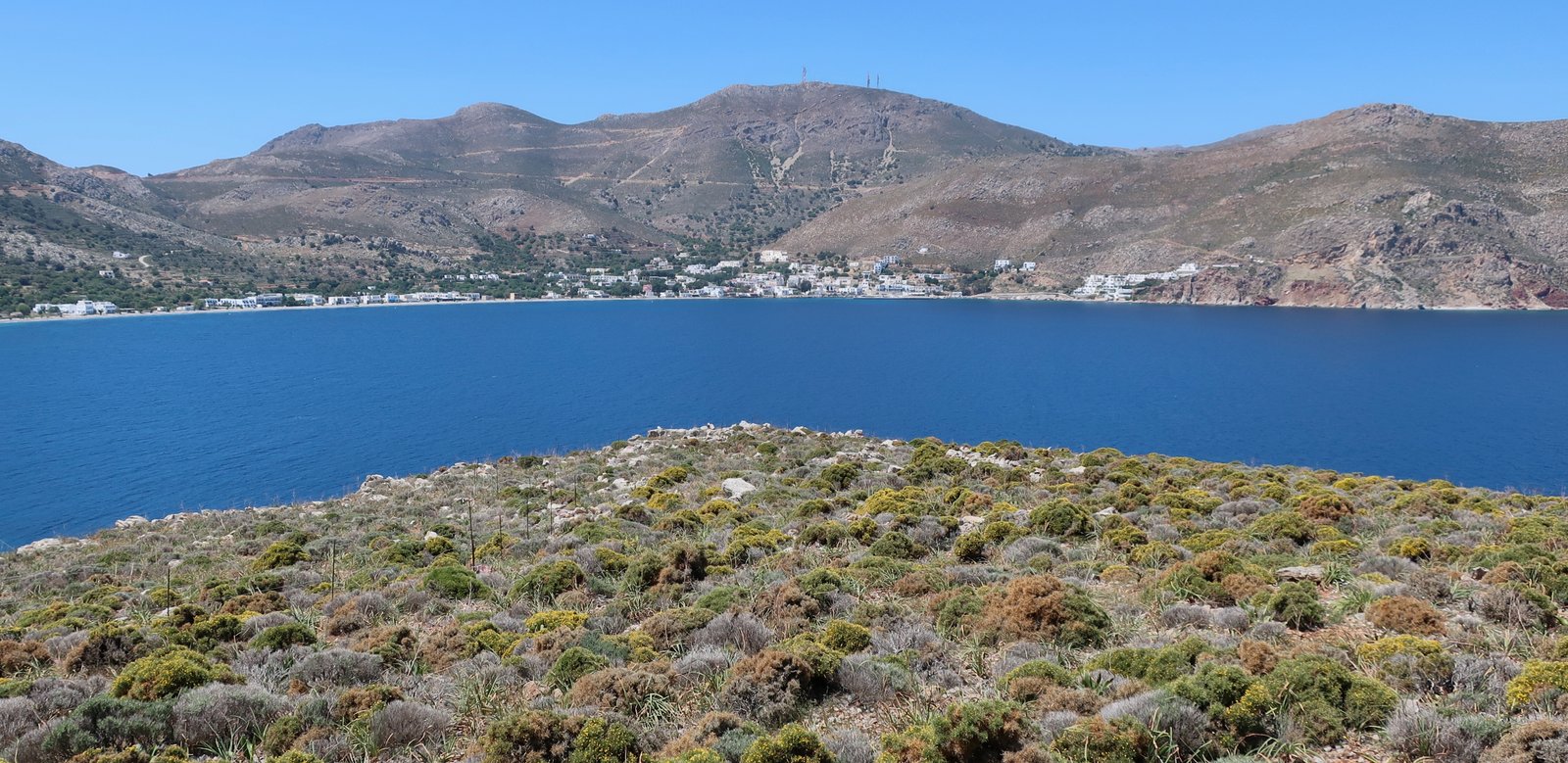
On our two previous visits to Tilos, both of them in April, Livadia had been deserted. Now, several weeks later in the year, there are enough visitors that the half dozen tavernas are all open. They greet returning customers with just the right amount of familiarity; a touch on the arm, even a small hug – especially for the women, typically more at ease than the men in this sunny foreign world.
Tilos it transpires has marketed itself as an out of season destination for Northern European retirees. Other islands must be taking note of what’s happening here, wondering how they can work the same small miracle. Decent-sized airports nearby on Kos and Rhodes help. You have to get the people in. But there are very many islands with functional proximity to a suitable airport. The airports aren’t the main reason. The main reason is that, having the same unused infrastructure we see for months on end all over the islands, aware that even away from the short high season the weather is still great for much of the year, someone has had an idea.
It’s easy to sigh, to look back with longing on a pre-tourism past, but those days are gone. And besides, it’s far from sure that for the people who lived here they always were good old days. If the islands are to be kept alive as places on which people can survive all year round, models of gentle development need to be found and this version, the invention of a destination a little more adventurous than Benidorm say, or, closer at hand, more independent than Rhodes or Santorini, may be part of the solution.
Or maybe it’s just another problem and there is no hope. Maybe the great holiday tidal wave is unstoppable. The islands are too lovely for their own good and right now we’re on the cusp of their undoing, this stretched-out moment during which we can come and teeter at the end of their long history, and still see it all, and touch it all, and feel it all before it disappears, still have them to ourselves for most of the year, these wild little museums-in-the-making.
Perhaps the same people responsible for the stretching out of the tourist season were also responsible for the minor notoriety Tilos has gained as one of the most green of Greek Islands. Some years ago the forward-thinking mayor and his team addressed the problem of energy-consumption. They moved into wind and solar power to such an extent that Tilos is now self-sufficient. They’ve since taken other initiatives, such as changing the municipality’s small number of vehicles to electric, and, in order to preserve the island’s fauna, banning hunting. (I cannot imagine how difficult this latter must have been.) The same mayor of this small island, on which around seven hundred people live all year round, was also, in his capacity as local administrative official, the first person in Greece to officiate at a same-sex marriage. Many of the larger countries in the world would like to claim a nexus between morality and muscle. And then this example. How could you not warm to such a place?
When we were staying on Halki, Tilos’ southern neighbour, the lady we were staying with told us, Tilos isn’t like Halki. Or Symi. Or Kastellorizo.
It’s not beautiful in the same way, she was saying, not without a hint of neighbourly disdain, neighbourly disdain being just as prevalent here as anywhere else. Perhaps more so, this being a place where the lines between neighbours, between islands, are so categorical.
She’s right though, Halki is exceptionally pretty. Tilos in comparison is a tad scruffy. But then, set off southeast from Livadia towards the abandoned village of Gera, then pause just past the end of Livadia bay at the small church of Agios Ioannis. It marks the point at which you leave the port behind with its smattering of civilisation and head off onto a great stone path sliced into the hillside above the coast. There’s a pine tree for shade in the small courtyard in front of the church. There’s a field next to it that was palest beige at the end of May, bright green in mid-April.
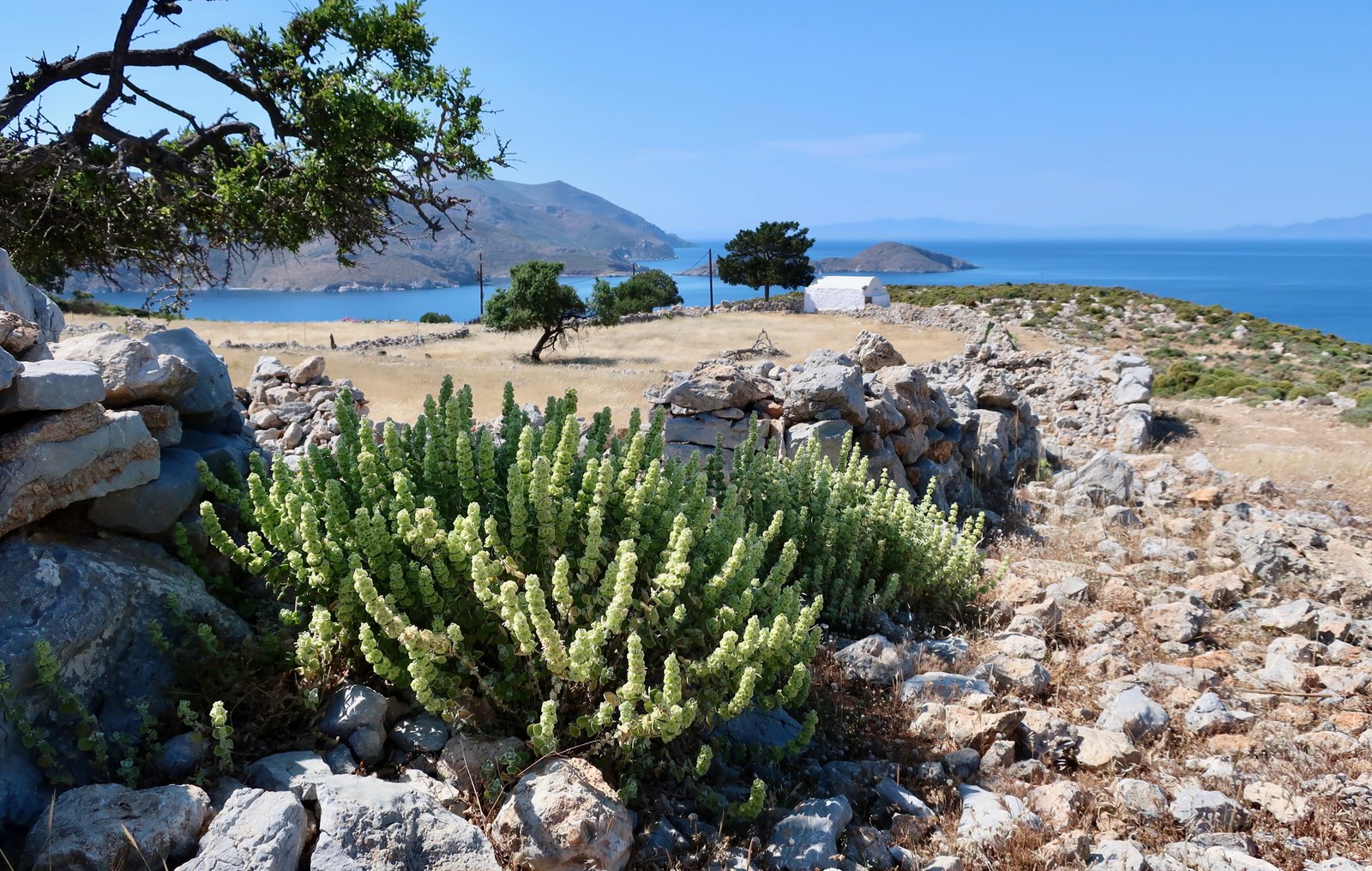
Combinations of shape and colour and texture like this are everywhere in the islands, with the blue Aegean as backdrop and here that stump of a church, the focal point that draws the eye, its rounded barrel-roof. The shade of the pine tree slanting down its wall. Contrasting furry green skewers and scratchy brown grasses and rocks fill the foreground. The curve of the stone wall that leads to the church. The light.
One simple yardstick like ‘pretty’ doesn’t even come close when it comes to ranking islands. There’s so much more.
There are only two villages on Tilos: the port, Livadia, and Megalo Chorio. Livadia is the centre of everything these days and still there’s not much here. A small amount of newish construction that peters out halfway along the beach. A few minimarkets that have the washed-out unvisitedness of many small-island stores. A gathering-point bar where during the winter they light the wood stove on cold evenings and sit around smoking and gossiping and watching endless matches of football. Even at the end of May with the surprise of, I don’t know, a few dozen, a hundred, mature northern Europeans, it’s a slow-motion world. It feels like this group of people have discovered something they could never have expected. It almost feels like they’re winking at each other still in their surprise. Our secret.
Megalo Chorio, the old capital, is white, Cycladean, very slow. A cafe, perhaps two tavernas in season, one small shop, a pharmacy. The shop was sweet chaos when we were there, with randomly piled heaps of foodstuffs and household goods. With even three people inside, getting around was a ballet of sygnomi and efharisto, squeezing past and pointing. The mother and daughter who ran the shop were all smiles and helpfulness. When the mother had to get past Yvonne to go and cut some cheese for us, she put her hands oh-so-gently on Yvonne’s hips and slipped through with touching nonchalance.

Above Megalo Chorio on the crag are the scant ruins of the ancient city of Telos, some cyclopean stones, bits of wall, and most of all the remains of a castle, built in 1307 by the Knights of the Order of St John on top of an earlier Byzantine structure. It lasted until 1470, a bastion against Ottoman expansion during the years of final collapse of the Byzantine Empire. The path up is steep, leading also to a church, or half a church; the peeling frescoes inside are open to the weather now with one end of the building gone. There are some battlements and enough walls in all directions to give a proper idea of shape. All over the islands, these hilltop remnants of fortresses have become elemental, places of wind and sun and rain, heat and cold. Human purpose has been almost eroded out of them over the centuries.
***
Tilos has become a place we take people to. We’ve chosen to go back twice with friends and family, on both occasions a few days on Tilos followed by a few days on Nisyros, a small hop to the north. With a little more time, a two-week trip could finish with a few days on Halki. That would be perfect. They’re so close to each other and so different: a volcano with possibly the best classical site anywhere in the islands, (plus great paths); a wilderness with castles and abandoned villages, (plus great paths); and Halki, which really does make you smile it’s so pretty. The three of them strung out between Kos to the north and Rhodes to the south.
The ridiculous idea comes into my head that by writing this I’m encouraging hordes of people to invade. Ha ha. Of the six or so people who’ll ever read this, probably most of them are blood-related and have been already, or anyway know all about them. The other one or two? Well yes, go. You won’t regret it. Perhaps we’ll even see you there. Yvonne’s the one with the curly hair.
HIKING
Although we’ve been several times now, we initially went to Tilos very near the beginning of the first time we were in the islands. In those days we had no history of hiking, but when friends asked what we were going to do, we’d taken to saying we were going to walk. I don’t remember which one of us said it first or where it came from. But I think the fact we kept saying it means we recognised something.
There it was then, this idea, sloshing about. We could not have imagined what was to follow. I didn’t even have any hiking shoes when we set off. Just a cheap pair of trainers. It’s hard to believe now.
Soon after arriving in Tilos we got talking to the elderly couple staying in the upstairs apartment. Possibly the only other visitors on the island beside us, they’d been coming to Tilos out of season for years. It was cheap, they said, and the weather was good compared to England. I don’t know what their story was but they’ve morphed now into British ex-India, even if logically seventy-five years too late. Do you hike? they asked, and pushed a small book at us, almost a pamphlet, self-published by a friend, about hiking on Tilos. In a way that was how it started. But I think, if it hadn’t happened in this way, there would have been a different beginning.
The two best-known paths on the island fan out from Livadia, north and south. Both are stone-laid, or stone-edged, for most of their length. Although they’re almost certainly much older, they were re-done during the Italian occupation, the thirty or so years following the Italo-Turkish war of 1912 during which Italy owned the Dodecanese. Mussolini’s islands in the sun. As if he didn’t have enough sun and islands already.
But there are also the remains of the stone path that used to connect Livadia to Mikrochorio, the old capital in the middle of the island, plus a great walk that goes from Megalochorio in a loop around the north coast, into the mountainous north-eastern bulge, the part of Tilos shaped like a slightly-exaggerated version of the head of a Highland Terrier. Plus there are various others, most of them accessible from Livadia.
According to the Terrain map there are thirteen paths in total, for a length of about forty kilometres. Most of them are short and it isn’t necessary to do them all, although why not? If you want to properly see the island it’s hard to do so in less than four days. But they won’t all be long days, you’ll have lots of time for swimming and lying around and, if you’re there at the right time of year, for sitting in a café on the seafront in Livadia in the early morning, drinking coffee, watching the small world go by.
HIKE 1
Livadia – Gera – the summit of Koutsoumpas – Livadia.
Approx 18 kms
The Terrain Map describes this as possibly one of best hikes in the whole Aegean. Objectively there’s no such thing, but it is very nice. It begins at Agios Ioannis, the little church just past the end of Livadia Bay, and cuts around the coast at a height of about a hundred metres. Some paths flow like water, round and up and down, always following the way of least resistance. Others appear to have been built with rulers and mathematics. This is one of the latter, a tapeworm of a path stretched out across the slopes.

Down to the left a succession of small bays and beaches, with gradations of turquoise water. About halfway to Gera, below the path at first, then on both sides, there are old terraces, then an almond orchard, a few stray citrus trees, some olives. At this end of the island there’s a patch of ex-agricultural land the shape of a stretched triangle. It’s easier to see the shape on a satellite image, the wrinkles scribbled onto the pale brown and olive green slopes. The tight terrace-lines follow the nuances of the land.
The village of Gera must have existed because of this tract of useful land. The bones of a village are left, a cemetery of walls and alleys. It sits about a hundred metres above Despoti Nero beach, right at the point where the coastline makes an elbow and turns sharply towards the rocky headland of Koutsoumpas. The houses are tiny, most no more than about eight square metres. Within these stony rectangles we search out the fireplaces, the alcoves, moved by the way these details humanise spaces that might otherwise be stalls for animals. Many buildings still have the ribs of their roofs, twisted cross-pieces baked white by the sun. In most of them there wasn’t even enough space for a man to lie width-wise.
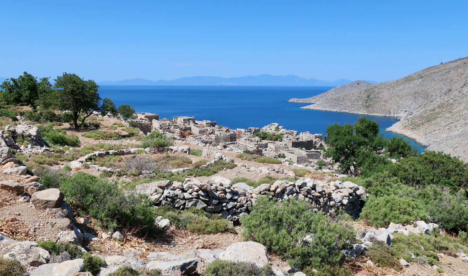
The basic pattern of the village is visible: the buildings, the paths and steps between them, a number of threshing circles at the edges.
The islands are full of ghosts. Here on Tilos the sense of loss is everywhere. Deserted villages, windswept castles, unvisited churches that resist the years braced liked bulldogs against the centuries. A house in Megalo Chorio is built on several rows of huge two-thousand-year-old stones that were once the foundations of something considered so necessary that men must have given great gobs of their lives laboriously carving them into these perfect stacking shapes, then hoisting them into place.
The way continues, clearly at first, then more roughly, up to the peak of Koutsoumpas, the high-point (494 metres) of the southeastern end of the island. The trail comes and goes, and is easier to follow down than up. At the top is an ugly prefab box of a building, once a look-out perhaps, home only to goats now. When, as we drew near, several dozen of them poured out the front door, the thunder of their hooves was startling. Once outside they leapt in panic at seeing us, exaggeratedly skewing from rock to rock, off down the hill, out of our awful sight.
On the way down is the ruined church of Aghios Taxiarchis.

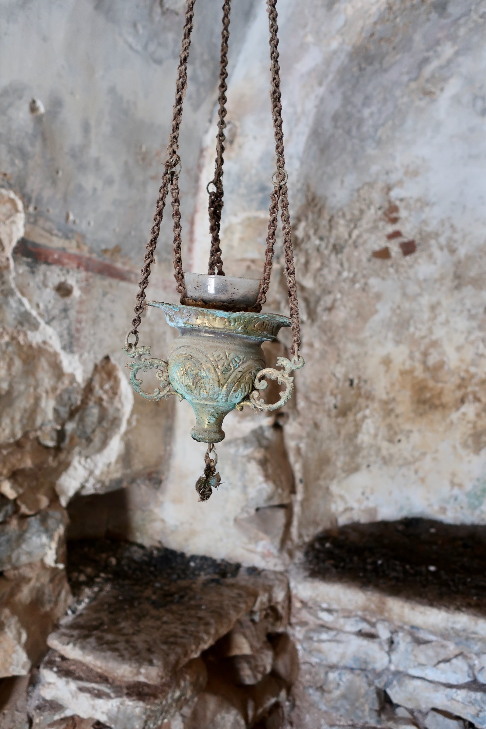
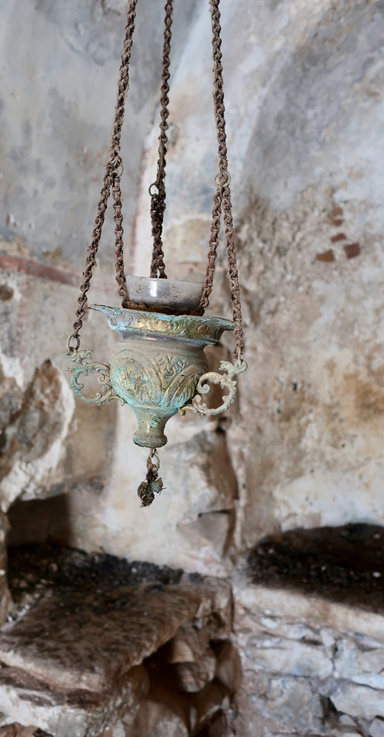
The doorway is so low you have to enter on all fours. Inside, the floor is covered in goat pellets. The smell is acrid. Some remnants of rough ancient fresco remain. A green patina’ed brass oil candle hangs at an angle.
At the end of May when we were there the weather was stiflingly hot. Along one outside wall is a place to sit, with just enough narrow shade in the early afternoon for lunch. Half an hour later, after we had descended and reached the lowland again, we spent ten minutes looking back up, trying to spot the church. It had completely disappeared, melted back into the hillside rock as if it had never existed.
From Aghios Taxiarchis the downward trail stays higher than, but further south than on the way up. There’s a lookout point with a view over Antitilos, a thin bandage-strip of an island that had, when we were there, a thin bandage-strip of cloud suspended mirror-like over it. Behind it Halki, behind Halki Rhodes, long and slim, occupying the southern horizon. And then the limitless bulk of Anatolia to the east.
An easy path leads back to Gera. It joins the other trail at the same point we diverted off a couple of hours earlier, a place where there’s a spring and the small fireworks of a palm tree, behind which from certain angles Gera is transformed into a North African village, an oasis.
HIKE 2
Livadia – Lethra beach – Mikro Chorio – Livadia
Approx 10 kms
The trail that leads north out of Livadia is the mirror-twin of the one that leads southeast, equally well-constructed. It follows the coast as far as Lethra Beach. The land this side is not quite as dramatic, the path shorter, and there’s no Gera at the end of it. But the water is even more irresistible. Since the slopes are shallower than on the other side, you can carefully pick your way down to empty little bays and tiny beaches.
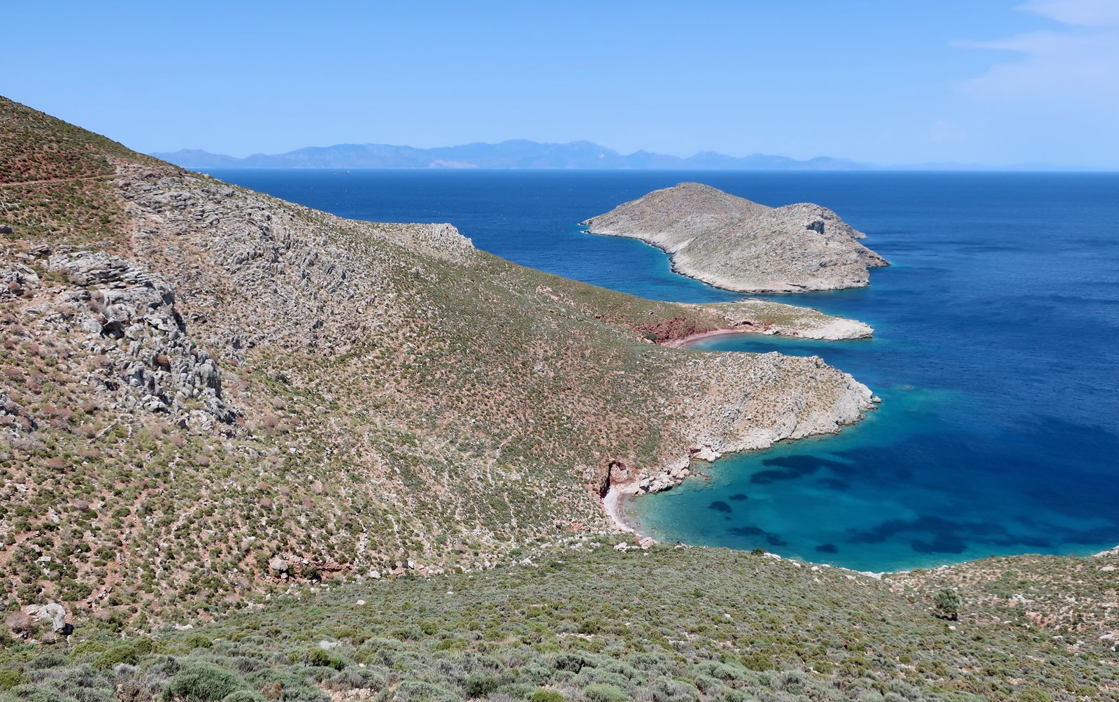
After Lethra there are two possibilities: double back a few hundred metres on the trail to a clear fork inland, from there take an obvious path all the way to the main road that runs between Livadia and Megalo Chorio; or, follow the stream-bed behind the beach. Several times we’ve chosen the latter. In Spring, pink and white oleanders line the stream. There are pools, several crossings from one side to the other, goats, and gated fences to pass. It’s shady and a little overgrown and beautiful. The two alternative routes come together at the spring of Potamos, a few hundred metres before the road.
The trail crosses the road and continues as an old stone path the five or six hundred metres into Mikro Chorio, a second ghost village, abandoned during the early to mid twentieth century – although it’s hard to believe it could have been lived in so recently. Compared to Gera it’s a great metropolis; the houses are bigger, often two storeys, with balconies, separate rooms, style. But the roofs are all down and trees are pushing up now through earth floors. Keeping their distance from us, goats skitter around the steps and lanes, tap over the tops of stone walls. It’s a film set, with perfect ruined houses and filtered sunlight and stone steps leading in all directions with plants pushing through them, upturning slabs, everything with an air of artful neglect.
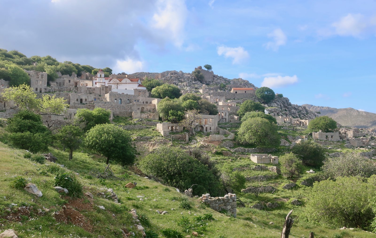
Someone has converted one old building into a bar, open in the summer. The main church is painted and proper, as if oblivious to the dereliction all around. A couple of properties are being worked on, brought back from the dead. Most buildings are marked with roughly-painted initials denoting ownership. Perhaps it’s tourism that has caused this new awareness of possibility, even of value. The re-birth of a village: that would be something.
The way back to Livadia, which must once have been the main path to the sea, is partly stone-laid still, leading through the soft agricultural valley in front of the village.
HIKE 3
Megalo Chorio – the monastery of Agios Panteleimonas – Eristos beach – the Palaeontological Museum – Mikro Chorio – Livadia.
Somewhere between 23 and 25 kms, depending on deviations
Had we not taken the bus from Livadia to Megalo Chorio, a walk on the main road would only have added about seven kilometres. A little more on paths and back roads. Avoiding the bus then, it would be possible to make this hike fully circular, with some repetition on the section in and out of Livadia. But it would take the total to between thirty and thirty-five kilometres.

From Megalo Chorio Trail 2 descends to the windy north coast beach and tiny harbour of Aghios Antonios, with Nisyros in the distance. Trail 3 begins halfway along the beach, a nice, well-marked path leading towards the mountainous west of Tilos and the 15th century monastery of Aghios Panteleimonas, another of very many island monasteries constructed around a water source.
The road ends at the monastery, which sits at a height of about two hundred and fifty metres on the slopes of a rocky amphitheatre, facing directly out to sea. Before the road came it would have been even more extraordinary, the monastery, all its buildings and gardens, clinging to the steep hillside in this hidden place.
Standing there, looking up to where the trail should be, even with the map it’s difficult to trace the sense of the way it goes. First it climbs abruptly. Then it traverses the bowl at about 400 metres, before the unlikely crossing of a high, steep, scree slope. It’s one of those paths that reveals itself bit by bit, at each step only the next short section clear. You have to believe.
The path exits the bowl over a col at a height of about 450 metres, and continues, at times faintly, through rocky terrain, with sparse but followable red dots to mark the way. This western lump of the island is wild and empty. There are no dwellings, no roads, hardly any marks of agriculture. The only signs of life are a couple of miniature, stark, unvisited churches.
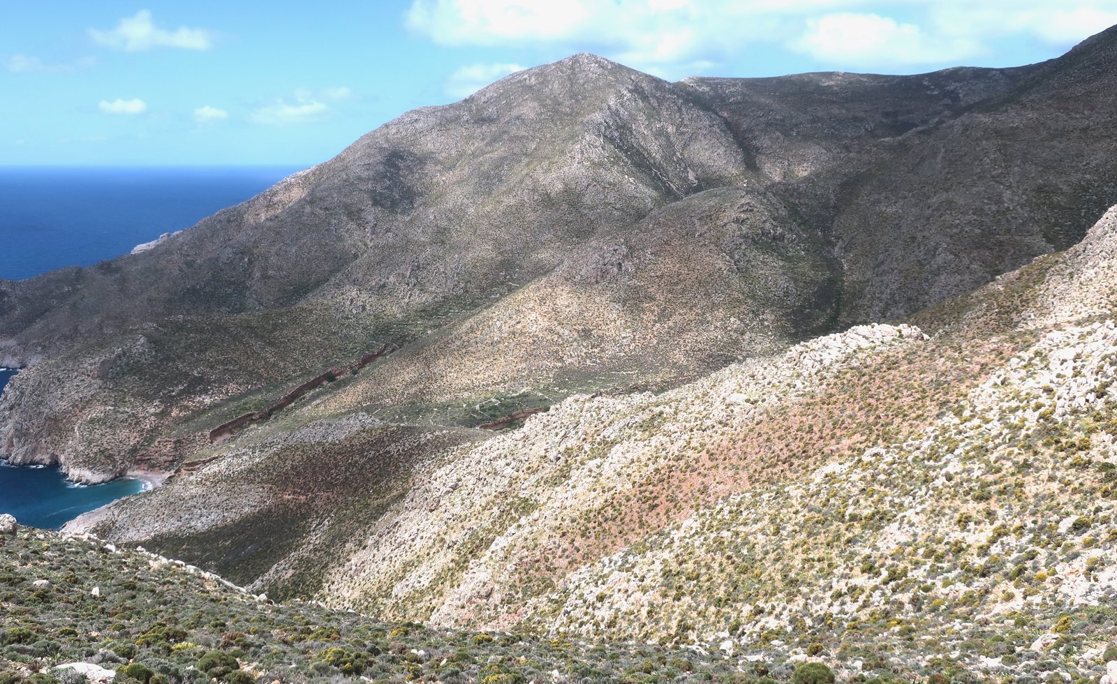
From Agios Panteleimonas to Eristos beach is about eight kilometres. It feels about as far away from civilisation as you can get anywhere in the islands.
Much of the flat land behind Eristos leading up to Megalo Chorio is agricultural. It’s also prime birding territory. Tilos is popular with ornithologists. For serious birders there are rare buzzards and falcons and eagles. For amateurs, the brilliance of bee-eaters, rollers, golden orioles.
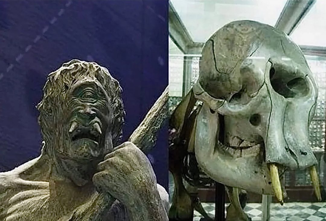
There are various alternative routes to Mikro Chorio, but most of them pass by the new museum (check opening hours) next to Harkadio Cave, where in 1971 Greek scientists discovered the remains of dozens of dwarf elephants. When, during the Pleistocene, (2.6 million to about 9000 years ago), sea levels rose in the Mediterranean, full-sized elephants were trapped on many islands, including Tilos. Either because of the lack of resources or the absence of competition, over eons the elephants gradually shrunk. As far as we know, the dwarf elephants on Tilos were the last Mediterranean elephants to become extinct. Skeletons have been dated to as recently as 1840 BCE, contemporaneous with Cretan Minoan culture. Some researchers have posited that the ancient discovery of dwarf elephant skulls – about twice the size of human skulls and with a single hole in the middle of their foreheads for the base of the trunk – may be the origin for stories of cyclops.
OTHER HIKES
If you do the three hikes above and add on a climb up to Agriosykia castle, (Trail 13 on the Terrain Map) you’ll have done over thirty-three of the forty kilometres on the map.
There are various ways to get up to Agriosykia and various ways down. Looking up from the port it looms. It’s hardly any distance at all from Livadia, at an altitude of not much more than 200 metres. Ingress to the castle itself is all but impossible; the land in front, by the entrance, has fallen away. All that’s left are some walls, the site itself, an impression of what must have been.
You could spend a couple of hours wandering around over the low hills that fill the bowl behind the beach. There are some bits of path to find, but paths are not necessary. Or you could just find a high point and sit watching. If you’re lucky a giant ferry will come in and you’ll talk about how tiny it makes Livadia seem, and you won’t be able to take your eyes off it as it manoeuvres, turning and backing and churning the water white behind it.
