
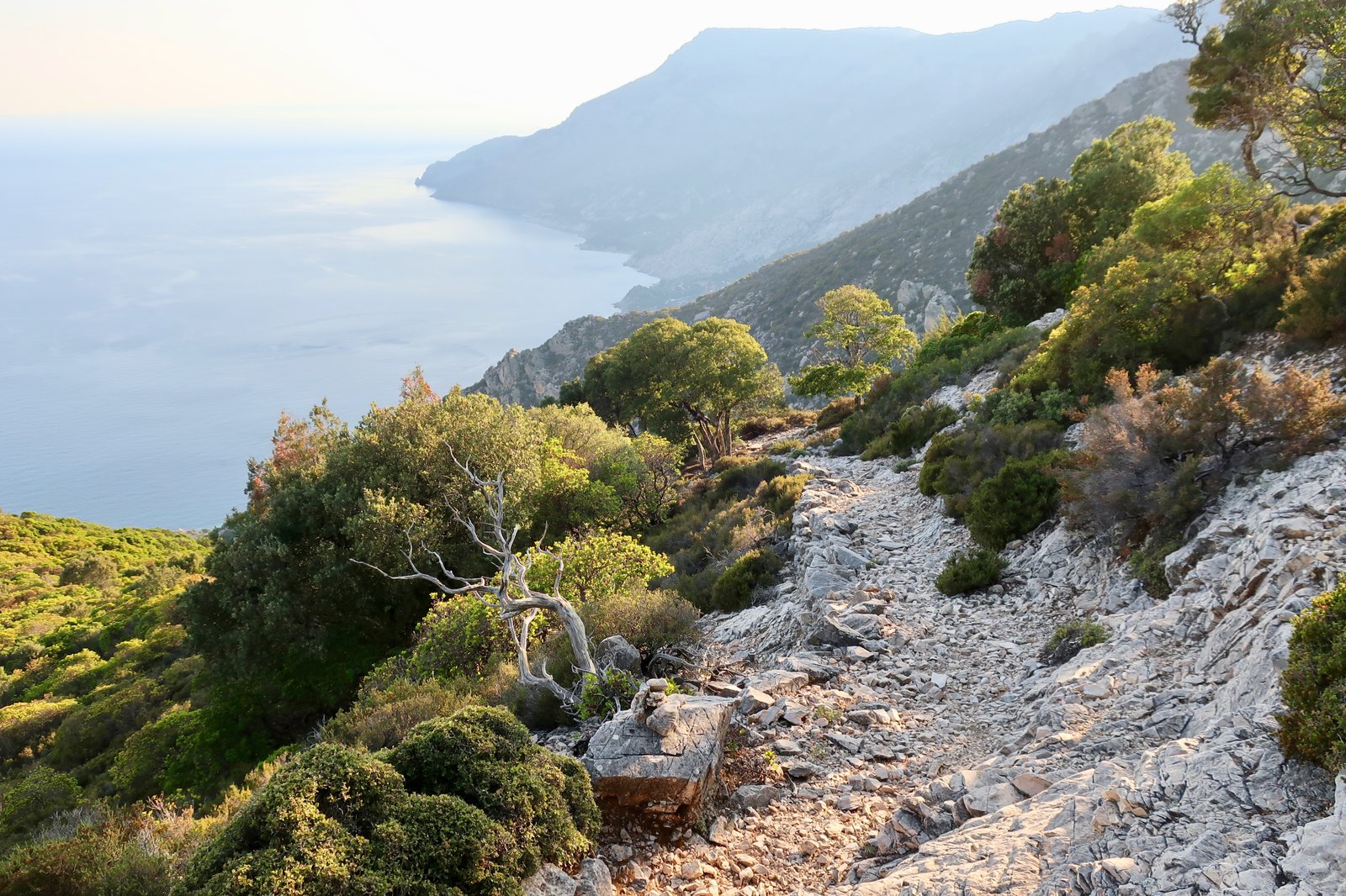
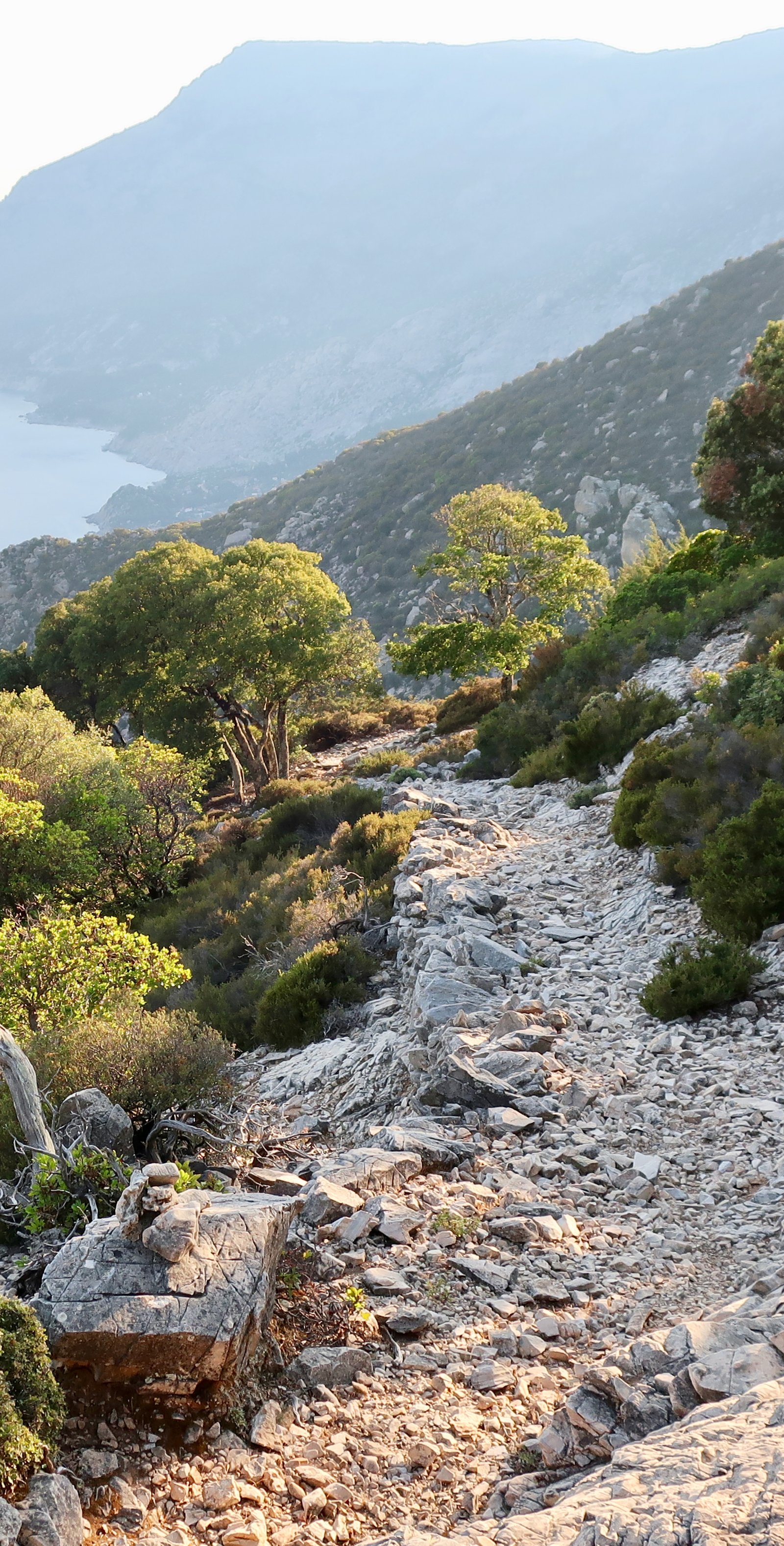
On our first visit we came into Evdilos on the north coast in the morning, left from Agios Kirykos in the south in the afternoon. Because of ferry schedules and direction, we had to pass over Ikaria on the way to Samos. With no bus service during the off season, a taxi was the only way. The driver held forth as we went up one side, down the other: Ikaria isn’t like other islands. You’ll see, it’s paradise. We have water, we have trees. We dance all night. On Ikaria we live forever.
Some years ago Ikaria was singled out as one of the world’s Blue Zones, places where human longevity is exceptional. The international media having made much of it, Ikarians have become aware of their distinction and gained a certain amiable swagger. Journalists turn up from time to time wanting to interview those of extreme age. They flatter the old ladies, joke with old men about virility, take pictures of well-worn faces, furrows and wrinkles.
On our second visit we stayed near Raches, in the western hills, the last week of May. It was casual mayhem from the moment we were picked up from the port. Our host’s style of driving presupposed one-way traffic only on the island. He leaned far forward over the wheel, rarely changing out of second, engine straining. Blind corners were terrifying.
Mayhem at home too. A courtyard awash with abandoned plastic animals. Unruly greenery everywhere. Dozens of cats and dogs. A scurrying in the ceiling above us at night. Beetles on the floor. A huge, really huge, dead spider, all elbows and fur.
Holy god, Yvonne said, when she saw it.
No hot water. A marked slope on the building, as if at sea, not one surface on which a marble might settle.
On our third visit we stayed at Manganitis in the southeast. A small boat took us there from Agios Kirykos, chugging along the coast, taking all the time in the world as we stared up at the forested slopes, the line of cliffs looming above, the magnitude of it.
Arriving, Pinch me, Yvonne said. And we’re as used to the Greek island parade of picturesque as anyone. The tiny port is a dream of such places, a frothing of greenery around a few buildings, a café/bar overhanging the water, some small boats. The sheltered water behind the sea-wall is deep and transparent, a great block of bluish ice.

It’s nothing like a normal Greek coastal settlement – no seafront, no beach, no openness. The village touches the coast just at this point. Behind, the land rising steeply, the greenery, you’d hardly suspect more than a few buildings. Ikarians have a predilection for hiding.
As with all the islands, Ikaria was a target for permanent or temporary invasion. Early in the historical period it was Greeks from Miletus, then from the neighbouring island of Samos. Thereafter Romans, Byzantines, Genoese, Turks. And pirates of course, as always. Fourni just to the south was a notorious base.
Watch towers were constructed and a complex system of warning signals developed. When piracy was especially rife, the Ikarians destroyed all their ports and retreated into the hills. Not to fortified villages as elsewhere, but to lone, isolated houses, some even built into or under rocks, some in caves. They dared not have chimneys; cooking smoke was allowed to escape in wisps, filtered through tiny cracks, or roofs made of rushes. Each dwelling was more or less self-sufficient. This policy of dispersion was effective in preventing the mass disasters that occurred on other islands.
The novel solution to the problem of piracy became fixed into a system of belief, identiy. We are told the stories, shown the secret places. Everything bad comes from the sea, they repeat. Everything good comes from the land. An Ikarian mantra, Orwellian in its incontrovertibility.
Manganitis in May just about ticks along. The small ferryboat stops in on its back and forth between Agios Kirykos and Karkinagri, carrying bread, bags of supplies, one or two passengers. There are apricot and mulberry trees at the roadsides. Fallen fruit ferments on the ground in small, buzzing heaps. A very old woman, her face a perfect classical theatrical mask with downturned open mouth, sits outside our accommodation like a visitation from the old gods. A few, mostly elderly, people wander around. A number of them, returnees, men, always men, home from Chicago or Florida, retired now in their new homes on the edge of the village, play with their old cars, sit in the cafes, talk about the past.
There were over 700 people here when I was a boy. A hundred fifty kids. Ya know what I mean. We had no money, we didn’t even have shoes, but we were happy, it was nice. We were free, ya know.
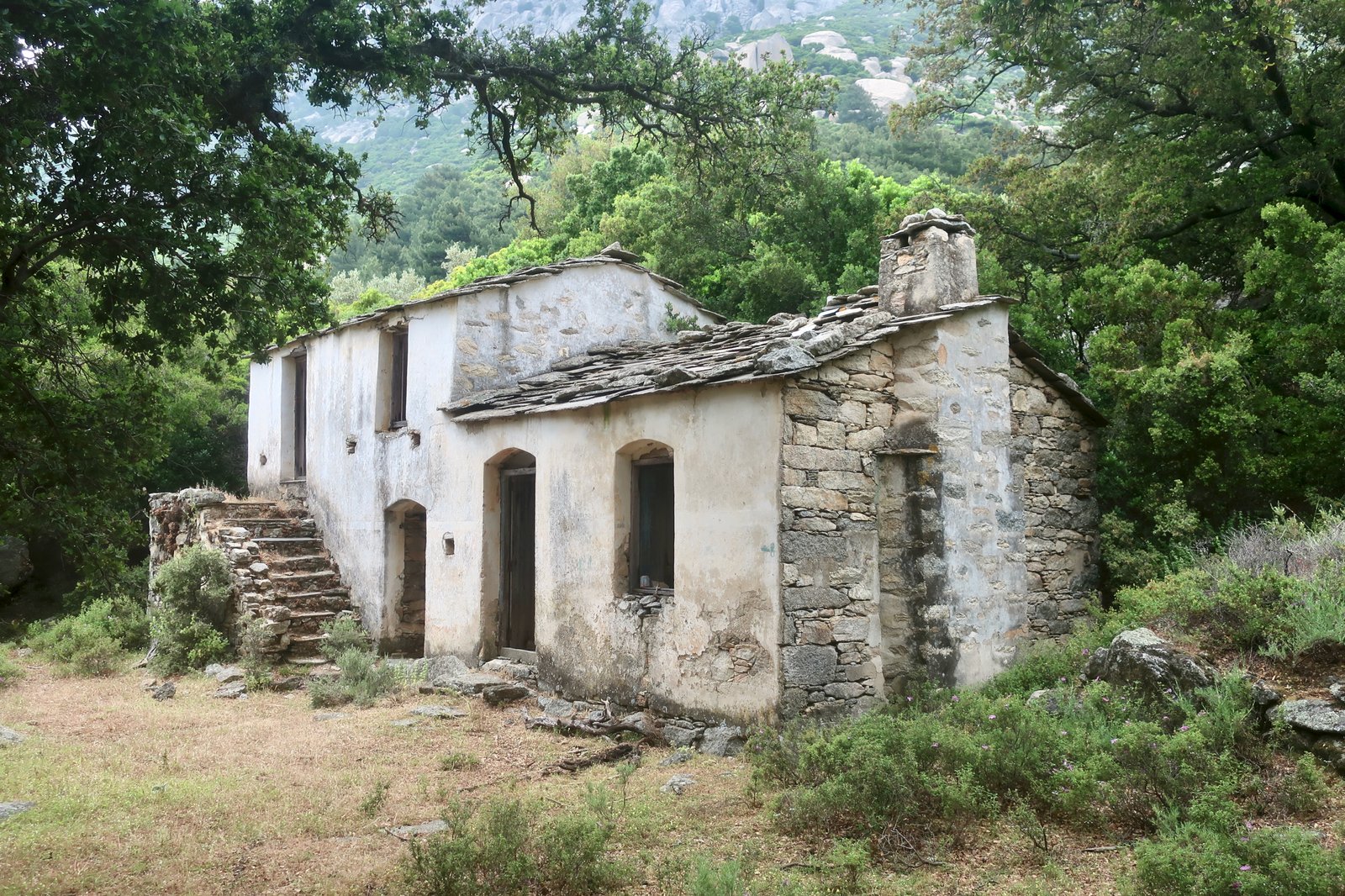
Yeah course I know the place! What a house. He had a thousand, two thousand goats, the guy who lived there. We used to go, us kids. He’d give us things. He was a nice man. What a place, ya know. His grandchildren own it now but they don’t come no more
Our host gave us olives, she gave us herb fritters, sugary treats, local wine like sherry. She wanted me to fix her smart bracelet, linked to her phone but not working, no longer recording her steps, or heart-rate, or something. As if just having the thing was enough.
The woman in the one small shop decided I was Turkish. I told her not, but ‘You look Turkish’, she said. ‘Do you not have some Turkish? Your father, grandfather?’
‘How do you say “I love you” in Turkish?’ she asked. Testing, probing.
She would tell us what Erdo-gan had done, that he wants to take the islands, that it’s not the normal Turkish people of course, it’s the politics… When I talked about the paths and used the word ‘kalderimi’, meaning path or trail in Greek, she fixed me, ‘Kal-der-im, I think is Turkish word…’
On our fourth, most recent visit, we stayed in Evdilos. I had had a notion it was smart. I can’t believe you thought that, Yvonne said, it’s just like Agios Kirykos. Meaning, this is Ikaria, take it or leave it, this is what you get. Meaning, no frills.
When we arrived at our accommodation and I asked our elderly host if she spoke English, she grinned. Mono Ikariotika, (only Ikariotika, the island dialect), she said.
In May we strolled around the quiet port, sat in a cafe watching the sea sucking in and out, as if breathing, took note of all the old people. How old do you think she is? we wondered, as a small, ancient-looking woman went by. How old is he, is he a hundred?
***
Legend has it Icarus plunged into the sea just off the south coast. It’s where the name comes from. Perhaps. There’s another version to do with fish. (Ich- something.) He and his father Daedalus had flown all the way from Crete. A watery rock marks the spot where he fell.
Much of the island is oversized. There are highlands of barren rock, massive boulders, towering cliffs. There are river gorges and waterfalls, thick forests, head-high ferns. Clouds roll in frequently to hang on the high ridge, sometimes dense white, shifting with the wind, tumbling back down the cliffs then gathering force to come again, sometimes an ominous dark-grey, oozing moisture, set in for the day.
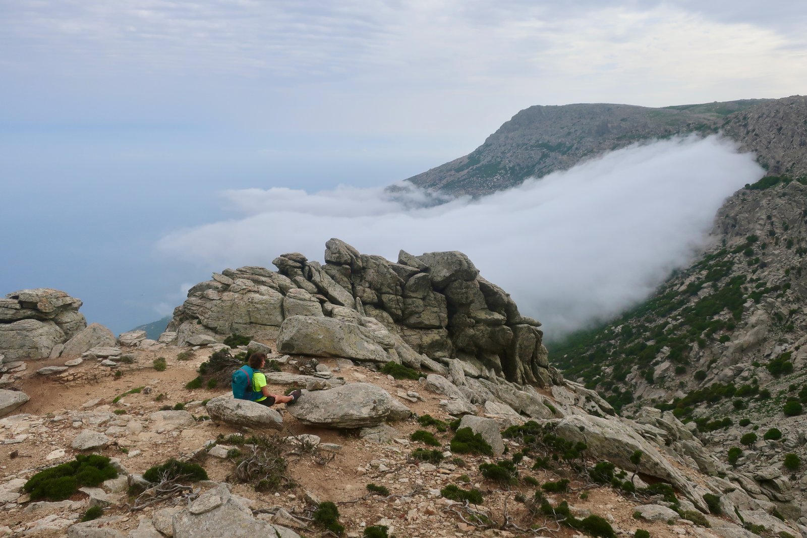
Flat on the map the island looks like a slug. In 3D it’s a giant wave that runs for 30 kilometres at between 800 and 1000 metres. The hiking is exceptional.
Although it belongs administratively to the Northern Aegean group, Ikaria’s not really part of any group at all. Maybe the line of the Ikarian ridge is the watershed in this part of the Aegean, north and south/Northern Aegean and Dodecanese-Cycladic. There was a very brief period in 1912 when the Ikariots overthrew the Turks and declared themselves an independent state with a president, a government, their own flag – a white cross on a dark blue background, on which was inscribed, ΕΛΕΥΘΕΡΑ ΠΟΛΙΤΕΙΑ ΙΚΑΡΙΑΣ (Free State of Ikaria). Independence lasted five months before absorption into the Kingdom of Greece.
During the Greek civil war (1946-1949), more than 10000 political prisoners were exiled to Ikaria by the military government. There has been a strong communist political presence every since. In the 1960s the council was entirely communist. Still, in the elections of May 2023, the communists were the biggest party with 35% of the vote. (The national average was just over 7%.) Greeks refer to Ikaria as the Red Rock.
If for foreigners Mykonos, Zakynthos and Ios are the islands best-known for nightlife, for Greeks Ikaria is the party island. From mid-May to mid-September there are regular panigiria – village parties/feasts – where often hundreds of people eat and drink and dance all through the night. Although panigiria take place on all the islands, especially during the summer months, it is implicit that those on Ikaria owe something of their frequency, the intensity of the bacchanalianism, to Ikaria’s egalitarian politics and spirit of independence.
Even if it isn’t quite a beach destination, this is the Aegean where the sea is warm and the weather’s good. There are holiday beaches around Armenistis and close to Evdilos, nice enough but somewhat exposed to the north wind. There’s the beach at Therma in the south, another of Greece’s once-fashionable thermal resorts, leftover from the boom and bust of thermal tourism during the first half of the last century.

Near Manganitis there is Seychelles Beach. They have aimed high with the name.
In the south there are a few more beaches, some of which have steamy, volcanic, pockets in which to sit, where hot water from underground swirls into the cooler seawater and the rocks are coated in rich brown or yellow growth, slimy to the touch.
HIKING
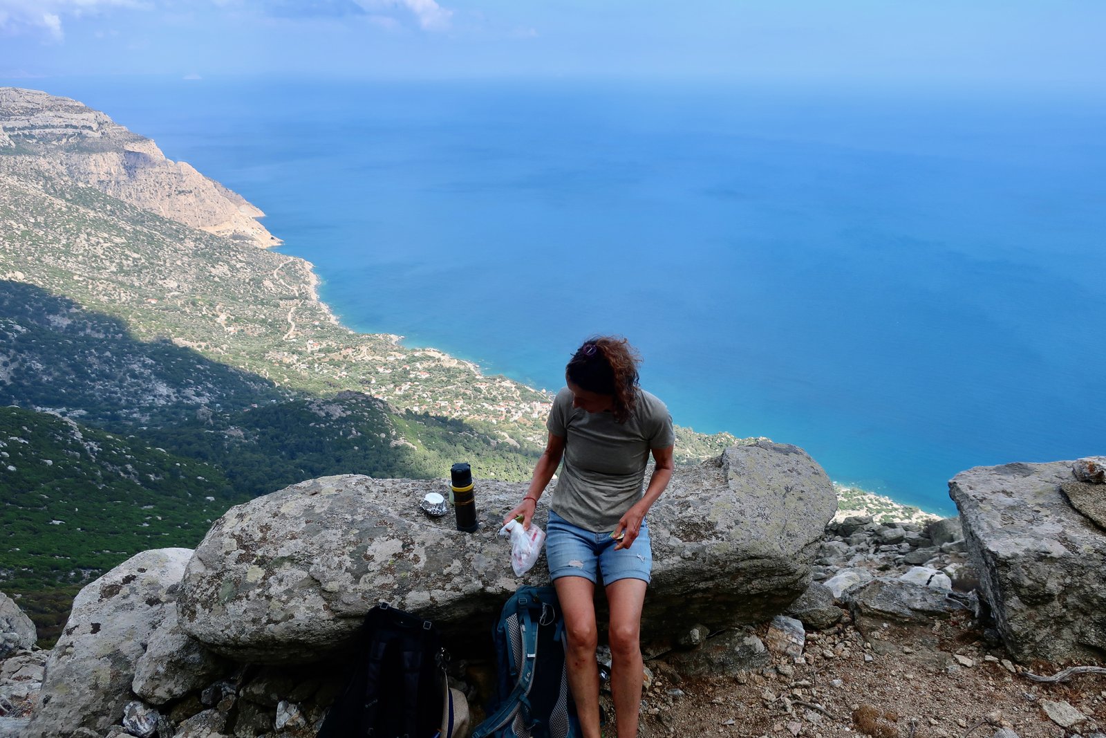
Ikaria has everything: ancient stone-laid paths; a great ridge/cliff-walk; a gorge walk with countless rock-pools along the way; abandoned villages; dense forest and barren, rocky highlands; remote churches; secret stone houses hidden under rocks deep in the woods, or planted on hard-to-get-to rocky promontories. And most of it in Ikarian style. Which is to say, somewhat chaotic, not well-signed, just occasionally a little hairy.
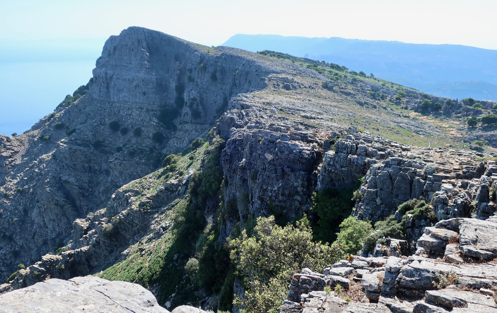
If you walk on Ikaria you’ll get lost. Many of the paths are not well-maintained and very often the signing is inadequate. Often the land is so steep that the obliteration of a section of trail – an inevitability in the Aegean where earthquakes are common and the land has always moved – risks rendering the rest of the trail useless, hanging like the two halves of a severed bridge.
It’s big terrain to get lost on. Visibility comes and goes. On Ikaria cloud rolls in from the north or south, up the slopes and cliffs, to suddenly envelop the whole world.
Between the north and south the weather is often different. It can be raining on one side, clear on the other. Cloud or sun. Baking at sea level, bitingly cold on top. It’s risky to set off without a waterproof and a warm layer, just in case.
The topography of the island imposed the construction of stone pathways to link the two sides, north and south. Up and over the ridge. The south is steep. The north usually less so. But not always.
Planning is essential. Get hold of a hiking map, Terrain or Anavasi, or look for information online. But beware, the scale of the maps, the size of the island, is such that details are not sharp enough.
The numbers of the trails are not logical. The numbering of Trails 05, 06 and 07 is unnecessarily confusing. Trail 01 is hardly a trail at all. There’s no coherent progression of numbers. Some great trails, such as the loop that takes in Droutsoulas and Akamatra, have no number. Trail 04 is so overgrown as to no longer be usable.
Even if you sit down and try to plan logically, it isn’t always straightforward. The ridge walk in particular, (05 and 06), the most iconic of the hikes on Ikaria, is hard to organise without either a taxi at the two end-points – expensive, and not anyway satisfactory in a hiking sense – or a day potentially so long that most people will avoid it.
See where the trails are and plan your stay accordingly. Ikaria is too big to be done from one base, particularly since public transport is insufficient or non-existent for most of the year and taxis expensive. Get hold of a hiking map and look up online – but there’s not a lot. The clarity of paper helps, until it doesn’t any more. The hikes don’t all have to be long. Sometimes, but not always, they can be sliced into smaller pieces.
A week isn’t nearly enough to do everything. It’s just about enough to understand the island, the shapes and folds of it, how good the hiking is, to do some of the best-known paths. But there’s so much to be explored.
Get a moped or hire car perhaps. At least for a day or two. Use the little boat that runs along the south coast. Stay in two or three different locations. Go back next year.
We have hiked from near Christos Raches, from Manganitis and from Evdilos. Manganitis gives access to the web of trails that fan out from there into the highlands above, plus, if you have the energy, all the southwest. But not the whole island.
From Raches there’s the gorge walk, (Trail 02 on the Terrain Map), a couple of other walks in the north, all the highlands around To Spitaki Tis Mamis, the trails and half-trails through the Randis Forest. Even the wonderful paths down to Manganitis and up again are within reach. Find accommodation close to Christos Raches and after hiking 25 or 30 kilometres, go home and dance till five in the morning.
From Evdilos various hikes go up and down again, or up and over, or meander through the central north of the island.
***
For Ikaria, because of the size of the island, the wealth of trails, because we have repeated many trails several times in different directions or coupled differently with other trails, rather than go through in detail exactly what we’ve done, the section below is mostly a short guide to what trails there are. For convenience, I have stuck with the numbers given on the Terrain Map.
TRAIL 01
Hardly a trail. More a way to get to the beginning of Trail 09.
Park the car/motorbike either next to the reservoir or somewhere along the road that Trail 01 crosses back and forth – tarmac at first, then dirt. Walk the trail, if you can find it, or walk the road, it doesn’t really matter.
TRAIL 02 – The Chalaris Gorge
Trail 02 begins at an altitude of 700 metres at the reservoir four or five kilometres southeast of Christos Raches. The top section is gentle. The middle section, vertiginously down into the bottom of the gorge, is glorious. The lower part traverses the wooded eastern slopes of the gorge high above the stream.
When we did this towards the end of May there was still a lot of water running into and flowing out of a chain of infinity rock pools, many of them big enough for bathing, although pretty cold this early in the year.
On a high, terraced promontory in the middle of the upper gorge, there’s an old stone house every bit as evocative as the stone house in the woods above Manganitis in which the man with a thousand goats lived. The stonework is refined – house, outbuildings, and a circular compound with central stone pillar, presumably for livestock.
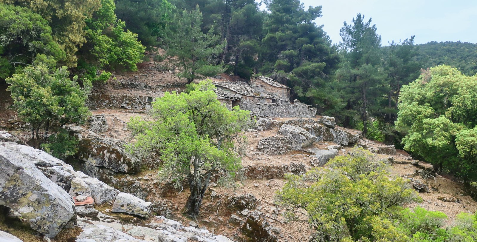
What a wild place to live a life this was, perched there, an hour or two to the nearest neighbour, with only the sound of wind and falling water for company. Invariably it is not the gorges themselves, or the mountains or the beaches that move us most, but the traces of human habitation in these lonely places. A house, a path laid in stone, a remote church, the slicing of the land into terraces shored up by stone walls.
The path to the waterfall at Raxounia is a short, dead-end diversion off to the right of the trail. Even here, where rock-faces descend almost vertically on all sides, there was once terracing, small plateaux suspended above the course of the tributary stream below, a patchwork of crops on narrow ledges.
A few dozen metres back, the main trail takes a sudden descent into the bottom of the gorge. At first it seems unlikely, it’s too sheer. But the path descends artfully, picking back and forth.
And then the pools. And a stone bridge that no longer exists, that used to cross the bottom of the gorge before being cut either by flood waters or earthquake. There are foundations still, stone markers on both sides.
We normally move at more-than-average speed and it took us a hard-to-believe six hours to get from the reservoir down to Nas. We made a few mistakes, took some wrong turns and several times had to double back. But the two and a half hours that the Terrain Map gives is way off.
Nas beach and Kato Raches next to it are ex-hippie hangouts, very laid-back still.
Then a stroll to the main holiday stretch of the north coast, Armenistis and Gialiskari and their beaches, before heading back up to Christos Raches on the road.
TRAIL 03 – (Evdilos to) Kambos – Pigi – Theoktisti Monastery – Myrsonas Gorge – Gialiskari. (Back to Evdilos on the road)
After a short walk along the road from Evdilos, a left turn onto Trail 03 at Kambos. The first section is a mix of village lane, grassy trail and dirt track. Some confusion in these early stages, when red dots appear to go in opposing directions, or just disappear. In particular, a section of narrow path through open woodland where suddenly there are 3 dots on the trail, and a straight on/right turn alternative. Straight on, between dots, is the right way, onto a small open terrace, then up to the right and along to the left.
Having emerged onto a small, driveable lane, the path almost immediately dives right up stone steps into woods again. From here until the monastery the old cobbled surface is intermittently visible through heaps of leaves, dirt, rubble, with sometimes edge-stones, and sharp switchbacks in the steeper sections.
After crossing another lane, the way is barely followable through open meadow, just a faint trace that emerges onto yet another lane/dirt track, on the other side of which there are beehives. The trail goes straight, just to the left of the hives, into damp, mossy pine woods, then butts up against an old stone wall. Just beyond the wall is one of the most famous of the hidden rock-buildings of Ikaria, a tiny chapel built under a huge lid of stone. The doorway is half-human height, with inside barely enough room for five or six worshippers. It is remarkably, quite exactly, like a tiny version of Le Corbusier’s chapel at Ronchamp.

Just below the chapel is the Theoktisti Monastery, where another small church, 400 years old, is splayed out wide to brace against the angle of the rock on which it is built. The floor of the church is a patchwork of stones recuperated from the classical port at Kampos; metal rings, to which boats used to tie up, are still attached. The walls are covered in frescoes, heaven and hell, devils and snakes, the last judgement. Holes around the foot of the door are drainage channels from which water pours like tears when the rain comes. Outside are a dozen or so cells where no monks now live and a central building in which ladies from the local villages deep-fry lumps of dough the size of golf balls, smother them in honey and offer them to visitors.
After the monastery a relatively long section of woodland path leads to the Myrsonas gorge, at first closed and shadowy, kermes oak and mastic, later mostly pine, more open, a thick layer of pine needles underfoot. In the not very informative write-up on the back of the Terrain Map, they make no mention of how good a path this is. In fact the whole write-up on the back of the Terrain Map is understated.
The start-point of the final section of trail through the gorge is hard to find. Several times we walked up and down the track from which the trail begins, before eventually finding it on a very slight left-bending (when descending) corner of the track. It is unmarked for the first couple of hundred metres and never descends to the stream itself, although in many places there are views down to rock pools and mini waterfalls.
After Gialiskari it’s a walk along the road back to Evdilos, with at the beginning at least the possibility of wandering along the coast just off the road for a while.
TRAIL 04 – Doesn’t really exist any more.
We did it (with difficulty) towards the end of a hike that began at the bottom of Trail 06 at Karavostamo, went up onto the ridge, continued west along the ridge on Trail 06 and then down Trail 04 to Arethousa. From there it was a road-walk back to Evdilos. 30+ kms. But Trail 04 really is too overgrown to be called a trail any more.
TRAIL 05 – The short section of the ridge-walk between Mavrato and Mavros Louros
Trail 05 begins on the main road at Mavrato, goes as far as the junction point of 05 and 06 at Mavros Louros 2.5 kms later. It takes no more than an hour. At first a fine old stone path through oak forest, it climbs about 450m into barren highlands, skirting the ruins of Kapsalino Castle, of which little remains. The site however is impressive, with views stretching far across the northern Dodecanese.
TRAIL 06 – First, the tail end of Trail 06, from Karavostamo to Mavros Louros – about 5kms, with a climb of 700 metres. Then from Mavros Louros along the ridge as far as Agios Dimitrios.
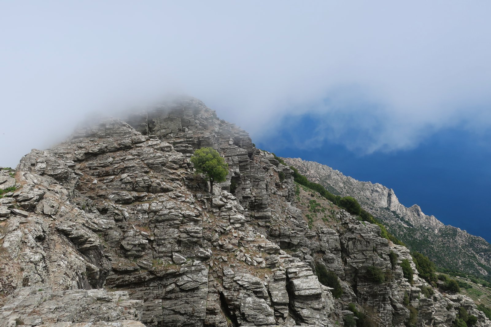
Trail 06 is the most dramatic, most unmissable stage of the Atheras Trail, the walk along the spine of Ikaria. We’ve done the central section that passes the ‘bad descent’ twice. The first time we were staying in Manganitis. We took the early morning boat along the coast to Agios Kirykos. From there up to Mavrato, the start-point of Trail 05, by taxi. (It’s not worth road-walking the 5 kms between Agios Kirykos and Mavrato, especially since the ridge walk can be complicated, and slower than the actual length would suggest.)
The second time we did it we were staying in Evdilos and took a taxi to Karavostamo and the lower start-point of Trail 06. From there we walked this tail of Trail 06 up to the ridge, and then along the ridge on Trail 06 as far as the turn back towards the north and Arethousa on Trail 04. Since Trail 04 turns out to be more or less impassable, a better option would be to simply walk the road from this Arethousa turn-off back to Arethousa, and then on to Evdilos. Or, given time, to continue along Trail 06 to Agios Dimitrios, and organise a taxi from there. To walk as far as Agios Dimitrios on the ridge, then all the way back down the road to Evdilos would be very long.
Both the 05 and tail of the 06 up from Karavostamo are worth doing, and lead to the same point at Mavros Louros. The latter is probably better though. It’s also much longer, at least two hours instead of one. (Because we got lost at the beginning, several times, for us it was more like three hours.)
***
So, a taxi to the point, several kms past Karavostamo on the main road, at which Trail 06 is supposed to start. Supposed, because where is it? Looking at the Terrain Map, there’s a short section of trail between the road and the church of Agios Georgios. It begins where a few faded reddish squiggles are painted on a lump of concrete wall at the side of the road.

We wasted half an hour trying to find the path here. We went straight up, too high, turned left, turned right, came down, tried again.
What you should do is turn immediately to the right after climbing up a couple of metres from the road. Hardly a path though. Hardly findable because hardly visible. Hardly a path in fact for most of this section between the road and the church.
Low vegetation, wire fence, big rock, on-off narrow trail, a point of passage through the fence. A gate post with a large stone pillar on the right through which you pass, then look back, and ta-dah, a red waymark! Continue on towards the church, but not as far as the church since at a right-hand turn down towards the church the real path instead carries straight on.
Into a forest of strawberry trees. Careful to stay on the path. The red marks are often so faded as to be barely there. (Presumably many of them are no longer there.)
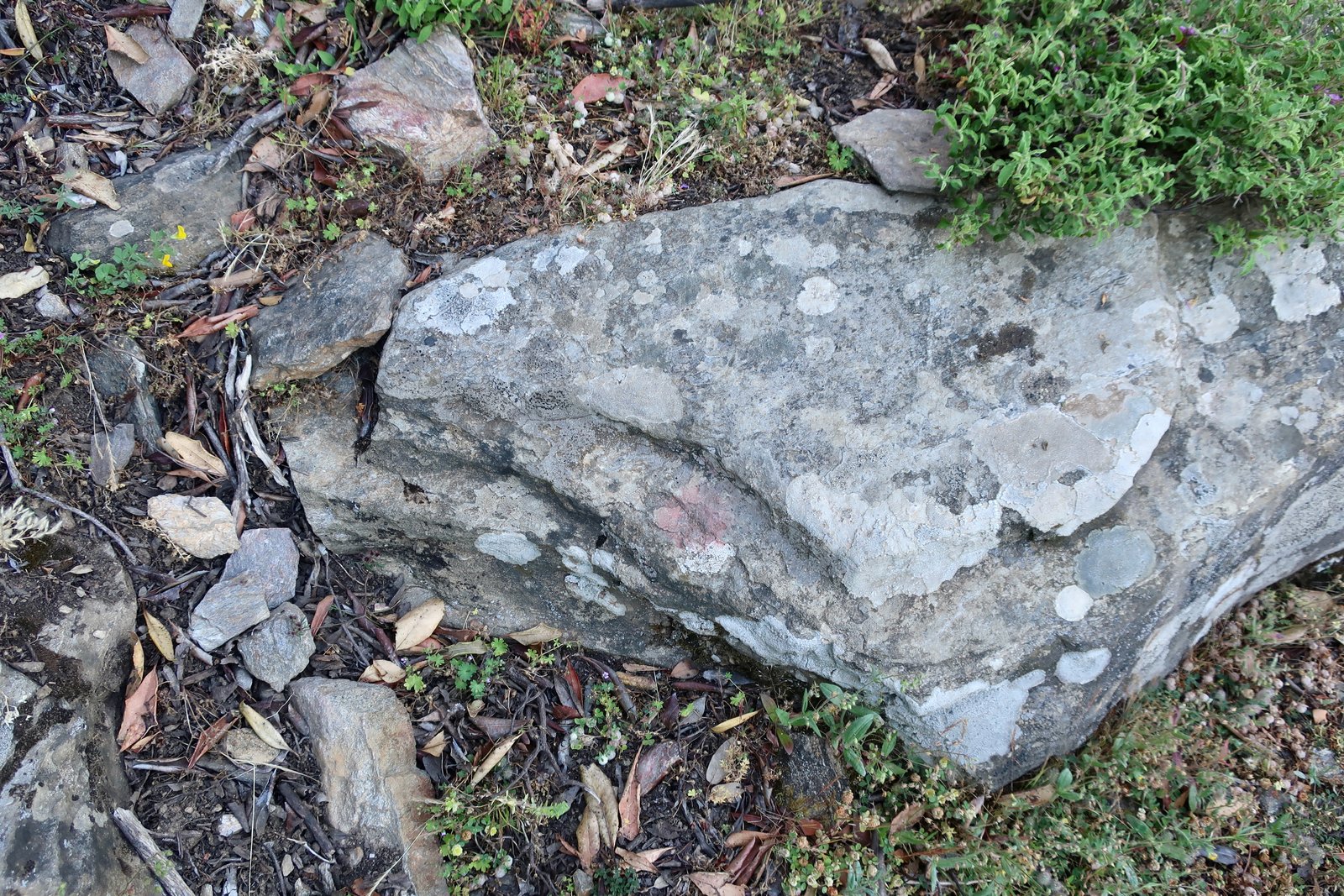

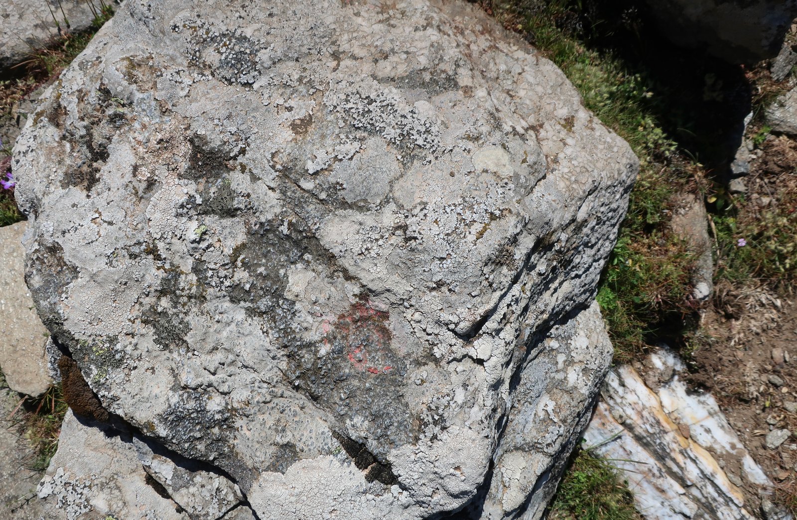
A narrowing and a widening, snagging undergrowth, more strawberry trees, in and out of darkness and light and always the same regular incline, never excessively steep – this is a path on which there must once have been constant passage, not a sneaky path for goatherds.
Stopping to look back, the hillside behind is nothing but trees, no hint of a path. The slopes on the other side of the valley are similarly thick with strawberry trees, whose luminously waxy leaves seem to be in the sun even when they aren’t.
In places the path is edged in stone. There are some stone steps. But zero maintenance, zero new waymarks, zero clearance. The only reason the path still exists, is so good, is that it was so well-built in the beginning.
Two hours after exiting the taxi we still hadn’t caught sight of the main ridge.
Eventually there is a sign, Kapsalino 2 kms in one direction, Karavostamo 3.35 kms the other, (down). 30 minutes and 1 hour 15, respectively, the sign says, which is very optimistic.
The path continues on the level at an altitude of roughly 800m, through woods and ferns, with a hint of edge stones at first where the path is a bit overgrown, and then the way opens and is all edged and you’re walking through a holm oak forest with ferns underneath and an abundance of wild flowers, and sunlight and cloud, and looking down in places the drops are vertiginous and the whole thing is quite stupendous.
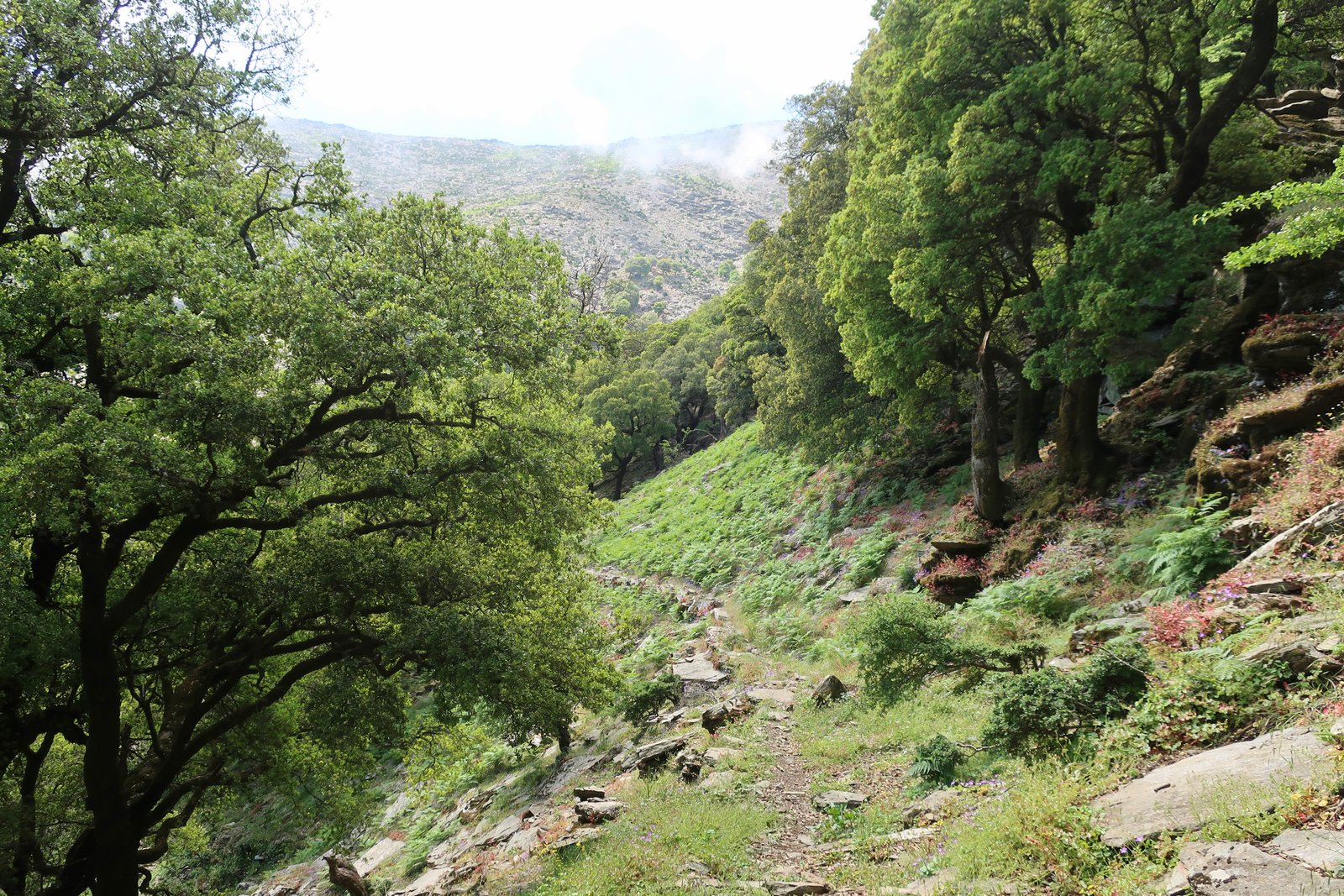
We missed a turn to the right, (up), instead followed a black water pipe which seemed to lead us on a path of sorts, on the level, around the hillside. But the slopes became steeper and the path we thought we were following disappeared. We doubled back and tried again to find the path but couldn’t, so went rogue, cross country and up, and eventually came to the three-way junction point on the top, at Mavros Louros.
I don’t know if the fact that we found the right place was lucky, or logical. Perhaps a bit of both. About 20 or 30 metres from the signpost there, we have left an arrow made of stones to show the place the path back down to Karavostamo begins. But we still don’t know where we should earlier have turned to the right to make it to this point, and don’t know what that path is like – although it’s probably ok since the slopes here are not steep.
Mavros Louros marks the end of the tail of Trail 06/the junction-point between Trails 05/06. From here on, to the east it’s back along the 05 to Mavrato, to the west it’s the ridge-walk.)
Although we’ve been calling it a ridge-walk, much of it is more a walk along a clifftop, interspersed with short sections of ridge proper. The Terrain Map, with its tightly bunched contour lines all along the southern side of the clifftop, gives an idea of the drama of the terrain. In some places on the northern side too, particularly around Tsolias Peak, the land is almost equally steep. Most of the Trail runs at over 900 metres, with a high-point of 1040 metres at Efanos. It is grandiose and heart-stopping and the views and landscapes are incredible.

Continuing on from Mavros Louros there’s not really a path, although there are occasional red marks and cairns, and a sort of path, very fine. In this early section it probably doesn’t matter too much exactly where you walk so long as you don’t get too close to the edge and are careful and logical.
Just after we reached the ridge, a first wave of cloud came in and swamped us. For the next several hours visibility was intermittent.
The terrain builds up for the bad descent. Here’s what the Terrain Map says:
The trail narrows to a mere 1.5 metres and it passes between two steep cliffs, at a point locals call Kako Katavasidi (Bad Descent). This part requires very close attention and experience, because the trail passes near the cliffs and scary parts where you will be exposed.
The terrain becomes rockier, the possible path narrower, craggier. And then you come to it and there is nowhere to go but a) over the cliff to the left, (mortal) b) down the pouring precipitous scree slope through a narrow gap to the right (a terrible idea) or c) straight on, a very brief, exposed climb up onto a fat rock, then bending around to the left and continuing on. In a scrambling sense it isn’t difficult, although you do need to have a reasonable head for heights because, briefly, a slip would be serious.
And that’s it: up, left, around. Very soon you’re on a path of sorts. Or rather, a narrow route marked by cairns, and then a little steep rocky staircase and more cairns.
This path is grand and wonderful and should you be up there when cloud comes in, serious care needs to be taken. The second time we did it is the only time I have ever properly understood what it is to be wholly disorientated in the mountains. Suddenly we were blanketed in thick cloud and for a short while lost all sense of direction. When the clouds thinned I thought I was seeing the same rock we had walked past a few minutes before, that we had been walking round and round in circles. When through a gap in the cloud we glimpsed the sea below we had no idea if it was the north or south coast.
This was just a little bit scary because totally unexpected and wholly out of character. Or so I would have said. The level of confusion is still hard to fathom.
And then just as suddenly, the clouds dispersed and the mental fog cleared and we knew where we were and in which direction we were going and we were talking again about how wonderful it all was.
The exposure is not quite over however. The path curls around on the southern side just below the ridge on a scree slope. It’s a narrow, barely visible trail. Again, easier than it at first looks.
(As far as we can make out, the trace of Trail 06 on the Terrain Map, at the point at which the bad descent is marked, suggests a descent on the northern side of the ridge of perhaps a hundred metres, before traversing and then climbing back up onto the ridge and continuing. This is not right. Do not descend on the northern side. Stay high, do the step, follow the cairns, do the staircase, then do the scree-slope on the other, southern side.)
After this, the path returns to cliff-edge, heartfilling views, without danger. For long sections irregular flat stones have been planted along the ridge. They resemble jagged teeth, or the armoured plates on the back of a dinosaur.


The point at which the 04 spurts off north and down is marked: there’s a gap in the cliff-edge wall and a sign, left to Chrysostomos, right to Arethousa. (This path to Chrysostomos we haven’t done. Notably, on the Terrain Map there are three hazard warning signs along its length.)
The 06 passes the church of Agios Efstathios and soon after heads north a little away from the ridge into a strange terrain of mini crevasses between flat rocks. From a distance it seems level. Up close there’s a constant skipping across the small crevasses, some of which descend several metres. The gaps get steadily wider. A little care is again needed.
Eventually the path, again not always well-signed or marked, reaches the Church of Agios Dimitrios, just off the main road coming up from Evdilos.
TRAIL 07 – The three Trails that fan up and out from Manganitis
On the left the 07b. On the right the 07a. The one in the middle, unnumbered on the map, is presumably the tail-end of the 07. All three of these paths are wonderful.
The 07b spits out of the high-point of Manganitis straight into forest, at first deciduous then mixed deciduous/pine as it climbs. For much of the way it’s wide and paved, an ancient forest path. The house of the man with two thousand goats is here, deep in the woods, almost eerie in its loveliness, in the process of being swallowed by the closing-in of the forest. There are stone steps up to the raised living floor. Two coats are still hanging where they were left after their last wearing. A raggedy pair of work trousers nearby. Other household items abandoned when the last resident passed or moved away. No-one has thought to clean or clear.
The world has turned away from this place. It serves no purpose any more and is too isolated, too difficult of access, to be a holiday home. The surrounding woodland is miraculously terraced, the once-sharp terrace steps softened by time and heaps of pine needles. Pine forest exists on a different chronological scale to oak or olive. Even if visually there is the same impression of age, pine trees are overnight colonisers.
After the house the path continues up, cobbled stone with more and more mastic bushes intruding, jutting, overhanging, narrowing the walkable way, causing us to edge around, duck under. A dampness on the stones, moss and lichen.
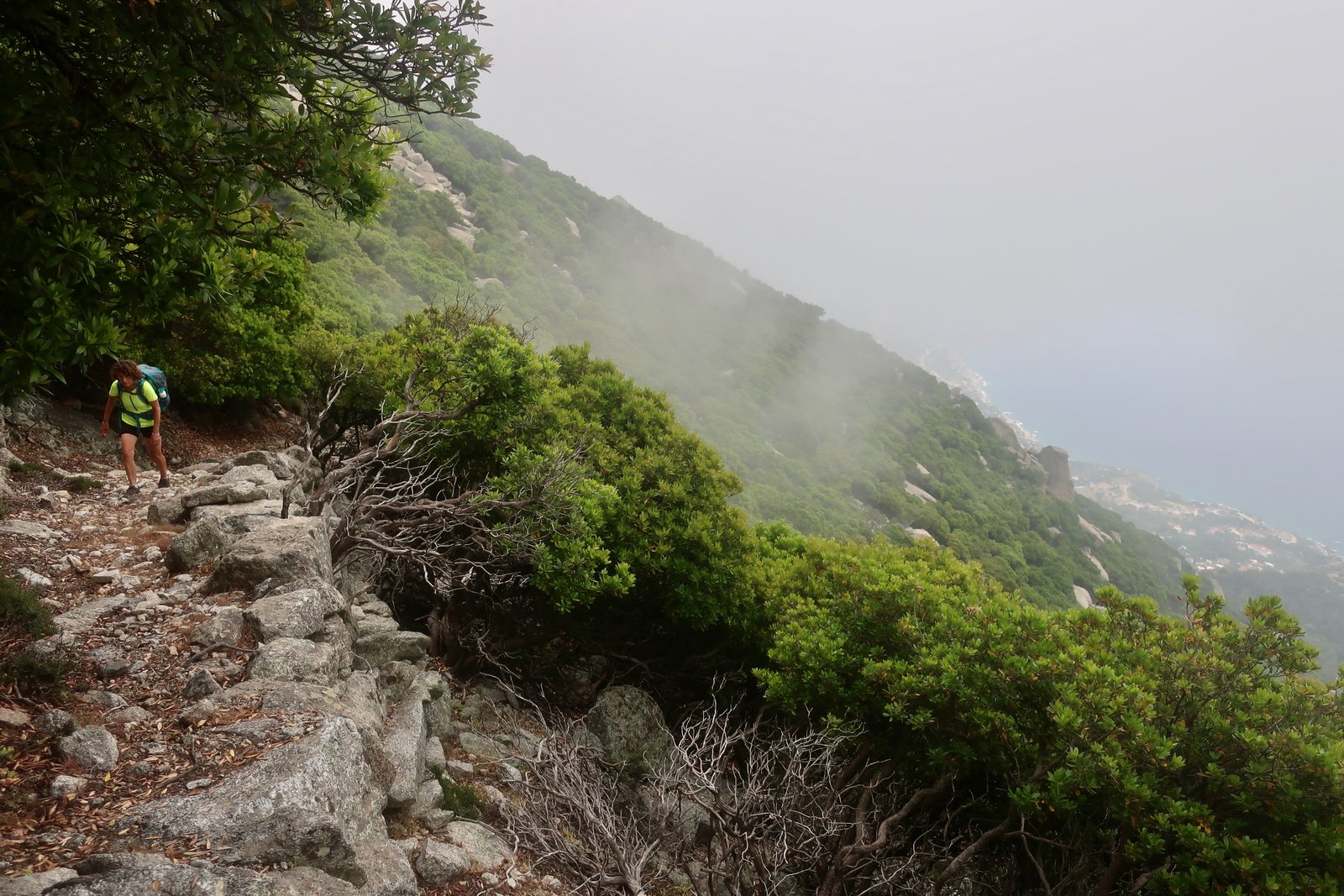
And then, after a short transition into a jumbled, collapsed section of boulders and stones and the last of the trees, the trail arrives in the highlands where there is little but rock and fern.
The first time we came up this path, one moment the views were clear down to Manganitis and along the coast as far as Agios Kirykos, the next we were swamped by grey cloud and visibility was down to a metre or two.
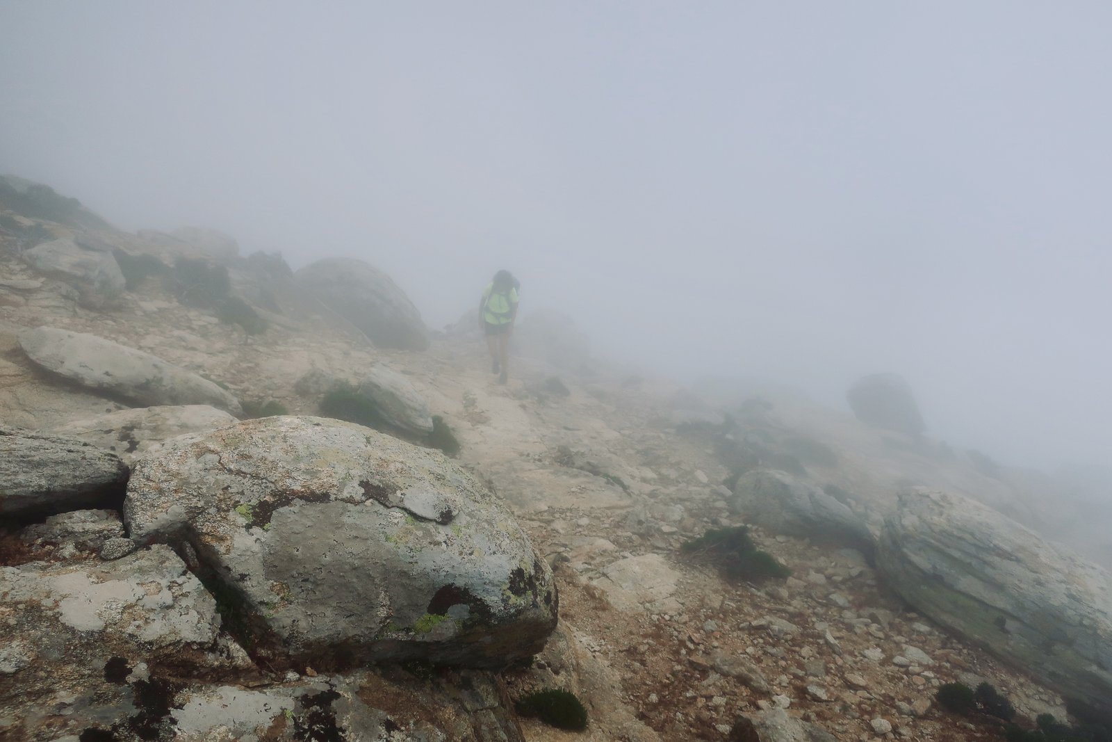
The 07b runs along the ridge, from stark, rocky highlands into Randis Forest. Much of the forest is dense holm oak, between 200 and 300 years old, one of the largest areas of ancient forest in the Aegean. According to the Terrain Map there’s a network of walking paths through the trees. We struggled to find any paths but as in some fairy tale were led deeper and deeper, the path behind disappearing because there was no path. Branches snag and clutch as you duck and twist and swerve to avoid them.
If not sucked in and lost forever, eaten by wolves or bears, captured by a forest witch, moving south and east there’s a fair chance you’ll come to a wire mesh fence that runs for a while along the ridge. It’s ugly, but easy to follow.
Trail 07 up from Manganitis, the middle of the three, is similar to the 07b in the quality of the stone paving, but less damp and without the intrusion of mastic bushes. The beginning of the path, from near the top of Manganitis – see map – is signed Pros Taxiarchis; no mention of Trail 07. It’s a mostly strong stone path as far as the grey stone Taxiarchis church, overwhelmed now in the thickly forested lower slopes above Manganitis.
If you get as far as the church, you’ve gone too far. About 100 metres before it the trail branches off to the left and soon after crosses a steep, dry, river course. On the other side it meets a low, wire fence, climbing at right-angle to the river course. When, after a few dozen metres, this reaches the hump of the descending hill, what is left of the path turns left up along the hump. It’s very indistinct. Following this hump or ridge as best as possible, using the map, after a while the path reappears and is soon strong stone-paved again all the way to the top, beautifully constructed through the steeper slopes below the ridge. In places landslides have poured over the path, or trees have invaded, but the way is clear enough.

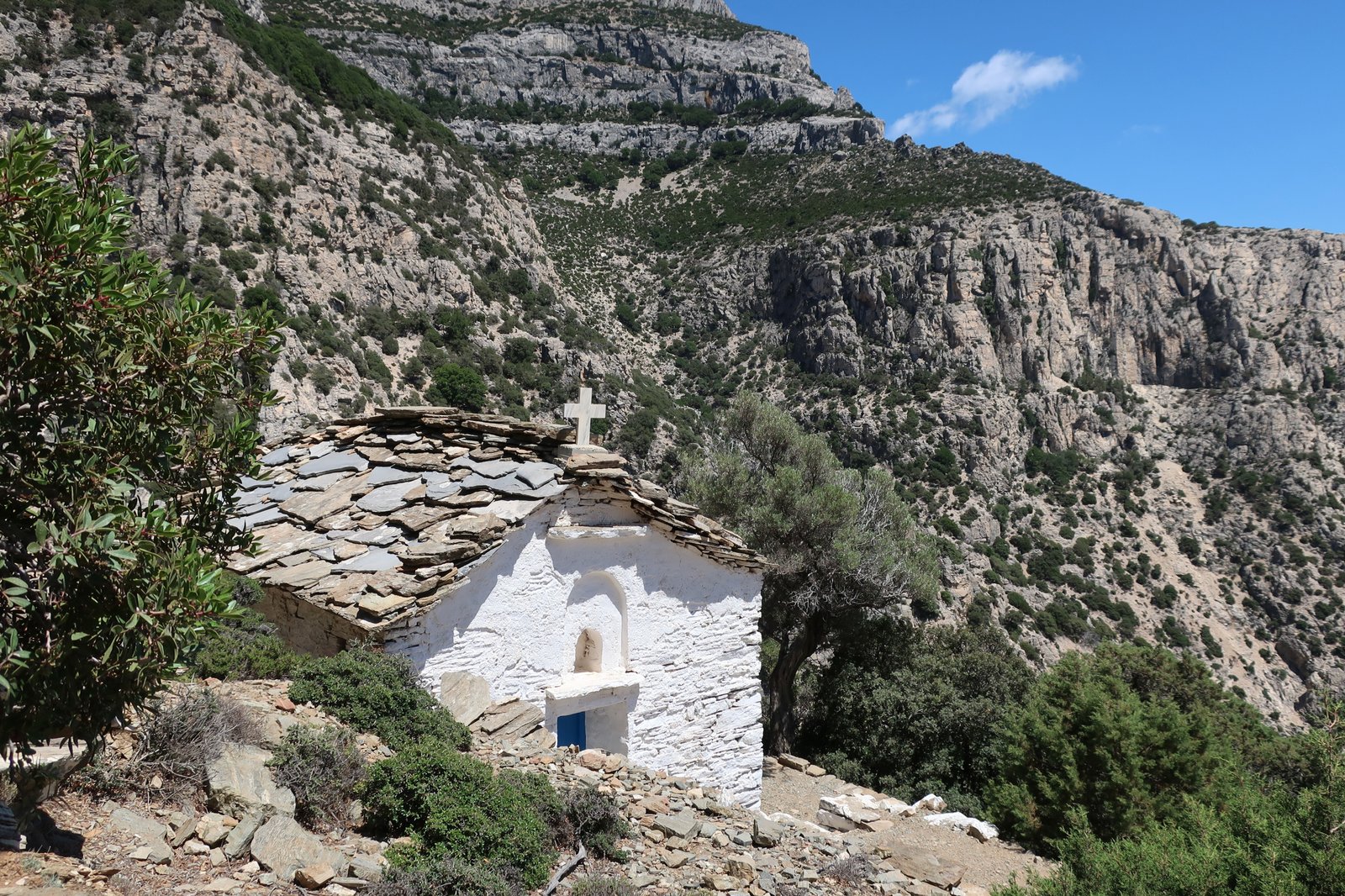
The third path, 07a, is similar to the other two – stone-paved in the upper, steep sections, traversing, zigzagging, sometimes disturbed by rockfalls, subsidence. It was still followable when last we were there. Halfway down there’s a small diversion off to the left (east) to the church of Profitis Ilias, perched on a promontory within one of the steep valleys that plunge towards the coast. Far below is Seychelles Beach. It is as remote and evocative a small church as anywhere in the islands.
TRAIL 08 – From the church of Agios Dimitrios down to Vardarades and back, with a diversion on the subsidiary path to Plagia and back. (This hike, almost wholly on the southern side of the island, we chose to do because of a forecast for strong wind from the north. The total length was about 18-19 kms.))
We parked the hire car as close as possible to the church of Agios Dimtrios, at the junction point of Trails 06 and 07 on the ridge.
The first short section, on Trail 06 through flat, open terrain near the edge of the cliff/ridge, is loosely marked by cairns. Trail 08 is a right-hand turn off the ridge after a couple of hundred metres. The junction is obvious and still at first seems unlikely. A prominent headland/cliff juts south. The Trail runs around the base of the headland at the top of a steep, loose slope, then disappears. It is narrow, ill-defined, and seems to be going nowhere good. But the hazard warning sign on the Terrain Map here turns out to be unjustified. These Terrain hazard warnings are not reliable, but because occasionally they really do mark points of considerable danger, it is difficult to ignore them.
For most of the day there was zero wind. At the very end however, when we did this final, exposed section of path in reverse, the wind from the north was so strong we had to lean in to the slope of the mountain to stop ourselves being blown away.
At the tip of the headland – the last visible point of the path when looking out from where it begins – there has been a landslide. Large rocks completely block the surface of the trail. With a donkey it would be no longer be possible to get through. On foot it’s a simple scramble over the fallen rocks. Further along the path there have been other landslides, and smaller stones and rocks are regularly strewn over the surface of the trail.
Most of the stone edging is intact, and the width, the grandeur of the original path is evident. The thin, curving first part of the trail under the headland must originally have been equally well-constructed, wide and paved, but the looser nature of the terrain has caused it to be completely wiped away.
In the past this, sliced into the almost sheer rocky slopes, and the offshoot to Plagia, were among the most important linking paths between the north and south of Ikaria. The man we came across on the lower part of this trail just outside Vardarades, who with his mattock and bare hands was doing repairs to the path – this was miraculous to us, the first time we have seen such simple maintenance anywhere in the islands – will not be enough to keep these trails open for much longer.
Without the sort of communal effort that in the past happened naturally, from necessity, either at the next big landslide or from an accumulation of smaller events, like so many others these stripes on the map and all the history they tell will cease to exist. Eventually the island will reabsorb every single footfall and even the memory of these paths will be gone.
At a height of about 600 metres, tucked under the cliff at a point where the terrain is less steep and the holm oaks thicker, the path goes through a ruined village. According to the internet, it was called Aris, and was abandoned sometime after the threat of piracy faded, possibly as late as the second half of the 19th or early 20th century. On Apple Maps it is clearly visible in a green clearing about halfway to Vardarades. In a satellite view, the lines of old terraces are still visible. There are tumbledown stone dwellings, with still the shapes of doorways, walls. Sunlight filters through the trees. There is a softness, a dampness. Trees sprout within old buildings, weeds in the walkways between them. An impression of invasion, colonisation, reclamation. Years and years of acorns, acorn cups and oak leaves crunch underfoot.
Soon after the village, on a small knoll among trees, there is a concrete water box with tubes going in and out. The path at this point, a little deceptive, turns up and to the left behind the water box – almost straight on – before continuing, much of it paved, all the way to Vardarades. (On the Terrain Map the water point is marked, but from there the path appears to go down and almost back on itself. This is wrong.)
We did a quick about-turn in Vardarades. Up the trail, back past the abandoned, mossy village of Aris, onto the hanging-on-the-cliff path, over all the rockfalls, boulders and loose scree.

When we got to the point where the path to Plagia takes a sharp turn left and down, we took it. The first two thirds of this path is not inferior in historical quality to the path to Vardarades. The last third, after passing through a wire gate in a wall on the left, is a more agricultural continuance among terraces of holm oak. It comes out among a few small houses, onto a side road and then the main road. There are no markers at the bottom end to show where it begins. This whole down and straight back up on the path to Plagia took a little less than two hours.
TRAIL 09 and 010 – Beginning at the reservoir, we went through the highlands west as far as Agios Isidoros on Trail 09, then 010 down to Karkinagri. Back up to Agios Isidoros, then on the road back to the reservoir. Total 23 – 24 kms.
One could do Trails 09 and 010 without transport to and from a start/end-point – stay in Manganitis for example, go up the 07b, west through the highlands, Trails 09 and 010 down to Karkinagri, then back to Manganitis on the dirt road that runs along the coast. Alternatively, stay in or near Raches. Without diversions – and there are almost always diversions – either would be a very long day. Also without getting lost somewhere along the way. But the easiest way to do the 09 and 010, presuming you’re not staying in Karkinagri, which might have attraction for lovers of the out-of-the-way, the little-visited, is to leave a vehicle, moped or car, somewhere near the reservoir, walk out, down and back up again.
We drove the hire car as far as seemed reasonable on the tarmac then dirt road that Trail 01 meanderingly follows. (The road surface deteriorates.) Having parked, we did a little of Trail 01, mostly not easy to find, and some dirt track too until the beginning of Trail 09.
Trail 09 is all ferns and wild west rock formations. The few trees soon give way to emptiness and sky. The path passes through a flattish plateau, the highest continuous section of any trail on Ikaria. It is indistinct, sometimes a thin trace, sometimes nothing but small cairns, like join-the-dots. There are often dozens of metres between the cairns. In thick cloud it would be very difficult to stay on track.
After an hour or more in this terrain, the route descends a couple of hundred metres to Agios Isidoros, yet another out-of-the-way Greek church that retains significance for the local population, whose modern knowledge of the landscape here and in other places is often limited to these sacred outposts.
The Trail from Agios Isidoros down to Karkinagri decends about 750 metres. Much of it is still stone-paved, slabs at the top then broad cobbles. Just occasionally there are steps, but for the most part it has the feel of a steep, twisting and turning ancient conveyor belt. On the way down in particular the pressure on the thighs is constant. It’s like having the brakes on all the time, not at all like going down a staircase.
In the islands, important stone paths were generally not steep. It says something of the terrain here, but also how far out of the way Karkinagri and the end of the island was, that this path is one of the consistently steeper main-road paths we have done.
The landscape in this far west is different from elsewhere on the island; more arid, presumably less likely to be enveloped in damp cloud than elsewhere. At the top it was almost chilly, at the bottom 26 degrees and full sun. The ascent was hard, and very hot. Soon after getting back to Agios Isidoros, walking on flat, windswept roads back to the reservoir, we had to put jackets on again.
The loop from Keramio to Droutsoulas to Akamatra, and back to Keramio. Beginning and ending in Evdilos. 16 – 17 kms
We had no idea what to expect from this. On the Terrain Map the route is dotted, but has no number. The previous day we had done Trail 04, which while numbered and described on the map, practically no longer exists. This trail, how good it is, was a surprise.
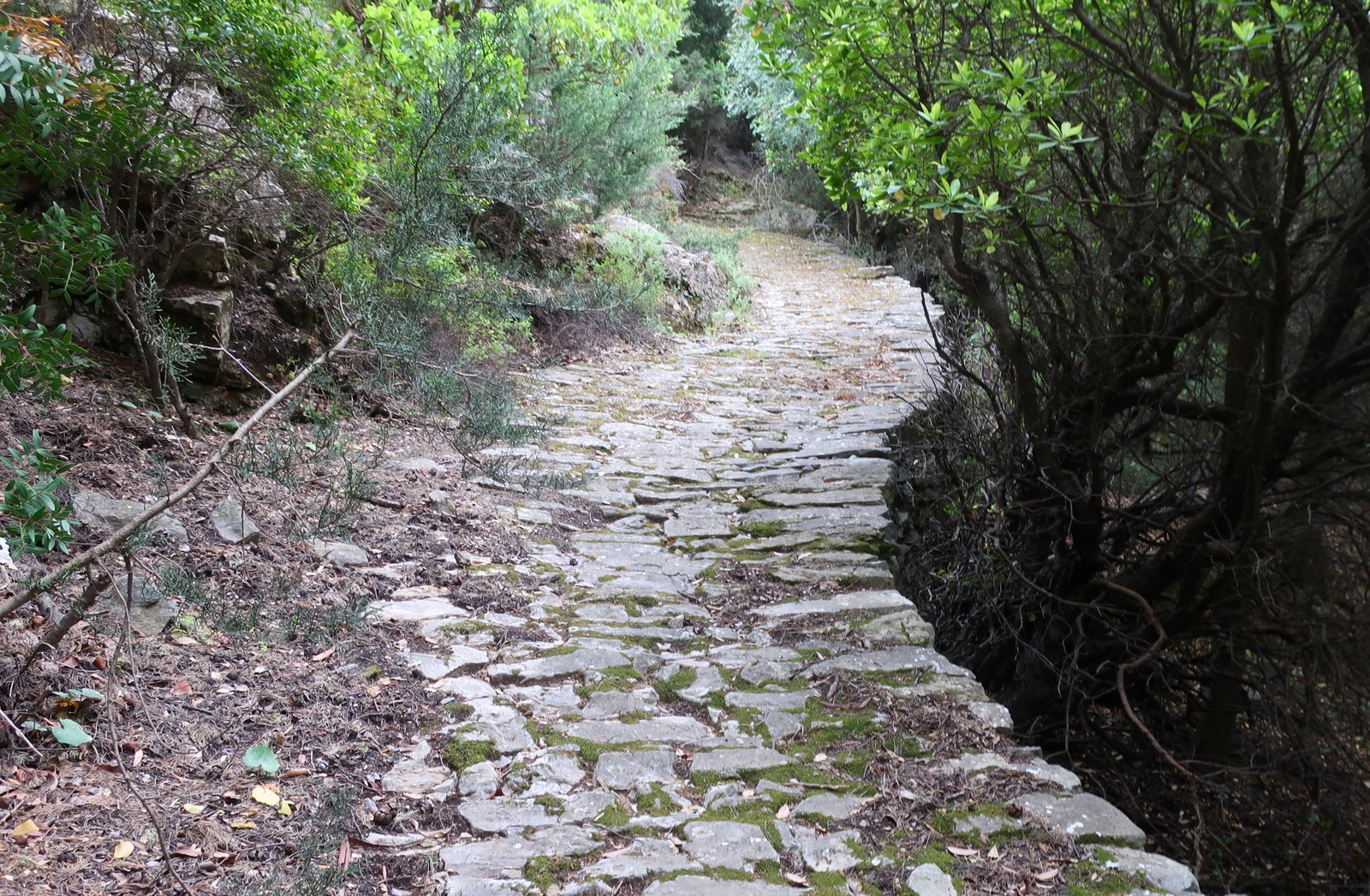
Before the advent of motorised transport, all villages were joined by paths like these. Here the purpose of this rough triangle was to connect Keramio (the coast), Droutsoulas and Akamatra. The two mountain villages, Droutsoulas and Akamatra, are typically hidden from the coast, while at the same time having sweeping views down over the sea east and west.
The trail begins a little past Keramio, just before the Health Centre, 50 metres off the road at the church of Agios Ioannis. The first side of the triangle goes from here to the small village of Droutsoulas. There are short sections of dirt track or concrete, but most of the way is stone-paved, sometimes narrow, sometimes several metres wide. It winds and climbs 400 metres through once-rich farmland. Approaching Droutsoulas, the landscape is all olive groves and strawberry trees on terraces, with in springtime sage, dog-rose, lavender and poppies as decoration. Sometimes, instead of paving stones the rock of the hill itself has been incorporated into the bed of the path. For the whole length of this path there are red marks to guide the way.
The first side of the triangle ends on dirt track just below Droutsoulas at a point where a mountain stream was some time in the past dammed to form a pool. A short detour leads by old footpath up to the tiny settlement, once a small agricultural hub, now barely surviving – in the census of 2011 it was recorded as having 10 inhabitants. There are a couple of dozen houses, a white church with a stone-built, rustic bell tower, a cat or two, a small plywood bandstand, warped by the weather, where once or twice a year musicians come to play. In these small, fading communities, but also in the yards of churches and monasteries throughout the islands, local feast-days are often the last echo of hundreds of years of uninterrupted life.
Just beyond the water-point on the dirt track below Droutsoulas is a gate, immediately after which a small path dives down to the right off the track. This is the beginning of the second, most distorted, side of the triangle, which used to link Droutsoulas to Akamatra via the now-abandoned village of Xeredho.
At first there is a thin footpath through sparse woodland on the steep gorge slope. Although the path is easy to follow, when we were there, branches that had fallen over the path had not been moved.
After a stone-built water point the sides of the valley, still steep, become more intensely agricultural, levels of old terracing both above and below. The path leads into the ruins of Xeredho, constructed on grassy terraces fringed in stone.

There is a small cluster of houses, roofless shells among olive and almond trees. The size of these ruined houses, somewhat bigger than the one-roomed bare minimum, attests to the relative wealth of the settlement. The view is uninterrupted down the length of a long, deep, valley all the way to the coast. Both sides of the valley have been scoured into high terraces whose integrity is still mostly maintained by fine stone walls.
The path from here has been well-maintained. There are even short sections of new wooden fencing. Towards the vee-point of the valley the terraces are more concentrated, there are a few small tumbledown buildings, and right in the water course, several large fig trees. It is impossible to understand why this path has no official hiking number. Twenty-four degrees, a perfect Aegean spring day, and no one there but us.
This second side of the triangle leads into Akamatra, a mid-sized hill village, once-flourishing, now with some small new tourist life. A village square. A few cafes and bars. Very sleepy in mid-May.
The path that leads back down to Keramio shoots to the right off the road about a kilometre below Akamatra, just where the Terrain Map says it should. It continues through woodland until it reaches a farmhouse, where the path appears to divide, right or straight on. Go straight on – to the left of the farmhouse – then turn right at the next junction-point after about 100 metres.
The waymarks are very faded but just about legible. The path is narrow, through low, close woodland.
On a high tongue between two shallow valleys there is a farmhouse very like other abandoned farmhouses on Ikaria – well-built, with outbuildings and land, invisible until you’re actually there. Around the house are olive groves and orange trees.
The continuation of the path is a little difficult to find – there is no actual path – but carries on along the rounded high-point of the tongue of land, then morphs into a path as it begins to descend, back and forth on the slope until reaching the river bed at the bottom. There is a scruffy old church with space alongside for feasting and dancing, around which the barriers have turned to rust.
After the church the path follows the stream until it comes to what looks like a rough and ready pirate ship, once a bar or venue of sorts, now having slipped into its own more modern dilapidation.
The trail comes out on the road at Keramio, very close to the start-point of the loop, a little more than 1.5 kms from Evdilos.