Departing Anafi, we were up in the middle of the night. On the lesser-visited islands boat-times are often unsocial. At the top of the village, waiting uncertainly for a bus we had been told would come to take us down the hill to the port, a few streetlamps flickered on and off in the otherwise total dark.
Looking up and out, little more than twenty kilometres to the west across the water the countless lights of Santorini glittered. A distant barking dog, the awful racket of our bags through the paved alleys, the wind, only magnified the silence and the entirely different trajectories the two islands have taken. Anafi’s closest neighbour. Over three million visitors last year.
Before coming, we’d spent a week on Santorini. When we told people we were going to Anafi, they had at first looked nonplussed, before invariably remembering honey. The honey’s great, we were told several times, you must try it. The relative merits of the two islands are understood to be so unarguable that the neighbourly competition we often come across was dropped in favour of this minor affability.
From Santorini, Anafi is a mostly overlooked satellite at the very end of the spiral of the Cyclades. From Anafi, standing there in the darkness, seeing the distant lights, Santorini is an unignorable alternative reality.
***
According to one legend, Anafi was created by Apollo as a refuge for Jason and the Argonauts, lost at sea in a great storm. Images of the Argonauts feature on Anafi island tourist bumph. Islands often choose to anchor themselves in the mythological past with these stories of creation, gods and heroes. A kind of pedigree is inferred.
Agios Nikolaos, the only harbour on the island, is carved into the bottom of a steep, dirty-orange hillside, one of the most unprepossessing main ferry ports anywhere in Greece. The few scrappy buildings are piled up like a paper-and-matchstick architectural model. There’s a small unattractive beach.
Curiously, it has a passing similarity to the new port on Santorini, which although industrial in scale, similarly appears to have been chopped into the base of a quarry.

The whole scene, with its profoundly historical quality – and despite the muddy slopes – gives the illusion of being perpetually cast in faded black and white. To arrive in Agios Nikolaos is to step back in Aegean time.
Besides the port, the Chora is the only real settlement on the island. It sits on a hilltop at an altitude of over 200 metres overlooking the the south coast: narrow alleys, churches, white cubic but also barrel-shaped houses, the scant ruins of a Venetian fort that once crowned the summit. In the sunshine it basks like any other small, Cycladic hilltop village.
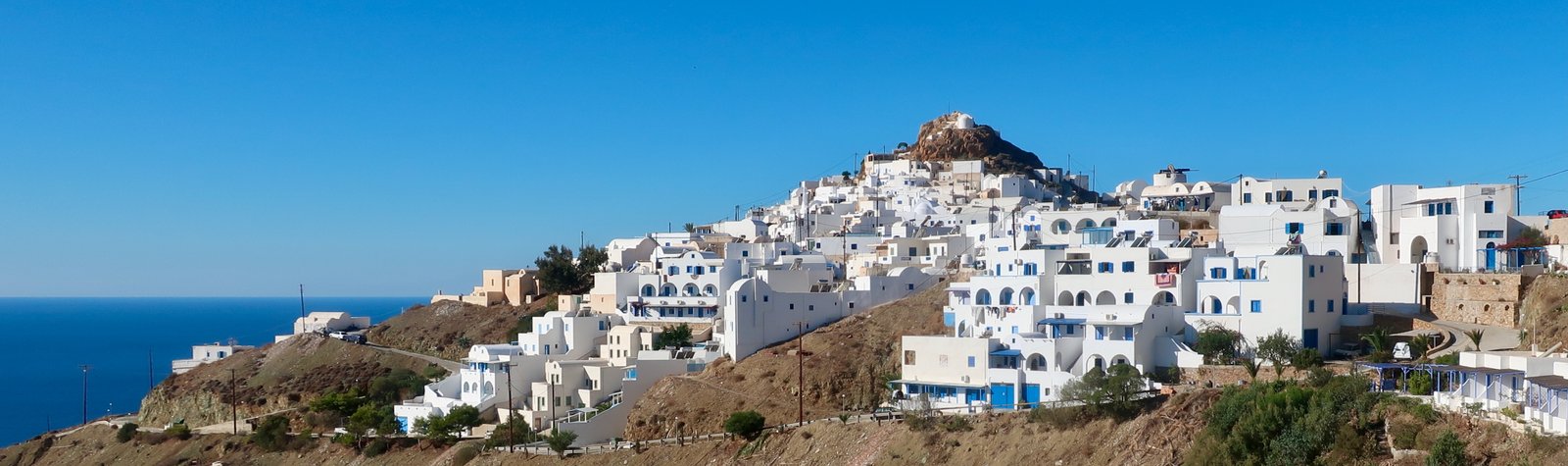
Out of season there’s one taverna, a bakery, and a small mini-market to serve the island’s two hundred permanent inhabitants.
Before going, the only fact that had registered enough to stick was that this capital village loomed high above the port. Everything we knew was concentrated into the anthropomorphizing of the whole island as a place of lookout.
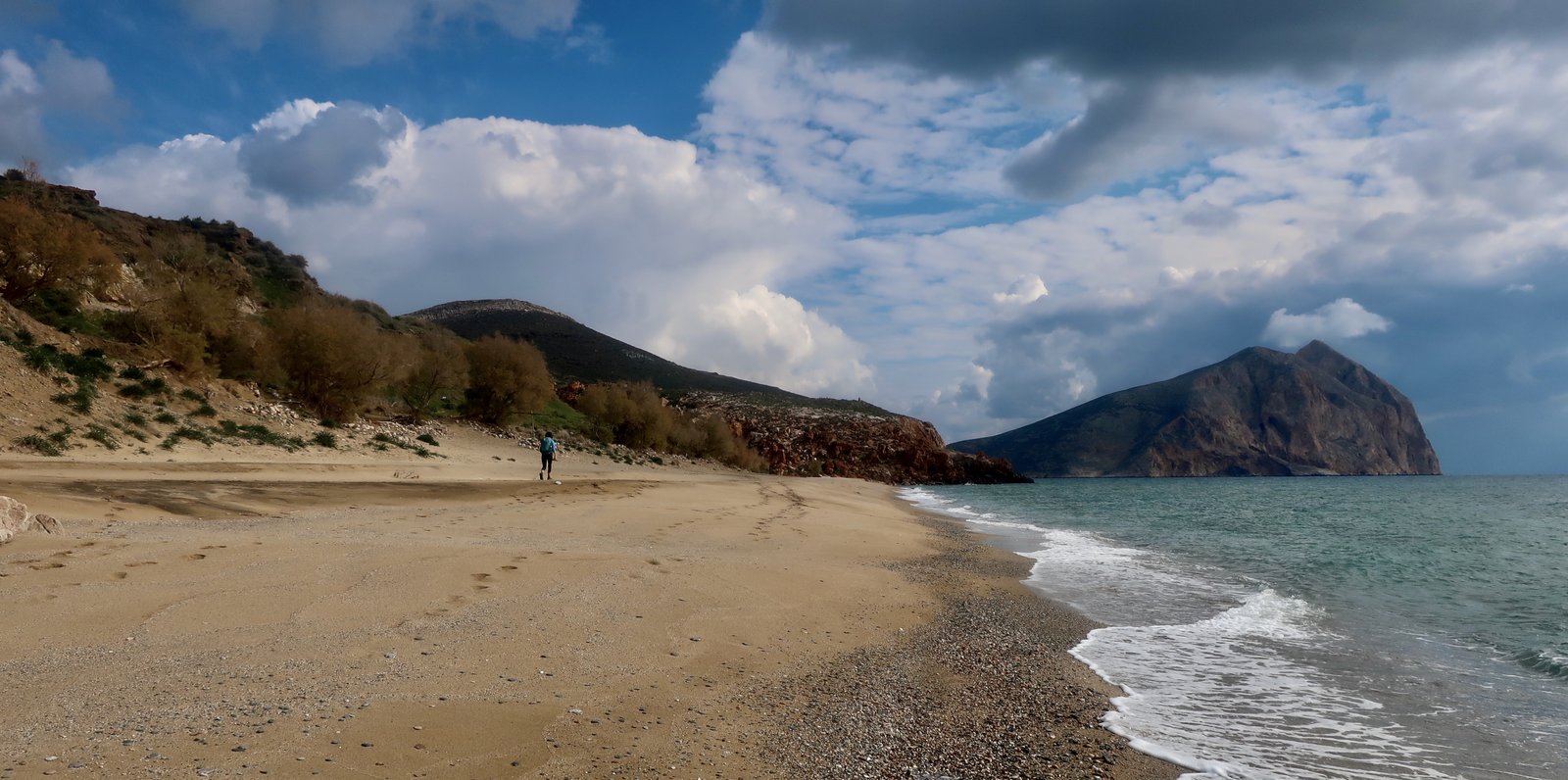
At the end of October when we were first there, even when the sun was trying to shine, it felt like cloud-sun, greysky-sun, windandrain-sun. Not Greek island sun. Although there are beaches, mostly along the southern coast, mostly not memorable, it was impossible to imagine parasols and deck-chairs, ice-creams and swimming costumes. And then, coming back in February of all times, the sun was shining and Anafi was showing off in its quiet, unpretentious way.
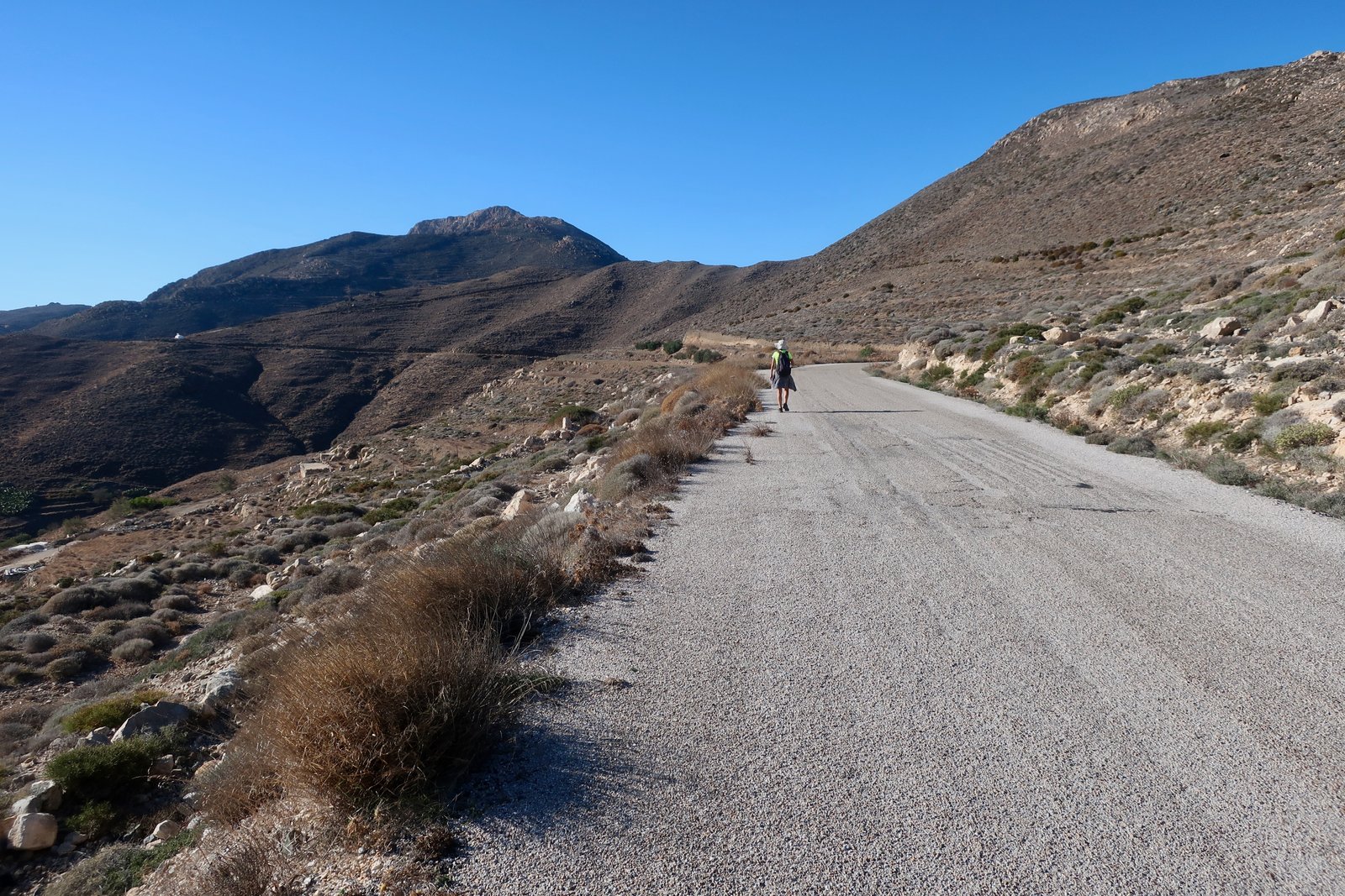
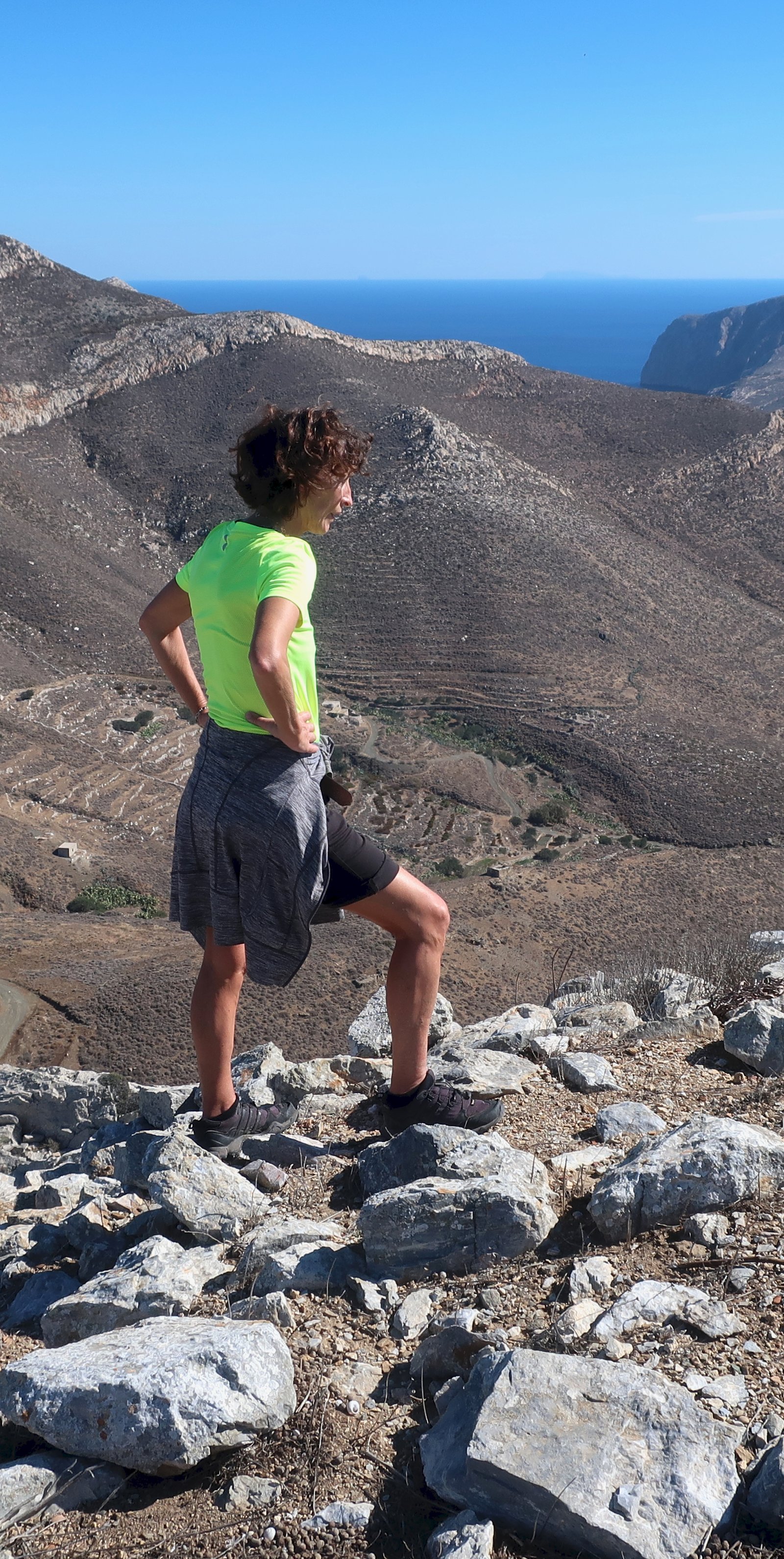
Because almost everyone goes to Greek islands at the same time of year, seasonal contrasts are largely unimagined. The following two photos were taken in the same part of Anafi, the hills between the Chora – visible in the distance in photo 2 – and Mt Vigla. The first was taken in late October, the second mid-February. A skim of green transforms the island from North African to almost Scottish.

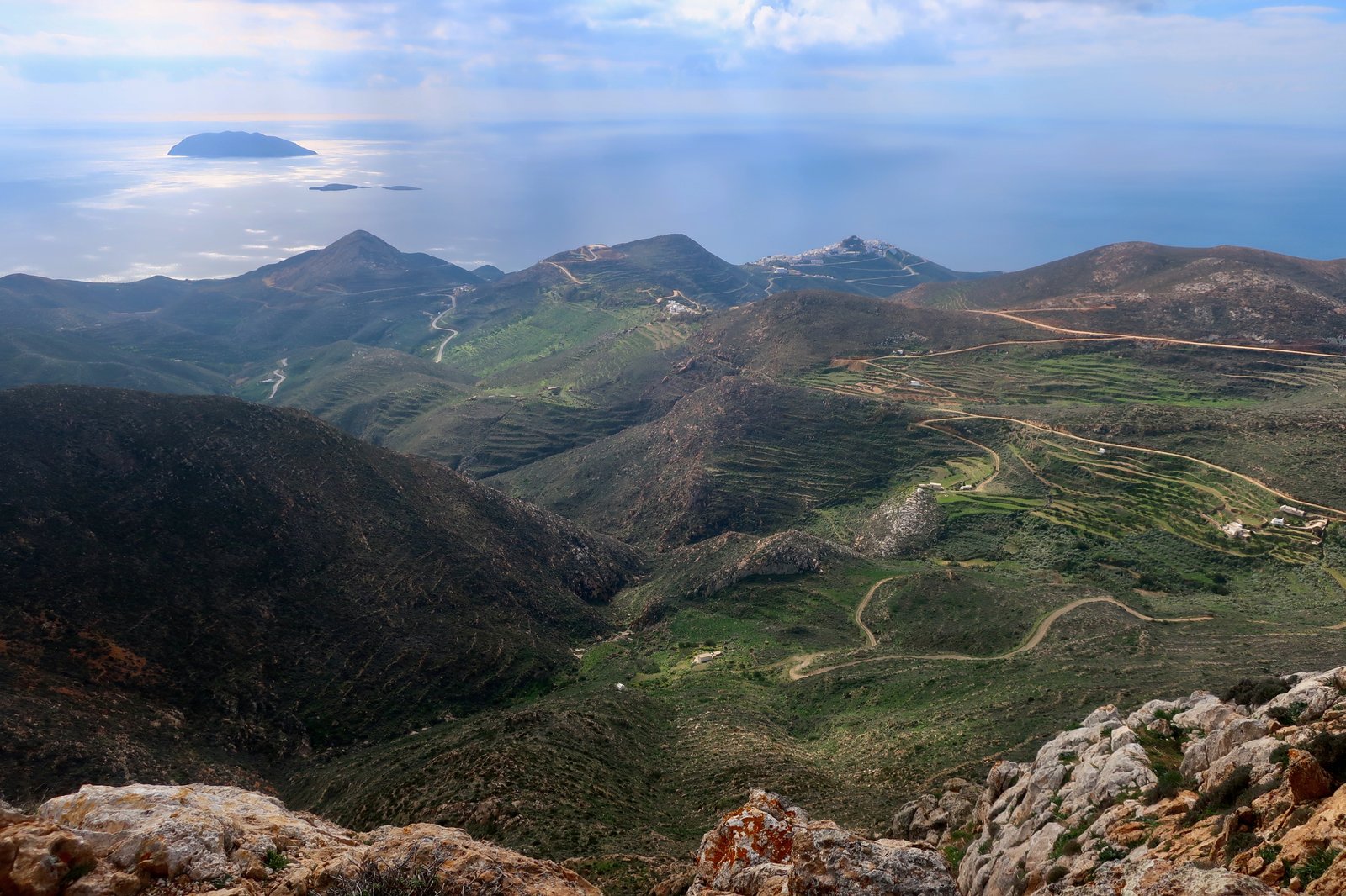
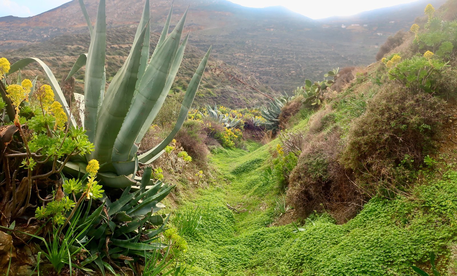
There are few trees on Anafi: some olives; the usual tamarisks along the backs of beaches; occasional fruit trees that in February, coming upon them in early blossom at random points on the trails, are pom-poms, little explosions. There are patches of pale, blue-green, prickly pear, like monstrous lichen. And there are agave plants, extraterrestrial invaders with their spiky bases and tall central shafts. The Anafiots use them strategically to stabilise dusty hillsides and in so doing stop their island being washed away.
There are classical remains – the scattered stones of a hilltop city, a few vestiges of its port on the coast below, and a temple to Apollo. At the monastery of Zoodochos Pigi, constructed on the ruins of this temple, it is the job of the custodian to receive visitors with honey-infused raki and chocolate sweets. In such ancient places, where the business of being a temple or monastery has now been replaced by this polite welcome and perhaps a guided tour, it’s unclear which gods inhabit the silence when the doors are shut and night falls.
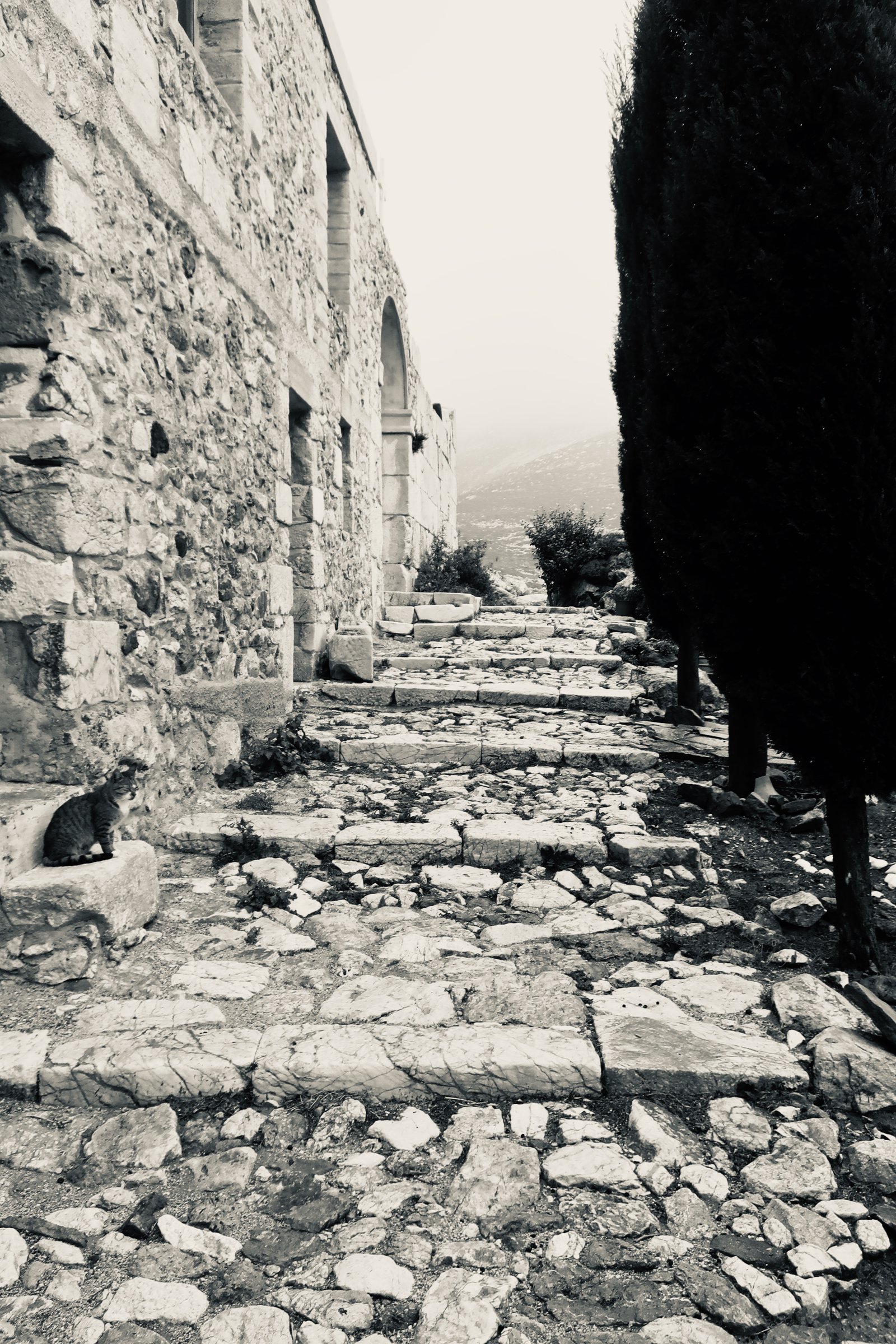
At the southeastern tip of the island is the great lump of Kalamos, one of the most dramatic monolithic rocks anywhere in the Aegean. It rises to over 460 metres, and is almost sheer along its southern edge.
There is also, tangentially, in Athens, a tiny neighbourhood on the slopes of the Acropolis called Anafiotika. It was founded by Anafian emigrés, who in the early years after Greek independence left the island to go and work on the construction of the new capital. They built themselves houses there as if they had never left home. Only a few dozen remain. People who will never know Anafi go still to take in the island charm of the small white houses right there in central Athens, the steep, narrow streets, the bougainvillea.
***
So, Anafi. You arrive, in October or March or January or practically whenever, as long as it’s away from the brief fizz of summer, to find yourself in another unfathomably strange place, where any children you come across will brazenly stare at the implausibility of your presence, three men sitting in the only open café playing cards will raise their heads to see you pass, and say not a word, and as you move through the narrow, white-walled lanes – this movement being almost rhythmic, the sway of your steps, the curve of the lanes – the only sound is someone close by playing the balalaika as if it could be nothing else, as if it has always been like this, the notes drifting off over the water towards Crete. It is impossible not to be susceptible, again, to the wonder of it all..
HIKING
At last count there were half a dozen marked trails on Anafi, many of them not all that well marked. Taken as a whole, they cover much of the north, the centre and east of the island, and most of the southeast.
Both Terrain and Anavasi produce Anafi hiking maps. Unusually, we had neither, but used the noticeboard in the Chora. It’s pretty much the same thing. The numbers quoted below correspond to that municipal map.
There’s no obvious order in which to do the trails. There’s no obvious direction and there’s no obvious way to combine them. Look at the map, work out approximate times and distances, the logic of setting out and getting home, and find a suitable method.
We did everything in three long hikes, each between 25 and 30 kilometres. Possibly most people will have other, less immoderate ideas. We have slipped into the habit of excess. We are throwing ourselves at Greek islands, we say, in an almost literal, physical sense, because, not only do we get endless satisfaction from turning hiking into a sort of sporting challenge, but also, how else could we ever possibly get to walk more or less all the trails on more or less all the islands in Greece?
There are few sections of pure kalderimi – stone-laid path – on Anafi. It’s possible they never existed, that there were never enough people commuting back and forth between church, work-place, settlement, to make their labour-intensive construction viable. But it’s also possible they’ve disappeared, either because the nature of the land lends itself to erosion more quickly than on some other islands – here the remains of agricultural terraces are often so dim as to be barely visible, melted away like footsteps when the tide comes in – or simply because in time everything disappears.
Most memorably, the hike up to the monastery on top of Kalamos rock, is one of the best short hikes anywhere in the islands.
The following information is for rough guidance, and is based around the three hikes we did.
HIKE 1
The Chora to Stavros on Trail 4. Stavros to Vouna. Vouna to Livoskopos Beach and Feneromeni Church on Trail 5. Back to Stavros. North to the end of Trail 4. Back to the Chora on dirt track at first, then the rest of the way on asphalt road.
25 to 27 kilometres
To Stavros on Trail 4 the way is mostly flattish and easy to follow. From Stavros there’s a nice hillside-traversing path around the northern slopes of Mt Vigla, Anafi’s highest point at about 600 metres. On the far, northern side, almost invisible just off the path, is the entrance to a tunnel that runs straight into the heart of the mountain. It’s beautifully formed, a little more than man-sized, with a curved ceiling. Obviously man-made, presumably a long-disused mine. I didn’t go far in, with my weak phone-light and wariness, and with Yvonne, who doesn’t think much of caves or tunnels, firmly planted in the entrance looking nervously after me.

Later we spoke to some local men who expressed concern about entering at all. Perhaps there are plunge-points where the floor disappears, they thought, imagining the worst.
Extreme care should be taken. Actually, entry is probably not a good idea. There may be plunge-points where the floor disappears. There may be anything.
Where the trail hits a dirt track you can take a diversion and turn to climb to the top of Vigla. As usual, the dotted path on the map is easier to find on the way down. More or less any careful route between the two points will do.
At Vouna, Trail 5 heads off left behind the church. When we were there, the trail marker had been removed, a blank where it used to be. The path is not as well-defined as Trail 4 around the mountain, not quite as lovely. It leads through scrubby land past a few small terrace-fields of Santorini-style nest-vines that we cannot help but see not as a miniature vineyard, but as the beginning of an attempt to redress imbalance.
The beach at Livospokos is rough, hardly worth descending to unless the day is especially hot. The path from there to Faneromeni is badly marked, it seems almost wilfully so, but it’s easy enough to head for the church of Aghios Nikolaos and approximate from there. At Faneromeni you can sit in front of the small church and drink coffee or eat lunch and gawk at the beauty of the Aegean. On a clear day Amorgos is visible 45 kilometres to the north, Astypalaia 45 kilometres east.
The first half of the way home is more or less the same path in reverse as far as Stavros. After that, north on Trail 4, to its end. Except we somehow missed the beginning of the trail and found ourselves instead walking down a sharp red-stone ridge, past a small collection of ruined agricultural buildings in the direction of the churches of Agios Vasileos and Agios Giorgios in the valley below. Each time it seems it might become too complicated to continue, there is another small crest and the way unfolds again.
And then, after a short section of dirt track, it’s road all the way home, a couple of flat-out hours at the end of the day with a final zigzag climb up to the Chora.
(Given time and energy, there are a number of supplementary right-hand turn-offs from the road, dirt tracks that lead down towards the west and southwest coast.)
HIKE 2
The Chora to the coast on Trail 1. Along the coast all the way to the Zoodochos Pigi Monastery in the far east. Up Kalamos rock to the Kalamiotissa Monastery, and back down to Zoodochos Pigi. From there, a choice of route home: either back along the coast, or via the church of Panaghia Sto Dokari, with a diversion to the ancient city of Kastelli, then on Trail 6 inland, to its end, and from there, a road-walk home. Alternatively, the road all the way back from the monastery.
25 – 28 kilometres
Down the hill from the Chora to the coast on Trail 1. There’s always a feeling when doing these old paths that connect Choras-at-altitude to the coast, that in taking the path, avoiding the back and forth snaking tarmac, you’re doing it the right way.
Between Katsouni and Katalimatsa there is a small delta of competing sandy paths. As long as they head more or less east along the coast, it probably doesn’t matter which you take.
Katalimatsa was the port for the classical hilltop-city of Kastelli. There’s nothing left but scraps: a sculpted corniche stone repurposed into the doorway of a ruined agricultural hut; a few pieces of scattered column. On occasion these odd scraps are all there is to mark the place where a settlement was. Sometimes there’s even less, or there seems at first to be nothing at all, so that in stumbling across an obvious relic we feel a wave of improbable pleasure far out of proportion to the piece itself.
After Katalimatsa the path hugs the coast as far as Prasies Bay, then turns up towards the Zoodochos Pigi monastery.

The last short section up from the beach is stone-laid. Generations of monks must have taken it back and forth, down to their sea-place. The monastery is built over the ancient temple of Apollo. Evidence is everywhere, inside and out: a whole wall of massive stones; an almost complete four-walled ancient structure inside.
The monastery sits on the neck of land that connects the island to the promontory of Kalamos rock. Think Gibraltar. A wonderful path connects the main monastery to the tiny Kalamiotissa church/monastery, nested on top.
The first half wanders gradually upwards, with views back down towards Zoodochos Pigi, the valleys and ridges, summits and shadows of the rucked-up island behind.

The second half of the trail has been sliced into the steep rock-slope. It’s one of many stone paths in the islands that could be used as location for a film with dwarves and orcs and elves and clanking swords and armour, and a dragon perched on the rocky pinnacle.
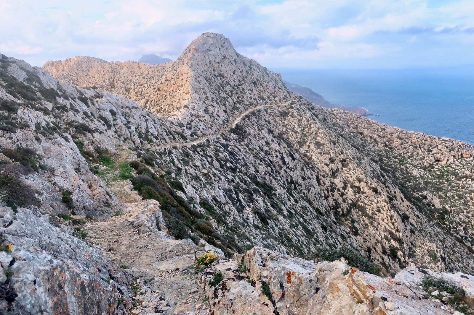
The Kalamiotissa Monastery doesn’t come into view until the path crosses the high ridge and turns back on itself. Uninhabited, brooding, it seems as much Victorian lighthouse, or prop for a Jules Verne story, as it does church or monastery. From the concrete terrace in front of it, the drop is 400 metres almost straight down.
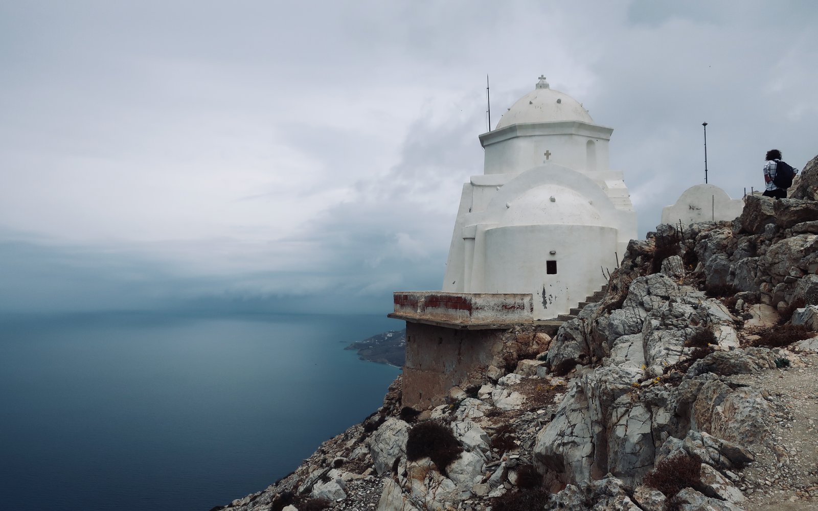
The first time we did the Kalamiotissa path, we did it at speed, with a roiling cloud-wave coming in towards Anafi across the sea, milky at first, dark grey behind. We paused for only two minutes at the top before running all the way back down with the storm at our heels, knowing there would be nowhere to shelter until we reached the bottom. The storm broke just as we reached the Zoodochos Pigi monastery, lightning crashing all around as we ducked into a small chapel underneath the monastery. We ate our lunch in the shadows there, with the smell of burning wax and an assortment of the usual icons, but especially Giorgios slaying the dragon again, here in Enid Blyton incarnation with rosy cheeks, bob haircut and hairband.
After which, an hour at least of waiting, poking heads out of the doorway, alternating between
I think it’s clearing
or
It’s set in
or
Shall we make a dash for it?
We made it halfway to the Chora, half walking, half running, before the storm exploded again. With rain coming down in diagonal spears, we huddled behind a concrete gatepost. When the wind changed and the rain began to hit us vertically, we risked running up the drive to shelter under the covered terrace of an empty, unfinished house. Except that when we got there, there were shoes outside the door and other signs of life, and very soon an elderly couple emerged, quite unfazed by our presence. They gave us home-made fire-water and chocolate biscuits and sketched their life stories as islanders urgently will: birth on Anafi, long exile for work, final return. To here, a little house on a stark, lonely hillside, six kilometres from the only real settlement on an out-of-the-way island in the southern Aegean. It is almost certain that this plot of land had been waiting for them, that it came from one of their families, that this hillside, the view south over the Aegean towards far-off Crete, the wind, the rocks, had always been in their bones.
He drove us very, very slowly back to the Chora, windscreen wipers battling back and forth. Not even a dog should be outside in this weather, he said, leaning so far forward that his face almost touched the windscreen.
HIKE 3
The Chora north on the road to the beginning of Trail 3/Mantourlos. The church of Aghios Antonios. Right turn off Trail 3 onto Trail 2 just before the Zoodochos Pigi Monastery. Trail 2 as far as Kastelli/Panaghia Sto Dokari, then any one of three alternative routes back to the Chora (see HIKE 2).
22 – 26 kms, depending on deviations
North off the main road just east of the Chora onto a tarmac road that curves around eastwards, as far as the beginning of Trail 3. There are a few little farmhouses on the way which psychologically we see as remote, even if at the same time we understand that remoteness is relative. Only five minutes from the Chora in battered island pick-up, paint-peeling island car. It’s not the houses that are remote, it’s the whole context. It’s Anafi.
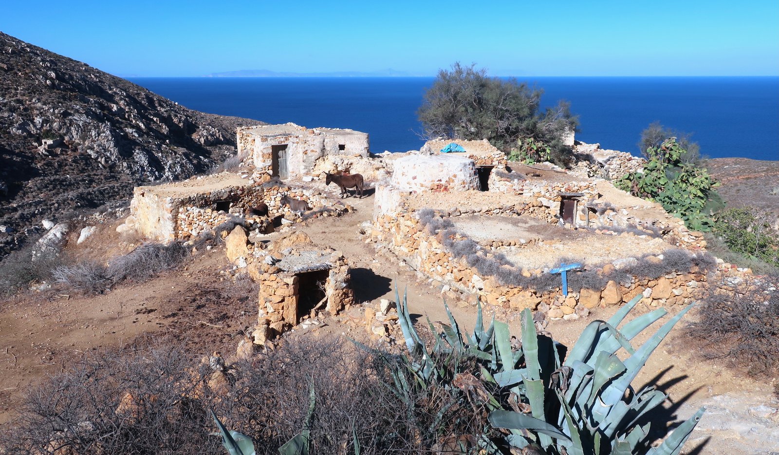
The trail proper begins at Mantourlos, a cluster of tumbledown agricultural buildings where both times we’ve been we’ve found a small gathering of hobbled donkeys, their legs tied on one side front to back to stop them wandering. There’s a blue wooden picket sign pointing in the right direction, towards Agios Antonios and a lovely path that winds it way gradually downhill, then out to the east coast.
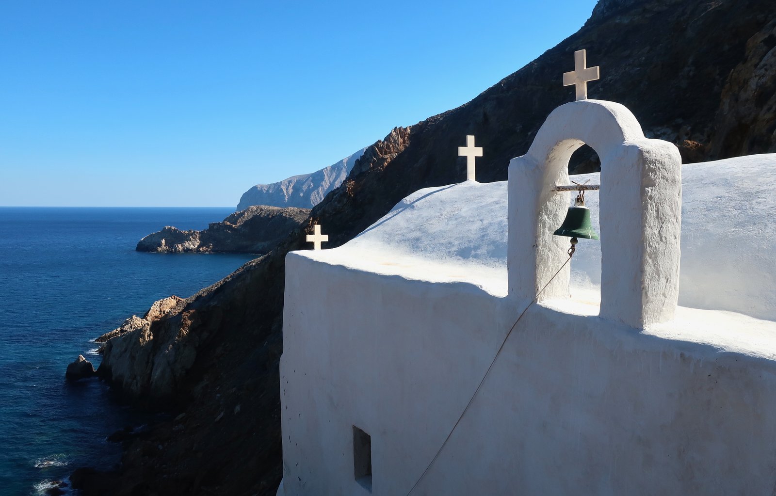
The church of Agios Antonios, a small diversion off the trail, is hidden behind a jagged orange outcrop of rock. It sits on a narrow ledge on a small cliff seventy or eighty metres above the water and is invisible from all directions but the sea.
In visiting so many similar churches and monasteries, built on hilltops or cliff-faces or remote valleys or tiny islands, we have taken to imagining their construction as a sort of pre-penance, an investment against future sins. Afterwards they are forever filled by the adversity of their elaboration.
There’s nothing here but wind and waves, and the endless movement of sunshine and shadow over the ridges of the coast and the church – the shifting shapes of the crosses, the curve of the roof, the bell-support, the verdigris of the small bell.
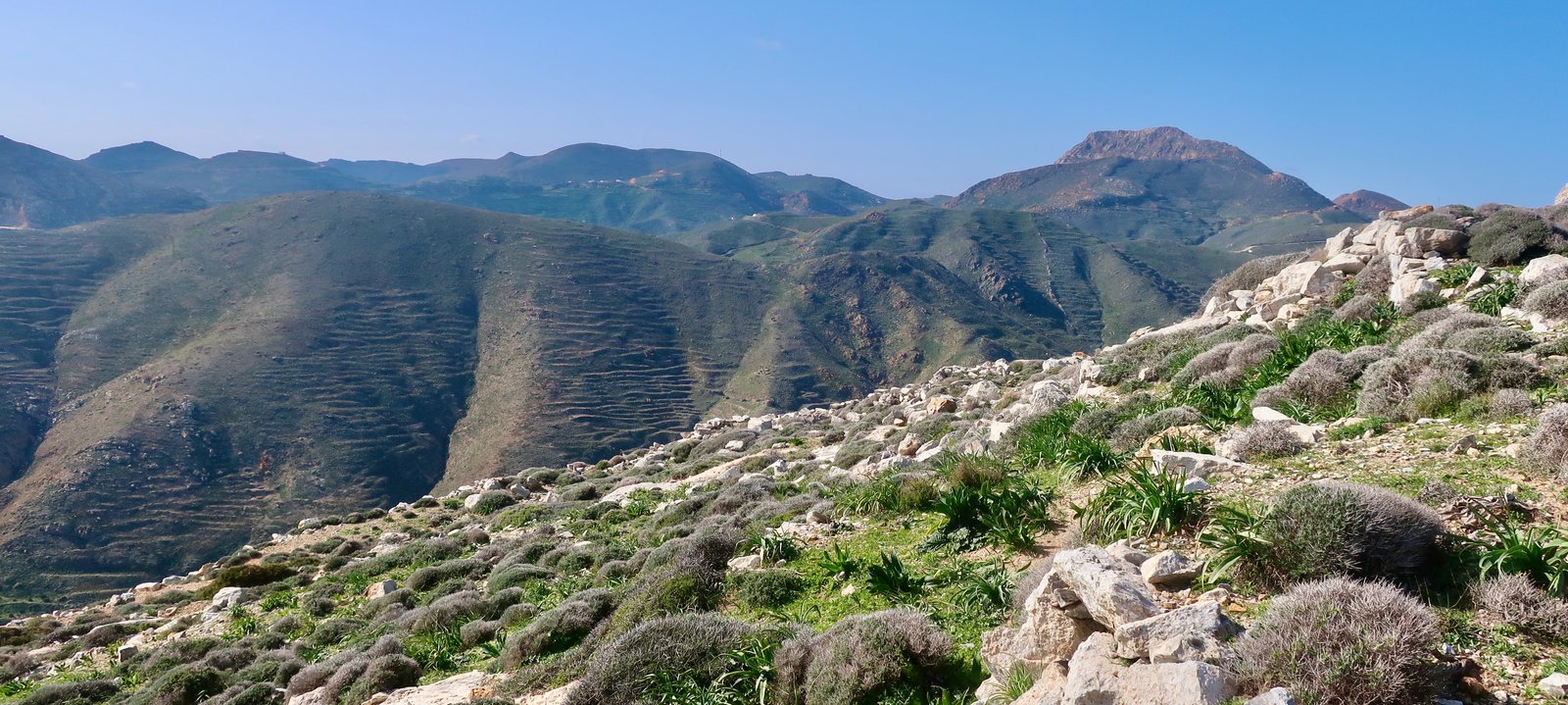
From Agios Antonios the trail climbs up a couple of hundred metres, turns into dirt track, then back into trail and climbs again, up and over a ridge where in February a blanket of purple, lilac, mauve and white anemones cover the ground. Anemones are wind flowers, anemos the wind in Greek. In exposed places where the wind blows relentlessly, they squat low to the ground and resist where hardly anything else will grow. And because there are so many of them, here and elsewhere on the island, there are also bees. On some paths there’s a constant humming. It’s the high proportion of anemone flower in it that makes the singularity of Anafian honey, they say.
A little before it reaches the Zoodochos Pigi monastery, Trail 3 turns into Trail 2 and almost doubles back on itself. This is the ancient path that used to connect the city of Kastelli to the temple of Apollo. A few short stone sections remain.
There is no telling how old these stones are. It would be nice to think that some are original, or at least re-purposed original. Knowing that at one end there was Kastelli and the other the temple, there have been more than two thousand years of passage along this route.
Of Kastelli, which once occupied the hilltop just above the church of Panagia sto Dokari, almost nothing remains but heaps of stone, with here and there some impression of wall. We spent a perfect couple of hours having lunch in the February sunshine, then picking through the stones and around the walls gathering wild asparagus. Mid-February is the earliest we’ve found asparagus in such abundance. Up there, where hardly anyone can ever go, and certainly not at that time of year, it was all ours.
From Kastelli, the mountains behind, with their fading terraces and deep valleys and ridges, are in need of ironing. The whole island is in need of ironing.
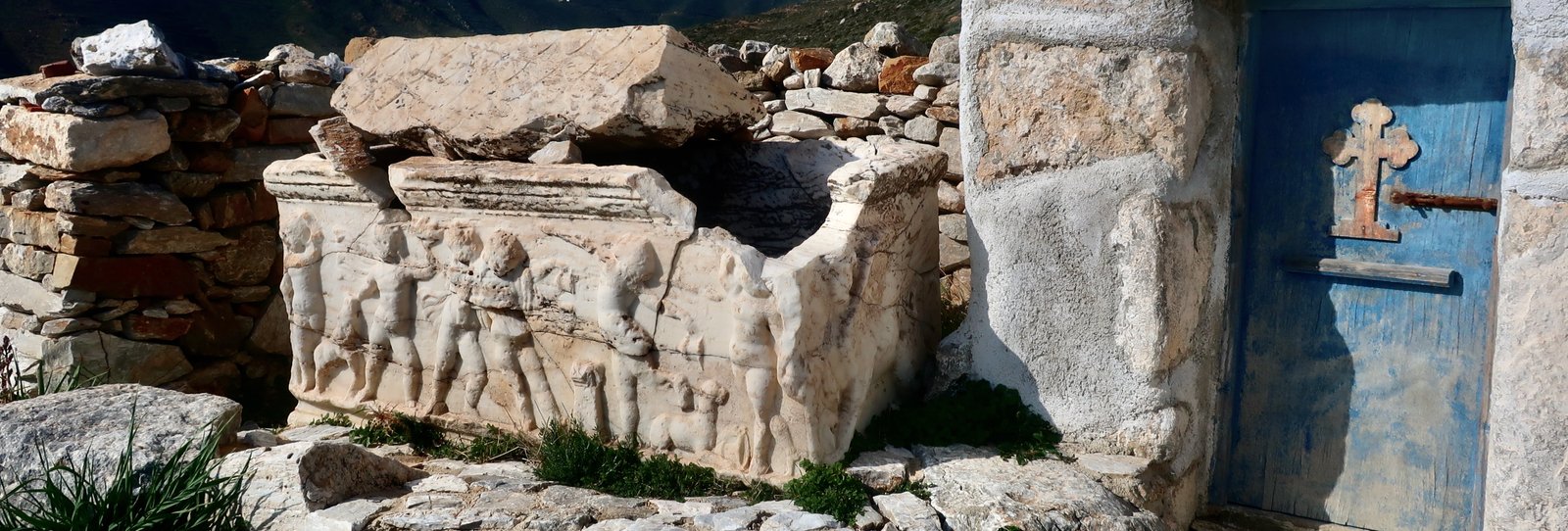
At Panaghia sto Dokari, in the small courtyard in front of the church there’s a sculpted sarcophagus, decorated with partying, dancing cherubs. It was found among the stones of the old city, is cracked and missing part of one corner and is just about holding together. It is over two thousand years old and is quite movingly beautiful. A coffin. There’s such joy in it.
From the church Trail 6 goes inland, across hillsides, through valleys, up over a ridge, into a valley full of prickly pear and euphorbia, agave and Bermuda buttercup. In October, it was dry and cracked. In February, early spring in the southern Aegean, the same narrow, channelled path was impossibly green and wet like a sponge.

Finally, several kilometres, on tarmac road, again, back to the Chora.