
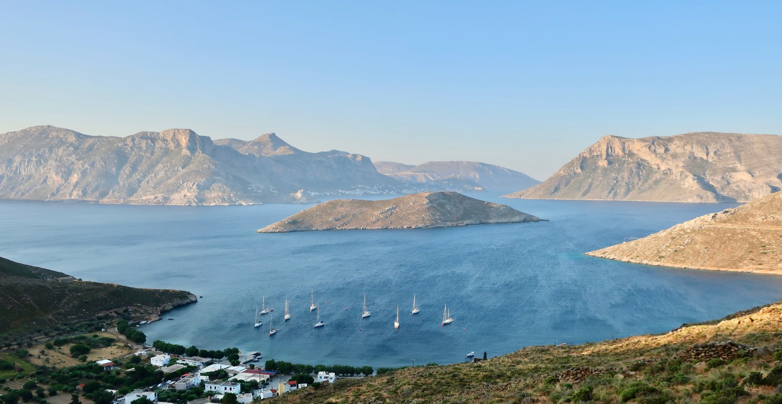
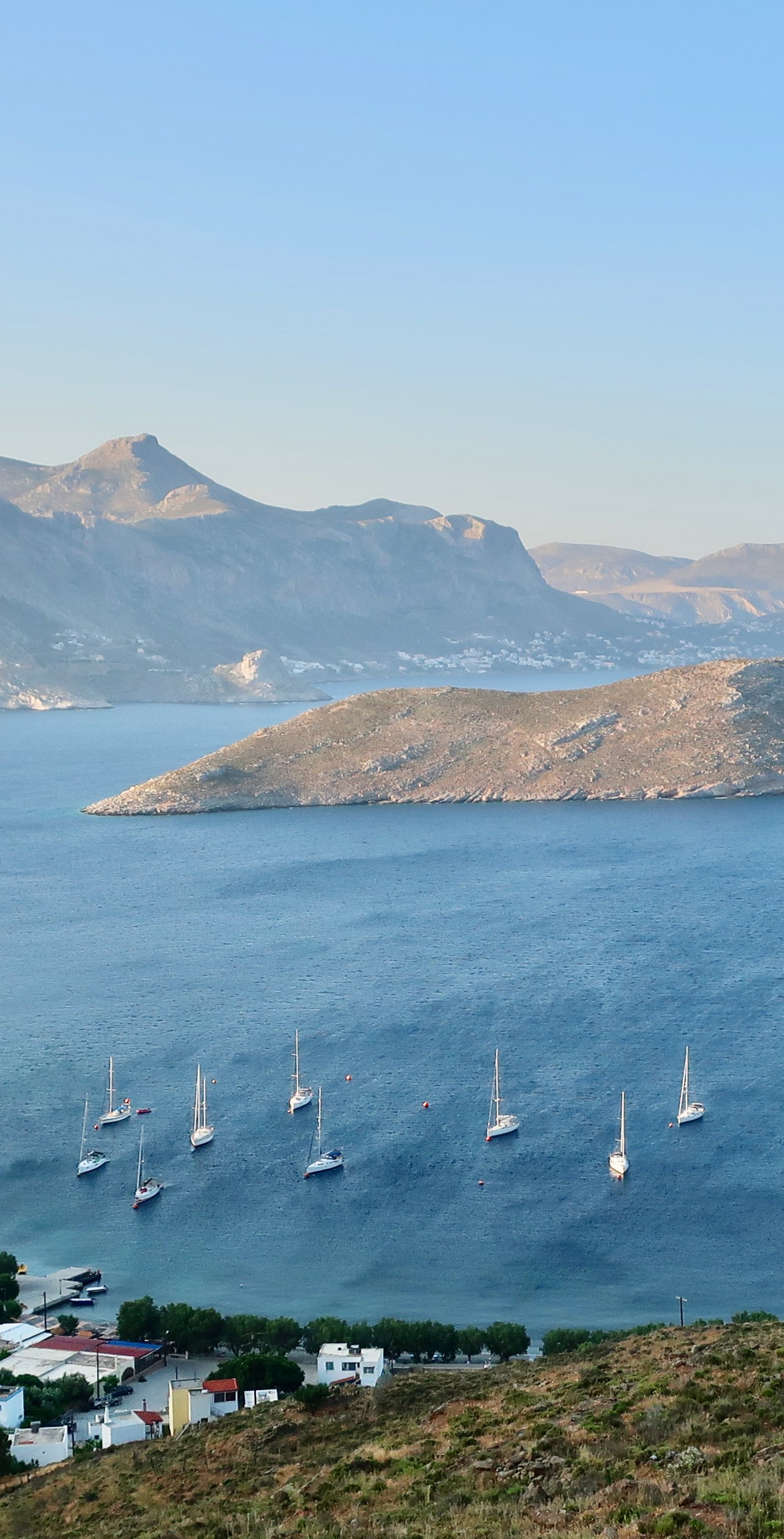
Arriving in Kalymnos in the middle of the night. Standing at the saloon window as lights begin to appear like low stars. Trying to find shapes, nuances of dark, in the blackness around them. The distance between that world and the theatrical illumination of the inside of the ferry could not be greater. Likewise the contrast between the silence outside, a silence almost tangible, and the fact that you are approaching on a great, throbbing, mechanical hulk. In the final moments, down on the car deck with two or ten or twenty other people, tasting oil and salt and iron, bags at the ready, waiting at the point of disembarkation for the curtain to rise, (the curtain to fall), it’s possible to be so held by the idea of silence that the pulse of the alarm that sounds when the door starts to open is shocking. As if you weren’t anyway inside a thing made of pure sound. And then the resounding metallic clang of the door coming down on the concrete jetty and out you pour, into a sort of epic emptiness.
***
Kalymnos is best known these days as one of Europe’s top sport-climbing destinations. Its hundreds of perfect limestone cliffs were discovered by a vacationing Italian climber little more than twenty years ago. Until its new incarnation, Kalymnos had been an ex sponge-diving island in a world from which Mediterranean sponges have mostly disappeared. The style of redirection is unique in the Aegean.
In the late nineteenth and early twentieth century the island grew rich on the sponge trade. Pothia, the main town and port, is sprinkled with neo-classical houses built on the profits of sponge-diving. These days, walking along the seafront, there are sponges for sale, but also sponge-focused mementoes, a sponge workshop to visit, a sponge factory, the sponge-themed nautical museum. Tourism is where the money is now, but Kalymnos has a different idea of itself. Sponges were harvested all over the Aegean but no island is more associated with the trade.
Until the middle of the nineteenth century, the method was simple: divers would descend to the sea-bed for as long as one breath would last. Then the diving suit was invented, the round metal helmet and rippling sack of a costume filled with air. Divers could go deeper, spend far, far longer underwater and go down many times a day. But they didn’t understand the consequences. They knew nothing of the bends, the nitrogen bubbles that swelled in their blood. No-one yet did. Sponge-diving had always been dangerous work, but at the end of the nineteenth century and beginning of the twentieth sponge-divers died and were crippled in their thousands. The sponge fleet went away for months at a time, to the coasts of Libya and Tunisia, and harvested tons of sponges. But the mortality rate got to be so high that when the men left for the season, their mothers and wives put on black, as if they were already dead.
During the twentieth century, sporadic global and local disasters further impoverished an already-struggling Greece. In Kalymnos, problems were exacerbated by overfishing and, later, disease. Sponge profits plummeted. Like others from all over the country, men from Kalymnos left home to find work elsewhere.
From time to time we meet elderly Greek men who have come home, leaving ex-wives and grown-up children in the other place. They offer us lifts in their flat-bed trucks, call to us in the highlands where they have their goats. They want to use their English on us, which even after decades away more often than not is a string of perfectly-accented expressions in American-English or Australian-English, that hang like clusters of beads on the connecting glue of their original, roughly-translated, island-Greek. Thirty years away, they say, forty years, fifty years. Watching closely for reaction, waiting to register our surprise at how well-preserved they are.
The mechanism is simple: first one man goes, makes a base, a life. When others from his family, friends, island, want to leave, they use him as a landing-point. The result is island-concentrations. There are Greek exile communities all over the world, but from Kalymnos they’ve gone especially to Darwin in Australia, Tarpon Springs, Florida, Gary, Indiana, and Campbell, Ohio, the latter where expatriate Kalymnians have reinvented themselves as painters of bridges. Previous generations lumbered in slow motion across the sea-bed, oxygen pumped down to them through tubes. Now they are airborne and take in great mouthfuls of sky. They’ve swapped the glamour of one risk-of-life recklessness for another. There’s poetry in the transformation.
In Darwin Kalymnians were imported to work as pearl divers. The taxi driver who took us from the ferry in the middle of the night had gone and come back. He filled the car with a taxi driver’s flow of words for the twenty dark minutes we spent together. How is Darwin? he guffawed. Excuse my language, but it’s shitty in the winter when it’s really hot, then it gets shittier when it gets hotter in the summer. All you want to do is swim but you can’t swim because the water’s full of shitty crocodiles.
Greek islanders leave home reluctantly then keep alive an idealised distillation of where it is they come from. Greek culture, even deracinated, is resilient.
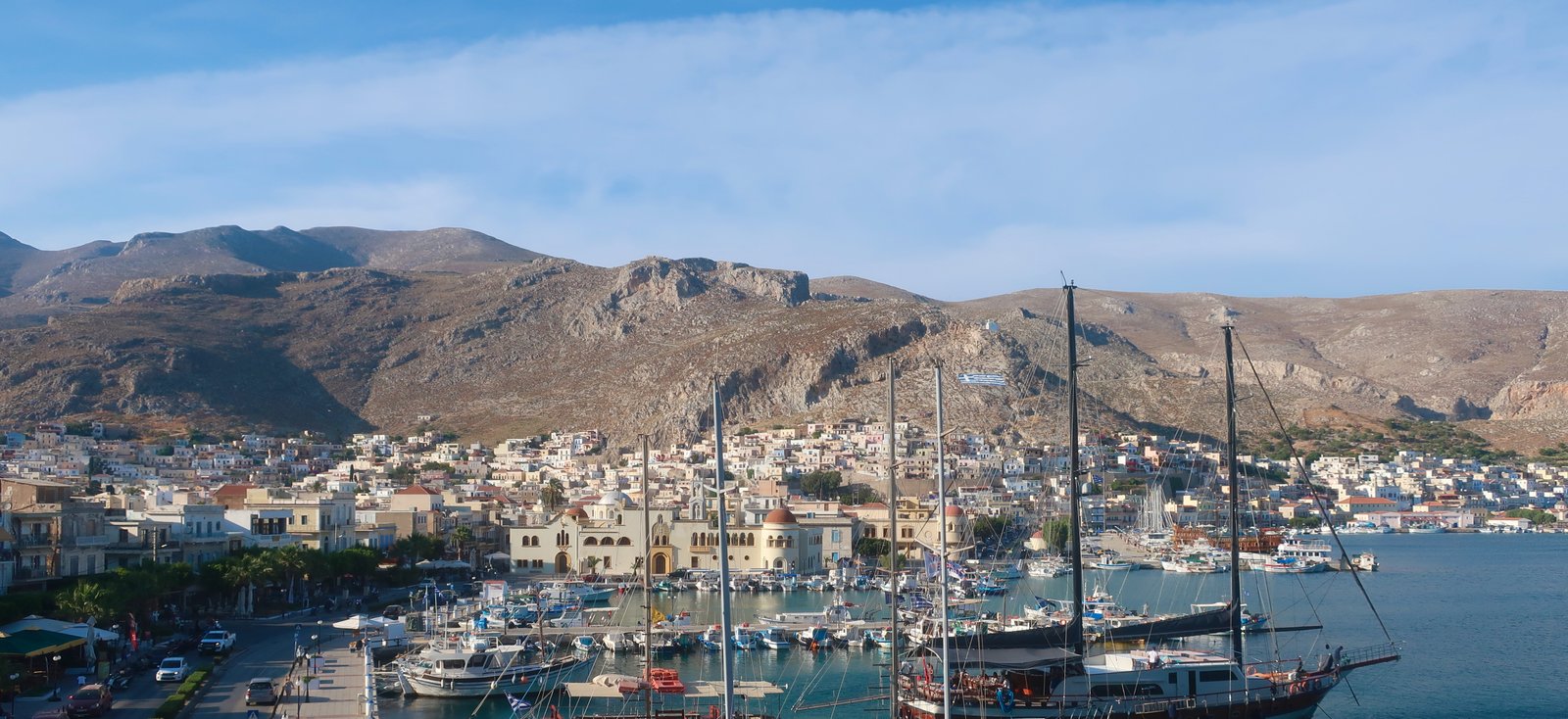
Despite the run of fish tavernas along the waterfront, Pothia still feels old-fashioned. It isn’t a tourist town. Anyway there are no beaches. It’s a hub, a point of arrival and departure, and a working town. In season the usual summer tourists pass through, heading for the beaches. In Spring and Autumn, climbing season, those who come and go often have backpacks, with coils of rope over their shoulders. Remarkably, climbers have become more economically important than the beach crowd, their season longer. Masouri/Myrties on the west coast, where most of the climbers stay, has taken on the characteristics of this new clientele. During the climbing season it’s as if the cafes and bars are themed. There’s a heightened level of sociability, a sense of commonality absent in a beach resort. Perhaps there’s also a less heavy-handed selling of picturesque Greekness than elsewhere. Adaptation has been quick. Masouri seems now not to look towards the sea, but inwards to the great line of cliffs that loom just above, pinkish when lit by the evening sun.
The highest point on Kalymnos is six hundred and seventy-six metres. Less than Paros, Tinos, Zakynthos and Skopelos. Hardly more than Symi, Chalki, Hydra, all of them hilly islands. Kalymnos, even if it barely makes the top thirty by height, is not hilly, it is mountainous. It is jagged, petrified, harsh, craggy, rugged, rocky, stark. It’s not pure height but the lay of the land that counts. When thinking about altitude, five hundred metres seems not much until you’re standing at the edge of the drop. Then it’s terrifying, limitless.

Kalymnos is made of a parallel succession of valleys and ridges on a northwest/southeast axis. It looks almost as if the splayed fingers of a giant hand had been forced down into it when the island was still wet, just formed, causing the ground to squeeze up between them.
In the southwest the land rises quickly to five hundred metres. Much of the coast is impossibly precipitous. The Agia Triada convent near the southwestern tip is so cut off that the nuns come in and out by boat and still use the Julian Calendar, officially replaced by the Gregorian Calendar in 1582. Currently they’re thirteen days behind the rest of the world. Imperceptibly slowly the gap continues to widen.
After this lumpy beginning, after the airport, perched on a scraped-flat hillside plateau, the land descends to the first of two main valleys, stretching from Pothia on one coast, to Panormos/Kantouni on the other.
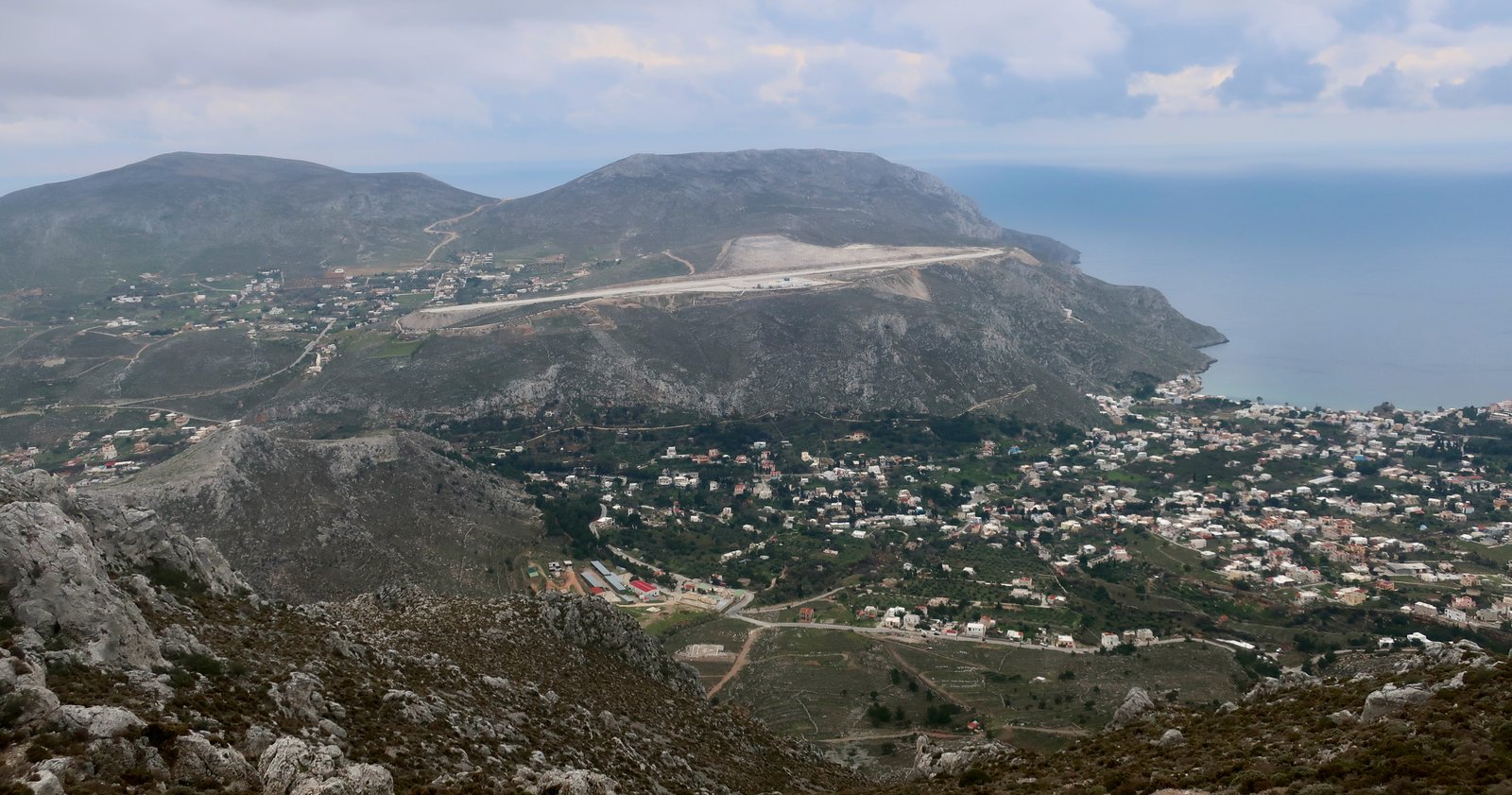
The old Chora, the island capital, is at the halfway point. Pothia flows uninterruptedly into it now. From this valley the land climbs steeply up again to the central ridge, which also stretches from sea to sea. The island of Telendos, one kilometre off the western coast, is an extension of this ridge. It became separated from the mainland after an earthquake in 554 CE. It has a sweet little fishing port on the sheltered side facing Kalymnos, that now mostly works with the seasonal climbers, some of whom stay there, others who take the frequent small boats across from Masouri. Telendos, three and a half kilometres long, a kilometre and a half wide, the summit rising to just under five hundred metres, is nothing but a giant rock on which there are now hundreds of climbing routes. Even the Terrain Map walking trail that circumnavigates the island is marked with at least three danger signs, hazardous sections requiring some climbing skills. There is no easy way round.
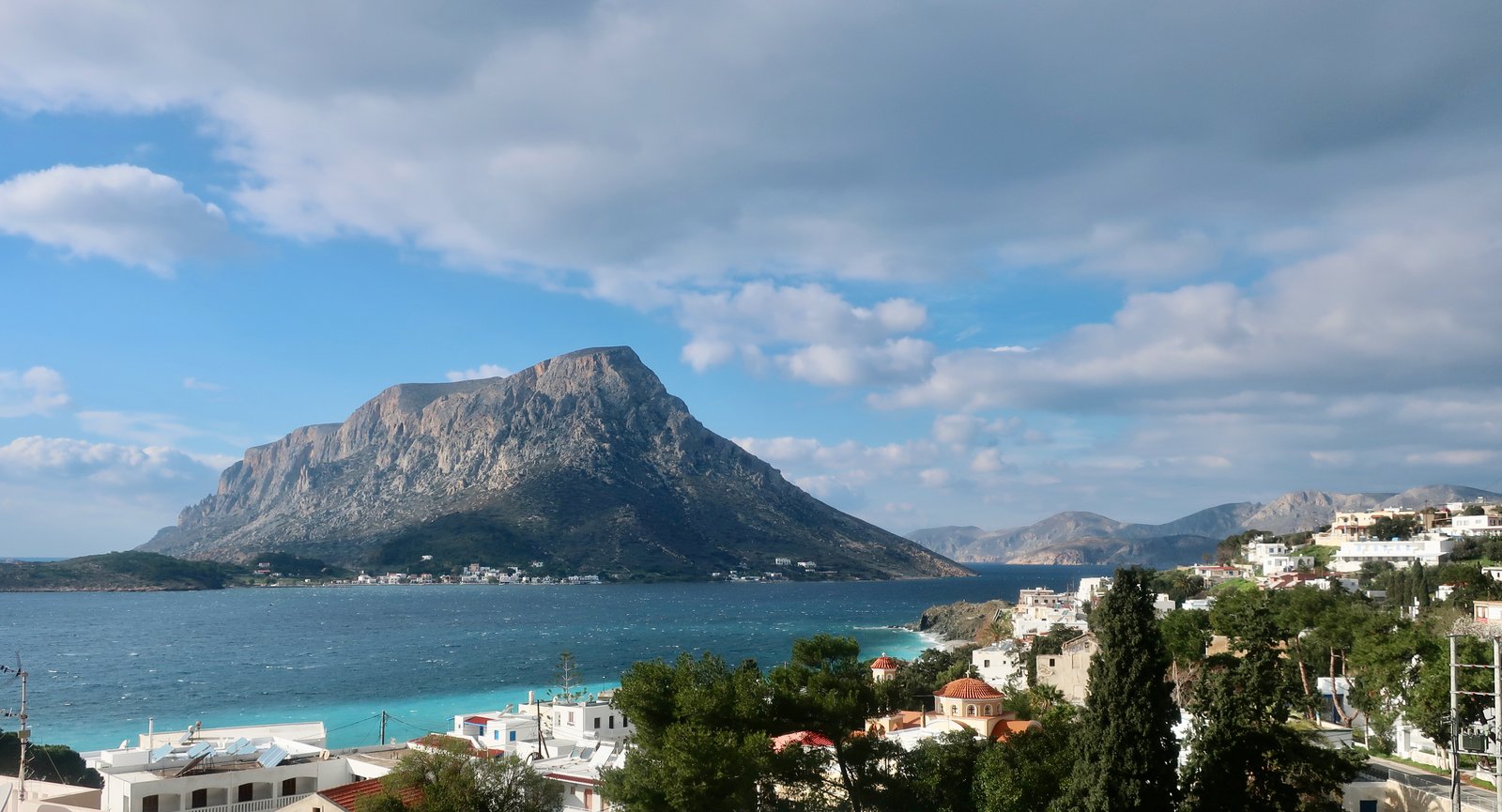
Profitis Ilias church, the highest point on Kalymnos, is roughly in the middle of the island’s central ridge, above the Chora. Being built on the very top, it looks in all directions. It is as barren, as harsh and windswept a hilltop church as anywhere in the islands, freezing when the cold north wind blows in winter, in summer the only point of shelter in a shadeless, baking landscape.
From the ridge the land drops steeply to the second valley, parallel with the first. This is the island’s main agricultural area, where olives and citrus fruits are grown. Only twelve per cent of the island’s land is productive. Wherever possible, the farming is, or was, intense. The little port of Vathy is at the easternmost point of this valley, at the end of a deep, narrow, fjord-like inlet. The valley doesn’t quite reach the other, western coast, a range of rocky hills rises up to close it off, as if the finger that pressed down into the still-forming land wasn’t long enough to stretch all the way. From outside, looking back in towards the island from the western sea, a line of cliffs runs most of the way along the west coast, rising almost sheer to five hundred metres again. This is prime climbing area, probably the largest concentration of bolted rock walls on the island.
After the valley, the land climbs yet again to make another coast-to-coast ridge rising to just over six hundred metres.
Finally, sticking out from the top of the island, a long, craggy finger of land points northwest a dozen or so kilometres. It too has a central ridge over six hundred metres high, it too is mostly barren rock.
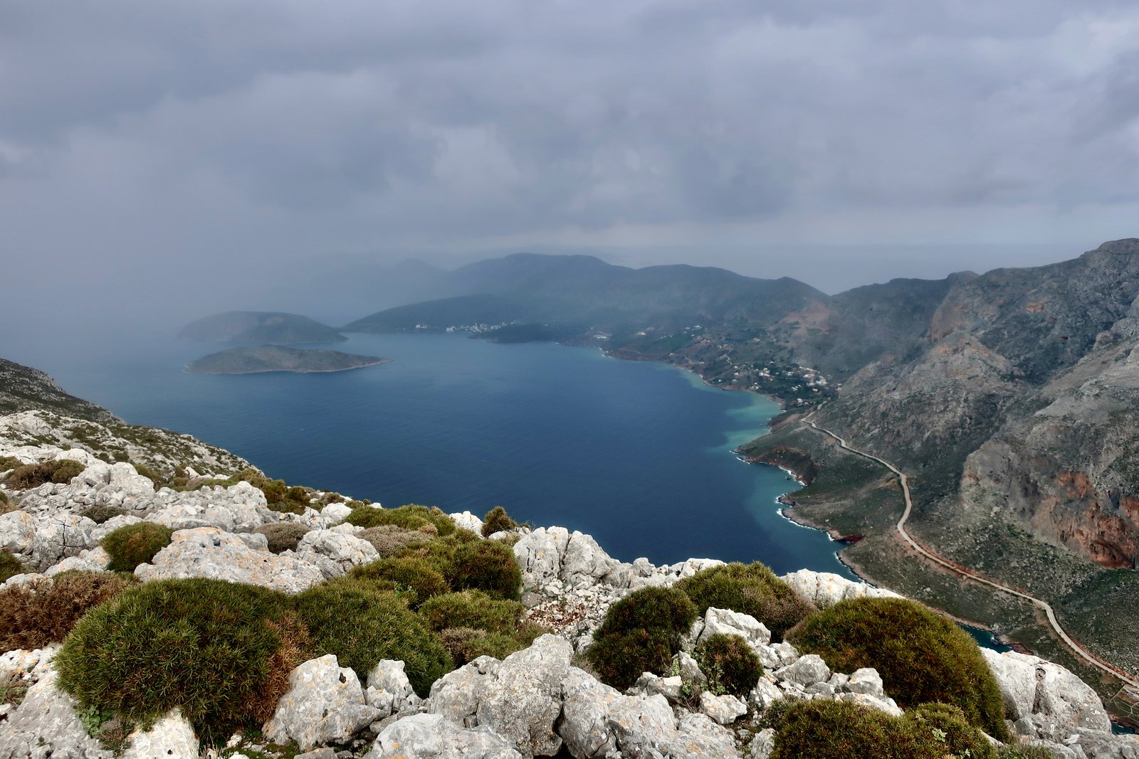
Even for the Aegean, so often austere behind the thin veneer of glossy picture-perfect, much of Kalymnos is strikingly inhospitable.
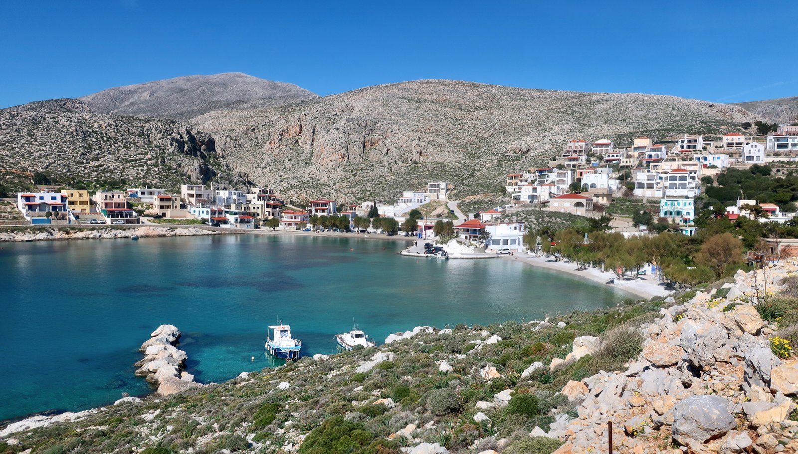
But as well as the crags and cliffs and ridges, there’s also the sea. In the south, Vlychadia has a lovely little double beach, a few tavernas, protected swimming and a handful of places to stay. Emporios in the north is even more attractive, a sheltered beach, good swimming, several tavernas, some places to stay. Enough, not too much.

There are historical remains at several locations, both classical and Byzantine. Kastelli in the north is evocative, the little that has resisted: some cut stones, the base of a tower, a panoramic view down over Emporios and Telendos. There’s no information on site and little on the internet.
The old castle/fortified village that looms over the Chora is one of the best Byzantine defensive sites in the Aegean. It was a stronghold for seven hundred years until being finally abandoned in the early nineteenth century. It still retains an unbroken perimeter wall and, within, the chaotic ruins of a large village plus a dozen or so churches. After the steep climb up from the Chora, we had imagined continuing on up the mountain from the village, skipping over the wall at the back. It is quite impossible. The land is sheer on all sides, the site impregnable. You have to go back down to the main valley before heading up.
Finally there’s the archaeological museum in Pothia. Almost all islands have museums. We go to most. They vary from one-room collections of pottery shards and time-and-climate-weathered stone – sometimes so eroded as to be barely recognisable as architectural component or sculpture – to buildings crammed with a quantity of wonders. The museum in Pothia is unmissable for one piece, dubbed The Lady of Kalymnos, a more than life-size bronze statue that was dragged up from the sea bed by local fishermen in 1994. It is rare enough, and wonderful enough to transcend the island. No photos here. Just go and see it.
HIKING
The Kalymnos Trail, a ten stage hiking route available in small book form, is unlike anything else in the islands. There are many longer hikes – no section here is more than thirteen kilometres – and there are very many island-walks with much greater altitude gain. But with hikes graded from Moderate to Hard and Very Hard, there is nothing, anywhere, as broadly challenging.
For a number of sections, while climbing skills are not needed, scrambling skills certainly are, and so, according to the guide is a good sense of balance, a high degree of caution, a high level of skill with maps, and experience in mountain trekking. Plus, for sure, a good head for heights. And maybe, even if not climbing skills exactly, then something like a climber’s composure.
If you’re going to hike on Kalymnos, you absolutely don’t need to do the Kalymnos Trail. Or not all of it and not even all of any particular section. Kalymnos can be treated like anywhere else, trails cherry-picked and/or combined to suit taste and available time. However – and this is a first for us – if you are intending to hike on Kalymnos in any way, we’d recommend getting the book, called The Kalymnos Trail, and published by Terrain.
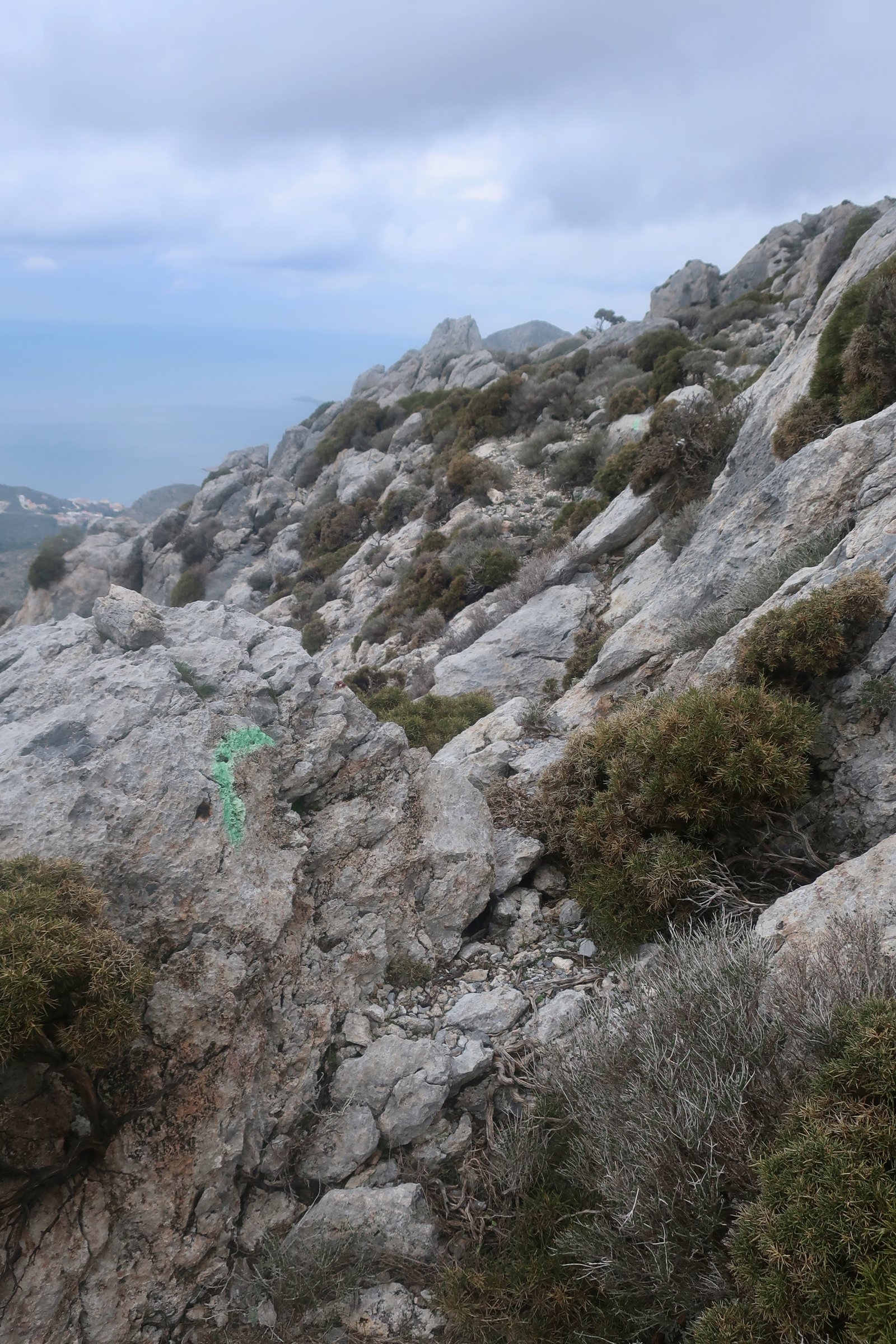
All the trails we’ve done using the book have been well-enough marked to follow – sometimes only just – using, usually, green paint, sometimes red, and/or cairns. Green doesn’t stand out at distance quite as well as the more traditional red. On the other hand, if you do see a green mark, you know you’re on track.
We haven’t done all the trails. Hopefully we’ll finish them on our next visit to Kalymnos. For now, notably, we’ve skipped the four trails or parts of trail classified Very Hard. The guy who worked out the trails and wrote the book is a climber as well as a hiker, and I’m still not quite sure how much crossover is necessary between the two in order to do all the hikes. The answer I suspect is not too much. But we’ll see.
The following is therefore not a review of the book. (The book is excellent, and good not just on the Kalymnos Trail but insightful and informative about Kalymnos too. The best, by far, of any Greek island hiking book we’ve seen.)
Masouri/Myrties, the climbing hub, is the obvious place to stay. Many of the hikes can be done directly from there, but there’s also a good bus service into town and from town to Vathy/Rina. However, the three hikes on the long northern finger of Kalymnos are not accessible on foot from Masouri, and buses to the top of the island are sketchy. Rental cars, rental bikes, buses, taxis, a two-centre stay… All are possible. Check out the times/distances for each hike, given in the book or on the Terrain Map, check out buses, check the weather.
Each of the hikes we did below are referenced also to their place/number on the Kalymnos Trail.
HIKE 1
KALYMNOS TRAIL – SECTION 1 and the first half of SECTION 2
For us, a circular route beginning and ending in Panormos. Roughly 25kms. An easy all-day hike that could be cut off at Vlychadia, although you’d then need to organise a way back to base.
Because the 07:20 bus didn’t come, we had to walk into Pothia. Perhaps there was a logical explanation: feast day, national holiday, misreading of timetable, broken-down bus, other. The walk into town is not ideal. There’s a reasonable amount of traffic – 16000 people live on Kalymnos – and not always a decent roadside space to withdraw into when vehicles pass.
By the time we’d reached Pothia, scoured the bakeries for coffee-time treats ideally containing raisins, found the way, two hours had passed.
Kalymnos lies crosswise to the prevailing north wind. The parallel ridges and valleys, close to an east-west axis, make for clearly-defined areas of wind and calm. (Of course the wind doesn’t blow one hundred per cent reliably from the north, it can come from anywhere. It can also make eddies, irregularities. Like marine currents its direction can be baffling. But still, the north, usually.)
The trail to Vlychadia, a gentle, mostly coastal route over rock and narrow marked path, is on the sheltered southern side of the island. In late February the forecast said 13 degrees, but 13 degrees and clear sky and above all no wind feels much warmer. It’s difficult to set out without too many clothes – it’s winter, we’re programmed – so you end up peeling off, stuffing unwanted layers into rucksacks. During a coffee break in the small courtyard at the church of Agios Georgios, we had to duck into the shade, it was so warm.
Vlychadia, the little port, its twin beaches, a restrained sprinkling of holiday infrastructure, is one of those small resorts that through a combination of good luck and good planning (which may actually just be good luck and good luck) seems, for now, to have got it right.
Winter not yet officially over, in one of the two tavernas along the front they had already begun preparations for the holiday season, cleaning and painting to an accompaniment of sunshiney music. On one of the beaches a boy of eleven or twelve was swinging an octopus again and again over his head and down onto a rock, tenderising it with a splat, splat, splat, bashing all its brains out. There’s nothing to suggest animal about the noise; rather it sounds like pre-industrial clothes-washing. Along the seafront two nuns from the Agia Triada convent, invisibly charged with their chronological anachronism, were loading supplies onto a small boat. A slow world going about its slow business.
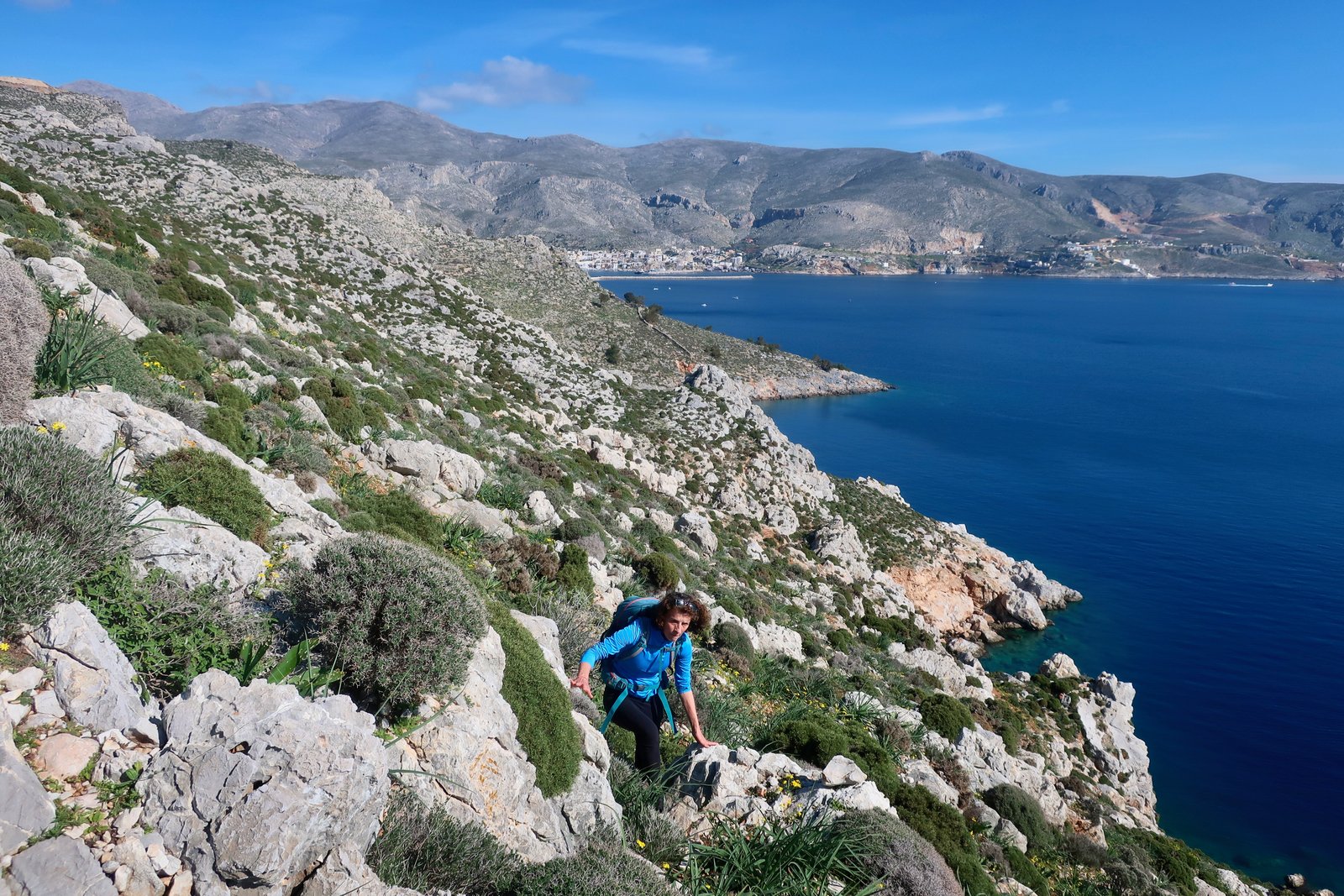
Section 2 begins uphill from Vlychadia, past two well-kept monasteries, past the Kefala Cave, the lovely church of Agios Andreas – an oasis of green in a spiky grey world – and eventually to the high land looking down over Pithari Bay and Agia Triada.


On the map a trail leads down to the monastery. With not enough time to get down and back up the same way – the only option – we turned into the gorge, rightly described in the Kalymnos Trail as a delight. Small gorges like this, where a little scrambling is necessary and some working-out has to be done to find the best solution through certain sections, are playgrounds.
At the top of the gorge, on a saddle between two peaks, is the bare little church of Aghios Konstantinos.
From there a decision has to be taken. The second half of SECTION 2 on around the coast, or on dirt road and then tarmac, past the airport, down to the main road, and for us back to Panormos. We did the latter. The Kalymnos Trail around the coastal cliffs is marked Hard/Very Hard, and described as ‘terrifying’.
HIKE 2
KALYMNOS TRAIL – SECTION 3
A circular route beginning and ending in Myrties/Kamari/Panormos/Linaria, it doesn’t matter which. To the Chora on the road. A diversion up to the Kastro, then a return down to the Chora followed by the trail as described in the book. With the add-ons to make it circular, and taking in the Kastro, probably more like 17 than 13 kms.
Described in the book as Moderate/Hard. For those put off by the word ‘hard’, something less than hard and just a little greater than moderate would be more accurate. The hard here I guess is for the quite steep climb up to Profitis Ilias, the high-point of the island, not for any technical difficulty.
As mentioned earlier, the Kastro, built on a crag overlooking the Chora, is a wonderful site, and a necessary diversion from the Trail. From a distance the whole village, all the houses exactly the same grey, might have been carved from the mountain, a process of withdrawal of matter rather than accretion.
As suggested in the book, the small shepherd’s path that deviates off to the right from the main drag up the valley, is by far the best way up to Profitis Ilias. It’s an uncompromising, narrow, twisting and turning trail, that rejoins the main trail in a high, spongy meadow where there are three wells and a miniature chapel carved into the rock-face. From there, only about half a kilometre to the summit.
We did this hike the day after doing Hike 1, above. At the top it was piercingly cold, the air full of liquid moisture. In winter, one day to the next on the same island the conditions can be so different.
Profitis Ilias is three or four scant rooms gathered together around the church. Inside there’s coffee and sugar and a small gas stove. You could hunker down for the night but it’s a spartan place, the interior of the church buildings almost as rigid as the outside.
For the next section of the path there’s lovely guidance – turn right at the fig tree with the fence around it – unmissable because there is only one fig tree here. The walk up from the tree is lonely and dramatic, through rough highland meadows, bare rocky land, across the slopes under a number of climbing cliffs that are as smooth and curving as the insides of caves. Afterwards, down through an easy gorge to Kamari.
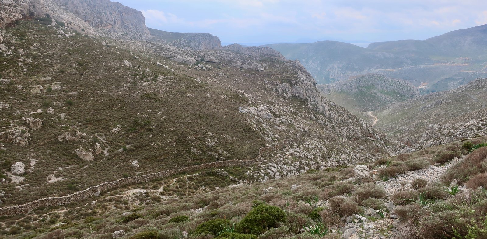
Perspiring on the uphill, then freezing air coming over the top to cut through us. Some days are like this, never being able to settle on the right clothes because there are no right clothes. All day long layers on and off according to exposure and altitude.
HIKE 3
KALYMNOS TRAIL – SECTION 4 Telendos
We did only the shorter half of the round-the-island path, in reverse up to Agios Konstantinos. Roughly 6kms, the whole thing there and back.
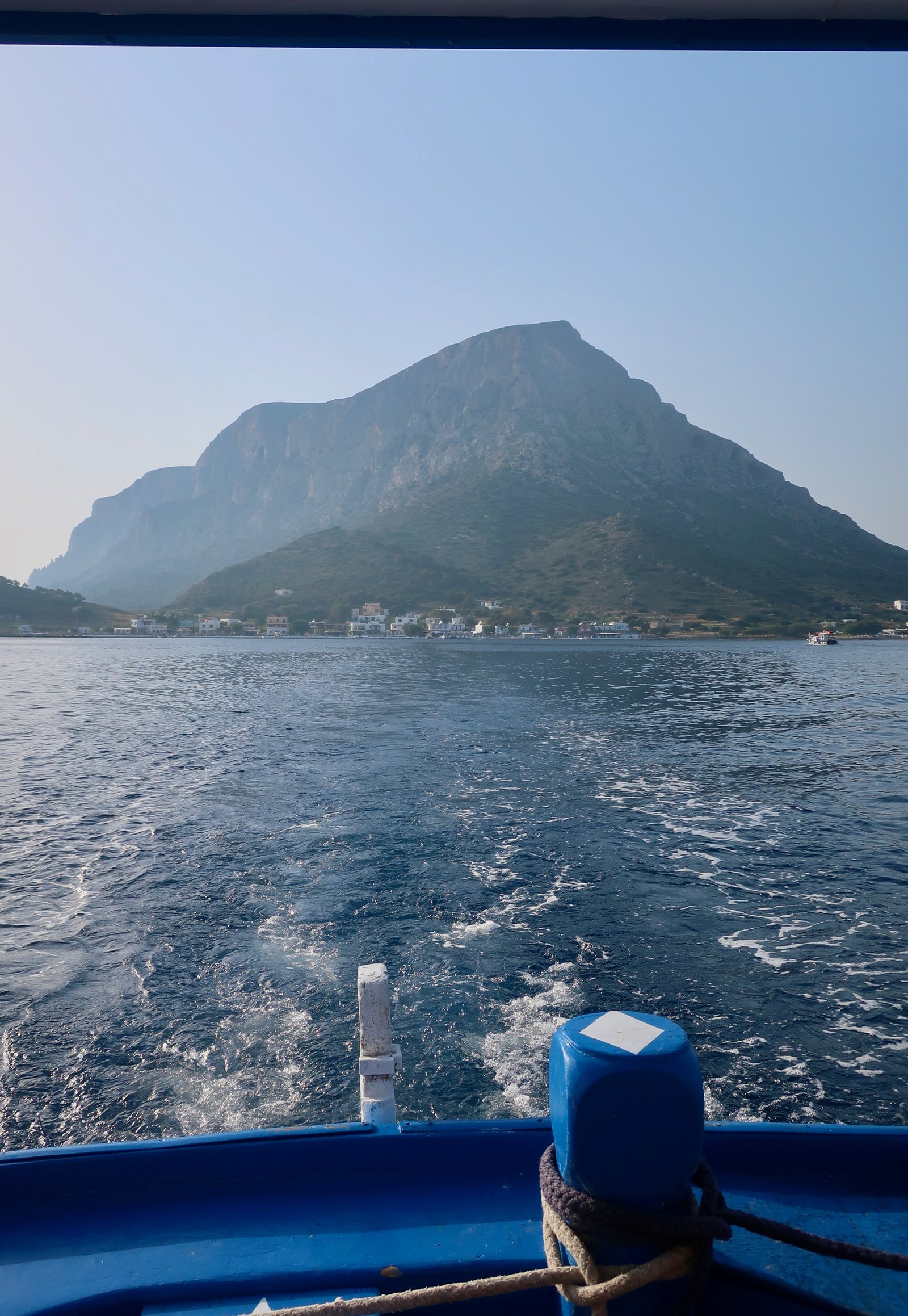
For the duration of the spring and autumn climbing seasons, some of the local fishermen have reinvented themselves as taxi-boats. A fifteen-minute boat trip between Myrties and Telendos, barely a kilometre across the channel. Such a nice way to start the day.
A coastal path, a steep climb up, a little bit of scrambling under the church. Worth doing for the path and for the views, and for coffee at the broken old remnant of a chapel.
The book describes the full circumnavigation of Telendos, which we haven’t yet done, as hard.
HIKE 4
KALYMNOS TRAIL – SECTION 5
Panormos – up the main coastal road to Armeos, then Trail 5, the ridge trail, until its end, and back on the road to Panormos.
About 22 kilometres, most of it on tarmac road.
Section 5 is only 8 kilometres long and is described as hard. There’s a rock-scramble near the beginning of the path, which has some ‘exposure’, according to the book. We lost our way and did a short scramble with some ‘exposure’ that I’m pretty sure wasn’t the right short scramble with exposure, but must have been similar.
Having ascended past the climbing walls, the path leads through barren highlands, past some old walls, over a couple of cols and up to the western end of the island’s second long ridge, that looks down to Vathy valley on one side, the northern coast on the other.
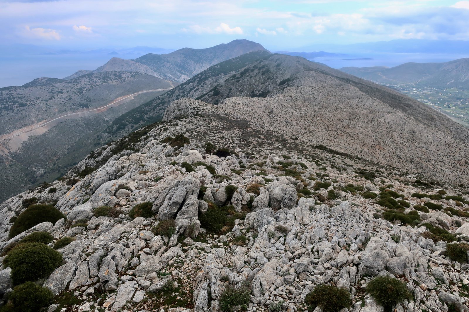
Near the top are the remains of an ancient stone path, which can be followed on and off. But it’s just as easy to stay on the crest of the ridge most of the way. The land is harsh and dramatic, almost lunar.
After reaching Monte Rito, a small pavilion just off the road, we made the mistake of pointlessly walking all the way back to Panormos on the main road. We should at least have walked down to Arginonda on a footpath on the other side of the valley we were in, – that we somehow missed, both on the map and for real – until it was too late to do anything but stare across to where we could belatedly see it descending.
An alternative for those with a lot of energy would be to take a different, longer route home, via Metochi, or Profitis Ilias, or the Italian path… There are options.
HIKE 5
KALYMNOS TRAIL – SECTION 7
From a base in Emborios, a loop around on Trail 7, avoiding the final road-walk to Palionissos, to instead do a road-walk back to Emborios.
About 14 kilometres.
This section is described as Moderate/Hard. The assigning of difficulty value isn’t straightforward. There’s a responsibility, and the consequent tendency to marginally over-rate.
The ascent to Patela (433 metres), was followed (for us) by a nice ridge-walk all the way to the road at Agios Panormitis. The last third of the walk, on the ridge, is a diversion off the Kalymnos Trail path, which goes down towards Skati Cave and then traverses to the road above Palionissos, a very pretty, very sheltered bay with a couple of tavernas and not much else.
The whole northern half of this hike is memorable, up to and past what the book calls The Stairway to Heaven, a set of ‘discovered’ stone steps three kilometres or so out of Emborios. The steps are a typical goatherd’s solution to the problem of how to get up to the higher land in difficult, steep terrain. Coming across this sort of historical solution is always a pleasure. If ever you stumble across old stone steps which appear not to be marked on any map, you will feel like a metal detectorist who has unearthed something rare. The book talks of ‘glee’ and ‘delight’. Lovely.
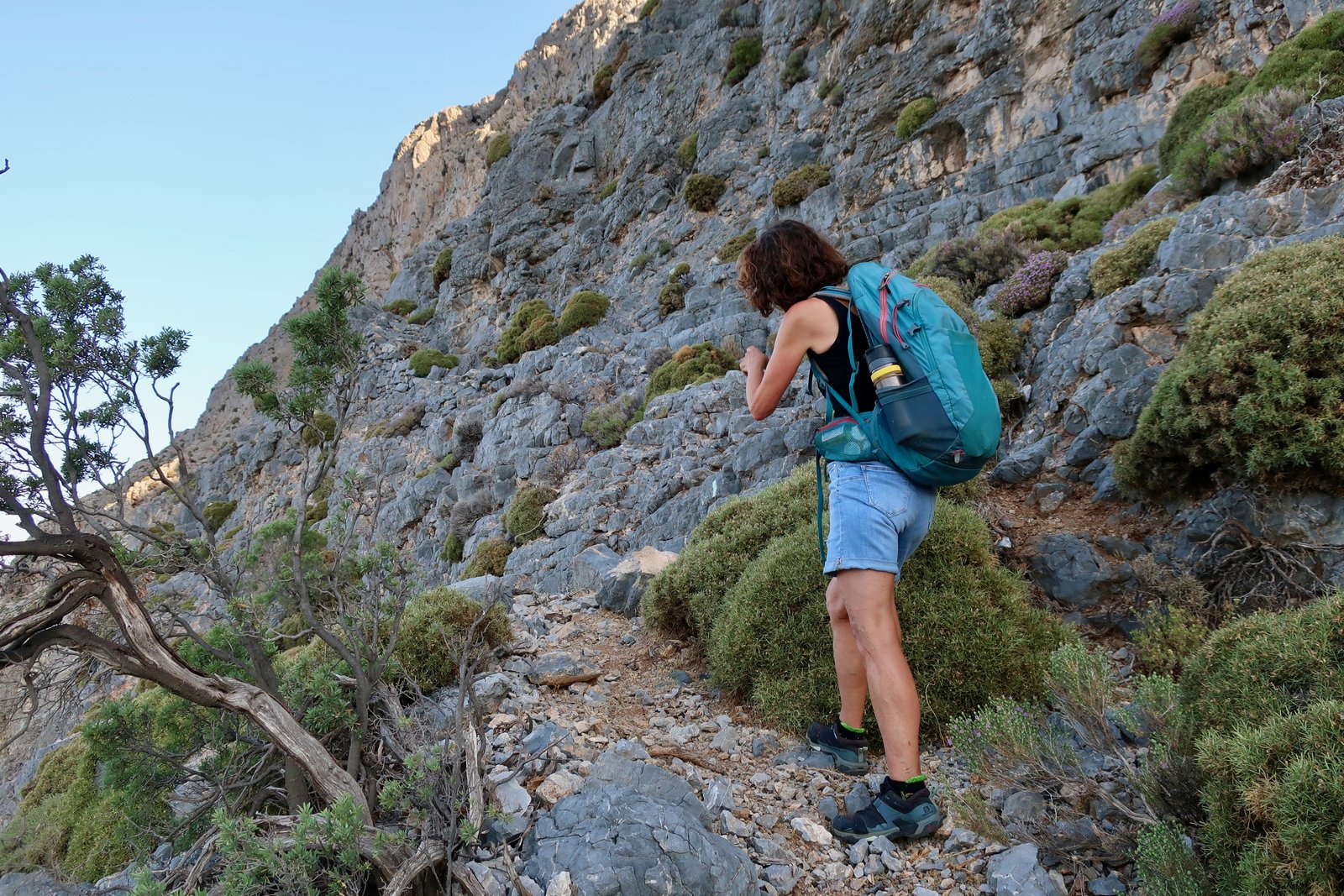
Before, and particularly after the steps, the views back down over Emborios, Telendos, the western coast of Kalymnos, are awesome.
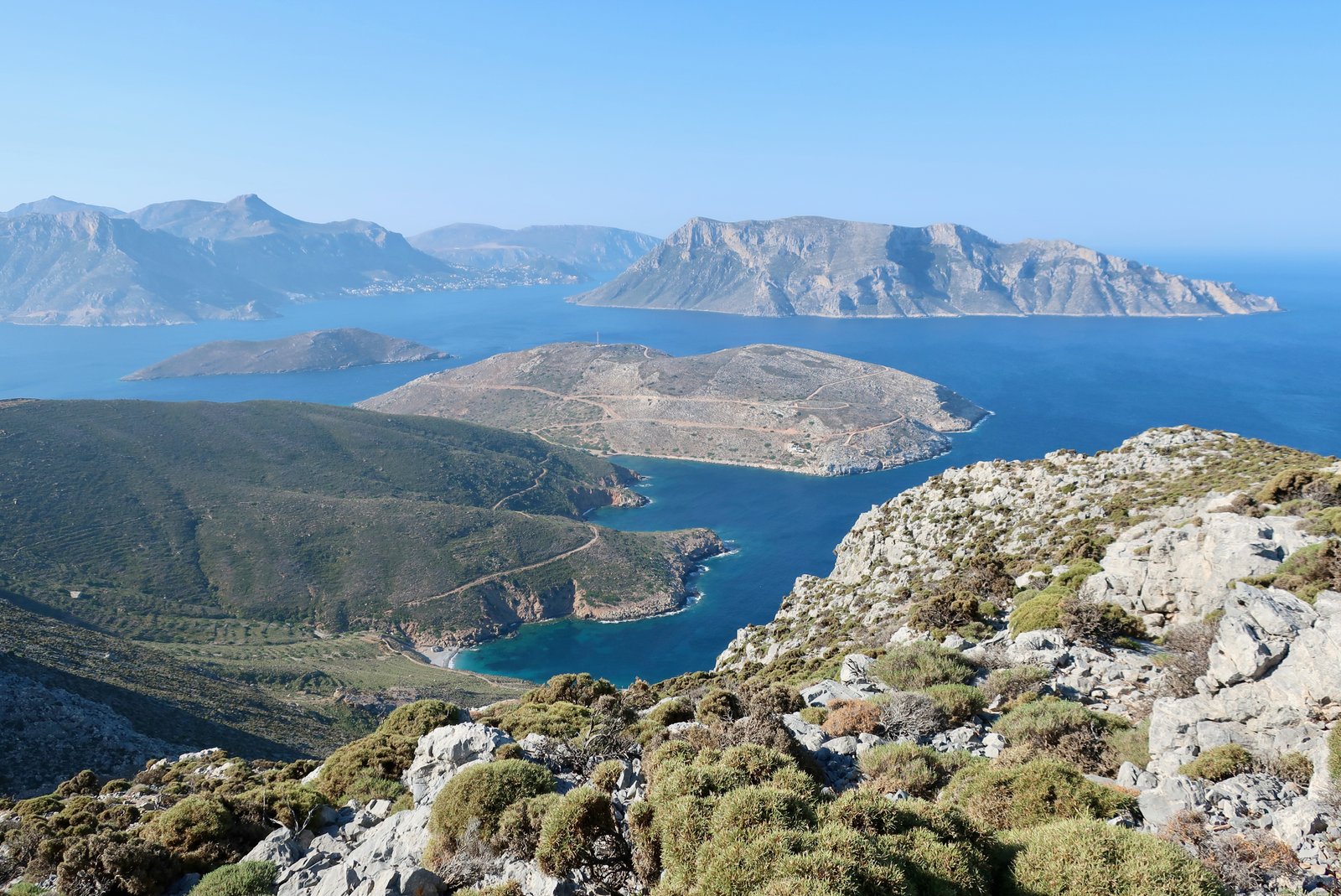
We did this in early summer, with a start at 06:45 to avoid the heat. The exigencies of Greek island travel, which because of ferry times necessitate early morning, evening, all night voyages, and Greek island hiking, which because of heat, cold, wind, public transport (very early morning school buses in winter on some islands), imposes early hiking starts and a rhythm that would probably otherwise not be chosen, is a bonus. You can’t help becoming familiar with the out of the ordinary, and always, without exception, are aware of having gained something.
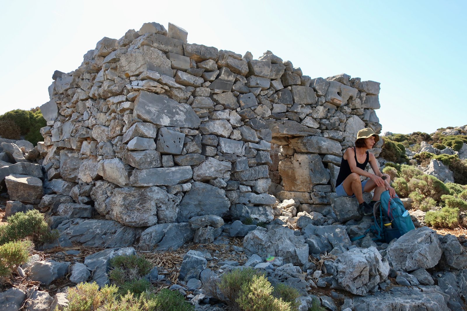
We were in the shade until we reached the ridge. There’s a small amount of very easy scrambling at the top. At 10:00 we stopped for coffee by a small, square goatherd’s hut. The stone more iron than stone. Not a hint of weather-softening.
Along the top the path in places is so narrow between spike plants, burnet and spurge and thistle, that we jump, and hop, from small clearing to small clearing, trying not to touch the thorns either side. It feels a little like the old-fashioned child’s game in which a metal eye is threaded along a twisted metal wire. At every mistake, every touch, an electronic beep sounds.
The very narrow passages between stiff plants are marked by tufts of goat- or sheep-hair, a scruffy little harvest scraped from passing animals.
HIKE 6
KALYMNOS TRAIL – SECTION 10
The Italian Path. Only 5 kilometres long, with a climb up to about 400 metres and down again.
Probably the best known path on Kalymnos. Until the coastal road between Pothia and Vathy was built, this was the way to go between the two settlements. The Italian army, which occupied the Dodecanese from 1912 – 1943, rebuilt and reinforced much of the path, so that in some places you could drive a tank over it. Other parts are pure old kalderimi.
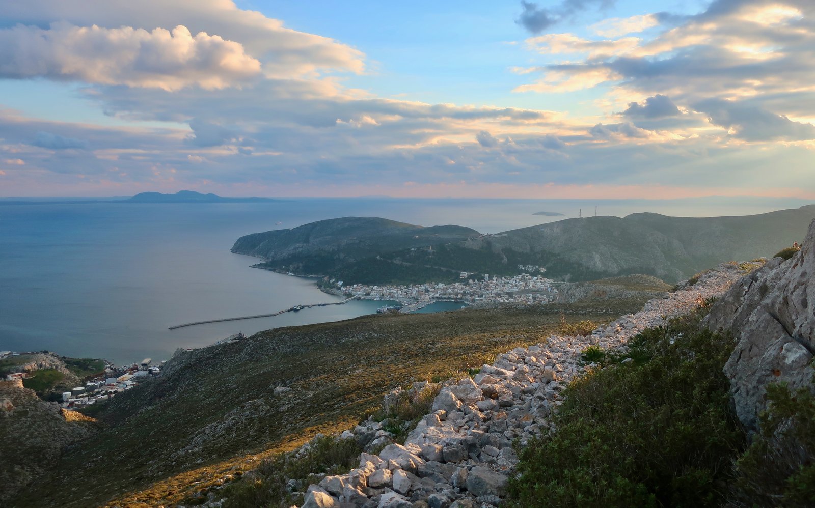
The climb up from Rina in the Vathy valley is the most authentic section. The descent towards Pothia – do it in this sense if possible – takes a classic meandering way through the hills and has great views over the town.
HIKE 7
BONUS SECTION
If you have one day only and are happy with longer hikes, this is an example of what can be done, a mix and match selection that takes in parts of Sections 3, 8 and 10, plus another couple of trails not in the book. But there are all sorts of ways to custom-frame days around the book and Terrain Map.
From the Chora, up the so-called ‘Tourist Path’ that skirts Profitis Ilias, down on the marked trail to the church of Agios Nikolaos near Metochi in the Vathy Valley. Up the other side of the valley (Embolas, Aghios Dimitrios), then down to Pezonda Bay on the north coast. Up to Kira Psili monastery, back down the road to Metochi/Platanos. Finally, the Italian path to Pothia and the bus home.
Approx 28 – 30 kms.
The nice trail down from the far-point of the Tourist Path on the central ridge near Profitis Ilias is easy to follow, traversing as it descends. On the far side of the valley, paths that begin at Agios Dimitrios and climb up to a trail-junction-point at about 360 metres (see map), are marked on both sides of the valley through which, although it’s hard to imagine, very occasionally a stream must run after rain. On the right-hand side are the remnants of an old cobbled path.
The first half of the dotted trail down to Pezonda Bay (see map) is steep, but followable. It takes a wandering line back and forth, rarely visible much below the point you’ve reached, although the place at which it crosses the main valley on the left can be guessed at, a couple of hundred metres further down the slope. For paths that have to cross the deep folds of valleys, there’s very often just one right way to go. Consciously or unconsciously we’re always looking ahead to try and work out where it might be.
We lost the trail almost as soon as we reached the small gorge that leads to Pezonda Beach. The best way seemed to be to stay low, and left, just above the dry course of the stream. But it could be that a stroll actually through the stream-bed would be fine, with occasional scrambling over rocks in places where small waterfalls must appear after heavy rain.
The beach, approximately mid-point on the Kalymnos Trail SECTION 8, is remote and dramatic, only reachable on foot or by boat, one of countless thousands of island places made all the more attractive by their inaccessibility.
From the beach we followed the trail up to the car park near the Kyra Psili church. The path stays in the valley/gorge, which slowly widens, opening into gradually-stepped agricultural terraces with rough animal pens and huge, ancient olive trees.
From the right-hand side of the penultimate terrace a faint path that soon thickens climbs up to the car park one hundred and fifty metres higher up the slope. From there a sliced mountain path leads to the church itself, which from the outside looks like the rough corner of an old castle grafted onto a cliff-face. Inside it’s a damp, cavernous and melancholy place. The view back down to Pezonda Bay is pure Greek island/Kalymnos wonderland.
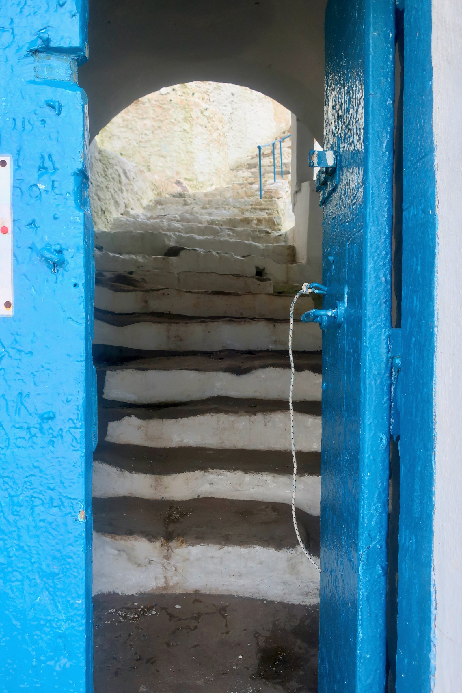
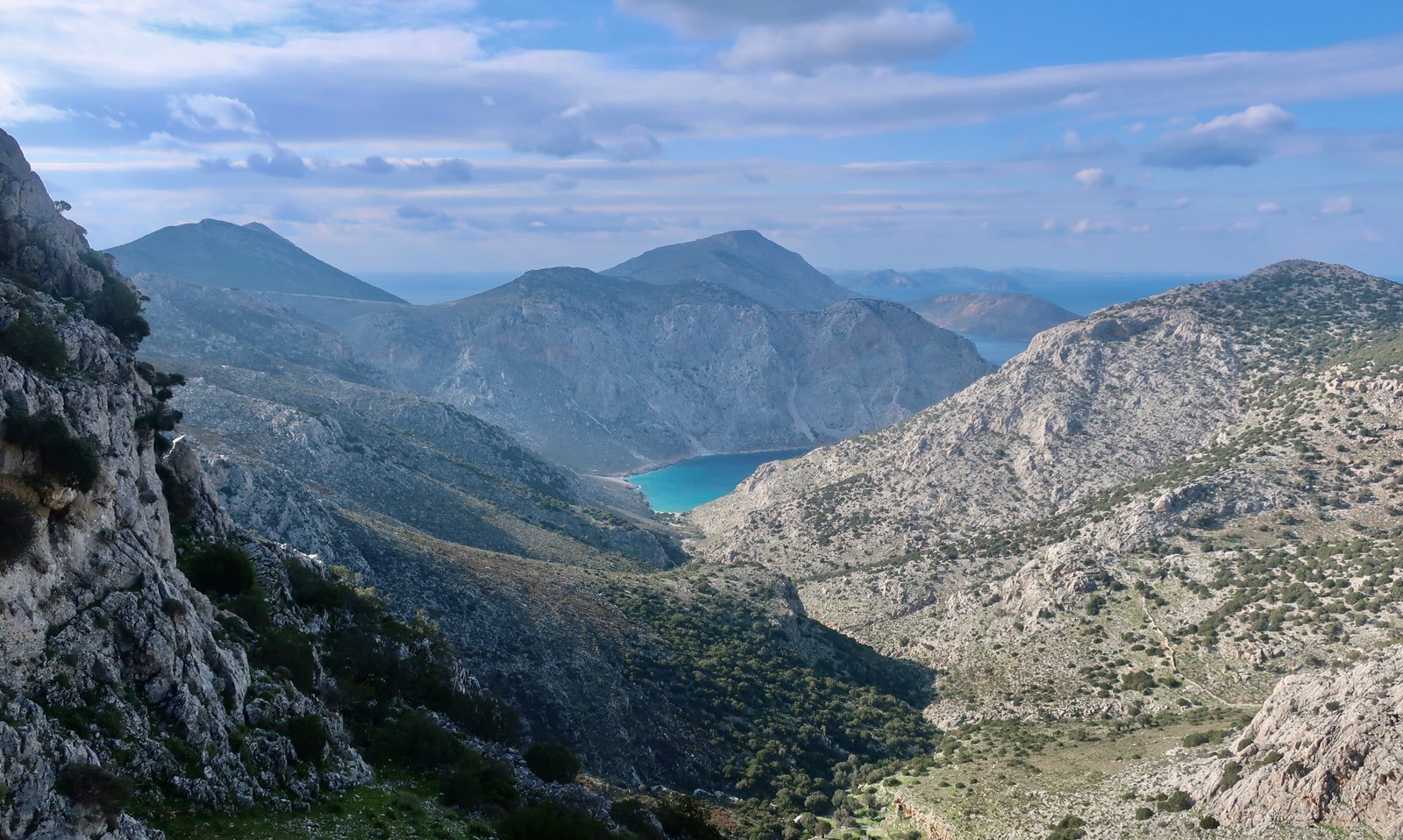
From the church we went rapidly down the road, and at speed up and down the Italian path to be in Pothia for the 18:30 bus back to Panormos where we were staying.
***
(At some point in the near future this hiking section will hopefully be updated to include some guidance on the missing sections of the Kalymnos Trail. Which is to say, whether or not they reasonably can be done by non-climbers.)