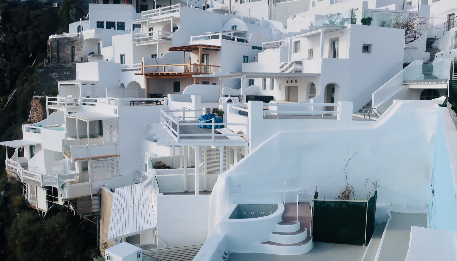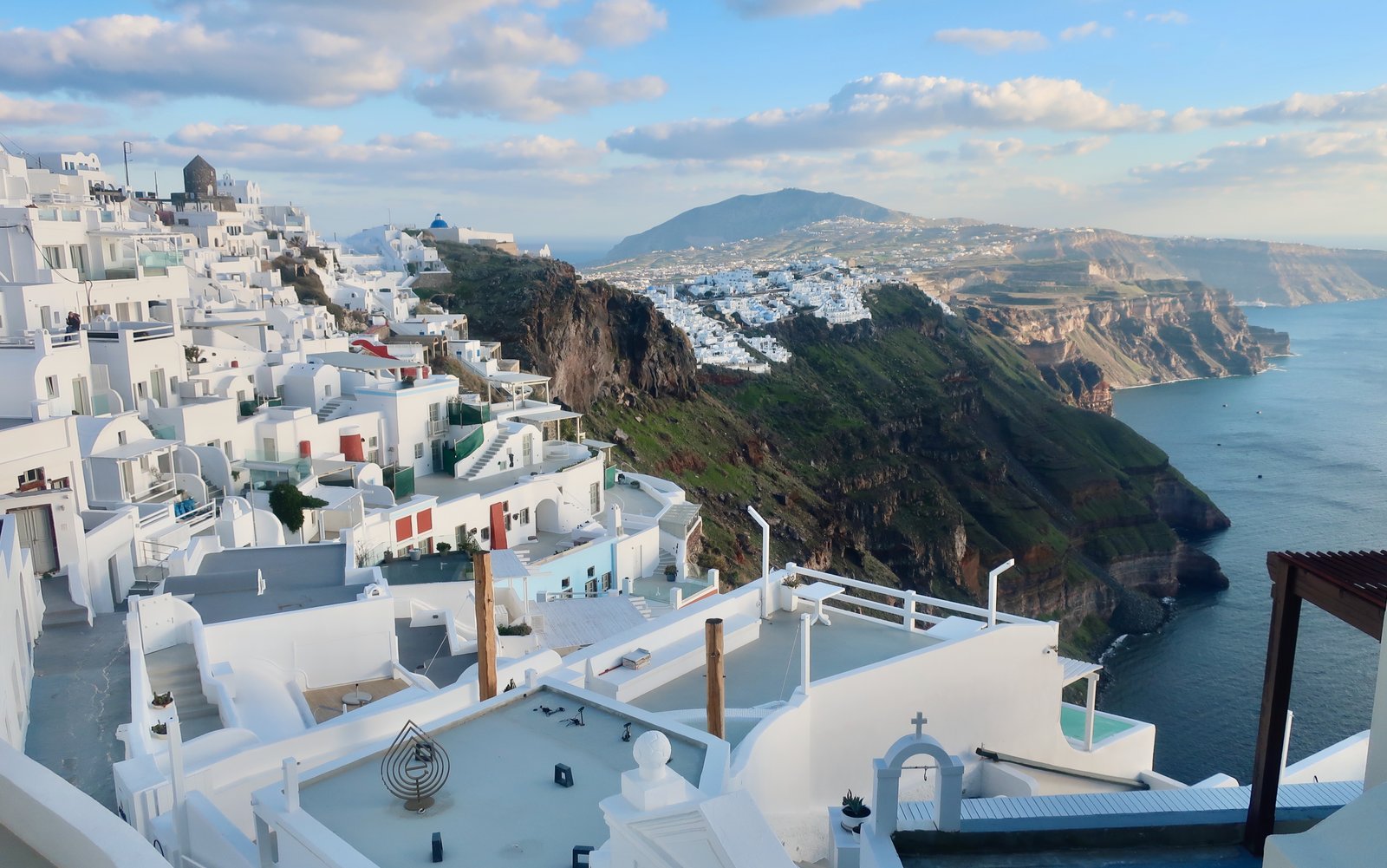
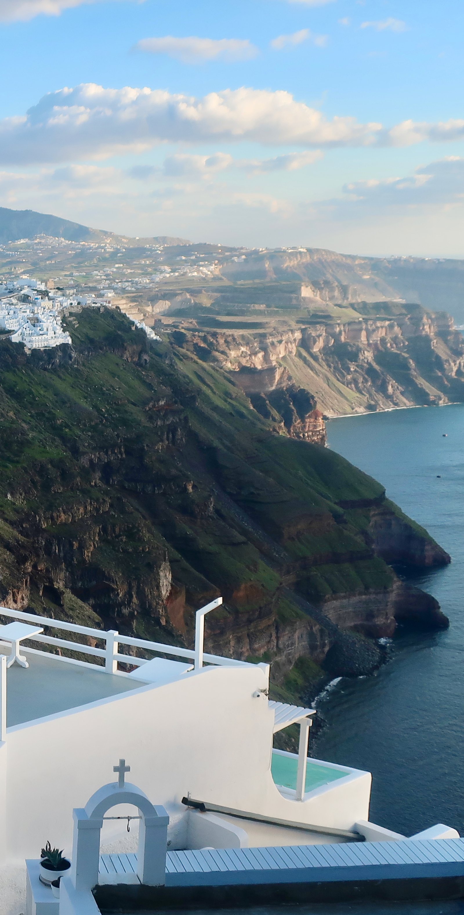
Time and again we’ve entered our ordinary little studio accommodations, wherever in the islands we are, to find pictures of Santorini on the walls. Mass-produced, somewhat gaudy artworks of blue-domed churches and windmills, white houses and steep winding steps clamped to the edge of the crater, splashed by bougainvillea and geranium. With a donkey maybe, and a setting sun.
For a long time we avoided going to Santorini. Sometimes a ferry we were on would call in on the way to somewhere else, so we knew the look of it, how the ship enters the flooded crater through a gap in the rim. We knew the port, an ugly concrete platform at the base of a steep cliff with nothing at all glamorous about it. It’s connected to the rim, the top, by a zigzag cliff road whose hairpin corners are as sharp as tweezers.
Around three million people visit Santorini every year. Excepting Crete and Rhodes, it’s the most-visited Greek island. A quarter of them come by air, the rest by sea. For much of the year the main port must be a chaotic place, football crowds of people pouring off the ferries, siphoning onto the squadrons of buses that carry them uphill to their destinations.
A little further along there’s another port, no longer used by the ferries. There are some older buildings, a church or two, some scruffy restaurants and, still linking top to bottom, the Karavolades Stairs, an old stone-laid donkey trail, a named attraction in its own right and a small challenge for keen tourists. From space it’s sharp, like one of those old-fashioned carpenter’s wooden rulers with multiple elbows, the steps on the path inches or centimetres, as clear as clear can be.
Probably some tourists even swim there. Santorini, the famous side, not the beach resorts on the other coast, is unusual among Greek island holiday destinations in having such difficult access to the water. It would be something to come down here early morning and stroke out into the pond of the crater. Except that often it isn’t a pond at all. When the meltemi’s blowing from the north, as it does, as it did for most of the week we were there, white-topped waves rush into the opening through which ferries pass. On two separate days, from here and from the little red-and-pastel port at Oia, we sat and watched the flow of it, the cleanness of the dividing line between calm and torrent. Swimming out too far and finding yourself suddenly grabbed would be like falling onto a fast-moving watery conveyor belt.

With all the photos and articles, the gangs of influencers, tik-tokkers and instagrammers, we had assumed that, unlike other islands, on Santorini there would be no off-season. We were wrong. In early February, barring a tiny handful of others, who we came to recognise, we were it.
We stayed in Karterados, on the road near Fira, neither a place-with-a-view, nor one of the beach resorts on the far side. A de-humidifier was permanently on, sucking moisture from the walls. Without it, they streamed. You could wring them out in winter, old Greek houses.
The choice of accommodation in February is limited. Doubtless there would have been more available had we upped the price filter. But still, almost everything exclusively connected with the tourist industry was closed: hotels, apartments, cafes, bars and restaurants; fancy shops, trinket shops; the seven nights a week cinema that in season alternates between Mamma Mia and My Big Fat Greek Wedding. Open were places needed by the permanent population and, as on most islands, some limited service for the trickle of out of season tourists, provided by people for whom, for one reason or another, staying open is not so inconvenient or undesirable as it is for the rest.
At Karterados the bus passes. Some cafes that cater to local people are open. There’s a good bakery within which we snuffled around in the morning with our Exete kati me stafida?, Do you have anything with raisins?.
Ice in Mykonos the week before. Snow in Tinos in early January, hailstones inches deep in the roads. In Santorini I was half the time in shorts. A month later, in the hills of Naxos in March, with snow coming in, I wore thermals. Winter in the islands is a meteorological lottery. Number one question when travelling in the winter: is there heating? Reversible air conditioning is usually the best to hope for. Full central heating with radiators, a dream.
We went to Santorini without great expectations. It had begun to seem faintly ridiculous to have been almost everywhere except Santorini, as if we were labouring the point.
We came away having done two deeply pleasing long hikes, having also internalised a rough, sequential history of the island as told through the story of four settlements, a framework almost like stepping stones on which to hang six and a half thousand years of history.
HIKING
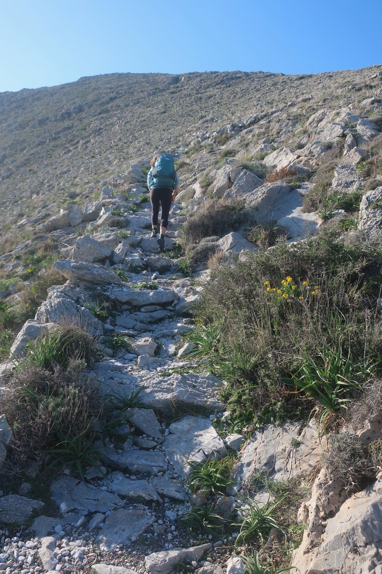
The municipality in Santorini has a plan to clear and mark twenty-five hiking routes. When we were there, February 2022, very little had been done. Paper editions of both Terrain and Anavasi Maps show these hypothetical trails. Because Santorini is richly agricultural – the volcanic soil is particularly fertile, the island has always been able to support a large population compared to most islands – there must have been paths everywhere. It is possible the hiking route project will unearth some of these, more likely that most of the original surfaces, the pavements, are gone for ever.
HIKE 1
Ancient Akrotiri – the Red Beach – ancient Akrotiri – Perissa – ancient Thera – Profitis Ilias – Pyrgos – Karterados.
About 30 kilometres
We caught the bus from in front of the bakery in Karterados, got off just along the road from the visitor centre at ancient Akrotiri. Even out of season, buses work well on Santorini.
A small diversion on a path around the coast to the Red Beach, famous principally because these days everything on Santorini harbours latent potential for fame, but also because good beaches are in short supply on the island. This is not a good beach. It’s quite ugly. Because there have been landslides that have poured right onto the beach, and irrespective of its aesthetic status, it may or may not even be a good idea to go there and it may or may not be open.

From the beach, a stroll along the road to the archaeological site at Akrotiri.
Ancient Akrotiri is the first of the four settlements:
The site, the visitor centre, is open all-year-round, protected from the weather by a modern roof-structure. For people who like Greek islands and like history, this is one of the best sites in Greece. Both for the site itself and for the story it tells.
Evidence of habitation at Akrotiri goes back to at least the fifth millennium BCE, when it was a small fishing and farming community. The people who lived there were originally Minoans, from Crete. They were the first people known to have fully invested Santorini, although there may have been others, traceless now in the long line of custodians. On Santorini there have been Minoans, Phoenicians and Dorian Spartans, Egyptians, Romans and Byzantines. The Duchy of Naxos ruled the island for a while – a Greek island speciality, these minor satrapies, squabbling over islands, lording it up as if they were great empires. After which Venetians, Ottomans and Venetians again. Then Ottomans again, Russians, (Russians!), Ottomans yet again, the kingdom of Greece, Italians, Germans and finally, presumably definitively, Greece again. It’s tempting to believe there is something special about Santorini, but really it is not so different from the rest of the Aegean, which has always given itself to dissection. All these islands at times have been part of something purportedly greater, at times worlds unto themselves. Santorini is another place to own. (Still today there are rocks that Greece and Turkey argue about, over which they’ve come to the brink of armed conflict. Literal rocks. From time to time one side or other, the currently dispossessed, will sneak over and plant a flag and there will be another diplomatic incident.)
In the third millennium BCE Akrotiri was a sizeable town, with broad trading links across the Mediterranean. By the middle of the second millennium it had proper drainage, streets lined with three-storey stone houses, hot and cold water. Toilets even. Sophistication. In a world without written history, people had been there forever, endless generations had come and gone.
In approximately 1600 BCE, with the volcanic eruption that created the gutted remnant that is modern Santorini, everything came to an end. It was one of the largest known volcanic events in human history. Akrotiri was buried under a layer of ash and debris dozens of metres deep. It is thought that before this catastrophic explosion there had been a minor eruption, perhaps an earthquake, even a series of tremors. Whatever it was, the inhabitants of Akrotiri had had such unequivocal warning that they evacuated the town before the disaster.
Three and half thousand years of absolute silence passed. In 1967 a team of archaeologists began digging at what they thought might be the site of an ancient town. They soon found themselves in archaeological wonderland. For fifty-five years now they have been chipping away, uncovering piece by piece a petrified image of the past.
In among the streets lined with houses, the store-rooms, the amphorae, the furniture and other objects left to be covered with ash, whose negative forms have been remoulded, no human remains have ever been found.
The following are images of some of the frescoes discovered on the walls of houses unearthed at Akrotiri.
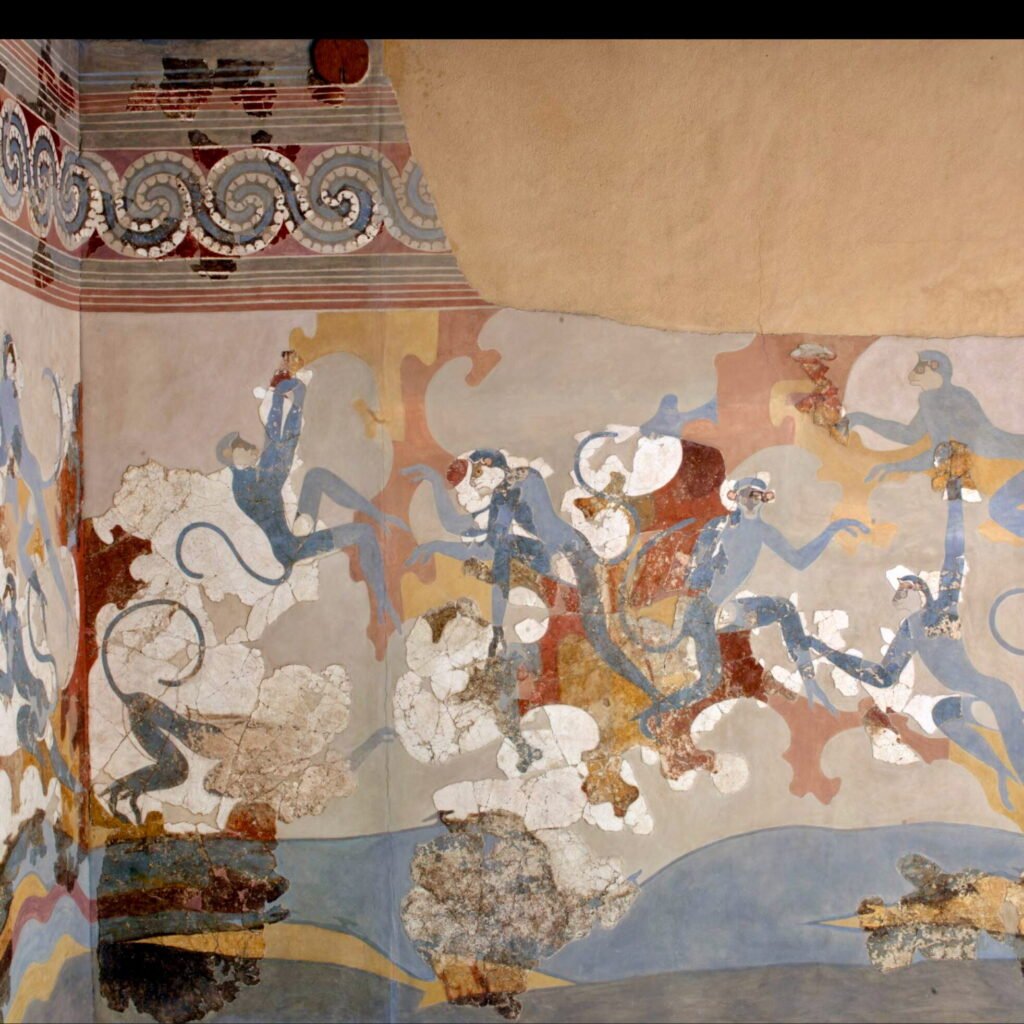
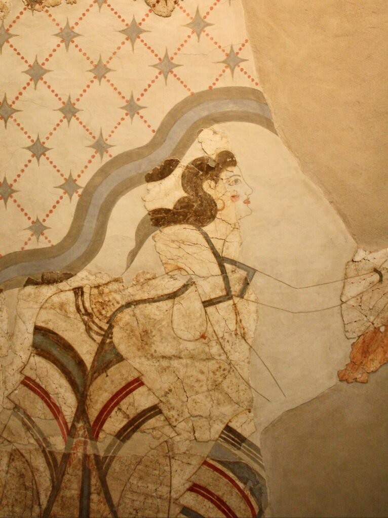
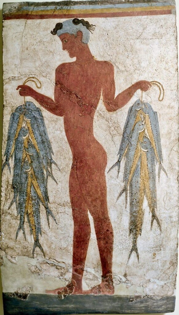
They pre-date classical Greek civilisation by at least a thousand years.
In the visitor centre you can watch a simple video presentation of the imagined life of a particular house, in which one moves through rooms while the people who lived in the house are portrayed as silhouettes, as ghost forms. I found this inexplicably moving.
When they abandoned Akrotiri, the inhabitants took everything that could be carried with them, all their portable wealth. Virtually no precious metals or jewels have been found. The one exception is a small solid gold ibex, discovered under the floorboards of one of the houses. At some point it must have been hidden, and then forgotten. It takes the breath away.
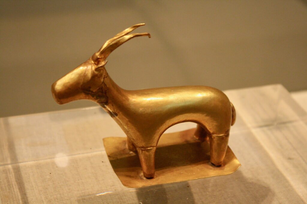
Archaeologists estimate that so far only about twenty-five per cent of the town has been unearthed.
It is not in fact known what the settlement was called in ancient times. The name Akrotiri comes from the name of the nearby village. It is a place without a name.
After Akrotiri, using a very poor little map, we walked to Perissa, on the south coast. There are some paths, badly-marked, some lanes, some dead-ends through farmland. Much of this is wine-growing area, fields of the bird’s nest vines for which Santorini is known – because of the almost constant wind they’re trained to swirl around on themselves, to hug the ground rather than grow up.
At Vlichada on the sheltered southern side of the island a new port has been constructed.
Perissa is a relatively laid-back resort, with (famous) black sand beaches.
On the outskirts of Perissa we picked up signs for ancient Thera. The low coastline is interrupted by the highest land on Santorini, a sudden great lump of rock that seems to have no logical place there. At one end of it, a couple of kilometres inland, is Profitis Ilias (564m). On the other end the monolith of Mesa Vouno, a daunting presence sticking out into the sea flanked by the dead flat land of Perissa on one side, Kamari, another resort, on the other. The classical settlement of Thera was built on top of this rock.
Ancient Thera is the second of the four settlements:
As with most settlements from this period in the Aegean, the site was chosen for its defensibility. The contrast with Akrotiri, low-lying, near the coast, is singular. Those rare places that appear not to have been built first and foremost for the protection from attack they offer – Karthaia in Kea is another example – beg questions about the world in which they existed, how and why it was different. They are rich with other possibilities, other aspirations. Everything about the modern world is so unlike this ancient one, that Mesa Vouna, once the capital, is now one of the few places on Santorini on which no-one at all lives.

Today the path up from Perissa is a mix of stone-laid and the bare stone and rubble of the mountain. It must have been walked countless thousands of times, back and forth between Thera and the coast below, looping across slopes punctuated by anemone and giant fennel.
There’s an entrance-gate to the site, which closes mid-afternoon.
Thera was founded in the 9th century BCE by Dorians from Sparta. Santorini had been uninhabited for at least 600 years after the great eruption. During that period it must have seemed a black and blighted place.
The views from the top of the rock are spectacular. From here, and with another outpost up behind on the top of Profitis Ilias, the horizon in all directions can be surveyed. Enough remains of the imprint of the city, the paths, steps, the stamp of houses and public buildings, that it’s possible to get an overall impression of what it must have been like. But the wind is terrible. We struggled even to find a place to sit and eat a picnic.
From Thera we went back down to the saddle below, from where on one side the path drops to Perissa, on the other to Kamari via a scribbled road. We took neither but went straight up to Profitis Ilias. From below, the trail isn’t visible, and with the steepness of the terrain seems unlikely. It’s one of those paths that unfolds only as you move along it. At first it’s on the right of the main ridge, then crosses over onto what looks like a scree slope but is actually perfectly safe, a barren hillside of solid rock.

After a large cairn the terrain changes. There’s some plant growth and even a large stand of pines that have been blown almost flat by the wind. The path continues through them, under them, a tunnel. It’s easy to miss. The markings in the last section up to the monastery are in need of work, but the approximate direction is clear and easy.
On the hilltop, next to the monastery there are aerials and an ugly military installation.
There’s a nice stone-laid path down to Pyrgos. The beginning, unmarked, is on the right just past the switchback corner where the last antenna has been planted.
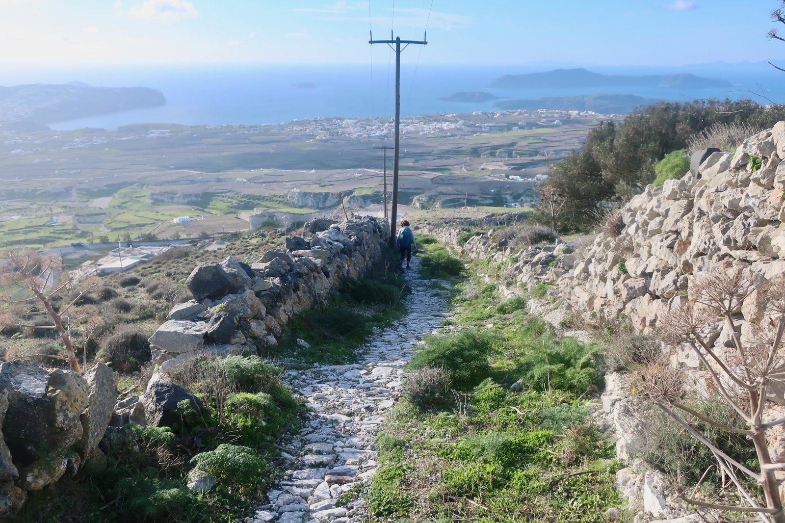
Pyrgos is very nice. It’s worth taking the time to wander around. From there we walked on roads back to Karterados, with views to the left across the caldera.
HIKE 2
Karterados – Fira – Imerovigli – Oia (port) – back along the rim trail as far as Skaros Rock at Imeroviglia – Fira – Karterados.
Approx 27 kilometres
This is the best-known walk on Santorini, one of the best-known walks anywhere in the islands and a walk that even many non-walkers make a point of doing as part of the full Santorini experience. For all these reasons there might be a not unreasonable presumption among people who go walking that this is just a tourist thing. The more so since, according to internet-blurb, whenever there are a lot of visitors on the island – which is the case for much of the year – there are potentially large numbers of people on this path. It’s a hike highway.
However, if you go to Santorini, and whatever time of year – but ideally not in the high season, when there will be crowds of people to disturb the pleasure of it – this rim-walk from Fira to Oia (and maybe back if you can be bothered), is worth doing.
You can do it in the morning, early, to avoid people, if you’re there in season. The light also, on the crater, on the water, on the path, on the settlements and churches along the way, will be memorable. You can do it in the evening so that you get the famous sunset, which of course is just a sunset, but still, walking along the rim of the caldera, watching the sun go down over the far side, the changing light and colours, why not?


The path is simple: it runs from Fira to Oia, through various settlements on the way. Some of them are old, some the new, perched holiday constructions seen in a million photos. Sometimes the path is dirt track. Sometimes it’s old stone-laid kalderimi – before there were tourists, before there were roads and motorised vehicles, this was the main road between Fira and Oia. There are gaps between settlements, it isn’t all built-up. Sometimes too you walk on roads, or through settlements where often you can weave down lower on the footpaths that mesh their way through all the built spaces, with steps up and down, small squares, dead-ends.
From Fira to Oia is 10 kilometres. And then perhaps a taxi or public transport back. We did a little more than twice that because we started in Karterados and went there and back, because we deviated off a little, and because we visited Skaros Rock on the return.
Skaros is settlement number three of the four mentioned above:
At Imerovigli the curve of the rim, which is relatively regular from north to south, makes a spike towards the water. Further along there are other imperfections in the edge, but this is the most salient. Looking from Imerovigli there’s a small path that descends, then climbs back up again towards a jagged tooth of rock. The stone steps come to a sudden end. There’s a warning sign:
Caution – Danger
Access to Skaros Castle after this point is extremely dangerous and is strictly forbidden
There are the main steps, then just above them and to the right a secondary smaller flight, suspended, with a start and finish like a stone escalator. Apart from these leftovers, there are just a few remains of rough stone wall. There’s no sign of anything resembling a castle. Even on a sunny day this seems a dark place.
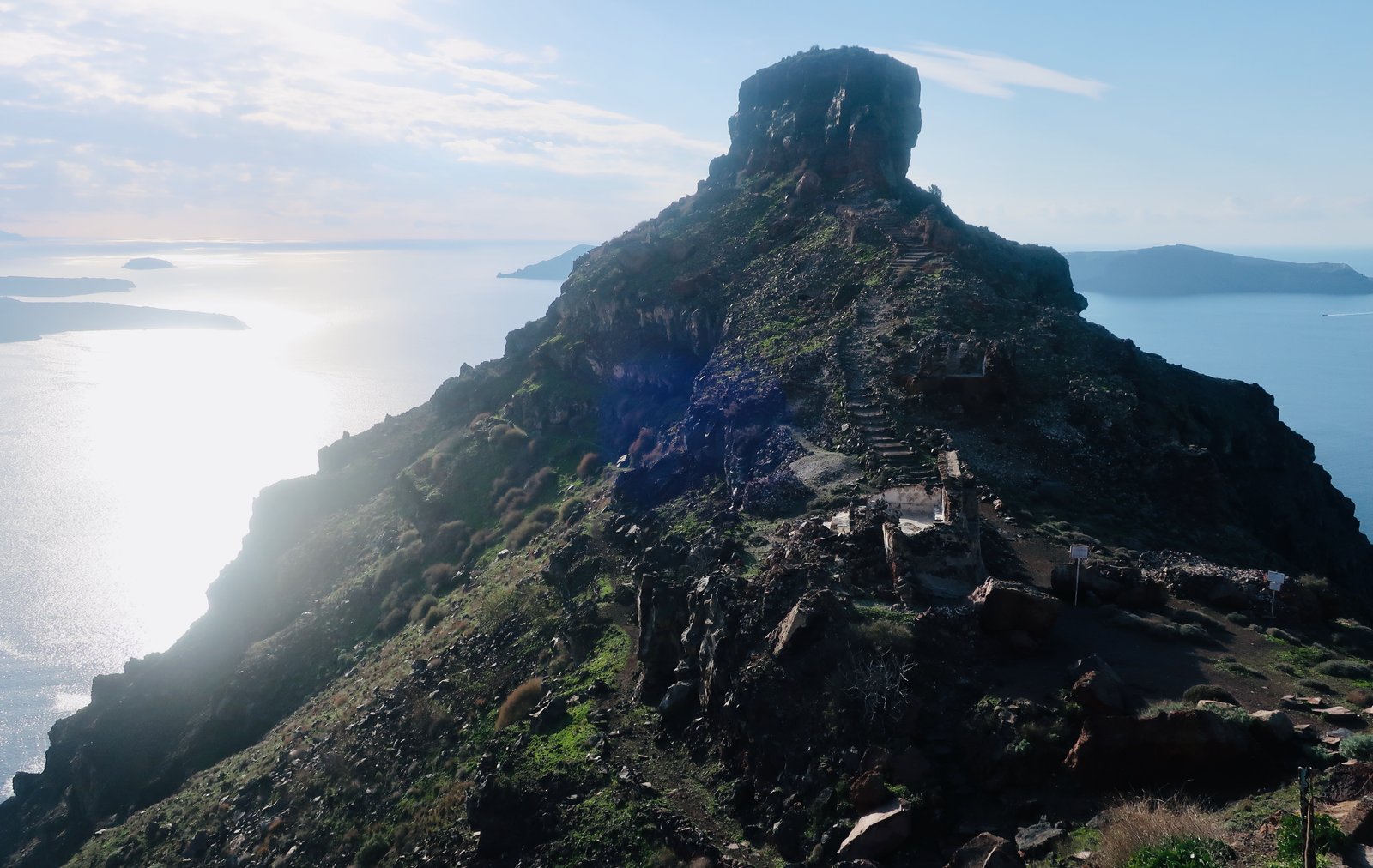
In 1207 an initial fortress was built on Skaros Rock. By 1336 when the Venetians took over, it was the capital of Santorini, and with several hundred homes the largest settlement on the island. There was also a small harbour at the base of the rock. Looking at it now, it’s inconceivable that there were monasteries, churches, a ducal palace, a school, a complete village.
In the seventeenth and eighteenth century much of the town was destroyed by a succession volcanic eruptions and earthquakes. By the middle of the 19th century there was nothing left but ruins. The sea below it must be choked.
This from E M Leycester, a British traveller from 1850:
Around this crag are the houses of the now ruined town of Skaro, a most extraordinary group, perched one over another where a crevice in the sides of the precipice will admit of it, and in most frightful positions, the out wall of the buildings being in a line with the perpendicular rocks. I sprung a covey of partridges among this mass of ruins, and was once near falling into a vault full of skulls and other human bones; not a living soul now inhabits this place.
The following illustration was done by Thomas Hope in the same year, 1850. A ghost town.

While it’s strictly forbidden to climb directly up onto the rock, there’s a small footpath that leads circularly around on the left-hand side, to eventually reach the Mother of Lord Theoskepasti Church. Maybe it’s the best spot in all of Santorini. We had a picnic there one remarkably warm and sunny February day. There was no-one else around and not a breath of wind.
Because wind can be so critical in the islands, particularly in winter, trying to travel around the islands at the mercy of cancelled ferries, changes to schedules, we’re used to looking at Greek weather forecasts. Very rarely we see the word apnoia. Apnoea in medical English is the temporary cessation of breathing. In French la plongée en apnée is freediving, again a temporary halt of breath. In Greek, apnoia is windlessness. Ap-nee-a. When we visited the Mother of Lord Theoskepasti Church, a February sun was shining warmly and the island was in a state of perfect apnoia.
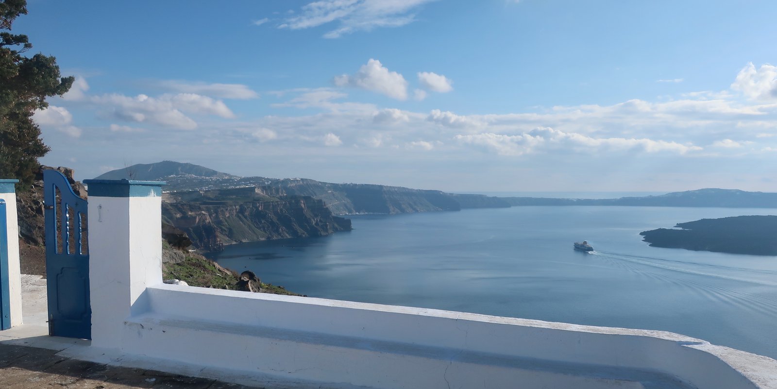
From the far side of the rock, either just before the church or in continuation of the path that leads to the church, curving around the side and then climbing, it’s possible to get to the top of the rock. The path goes to the top then down again on this outer side. The return to Imerovigli is on the same path you take to get to the church. It is definitely not advisable to try and continue across the top to find another way down.
***
The fourth settlement of Santorini is the island today, the tourist infrastructure for which it’s most famous:
Dug into the volcanic cliffs overlooking the caldera, from what were initially the homes of Santorini’s poor a brand has been created that’s known the world over.
The idea having caught on, the old cliff-houses have been renovated and restructured and many new ones have been added, so that much of Fira, Imerovigli and Oia resemble nothing so much as a human seabird colony. Between neighbouring apartments or rooms there’s little or no space. Looking down on the tourist areas, there’s a concentration of occasionally small swimming pools but mostly jacuzzis, wet places in which to sit and watch the sunset on hot summer days. For sheer weirdness it’s quite exceptional, possibly even a vision of some touristic future.
We have imagined going there in summer, sitting in our jacuzzi with our cocktails, right next to the neighbours’ cocktails, so close that it practically feels like we’re in the same jacuzzi – our elbows might rub, we might mistake each others’ drinks and smile and hand them back. We’ll sit there sipping and reading. Or maybe we’ll play backgammon, the board balanced on the edge of the jacuzzi. We’ll have neighbours from Japan and they’ll see the backgammon and be thrilled and we’ll end up spending a whole week just sitting there, sunrises, sunsets, cocktails, endless backgammon, round and round and round.