

With no ferry link to any other island, the only way to get to Thasos is by boat from the Thracian mainland, Kavala or Keramoti. In this sense, it is an island apart. But then, all the Northern Aegean islands are more singular than coherent group. What they have in common is trees, (most of them have trees, although not Psara and Agios Efstratios), that they’re roughly in the north of the Aegean, and that they don’t belong to any of the other groups. Among them, Chios and Samos are something like a pair. Perhaps with Lesbos they make a threesome. The rest are standalone. They are misfit islands, stragglers.
Thasos, with 13000 permanent inhabitants, is relatively populous by Greek island standards. But unlike most islands, on which population is concentrated in a capital, usually a port these days, it has no focal point. There are at least ten settlements with more than 400 inhabitants. In the past, people were scattered among a number of large inland villages, many of which had satellite links to the coast – their own ports – for fishing and trade, but not places to live, or hardly. Too dangerous, the coast. This connection exists still in the names: Rachoni – Skala Rachoniou; Prinos – Skala Prinou; Kallirachi – Skala Kallirachis. Skala = staircase or ladder. Down the stairs to the coast. There are many more, all the way around to Panagia and Potamia in the northeast, with their historical division of Golden Beach, Thasos’ best known strand, into Skala Panagias and Skala Potamias. Theologos and Potos were also a pair, even if there’s no semantic clue. Each coastal settlement was a mini colony. But now the colonies have outgrown, or are fast outgrowing the matrices. It’s tourism of course, the breakneck movement away from the land. The same thing on all the islands, just that here it’s so schematic. These links, inland to coast, are arteries along which people have pulsed into the modern Greek-island world.
***
If there’s a heart to the island, it may be Theologos, lying in a shallow valley between hills.

Today five hundred people live there. It used to be much larger, hidden inland away from the violence of sea-raiders, even if it is hard to imagine this lying-low strategy can have been successful here. Less than seven kilometres from the coast and with no obvious means of defence, how would raiders not have known? And what sort of raiders would be put off by a short stroll?
Now the people in Theologos live from what? The remains of agriculture, their pensions, some summer tourism. A taverna advertises in English, ‘kid on the spit’ and ‘kids’ heads’.
Or perhaps the heart is the Kastro, closer to the geographical centre of the island, on a wind-blasted hilltop at an altitude of 500 metres. As the name suggests, there was once a fortress. This is the other approach, not hidden but defensible. But as is often the case, what a place to live, a rocky outcrop isolated away from the best land.
The village was abandoned decades ago, but is slowly being renovated, house by house. There’s even a taverna in season, for the sightseers, nostalgists, history buffs. The census of 2011 recorded one permanent inhabitant.
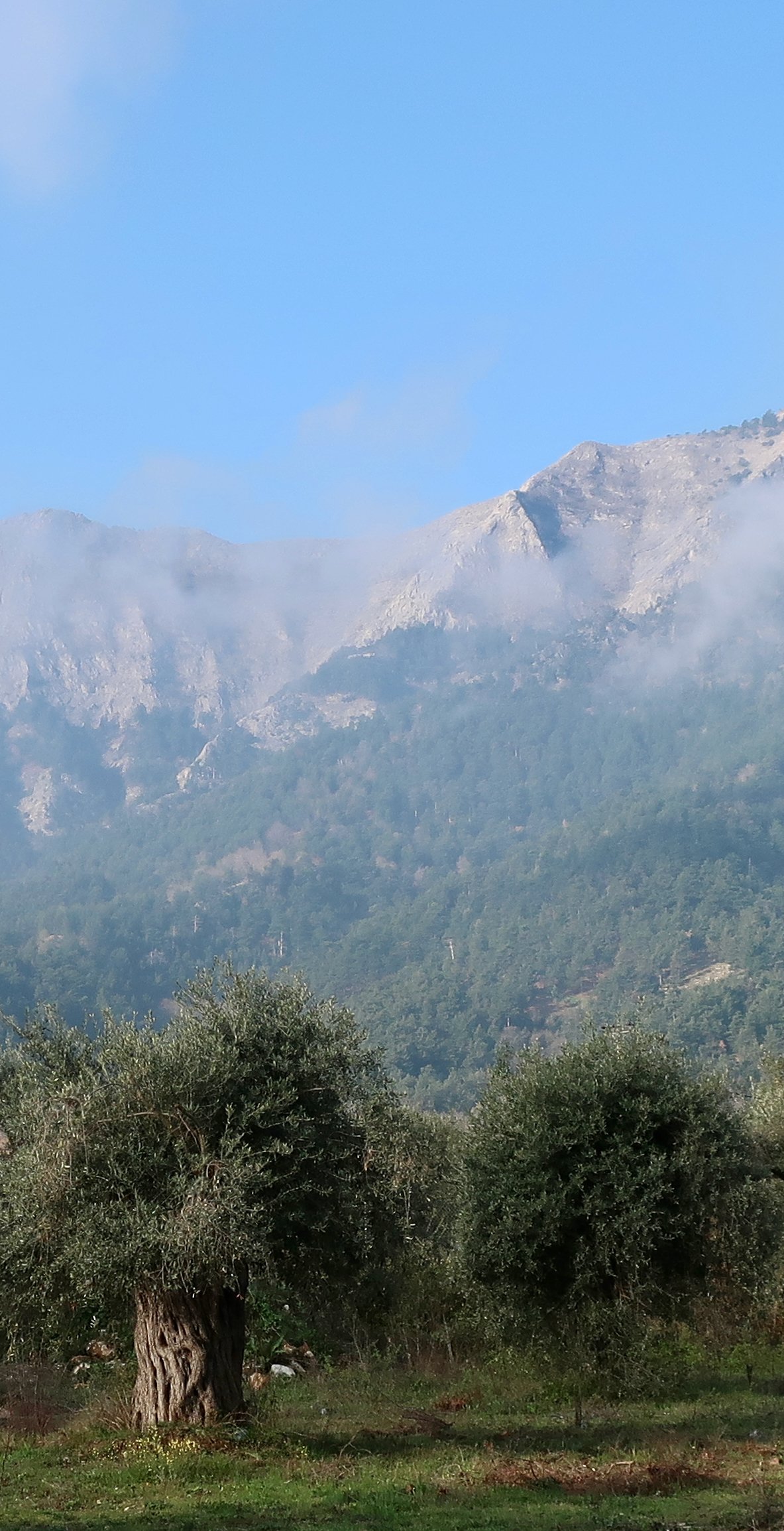
According to Thasos guides, the best villages are Potamia and Panagia, the former at an altitude of 100m, the latter only just 200. Despite their low-lying situations, they feel and look like mountain villages – tight streets, squeezed-in houses, the visual fug of community. Less than three kilometres away is the coast, their Skalas. Just as close but in the other direction, the land rises steeply, then almost vertically, towards Mt Ipsarion (1200m) and the great bowl of cliff that runs for more than 5kms at over 1000 metres altitude. A dramatic trail skims along the edge, from Profitis Ilias in the north, to Vrachos in the south.

More than anything, Thasos is a Northern Aegean island. The closest place to it, geographically and visually, is Samothraki. They might make a sub-group: the North of the North. Is it too much to suggest there’s a lesser intensity to the light here, compared to the south? But also that compared to the stripped-back clarity of the Cyclades in particular, they are somehow cluttered?
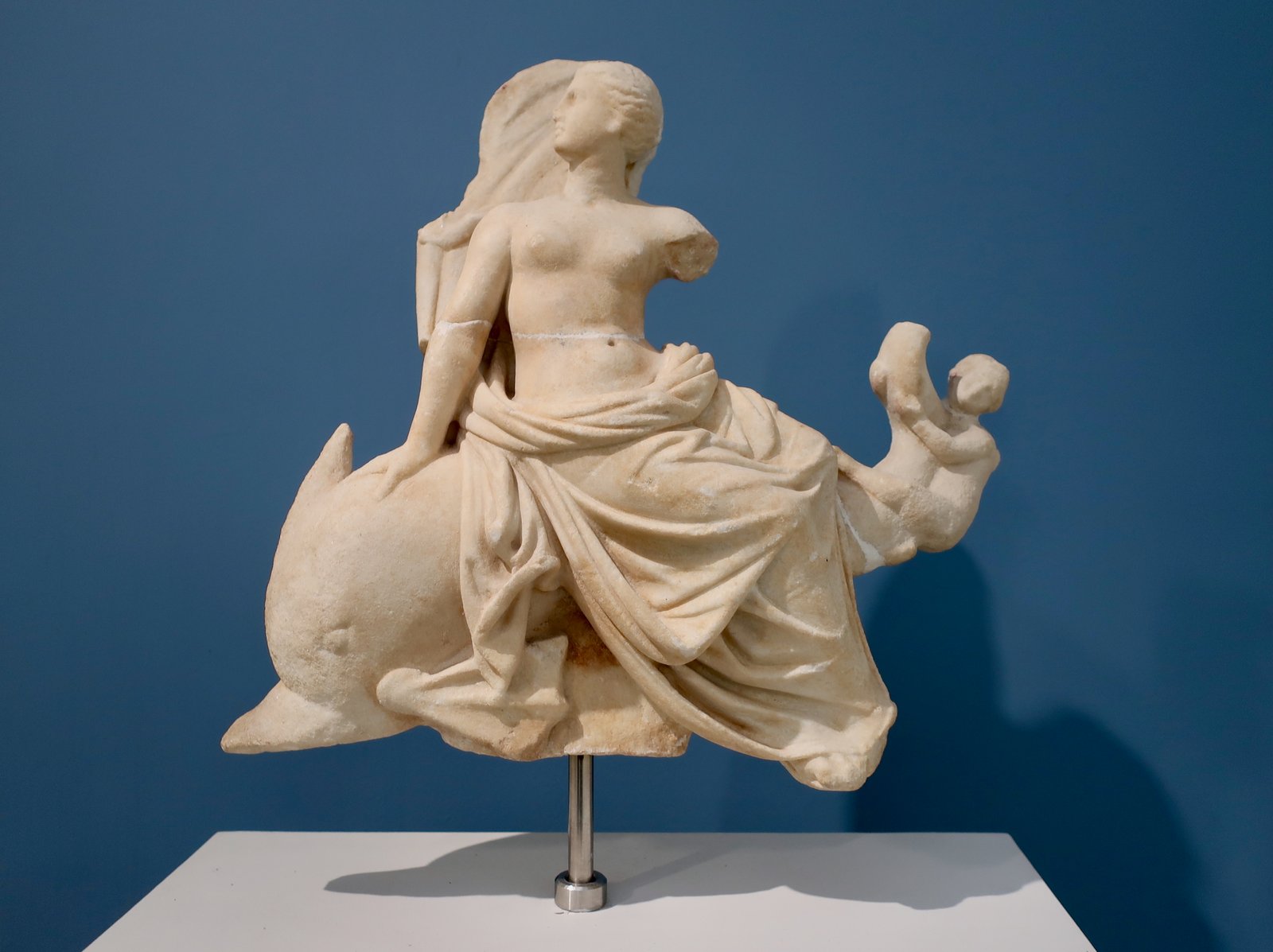
Limenas, the main port and largest town, the point of arrival for boats from Keramoti, is a place of two halves. The western side is newish, laid out in grid fashion, far from the archetypal Greek island template. The eastern side is older, and includes the original port, an open-air archaeological site, and the archaeological museum, in which there is a memorable small sculpture of Aphrodite riding a dolphin – see the stowaway hanging on the dophin’s tail.
The way past the museum leads eventually to the amphitheatre, with up behind it on a wooded hilltop the Temple of Athena and the ruins of a Byzantine castle. They were working on the amphitheatre in 2023 when we passed through, cranes and disruption. Hopefully it has not been, or will not be, overdone.
We were there in March, when the coastal resorts were all deserted. Colour-enhanced photos of summer-holiday-Thasos on the internet – beaches full of sunbeds and parasols – are difficult to resolve. In the short season Rumanians and Bulgarians come with their cars. Plus other Eastern Europeans, and Turks, and there must be Greeks too, from the north. And more. In March though there was only us.
Still, even then, as far out of season as possible, there’s a useful bus service from Limenas that goes around the island in both directions. On the western side, there are olive groves, beaches, a number of resorts – the biggest of them Limenaria – and the end of the central highlands, that sweep down in a curve to a point midway between Kallirachi and Limenaria. Barely more than two kms in from the coast the high-point is already over 800m.
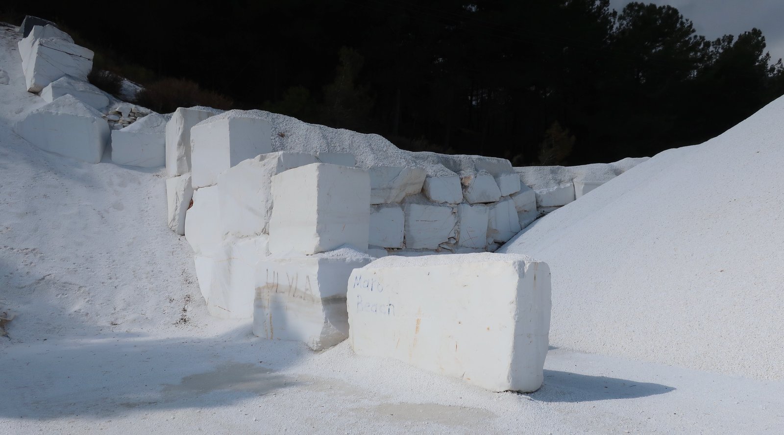
In the east, Panagia and Potamia, where in March there was some slow sign of life, Golden Beach, where there was none at all, and the startling white of marble. Marble has been quarried on the island for almost 3000 years. There’s Thasos marble in the Acropolis in Athens, at Delphi, all over the monuments of the ancient world. Still today the whitest marble in the world – Thasos Snow White – is quarried on the island. Along the northeast coast there are white beaches, and loading points where blocks of pure white marble and their dust are piled.
HIKING
We probably would have stayed in Theologos, the only base from which all the marked trails on the Terrain Map can be done without having to bother with cars or taxis or buses, but out of season there was nothing available. Instead we split our time between Potamia, in the northeast, and Potos in the southeast. Theologos was the linking point. In Potos there is an amusement-arcade along the seafront. Closed of course in March, but it was the very first time on an island in Greece we have come across such a thing – although I do realise we are insulated by our reluctance to go to the package holiday islands, and in season.
FROM POTAMIA
HIKE 1
Trail 1, Trail 8, Trail 4, from Potamia to Ipsarion peak, to Theologos, to Profitis Ilias, and back to Potamia. A little over 1600m total ascent.
Roughly 35kms
If you do one hike on Thasos, this is it. If you don’t want to do 35 kilometres, hike from Potamia to Theologos, and from there organise a lift home. On another day go from Potamia up Trail 4, then do one side or other of Trail 10 down to Kinyra. From there, a lift, a bus – if there is one, check timetables – or a flat road-walk home. Out of season there’ll be almost no traffic. In season it would be too hot and you’ll be at the beach anyway, reading a book, swimming, eating lunchtime Greek salad.
After three kilometres of lane and track due west out of Potamia, having climbed relatively gently to nearly 500m, there’s a junction-point at which Trail 1 goes straight on, Trail 2 to the right. Trail 1 climbs another 500m in less than two kilometres, to emerge at the low-point of the cliff-ridge. When looking up towards the mountain from Potamia it seems too high and too far to go on foot. Years ago, before we started walking, I wouldn’t have believed it possible. Everywhere, in all aspects of life, our relationship to distance has been transformed.
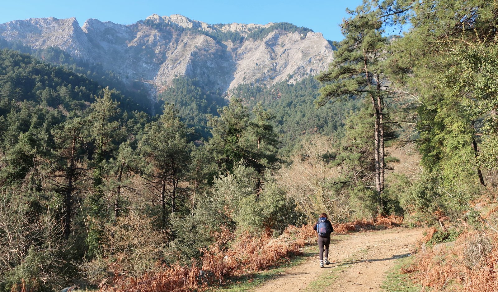
The trail runs alongside a narrow lane that leads to the refuge under Ipsarion, then pretty steeply up to the peak, yet another of so many countless dramatic viewpoints in the Aegean.
From the peak the trail takes the cliff-edge for two and a half kilometres, as far as a sign clearly indicating the way down to Theologos. There is no actual path, just some red dots on the rock. You can’t get lost, just follow the edge, not too close if there’s wind.

There’s a ninety degree turn away from the cliff on bare rock towards Theologos, following red dots. In some places the dots are sparse, elsewhere the person marking the trail has splashed red paint everywhere. Without markers, the way down to Theologos would be very difficult to find. It moves back and forth over ridges and mountain slopes, much of it in pine forest. The final section is a proper stone-paved path.

All of it is hard on the legs, 900m of descent at speed, knowing the day is going to be very long.
Trail 4 out of Theologos, through old farmland, some of it still in use, quickly gets confusing. There’s an easier way, a track just to the left, almost parallel, that can be followed for a short distance until a point where a right-hand turn back onto the trail is marked.
The next section goes through pine forest up to a junction from where you can either go straight on/left to Profitis Ilias and Potamia, or right on Trail 10 down to Kinyra.
We have never seen so many tortoises as we saw on this day, mostly here between Theologos and Profitis Ilias. As with the snakes we saw the following day, their biological alarms must all have been going off at the same time.
A nice, open, highland path climbs up to Profitis Ilias at 700m. Again someone has been too liberal with the paint splashes.
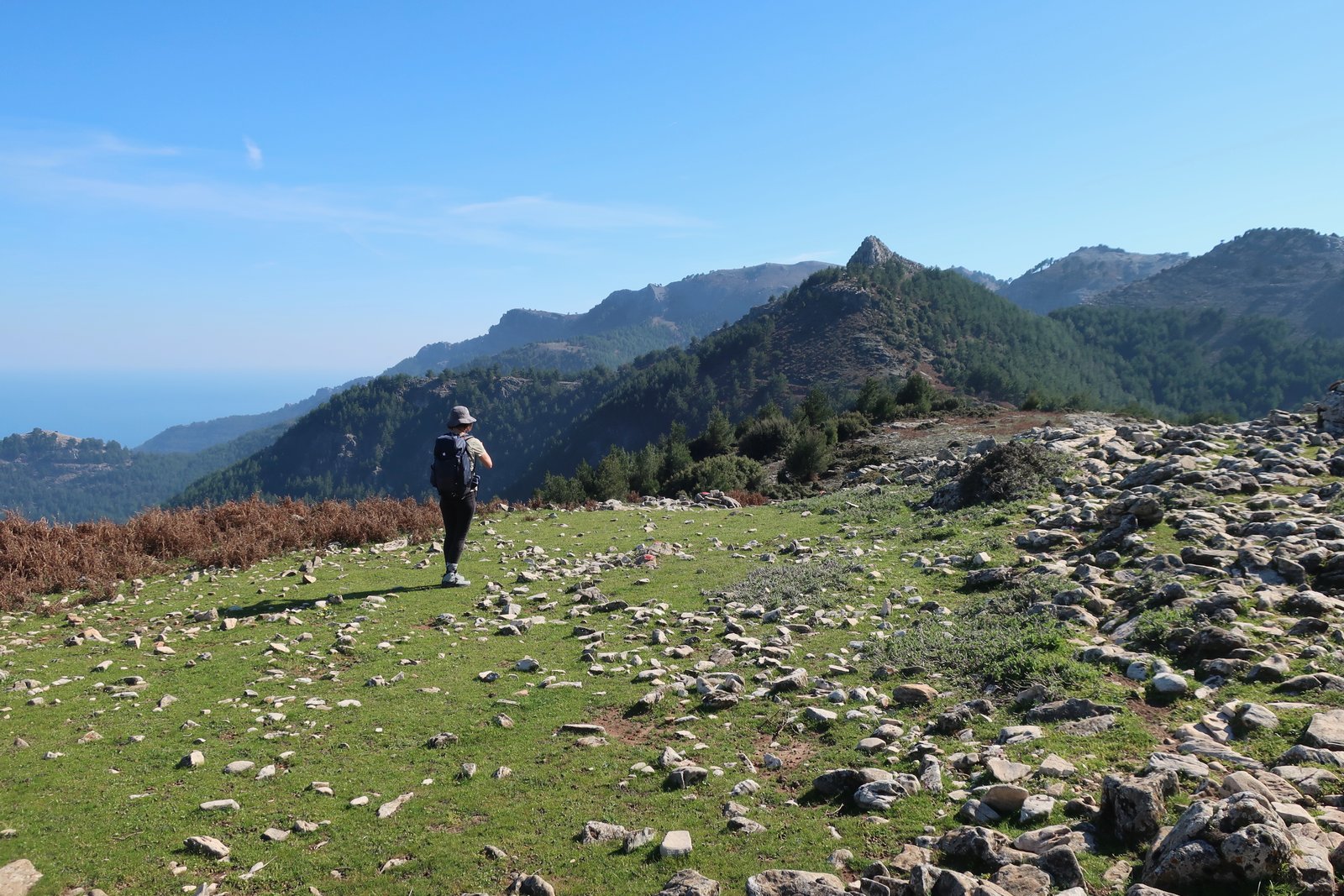
The church is on a small green plateau with views down towards Potamia and the coast. As the crow flies it’s only about 500m from the place where, earlier in the day, after the cliff-walk Trail 8 takes a hard right to begin the descent towards Theologos. According to the map, there’s no way to go between these two points. (There’s a danger sign for those who might be tempted.)
Just past Profitis Ilias on a wide track there’s a turn-off onto the trail that descends to Potamia. It’s easy to miss, just a small right-angled arrow on the other, high side of the track. This trail goes through dense woods onto a ridge from which at first there appears to be no way down, until suddenly it turns into a very beautiful, zigzagging, stone-paved path. The Terrain Map bafflingly describes this section as ‘constructed’, as if that was a bad thing, understating the fact that this is precisely the sort of path that any hiker would be thrilled to find.

The final section is not well marked. But you can’t really go far wrong. All roads lead to Potamia and/or the coast.
HIKE 2
From Potamia on Trail 2 up onto a different Profitis Ilias – not the one from HIKE 1. From there along the ridge almost as far the mountain refuge on HIKE 1. Home to Potamia on Trail 1.
About 18kms
The same as HIKE 1 out of Potamia. At the Trail 1/Trail 2 junction point, a right-hand turn instead of a left.
Just as steep as Trail 1 as far as the peak of Profitis Ilias. We saw seven snakes during this climb, an all-time record for one day. For a while we seemed to be disturbing them at practically every footfall. The speed at which they can move is quite astonishing, they hardly seem to touch the ground, skimming the tips of the grass and the salient points of rocks.
It’s not obvious from the map, but before reaching the summit the trail goes around the back of the mountain into pine forest. The slope here is steep and the stripe of path very narrow, although the trees mostly negate the impression of precipitousness.
The final hundred metres or so is almost rock-hopping up to the bare hilltop. No clear path, but again there are marks to guide the way.
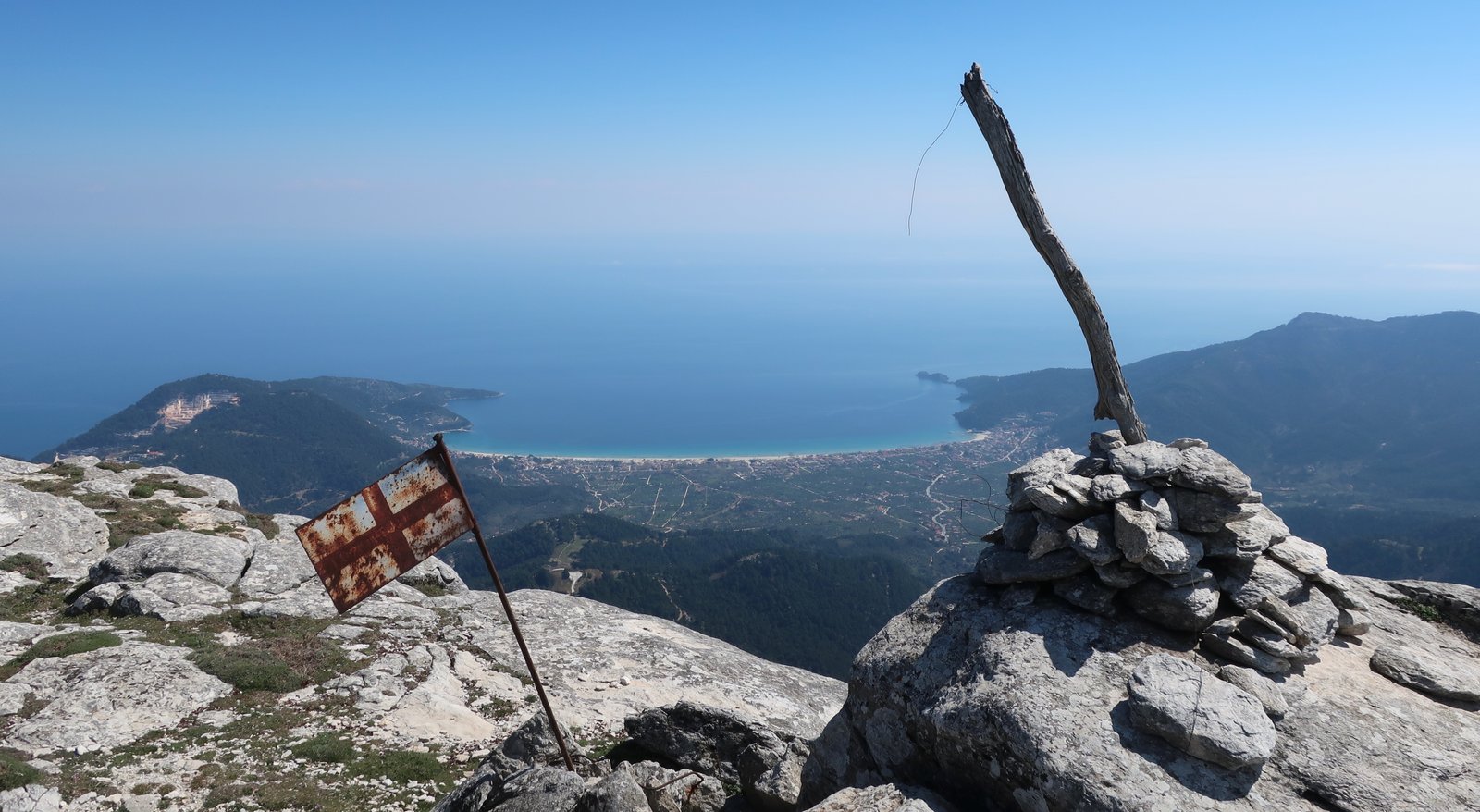
From the peak the island is visible in both directions, to Potamia and to Limenas. If anything, the view is even better than from Mt Ipsarion.
The first part of the descent goes down into a deep saddle before going almost as steeply up the other side. Looking back towards the top, the tip, a trick of perspective makes it seem much too steep to be walkable.

Again there is no path, but there are some marker paint-dots and anyway, the map makes it clear that there’s nowhere to go but along the edge, down and up.
Then a fairly gentle stroll, again not well-marked, until the point at which Trail 1 hits the ridge and the mountain pours down towards the coast.
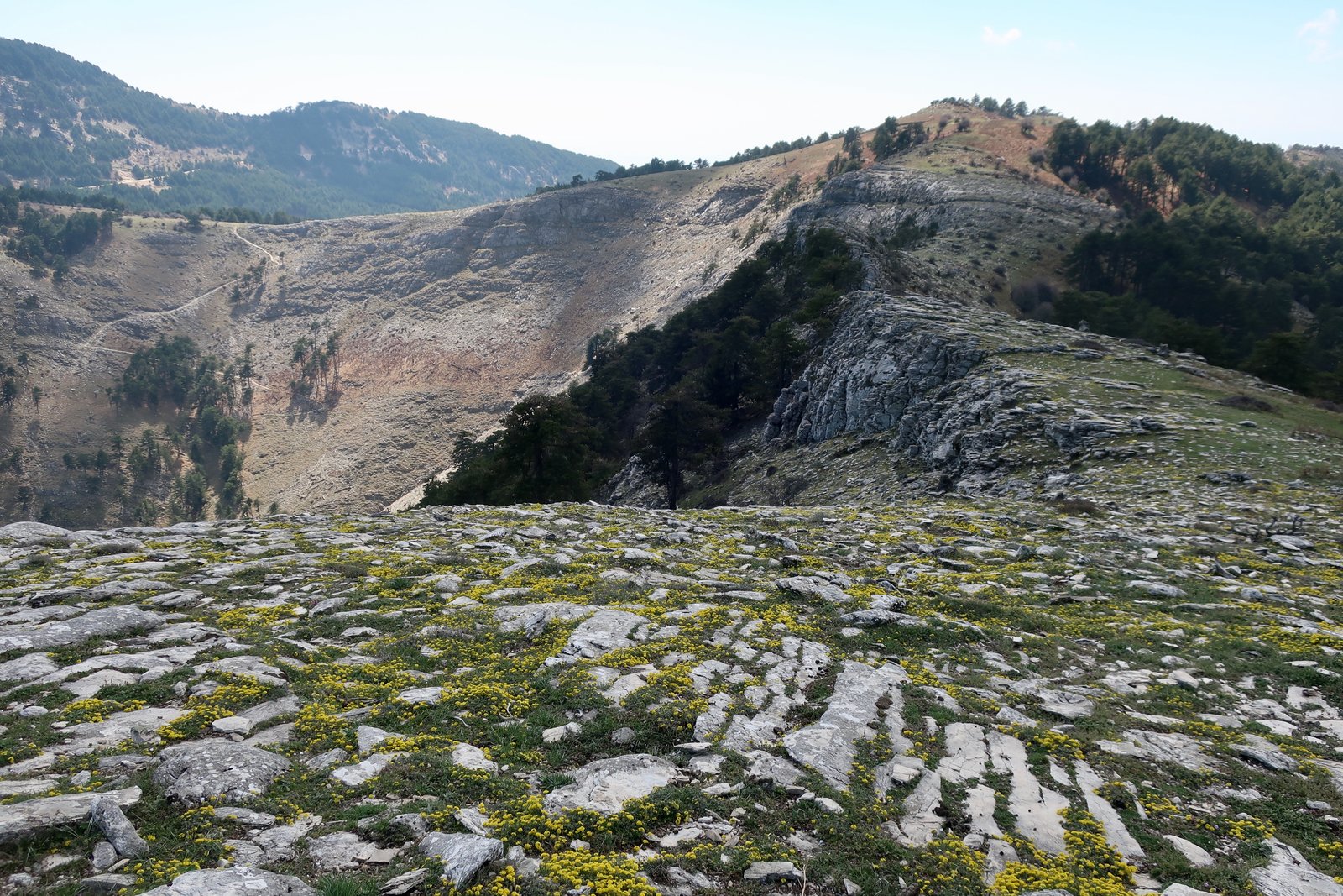
From there back down to Potamia. This path is harder downhill than up. There are a lot of loose stones and it’s easy to slip.
HIKE 3
Potamia to Skala Potamias, then on the road north along the coast until the point at which a narrow lane heads into the sprawling site of ancient Thasos. A wander. On to the amphitheatre, into town, bus back to Potamia.
About 18 kms
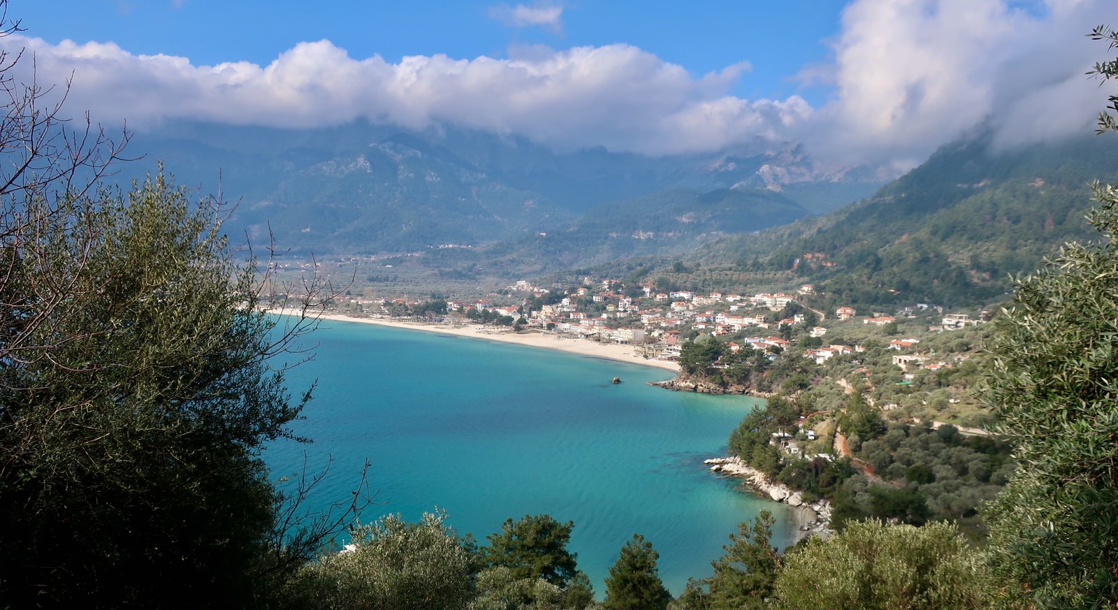
Not really a hike, a stroll around the coast: down onto Golden Beach, past the well-known marble beach at Saliara and into the large, chaotic, archaeological site where paths go in various directions though the trees. There’s little chance of knowing where they lead until you arrive, at Pan’s Sanctuary, the Temple of Athena, the medieval castle and so on. The vestiges of the Temple of Athena are especially evocative, on a hilltop overlooking the modern town and port. Much of the base of a double-skin stone wall remains, showing in intricate detail how the two skins of the wall, inner and outer, locked perfectly together.


At some point in the recent past it all appears to have been better-maintained than it is today. There are lamp-posts along a path, non-functional now. A fence around the castle and the Temple of Athena has been left to rust; the gates lie open, unhinged, or on the ground to be stepped over. With the exponential rise in popularity of the Greek islands, we have the idea that everything is constantly moving forwards. Not always in the most desirable way, but moving anyway. More and more people are coming. They need the obvious holiday infrastructure, but also classical sites like this, museums, cultural attractions. And then, this.
The amphitheatre was being worked on when we there in early 2023. Entry wasn’t possible. Twenty years from now perhaps there will be evidence of a moment of interest, before it too is left to the elements.
The eastern end of Limenas is older and nicer than the west. The ancient agora comes almost down to the waterfront, a meadow of stunted pillars, stone foundations and steps. Elsewhere, through back gardens there are head-high alleys lined with great stones. They run like gouged channels at this end of town, with ricketty wooden stepladders in and out of them, like a video game. Some of the actual houses must be planted on foundations laid two and half thousand years ago.
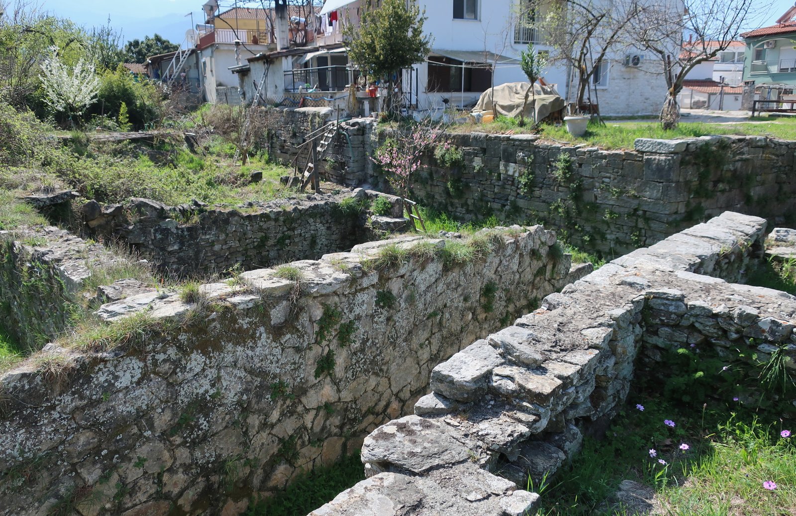
FROM POTOS
HIKE 4
From Potamia up to Theologos on Trail 6. Back down on Trail 5.
25 + kms, depending on diversions
The Terrain Map suggests a total time of ten hours for these two hikes. Always better to err on the side of caution, but this really is an exaggeration.
Trail 6 is a combination of dirt road, forest path, rock and trail. None of it is paved. We saw no waymarking. Still a nice walk though, if confusing in places. From the coast up to about 400m, along a small ridge, then down to 200m again at the lower end of Theologos. Agricultural land, woodland. Soft landscapes. Not at all of the same scale as the mountains around Ipsarion.
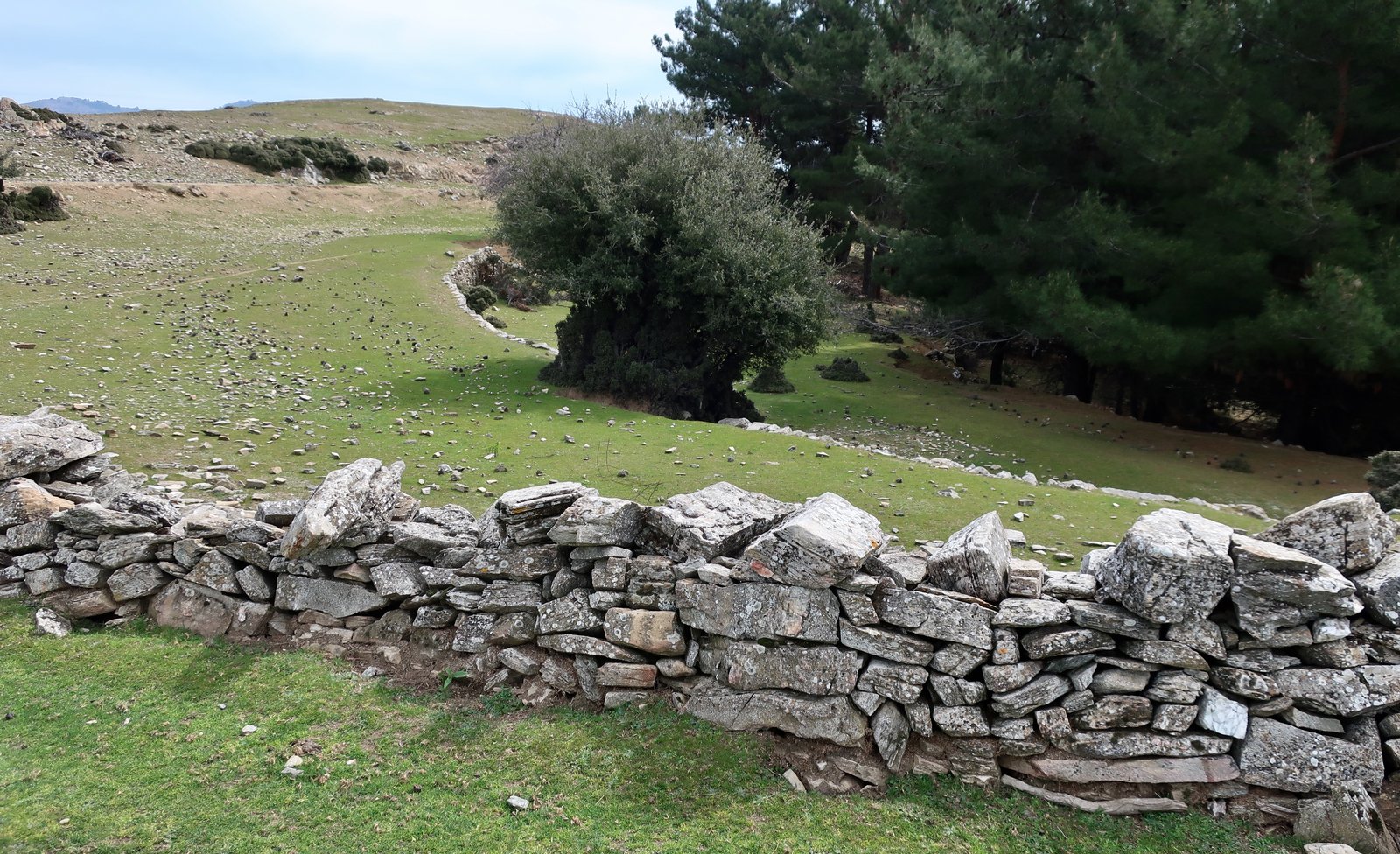
Theologos is neat, built in a barely-noticeable fold in the land. Very often island-villages have coalesced around a central point, usually a square, with a plane tree and a church. This is not that sort of village. It’s a bit straggly, has no obvious centre, the easy topography has allowed it to spread. According to a noticeboard outside Agia Paraskevi church, in 1880 Theologos had a population of 2200. In a pragmatic nod to the provenance of likely visitors today, there is a notice in both English and Rumanian.
On the southern side of the village there’s a mesh of stone paths, giving an idea of what must once have been. Within a few hundred metres they die out and Trail 5 back to Potos follows the path of a small stream. Even in March the water soon disappeared. With the seasons there must always be a sort of shrinkage, with water retreating towards the centre of the island, the highlands, leaving the coasts mostly dry even when streams are still running further inland.
The walk back to Potos along Trail 5 is a bit of a mess. Often the stream-bed is a place of minor refuse for piled-up water-borne waste. And then around it broken down trucks, earth movers, breeze block buildings.
HIKE 5
The morning bus to Theologos from Potos, then Trail 9 to the Archangelos Monastery. From there the coast road back to Potos.
About 30 kms

Again, close to Theologos there’s a network of lovely old stone paths that quite quickly disappear. Probably a paved path used to go all the way to the Archangelos Monastery on the coast, the end-point of this Trail. There is almost nothing left of it. Most of the way now is on dirt track. The last evocative point is a meadow close to Theologos, where the villagers used to go for picnics on Clean Monday, the first day of Lent and an important day of celebration in the Greek Orthodox calendar, on which, traditionally, kites are flown to symbolise the journey of the soul towards purity. A couple of times in the islands we have been surprised on what seemed to us an ordinary sort of day by small crowds of people on the beaches, in the public spaces, feasting and flying kites.
Here in this place near Theologos there are photos of a lost world.
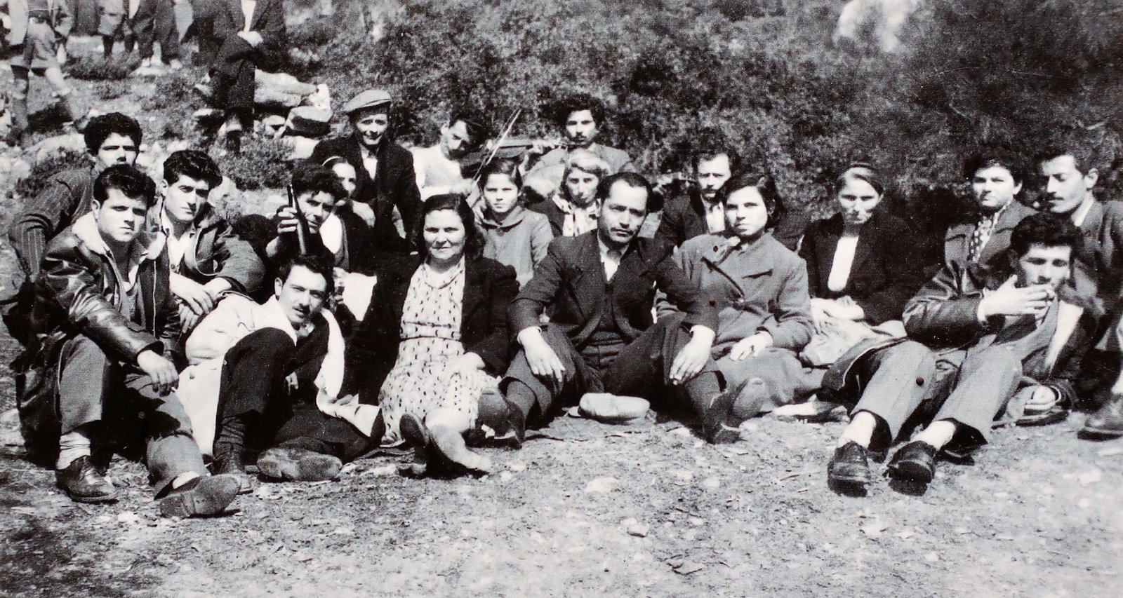


When we were on Thasos in March 2023 this walk to the coast was a walk through desolation. Whole hillsides of trees were dead, flattened, as if combed down, and/or burnt. In many places there was not one single tree standing.

Just occasionally we would come to a spot protected from the wind and be in a small olive or walnut orchard where everything was suddenly, briefly, normal.
Archangelos Monastery must have been quite something in the past, sat on its remote little cliff above the sea away from all civilisation. It has now been de-dramatized, rendered almost banal by the coming of the road.
There are several nice-looking pale sandy beaches along the south coast on the walk back to Potos. Accessible on foot or by car. Most people who come to Thasos will have a car.
HIKE 6
Morning bus from Potos to Theologos. Trail 11 up to Apostoli Waterfall then down to the Kastro. Back towards Trail 7 any way that seems reasonable, until the end-point of the scenic route marked in green on the Terrain Map, at Mandaloudi (309m). Back to Potos on mostly Trail 7.
About 28kms
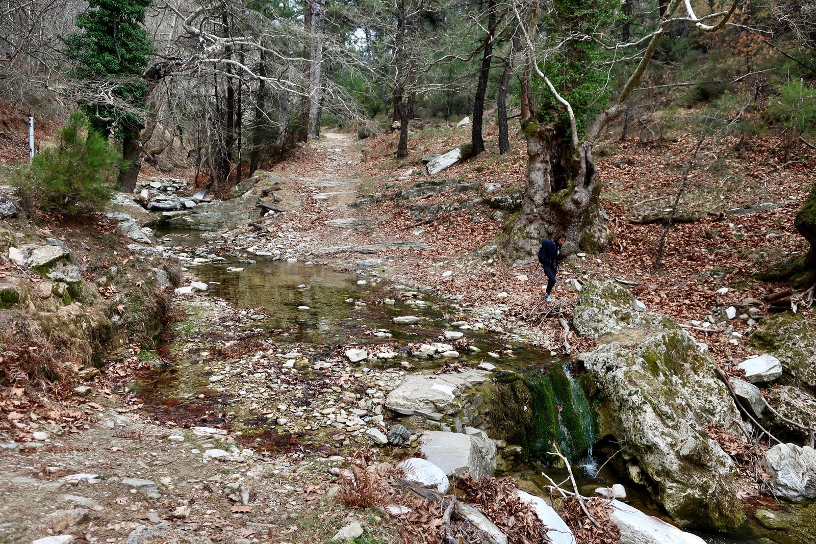
Starting from Theologos, the route marked in green, ‘scenic’, on the Terrain Map, to the bottom of the eastern side of Trail 11. From there it’s a forest path due north, along the route of a stream, which goes from dry at first, to the small waterfall at the northern turning-point of the trail, as if somewhere along the way the water coming downstream falls off the edge of the world. The course is marked by huge plane trees. In absolute contrast to HIKE 5, on this side of Theologos there had been no hurricane to blow the trees flat, no fire.
Back and forth across the stream. Blue-grey algae in the branches of the pines were Christmas-decoration explosions. On the left, the remains of what may have been a bridge, or a water mill. There are similar stone ruins in the Valley of the Mills close to Petra on Lesbos.

This is a good path for non-hikers. The ascent is almost imperceptible as far as the waterfall at Apostoli, then similarly gentle coming back the other way to the Kastro. The return path (south) is not as nice as the outward path (north). No plane trees, no stream. Instead it’s a wide track through shady pine forest.
Some agricultural use has been made of the land near the Kastro. Some terracing, some high fields. Stuck up on the remote hilltop, the people who lived in the Kastro must have had the imperative to make use of all accessible fertile land.
We saw no sign of life in the village. A pretty church square. Evidence of renovation. Panoramic views for early warning of approaching enemies.
The path down from the tip of the village, dotted on the Terrain Map, is unclear. But it’s only a kilometre to the point where it meets the dirt track and you can’t go too far wrong. There are some red marks, and some cairns, and olive trees and open meadows and right at the bottom, just before the trail meets the track, the remains of what must have been the old paved path that came down from the Kastro. Just a short section of stone, a hint of corner, of steps, a lovely relic.
Between there and the neolithic cemetery at Larnaki, there are various options. We went through holm oak scrub, over rock, along a wide dirt track and through one of the best-kept, neatest olive orchards we have ever seen. Then upland meadows and pine trees, and down to the cemetery, which like parts of the archaeological site of ancient Thasos at Limenas, has seen better days. It was once ringed by a chain metal fence. Now the fence has rusted, and has collapsed in several places.
The graves date to as long ago as the 5th millennium BCE. Rather than classical stone sarcophagi, here shallow graves were dug and lined with stone. Open, they look like short launching ramps for small boats. When the body was slipped in, the top was closed with a lid of flat stones. There is a softness in the shallow launching, a very visual lying down, not a burial.
The way back to Potos from there was confusing. We went wrong somehow.
We’ve since talked about going back to Thasos just in order to go to the hilltop of Kastri, a few hundred metres from the cemetery, where in the Neolithic there was a settlement.
After all this time and all these islands, all these walks, there can be a feeling of loss still at not having been to this one place.