
For at least 2500 years mastic has been used in traditional medicines, in the production of various liqueurs and in cooking. In Ancient Greece and Rome people chewed mastic resin as a breath freshener. It’s where the word masticate comes from. There was a time when mastic tears, the drips of sap excreted by the slashed bark of the mastic tree, were worth more than their weight in gold. These days mastic as a product has less resonance than in the past, although in the Middle East and Greece it’s still used widely in sweets and desserts – it accounts for not just the flavour, but also the stickiness, the chewiness, of Turkish ice cream.
The history of Chios is a history of mastic. For reasons of climate, soil and know-how, it’s where top quality mastic exclusively grows. The Ottomans, who reigned over Chios as they did over most of the Aegean, maintained a jealously-guarded monopoly. Chios is still called Sakız Adası, Mastic Island, in Turkish. In a pre-toothpaste world quantities of mastic were distributed to the women of the sultan’s harem.
There are a dozen or more mastic villages in the south of Chios, architecturally among the most distinct villages in the islands, but not, as might be presumed from the million photos on the internet, uniquely made of houses whose facades are covered in geometric black and white patterns.

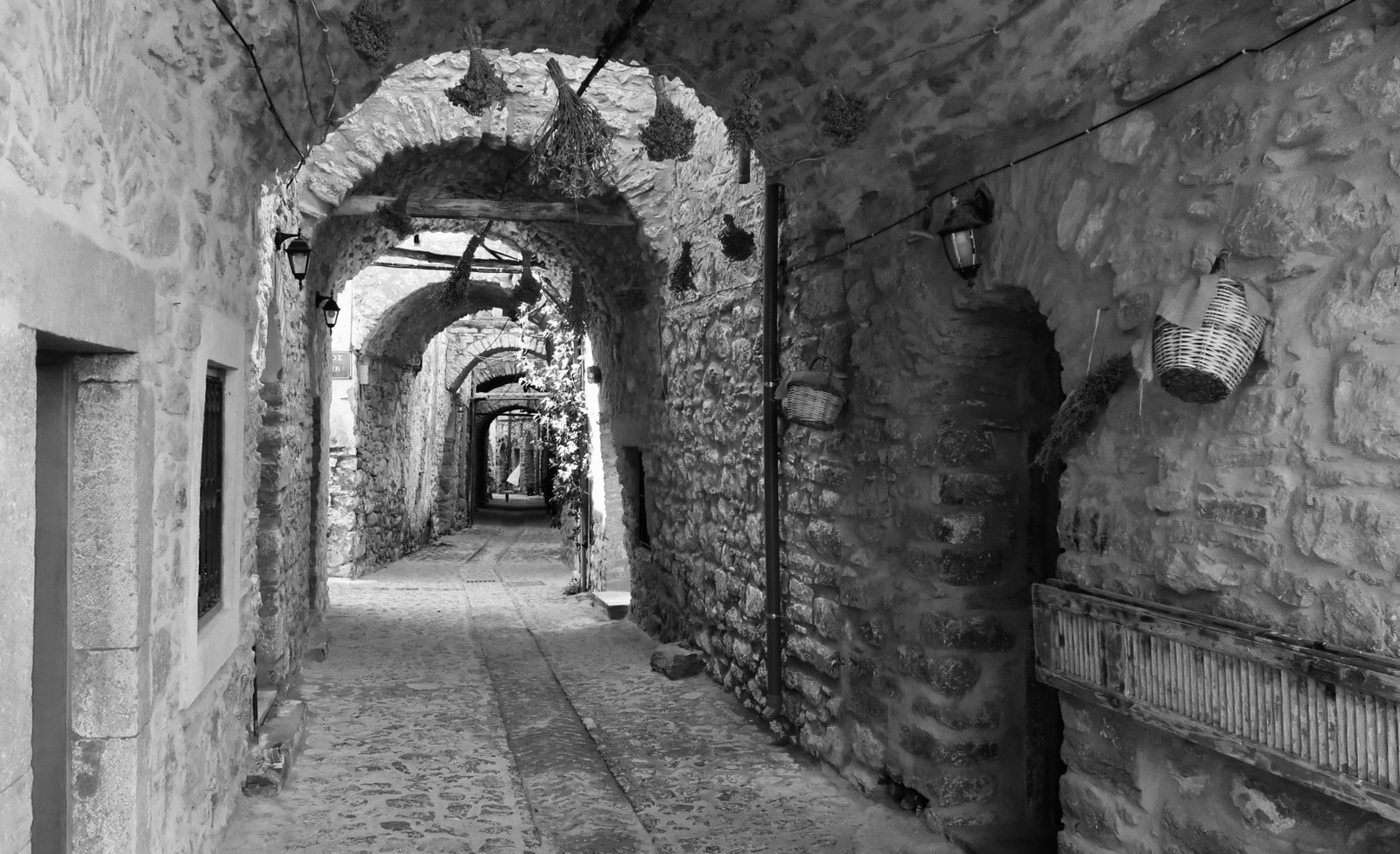
There are also classic old stone villages, once fortified against pirate attack by tall circumambient walls. Nowadays their winding, arched stone alleys lead to lovely piazzas that are the secret centre-points of labyrinths.
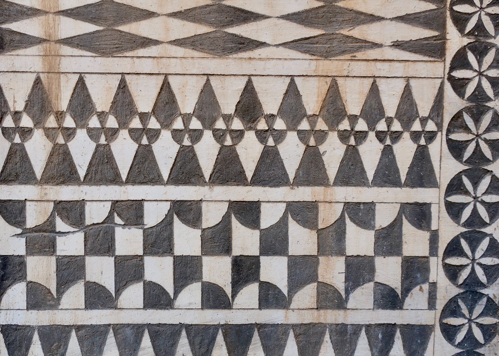
The black and white decoration, which we had imagined to be painstakingly created by the arranging of small marble slivers over the facades of the houses, is actually, rather than a process of accretion, one of subtraction. The buildings are cement-rendered and painted white. Geometric patterns are then painstakingly cut into this thin skin. When the surface layer of white is scraped off, the exposed render underneath is mid-grey, cement-coloured. From a distance the buildings are fantastical. They call to mind Calvino’s Invisible Cities:
The houses of the city of X are decorated with countless thousands of shards of harlequin marble, formed into endlessly repeating geometric patterns that dazzle and confuse the visitor’s eye.
From close up they’re another sort of invisible city, one in which the decoration is an elaborate counterfeit.
***
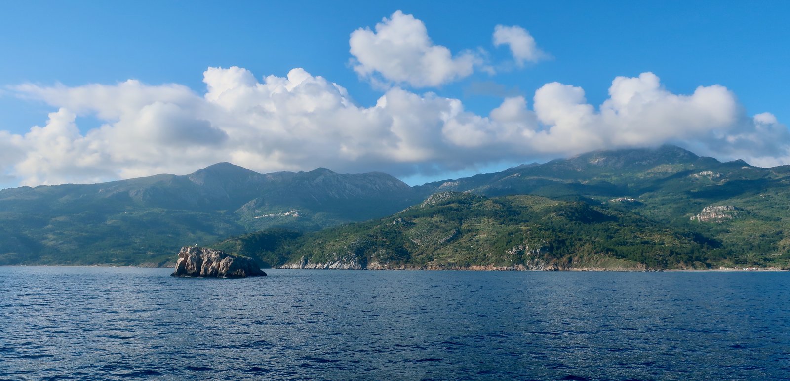
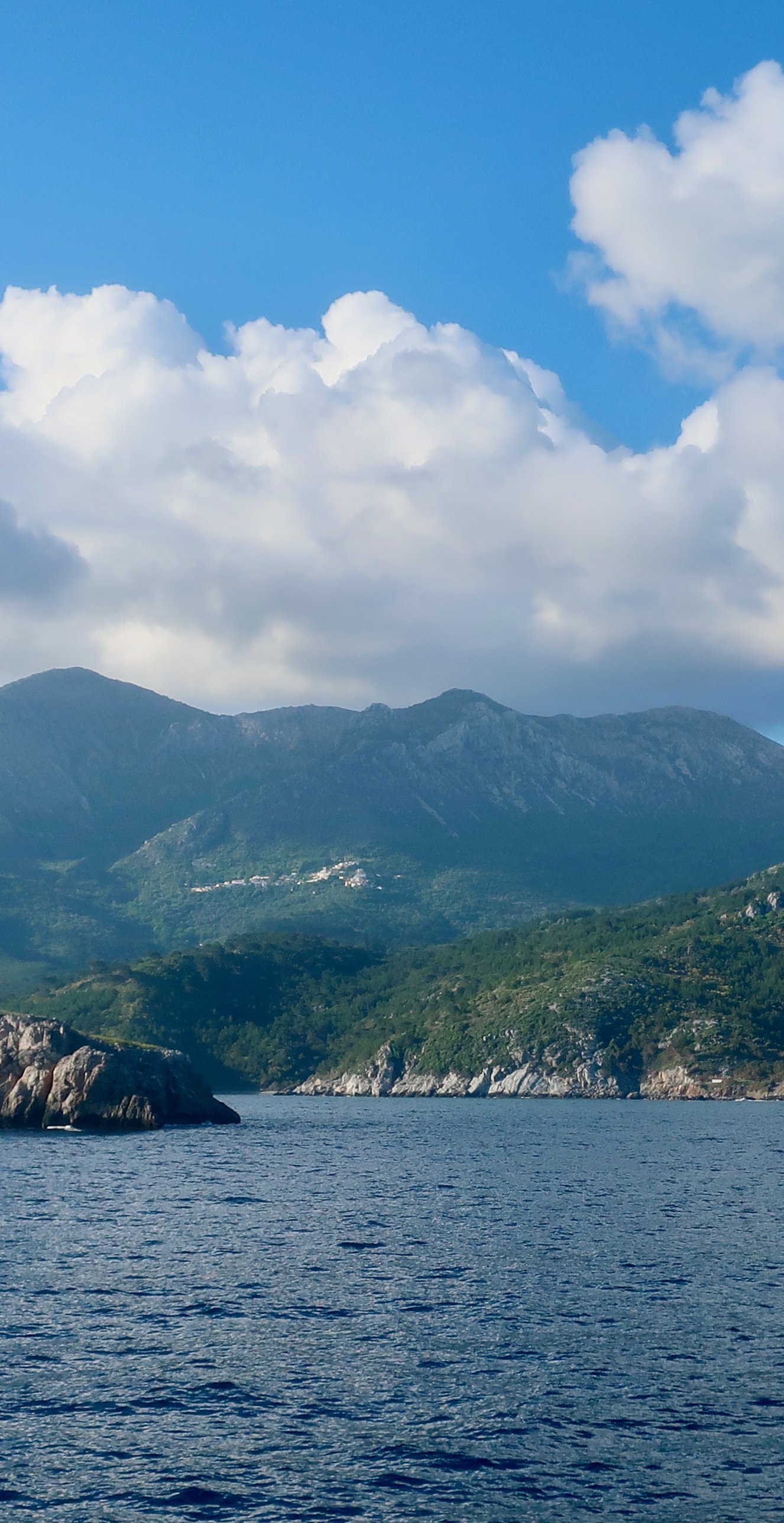
The first we saw of Chios was the north coast, in early May uniformly dark green. Here and there a lighter patch was a village, or a place where rock had broken through the green skin. At distance the two, outcrop and settlement, are almost indistinguishable.
The northern end of the island is an unbroken landscape of mountains and valleys. Mt Pellinaio (1300m) is the high-point, but much of the north is over 1000 metres. There are steep gorges, mountain villages, roads that on the map are as wrinkled as old bootlaces. The hill villages of the north have more in common with the thousands of hill villages of mainland Greece than they do with idealised notions of Greek islands.
Coming from the Cyclades, it all seemed huge. The endless rucks and contours of the Greek Islands, but more.
Even if the southern half of Chios is less mountainous than the north, there are hills of four hundred five hundred six hundred seven hundred metres. Plum in the middle of the island, near the Nea Moni monastery, there are peaks at over 800 metres. Just north of this, behind Vrondados – which may count as the end of the south, the beginning of the north, or the middle – the summit of Mt Epos is a little over 900. It’s really nothing but hills. Close to the southern tip even, around Vroulidia and Akrotirio Oura, right down there where the land slips into the sea there’s a ridge that climbs straight up three hundred metres. Only around Chios town is there much in the way of flat land, a small almost-plain on the central east coast.
***
Although Chios does have the secondary, largely seasonal, ferry port of Mesta in the southwest, most people coming by sea will arrive in Chios town, with even on a full-sunshine springtime day its air of neglect, of has-been. There’s an ex-industrial long, curving waterfront, with at one end, but very clearly separate, the tight nested streets of the old Turkish town, of historical interest but seemingly ignored, as if in pique. In the evenings the seafront is busy. All along the water there are cafes, mostly converted from old commercial buildings, a legacy not only of the great mastic days, but also of a time in the late nineteenth century when Chios was second only to Athens as a centre of maritime trade. The harbour must in those days have been a constant bustle of shipping. Now there are a few local pleasure boats, the big ferries heading south from Lesbos, north from Samos, and the fast, ricketty, small ferries that charge steep prices for the half-hour dash to Çesme in Turkey.
Most of the resorts stretch out south from Chios town. Out of season, even on an island like Chios on which more than fifty thousand people live, they slumber, a little scruffy. Further along the south coast there are beaches, some with small resorts, others with nothing at all beyond the probable installation of parasols-to-rent in summer. Overlooking the perfectly-formed little bay of Emborios, one of the most complete in terms of infrastructure, there’s a steep hill on which there was once a classical city.
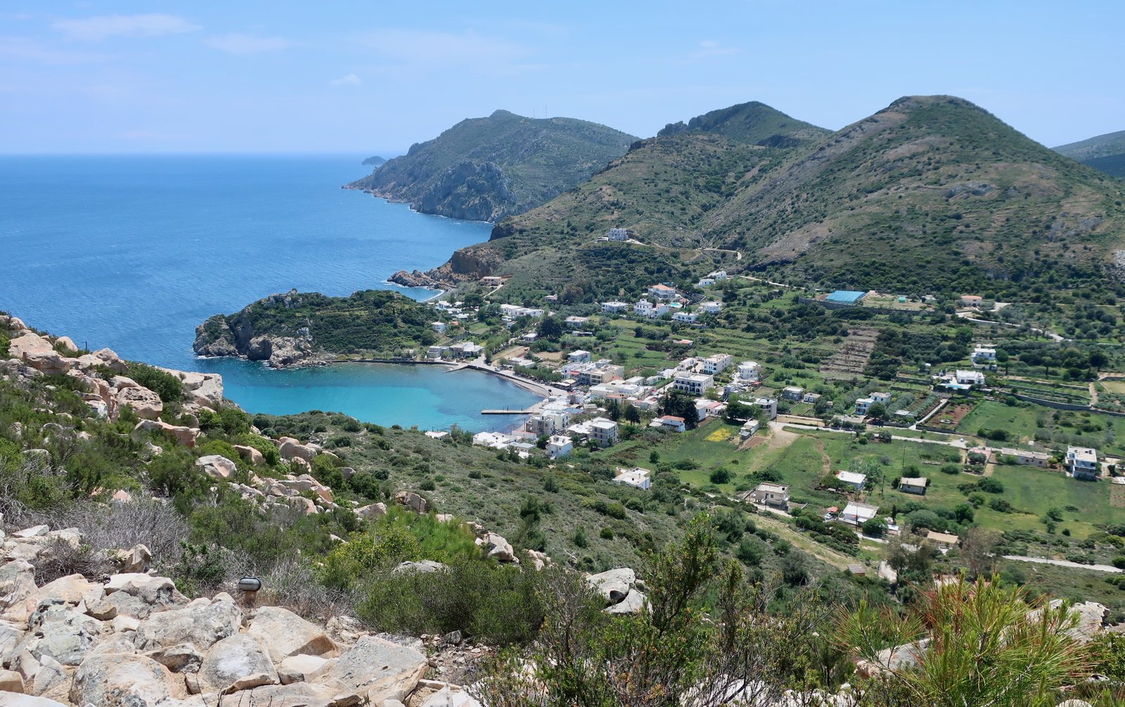
The site is wonderful, the treatment the ancient city has been given less so. A wide concrete footpath winds back and forth up the hill, with here and there piles of stones labelled house. The excess of concrete, the fastidiousness, succeed only in removing almost all historical inflection.
On the long west coast there are a few, little-visited, beaches. And then the wild north, exposed and undeveloped. On google maps, a succession of beach-names, marked by little green umbrellas. In reality, windswept little strands reached by steep, winding roads, many with little more than a church to mark the spot. At most a building or two. There is no tourist development at all until rounding the corner northeast, where shelter from the weather begins.
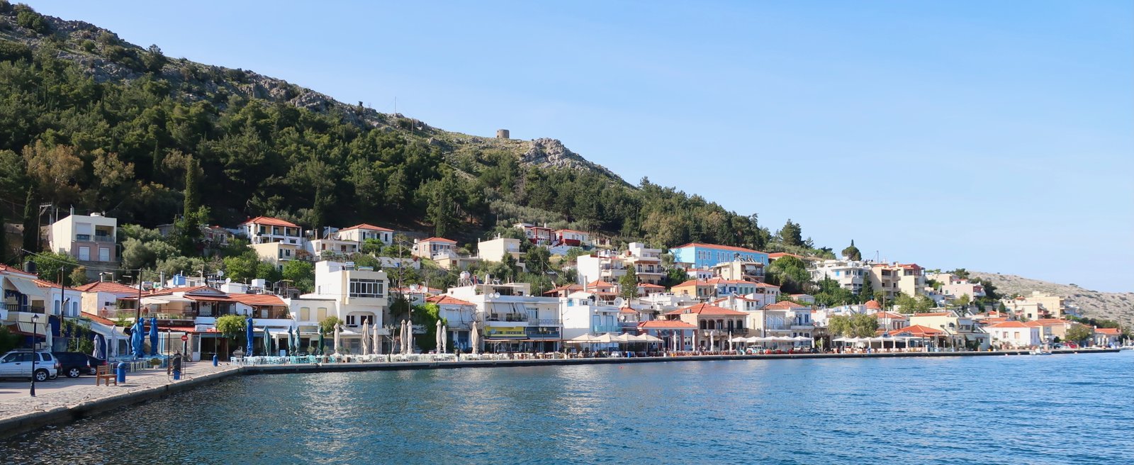
Then Gisonas, Kardamyla, the latter with half the village just inland, half on the coast. The port of Kardamyla has been marred by the addition of a long, ugly concrete waterfront. The nicest place is Langada, which seemed, when we were there, one of those seaside places where the recipe is by chance just right, where you could spend a week doing nothing much but reading and swimming. The town with its run of waterside tavernas is built on one side of the bay. At the head there’s a small beach, then all down the unbuilt eastern side of the bay are pine woods, with rocky access to the water and places to sit in the shade.
HIKING
In our early days of Greek Island hiking we tended to avoid what we thought of as Big Islands, those on which it isn’t obvious, in an organisational sense, how to do the hiking. Size is unsettling. It’s so much more straightforward if you can use the place in which you’re staying as hiking base camp: breakfast, shoes on, out the door and off you go.
On Chios there is no one place from which you can hike the whole island. There aren’t even two. It’s public transport or a rental car/bike, and on Chios, because of size, because of the thinness of the bus timetable and the length of many of the hikes, there’s really no choice. Even if we haven’t adapted to cars/motorbikes as a way of getting to the place from which we’re intending to hike – if anything, we’re more reluctant than ever, the cumulative effect of so much hiking, the richness of it and the different relationship with time that’s imposed – we’ve now accepted the fact that sometimes it’s the only solution.
The hiking isn’t very well-organised. There’s no central hiking body, no island-wide set-up. Information on the internet is sketchy. Because of the poor organisation, because we feared it was going to be Big-island-complicated, we were surprised by the trails, how very good they are. Some of the hiking on the Big Islands of the Northern Aegean – Chios, Samos and Lesbos make a Big Island cluster – is quite stunning.
We used the Terrain Map, on which there are two or three dozen trails or snippets of trail. The largest concentration is in the north, between Mt Oros and Mt Pellinaio. There’s a small group in the middle, mostly around Mt Epos, Karyes and Avgonyma. In the south there’s hardly anything at all. Unusually, the trails on the Terrain map are unnumbered and unexplained.
If you’re serious about hiking, it won’t be the high season which is too hot for walking, so if you want animation, Chios town is the place to stay. If you want swimming from your front door – although this is not necessarily so important if you have a car – it’s a quiet beach place somewhere, where in normal circumstances, on normal islands, out of season there will be few, if any, other foreign patrons in the one open café, only local women in the mini-market, and only you and just perhaps a few ritualistic locals, mostly women – believers in the unarguable benefits of year-round swimming – throwing yourselves into the out-of-season water.
But this is giant-sized Chios – fifty thousand people – so unless you choose a really tiny resort where hardly anyone stays outside the holiday season, there’ll be something open. The closer it is to summer, the more there’ll be.
Langada is well-placed for the northern and central trails, although by Greek island standards you’ll have a long drive to visit the south and the mastic villages.
Because you have a car, because there’s no public transport, you’ll have no choice but to plan circular hiking routes.
HIKE 1
Vrondados to Karyes. Karyes to Panaghia Arvanitissa on the dotted trail on the Terrain Map. From there a loop in front of the tip of Mt Epos, between the two peaks marked 852m and 860m. Back down to Vrondados.
About 30 kilometres
We did this the first time we went to Chios, a flying visit, two days, one hike. It would not have been so long a hike had we been staying in Karyes instead of Vrondados. (But it may well be that out of season in Karyes there’s nowhere to stay.) It would not have been so long had we not got lost around Karyes looking for the path, then lost again trying to find a way down out of the highlands.
There are various options for the stroll from Vrondados to Karyes, where the path begins. All of them go through a valley of pine woods, where on our Thursday morning the sound of a Greek church service was ebbing and flowing. It happens on hilly, windy Greek islands that sound comes and goes, muffled behind bluffs and corners, carried this way and that by the wind. At first we weren’t sure that the distant hum wasn’t a lawn mower or strimmer, until we rounded another corner and there it was again, unmistakeable, the singular tonality of Greek liturgy.
In Karyes, a big, tidy village between the mountains and the coast, we struggled to find the path. Had we paid better attention to the map we wouldn’t have turned left in the village centre, before realising we were wrong and doubling back. Once back in the village, we stopped to ask someone. One person, two people, soon a small crowd of ten or twelve had gathered to participate in this unprecedented conversation. The idea of hiking up into the high hills above the village was so strange, so unlikely; they wanted to tell us, had to tell us, how far it is to Panaghia Arvanitissa, which we had tapped on the map for them.
How much and how quickly life has changed.
Drakondospilo?, we asked the small crowd, pointing to a cave marked on the map. Shrugs and head-shakes. Various fingers stroked the word, the place. What is it?
I’ll get my grandmother, said one young woman. She disappeared down the street and a few minutes later came back towards us with a small woman all in black. Slowly, reverently. The oracle. The small crowd parted.
She listened, looked up at the middle of the steep slope whose grey face looms over the village, and pointed. That’s the way we used to go, she said. And everyone was so pleased, so proud. It was when I was young, she said, harking back to a different world that her neighbours think anecdotal, even if at the same time it’s somehow theirs, an inheritance they hardly know what to do with.
It looked so unlikely, straight up, but we went where she pointed, turned right at the stone wall under the slopes at the top of the village, and then miraculously, just where she had said it was, there was a red dot and the start of a path to the left up towards the top.
At first it’s solid rock. There are more red dots. You pass through a sort of rock gateway and imagine it’ll be like that all the way, carved onto the face of the mountain with the same monumental stone steps we’ve seen in so many other places. And then nothing. No more solid stone on which to walk. Instead a faint zigzag that’s not really a path at all, that can only be followed because there are still occasional, faded red dots to show the way sharply back and forth on what is a giant, uncomfortable, scree-slope. It isn’t difficult, but as with any scree-slope, care needs to be taken. You need to tiptoe.
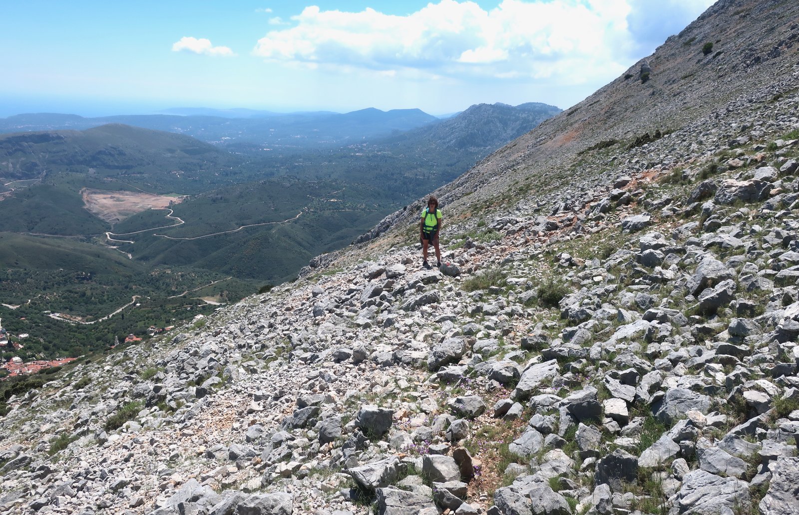
At the top there’s an obvious trail to follow, a thin line that wanders across the high plateau and on down into a valley, where there are rough compounds and sheep, and goats. Then back up again towards Panaghia Arvanitissa.
It’s impossible to understand from the map what the land is like up here. Even in mid to late Spring when we were there it was desolate. The further you go, the harsher, the more brutal the terrain of grey rock. There are small patches of dark-green stunted bushes, scatterings of scratchy spike plants. A few sheep pick through this wasteland, heads down in that attitude sheep have, concerned with nothing but their meagre pickings until they hear us clacking along and look up to check, and move uneasily away.
It’s impossible too to understand from the map the succession of small gorges and ravines that plunge down to the right, in the approximate direction we wanted to go. We tried to follow contours from the map, to be logical, and twice dived down too soon, only to find the paths we had taken were not paths at all but dry water courses that narrow quickly, too steep for us to scramble down. We had to double back, continue on, try again.
We would have won no prizes for our orienteering. Sometimes it’s only afterwards, when we have time to stop and think clearly, that we know we didn’t pay enough attention, didn’t read the map well enough, should have made earlier or better use of phone GPS.
Eventually we found the right way down, were spat out of the easily-walkable gorge and curved around onto the track we were looking for, that took us back to Vrondados. By the time we got home, after twelve and a half hours, it was almost nine o’clock, almost dark. Down the street through on and off puddles of yellow, fuzzy, streetlamp-glow.

HIKE 2
Karyes to Nea Moni. Nea Moni to Agioi Pateres and then towards Anavatos. All on dotted trails until the trail turns into a wide forest track that feeds into the tarmac road to Anavatos. From Anavatos to Avgonyma on road, and Avgonyma back to Nea Moni on map-marked trails. From there back to Karyes on the same trail we took in the morning.
Roughly 34 kilometres
Even with the six or seven kilometres of tarmac road-walking, this is a strikingly beautiful day’s hiking. If you do one walk on Chios, it isn’t the trail to the summit of Pellinaio, nice as it is, but this. If 34 kilometres seems excessive, study the map, see how it can be shortened, perhaps made into more than one hike. Karyes to the two monasteries and back is the most essential part. Plus the first few kilometres after the monasteries, towards Anavatos.
***
In Karyes there’s a notice board that shows the path, the way it spurts out of the lane past the church. On Apple or Google Maps it appears as a pale, blurry stripe through dull, sandy terrain. There are spotty clumps of dark green trees.
That isn’t how it is at all.

In springtime it’s a narrow thread among wildflowers. It runs through terraced olive groves, with fruit trees, heavy clusters of oregano on the walls, clumps of wild asparagus and views down to the coast and Chios town. It is very lovely.
By the time the path reaches the tarmac road at the col, it has slipped into pine forest. The continuation is clearly marked and obvious from the map – briefly to the left on the road, then plunging down and right into a wooded valley in the direction of Nea Moni. Before this though, there’s an optional short diversion uphill to the small (third) monastery of Aghios Markos, where Yvonne was asked to hide her knees, and in so doing protect the sensibility of two very ancient white-bearded monks being led like royalty through the pale blue courtyard, with its vineyards, its two oak trees.

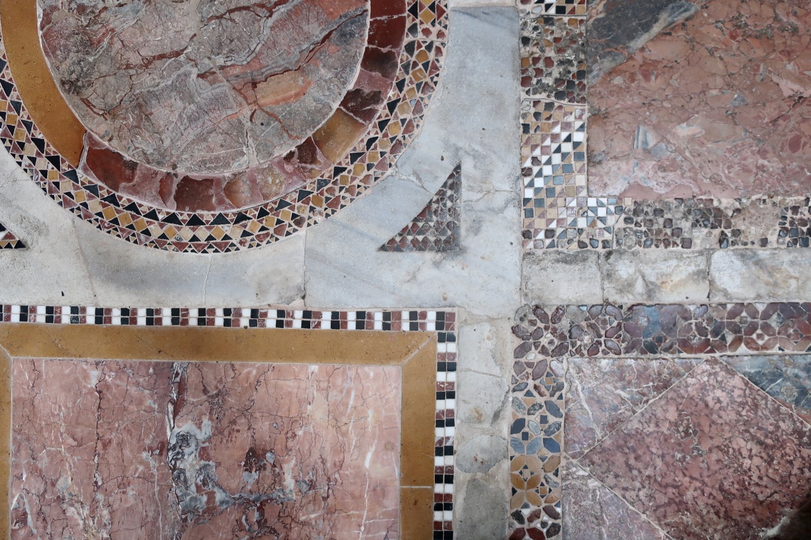
After this diversion the path proper drops into the woods, skipping back and forth across the bed of a small stream, all filtered light and pine needles as far as the next church-in-the-woods, Agios Antonios. From there, it’s part narrow footpath, part stone-laid kalderimi – some of it briefly, incongruously, lathered with a skin of concrete. It leads to the World Heritage site of Nea Moni, a wonderful brownstone Byzantine walled monastery founded in the eleventh century. Outside its walls are the tumbledown remains of more buildings where a small village once gathered at its skirts. The main compound too is more village than monastery, with several churches and numerous buildings within the walls. The mosaic and marble floor of the central church is especially lovely, a precisely irregular mosaic of shapes and colours, so artisanal it must have been soft and worn with age even before it was soft and worn with age.
At the small church to the left of the great gate as you enter, in a glass-fronted display case in which there might otherwise be tableware, glasses, the shelves are piled with skulls and bones. On the wall next to them, a brief explanatory plaque:
When the Ottoman troops came to Chios in 1822, three and half thousand mostly women and children fled to Nea Moni for sanctuary. All of them were killed. Some of their bones are kept in this church.
When the Greek War of Independence broke out in 1821, the Chiots hesitated. Because of the wealth generated by mastic production, they had long enjoyed special privileges under the Ottomans, and were reluctant to risk their elevated status. In early 1822 a contingent of rebels from neighbouring Samos came to the island and coerced/persuaded/inflamed some of the Chiots into attacking the local Ottoman garrison. In revenge for what they saw as this treachery, the Ottomans invaded in force. Eighty percent of the population of between one hundred and one hundred and twenty thousand was murdered, enslaved, or fled the island.
Most of the remains of those killed at Nea Moni are heaped in two crypts beneath the small church of Agios Loukas, just outside the grounds of the monastery. There are dreadful peepholes in the crypt doors.
The slopes of the valley around Nea Moni are still terraced, with olives, figs and almond trees. Thirty or so dark cypresses stand out above the red-tiled roofs of the monastery, have outgrown even the bell-tower.
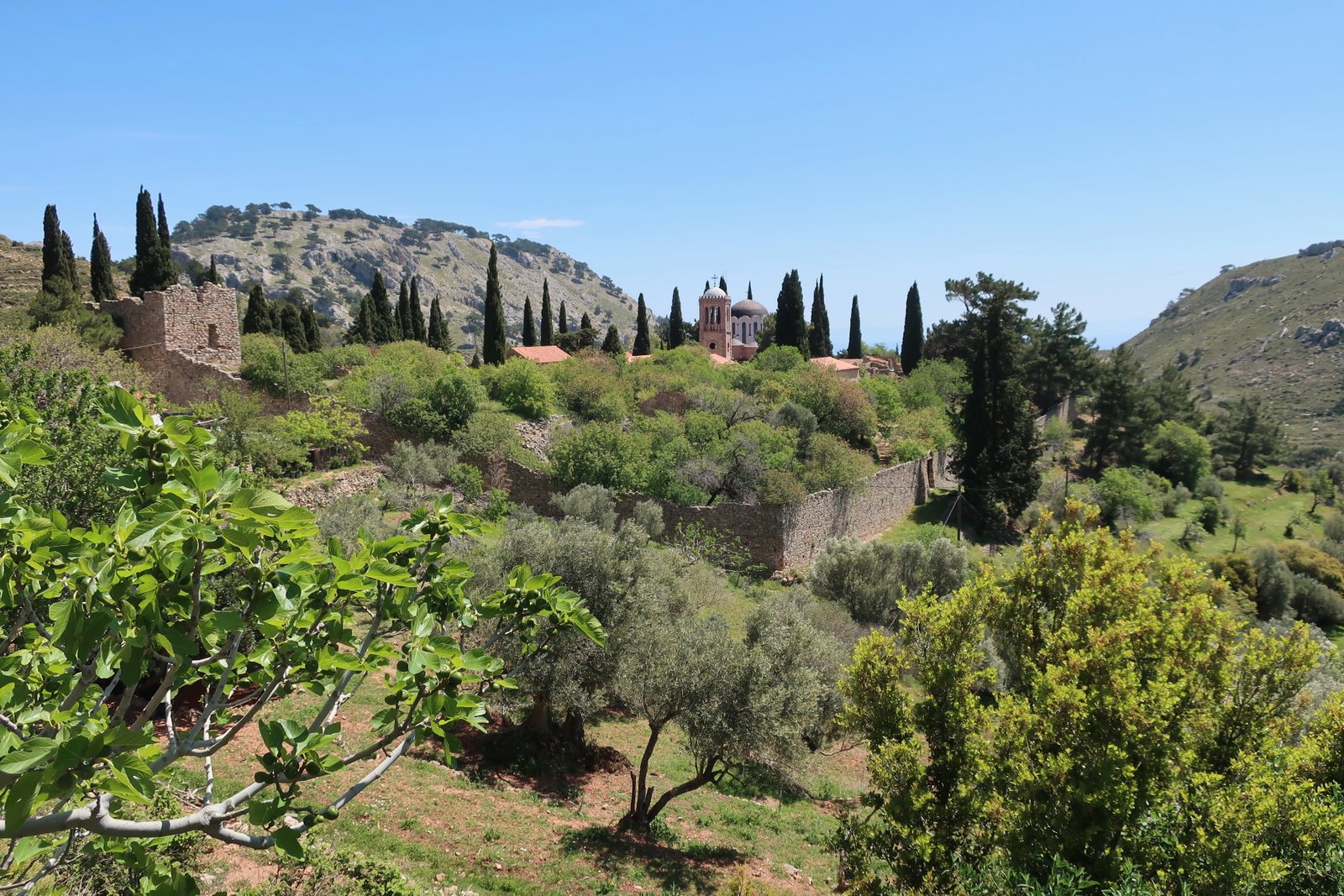
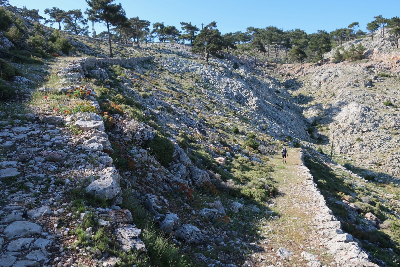
A couple of hundred metres altitude above and less than two kilometres distance away is the seventeenth century Agioi Pateres monastery. A wide, stone-laid path links the two complexes. The edge-stones are still there, but the surface pavement and steps are melting into the hill, with grass, dandelions, anemones, buttercups, pushing through. There must once have been a regular flowing up and downhill, junior monks sent running back and forth with messages and deliveries, the occasional stately processions of their superiors.
Following the map, after a short stroll down the tarmac from Agioi Pateres, beginning at the corner of the road another great stone-laid path meanders back and forth up the hill, well enough made hundreds of years ago that armies could march on it still. At the top, having crossed the main road, the same path continues on the other side of the crest, a remarkable old stone path through the woods. This path and the previous ascent must once have been the main route between Anavatos and the monasteries. Probably in decline since the massacres of 1822, it’s still a marvel.

After a while the path fades to a ribbon, then feeds into a dirt track, which leads all the way to Anavatos. Alternatively, it’s possible to do the last couple of kilometres on tarmac road.
Anavatos, spectacularly built on a steep-sided hilltop over a gorge, is also spectacularly dilapidated. A few dozen stone houses, many of them substantial, and several churches. It blends into the slope. The site is photogenic in the extreme. Most of it was closed-off when we were there, too dangerous to be visited, we were told. Work is being done to preserve it. A few buildings at the bottom of the village have already been renovated. In early May the restaurant there was doing great business.

We walked on the road all the way to Avgonyma, another old stone village, abandoned several decades ago but in recent years reinvented as a holiday destination, with some rental properties, and a few taverns around the lovely central square.
From Avgonyma the trail, again marked on the Terrain Map, climbs up and up through woodland to eventually join the high-point of the great stone-path that climbs up the other side from just past Agioi Pateres. There are occasional small sections of stone pavement, but mostly thin trails, well-marked. For hundreds of years the two great monasteries must have been at the centre of a web of paths linking them to all the villages of central Chios.
It isn’t necessary to go back to Agioi Pateres in order to return to Nea Moni. There’s a more direct, less grand path directly down the fold of the valley. From Nea Moni, we walked the same path back to Karyes we had taken in the morning.
HIKE 3
From Pityous village up to the peak of Mt Oros, in a loop all around the mountain and back down to Pityous.
About 24 kilometres, although for some time of that we were lost.
On the Terrain Map there are a great many dotted trails around Mt Oros and Mt Pellinaio. The trick is to turn them into circular routes so as to get back to wherever it is you’ve parked the car.
The signing is not great. We got lost or half-lost several times, before getting completely lost and having to find our own way down before the light faded.
***
We parked at the small church of Panagia Spiliotissa, just above the village of Pityous, intending to do the circular hike around Mt Oros, with a diversion to the peak. The tip of Mt Oros is 700m – 800m above Pityous. Since the route is circular, the point at which you start and finish makes no difference to length or difficulty. But this is a nice beginning, a flat, grassy place to leave the car, just at the mouth of the gorge into which the path ominously disappears.
Five hundred or so metres after entering the gorge, just after you’ve made a noticeable bend to the right – see the map – the path leaves the bed of the gorge and heads up a steep slope to the right, almost a scramble. On a rock at the bottom there’s a very faint arrow, easily missable. A route more or less straight up will at some point cross the zigzagging path, marked by very faint red dots. Once found, it would be a good idea not to lose it.
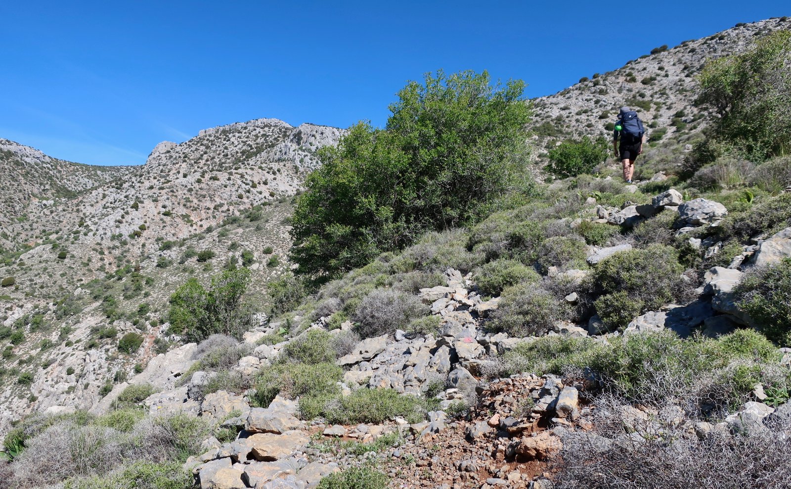
Steep, rocky terrain. A ridge appears above, which looks like it must be the top of Mt Pigadia on the map. When you get there it’s just a ridge behind which there’s another ridge. We are forever passing over phantom ridges, around phantom corners, reaching phantom peaks only to find we aren’t where we thought we were, that there’s another one behind and behind that more still.
Eventually the path levels out, turns sharply to the left through harsh terrain, the only things growing occasional top hat-like bushes, of which many more later, and compact, spiky cushions, even more vicious than usual. The way continues just to the right of the ridge that climbs roughly in a straight line towards the summit. There are old red dots most of the way, faded but followable.

At a stone-wall animal pen – the only sign of human presence on the way up – we lost the markers. The terrain by this point is not steep. The tip of a hilltop antenna is visible.
On the summit there’s a typical, basic, mountain-top refuge, presumably built at the same time as the antenna, long abandoned now. It’s another high place which sheep or goats have made a home of, within which they crowd for shelter from the sun. The ground around it is thick with droppings, the air acrid.
The path down from the summit is very difficult to locate and follow. There are occasional red dots but mostly there’s only rough direction through a barren landscape racked by wind, with in the far distance to the right the twin humps of Mt Pellinao.

The forecast had said gusts of fifty-five kilometres but up until this point there had been no wind at all. Suddenly, here on the exposed ridge the wind was so strong, the air so cold – and this despite an island-forecast of low twenties centigrade – that we were freezing, hunched up, battling forward. On a cold, windy, winter day, this would be a very, very difficult place to be.
And then you dive down into the gorge again – by this point hardly a gorge any more, more a shallow fold – either side of which there are peaks rising to more than eleven hundred metres. There are various humps and tributary-folds at the bottom, and nothing quite so straightforward as an obvious path. On the map the trail clearly curves around into the bed of the Amethounda stream. In May there was no water, although three springs are marked a little further ahead on the path. At times there are faded red dots. At times nothing. The scale of the map is not nearly large enough for accuracy.
We lost our way several times, then found the springs, one by one. There’s a lovely section where the marked trail leads along the face of a low cliff on the near side of the stream. Then for a while the path either sneaks onto the other, steep, rocky side or runs along the dry bed. It’s impossible to know for sure. But soon after there’s a marker in the bed itself – again easily missable – for an obvious path that leads up to the right. As long as you get to this point, it makes no difference whether the previous couple of hundred metres have been done in the bed or on the other bank somewhere.
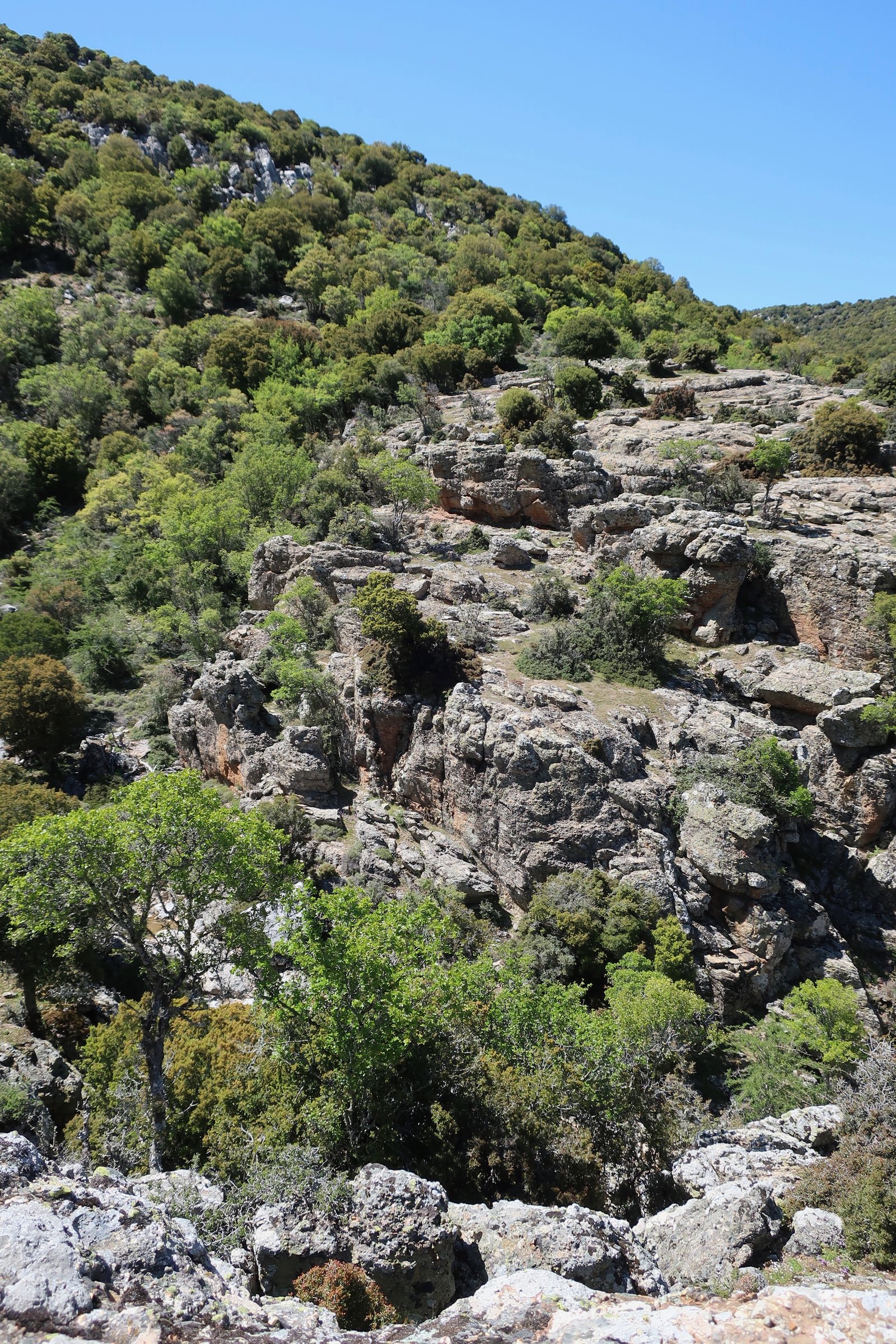
From here on, while the gorge descends quickly to the left, the path heads right, climbing a little at first, then running approximately level. Within a couple of kilometres the bed of the stream is three or four hundred metres below as you curve around the flank of the mountain, in and out of deep folds. The markings are difficult. Several times we had to go back to find the last red dot and search again. In one deep inward fold of the mountain, we went too low, then found it impossibly dangerous to cross the gully of the fold, so had to climb uncomfortably back up a steep scree-slope, stretching between larger rocks and small trees for limited solid-ground protection.
Knowing that at some point there are four hundred metres of descent before getting back to Pityous, the temptation again and again is to dive too low, too soon.
It was hardly a surprise when the red markers finally dried up completely. The terrain gets steeper, the gulleys more difficult to cross. To the north, the other side of the gorge of the Amethounda is now almost cliff-like. Kato Kardamyla is visible on the coast in the distance, with beyond it the island of Inousses, and further still Turkey. And no semblance of a path, and evening coming in.
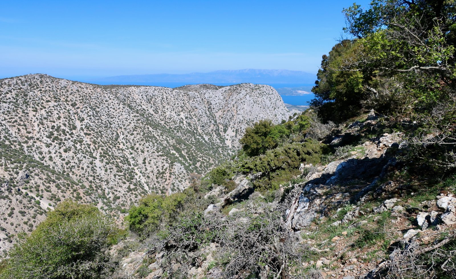
At a certain point we could see, hundreds of metres below, the end of the track we were supposed to eventually join, that would take us back to Pityous. Because it looked possible, because it looked more than possible that we would otherwise be wandering lost until dark, we took the decision to try to cut down towards the end of this lane.
The slopes are steep, with quite a lot of scree, but enough anchored small bushes and larger rocks to make the descent doable, with care. Half way down there was a postage-stamp-sized green hilltop-plateau, which from above appeared to have a promising narrow track on it. We headed for it and found nothing, just a brief pause after which the slope continued just as steep and unstable and pathless as it had been, the going just as slow, slipping and sliding between solid points.
By the time we got back to the car, three kilometres along the track just past Pityous, it was nearly eight o’clock. At the beginning of the day we had been thinking to climb Mt Oros, do this circuit at speed, then if we had enough time, from the place below Mt Oros near the three springs, to turn sharply left and take one of three possible, dotted trails back to Pityous in an anti-clockwise sweep. Almost a figure of eight on the day.
Retrospectively this was quite impossible. It’s rare we get it wrong to this extent.
Once you’re down, you do sometimes think, what would have happened if? Yvonne occasionally makes light reference to the foil blanket in her pack. We always have extra water and extra food. Our phones are always fully charged. And this is day-hiking on little Greek islands, we say, not the Himalayas.
Perhaps it would be possible to be a little more careful. Except that in continuing to do trails through relatively difficult, inhospitable terrain, there is always the very remote chance that something untoward will happen.
One thing is certain: we will get lost from time to time. It doesn’t have to be the fault of bad signing. It can be as simple as a moment of inattention and a missed turning. If you get lost, be prepared to go back. Never do anything that makes you so uncomfortable you can’t back. And, ideally, never hike on your own.
HIKE 4
We parked on the main road just outside Viki, at the bottom of the track that leads to Viki Refuge. From there to the refuge, then on the dotted trail up to Mt Pellinaio. On the way down, cross-country to the church of Aghia Eleni, back to Viki Refuge and down the track to the car.
Roughly 20 kilometres, perhaps not even.
The village of Viki sits on the wooded northern slopes of Chios at a height of about four hundred metres. From there, the top of Mt Pellinaio is a climb of nine hundred metres, with no particular difficulty but a nice change of terrain between the lower forests and the stark, grey rock of the mountain.
Not knowing if the track would be driveable all the way to Viki Refuge – it isn’t, unless you have a sturdy 4-wheel drive – we walked the three or so kilometres from where we parked the car. The first three hundred metres of altitude gain are on this track. The Refuge itself is newly-constructed – the stickers have not even been removed from the glass of the windows and doors – but appears to have been abandoned just before, or at completion. It is falling into such a state of disrepair that soon it will be beyond rescue.
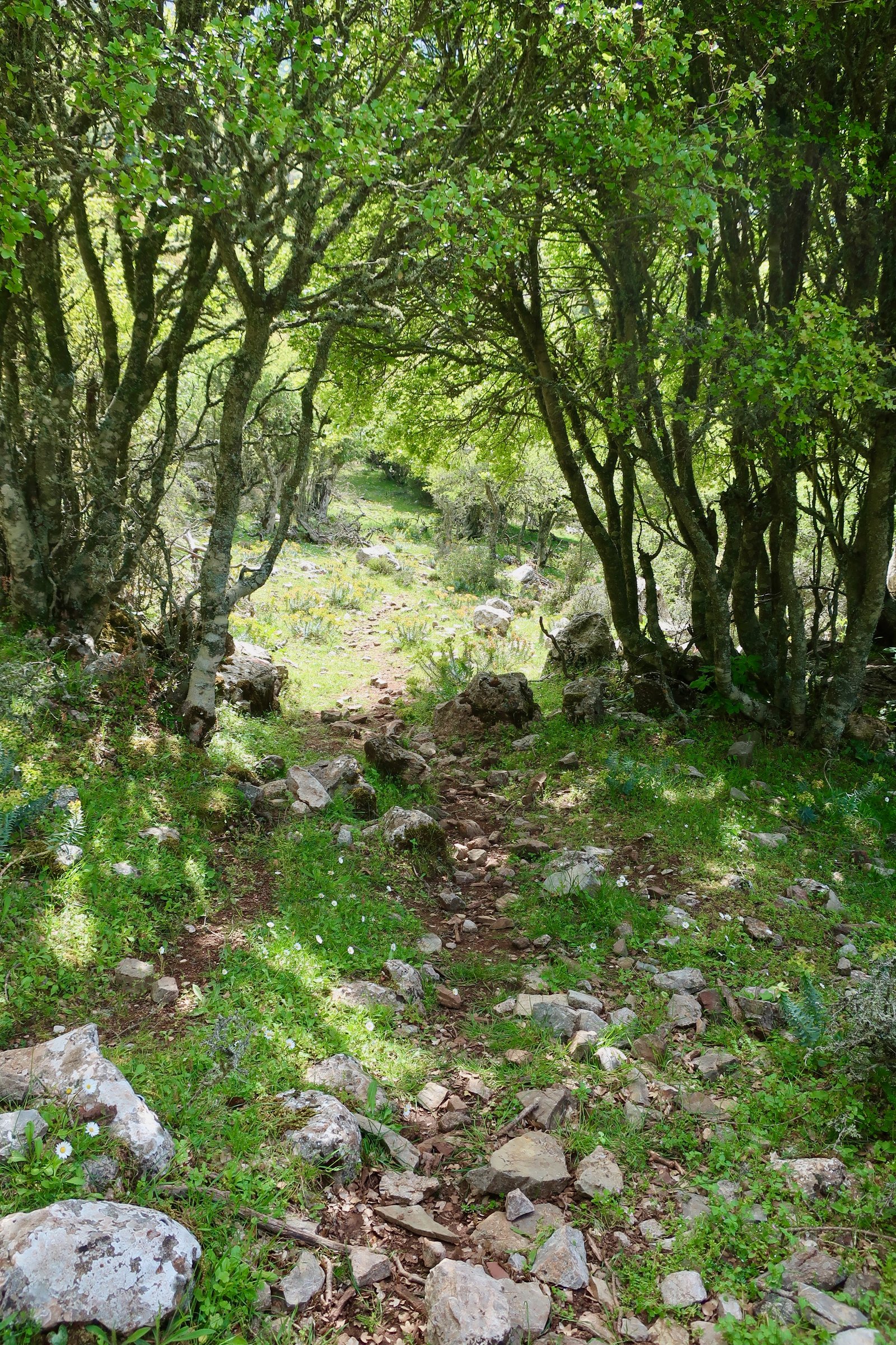
The path begins, as marked on the Terrain Map, at the corner of the road just past the refuge. There are red marks, dark green marks, pale blue marks and a mix of the three on a narrow trail that meanders through oak and poplar woods. After 1.2 kms (according to the map), there’s a point at which the path splits, with a left-hand branch going to the church of Aghia Eleni and a right-hand branch going to the summit. (In fact there are at least three alternatives.)
Just after a rock, (on the right of the main path), on which the word STRAT is written large in red, there’s a small open meadow with on the left a curved stone wall. This is the junction-point. Turn ninety degrees to the right up through the meadow for the summit, or straight on to Aghia Eleni. (Further to the right there are more, faint red dots, leading I don’t know where.)
The rest of the way is easy. The woods become thinner, the path steeper, soon giving way to the bare, grey-rock slopes of the mountain. For much of the way, the tiny, blue church of Aghia Triada, just below the summit, is visible.

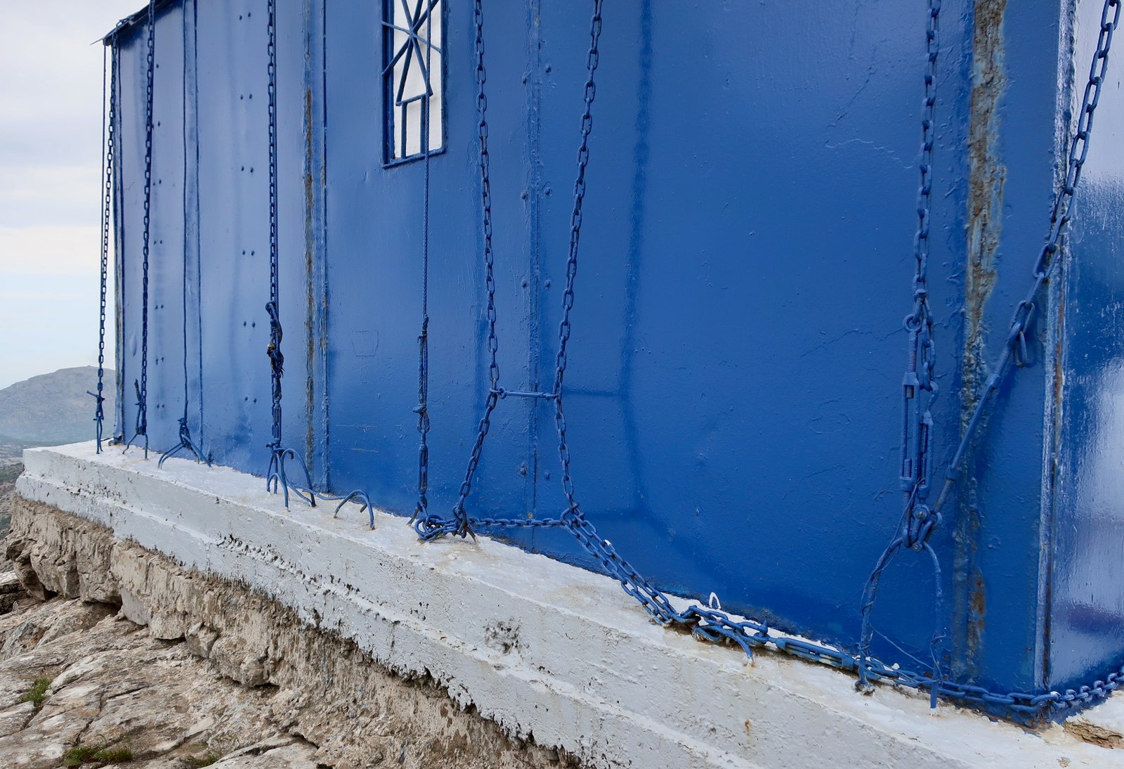
The church is a small metal box, unlike any other mountain-top church we’ve seen. It sits on a concrete pad just below the peak, where it may have been welded together, or simply airlifted in, lowered from a helicopter. I have no idea if such a thing is possible. Powerful metal chains have been tightened over the roof of the structure, tethering it to the mountain-top like Prometheus.
On the map there’s a ridge-walk to Pellinaio’s twin peak, almost the same height, two kilometres to the south. From Aghia Triada it looks straightforward. Afterwards, again according to the map, there’s a path that leads down from the second peak, and from there either back to Aghia Eleni or into the mesh of dotted routes that fan out in all directions. We didn’t have the time to go so far, and anyway after the previous day’s experience around Mt Oros, were unsure of the reliability of the paths.
Instead we followed the ridge for a short while then dived down left cross-country towards Aghia Eleni. Not far from the ridge we came across bits of faintly-marked path. In the past this was presumably a route between Aghia Triada and Aghia Eleni. Although the trail gets a little confusing, using the map and phone GPS, on which the church was marked, it wasn’t a problem.
From Aghia Eleni, a messy little mountain church, we tried to go to Amades via the church of Aghios Giorgios, but took a wrong turn and ended up on the path straight back to Viki Refuge. It’s a narrow woodland trail, with occasional red marks to follow, one of those paths it would be fun to do with enthusiastic children scouting around just ahead, playing the game of trying to find the dots.
If anywhere on this walk, either on the way up or down, you lose the red marks, you’ve gone wrong. Don’t persist. Go back, find the last red mark and look again.
OTHER HIKES
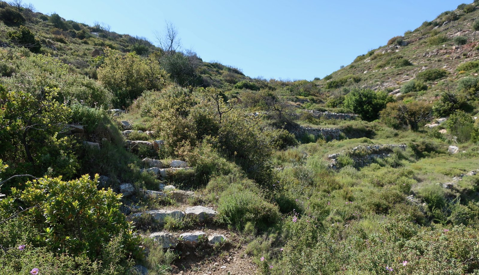
In the southwest there’s a short, sweet trail between the old mastic villages of Olympi and Mesta, about three kilometres long. On a small hilltop, the church of Agios Antonios marks the mid-point. There are some vestiges of stone pavement. Much of the way is through still-used agricultural land, olives, or groves of stumpy mastic trees with their skinny, tortuous trunks. We’ve seen mastic bushes growing wild all over the islands, but this is the only place we’ve ever seen them planted orchard-fashion.
This is a very, very gentle stroll.
***
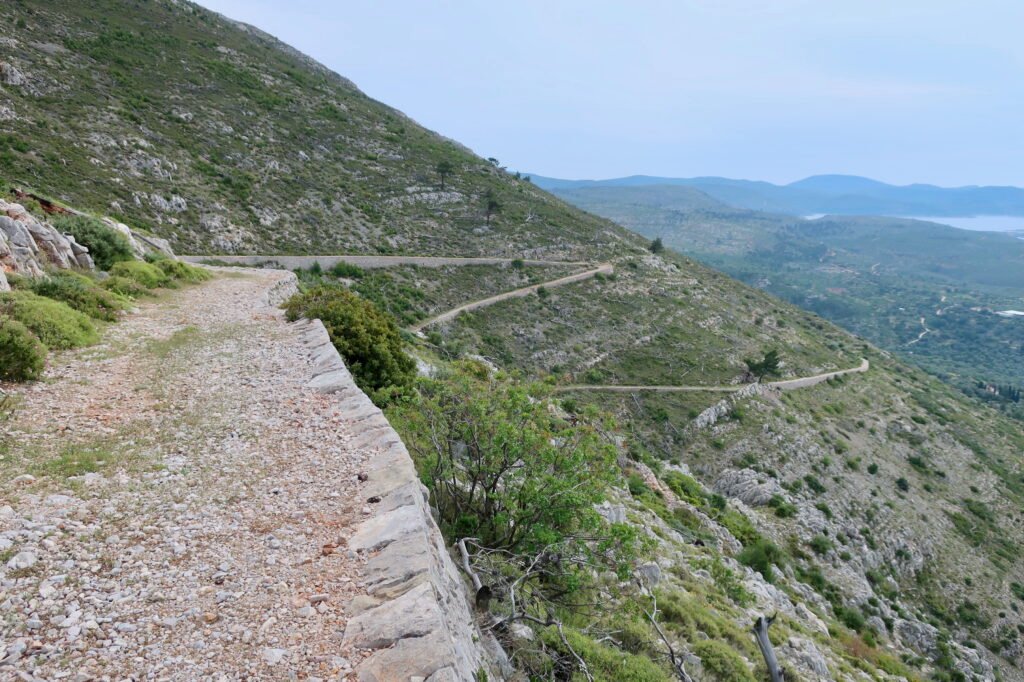
Further to the north are the remains of two extraordinary stone-paved paths. From Lithi, about halfway up the west coast, the Ottoman Trail, most of it still in excellent condition, heads inland and up into the hills for three or four kilometres.
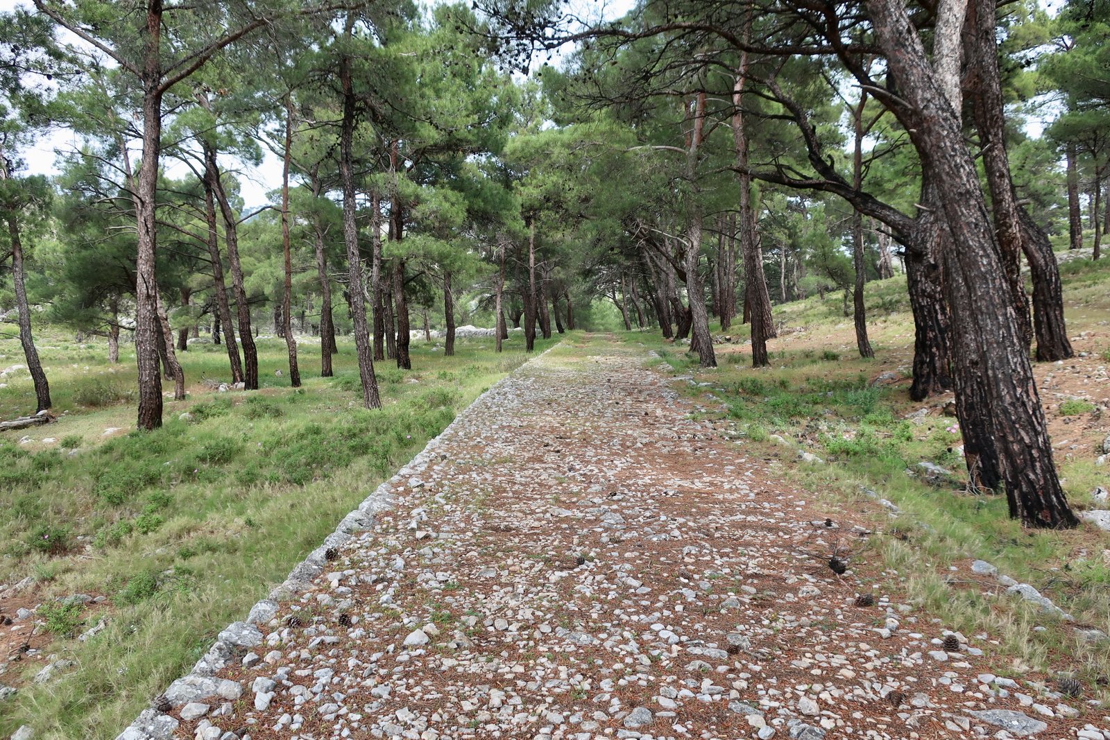
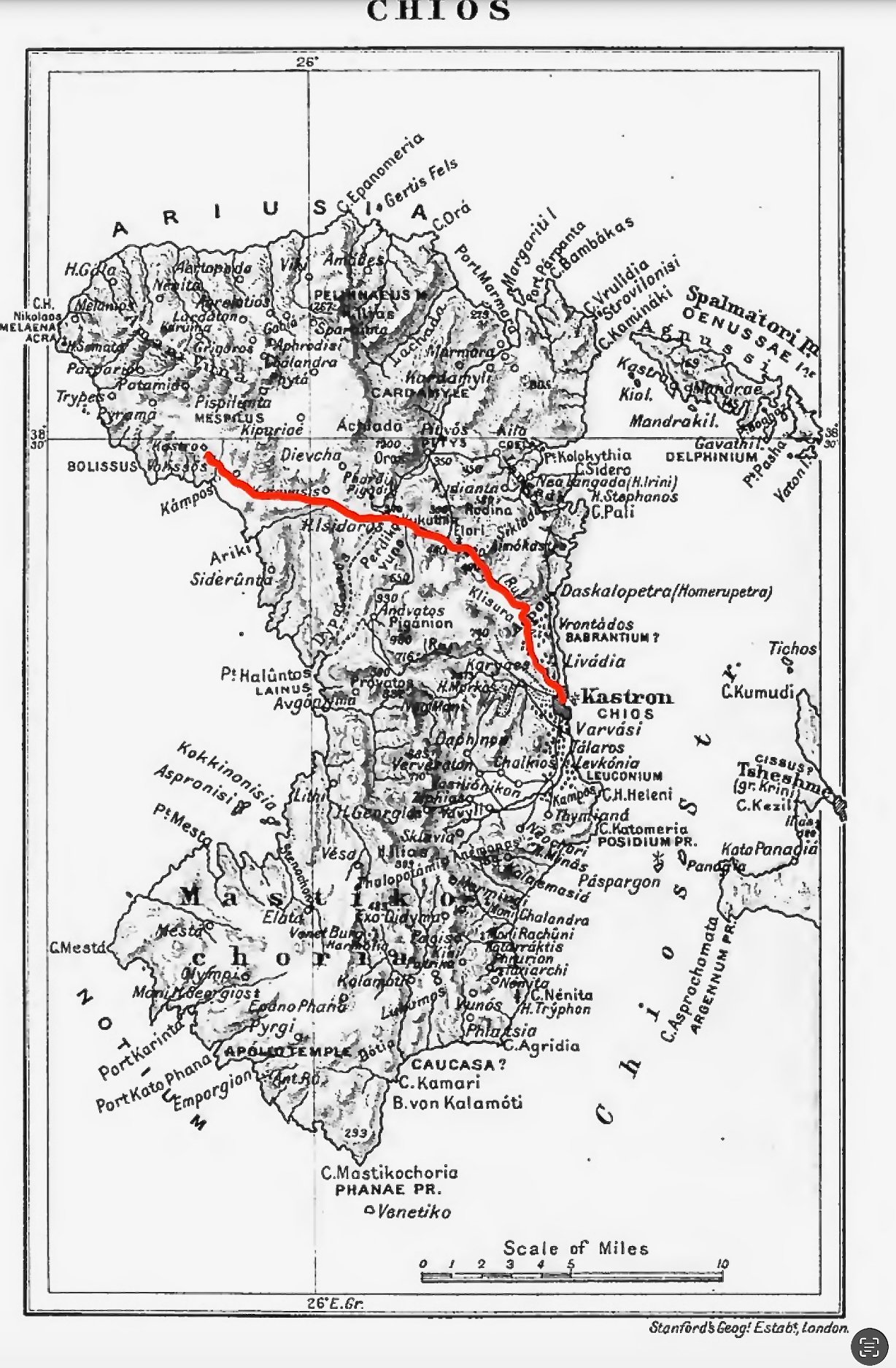
Another twenty-five kilometres to the north, the modern coastal road dives inland to join the main road from Chios Town in the east, to Volissos in the west. This road has borrowed the route of the old trans-island Ellininostrata, a great stone trail that used to cut the island in two. There are still at least six kilometres of old trail either running just alongside the new road, or, at points where the logic of motorised transport demands a slight change in route, straying a little. It was apparently in use until the middle of the 20th century. We saw at least one sign along its length, its ex-length, advertising its ex-existence.
During a very short chronological window, between the end of the old, insular, agricultural life and an awareness of its cultural and historical value, of what is being lost, wholesale destruction has been wreaked on so many paths and trails on so many islands. So much beauty, and effort, and history, snuffed out almost overnight.
Both of these stone roads, the Ottoman Trail and the Ellininostrata are unlike almost anything else we’ve seen in the islands. On some islands there are wide, old stone trails, but in comparison they’re more artisanal. The stone highway that sweeps down into the Chora on Andros for example, or sections of the rim-path on Santorini, that runs for ten kilometres between Thera and Oia. Or on Naxos the path into Apeiranthos from the ninth century church of Agia Kyriaki. Even some small-island paths such as the trail on Sikinos that drops into Pano Chorio from Agia Paraskevi, widening as it comes into the village, becoming a true stone highway. There are other examples. Tinos perhaps. Sifnos too.

But the only other roads that spring immediately to mind when thinking of these two on Chios, are the donkey-trail in the northwest of Corfu and the stone trails on Lesbos, between monasteries in the middle of the island, but also through the olive groves around Agiasos. All these roads are the high-point, in scale, of the road-builder’s art in the old Greek islands. It’s hard to comprehend the effort involved in their construction in a pre-mechanical world.
***
There are very many more paths on the Terrain map, and probably others on Chios not yet traced. How to deal with them, how to preserve them from loss, make them available without changing their character irrevocably, is the same challenge faced, to a greater or lesser degree on all the islands.