
If someone asks us which island is best for hiking, we tend to hesitate before answering that there’s no such thing. There are too many parameters to consider:
– for whom, and in what season?
– long hikes or short hikes?
– experienced hikers or novices?
– sport hiking, adventure hiking, or something less physical?
– a large island, or one of the smaller ones?
– organised paths with clear marks or semi-orienteering through Mediterranean wilderness?
– and for how long: will it be two days? two weeks?
And should we consider other criteria beyond the hiking itself? Because that would change everything. Is it even possible to consider the hiking without taking into account everything else?
If however the question is more precisely: For someone who’s never been hiking in the islands, where should they begin? that’s another matter. In that case, like a compass needle moving to magnetic north, we swing towards Sifnos and Andros. The classics, as a young Frenchman we met, called them. We too think of them as a pair, Andros the larger version. Without the specificity of hiking, others might not see the connection at all.
Sifnos, roughly in the centre of the Cyclades approximately equidistant between Serifos, Kimolos and Antiparos, has almost everything: one of the best, best-organised networks of stone-paved hiking trails anywhere in the islands; prototypical Cycladic architecture and settlements; beautiful ports; historic sites; no mass tourism; many lovely sheltered bays and beaches; wilderness, abandoned settlements, abandoned terraces, the echoes of thousands of years of continuous settlement and the attendant melancholy of loss; heat; style – nowadays, for those who want it, Sifnos even has style; and a wealth of monasteries and churches – they claim to have as many churches as there are days in the year.
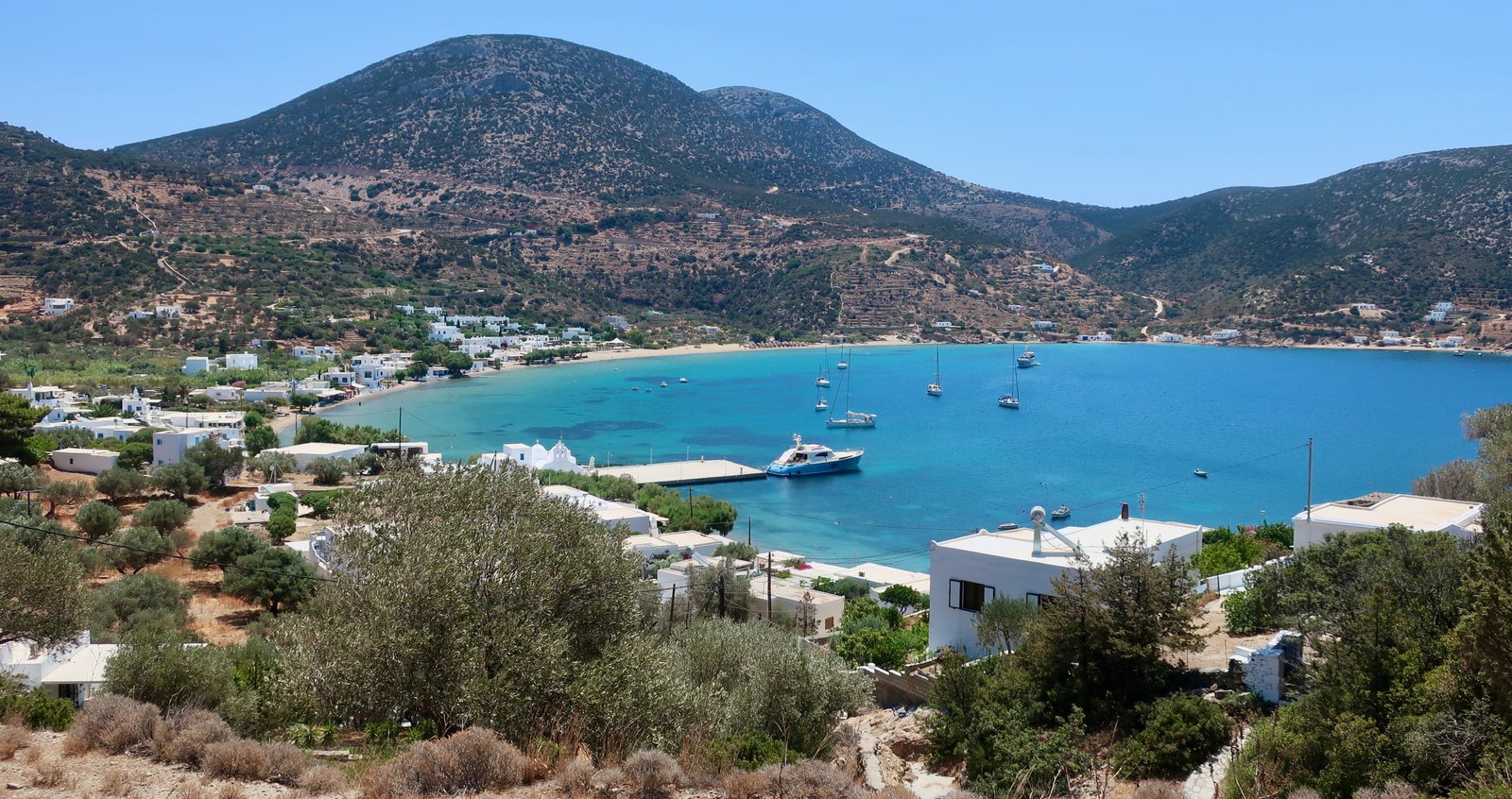
The following photo, one of a number of candidates for general title picture for this site, was taken overlooking Faros in the southeast of the island.

It doesn’t take much: a few simple white buildings; a handful of fishing boats; those white blocks of monastery or church on the promontories; the water, patches of turquoise and dark blue; three yachts motoring in. The ingredients are commonplace, their disposition here is fortuitous.
And even then, it is the paved path in the foreground that imposes itself, the dusty stones carrying with them an impression of slowness, of intentional arrival. The old paths were systems of movement, the connective tissue that gave the islands coherence. They existed in a landscape that was fully inhabited. The port of Faros, lovely as it is, is a paradigm of the modern islands, in which spaces are selectively used. Islands within islands.
The photo is an image of a world in transition, the old and the new for now existing side by side.
Faros used to be the main port before the ferries moved to Kamares. There are three or four tavernas now, a café or two, a minimarket, and beaches left and right, both more or less always sheltered from the prevailing winds. The swimming, for those who evaluate different swim-spots in the islands, is top quality. The double prong of Faros bay itself, then Fassolou beach and bay to the left, Chrysopigi to the right. If you swim them all, in the morning before breakfast, in the late afternoon when others are moving slowly through the lull between beach and evening, you will have done close to three kilometres, some of it along rocky shorelines where the fish hang out, some of it like flying through swirling dark blue glass across the mouths of the bays. If the distance seems excessive, it can be done in stages, stop and start, and how pumping and fine you feel, gliding up onto the beach at the end.
In the photo’s far right-hand distance is Chrysopigi monastery, squat on its headland on the other side of Chrysopigi bay. You have to cross a tiny bridge to get to it. It’s as harmonious in its way as any monastery in the islands.
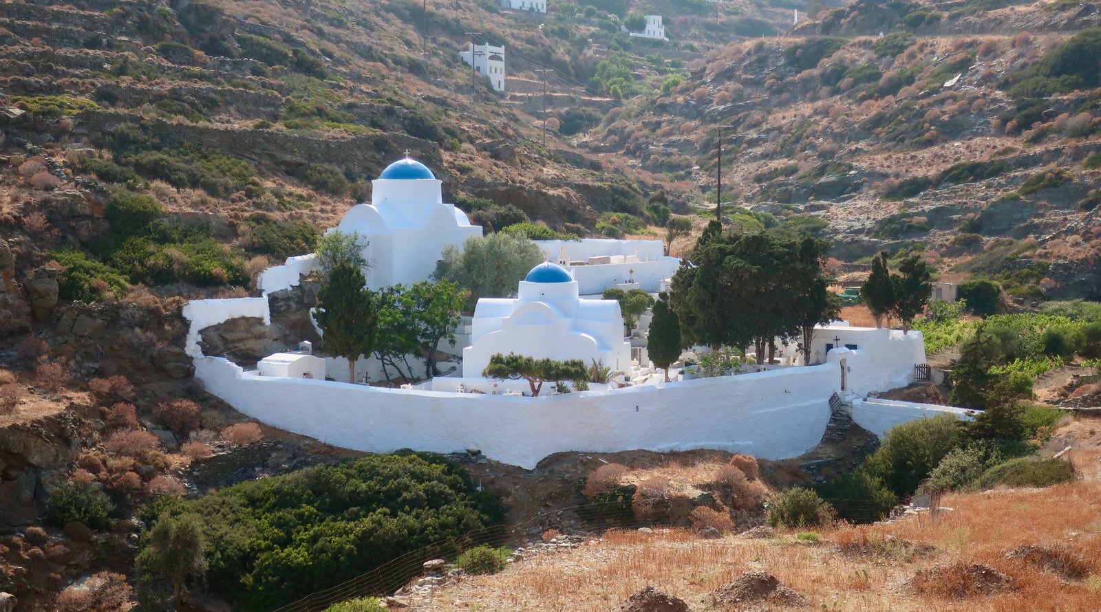
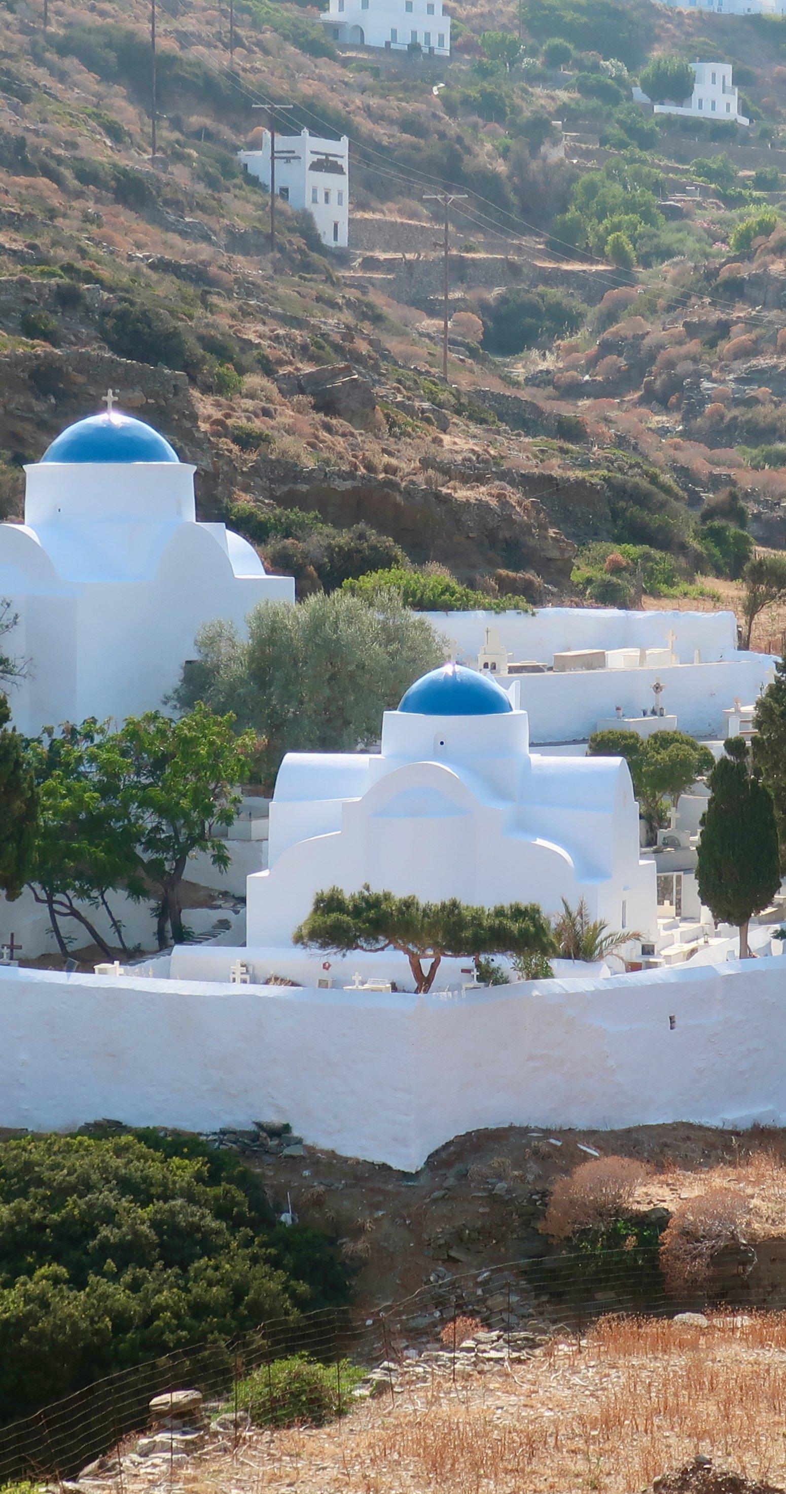
Scattered across the island there are other monasteries, different in style but all compelling, and the hundreds of churches.
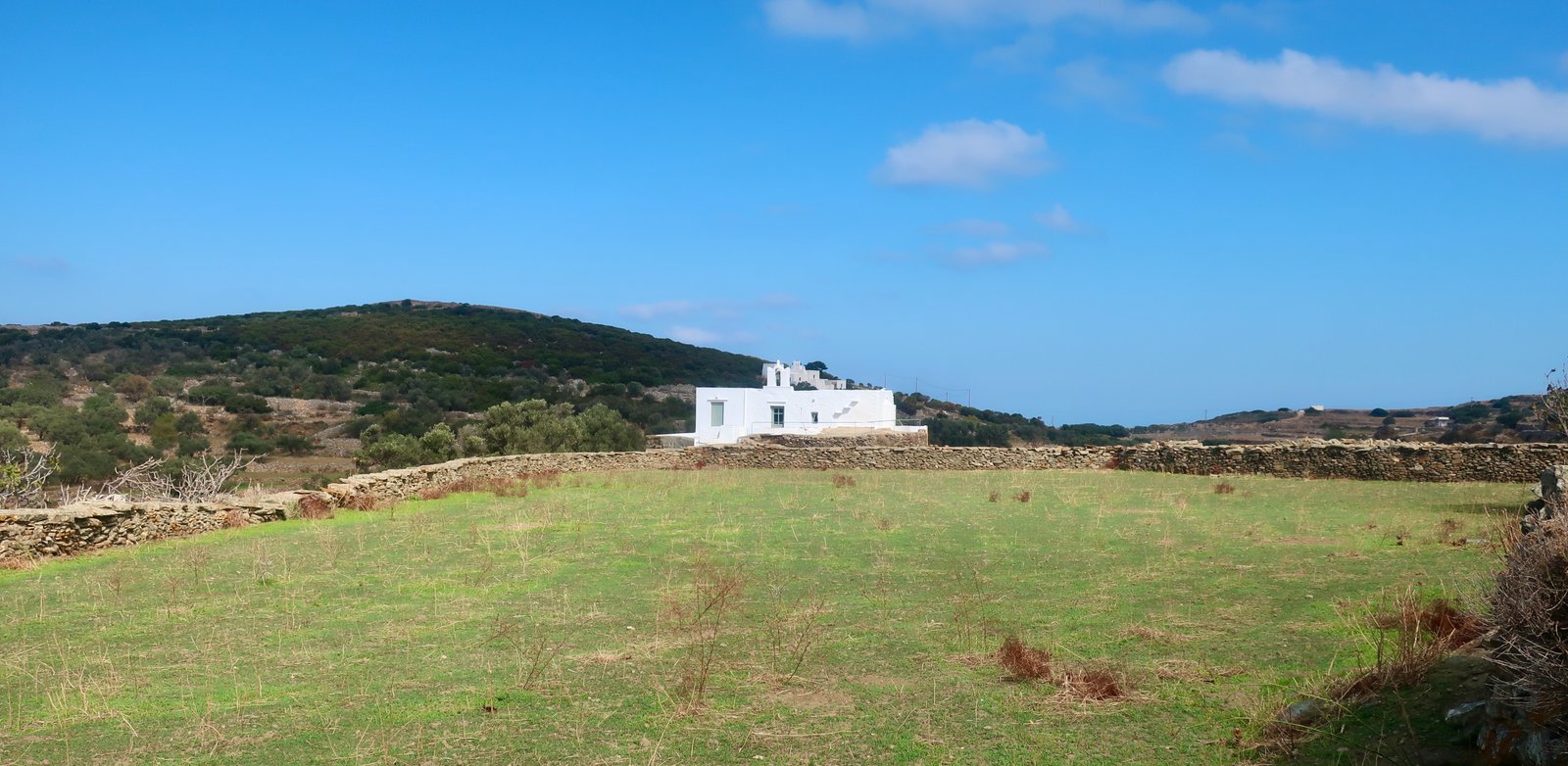


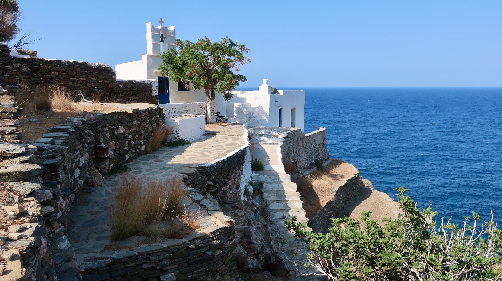
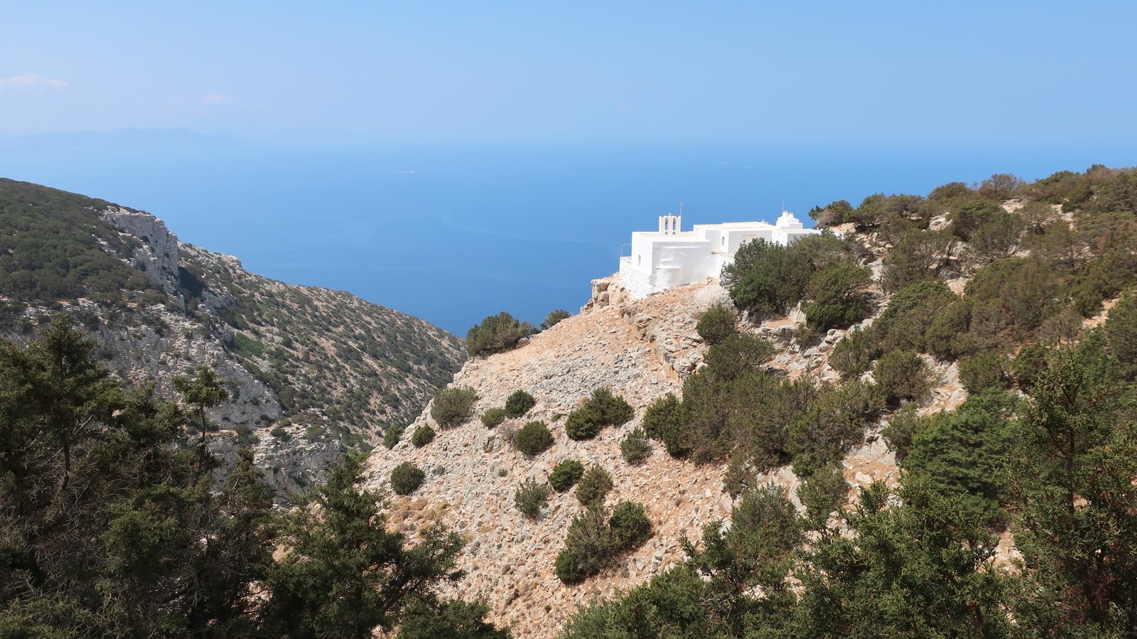
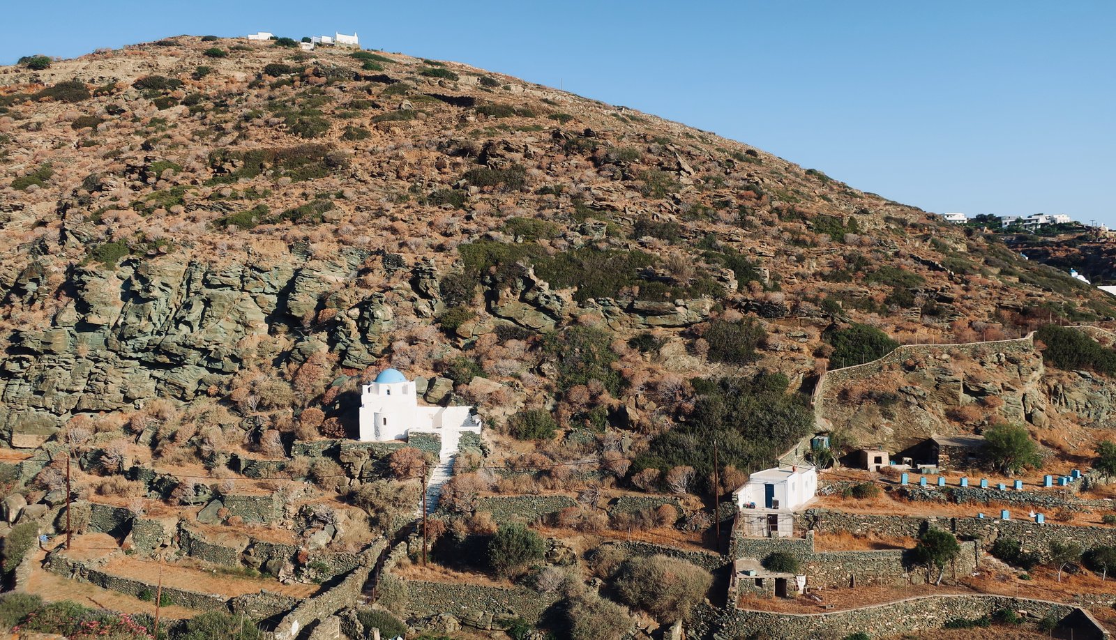
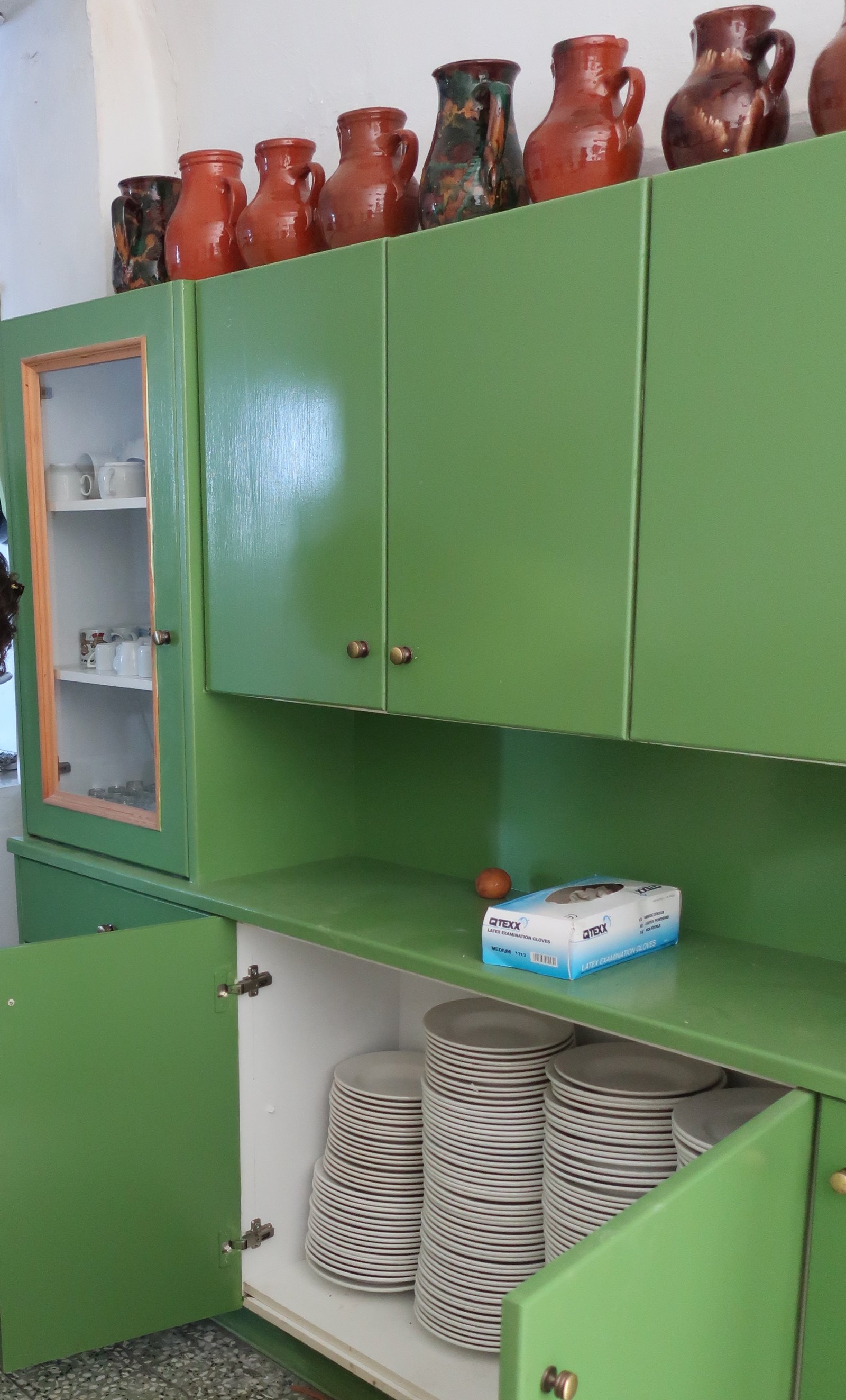
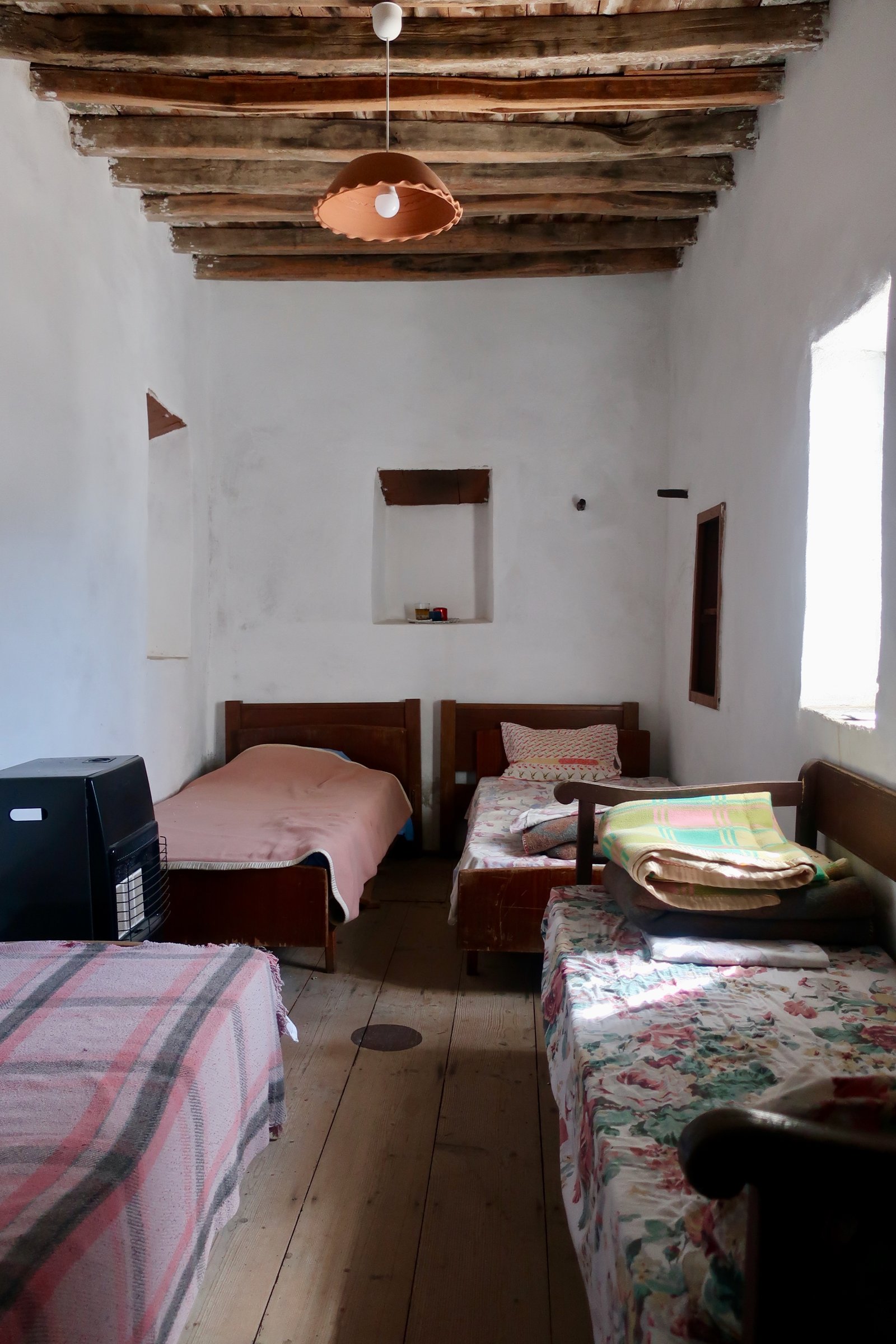
Some of them have been integrated into the hiking setup. They have annexes, with rustic kitchens, water, oil for cooking and gas rings or burners. Some have basic food supplies, some have refectory tables. Some even have beds for visitors who want to sleep in an out of the way place and wake up next morning in a raw world. There’s nothing else like it in the islands, this most extreme open-door hospitality. Sometimes on Sifnos we’ve opened cupboards to find wine or beer, and even small piles of money, voluntarily left to pay for what has been used.

***
We’ve been to Sifnos four times. Once in mid-June, once in August, once at the beginning and once at the end of October. The first time we stayed in the Kastro, built on a steep-sided hilltop overlooking the coast. It has been occupied continuously for more than three thousand years. Vestiges – columns, huge rectangular stones – have been used in the construction of later buildings. They show up in walls, jumbled heaps of stones, underfoot. There are sarcophagi in the streets.
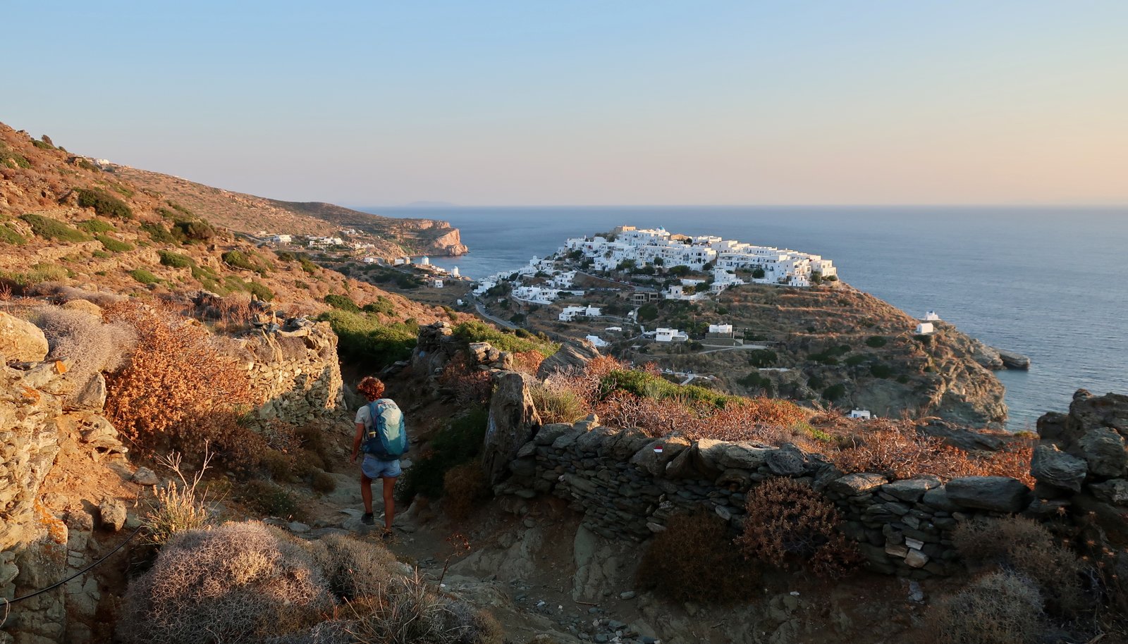
For most of its history the Kastro was the capital of the island. There’s still a medieval centre, several tight streets as beautiful and unlikely as a film set. The walls of the houses make a defensive circuit, the only way in through the old gates.
In mid-June one café was open, one bar. On a street in the medieval heart there was a tiny minimarket, a relic of the past that one day soon will cease to exist in its current form. On our first night we went there for supplies. Four elderly people were inside, drinking tea, eating cake, gossiping. There were no prices on anything. Having chosen toothpaste from an almost-bare shelf, we had to wait while the item was looked for in an old notebook, pages and pages of prices jotted in pencil.
On a rock jutting out into the sea is the tiny blue-domed Church of the Seven Martyrs, one of the most photographed spots on Sifnos. Just around the corner is the old port of Seralia, with a short pebble beach and a couple of unfashionable fish restaurants. It’s still the sixties or seventies down there. We had dinner one night and got speaking to a retired French couple who were travelling around the Cyclades in a 6-metre zodiac, belting at full throttle between islands when the sea was flat. They mostly slept on board under an awning, cooked on board, washed on board, and just occasionally spent a night of respite in a studio somewhere. Such intrepidity.
On the second visit we stayed in Exambela, just along the road from Apollonia in the centre of the island. Apollonia-Artemonas, which run into each other, together make the modern capital of Sifnos where most people live. With Exambela, Katavati and Kato Petali, they form a stretched-out cluster of villages, really just one place. Vehicles skirt around the outside, cut across the middle, but don’t intrude within where it’s all narrow, stepped alleys, small squares, churches. During the short summer season Apollonia is a little glamorous, it’s spinal main street lined with terraces and shops. And then pouf, September comes and it reverts to its customary sleepy state.
We were in Faros for the second half of August and swam our hearts out. We tend either to avoid completely the high season or hide away. But this two weeks in Faros was different, something we’d been talking about since the first time we came over the hill and saw it there. No hiking, we said, it’ll be too hot – but then of course we couldn’t resist and went out several days at dawn. The rest of the time we sat reading on our little terrace, drinking home-made cocktails or local white wine from plastic bottles, as cold as our stuttering fridge could keep it in the sultry, airless evenings. And we swam. All those expeditions around the bays. Just once or twice it was as good as swimming can be, when you zone in or zone out and become liquid, gliding through a parallel world. One day I paused halfway along the western length of the main bay to see sirens sitting on a rock underneath the old mine workings. Two adult women and four teenage girls, all at different levels on the rock at eight o’clock in the morning, staring at me in silence as if I was the sea-creature. Half an hour later I saw them stroking ever so slowly back towards the beach, heads out of the water like turtles up for breath, three or four of them in sunglasses, the women in wide-brimmed hats, stately, unconcerned and mythical.
At the end of the day, from the small beach just underneath our terrace, would come the sound of childrens’ voices. Always the last to leave. Unwilling to relinquish even a moment of this until absolutely necessary.
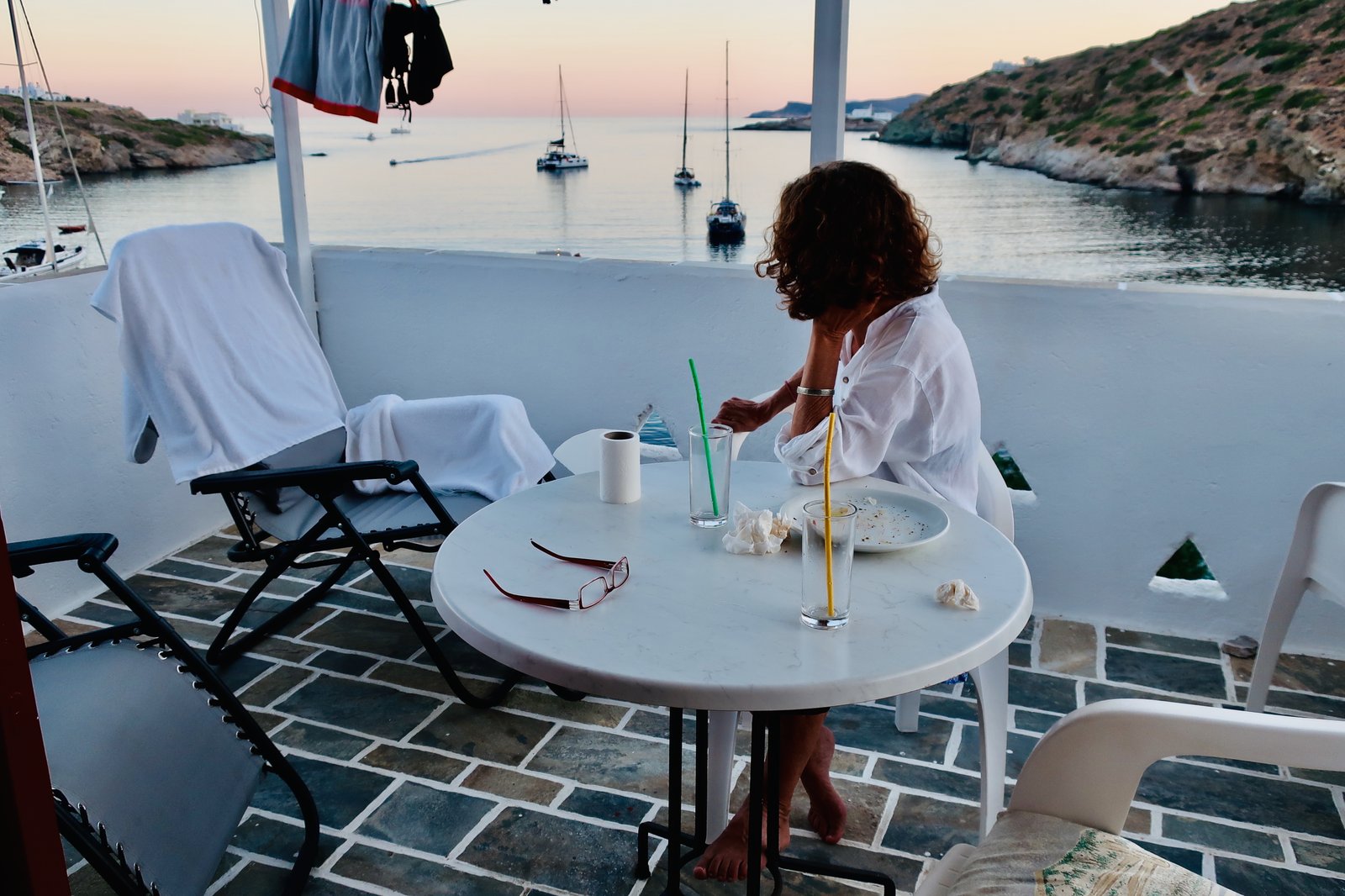
Lastly we stayed in Platis Gialos in early October. Knowing it was the most popular spot on Sifnos, we had at first thought, we don’t want to stay in a resort.
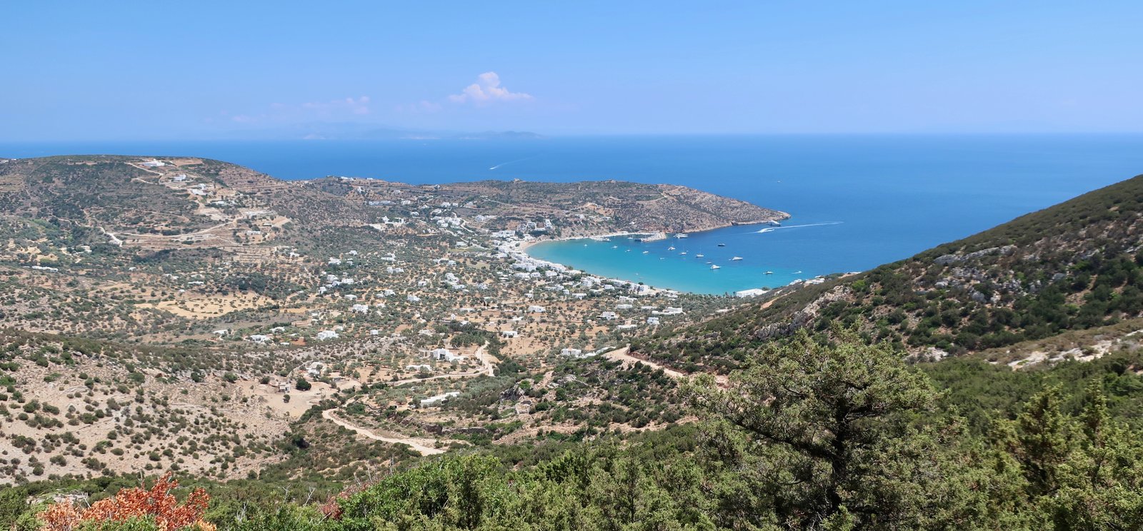
One road, that ends at the end of Platis Gialos, where the bus does a u-turn. One thin line of low buildings on the beach between the road and the water. A smattering of buildings on the other side of the road. A resort. When we were there a couple of tavernas were open, a couple of bars or cafes. Warm water, warm days, seven hundred metres of beach shared between, what, twenty or thirty people? On other trips with friends or family, mid-hike we’ve several times eaten lunch on the low sea-wall at the far end of the beach, in front of Hotel Sifnos, built in the 1960s, still functioning, a throwback to the early days of shiny holiday brochures, the beginnings of Cycladic tourism.
HIKING
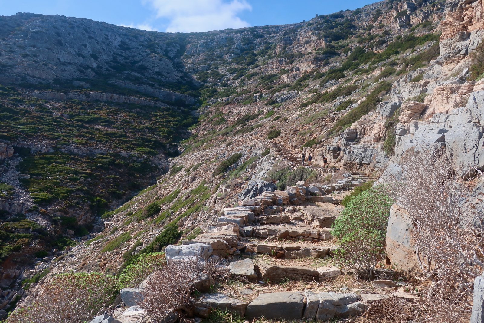
The trails on Sifnos are well-signed and cover most of the island. Very many of them are stone-laid. The https://sifnostrails.com/ website has comprehensive details, complete with photos, distances, altitude gain, degree of difficulty and estimated time. You could get the map and sit at home on a cold, rainy February afternoon, planning day by day. It can all be downloaded to your phone, even if, while useful for planning or reference, none of it’s necessary for navigation. The paths are so good, so clear, all you need is a map. We used the Anavasi version. No doubt the Terrain Map is the same.
Sifnos doesn’t have the altitude of some of the larger islands, nor quite the thrill of Kalymnos, for example – no heart-pumping cliff passages – nor the size of Andros, the closest to Sifnos in terms of hiking organisation. But numbered routes anyway are often just a trail-maker’s idea of convenient stopping and starting points, a logical way to divide up and classify pre-existing paths. Trail-lengths can be adjusted by skipping from one numbered trail to another, imagining one-way or circular paths of whatever length might suit.
Sifnos is small enough that you can walk from one end to the other in a day, rich enough in trails that even if you walked every day it would be difficult to do them all in a two-week visit. And it’s still hilly enough to be challenging – while the high point is just under seven hundred metres, much of it is over four. Up and down you go, beach to hilltop to plateau and down again.
For maximum convenience, Apollonia-Artemonas is probably the place to stay. From there, without having to use the buses, all the trails can be done. But public transport is so good it doesn’t matter too much where you are. From a base in Faros, one day we walked the length of the island, and bussed back. Another day we did a great loop, taking in the Kastro, Apollonia, Toso Nero in the wild west, Vathi and Platys Gialos. It’s up to you. Everything is worth doing. Everywhere is worth going. It’s all extraordinary.
PROFITIS ILIAS

Lording it over a desert of grey rock, there’s a monastery-fortress on top of Profitis Ilias (682m), the summit of the island. Like so many Greek churches and monasteries built in extreme locations, it seems as much as anything a construct of defiance against the weather. Go in summer when the sun’s shining and after you’ve explored the compound, the underground kitchen, the refectory with its long table under stone arches where the monks used to eat, you can wander over the rooves of the outbuildings and take in the whole island and, further, ten or fifteen or twenty islands trailing off into the blue distance. Despite the bleakness of the setting it seems almost benevolent. Go back when the wind’s screaming, rain driving across the mountain ridge, or when grey clouds have blotted out all but a few metres of rock in all directions, and everything is different. It’s a place beyond, out of the world. Aeolus, the ruler of the winds in Greek mythology, might live in a stronghold like this.
It’s not inhabited now, but when it was the monks used to abandon it every winter to live temporarily in one of the lower monasteries, like transhumance farmers. There’s nothing up there to sustain life. Around most monasteries, even remote ones in dramatic settings, gardens have been created, transforming them into small Edens, so that there seems a psychological contradiction between the rigour of withdrawal and the creation of these places of abundance. Not here. There’s no possibility of garden in this wilderness. All food, all supplies, had to be dragged up the mountain. There must have been a constant coming and going.
There are two paths up. One, the highway, Trail 6B, comes from the heartland, from Apollonia and Artemonas and their satellite villages. On feast-days a stream of people would have come, on foot, on donkey-back. Parts of it have been newly flat-paved now, making it more accessible to casual strollers, although the top section is unchanged, rock steps that seem one with the mountain. Some summer visitors to Sifnos come up here in the early morning. Others for the sunset.
The other way is a secret path up the back, short and steep and much less well-defined. It begins on a plateau to the west of the peak, a goat and sheep farm where the animals have turned the land into a grey-brown wilderness; they’ve eaten everything, leaving behind only their stink of occupation. The last time we were on Sifnos we took this path, although it’s barely a path, rather a direction roughly marked by splodges of paint and arrows. Halfway up we caught the unmistakeable smell of death, looked around and saw a large donkey, sprawled just below us on its side with one back leg sticking impossibly straight up into the air. The carcass was swollen, ready to pop. Strewn over the slopes all around it were thousands and thousands of thin, yellow candles. When the donkey slipped and fell no-one bothered to gather them, leaving this evidence like a resumé of the way it’s always been.
THE SOUTHEAST
Trails 1, 1A, 2, 3A
There’s a network of paths in the wide southeast linking Artemonas and Apollonia, the Kastro, Faros, Chrysopigi and Platis Gialos. This is the softest part of Sifnos, where agriculture was most intensive and most of the population must have lived for most of history. The land is gentle and fertile and terraced and the paths, most of them stone-laid still, built to last forever, are sometimes like country walking paths, on which one might meet a vicar with a walking stick on a constitutional. One early morning out and about we saw in a small scoop of valley several men sitting for a break on the edge of a shorn, stubbly, orange-lit field. All around them were olive groves. It seemed an exact picture of how life must have been for the last two or three thousand years. The centrality of old-fashioned agriculture has been so suddenly and completely replaced that images like this are rare.
One end of Trail 1 goes from Exambela to the Kastro on old stone, the other from Artemonas to the Kastro on stone at least as far as the small monastery of Panagia Poulati, another church seemingly constructed principally of sun and shade.
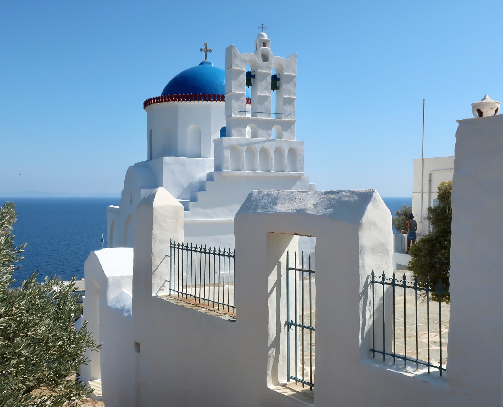
Heading towards the Kastro, soon after Panagia Poulati Trail 1 becomes a narrow dirt strip. Looking along the coast from this side the logic of the classical settlement, sitting defensively on its egg-like hill, becomes clear. From some points the rock it’s on can look almost like an island, one of those rounded humps that seem made for impregnably commanding the coast.
Trail 2 between the Kastro and Faros is a thing of beauty, most of it paved, running through ancient terraces, rising from sea level up to 200 metres then back down again. Coming over the hill down into Faros is one of those island views that can make you swell with sheer pleasure, a sort of fizz of happiness. The path is beautifully done, the paving stones wander back and forth, as if poured there flat on the surface of the slope. In some other sections of this path the style is different, paved with stone just the same but then lined both sides with walls of sheltering stone, like ancient toboggan runs.
From Faros Trail 2 continues on around the coast to Chrysopigi beach. The stone footpath that hugs the coast has been renovated for tourists but is still lovely. In season an on-off flow of people in swimming costumes use it. In style it’s very similar to the path on Alonissos between Agios Petros and Steni Vala.
From the back of Chrysopigi beach Trail 3A shoots out of a track overhung by fig trees, flows into a mostly stone-paved network of paths and heads back to Apollonia, or Exambela, or a diversion can be taken onto the tail-end of Trail 1 up to Agios Andreas, a hilltop where once, more than three thousand years ago, there was a Mycenaean fortress. The whole shape of the settlement still exists, the circular external defensive wall and a complete urban imprint of houses, roads, and temples. Its full extent is clearly visible in aerial photos.
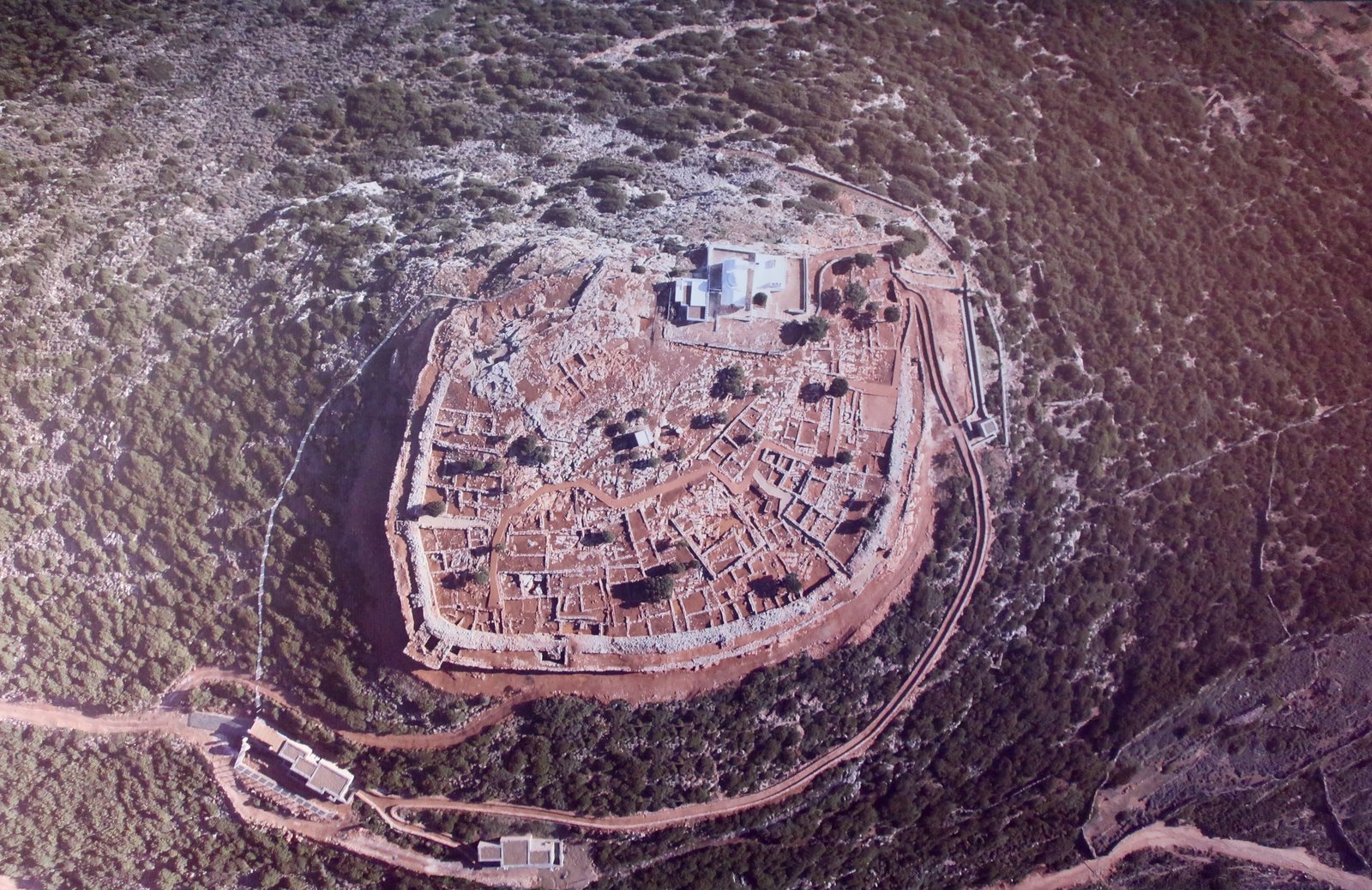
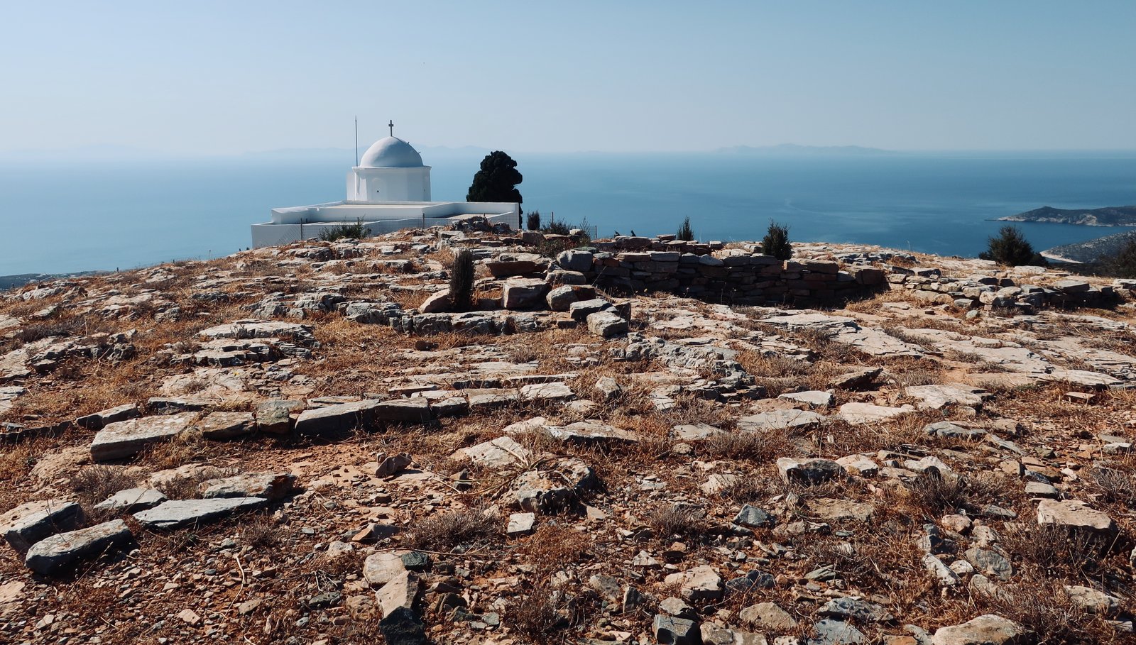
After Agios Andreas a linking-path, Trail 1A, continues through dark green hills, with more white churches among the pine and juniper. It curls around to join the bottom of the main Trail leading up to Profitis Ilias.
Alternatively, Trail 3 from Platis Gialos, also largely paved, joins up with Trail 3A just south of the Panagia Vrysis monastery, then loops around the east of Exambela to finish at the junction-point between Apollonia and Artemonas, where there are cafes and bakeries and bars.
THE SOUTHWEST
Trails 4, 4A
Trail 4 heads south out of Platis Gialos, then southwest roughly along the coast. Although it never gets to any height, it feels like a mountain path – the surprise of suddenly finding yourself walking through thick juniper and pine. Sometimes the surface is loose stone, sometimes the angled rock of the hill itself, not laid but scraped bare, a found path instead of a built one. The route skirts above a succession of small rocky bays that almost no-one ever visits. The first time we took this path we overtook an elderly French couple. We heard her before we saw them, she was singing as she walked. When we went past she looked up and smiled: Vous faites la course? she said, continuing to hum, twinkling.
Fikiada Bay is deep and narrow. There are no roads in. Access is either on foot or by boat, although a boat isn’t straightforward – even if you could find someone it’s five kilometres or so from Platis Gialos one side, Vathy the other. There are two beaches, one wide and open, the other just around the corner, squeezed between rocks. On one side of the bay is the glorious little white church of Agios Georgios, right on the water.
We’ve been several times to Fikiada and have sometimes had it to ourselves, sometimes had to share it with one yacht, or with two or three other people, hikers like us.
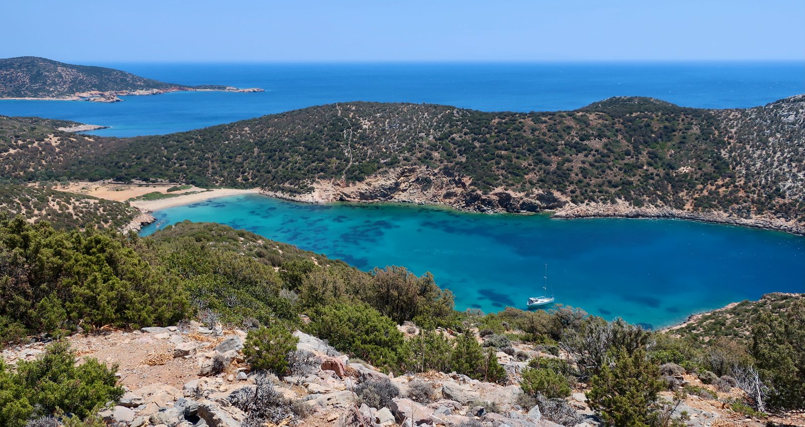
From there the trail goes steeply uphill towards Vathy. It rises to no more than 300 metres but again feels like a mountain path. At the end there’s a short mess of road and trail down to Vathy, for which the expression horseshoe bay might have been coined, it’s so perfect.
From Vathy, Trail 4 cuts its circular way back to Platis Gialos by more direct route, avoiding Fikiada, or Trail 5 goes the long way to Apollonia. And there’s the bus, even if hours are irregular, back to the central bus station in Artemonas.
THE TRAIL OF THE MINES
Trail 8
Trail 8, the Trail of the Mines, leads from Artemonas to the church of Agios Sostis, a little more than halfway up the east coast. The first section is an easy wander through the narrow lanes of the village. Then it’s a dirt path with views out over the east coast. And finally, the last section is an iron-hard stone path cut into the barren slopes of the hill. In the past there were silver and lead mines here. The path was made by miners, for miners. There’s nothing quaint or sweet about it. It’s fierce.
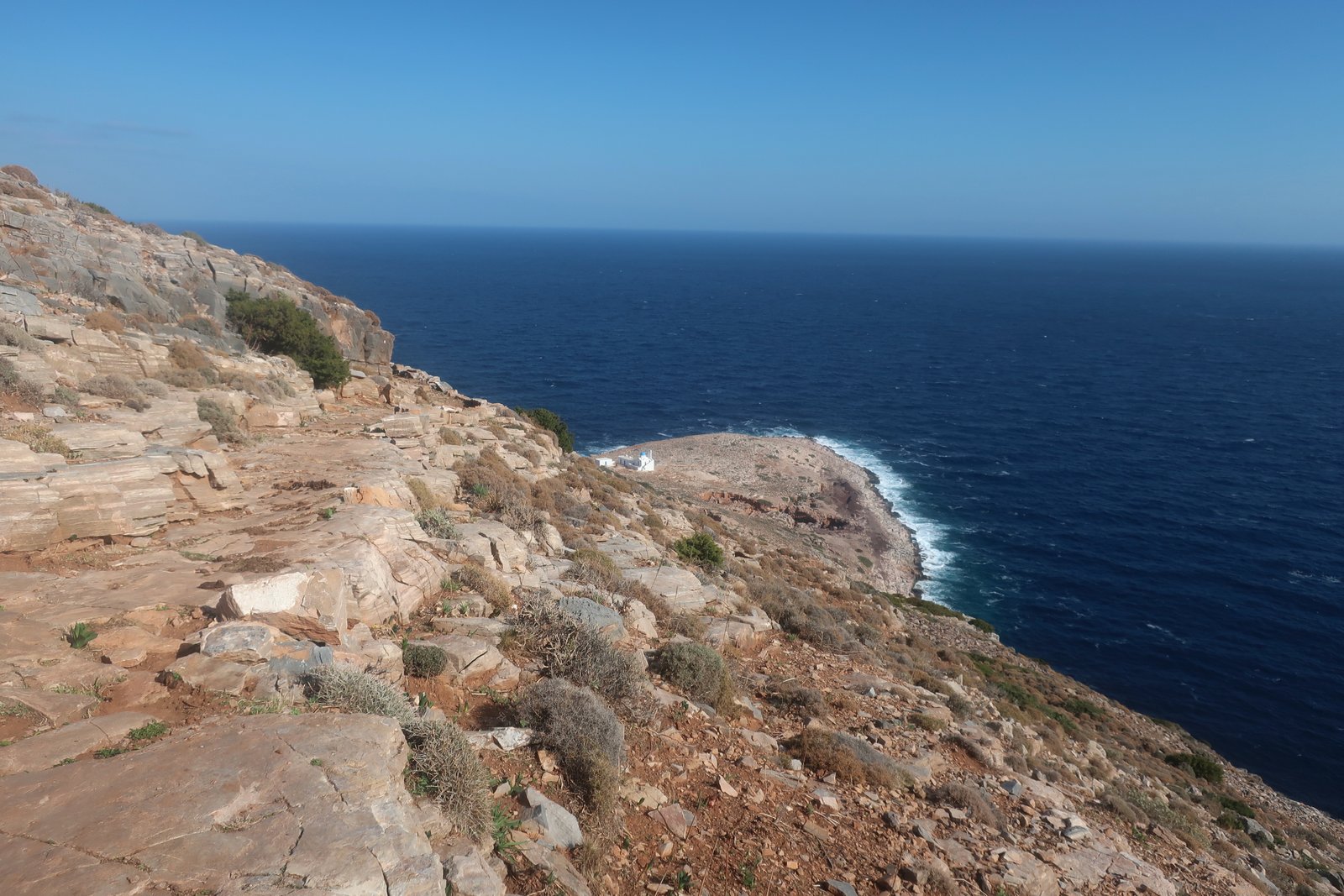
It descends towards a flat, almost circular promontory. There are still gaping holes, with lips to stay clear of. Agios Sostis church sits all on its own in the middle. Just the church on the rock, utterly incongruous. Even if we get used to seeing these desolate places, there’s still a jolt.
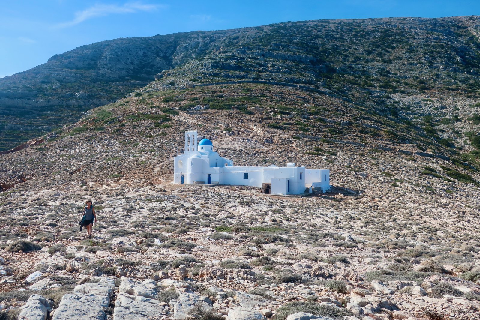
There are supplies down there for making hot drinks or a basic dinner, and also a small dormitory-room. You can sleep there with the wind thumping outside and waves swarming up over the rocks.
CENTRE WEST
Artemonas – Agios Symeon – Profitis Ilias Troulakiou on Trail 7
Kamares to Profitis Ilias Troulakiou, unmarked
Kamares, the ferry port, sits at the head of a deep bay with headlands on both sides climbing to nearly 500 metres. There’s a wide beach and some tourist accommodation. Because everyone has to pass through, on and off the island, much of it stays open even out of season.
On the northern side of the bay the ridge makes a hard, looping line of inverse scallops. The monasteries of Profitis Ilias and Agios Symeon sit on this edge, from below barely visible, tiny white dabs.
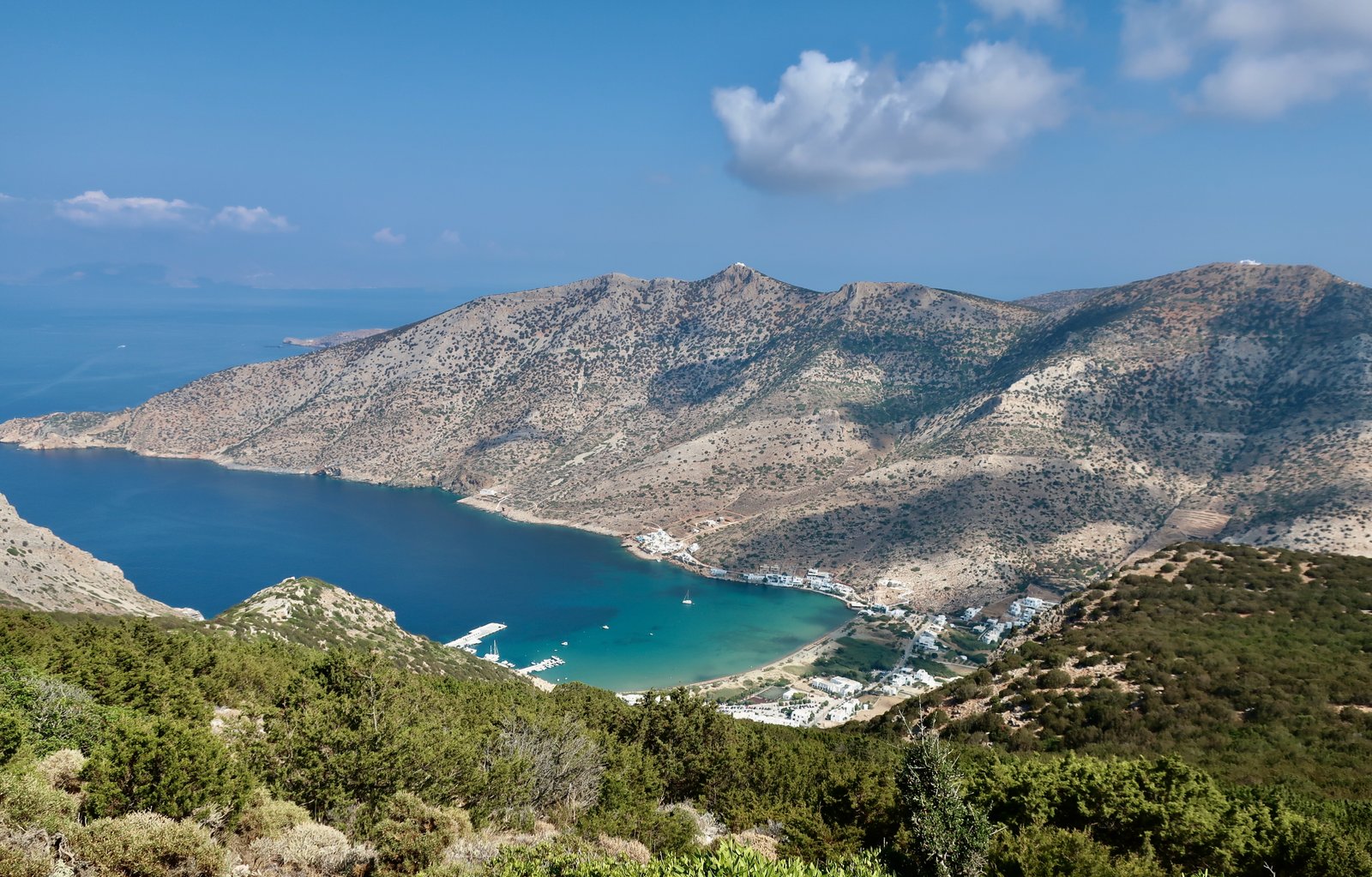
The view from up there, from either building, over Kamares and the bay is spectacular.

Trail 7 leads from Artemonas through rich farmland all the way up to Agios Symeon. There are vines and olives over the terraces and a couple of wonderful sections of stone staircase.
But there’s another path, not on the main network but faintly marked on the map, that leads down from Profitis Ilias to Cape Kokalas, the tip of the northern headland of Kamares Bay. From there a stronger path follows the coast of the bay back to Kamares.
We tried at first to do this path from the top, starting at Profitis Ilias, and had to turn back. There’s no trail to follow, no marks. It’s sheer on the port-side, while on the other the stone slope leans precipitously. The angle is such that you can just about walk upright without using hands. We turned back because it was wet and windy and felt foolishly dangerous.
We tried again on a calm, clear day at the beginning of September, and in the other direction, bottom to top, thinking that if at any point it became uncomfortable we could turn back.
The way, unmarked, leaves the coastal path a little before the tip of the headland, heading for the low ridge. The lower slope is quite easy. The second section, before getting to the diagonal slope at the top we’d originally tried in the other direction, is more difficult. The juniper undergrowth gets more and more dense. You have to stay close to the ridge without getting too close. There are dead ends. Simple zigzagging would be easy in comparison. Having made it through, onto the leaning slope of the mountain top, it’s easier. Which is surprising, because the leaning slope at the top didn’t look all that comfortable when we’d seen it from the other side.

This is not exactly a recommend. But it’s there, on the map.
SOUTH TO NORTH, TOE TO TIP (OR VICE VERSA)
Some combination of Trails 1/2/3 and 3A from the south east to Artemonas. Trail 7 or 8 out of Artemonas. Unmarked northern Trails. Trail 9 to Cheronisos
It’s possible to walk the whole length of the island. From somewhere down south, Platis Gialos or Faros, the bottom half of this hike leads to Artemonas. It doesn’t really matter where you set off from and time-wise there’s little difference, but Faros to the Kastro on Trail 2 is particularly lovely. We went very early one day towards the end of August and took the coastal route to the Kastro, passing it before 07:30 with a liquid orange Greek-island summer sun illuminating the hilltop.
The top half of this trail, Artemonas to Cheronisos, is inconsistent. Trail 7 or 8 out of Artemonas, then a long section of unnumbered paths before reaching the turn-off for Trail 9 near the top of the island. What counts are not the individual sections, but the whole. Walking the length of the island is a way of understanding both the physical and the psychological space. And it’s a challenge.
On the Anavasi map there’s a small mesh of dotted paths that make possible a connection between Trail 7/8 and Trail 9. Using a combination of these the asphalt main road can be almost entirely bypassed.
Many sections are worth doing on their own even if not being used as a part of the long route to the top of the island. The various paths up to and around Aghios Nikitas, for example, where there’s not only the church but the sparse remains of a classical site, some obvious sections of massive stone wall that from a distance are as scruffy as the breeze-block foundations of an agricultural outbuilding, but up close are greyed and softened by two thousand years of weather.

The unmarked path between the churches of Aghios Nikitas and Aghios Antonios goes around the back of the summit of Adri (453m), and is unusual on Sifnos in that the right way is so unclear it’s difficult even to approximate. We went from being too high to too low, and had to adjust back and forth to be able to progress across a hillside of thick juniper. It’s a labyrinth of possibilities and cul-de-sacs where suddenly you can find yourselves trapped in parking space-sized openings with the only way out being the way you came in.
When we were last on Sifnos, summer 2022, work was being done on sections of this northern trail. The aim appears to be to join the top of the island to the rest of the network, making it possible to do this whole hike, top to bottom, on waymarked trails.
At the tip of the island, where a long tongue of water has pushed deep inland, the tiny village of Cheronisos sits comfortably sheltered from the north wind. Just 150 metres across the thin strip of land that protects it, seasonal meltemi winds bang up against the coast. It must have been such a perfect little fishing village. Today there are two or three dozen buildings, a car park, several tavernas, and some accommodation. Internet photos promise optimal desirability, but it’s so small that when we arrived, high season, day trippers had filled the beach and we had to tiptoe between them to reach the other side as if they were a colony of seals or walruses.

After a bus to Artemonas, then another to Faros, we were back in our accommodation by 14:00.
THE BROAD SOUTH – A LONG HIKE
Circular from Faros/Chrisopigi/Platis Gialos to Apollonia on some combination of 1/1A/2/3/3A. Trail 6 to Toso Nero, Trail 5/5A to Vathy. Trail 4 back to Platis Gialos/Chrisopigi/Faros
This last hike is an extreme example of how Trails can be combined. It isn’t the longest hike we’ve done in the islands, but with the August heat, one of the most exhausting:
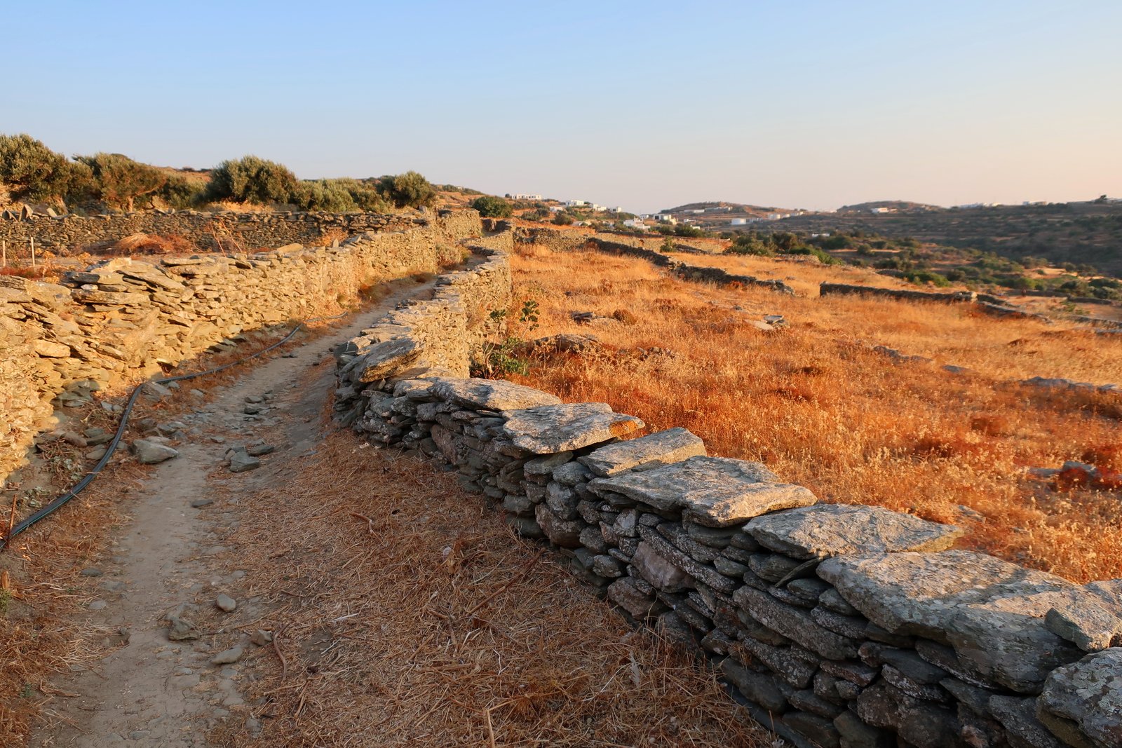
Set off from Faros at around 06:40. No wind. Already hot. We should have left earlier but hadn’t exactly planned to go so far. We’ll just set off and see what happens, we said. Oh the sham of that, both of us understanding the situation, that we’re giving ourselves a get-out clause that we’re so unlikely to use.
Around the coast to Chrysopigi, then Trail 1A to Agios Andreas, skirting the Mycenaean settlement, before picking up Trail 5 and going down the stepped walkway through Apollonia to the crossroads where the main road slices Apollonia and Artemonas in two. Trails 2, 3, 6 and 10 meet at this point.
Left Apollonia by 09:00, having bought supplies at the bakery.
Onto Trail 6, left the built behind, moved onto a nice stone path. Agios Leftheris for breakfast. Splashed ourselves at the tap in the little canteen-room adjacent to the church. Already the hottest ever, dripping. We ate in the narrow shade outside the small room because there we discovered just a tiny breath of cooling wind.
The next section is a high path through sparse woods and low scrub. We’ve done this several times and always look forward to the view down to Kamares and across to the other side, the high monasteries of Agios Symeon and Profitis Ilias on their serrated spine above the bay.
(There’s also Trail 6A here, a right-hand turn-off that goes directly down to Kamares. It’s the only path marked on the Sifnos Trails site as Difficult. But it isn’t really. It’s a little steep, but only 2.7 kilometres long and worth doing, probably better up than down.)
As soon as Trail 6 rounds the corner, a left turn over the ridge, you’re in wilderness. Vathy is the only settlement on this long southeast coast. It’s a loose-stone uncomfortable yet lovely path down to Panagia Toso Nero, a 250 metre descent. The church is built on a small plateau. There’s no other sign of civilisation.
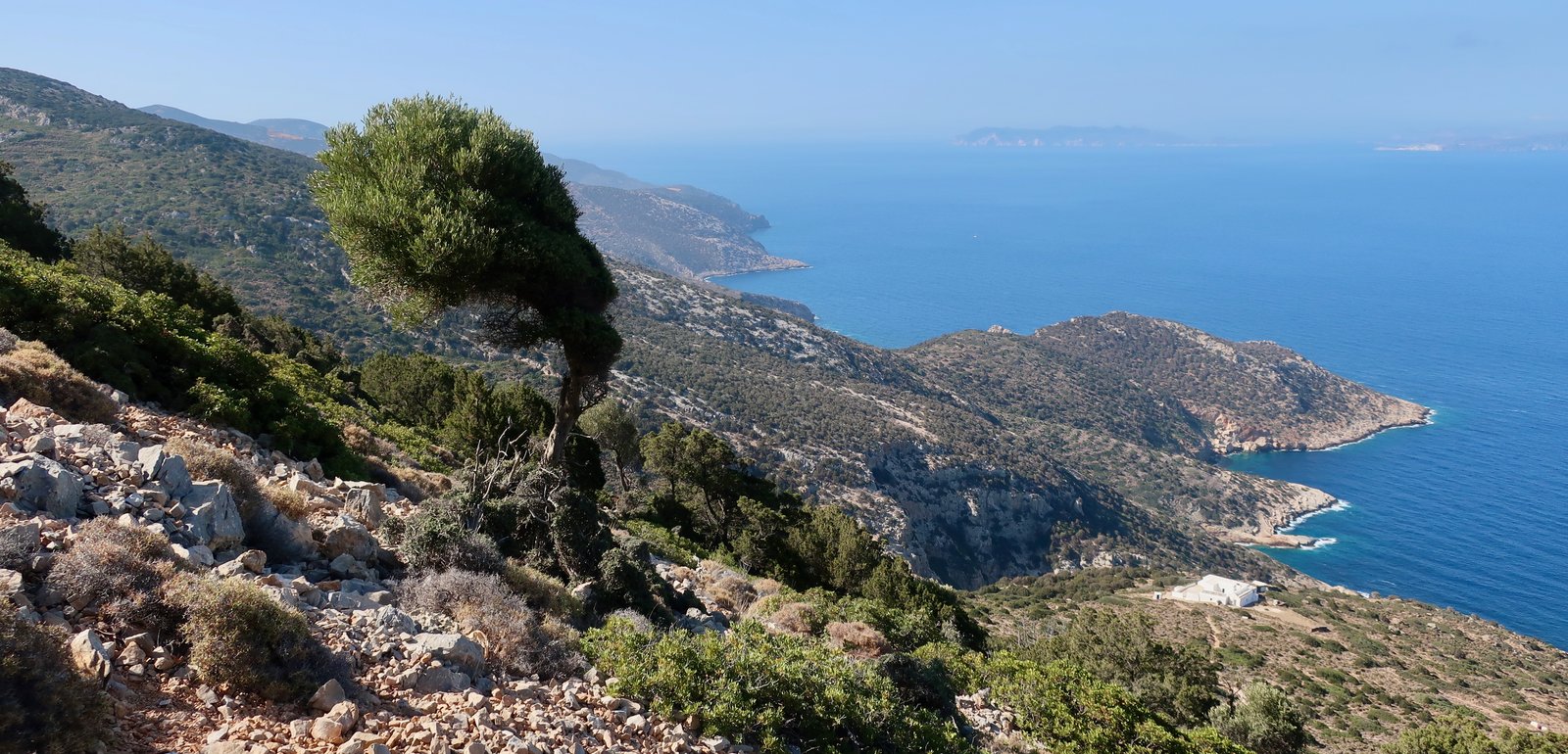
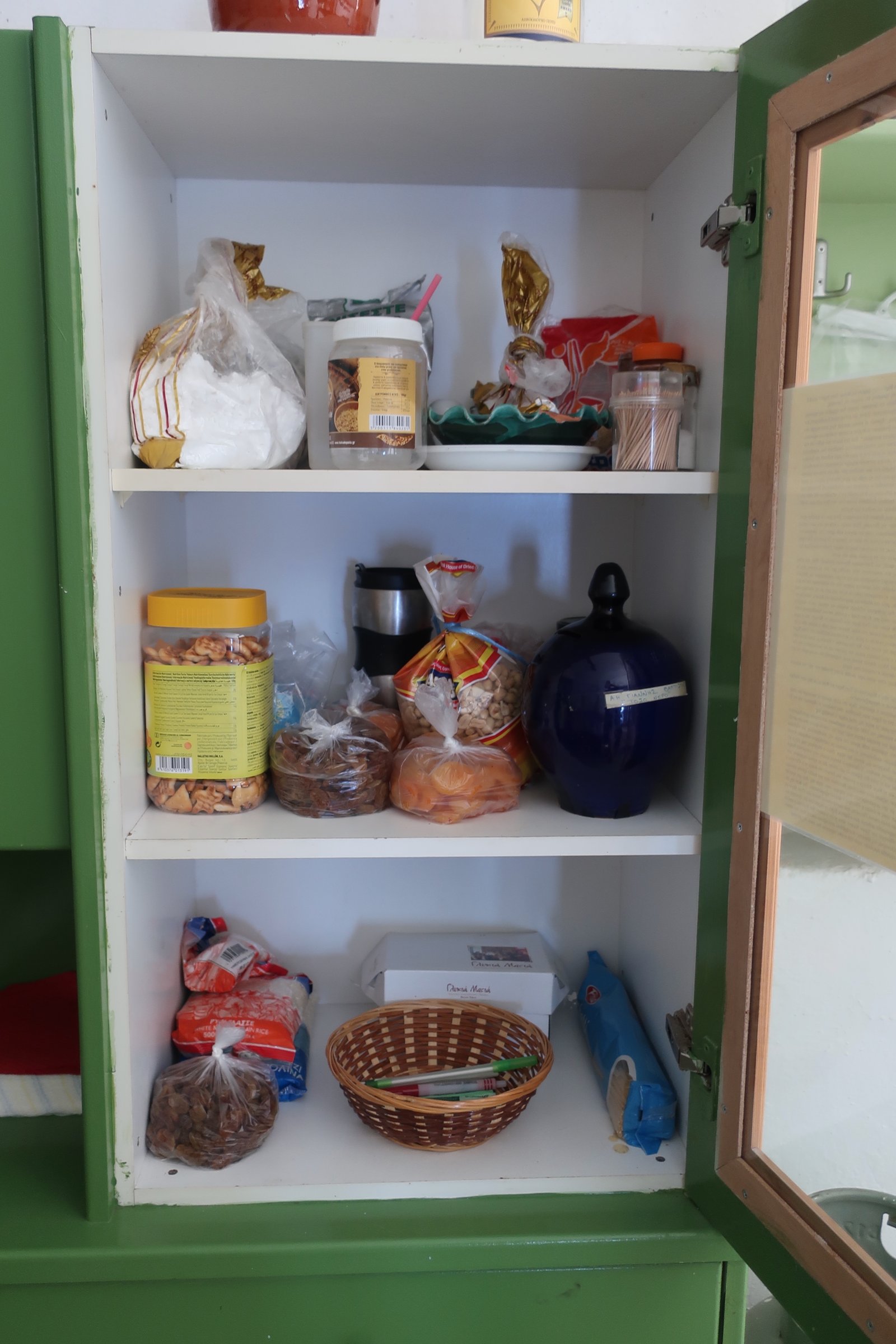
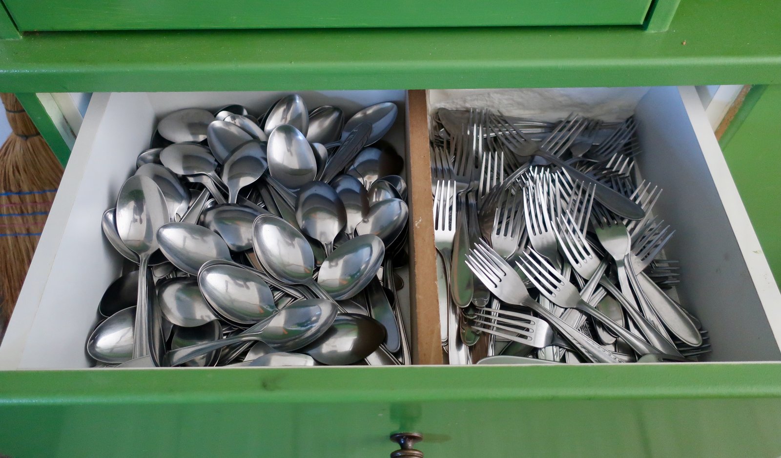
Attached to the church around the courtyard there’s a large kitchen, a refectory with a table easily long enough to seat forty people and a dormitory. Out here, as far away from everything as it’s possible to be on Sifnos, is the best-equipped church-kitchen on the island. There are iron cooking-pots, open fireplaces, gas for cooking, and in the cupboards oil, salt, potatoes, peanuts, pasta, rice and flour, apricots and raisins, sugar and biscuits, ouzo, beer and wine and on and on. There are drawers full of more cutlery than we’ve ever seen gathered together in one place. There are cupboards full of plates, and bowls and glasses. There’s even a CD player. It’s quite wonderful.
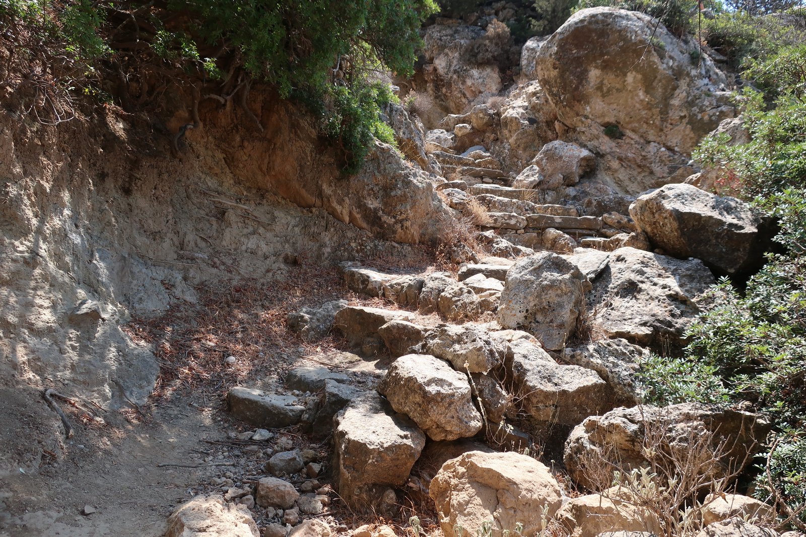
Having descended to about 180 metres, the path then climbs back up to the goat-and-sheep farm plateau under Profitis Ilias, at 400 metres. Much of the way is stone-laid, much of it through juniper forest. Steep slopes down to the sea on one side, up to the island’s high ridge on the other. Compared to elsewhere on Sifnos there’s little sign of agriculture. A few small concentrations, some terraces, some walls and small ragged churches, a stone drinking trough.
The section of Trail 5 between the plateau and Vathy is one of the loveliest sections anywhere on the island. There are a couple of small, abandoned farming communities. The solidity and style of the trail, with its stone steps and high passageways, suggests it was once important. Some terraces of olive, way out here, are still farmed. The path weaves up and down and through the hills. As elsewhere, very often the best-preserved stone sections are those that must have been the hardest to build, the steep, twisting staircases.
We reached Vathy at around 13:30 and had lunch in the shade of one wall of the Taxiarchis church/monastery, built in the 16th century right on the water at the end of the first small beach (coming from the north).
From Vathy, rather than take the long way back to Platys Gialos via Fikiada, we took the short-cut straight across on the northern section of Trail 4. It goes around the left hand side of the hill, a mountain path heavy with the aroma of juniper and mastic super-heated by the sun, the rock underfoot as hot as pizza stones.
The final way-marker is the church of Profitis Ilias Kontou, the smallest of the three Profitis Iliases, this one too an open house with facilities.
We were a spectacle in the shop in Platys Gialos, soaked through, dripping and dusty, with still three or four kilometres to go before getting back to Faros.