
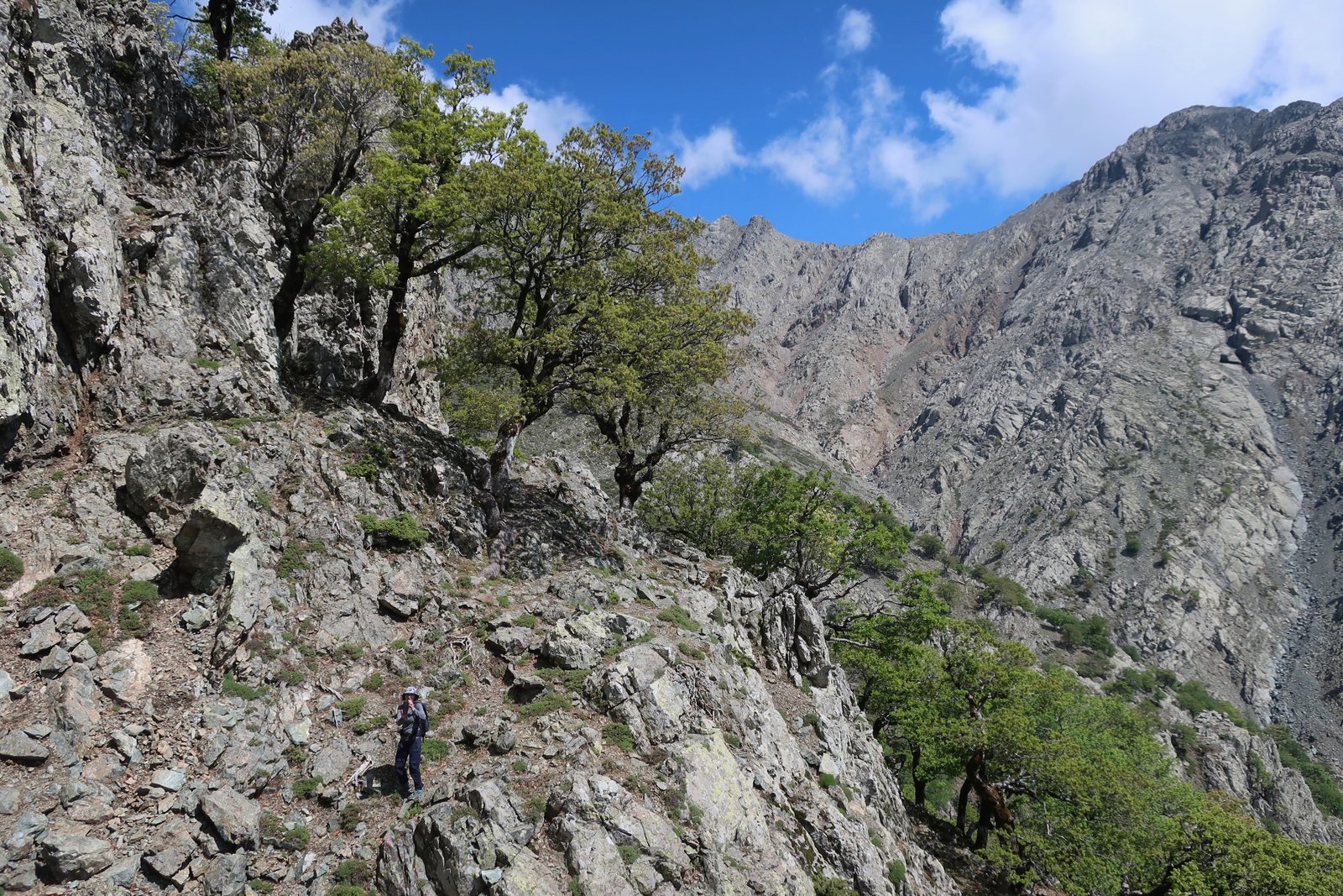
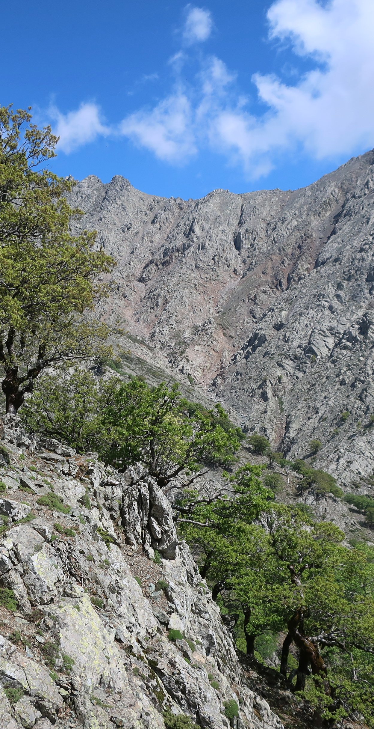
Poseidon watched the Trojan war from a perch on top of Mount Fengari (1611m). From the summit on a clear day you can see north into Thrace, east into Anatolia, west as far as Mt Athos. Apart from Dyrfis on Euboea (1743m), and excluding Crete, there’s no higher peak in the Aegean. From the ferry, the slopes of the mountain are so steep it’s hard to see how the road gets to Therma, the island’s best-known holiday destination halfway along the north coast. Then there it is, a narrow strip of tarmac hugging tight to the shoreline.
Although there is a regular connection with Lemnos – hardly anyway a household name among Greek islands – Samothraki is not a place to which travellers might hop, in the sense of island-hop, isolated up there in the far northeast corner of the Aegean. Visitors generally get the boat from Alexandroupoli in Thrace, exactly halfway between Thessaloniki and Istanbul. Mostly northern Greeks come. And Bulgarians, because they’re close. It’s a problem, said the man from the car hire place, said the guy in the bar in the Chora, said the woman on the till in one of the small supermarkets in the port. People don’t know we exist.
The nearest-neighbour island isn’t even Greek, it’s Gökçeada, one of only two significant islands that remained Turkish after the implosion of the Ottoman Empire. There’s no communication between them, Samothraki and Gökçeada, no ferry link. As if they had their backs turned one to the other in an attitude of geopolitical sulk. Which is pretty much how it is.
Before going we watched Pantelis Voulgaris’ film Nyfes (Brides). Most of the action takes place on an ocean liner, but the capital place of the film is Samothraki, from where some of the eponymous brides set out on their journey to North America to meet their husbands-to-be. This long-distance matchmaking, the sending of young Greek women thousands of miles across the ocean to be married, was another ripple effect of the mass emigration away from Greece. The vanguard was always men, the breadwinners, who then found themselves far from home and community without suitable partners. At the beginning of the film the heroine is pictured first lying on, then running along, the top of a typical Greek island drystone wall, in a typical Greek island brown and barren landscape of spike plants and hills. But Samothraki on the internet is all greenery and water, streams and pools and waterfalls. It’s how the island is marketed. A little research reveals that for Brides the shots of Samothraki were actually filmed on Andros. Even for Pantelis Voulgaris it was easier to go somewhere else.
If Samothraki is known at all, it’s as the home of the Nike, or Winged Victory, one of the most famous statues in the world. It was found, in pieces, at the Sanctuary of the Great Gods on Samothraki in 1863. Reassembled, headless, and extraordinary, it stands magnificently at the top of the Daru staircase in the Louvre.
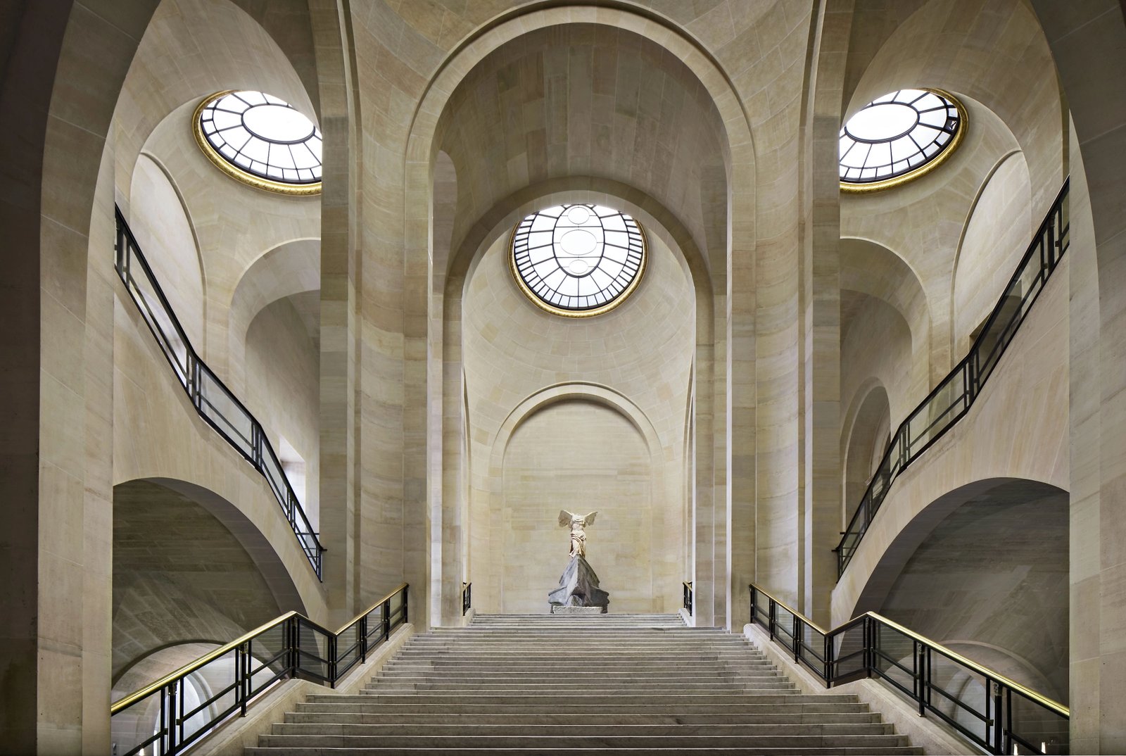
There’s a copy at the impressive new museum on Samothraki. Some time probably far in the future, like the Aphrodite of Milos (Venus de Milo), like the Elgin Marbles, like so many other less well-known pieces filched by western Europeans in the nineteenth century, it may find its way home. At which point many people will suddenly become aware of Samothraki and there will be an inconceivable spike in visitor numbers.
The Sanctuary of the Great Gods itself, attached to the museum – or vice versa – is a very nice island classical site. From it the remains of the great walls of the ancient city of Paleopolis can be seen climbing up the hills to the east.

***
The ferry goes to Kamariotissa, Samothraki’s only port, on the low-lying western end of the island. It’s a dusty, graceless, little place that in recent years has become the biggest population centre.

It’s the same story we see on most of the islands, people moving out of the hill villages, away from agriculture and historical safety, to the new arms-flung-wide tourism world. Car rental places have strategically bloomed at the point where the ferry docks. Bars and cafes line the front. It has nothing in particular to recommend it and how we enjoyed stepping ashore there, how comfortable we feel entering the slightly ramshackle world of much of the 21st century Greek islands, all these places looking for identity, many still unsure of themselves in this hiatus somewhere between the old world and the new.
The Chora is different. It’s a few kilometres away, at no great height in the foothills, 200m to 250m, hidden from the coasts, built to be defensible, and, with the sun shining in mid-May, even if mostly closed up still, even if not one single taverna was open, oozing with charm. Classically amphitheatrical, it has squares, alleys and greenery. The ruins of the castle of the Genovese Gattilusi family still guard the narrow entrance. Only on the morning we left, having spent a few days there after a few days in Therma, was it beginning to open for the short season. Until then the only things doing business had been a couple of minimarkets, two or three cafes, one early tourist shop.
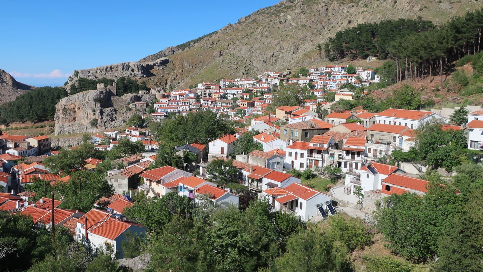
Therma, on the north coast, is hardly a village, more a collection of buildings in the woods. One of the bar owners in the Chora, in a Greek island parochially competitive style we have become used to, suggested that it was an unhealthy place to live. All those trees, he said, all that moisture. It has no village structure at all and in season, apparently, buzzes, with a young and dancing crowd, a few of whom stay there, rather more in the nearby campgrounds on the coast.
Samothraki is being developed as a canyoning destination, but it’s hard to imagine canyoning will ever draw crowds. (Canyoning, for those not au fait, means going down watery gorges with ropes and hard hats, jumping in and out of pools, having adventures. It’s pretty niche.) There’s also a camping/alternative/hippy vibe, centred around Therma. One does wonder, what part of this holiday categorisation, which one way or another applies to most islands, is organic, an unplanned consequence of the way the island in question already is, or sees itself, what part these days is wilfully created, the result of something like a collective, stretched-out session of brainstorming?
For the rest of the island, there are places to swim, mostly not Instagram perfect. A few scattered places to stay. Some tavernas here and there, in particular at Profitis Ilias in the south. And in Alonia a large army base. No doubt the military presence helps prop up the economy. And sends an unequivocal message to the closest neighbours.
HIKING
The paths to Fengari Peak, from Therma and from the Chora, are among the most strenuous, challenging, exciting hikes anywhere in the islands, but in a Greek island sense they are atypical. This is mountain hiking with much of the Greekness taken out of it. There are no small churches along the way. There are no paved donkey paths, no hillsides of thyme or sage. There are no stone walls, no small villages, no agricultural terraces and no descents to deserted beaches.
Of the two Greek island hiking map makers, Anavasi and Terrain, so far only Terrain have produced a paper map of Samothraki. Unusually, it’s inadequate, and misleading. On the internet, information is similarly imperfect. There’s nothing at all written about the hike from the Chora (see below). The hike up from Therma, that goes from more or less sea level to just over 1600 metres, is variously said to take between eight and twelve hours, there and back. Some commentators suggest it should not be done without a guide. Others recommend that only the very experienced and the very fit should attempt it.
The only other hike the Terrain Map numbers, and describes, is the one along the Fonias Gorge, most of which is more of a stroll than a proper hike. There are a number of other routes dotted on the map, but no information about them.
Arriving in Therma, we were shown to our accommodation by Panagiotis, who it transpired has been all through the mountains. We pumped him for advice. In the port, near where the ferry comes in, there’s an old notice-board-map, sun-blasted now, barely legible, that indicates a trail from the top of Mt Fengari down to Ano Meria in the northeast. I showed him a photo of this and he became agitated. It isn’t possible, he said, and told us the story of two foreigners who got lost up there a couple of years ago, spent two days wandering around and were eventually rescued, in extremis, by helicopter. But are there actually trails? I asked. There are always trails, he said, for goats. But not for humans.
When I showed Panagiotis the Terrain Map route that leaves from the viewpoint marked at the end of the back and forth switchback dirt track above Ano Meria, that goes past Koufouklio Peak (1074m) and is marked with danger signs at a couple of points, he became very excited. You cannot go there unless you want to die! he said.
He also suggested it would not be a good idea to do in one day the trail up to Fengari from Therma, and then continue on down to the Chora, which is what we told him we were thinking of. The Chora trail is possible, he said, but should be done in the other direction, starting at the Chora. Having now hiked both trails, this is good advice. You could go up from Therma, and then down to the Chora, but really only if you already knew the way. The trail from the Chora to Fengari is not well-marked. Considering the time, the distance and the challenging terrain, it just wouldn’t be a good idea to combine the two trails without knowing what you were doing.
On the reverse of the Terrain Map, at the end of their brief guide to the trail that runs from Therma to Fengari, the following is written:
From the peak you can follow the same way back, or wander around the other peaks by walking along the ridgeline (but there are no markers or trails).
If I’d shown that to Panagiotis he would have had heart failure. The idea of ‘wandering around’ the highlands of Samothraki, ridges and cliffs and treacherous moonscapes and no trails and four or six or eight hours from home, is beyond crazy.
***
Apart from the two paths up to Fengari, we also did the standard stroll up the Fonias Gorge, and the Terrain Map path that leaves from Varades campground, on the coast just along from Therma, that goes high up into the hills before coming down to Ano Meria on a winding dirt track.
Excepting these, and the out-of-bounds trail marked with danger signs, there are two further significant trails on the Terrain Map. One that goes to Agia Thekla, in the south, we didn’t have time to do. The other, the coastal walk that begins just past Pacchia Ammos beach on the south coast, and leads to Kremastos Waterfall, we tried, but abandoned. At the very least there should be danger signs on the map. Plus there should be a clear description, pointing out that this is hybrid mountaineering and hiking. The path heads directly onto a narrow ledge along a cliff 100 metres above Katarti beach. At first there’s a wire, bolted into the rock, but this soon disappears. You have no choice then but to continue on the narrow path, which turns immediately into a scramble, above the void below.
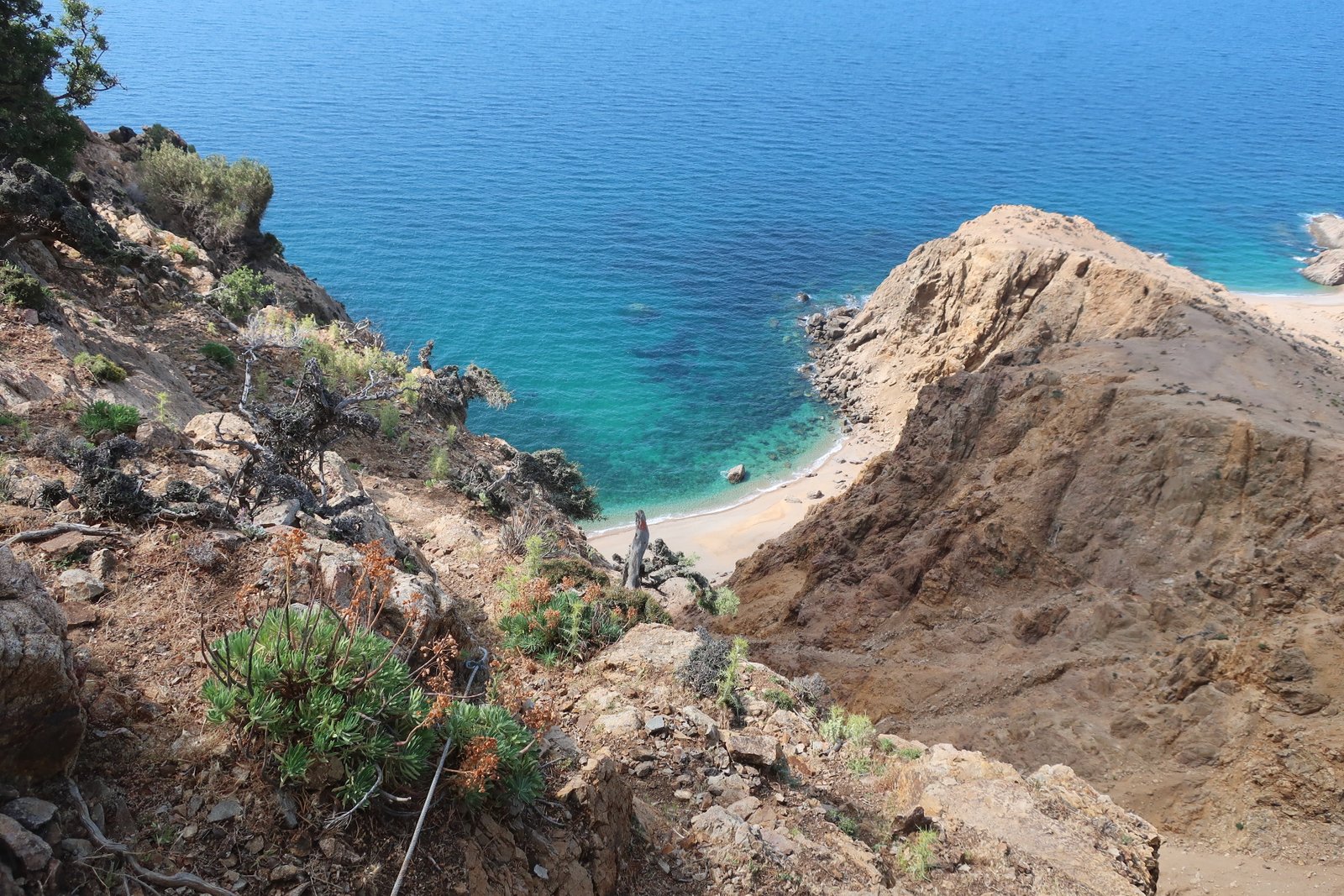
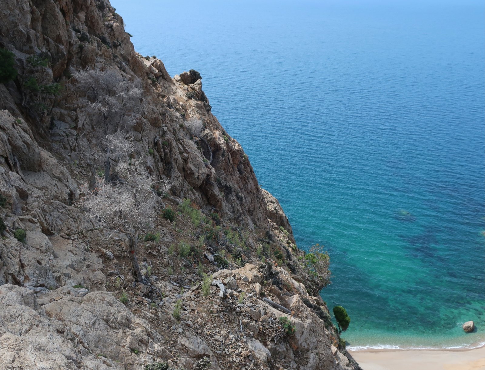
Maybe it gets less mortal around the corner. We went no further.
We later found this, on the In Samothraki website:
Even though the path from Pachia Ammos is marked it’s way too dangerous in my opinion. People have died on easier paths on the island. It’s not something I want to encourage.
And this, from someone else:
The path really is highly dangerous and involves a lot of climbing along the cliff. There are ropes to help at some of the hardest parts, but some ropes were missing.
HIKE 1
Therma to Fengari Peak round trip. 1600m up, 1600m down.
About 16 kms total, up and back, but that figure really doesn’t represent the time it takes, or the physical difficulty.
The path, which is dirt track for the first 2 kms, leaves from the ugly thermal building at the bottom end of Therma. By the time you reach the end of the dirt track, you’re at about 300 metres. It’s pretty well-signed all the way. Be careful not to turn left at the point on the map where the trail divides. Not paying attention, we did. We went left and wasted an hour or so tramping through ferns in a sunny oak forest before coming to a gaping ridge at the end of the forest and realising what we’d done.
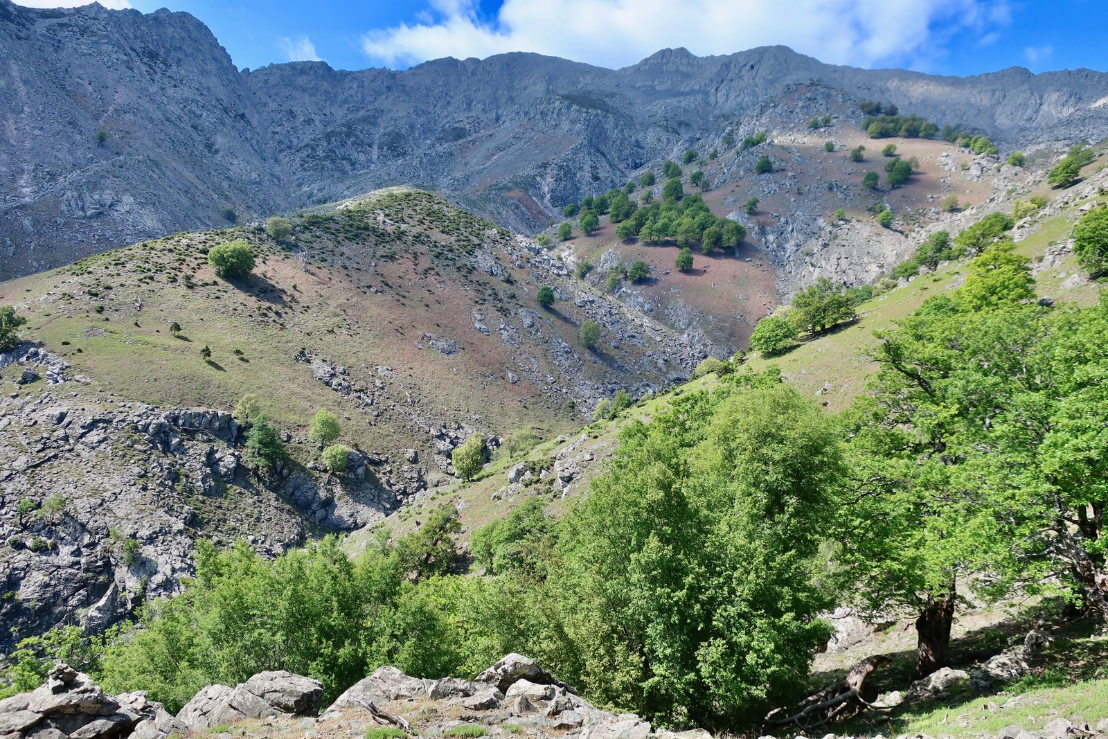
The trail proper goes first into woods – oak, mastic and fern – then up a narrowish cleft, climbing steeply back and forth. At the top it climbs a little more gently for a few hundred metres, until the oak woodland thins and the path gets steeper again. For much of the way on this section there’s barely any path at all, just a light and dusty trace through the trees, but there are markers on the trees and it’s quite easy to follow. This section goes up to over 1000 metres and is hard work.
The path flattens out, crosses a stream, doubles back on itself traversing a hillside, goes briefly into woods again then takes the rounded back of a ridge most of the way up to the main col at the top.
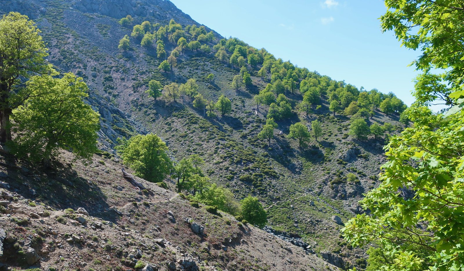
The final 400 metres of climb are very steep. The trees disappear completely. You go first into a strange environment of low, very spiky, very rigid bushes, through which the path meanders narrowly. It’s a little like a low level maze with booby traps, but is fairly well-marked, by cairns and splodges of paint.

And then there’s nothing but rock, with barely enough markers. The path was probably better-defined in the past, but has been smudged away by rockfalls. This section is steep in places, and sometimes disappears completely, so that the only way forward is to scramble onwards and upwards over rocks and boulders. You must not lose the markers.
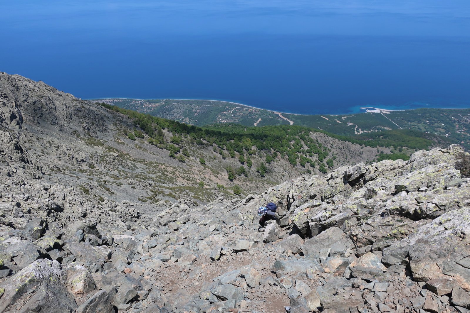
Having reached the col, with a view down the other side of the island towards Kamariotissa, the port, and the more gentle western end, you might imagine the most challenging part of the trail to be over…
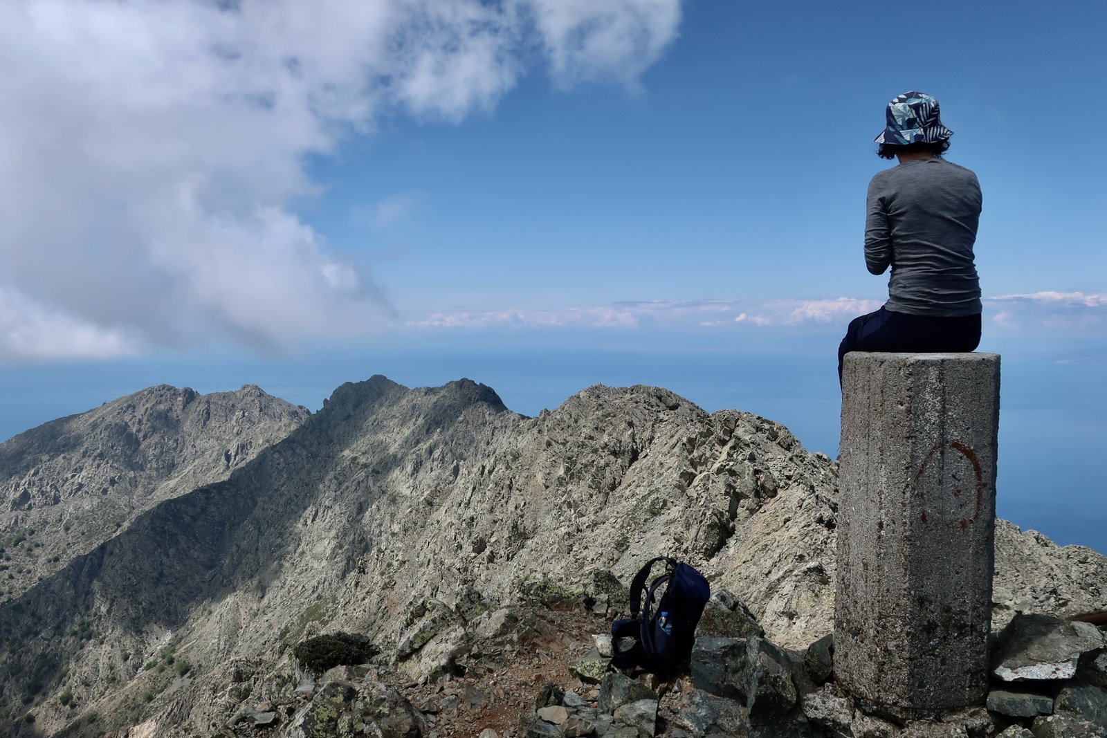
The Terrain Map inexplicably makes no mention of the last few hundred metres, an awesome snaky trail along a narrow ridge, to a first peak at 1584 metres, marked by a stone column. You then go down a little and on up again to the top of Fengari itself. It’s not technically difficult, but will not be for everyone. At some points it seems unlikely there might even be a safe way forward, and there is some exposure.
The following photo was taken from the tip of Fengari, looking back at the ridge we had just scrambled along. It really is that stunning.
The path down is almost as tiring as the path up. It’s unrelenting: the same pressure, the same muscles, all the way.
From the col, the joining point of the two paths, from Therma and from the Chora, some red marks are visible – the beginning of the path down to the Chora. It doesn’t look straightforward. We were quite happy not to be attempting it immediately after the long hike up.
HIKE 2
The Chora to Fengari Peak.
Perhaps 20kms, up and back. About half of this is on wide dirt track, not narrow trail or path.
In total, 1250 metres of ascent, followed by the same 1250 metres of descent.
Looking at the Terrain Map, when the dirt track from the Chora comes to an end, there’s an obvious W very near the beginning of the dotted path. In fact this W, a steep back and forth switchback, is also track, not trail at all. The trail proper that starts soon after is one of the most exciting five kilometres of mountain trail anywhere in the islands.
The waymarking is sketchy in places. You must not lose it. If it disappears, you’ve gone wrong. Go back. The last 300 metres of climb before the col and the joining point of the paths from the two sides, the Chora and Therma, is very steep, with a lot of scrambling.
The time it takes, there and back, will depend on individual hiking speed. Anyone who has spent much time hiking has a rough idea how they measure up to given averages. Allow at least nine hours there and back. Some people will spend more like ten. Even eleven or twelve, because you have to eat too, you have to stop for coffee and a raisin bun, and you may well have to rest from time to time.
The beginning of the trail section is immediately a little complicated. It goes out onto a quite steeply-sloping smoothish flank of rock. There are red dots to follow. It’s less scary than it might at first look. Still, you’re a bit exposed and don’t want to slip.

After this, much of the way, sometimes steep, sometimes traversing with only a small incline, is through sparse oak forest. In places there’s cliff above and steep slope below, with just a narrowish – but quite safe – passage through the middle.
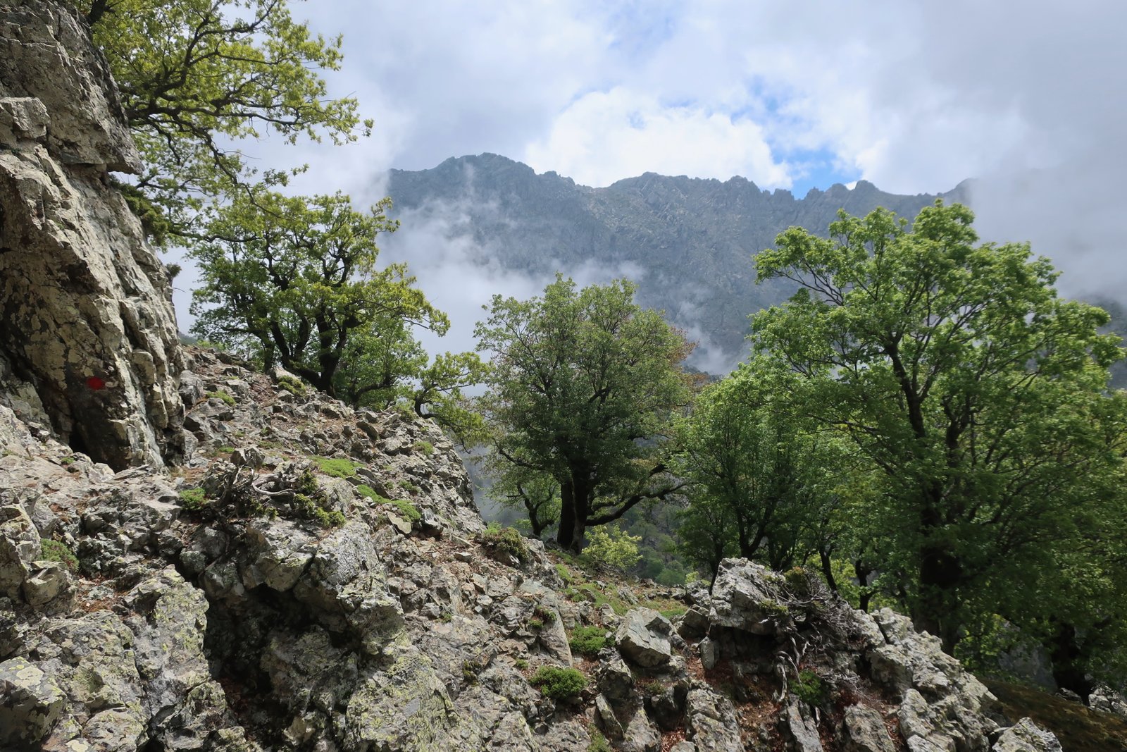
One short section goes up the spine of a ridge, steeply. The surface here is very loose and stony – uncomfortable coming down – and the path zigzags narrowly since the ground on one side is impossibly steep for walking, on the other sheer.
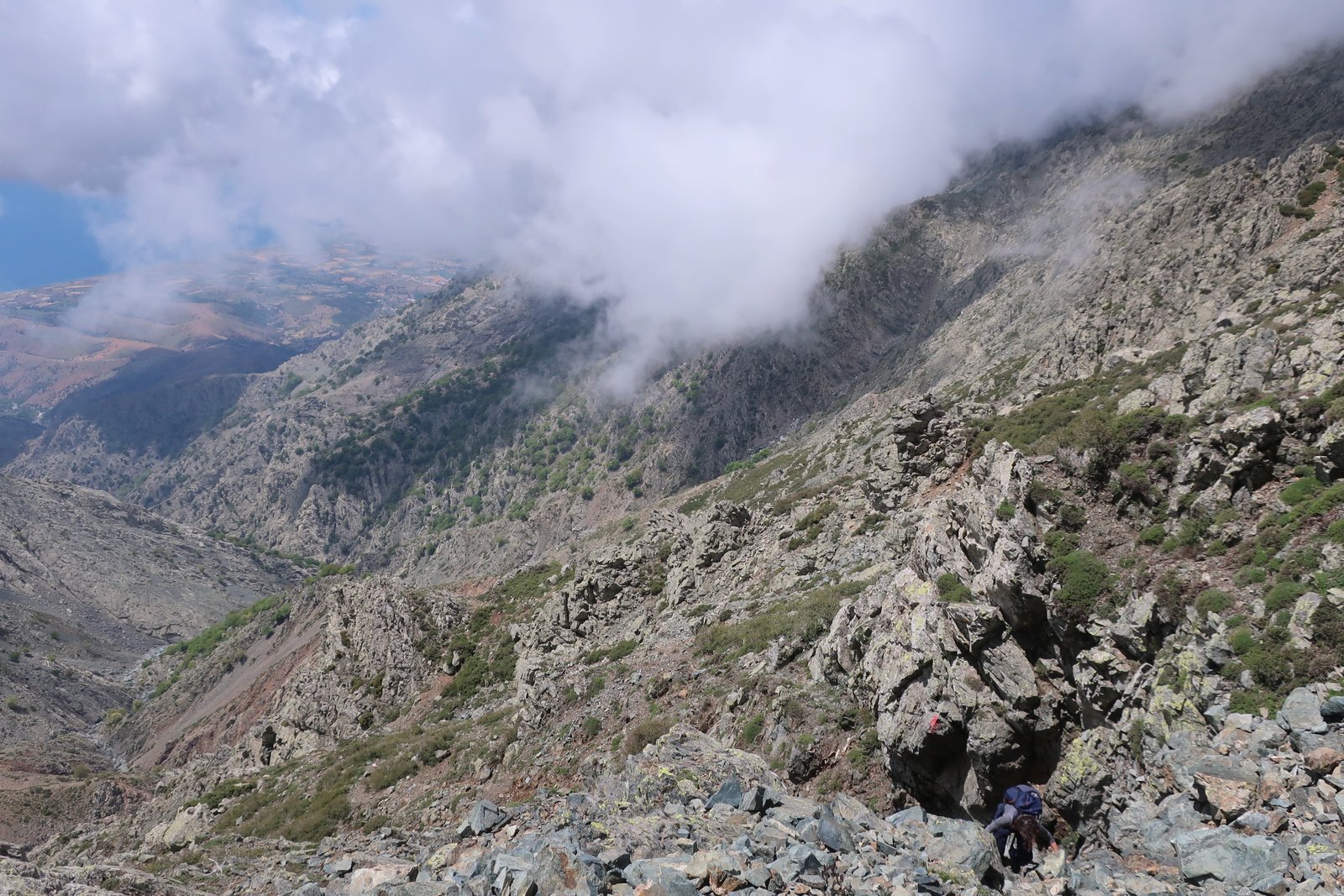
You cross a number of folds, or indentations, in most of which in mid-May there was water. On the day we did this walk banks of cloud were flowing up from the south, sometimes obscuring the view entirely, sometimes offering brief windows onto high, jagged peaks, then suddenly dissipating to show a whole sheer, spectacular mountainside rising up ahead.

The last section to the col is difficult, steep and scrambling. Ditto the return.
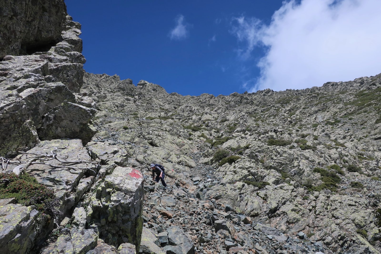
From the col, if you haven’t already been to the summit of Fengari, there’s the same scramble along the top-of-the-island ridge as in HIKE 1 above. Then you have to go all the way down again, seeing everything completely differently, wondering at times where on earth the path goes because unless your memory is photographic, and even if you’ve really made an effort on the way up, it’s impossible to remember every twist and turn of trail, every complication.
HIKE 3
From Therma to Varades on the road. 90 degrees straight inland on a dirt track until the path, dotted on the Terrain Map, begins. Up through the Fonias gorge, continuing on above the normal tourist section, then a hard left turn onto the dotted trail as far as the zigzagging dirt track that goes down to Ano Meria. Down the track, onto the road, and the coast road home.
Approx 32/33 kms.
Easily the longest hike we did on Samothraki, kilometre-wise, although most of it is on either road or wide dirt track, not narrow trail or path.
Even this hike, because Samothraki is so rugged, because the mountains are so high, goes from sea level up to over 800m. Or, if you get lost, which we did, from sea level to about 950m. And then back down again.

The trail part of this day is nice, not complicated, although the waymarking isn’t great in places. As elsewhere, if you lose the markers, go back and find them or you will probably get lost and will spend days wandering and have to be rescued by helicopter.
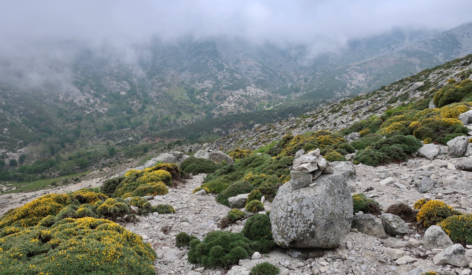
Having reached the first high-point at just over 700 metres, the trail turns left and down into the Fonias Gorge. Before getting there, it crosses at least one, if not two, smaller clefts down which small streams run. This section is badly-marked.
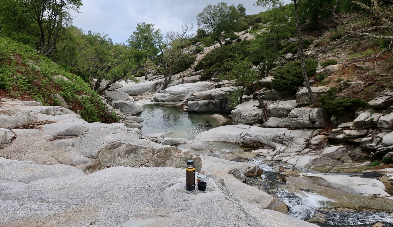
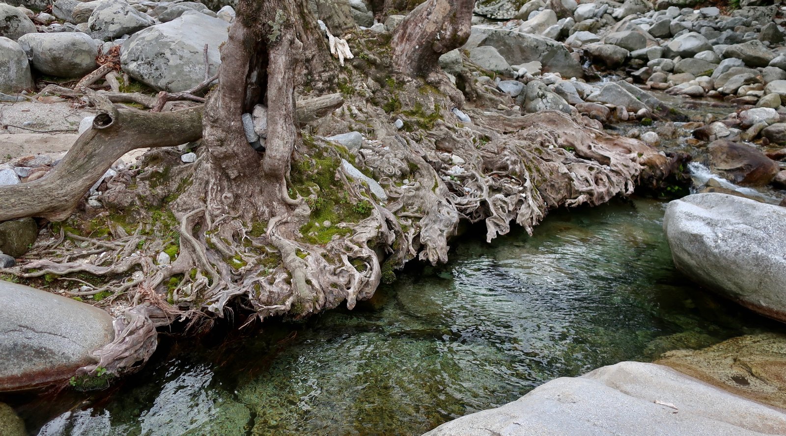
Once you reach the Fonias stream/gorge, there are some paint marks. In places the trail follows the vee of the stream itself, sometimes it diverts off to the left for a few dozen metres, up and round an obstruction in the course of the stream. You will know when you reach the waterfall, obviously.
From there, the path traverses, then climbs up to over 800m, approximately in the direction of Ano Meria. We never found it though. I still don’t know where we went wrong. Panagiotis had suggested we do this whole trail in the other direction, from Ano Meria, but I have no idea if this was because the route was easier to find that way, or whether it’s simply the way he’s always done it.
We went too high and ended up coming DOWN to the lookout point marked with a small red and white ‘mountain refuge’ icon on the map. There’s nothing there but a few fallen-down walls, and the frame of an old bunk bed, rusted and twisted. The way back to Therma is then long, but obvious.
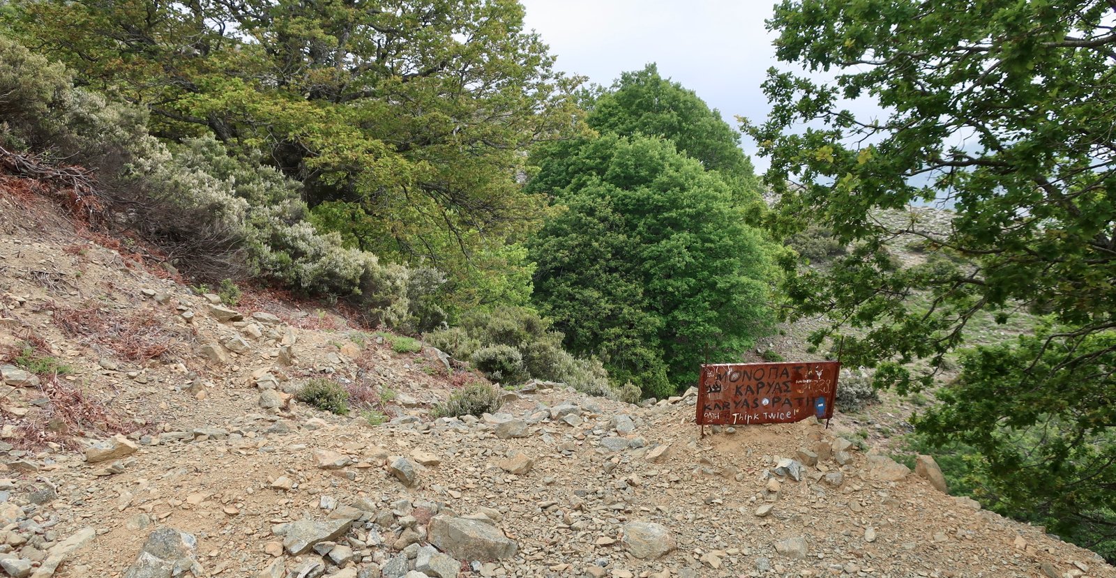
At the point at which we should have joined the zigzagging dirt track, had we not got lost, there’s a sign indicating the beginning – or end – of the actual trail. Apparently, someone who has done it would like you to consider seriously before committing.
Along the coast road on the way back to Therma, under the plane and oak trees to the left, there are whole meadows of oregano, more than we’ve seen anywhere else in the islands. Normally thyme and sage are much more common.
OTHER INFORMATION:
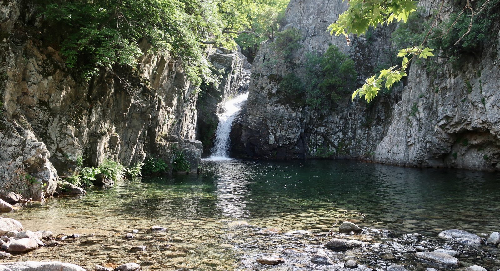
– We walked the Fonias Gorge tourist path to its end, the Klidosi waterfall. There, and at the first waterfall, there are large pools for swimming. As far as the first waterfall the path is more or less flat, and shady, along the river. Between the two waterfalls it climbs about 200m, with a short, quite steep section next to the first waterfall.
Although there is in theory an entrance fee for this path, in mid-May no-one was manning the booth by the road.
– We also went to the Xiropotamos waterfall, just above Xiropotamos in the southwest. It’s a short stroll, a couple of kilometres there and back. Again, at the end there are opportunities for bathing. There are several warning signs along the path, hardly necessary. A fat black irrigation pipe runs with the trail for much of the way, somewhat spoiling the aesthetic of it.