
Although we were there in March, which in the Cyclades you’d expect to be early Spring, a particular miracle in such arid, stony places, our visit coincided with an exceptional spell of freezing weather. Standing at the fruit and vegetable van in the car park in Koronos village, altitude about 600 metres, a group of elderly women discussed for my benefit when last it snowed so late in the year. Five years, said one. Ten, another, it was this deep. And measured up to her waist with a flat palm.
When hiking, memorable weather often has the effect of conferring a particular character, that afterwards remains indelibly glued to the land and the paths, so that we remember them not just as paths but paths-plus-weather. The walks we did from Koronos, it’s certain moments that come back first: light snow – snow crystals really – falling on the way to Lyonas; again and again finding ourselves at Stavros, which is just a bus shelter glorified with a name, a point midway between Apeiranthos and Koronos, where roads and paths come together and wind screams and we hunker down; coming over the ridge to Koronos on the way home with clouds being town ragged over the northern peaks; rounding the corner on the hike we did past Keramoti village, the north wind almost blowing us off our feet; the same hike, coming back towards Stavros, across what seems now a vast, frozen wasteland, where an elderly man with goats and two big, disinterested dogs came out of a small, rough, wooden hut from which a metal pipe was puffing dark smoke. Poly krio, poly krio, very cold. He thumped his hands together. When we explained our presence, Kataplyktiko, he said, shaking his head. What a word that is, kataplyktiko, meaning amazing, wow. The craziness for him of seeing us out there with evening coming on, the bitter cold, miles to go before getting back to Koronos, what on earth were we doing? He, day in, day out in his lonely windblasted shack. The kataplyktik irony of it.
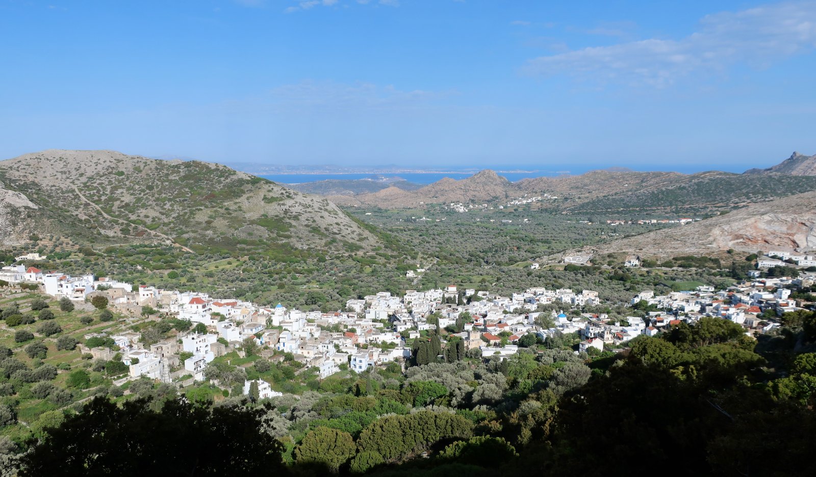
Likewise, being in Koronos it’s certain moments of cold that come to represent the whole: never losing sight of the prodigy of full central heating, an unheard-of luxury, getting home at the end of a hike, the moment of opening the door, the bliss; being squeezed into the short tub, just big enough to sit in with knees drawn up – practically the only bathtub I can remember from the islands and it was hardly bigger than a basin; in the village restaurant one evening, huddling in a pocket of warmth around the stove, one of those borderless spaces that are either too hot or too cold, the difference just a few centimetres either way; in the morning, opening the shutters, looking out over the village with thick snow falling, the houses on the far side of the stream that divides the village blurring out; the silence of cold, the silence of snow and the silence of time having passed and left this place behind, the school long closed, a handful of mostly old people remaining, moving like a failing pulse through the narrow alleys.
Compared to most Cycladic islands, there’s an impression of size on Naxos, of diversity. It’s not just that it’s big, although relatively it is, it’s also that it’s hard to grasp, the form of it. There’s Paros alongside for example, a pimple in the middle of the island, more or less all the rest of it sloping down away from the peak. Or in the other direction Amorgos, a long sliver of land with a high, spiny ridge along the middle. Even islands like Kalymnos or Andros, when parsed, are relatively obvious, both of them a succession of parallel ridges. Naxos is different. Looking inland from the west coast, where most tourists stay either in town or along the stretch of oatmeal sandy beaches to the south, there’s a confusion of peaks. It’s wildly erratic, with no readily distinguishable pattern.
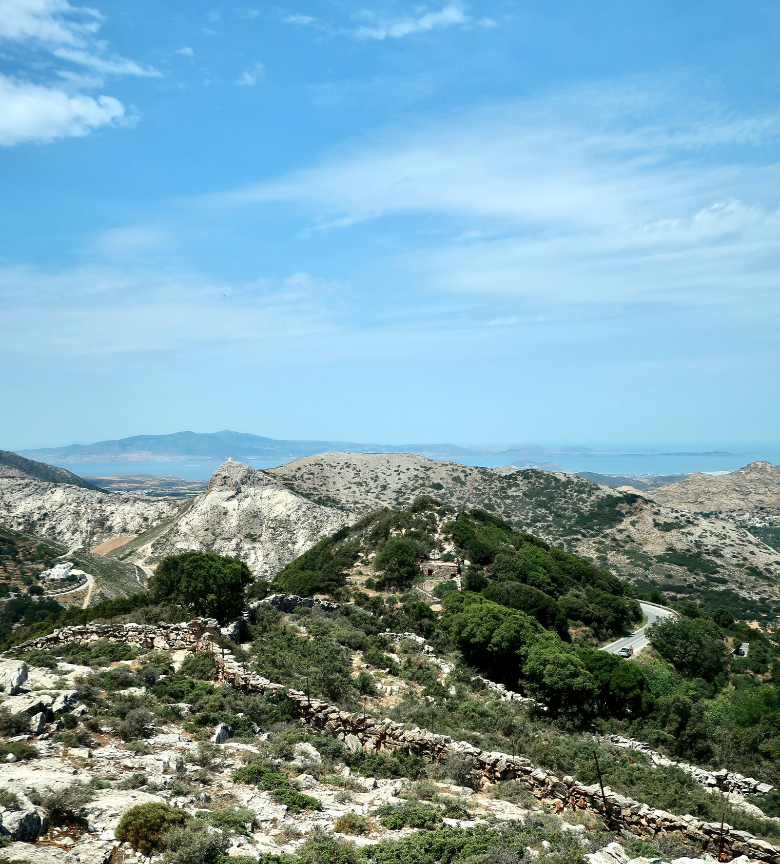
In the distant past on so many islands the best places to build would have been obvious. Ideally a location that was easily defensible, with good access to the sea and as broad a lookout as possible. Looking inwards from the west coast, Naxos resembles an underwater sonar image of points and troughs. There is potential for dozens of unconnected settlements.
Nowadays instead of building forts, visitors go for day-trips to the prettier hill villages. In Chalki there are cafes and tavernas and a few trinket shops. There’s style, a neatness. With plentiful water and large swathes of rich, non-precipitous land, Naxos was agriculturally comfortable, well-off in a way that most islands were not.
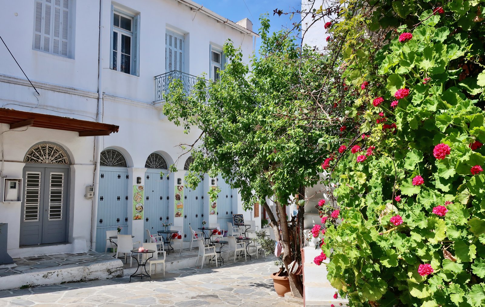
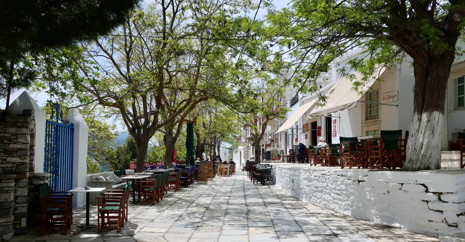
There was also marble. Naxian white marble, prized in the ancient world, is still quarried today. Apeiranthos is one of the Cyclades’ most notable marble villages, comparable to Pyrgos and the marble villages of northern Tinos. A wide marble promenade runs along the eastern side of the village, with cafes and restaurants giving onto it, before it narrows and continues on its way among the houses. In small places like this the apparent opulence of marble only happens if the marble is already there, ready for use, if when a pick is swung it’s as likely to strike marble as anything else. Even out in the country far from the villages marble blocks make random paving stones, the walls that line the paths are studded with marble.
On Naxos, uniquely, there was also emery, from which for thousands of years abrasives have been made. There was even a particular word for the villages involved in the production of emery: smiridohoria. Smirida is the modern word for emery. In the antique past, marble mined on Naxos or Paros or Tinos was shaped by obsidian blades from Milos, then smoothed, polished, using emery from Naxos. A whole industry, all the components hereabouts.
A few years before the cold March visit, early on our time in the islands, we visited Naxos for just a couple of days, passing through. With no time for hiking, we rented a car and found ourselves in a village in the hills where blossom from a huge tree had gathered like wool or snow on all the steps, in the corners, against the walls. It was airborne too, all around us, so that even though the sun was shining the village was blurred, soft-focus. At first we didn’t even know what it was, there was so much of it. It was like the stuffing from a million fancy pillows. We had never seen such a thing.
On this day of driving we were so taken with the land and the villages and the snatches of path we saw, that we talked about coming back and setting off with backpacks, hiking from place to place, staying in villages like this along the way. Carried away with the part-illusion, part-reality of magnitude. Naxos seemed a continent compared to most places we had been.
One of the things that happens when driving, rather than walking, is that often we don’t really know where we are. Driving is so easy, so quick, we pay less attention to contour and distance. So that when several years later we arrived in Koronos in March and on the first day went out to look around, hoping to find at least an open minimarket and bakery, we were amazed to realise we had been there before. The village with the blossom had become so indistinct – we had had no cause to evoke it since – that we had hardly any memory of it, not even that it had been on Naxos.
In damp, frozen March, instead of transparent, aerial blossom, green mould was blooming on the steps, in the corners, along the bottoms of walls. Everything was gripped in winter suspension. In the little shop an elderly couple sat around a small stove watching the television, calling out answers to quiz show questions. The bakery, which had no discernible logic to its opening hours, was a shadowy space not at all like a shop, that smelt of wood and bread, where bread that smelt and tasted of wood was sold and some few elderly people came to talk.
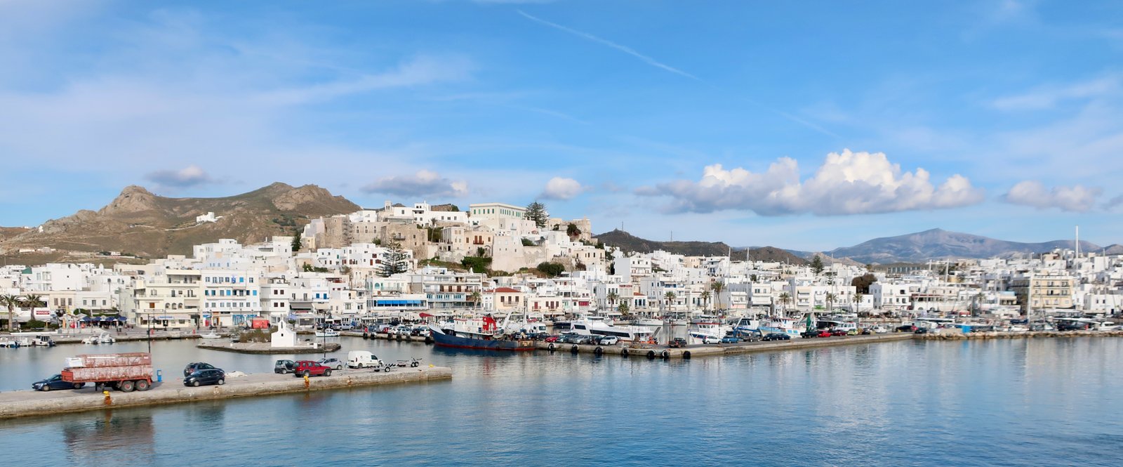
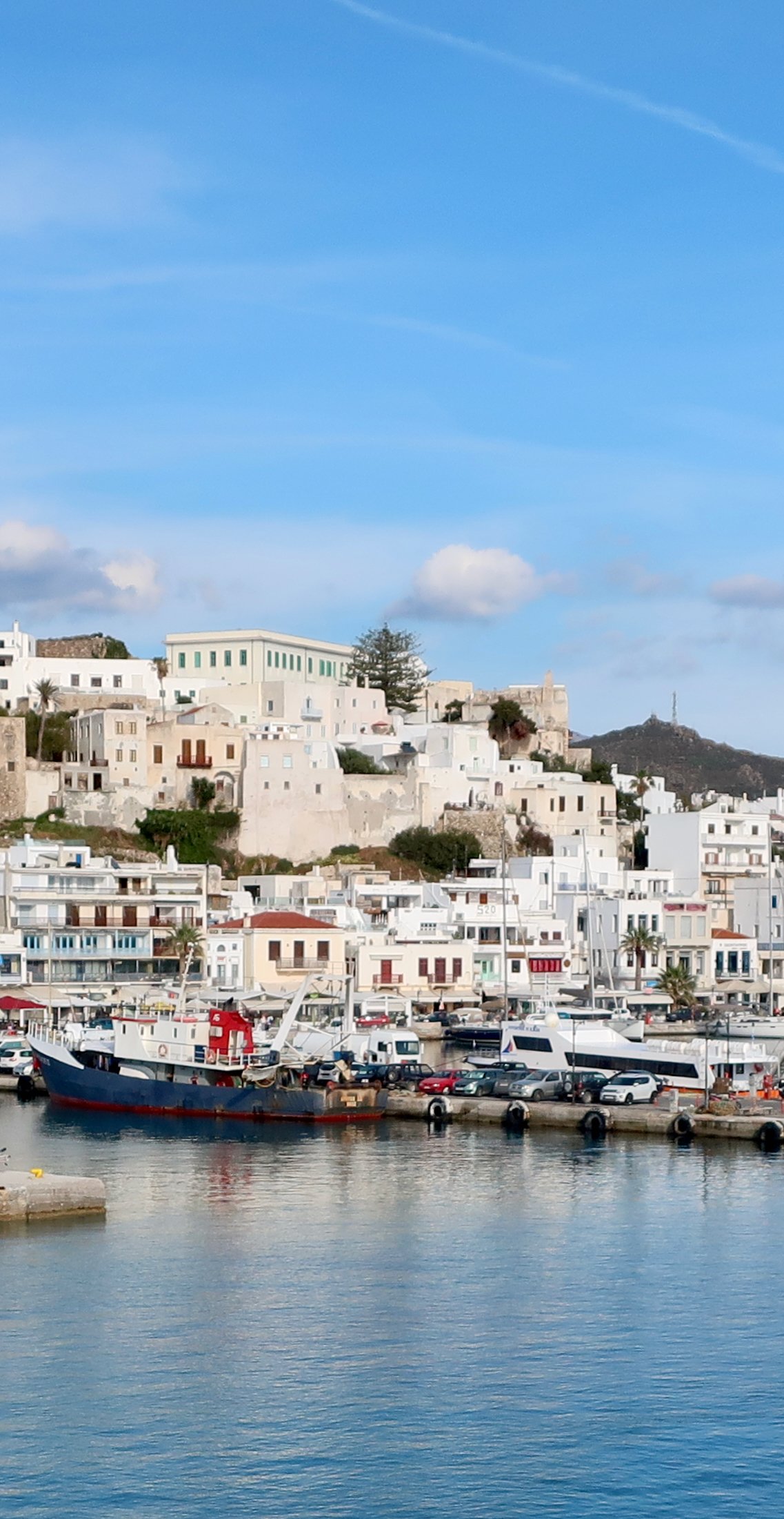
Naxos town, the Chora, with its hundreds of hotels and guest houses and studios, its dozens of tavernas and bars along the seafront, is a thousand miles away. In town things are open even in winter. There are always people. Thirteen thousand of the island’s twenty thousand permanent inhabitants live there. In season the seafront all along the port is classic Greek island touristy, happy hour cocktails and special offer seafood tavernas. Although, still, it’s a Greek island, there’s a port with its boats and the ferries coming and going, and heat, blistering heat and blue water and whiteness, so that even with all the summer people it has something, it is something.
The Venetian Kastro at the heart of the old town I didn’t even notice until walking back towards the Chora from inland one day. I looked up from the road and there it was, rising prominently over the rest of the town. Arriving on the ferry, our gaze is drawn down to the bustle of the seafront, not up. I hardly even realised there was an up. Even with the summer season frenzy of the seafront and the crowds at Agios Giorgios beach just alongside, the strollers and paddlers in its shallow, too-warm summer water, the Kastro stays quiet. But it’s one of those rare places in the islands where we wander through alleys of half-dilapidated old houses, many of them looking down over the port and across to the eastern edge of Paros, and, because even after all this time we’re still susceptible, and despite the fact that we do know better, we play the game of imagining to live there, in one of those houses, behind the crooked louvred shutters, the peeling paint, in a quiet place of dusty sunlight and old furniture, afternoons disturbed only by the mournful bells of another funeral.
HIKING
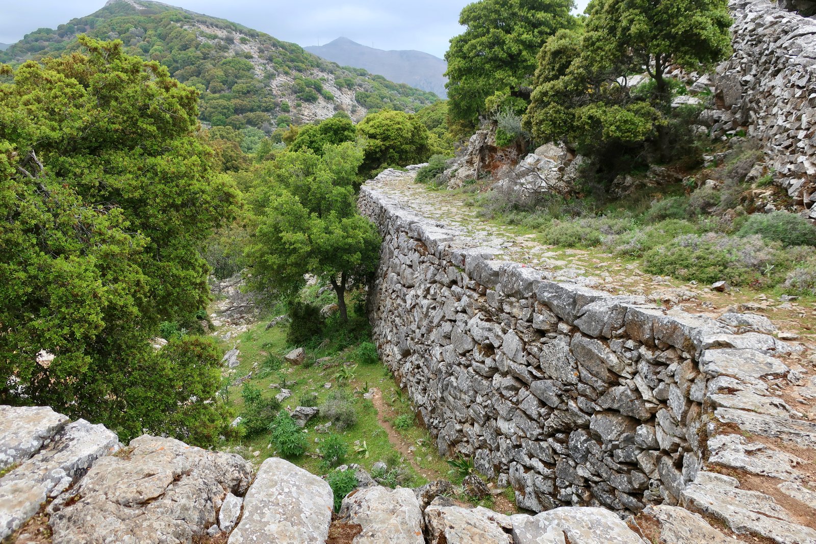
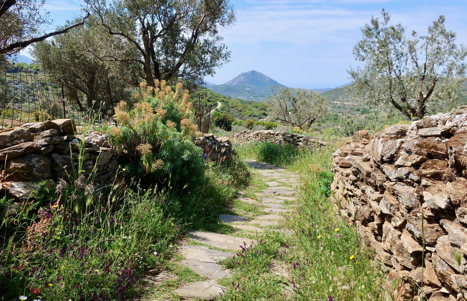
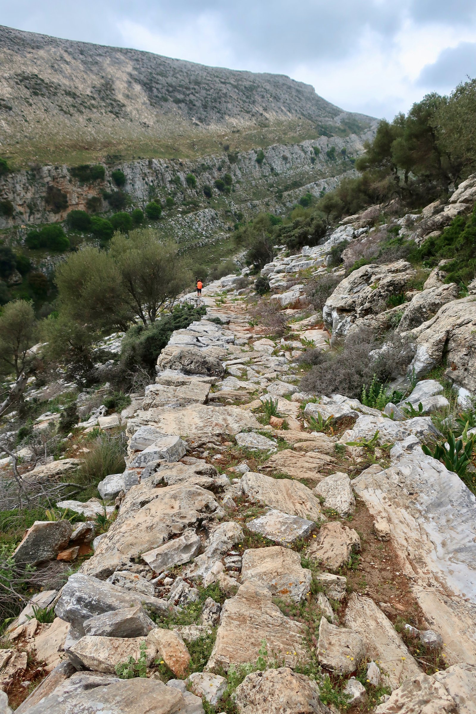
The path in the photo, above, a section of Trail 1 near Apeiranthos, is a little like one of those pictures of impossible golf holes. Of course it doesn’t exist. Whoever would build anything so exquisite, so labour-intensive, on a small Greek island? This is not a stone path in the sense of paving stones laid on the ground. It’s land-art.
***
It took us years to get around to Naxos but for hiking it’s hard to beat. There are so many exceptional paths. Lowland paths, highland paths, gentle paths, difficult paths, short paths and long paths. A great number of them are paved. The stone path-makers of Naxos were among the most prolific in the islands. As always, there is a clear relation between population numbers, agricultural land, religious centres – churches, monasteries – and the density and quality of the old paved paths.
The numbered trails are mostly well-signed, or well enough that they can be followed, which is all that matters. The large number of different routes makes it easier to combine them, to shorten, lengthen, play with them to suit all preferences.
If you were going to stay in one place only with a view to serious hiking, Apeiranthos would probably be most logical. Or perhaps Koronos. Or Filoti or Chalki. All of them inland villages from which routes radiate out. Alternatively, it would be possible to stay in a couple of different places and in so doing take Naxos section by section. Public transport is good enough that it’s possible to stay in the Chora and do some back and forth, bus morning and/or evening, but it makes for very long days.
Whatever you do, it almost certainly won’t be possible to do it all in one visit.
The following is a rough guide: routes we have done, combinations of routes we have done. Most of them are long, most can be chopped into more manageable pieces. We used the Anavasi Topo Islands hiking map, for which the Trail numbers are helpfully the same as the numbers on the ground. It isn’t always the case.
HIKE 1
Koronos to Lyonas and back, on Trail 10.
About 15 kms
Koronos village is at least eight hundred years old. Lyonas is the port for the village, their bit of coast, seven or eight kilometres, a descent of five or six hundred metres. People have been walking to the coast from Koronos for as long as the village has been there. It isn’t certain they’ve been taking this exact route, although they may have been. There’s a logic to routes. This one flows along one flank of the steep stream valley that runs from Koronos down to the coast.
There’s no telling exactly how old it is, the footpath from Koronos to Lyonas. The top half in particular, the section that runs along the left-hand wall of the gorge, is iron-hard, it feels and looks like carved mountain. There are large lumps of marble, rough stones, corners rounded by hundreds of years of passage. It may seem flat to donkeys with their less-discerning long legs and hooves of bone, but for human feet it’s a hard path, a tight jaw, a clenched fist.
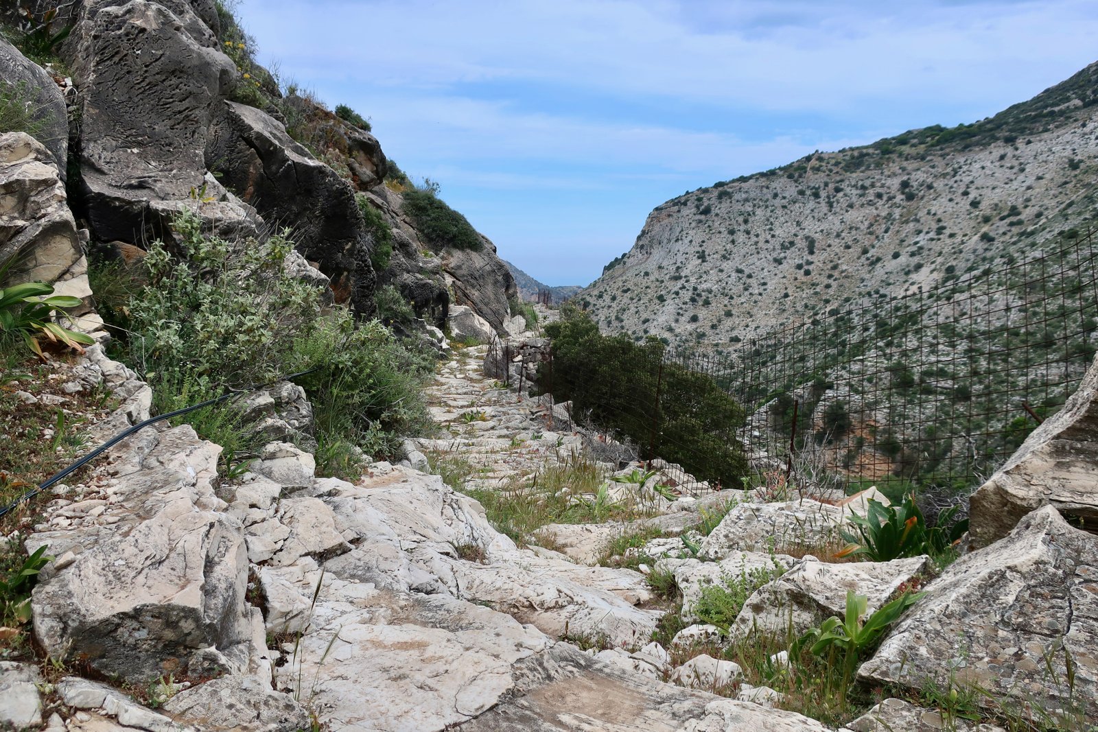
The path dives off to the left from a dirt track that spills out of the lower, eastern flank of the village. The signing is good. From then on, much of the way is paved.
The beach at Lyonas isn’t a holiday beach. It still has the feel of a functional place of work, a cleft in the coast between cliffs where small boats can come. Even if a road goes there now, even if there are a couple of hopeful tavernas, it’s too far out of the way for most people. We were there in March but it’s hard to imagine it much different in summer.
We met the Koronos donkey-man on the way down. A saddle hangs outside his small house in the village, an old-fashioned mark of trade. He’s used to occasional foreigners. If you meet him on the trail, Would you like to pat my alogaki, he asks, in Greek, understanding that all foreigners like to pat donkeys. If you demur he may nip into a store-room and reappear with an apple, understanding that all foreigners like to feed donkeys.
When this happened to us, halfway between Lyonas and Koronos, with light snow falling, Yvonne, keen to get home to the warmth, bundled up against the cold, not really paying attention, thought the apple was for her. Had I not intervened, practically pulled back her hand as the apple she had been given moved towards her mouth, she would have eaten it herself and the donkey man would have had a story to tell in the kafeneion for years to come: the foreign lady who ate the donkey’s apple, tell us again Dimitrios, Panos, Charalambos.
On the way back up to Koronos we sat on stone steps between high path-walls and ate lunch, away from the wind in a little flash of sunlight that ripped briefly through the clouds. For some minutes it was nearly warm.
HIKE 2
Koronos to Stavros to Keramoti to Skeponi on Trail 12. Skeponi to Eggares via the coast. Eggares to Kynidaros on Trail 11. Kynidaros to Stavros cross country. Stavros to Koronos on Trail 12 again.
About 35 kms
Having decided the forecast was too bad for walking, we didn’t set an alarm. We have an occasional tendency to agree, definitely, not to do whatever it is we might have done the following morning – most likely walking or swimming – all the while knowing we might change our minds. The possible change of mind is mutely built into the would-be definitive resolution not to. No swimming for us tomorrow morning, we declare, implying a sort of day-off. Yet there we go, trooping out the door before breakfast, heading for the water. Definitely no walking tomorrow, we assert, and may just as well have our fingers crossed behind our backs.
We were up early enough anyway that even after making coffee and reading the news and checking messages, having seen meanwhile that the day hadn’t started with heavy rain or snow, we still managed to speed up and be out the door by nine. Thirty-five kilometres to do, give or take, no time to waste. Not rain or snow as we set off, but a freezing morning; hats, gloves, scarves, long underwear. Guffs of smoky breath.
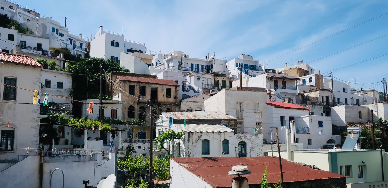
From where we were staying near the top of the main side of Koronos, most routes begin with a meander down through the village, a stepping and dropping to the point where there are two tavernas. On the climb up through the other, mostly-abandoned side of the village, the old stone steps have largely been concreted over. Leaving the village behind, the concrete comes to an end. A stone footpath heads straight up to the saddle in the hills in the direction of Stavros, avoiding the lengthy sinuousness of the asphalt road.
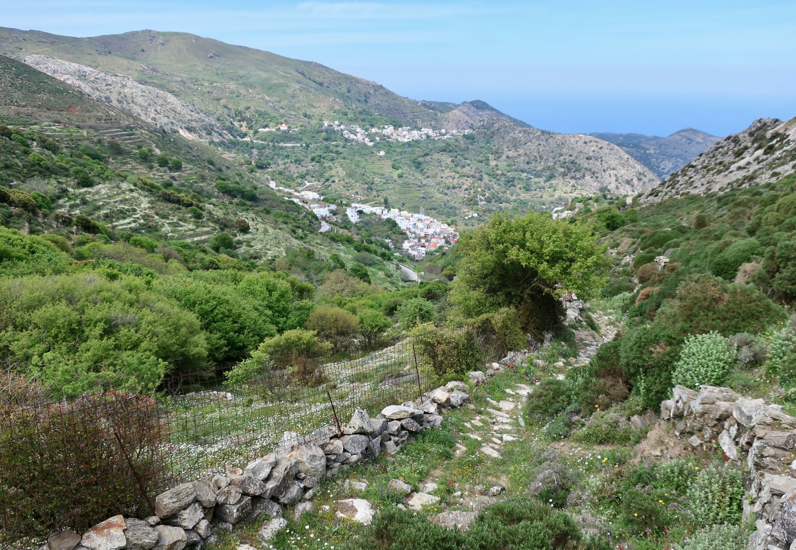
At Stavros, Trail 12 dives down towards Keramoti. The path is consequential, a stone-paved walkway that was once the main route between Koronos and Keramoti.
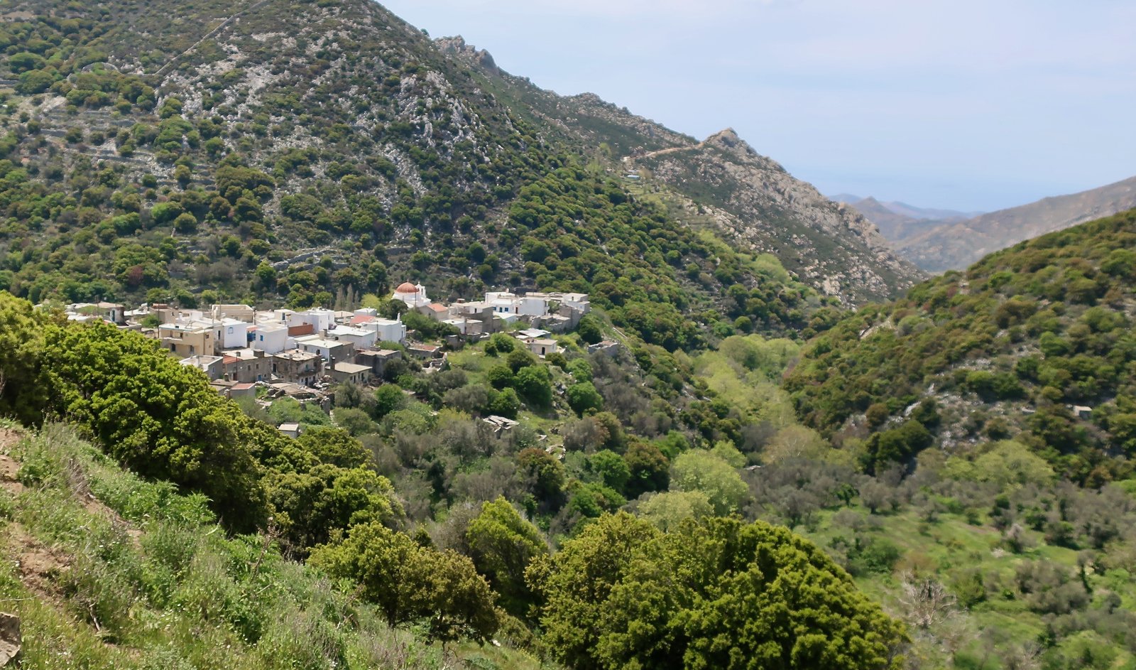
Keramoti sits on a bluff in a valley between much higher hills. In the past there were at least three main ways in and out: this path down from Stavros, another that comes from the direction of Sifones and a third that continues on to Skeponi. Nowadays the narrow tarmac road that comes down from Stavros ends at Keramoti. It gives the village a sort of fairtytale, end-of-the-world quality, sitting there on its small rise, at once surveying the lower land but also sheltered by the high ridges and hilltops all around. It’s a place in which minor princesses might live, from where they might throw down their long hair for suitors to climb. The radical alteration in the way most people move around the island has transformed Keramoti from connected mountain village just like many others, to this place where the road ends. It has suffered a psychological sea-change.
We saw no-one, but as befits a fairytale place heard a regular thudding that echoed just faintly around the valley. Someone, somewhere close, doing something manually repetitive.
The path begins at the tip of the village to the right of the crease of the valley. There’s a small waterfall, that occasional hikers visit. The paving fades, changes into mountain-path, hard and rocky. Dirt, stone, wind-blown land. When the trail turns the corner to head north we were almost blown over and had to hunch up, freezing and blasted, until the path descends into agricultural hollows and is calm again.
Skeponi, a couple of hours walking from Keramoti, is a once-village, now a collection of eloquent ruins above a stream that in March at least has water. There’s a watch-tower, a dozen homes, a bakery, perhaps. In all the buildings the remaining roof-beams are fire-black. People must have lived in a fug of permanent smoke, for cooking and for warmth. There are stone steps up from the stream, a compactness, a photogenic state of dilapidation.
Between there and Eggares, where Trail 11 begins, the way goes past another example of un-pretty island reservoir, this one the shape of a pennant in the wind. We followed it to the coast, before turning back inland. Eggares is a quiet, once-industrious, settlement where elderly men gather in the one small shop/café to smoke and drink and pass long, slow days.
Trail 11 heading inland to Kynidaros narrows from soft lane to footpath, on and off paved, through a low valley, back and forth across a stream. Nothing of the earlier mountain hardness here. Kynidaros is a typical low-hill village – scruffy with its untended flat rooves and mess of electricity and phone wires when seen from above, ordered and empty when walking through it.
With evening coming on and cold clamping down and the wind blasting across the plateau between Kynidaros and Moni, we walked on the road as afar as a marble workshop, a hangar clothed in grey dust, with heaps of assorted samples of marble sitting outside, and turned left. (This is the small black rectangle by the first left-hand turn-off on the Anavasi map on the road between Kynidaros and Moni.)
The only other person we saw was the goatherd with his slow, slowly-barking dogs, who said it was amazing to see us there, heading into the lengthening shadows of such a cold evening. Probably an hour and a half then home to the central heating and short bath and a plate of hot pasta.
The dirt road to Stavros is not lovely, but can be done at speed. Back in Koronos by nightfall, the man in the shop weighed out our onions and tomatoes and asked us where we had been, and shook his head when we told him.
HIKE 3
Koronos to Skado, Komiaki, Apollonas on Trail 9. Apollonas to Agia on the road. Agia to Komiaki on Trail 17. Komiaki back to Koronos mostly on the road.
Approx 32 – 34 kms
In the past the slopes and valleys between the mountain villages of Koronos, Komiaki and Skado were intensely cultivated. Trail 9 is the old path, or one of the old paths, that cuts through them and connects the villages. It heads north out of Koronos, runs across terraces, in and out of the folds of the valleys, staying high all the way. The morning we were there, a couple of men and a teenage boy were working the terraces just below Komiaki, smoke rising like frozen breath from a small winter bonfire. A donkey was carrying the heavy stuff back and forth. Not so far away from holiday-Naxos, beach-Naxos, some few people are hanging on to a barely modernized version of the old ways.
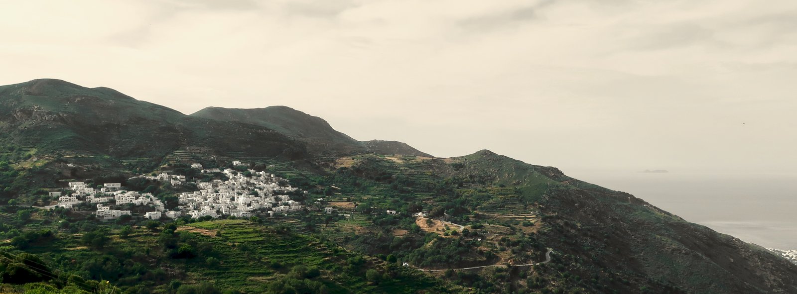
The continuation of Trail 9 from Komiaki to Apollonas follows the spine of the hills towards the coast, starting at about six hundred metres, gradually dropping. Most of the path is no longer paved, if ever it was. Descending, the slopes to the right, on the other side of the valley, are fully terraced, olive groves and tiny white churches. Donoussa is visible to the east, Mykonos to the north, straight ahead.
Apollonas is tucked away on the far side of the island, a distance from the tourist centres. There are a few tavernas and cafes, a small fishing port, a beach. It’s a world away from west coast Naxos. The more or less shininess that to greater or lesser degree has invested so many Greek island places has not reached Apollonas. Before there were roads and motor vehicles, the isolation of Apollonas, or Lyonas, must have been much more complete, although even now most summer visitors to the main west coast beaches will not make it this far.
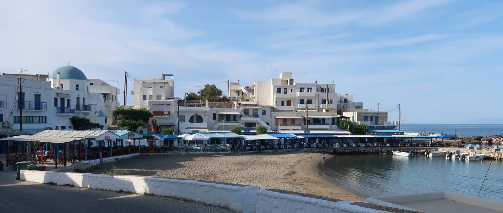
From Apollonas to Agia, with so many kilometres to do before dark, the road-walk has to be done at speed. Wherever the crease of a valley has created a protected spot away from the north wind the valley-slopes are terraced. Mykonos gets closer and closer, the southern glitzy edge with beaches tucked away from the buffeting of the north wind. Between the old ways and the new, agriculture and beach-holidays, wind, the avoidance of wind, is a rare common factor.
Trail 17 from Agia to Komiaki over the mountains is not always easy to follow. Even the beginning is not straightforward, a cluster of red dots daubed on rocks at the edge of the dirt road that branches off from the main tarmac coast road at a point, otherwise nondescript, indicated by the map and phone GPS.
The path comes and goes. There are occasional red dots. At time of writing it hasn’t been fully incorporated into the network of Naxos trails but is very lovely, and for Naxos, which is usually more about the quality of paving and the history of paths, the story of agricultural wealth they tell, it’s dramatic. It rises to about eight hundred metres in a landscape of sharp crags. A few sheep or goats, almost no terraces, almost no softness.
There are conflicting markers, old and older. At least one other path used to and may still go from near the high-point back to Apollonas by more direct route than Agia and the road. Near the top there are signs that an old stone path has been washed away, as if a giant flood had come. We lost the way down to Komiaki, found it, went too high the wrong side of a peak, followed an alternative path that was wrong and anyway disappeared.
From Komiaki, rather than re-do Trail 9 we took the road all the way back to Koronos.
***
On the edge of Skado, the middle village of the three, there’s a war memorial on which dozens and dozens of names are written. At first it seems like the sort of thing found in thousands of villages all over Europe, until on closer inspection you see that most people died in a short period between 1941 and 1942, and that the majority were children and the elderly.
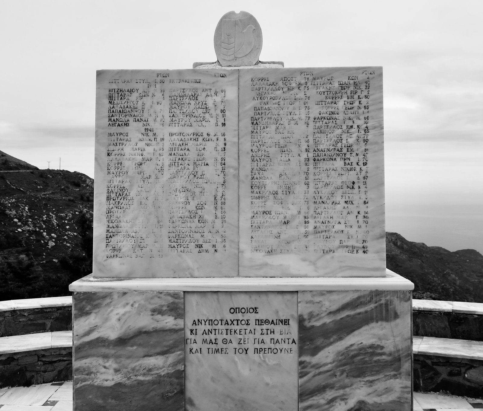
Skado depended on emery mining to such an extent that unlike other Naxian villages they had had little need for agriculture. During the war, the emery mines closed, the men mostly absent, they had no source of income. It is hard to believe, in this place surrounded still by evidence of intensive farming, but the people on the memorial starved to death.
HIKE 4
Koronos to Stavros on Trail 12. A cross-country cut to down to Trail 1 and on to Apeiranthos. Apeiranthos to Chalki via Agios Ioannis on Trail 3. Chalki to Moni on Trail 4. Moni to Sifones on Trail 8. Sifones to Stavros and on to Koronos on the road, then Trail 12.
Approx 29 kms.
This was the third hike of around thirty kilometres in five days, a circular inland hike that never comes near the coast. Except for the cut cross-country from the road near Stavros down to Trail 1, the route closely follows numbers and trails.
The cut-through to Trail 1 is not obvious:
Standing on the road at Stavros, Anavasi map in hand, looking east, down below perhaps a kilometre and a half away as the crow flies, (but not visible) is Trail 1. We guessed the direction and set off, over a fence, down, over another fence, along a barely visible path to the right, then left and down and so on. It wasn’t difficult and it wasn’t exactly straightforward. It’s a matter of choosing a direction and hoping for no unbroachable blockages.
What remains from the rest of the day is the following:
– The aesthetic of Trail 1, one of the grandest paved paths in the islands. The corners of it, the curves, how it undulates with the land, never ruler-straight or flat. The main section begins at Agia Kyriaki, one of a number of churches in Naxos that date back over a thousand years, and continues most of the way to Apeiranthos. The grey or brown weathered stone of many of these churches makes them seem archaeological, impossibly pre-Christian: Agia Kyriaki; Agios Ioannis Prodromos, mythological in an olive grove at Kerami; Drosiani, a nest of domes – inside it, a candle-blackened darkness.

– The oven-taste of the bread from Apeiranthos. The oven taste of the air in the bakery. A mother and son team working in a cloud of flour dust.
– Trail 3 south from Apeiranthos until the point at which it turns west and cuts the main road at Agios Ioannis, is a confusion. We blindly almost wandered into a farmyard where two snarling dogs, one chained either side of the track, were versions of Scylla and Scylla, all teeth and anger.
– Fruit orchards on the path between Agios Ioannis and Chalki. Olive of course, and almond, and orange and lemon and pomegranate, and patches of overgrown vines. Flowers everywhere. Coming down from a skiff of snow in the highlands to spring flowers here. Land for Sale! A sign, hand-photocopied. 31 olive trees, 2 orange trees and 1 pomegranate tree. (I speak Greek and English.)
– The path into Moni village from Drosiani, it meanders, a watercolour, a garden orchard path we did again two years and a month later to be dazzled by flowers, purple and white and red and orange and yellow and pink.
– Moni itself, a dying village. Few will choose to stay there with the coast calling, other, more modern lives to be lived in other places. Most of the houses are closed up, falling down in slow motion. There were oranges on the sloping path through the village. One here and one there until we found the source. The colour of them is extraordinary but the taste is awful, a bitterness that sticks to the fingers and dries the tongue, that you can’t get rid of. Water won’t do it. Drinking and spitting and drinking and spitting.
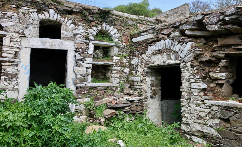
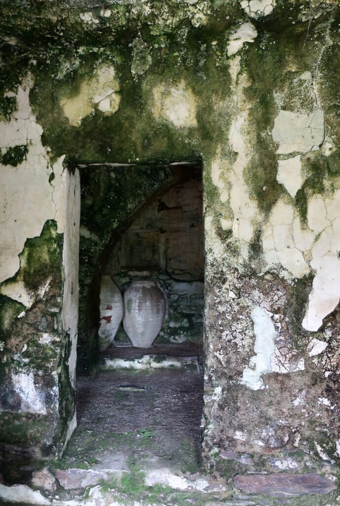
– Moni is dying but Sifones is dead. A linear village of abandoned, unrendered stone houses that follows the course of a small stream. The main village footpath runs between the stream and the line of front doors and courtyards-entrances. Nettles grow in abundance. There are arches, ovens, steps up and down. There are fat urns, and blackened hearths with stone seats either side. It is a Tolkien village for hobbits.
– The smell of mint coming into Sifones. We found it in the trickle of a thin, black, water course. Water was threaded around the luminous green leaves We dragged up a couple of dripping handfuls, to take home and use.
– Coming back over the saddle between Stavros and Koronos, walking through clouds as wet as cotton wool swabbed in water.
HIKE 5
Bus to Filoti from the Chora. Filoti to the church of Agia Marina and then to Danakos on Trail 2. From Danakos on to a point in the middle of nowhere, on a dirt-track, marked Flea, on Trail 13. From Flea, Trail 13a down into a steep valley and up the other side to the main tarmac road between Apeiranthos and Moutsouna. Right on the tarmac road towards Moutsouna as far as the left-hand turn-off towards the Emery Mines and Trail 1. Into Apeiranthos on Trail 1. Bus back to Naxos town.
About 25 – 26kms
This is a mishmash of three different numbered trails plus between seven and nine kilometres on tarmac road. The plan was to take the 07:30 school bus to Filoti in the morning, hike a circular route via Danakos and get to Apeiranthos in time to take the 16:15 – the last bus – back to Naxos town in the afternoon.
Trail 1, far more than the trail up Mt Zas, the best-known path on Naxos, is an unmissable classic, one of the truly great stone-laid paths, a thing not of height and drama but of breadth, and grand workmanship. But because it’s an out-and-back from Apeiranthos to Moutsouna, not a circular path, it’s not obvious how to go about it.
HIKE 4, above, is one way to do the most interesting part of Trail 1. This hike is another option, that takes in even more of Trail 1.
***
An 08:30 start in Filoti, allowing seven hours forty-five minutes for hiking on partially unpredictable terrain and paths.
The lower section of Trail 2 is also the beginning of HIKE 8 to Mt Zas. It’s mostly paved, gentle at first, before climbing a little more keenly up to Agia Marina where it splits in two, one arm going to the summit, one arm dropping slowly down through lush woodland to Danakos. We did this path in May, probably the greenest month of the year, before the heat kicks properly in.
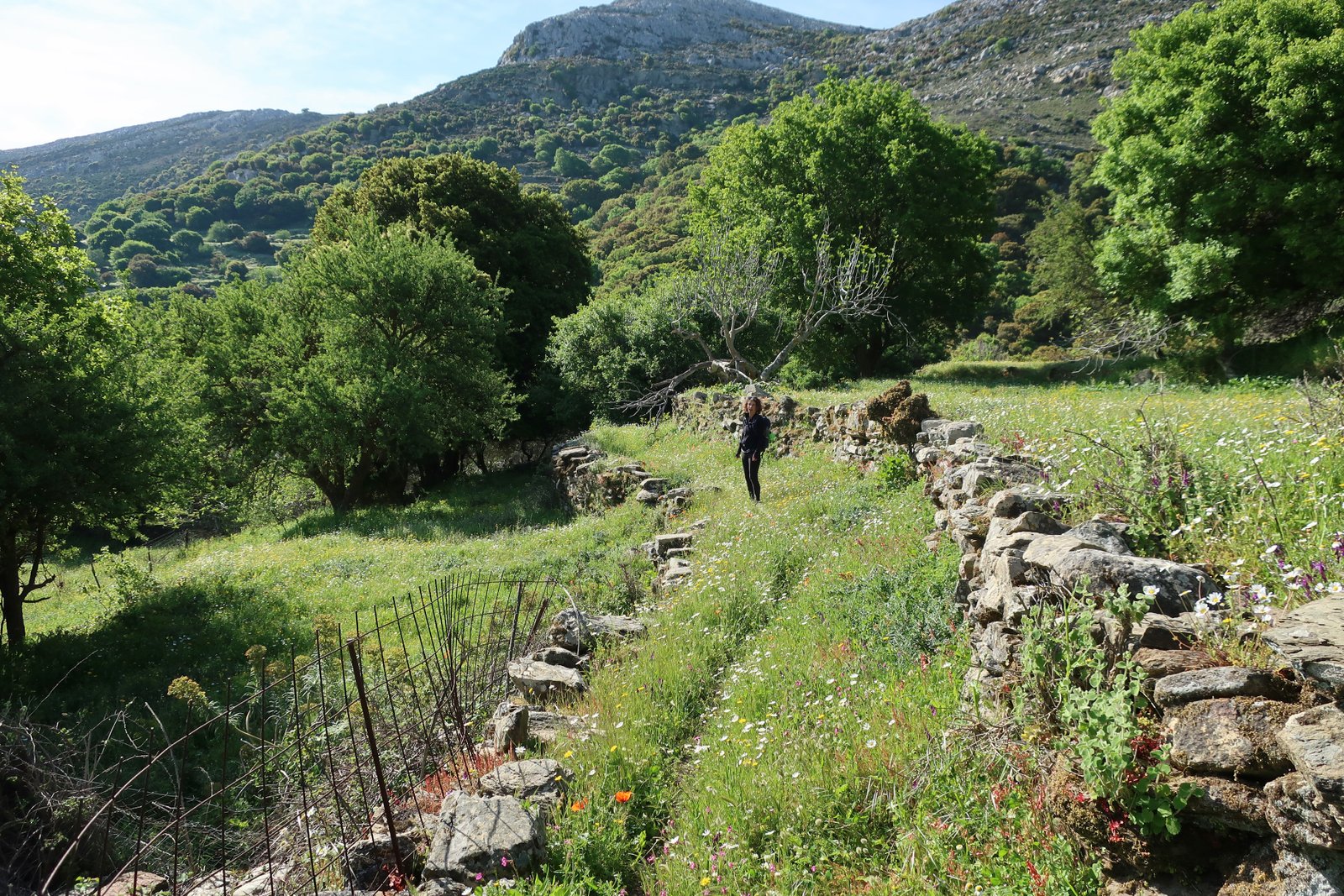
Danakos is a tidy old agricultural village, too far off the beaten track to have been much touched by tourism. A few kilometres of eccentricity away from the main villages of the island and it could be anywhere. There are a couple of tavernas, closed when we passed through, whose dusty windows gave the impression they might never open again. We saw one other person, an elderly woman who walked ahead of us for two minutes before slipping into the village cemetery .
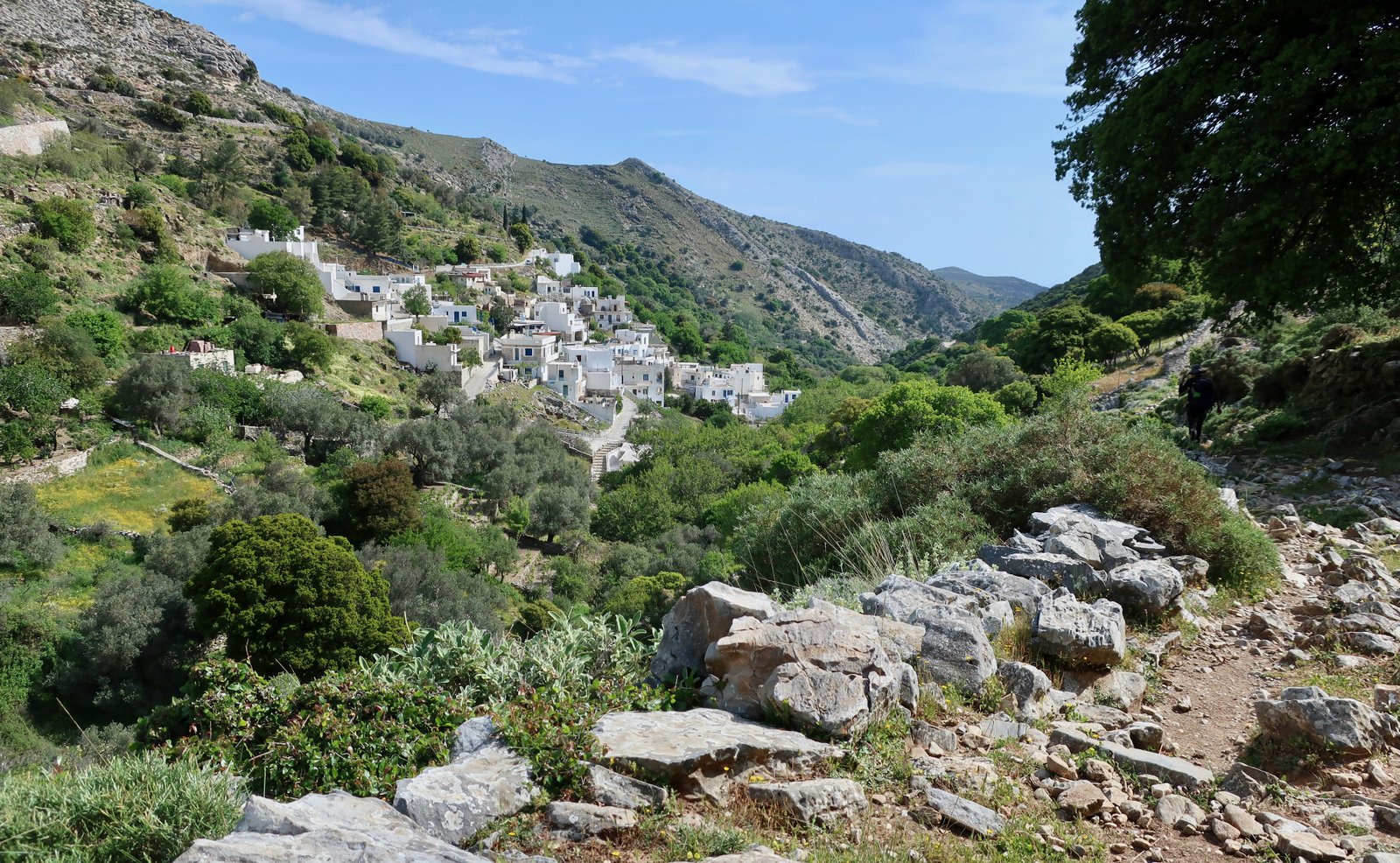
Trail 13 begins at Danakos. We had been planning to divert off this Trail at a point midway between Mersini and Stavros, first of all on a dotted, unnumbered trail marked on the Anavasi map to the church of Agios Charalambos, then on unpaved roads down to Moutsouna.
When we got to the turn-off point, having already been delayed by a wrong turn on Trail 13 – and now I look at the map and see the way the path clearly curls around the contours of Grammata hill, I’m at a loss to explain how we found ourselves on the crest of the hill, without a path – the linking path from Trail 13 to Agios Charalambos was a metre and more high in dense Roman stinging nettles. This variety of nettle is common in the islands, and has tiny, green stinging fruit-balls like unripe blackberries. Even had we not been in shorts, they easily pierce trousers. Getting stung happens all the time, but walking through a sea of waist-high Roman nettles, with no visible end in sight, would be absurdly masochistic. (These particular nettles are called Roman because the Romans used them to self-flagellate, and in so doing warm themselves up in cold weather.) The land on both sides of the stone-wall-channelled path within which the nettles were growing, was agricultural, in use, with unmanageable fences.
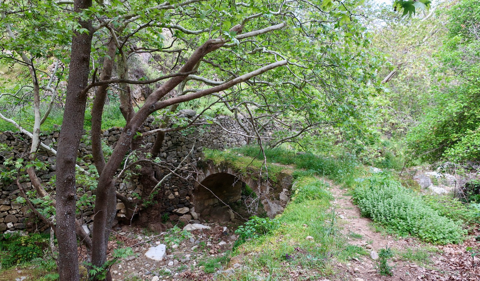
We abandoned the idea of Moutsouna, continued on Trail 13, then at Flea took the map-dotted deviation down to the right, marked 13a on the terrain. Had we diverted off to Agios Charalambos we’d not have done the 13a, which turns out to be another of the many classic paths on Naxos. The valley into which the 13a plunges, not even a couple of kilometres from Apeiranthos, is steep-sided, completely sheltered from the wind, and was once a hub of cultivation, with terraces all the way down both sides. Lemons and oranges, olives, figs and vines still grow along the way. Along the water course at the bottom are a number of abandoned mills. The path that climbs up the northern flank of the valley is a very beautiful paved trail up the wooded hillside.
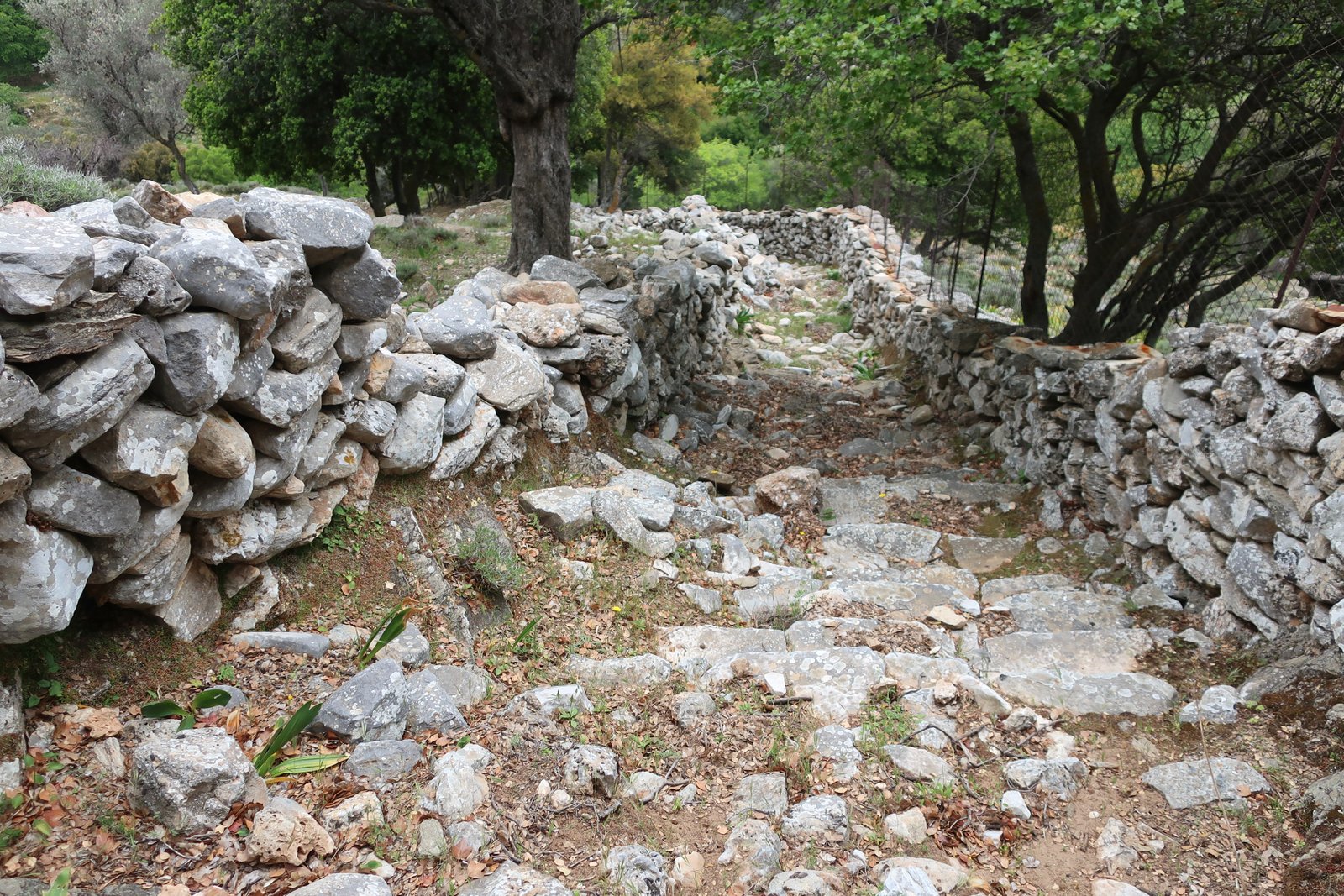
It still goes as far as the paved road, about half way to the village, and is in reasonable condition, but is fading. For much of the way the land is steep, especially susceptible. Where the weather has caused the land to slide, and the path with it, nothing has been fixed or replaced. A rockfall at one point has come down onto the path and been left untouched. Trees now push through the middle of the path, forcing up paving stones. The forest is taking over. Soon it will turn to myth, sections here and there of stone stairway among the trees suggestive of some past civilisation.
The point at which Trail 13a hits the tarmac road was the new decision-point. Either a stroll into Apeiranthos for a relaxing afternoon until the bus comes, or a dash, three hours for about fifteen kilometres, about half of which would be on tarmac, the other half on mostly stone-paved path. We chose the dash.
From the point at which we turned left off the main Moutsouna road towards the emery mines, there are cables overhead that used to carry hods of emery down to the coast, where the emery was loaded onto ships. No mining has been done for years. Everything has ground to a halt. In time the cables will come down. Already a couple of hods have fallen. The industrial detritus of the emery mines, the cables and towers and hods, the old mine buildings, the piles of earth and rock, all of it has been abandoned, left to melt into the island.

The downhill continuation of Trail 1 to Moutsouna is partly visible, running along the far, northern side of the valley. Before the tarmac road comes to an end, one corner of it touches Trail 1, so that depending on time/inclination about a kilometre and a half can be done on the path through the mine area, or on the road. Soon after, the trail proper returns, nice old stone through the hills, and then, a little before the church of Agia Kyriaki, dating back to the 800s, it begins the transformation into the grand thing it is for much of the way between the church and Apeiranthos.
We had to jog for the last fifteen minutes in order to be sure we’d make the bus. From the smiles of the bus driver and several of the passengers, it seems they were watching us, back and forth around corners, appearing and disappearing, understanding exactly what we were doing.
HIKE 6
Naxos town to Melanes, via Agkidia. Melanes to Vivlos on Trail 6. Vivlos to Agios Arsenios and back to Naxos town.
Easter Sunday, churchbells, the reciting of ancient litanies. Sunday church-people – which means almost everyone – in their Sunday church-clothes, milling about the overfull churches, hanging around outside with their babies to be jigged. Teenagers sitting on churchyard walls, tight with their teenage friends.
Back lanes out of town up the hill to Agkidia, then like a winding narrow Irish lane on over the hilltop and down the other side to Melanes. Shallow terraces, farmland humming with insects.
Trail 6 to Vivlos begins on old paved stone, softened by the passing of countless thousands of feet. There’s a storybook little café near the beginning, right on the path. An old couple came sideways down the trail, foraging, plastic bags bulging. As far as the Kouros at Flerio it’s unbrokenly perfect, a path to be done with children running ahead, a saunter on a sunday.
The Kouros is one of Naxos’ sights, a sketched-out unfinished marble statue four or five metres tall, lying for two thousand years in its roughed-out state. It seems funereal, it’s rare we see Greek or Roman statues lying down. Presumably it was an order from a sculptor somewhere, that before being sent off to be carved to a finish was roughed out into modernist morphology. Except that during this process, or during the beginning-to-move process, one of the legs broke, rendering it worthless. Similar accidents were probably frequent, but without this evidence who ever would think of such things. Two thousand years later and what was waste, a swearing match, has been transformed into tourist attraction.
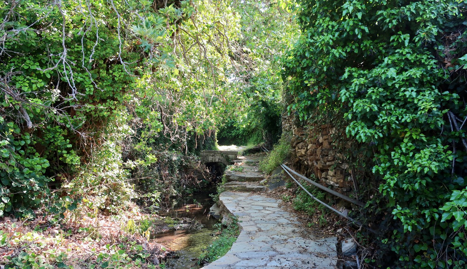
A wet walk through the Potamias, three linked villages, small and cute. The path along the water course that connects them was barely followable because of water splashing and lapping over paving stones.
Later, the church of Agios Mamas, another of Naxos’ ancient greystone churches. It sits in the middle of nowhere. It is simply impossible to imagine the world of the mid-800s, where instead of the surprise of coming across such a fine church in the middle of nowhere, it was presumably embedded into the logical network of the island. It was locked when I passed, with building materials piled up for a planned renovation.
After the third Agios Mamas, after Vivlos, the road to Agios Arsenios and the short, most direct, lane home, one of a small number of spokes that fan out from Naxos town. It’s a straight, farmyard road, agricultural not in the sense of olive groves or fruit trees, rather in that there were a succession of farms along the way, with gated entrances, muddy courtyards, the high, acid smell of cattle.
HIKE 7
Naxos town to Filoti by bus. Filoti to Mt Zas on Trail 2. Mt Zas to Damalas, Trail 2, road, unmarked path. Trail 7 to Ano Sangri. Ano Sangri to Vivlos. Vivlos to Galanado to Naxos town.
25 – 26kms
A bus from the Chora to Filoti, half an hour during which I was talked at by an elderly Englishman, obsessively unhappy that Harold Wilson had been Prime Minister in the UK in the 1960s.
Because Mt Zas, at just over a thousand metres, is the highest mountain in the Cyclades, this is the best-known path on Naxos. Zeus was brought up in a cave on the mountain. Zas – Zeus. The king of the gods, it’s a matter of local pride.
Even within the context of mythology, this Zeus business is not strictly true. Rather more often it’s agreed that he was born and brought up on Crete. Although given the nature of what’s being claimed, all opinions on the subject should probably be treated more or less equally.
The path up from Filoti (altitude about 350m, the largest village on Naxos bar the port/Chora) is short and steep, about four kilometres long. It’s one of those paths that even not-regular hikers do. It departs Filoti on a very, very old version of suburban paved stone, much softened, through close-to-town agricultural land and edge-of-village dwellings.
After the church of Agia Marina, the trail leads at first through woods, then onto a typical Cycladic bare stone mountain-top. On a clear day there are islands in every direction. Delos may be billed as the fulcrum, but in reality, looking at the southern Aegean, an area circumscribed by Athens and the Peloponnese to the West, Crete to the south, Izmir and Bodrum to the East, it’s Naxos, with its bulk, that occupies the centre-point.
Because this is a trail to the summit, in the way of a number of other summit trails it has become more about reaching a point than the path along the way.
Photos on the internet suggest that the trail, which is circular from Filoti, is more natural in the other sense, anticlockwise. Because I was planning to walk back to the Chora, I did it via Agia Marina, and struck off west at the point where the path has descended from the heights to hit the road south from Filoti to Aria and Mikraria. But really, having been to the top of Mt Zas, and wanting to get back to town, there are any number of possibilities. Bits of Trail 5, 6 or 7, via Chalki, the Potamias, Ano Sangri, Vivlos and so on.
Zeus’ cave, hidden in a fold of valley on the northwest slopes, is a damp, dark mouth in the hillside, not the sort of place anyone would want to spend their childhood. When I passed, there was a dead goat at the entrance. Its presence before I reached it was signalled not by the smell, which would not have been surprising since we often smell the remains of goats and sheep before we see them, but by the scream of an occasional hiker – trendy sneakers, not hiking shoes – who had hardly expected to come across such a thing.
***
Uniquely, these last two hikes, numbers 6, 7 and 8, I did on my own. In the gap between doing them and writing them down, a bizarre thing has happened: I have unconsciously, magically, inserted Yvonne into these walks she didn’t do. There are certain moments in particular where I can recall conversations that never happened, or where I remember things she did, even precisely where she walked, except that it’s all completely fabricated.
– On the way to Aghios Artemios on a bend in the road we talked about the rape seed in the air that was making my eyes water, confirmation that I have a minor allergy to rapeseed flowers. All around us were yellow fields of spring rape.
– On both of these walks we strolled along the main road into town, past the main town supermarket. We had never done this before. There’s an old stone bridge just off the road to the left. We stopped and looked at it, had a conversation about it being perhaps on the old path into town, such a lovely stone bridge.
– On the second of the solo strolls we – again we – passed through the three connected villages of Upper, Middle and Lower Potamia. The linking trail between them is not even a couple of kilometres long. For much of the way we were walking on a path that ran alongside the water course linking the villages. In some places water was overflowing onto the path. We had to jump over the wet patches, then tiptoe when jumping wasn’t possible. I can remember us both doing it. I can remember Yvonne putting her feet down into the water more casually than me, both because her shoes are waterproof and mine not, but also because I can jump a little further than she can.
– Finally, on the first of these two walks I did solo, I, (we), went from Vivlos to Galanado, before turning onto the main road into town. At Vivlos we talked about how quiet and undeveloped it was despite being close to an important tourist centre like Naxos town, how skin-deep so much of Greek island tourism is. Then in Galanado, winding on a lane through the middle of the small collection of houses that makes the village, there was some wild asparagus on the right-hand roadside. I stopped to pick it, as invariably I do. I can’t resist. Yvonne carried on walking just ahead. I can see her. It had been a very long day and evening was coming in so we really needed to be getting on. Still she didn’t say anything, like Come on, we have enough asparagus, we should get back, it’s getting late. It would have been quite reasonable for her to do so, but she never does. She just slowed for me, as usual. It’s funny, even in this imaginary scene which can’t have happened, Yvonne is endlessly patient, that’s how I’ve invented her.
It’s still so hard to believe that none of the above actually happened. I can see it, hear it.