
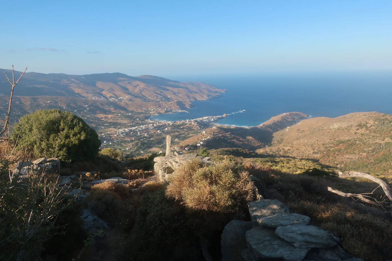

There was a Japanese girl on the ferry from Rafina to Gavrio. You can’t help noticing people, wondering about them.
The truth is, she might have been Chinese or Korean. Still, such a long way to come. And was that really all she had, one small backpack? It’s the sort of minimalism we aspire to but never seem to attain.
In Gavrio we caught the same bus as her down the west coast. When the conductor came to collect fares, the Japanese girl asked where the best beach was. The conductor was momentarily nonplussed. Conductors on Greek island buses are not tour guides.
Seeing the confusion she’d caused, the Japanese girl held up her phone. On it there was a photo of a beach.
That’s Korthi, said the conductor, we’re not going there.
Which is the best beach we’re going to?
By this time the conductor was warming to the Japanese girl, warming also to her new role.
Mpatsi is nice, she said.
Ten minutes later the Japanese girl was standing on the roadside at Mpatsi as the bus pulled away. Everyone on the bus had turned to watch her there, (our Japanese girl now, all of us) with just her small backpack, no real idea where she was, surveying Mpatsi and its nice beach.
Surprisingly often I think of this girl, knowing that we will never attain this level of insouciance. It’s not that we are incredibly, fussily, organised, but we do know where we’re going, and we do tend to know something about wherever it is we’ve just arrived.
Beyond the hiking trails, the picturesque ports and the scarred history of the Aegean, having stepped out of what we think of as normal life, even temporarily so, when travelling we cannot help becoming vulnerable to the question of who we think we might be, who we think we’d like to be.
It’s never just the Greek islands and hiking.
***
If asked to recommend a starting place for people who haven’t been to the islands, who want to hike, but who also want more, (who probably want everything), we will almost certainly string out a list of islands with qualifiers and characteristics before coming eventually to settle on either Andros or Sifnos.
(Apart from the fact that they both have everything), what they have in common are two of the best, best-organised, hiking networks in the islands. The difference is in the scale: while Sifnos has about 80 kms of trails, Andros has over 300kms of marked, walkable pathways.
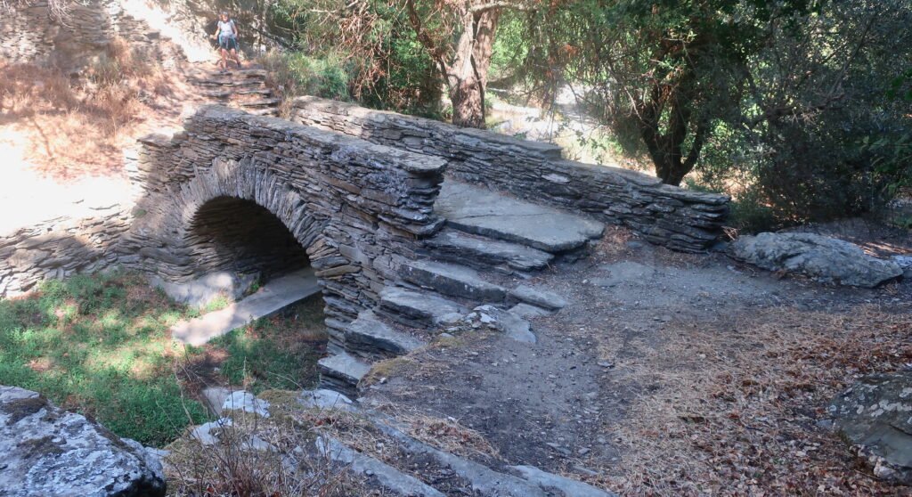
As on other islands, the number and quality of old stone paths is a sign of past agricultural wealth. Across the island, but especially in the southeast, there are substantial fertile valleys, most of them protected from the north wind by the particular topography of Andros – the whole island is a series of roughly east west parallel ridges and valleys. These valleys are watered by an exceptional number of streams. Still today there are dozens of stone bridges across the old waterways. Beyond the sumptuous aesthetic of the bridges, it’s impossible not to see in their profusion a sort of competition between local communities, but also the whole island wilfully vaunting its prosperity.


The second wealth of Andros was maritime. In the late-nineteenth and early twentieth centuries Andros was behind only Athens in total shipping tonnage. It was the canvas for the historical drama Little England (Mikra Anglia), Greece’s entry for the 2013 Oscars and one of the national film industry’s most successful films of recent years. In the film, while their husbands spend their lives at sea, Andriot women wait at home, sewing and gossiping and taking charge of everything the men would usually do. The children of these men, conceived during brief shore leave, know their fathers as strange, foreign men who bring them presents, sweep them up in their arms, invasively embrace their mothers.
We’ve watched Little England three times now. I tell myself it’s useful for learning Greek, which is not entirely untrue, although when I watch it I inevitably lose concentration, so that rather than language I’m left at the end each time with images of ocean, waves sweeping in towards the shore, and the tender, intensely sad, fingertip-writing of SOS on a bare chest.
The largest settlement on the island is the Chora, two thirds of the way down the east coast. It took its current form during the shipping boom, but must already have been well-off: the valley that sweeps down towards it, with its gardens and paths and orchards and a mesh of irrigation to feed it all, is as much as anywhere we’ve been a Greek islander’s idea of earthly paradise.
But the town itself, the setting, is extraordinary.

Built on a finger-thin promontory that thrusts five hundred metres straight out into the sea, there’s nothing else like it in the islands. With the money that poured in from shipping it became what it is today, a main street paved in smooth marble, with grand sea-captains’ houses and elegant early 20th century shops with their wrought iron and glass canopies.
Either side of the sauntering main street there’s a mesh of side-alleys, then down at sea level the rust of the old jetties, the ailing concrete of the water-access where, with shipping a thing of the past, no-one returns now after long years of absence. In the evening someone might be fishing. When it’s rough, water squirts up through cracks in the concrete. The second half of the main street, the oldest part over the water, bristles with balconies. Everywhere you can taste the salt. Gavrio, tucked into a protected bay in the northwest, is the ferry port because the Chora is too exposed to wind and waves. In Little England, when the seamen come home to the Chora, they come in liberty boats, leaving their ships like perfect ship-models further out in the bay.
The north wind barrels down through the middle of the Aegean to slam into Andros. There’s nothing in the way to break its passage. More than two hundred and fifty kilometres of build-up for the waves. Coming from Rafina on the ferry there’s shelter as long as the ship is behind Euboea. But then it has to cross the Kafireas Strait, the narrow gap between Euboea and the north of Andros, into which wind and waves funnel. Historically it’s one of the most dangerous places in the Aegean for shipping. On a huge modern ferry, of course there’s no danger, but the first time we took this ferry, for the duration of the short passage across the Strait, hardly more than ten kilometres, the whole world was cocked sideways. Wind and waves hit the ship broadside, a feeling not of the contained, choppy Aegean, but of a great, rolling ocean. Out of the long saloon windows on one side there was only sea, on the other only sky. It stayed that way until the ship reached the shelter of Andros and lurched back to horizontal.
At right angles on both sides of the Chora are long sandy beaches. The one to the north is the town beach, with a few tavernas, a wooden promenade, a casual holiday feel. On the other side the beach seems to have no relationship at all with the town. Nothing has been built. It feels almost remote, a beach from the middle of nowhere that just happens to find itself there.
The Greek islands are full of towns that owe their existence to the sea, but this is a town that seems to be straining to leave the land altogether. And like most coastal towns on Greek islands, even a place like this in which people live all year-round, it’s hard to imagine the original, that was entirely itself and not the modern version, defined either by its history or its short summer season. It’s as if all these places are indistinct images of themselves. A significant percentage of almost every Greek island coastal town is closed in the long off-season. Some towns only exist at all in the summer. The question of what is the real town is always present. In Andros, what is the real Chora? The summer one, full of people, vibrant and alive, inward-looking? Or the semi-dormant one that survives structurally, photogenically, historically, during the long winter, staring, with all the melancholy and pride of the glory years, out to sea?
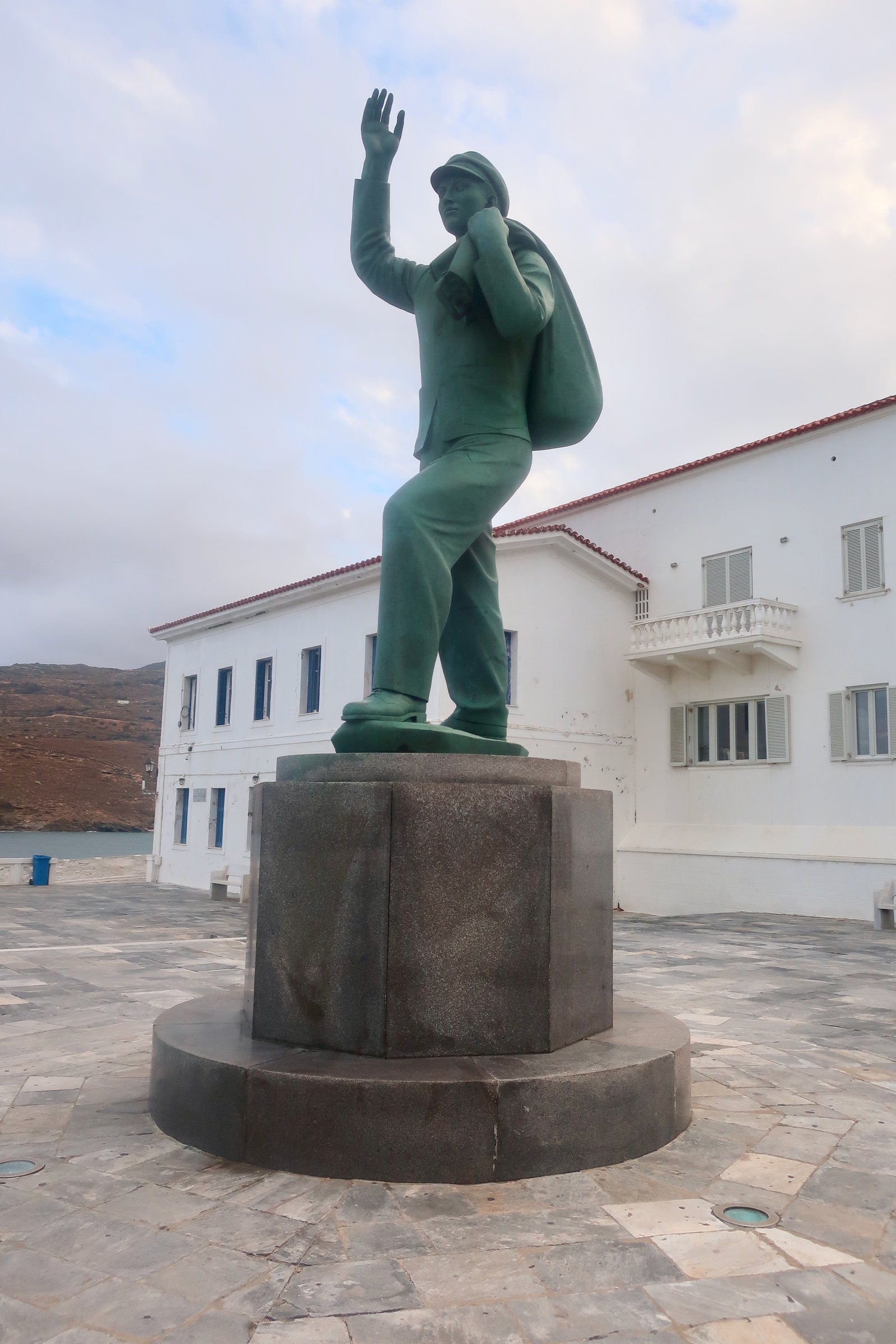
Down on the tip of the Chora, just before the arched bridge that leads to the ruins of a Venetian castle, there is a more than life-size statue of a sailor going off to sea, his kit-bag slung loosely over his shoulder. This Unknown Sailor, a memorial to all the sailors of Andros who lost their lives at sea, was officially inaugurated in 1959 by the King of Greece. When Greece still had a king. The ceremony was broadcast on state tv.
***
Apart from the summer beach resorts, mostly on the northwest coast between Gavrio and Mbatsi, mostly no more than skin-deep, with a couple of tavernas, a handful of places to stay and striking sandy beaches
apart from some accommodation in the villages in the low hills around the Chora, through which footpaths twist and turn
apart from a few places to rent in villages that tourists rarely visit, those places mostly ignored by the summer influx and which exist on most islands, or some islands, but which are difficult to find out of season, being locked, undusted, unheated
apart from these exceptions, for accommodation there are four main possibilities on Andros:
– the Chora, with its 1930s film-set elegance and some small all-year-round pulse of life;
– Gavrio, the ferry port in the north, well-situated for the far northern hikes, and where in a sudden downpour one day the streets flooded so violently, so quickly, we had to take off shoes and socks and wade knee-deep to our accommodation;
– Mpatsi, for which we have a particular fondness, which is a summer resort that in October, when we were there, had taken on its autumn slowness. The sun shines. No cars pass. The water in reflection reproduces an impressionistic version of the port, the houses, the boats. On the other side of the large bay at a little beach that no wind ever touches, a bay within the bay, occasional out-of-season visitors swim. Occasionally too, out-of-season yachts call in, sometimes with retired couples on board, sometimes enthusiastic families with teenage children – but these are more common in summer, during the school holidays – and sometimes, most often, with groups of men, mates, who do this thing every year, here or somewhere else, leaving their families at home, in search of what? Escape? Friendship? Their youth? Or perhaps it’s simply the picturesque? To some extent we all seek the picturesque;

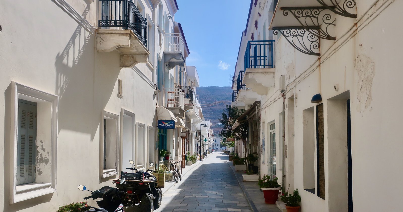
– finally Korthi, in the remote southeast, another almost-elegant seaside town, nothing like the Chora in configuration or wealth, yet somehow a version of it. As if the Chora was an organic thing and had evolved into the sort of place it is because of its specific circumstances, while this other Chora, this bud-Chora, has had to adapt to different geography, weather, history, but still has thrown off some similar shoots – the one marble street, the balconies.
In summer, briefly, it may come alive. But in the Spring, in Autumn, even more than in the Chora itself there is a feeling of loss, of existing more as memory than real place. Again, the permanent ache of the islands. So much of what we do here, the paths, the endless terraces, the desire to know the whole of each island even though most of them have been reduced to a small, useful vestige, is a reminder of what once was. So much of what is left is bones.
HIKING
As well as the more than three hundred kilometres of marked trails, there’s the Andros Route, a ten-day, one hundred kilometre hike that meanders from north to south, with overnight stops along the way. There is the internet site androsroutes.gr, which has everything in clear detail. There is even an in-house map of the island produced by androsroutes, which contains all the main and supplementary trails – plus a fair sprinkling of unnumbered trails too – in an aesthetically-pleasing, vivid-coloured format.
In the overall quality of their hiking set-up, while some other islands come close, none can match Andros for the quantity of trails, their variety and organisation. Andros probably doesn’t have the best single trail in the islands (I doubt anyway that such a thing might objectively exist), although any top ten would have to include something from Andros – but as a Greek island to come to for hiking it’s practically perfect.
There are so many different ways to hike the paths, endless combinations of full and partial routes. The androsroutes map, with its use of bright colour markings, makes them look like sweets to be grabbed by the handful, the cluster around the Chora in particular.
We’ve hiked almost all the marked trails. The following is a brief summary, by way of example. You could write a book.
HIKE 1
The Chora – Trail 1 – diversion onto Trail 10 to Apikia – the lower half of Trail 2 back to the Chora.
A very easy stroll, maybe 15 kilometres
There’s no reason to cut these paths up in this way, (or in this direction), except that we had only a few hours and wanted to make use of the time. But it gives a good introduction to the physical wealth of Andros, concentrated in the valley that leads down to the Chora. We were there at the beginning of October, just about the driest, most baked time of year, after the heat of summer, before the rains start. Even then, the valley behind the Chora was extravagant. Channelled water runs through stone troughs to irrigate a sheltered, windless world of sycamore and plane trees, oak, mulberry, fig and cypress.

Significant sections of the old stone paths that ramble through this landscape of homes and gardens have been concreted over, making passage easier for resident pedestrians, even if few people still live full-time in this garden-suburb of the Chora. It would be a place to spend extended summer holidays in old family houses, with children allowed to run free and make their own world around the maze of paths and steps, a wonderland for playing. There’s nothing quite like this, nothing as concentrated, nothing quite as exuberantly elegant, anywhere else in the islands.
The lower half of Trail 2, approaching the Chora, is a fine example of wide stone highway. Several donkeys could pass at once, easily two-way traffic and more. It drops towards the Chora like a royal road, the pebbles that form its surface laid not flat, but on end, so that instead of walking on a surface that is almost smooth, but which might be breakable in the same way that the slabs of any tiled path or terrace are breakable, the surface is like iron. The work in the construction is, as always, remarkable. But this isn’t a path to recommend to anyone prone to tripping or stumbling. The unforgiving surface vibrates through bone, muscle and joint.
HIKE 2
Chora to Korthi on Trail 3, with diversions to Syneti village and the Kastro. From Korthi, Trail 5 back towards the Chora, with a deviation to Episkopi, and the final few kilometres into the Chora on the end of Trail 18.
With extras, and exploring Korthi, about 35 kilometres
It isn’t necessary to do such distance. With a bus or taxi one way or the other, it can be cut in half and done in two days. Or without the diversions and deviations it can probably be chopped to about 25 kilometres and you can still go there and back in one. The highest points in either direction are no more than 600 metres, and the climbs are fairly gentle. There are no death-defying cliff walks, no really challenging passages.
The walk to Syneti is half-road, half-path. The village, although you could zoom past in a car and miss it entirely, is hard to imagine without the road, which passes just above it. Because, on more or less every island, driveable routes now connect every town or village or hamlet, lived places give the impression of being a consequence of the roads. It’s difficult to see them as they often would have been, independent oases, with only loose footpath-connections to the outside. Every single map we ever look at now is bloodvesselled with the lines of driveable roads. Such vacancy there must have been in the past, such quiet.
Syneti is hidden on a hillside just a few kilometres from the Chora. We stopped for coffee in the one café and met a recently-retired villager who treated us as captive and spilled a version of his life – the death of the village, his seafaring, walking to high school in the Chora when he was young because there was no road, one hour in the morning, one hour in the evening. Such poverty in those days, he said. People couldn’t even pay their taxes. As if in this lopsided world poverty wasn’t primarily about food and shoes and education, but taxes.
From the village the land plunges further to the narrow valley floor, down to a small beach. The other side, steeper still, has been carved into terraces wherever possible. In early October it was dirt-brown, and looked as if it had been centuries, not decades, since it was worked. There is a tiny white church, stone steps between worked patches of land. The terraces, avoiding impossibly rocky ridges and vertical sections, climb to the top of the hill, four hundred and fifty metres. The difficulty of working such steep land, preparing it, making it accessible, suggests a common effort. We know nothing about ownership, organisation, but this narrow place and its proximity to the one village suggests a story, how the taming of this hillside must have begun somewhere, one terrace, and then on and on, a history of labour, aspirations, cunning, enterprise, expertise and sweat.
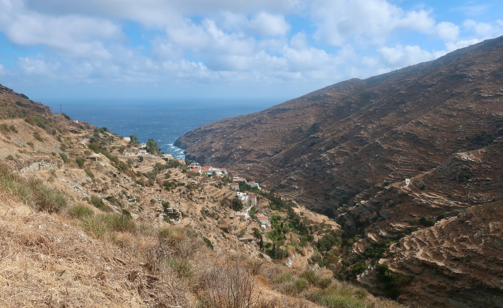
After the village the Trail jumps back up onto the tarmac road, but soon dives left into the same valley, which becomes softer as it climbs, with beehives and trees and less radical terracing. Coming out of the Chora the wind was howling, here there was nothing. All day in and out of the wind. We forget and open up, physically, then are hit again and shrink down. In the past, so many days must have been like this.
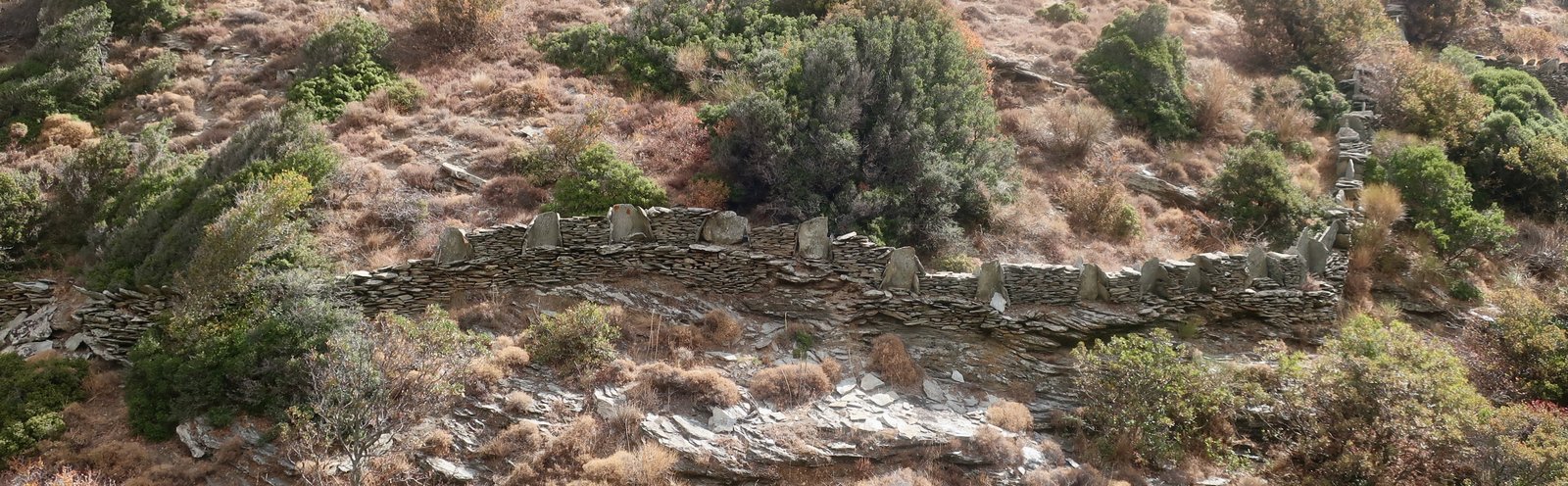
In places, the stone walls that line the path are so high there are several levels of style: the normal flat-laid stone on the bottom, then large vertical stones that create alcoves in which you could sit, that are like seats in the front row of the amphitheatre or the noble, high-backed pews in church.
There’s a fine stone bridge, one of the many, with solidly-built stone steps going up the other side. A sort of folding-in of gentleness down here after the toil of the hillside opposite Syneti.
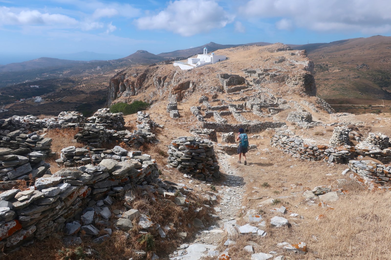
Within about two kilometres, Trail 3b takes a diversion left from the main trail up to the old Kastro. Most of what is left is the imprint of a Venetian fortress that used to follow the outline of the crust of rock that thrusts up from the hilltop. Just like the rock, the fortress was four hundred and fifty metres long, never more than ninety-five metres wide. It was built for Enrico Dandolo, the blind Doge of Venice, who acquired Andros just after he had led the Christian knights of the fourth crusade in the conquest of Constantinople in 1204. A freshly-painted church sits close to the top. While all around it the ruins of the castle have crumbled, the church is still maintained, roofed, clean white, topped with tiny blue domes.
The site is archaeology now more than castle, full of the outlines of houses, the foundations of walls. The views of the island, and Korthi, and the Aegean stretching east, are tremendous. But when we were there, the wind was so strong we didn’t dare climb to the very top-point for fear of being blown off.
A cobbled path leads down into Korthi, passing through the neat, prosperous village of Kochilou, where the terracing walls are up to two metres high and still in good condition. Olive, mulberry, cyprus and figs on the slopes and through the village. An abundance. Perfect stone steps between the high levels of terracing, like a video game, Super Mario trotting up and down. Churches, dovecotes with pitched red rooves. Caper bushes hanging in clusters in the village, grapes leaning down over the walls, the shoots a little longer every year, a little wilder, no-one there to cut or pick them any more.
Korthi in October is empty. The summer seafront, tavernas with tables on the water, is ragtag, thrashed by the wind. Behind, Korthi’s main street is deserted, but is marble-laid and elegant, a mini Chora. It has no wind at all. Just one parallel street back, a different world.
The long valley out of Korthi, the valley sides behind it, protected by the highlands to the north, were once heavily cultivated. Still today the same feeling of prosperity here as in the land around the Chora. In the afternoon sun it’s all shadows and light, cypress and olives for shape and colour, fruit trees for extravagance, neat villages, houses of standing, stone path, stone steps. As we climb higher, just occasionally a thumping gust of wind hits us, and then we round a corner and duck again and are safe again.

Through the villages of Mesa Vouni and Exo Vouni, climbing up to over five hundred metres, there’s an imperative to build just right, meaning, to understand the wind. You can go from being blustered to sneaking up next to the terrace of a house where there’s sunshine and not a breath, gardens full of pomegranate and figs and grapes. So many of these houses, with their backs to the north, are small sanctuaries.
Coming down a stone path towards the Chora in late afternoon sunshine, the lighthouse after the Venetian castle looks as if it is being shot from the pointing finger of the town. The whole view is an oil painting, with the colour dribbled thickly on, pre-Raphaelite in its excess.

HIKE 3
Bus from the Chora to the west coast. Get off near the Agia Triada church, at precisely the point the bus turns sharply right towards Mpatsi. To Zagora ancient site on Trail 7. All the way back to the Panachrantou Monastery on Trail 7, then Trail 1 back into the Chora.
About 24 kilometres
This western end of Trail 7 is much more rugged than Trails 3 and 5, the land around it harsh and bare. You pinball your way down a path between rough stone walls, heading for Zagora, an early iron age site built on a promontory over the sea, sheer on three sides, with on the fourth, landward side a would-be impregnable fortification wall of which there is nothing left.
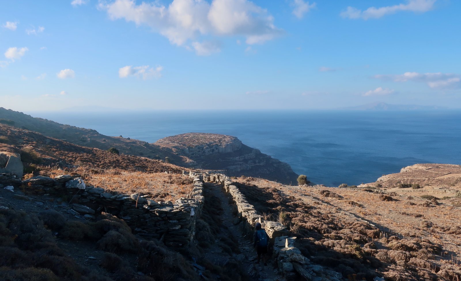
There’s little to see in the way of archaeological remains. Wall-foundations might be three thousand years old or poor agricultural dwellings from two hundred years ago. The site is another terrible place to live, chosen for its defensibility. The wind when we were there was fearsome. The thought of growing up in such a place, of spending a childhood hiding behind walls from the wind, from the scorching summer sun. We’ve seen goats huddling in Indian file in the narrow, almost vertical shadow of stone walls and imagine squatting children doing the same. How wild and savage must the people have been who spent their lives in such a place, watching the boats of raiders approaching, lining themselves up around the promontory, men, women and children turned out to make their numbers seem greater, with clanging weapons and shouts and screams. You scare them away, or close the gates and hope they can’t get in. There’s no notion of protecting the land. These hilltop fortresses were built to save lives only. Anyway the land around is poor. It says much about the ancient world that it was here, geometric Zagora, and at nearby neolothic Strofilos, that people chose to live, far away from the rich land around the Chora.
Trail 7 towards the Panachrantou monastery leaves from Zagora and gradually picks up the plenty of Andros along the way. By the time it reaches the monastery it has passed into semi-agricultural low valleys at the less-lush limit of the central Andros valley.

The monastery is a huge complex, constructed on a hillside at a height of about 500 metres, overlooking the main valley down towards the Chora. It’s more castle than monastery – but then many Aegean monasteries are the same, places of refuge for the monks and the surrounding population when attackers came.
A monk there proudly told us they have the head of St Panteleimon in a box. (Another version of the same head is in a monastery at Mt Athos.) So many Greek monasteries house relics – bits of bone, skull, hair even – the salvaged, scrapped-over body parts of the great and good.
As with many monasteries, there’s a miraculous founding myth, visions and icons and the directive to dig here – found a church here – live here. Nuns and monks tossing and turning in the night through their dreams of revelation.
Trail 1, that leads to the monastery from the Chora, twists and turns elegantly down from height, stone-stepped corners and walls. The very best paths, the most well-made, are often those that lead to great religious houses.
There is a labyrinth of paths spurring off in all directions in the valley behind the Chora. Paths and bridges and churches and settlements and endless, well-watered terraces.
HIKE 4
The Chora to Vourkoti village on Trail 2. Vourkoti to Achla beach on Trail 6. On dirt road and tarmac as far as Apikia, then Trail 8 and Trail 8a back to the Chora.
More than 30 kilometres
Up the main thoroughfare of Trail 2, down which we had already come from Apikia a few days before. After Apikia the trail changes, turns into an on and off, partly stone-laid bare-mountain path, climbing up to over 700 metres to cross the ridge of the range of hills that protect the Chora and its valley from the north wind.
Vourkoti is in a parallel valley – parallel to the valley behind the Chora and to the valley behind Korthi. Vourkoti valley is narrower though, and not quite so benignly agricultural. There is a well-made stone bridge at the entrance to the village, and another halfway down Trail 6 towards the beach.
The trail is a little less well-preserved than many others on Andros. Although it must have been built with much the same care and effort as the paths that lead south away from the Chora, some sections are now piling up, losing definition. Perhaps because it is less-used, but also because the land is a little steeper here.
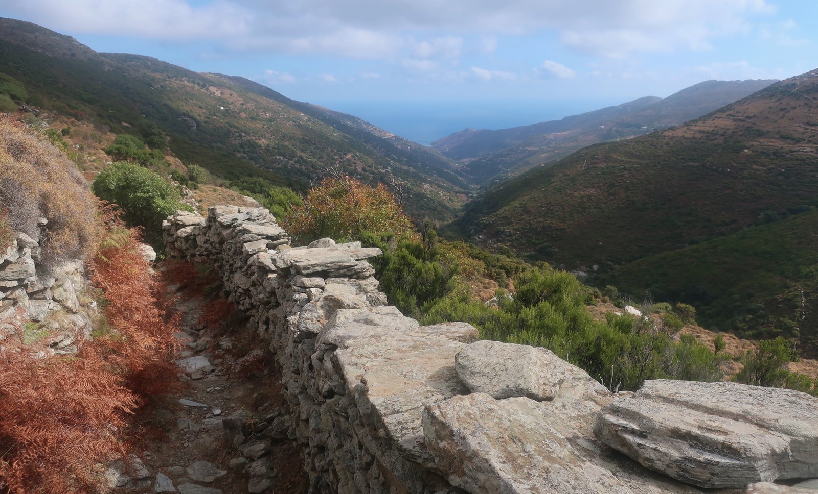
Agios Dimitrios monastery, a short distance past the second stone bridge, is another fortress. After it the path to Achla Beach changes, from paved stone to a narrow, sneaking, dirt footpath.
At the monastery, when we were there doing our obligatory visit to the compound (architecturally, structurally, always interesting), and church (almost immediately forgotten despite the opulence, the sombre light and shadow, the tiled floors and columns and cupolas), two middle-aged women were having a faith-based day out, kissing everything that glittered and treating a long-bearded ancient priest like a celebrity. When he brought out another holy trinket from behind the iconostasis at the front of the church, they immediately bent and began to kiss it too, prompting him to chide them, Oxi! No! Stop! He shooed them away like they were naughty children, or over-friendly farmyard animals.
Because it was early October in the Greek islands, and despite the fact that it was warm and that Achla is the sort of beach that might be photographed for a Greek Island best beaches coffee table book, there were just two other people there. The water was glassy and cool. Bearing in mind how far we were from home, we spent too long.
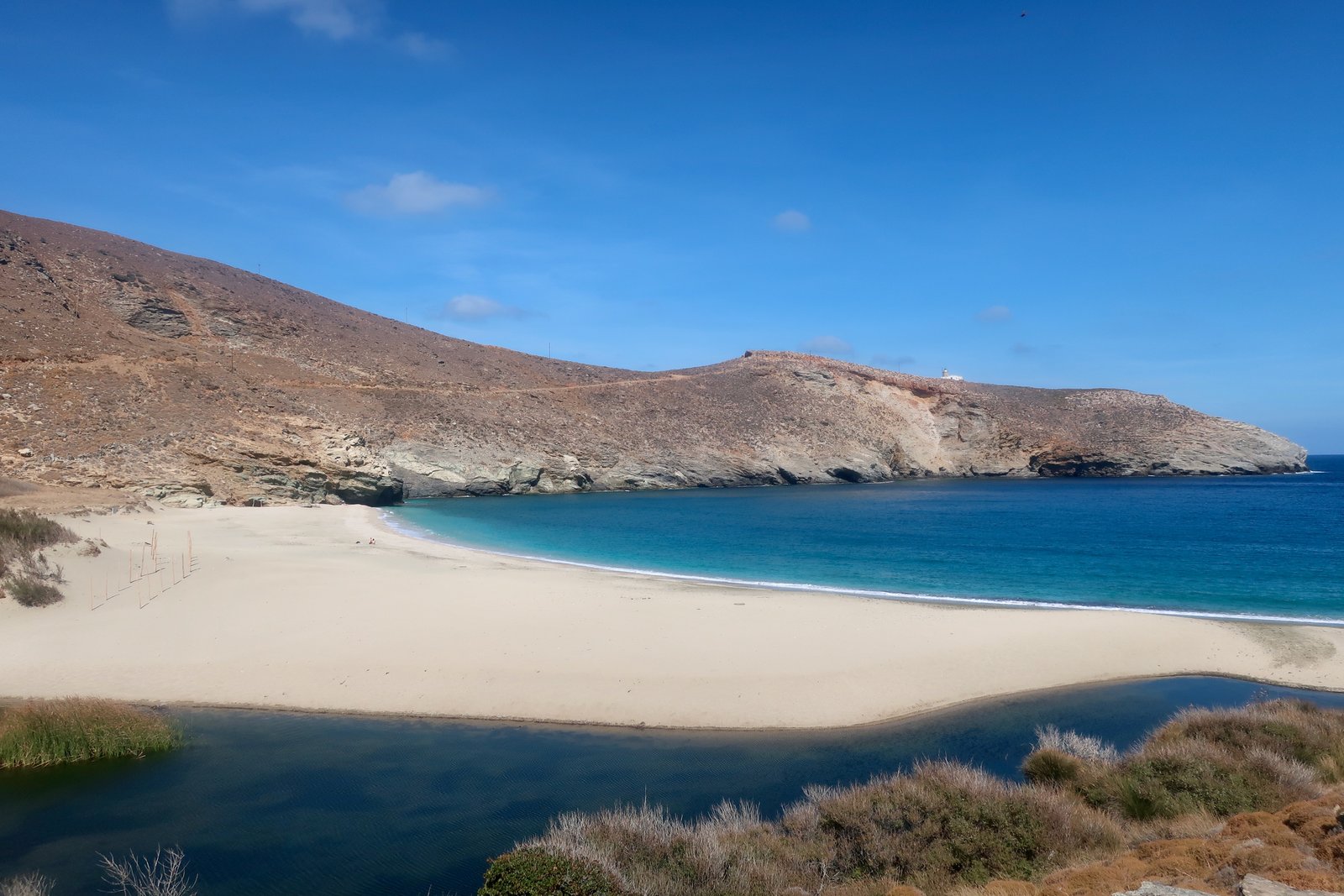
There is a choice of small dirt tracks, and then easy tarmac road to get back to Apikia. From there, Trail 8 wanders through another parallel valley, again well-watered, prosperous, down to the beach at Gialia. And then a stroll up over a small promontory and along the coast back to the Chora.
HIKE 5
From Gavrio to the beginning of Trail 14 at Xirokambos, up to Frousei at the top end of Trail 14, then back to Gavrio on roads, tracks, whatever.
22 – 24 kilometres
This is stage 1 of the 100 kilometre 10-day Andros Route, done in reverse. Plus then a stroll of about eight or nine kilometres on roads and tracks to get back to Gavrio from Frousei.
Had we done this hike two days earlier, it would have been bone dry. Instead, there was a huge downpour the day before we did it. The early parts of Trail 14 were slippery with mud, small stones, twigs and leaves that had washed down from the highlands. At the two or three passage-points through closed agricultural gates, there was a piling-up against them, a dam of detritus, a sort of natural junkyard clutter.
Thick fog blanketed the hills, cutting visibility down to twenty or thirty metres.

After the first section of carefully picking our way on the slippery track, the next long section up to Profitis Ilias, (altitude 650m), was mostly dirt track. In such a situation, with no view at all and no familiarity with the trail, we completely lose the spatial awareness that places us at such and such a point on a hillside, a ridge, the north of the island heading in this or that direction. All the visual strings that tie us to place are gone. There’s no idea of island even, nothing but the damp veil of mist and at our feet a surprising number of swaggering black beetles, that seem to love the weather, and are all over the paths with their mini komodo dragon sway.
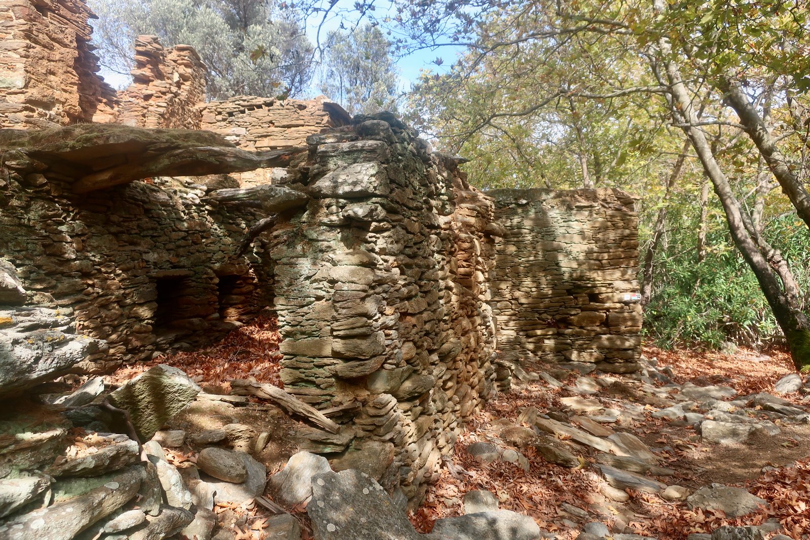
That was the first half of the day. The second half was a different world. The fog suddenly and completely disappeared. The sun came out. We descended on a proper path to a valley with a stream running through it – the section for which this Trail is so highly thought of. The ruins of a dozen watermills punctuate the valley floor, which is mossy, overgrown, lush.
HIKE 6
The bus from Mpatsi to Mesaria, followed by a short section on the road, a short section on Trail 1, a short section on Trail 10, then Trail 9, Trail 11a and the end of Trail 11 into Mpatsi.
22/23 kilometres
Instead of getting off at Mesaria, you could just as easily go all the way to the Chora on the bus, then leave the Chora on Trail 1, before picking up Trail 10 and Trail 9. The difference is no more than a kilometre or two and a small climb. Or you could walk the other way, west to east, and catch the bus back from Mpatsi, depending on times. There are all sorts of possibilities, coast to coast.
***
Most of Trail 9 is at between 400 and 600 metres altitude. It skirts the central range that rises to 1000m, that divides the top half of Andros from the bottom. It is a top class trail that with the short sections on Trail 10 and 1 begins in the heart of the valley behind the Chora, in the nest of paths and steps, and heads up into classic barren land on stone-paved paths.

Towards the west coast the trail rounds the end of the range and traverses at about 500 metres for a while before beginning to slope gradually down. There’s a grandeur to the path here that makes it seem mythical, as if the whole mountainside had been fortified, with concentric rings of wall, fortification, wall, round and round, up and up. On a good day you can see clear across to Kea, Kythnos, Serifos, Syros, Sifnos, Paros, Antiparos, even down as far as Kimolos and Milos. The view first over Palaeopolis, then down to Mpatsi, is as sublime a spectacle as anywhere in the islands.

In October we foraged late figs, grapes, blackberries, walnuts and sweet chestnuts. We could have filled sacks with prickly pear but what on earth to do with them? The only time we’ve picked them, with friends who were enthusiasts, we were pulling out their tiny daggers from our clothes for weeks afterwards.
HIKE 7
Mpatsi to Agios Petros on Trail 16, Agios Petros to Agios Petros beach on road/track and/or Trail 15, the coastal road home to Mpatsi.
16 to 20 kilometres, depending on diversions.
A nice path up to the Zoodochos Pigi monastery, but the whole day would not be number one choice for a hike on Andros if time was limited.
Again, the monastery is miraculous in its founding, a vision in a dream. Again it is a fortress, again it is almost empty in its modern incarnation. When we visited, there were only three, very elderly, nuns in residence. At the end of the 17th century it was home to over one hundred monks. The change from house of men to house of women happened sometime in between. Almost all monasteries we’ve seen, that are still inhabited, house between one and three monks, as if it were a modern monastic rule.
The beach at Agios Petros is as nice as it looks when passing on the bus, sandy and wild, with just a small amount of accommodation and infrastructure behind it.
The walk along the road back to Mpatsi would not be a good idea in the summer season, with summer traffic.
HIKE 8
From the Chora to Mpatsi on the bus, then Trails 11, 12 and 2 back to the Chora.
23/24 kilometres
Another stroll across the island, this one from west to east, and a little further to the north than Hike 6, above.
Dark red poppies. Yellow poppies. Chanting from a church in the early morning that was like the humming of bees. Huge paving stones uphill, like cemetery stones laid flat. The move from bare hillside into open woodland, from kalderimi to dirt and loose stone.
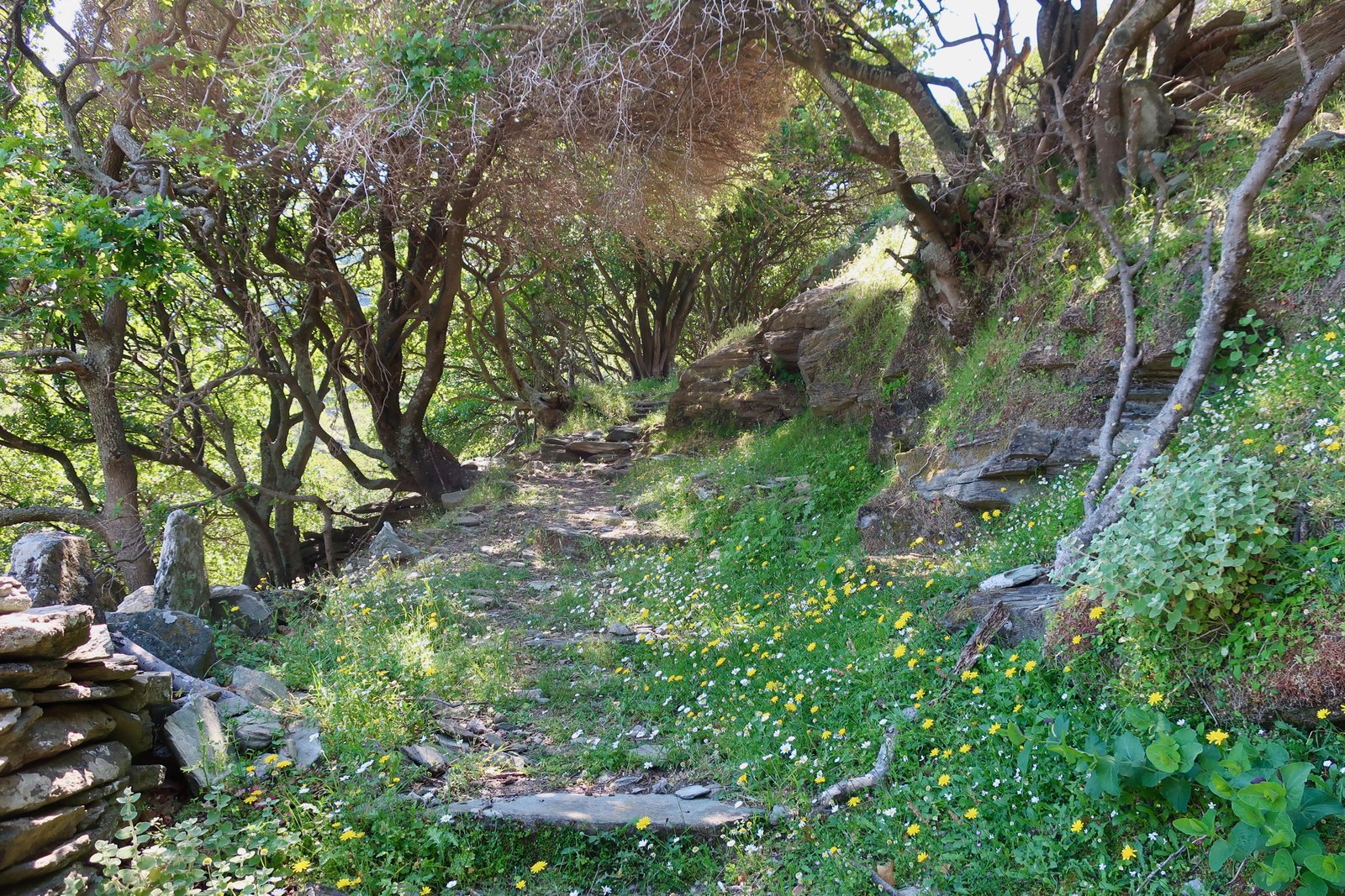
There are Shangri-la valleys between Katakilos and Arni, through woodland, across terraces, with small white churches dotted over the slopes and every single shade of green imaginable. The path dives in and out of their folds. In each one there is inevitably a water course and the leftovers of an agricultural world – clusters of fig trees, and vines that have gone wild and are climbing, net-like, over everything. It seems a place from fairy tales.
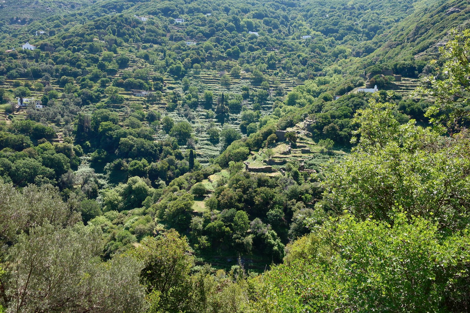
Trail 12 is the highest on Andros, it climbs to almost 1000 metres, with a Profitis Ilias church on top, of course, built on a prominent rock. Only sheep go there now, a place of shade where they skulk and concentrate their thick, sheepy smell and leave a carpet of droppings all around. The slopes on the way to the top are open, all ferns and spikes. The views are panoramic.

From there the path continues on a high ridge, over 900 metres, until turning down towards Vourkoti, and changing back into paved stone, running between walls.
Lunch at the stone bridge at Vourkoti. It’s always amazing how much water land is able to store, how streams like this one keep running long after the last rainfall. It flows down through the valley to Achla, where instead of breaking through the sand, as streams do, it sneaks under the hump of beach, invisibly pouring cold into the shallow warm sea-water.
Vourkoti from this direction, and earlier in the year than the previous time we saw it – June instead of October – seemed more prosperous. It seemed to have opened like a flower.
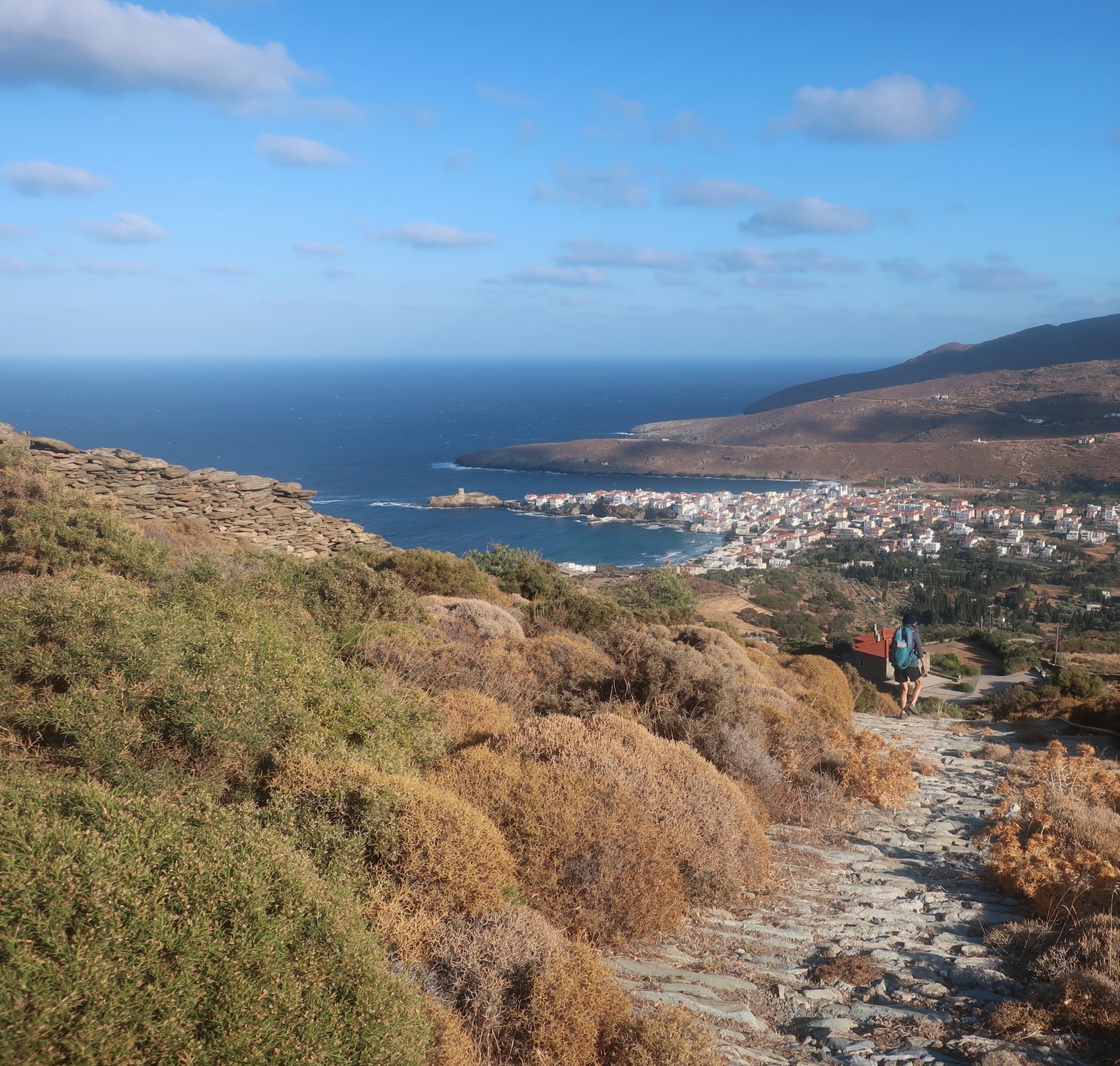
Again, whichever way we come at it, the view down towards the Chora pulls us up. We see so clearly the singularity of the shape, the whole structure of the town, as if from the air, long before we plunge into it.
HIKE 9
Trail 17.
6 or 7 kilometres
Through the valley on the south side of the Chora. A fruit-growing area. Elaborate stone paths, high stone walls, oranges and lemons and almonds and walnuts and mulberries. The latter grow wild on public land, overhang car parks, linger on the outskirts of villages and behind beaches. Orange and lemons grow in gardens and orchards. Olive blossom is pale, dusty yellow in May. Fig trees are everywhere, with their great hoofprint leaves and almost naively smooth bark. Wisteria blooms for decoration, it drapes. Normal little homes are made elegant by all this profusion.
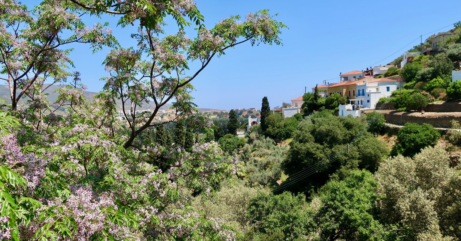
A hint of mint is mixed in with all the other smells. We sniff and track it down like animals, find it in a boggy patch.
HIKE 10
From the Chora on Trail 18 to Falika, then Trail Per C1/2 to Aladinou stone bridge. From there back into the Chora on Trail 1 all the way.
About 20 kilometres
Old cobbled paths all the way, although a little concreted over at the town-end of Trail 1. Soft and easy. No more than 300 metres of height to gain. In May it was already warm. We met only two people: an Albanian builder laying stones – Albanian builders lay stones all over Greece, and always wave, and always smile, and always want to talk; an elderly man cutting stalks from wild olive trees to use as supports for his tomatoes. He had worked in New York and Georgia, he said, in restaurants of course, What else would we Greeks do? He always dreamt, he said, of coming back to his paradise.
HIKE 11
Trail 9a, around Palaeopolis ancient city and harbour on the west coast.
About 5 kilometres
A short circuit, an explosion of wild flowers in the springtime. We failed to find the site of Palaeopolis, which I’ve since looked up on the map, and cannot see how we missed it. A good walk to do with smaller children, with a descent of about 300 metres, a stroll along the beach, a couple of churches and history.
