
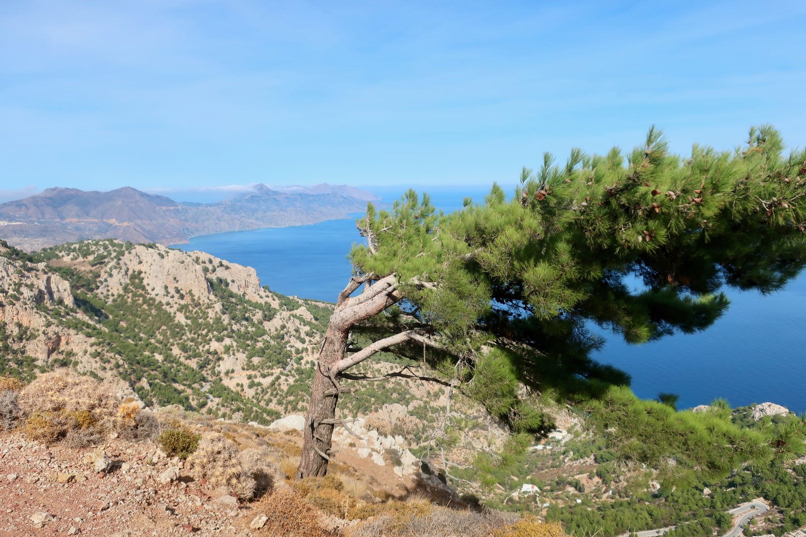

Wind was pretty much all we knew about Karpathos before going. Windsurfers and kitesurfers go there, to several beaches near the southeastern tip just above the airport. They give them names like Devil’s Bay, Gun Bay, Chicken Bay, surf-names that express a certain surf-swagger. Higher up the east coast there are places where the prevailing winds create such havoc that anything growing is forced flat and the island itself appears to be streaming south. But when we arrived at the end of October there was no wind at all. Coming in on the ferry, the sea was a mirror. Sometimes the islands just make you gape, they’re so lovely. An elderly gentleman in a chaotic shop in Pigadia, the port, the main town, said Of course there’s no wind, it’s the short summer of Aghios Demetrios, it’s like this every year at this time. In the islands we have become used to this meteorological dogmatism, handed down from generation to generation.
We’ve hiked in January in Tinos when the wind has been so staggeringly, painfully cold and penetrating that we were sure we would die if we stopped for long. We’ve been out in driving snow in the mountains on Naxos in early April, and would not have missed it for anything. We’ve been drenched on Kasos in May, Anafi in October, Kalymnos in March… And yet, if you travel much in the Greek islands out of season you’ll be certain to spend a great deal of the time thinking my god, how can it be that no-one’s here? In November or December or January, again and again it’s like honey, as if we’re coated in it, the warmth and the light and the colour.
When we were looking where to stay there were the two ports, Pigadia in the south, Diafani in the north. For us there wasn’t much between them. Pigadia was bigger, that was all. With hindsight, Pigadia is another version of an Aegean small island-capital and port, a place to live with a small-time developing tourist industry and a minor network of roads spreading out from it, connecting it. Diafani though is a place apart, the stepping stone to exile for anyone born in the north of Karpathos. It is unconnected, except to Olympos, a few kilometres inland, and traditional like no other big-ferry port we’ve been to. In the end we chose to begin in Pigadia because we found a cheap little Autumn apartment overlooking the port, but also because somewhere on the internet we read that Diafani was windswept. As if all Greek islands are not windswept.
These days if we mention Karpathos we don’t think about wind. Rather, it’s Olympos, tucked away in the mountains of the north. It’s the hikes we did from there, among the best we’ve ever done.
Even without the ten kilometres of uninhabited Saria island on top, Karpathos is fifty kilometres long. Six thousand people live there permanently, more than a third of them in Pigadia. Arriving, you might think there are more; there’s a short line of square four or five-storey buildings along the front and for just a moment it’s like a shrunken-down south of France. There could be a casino.
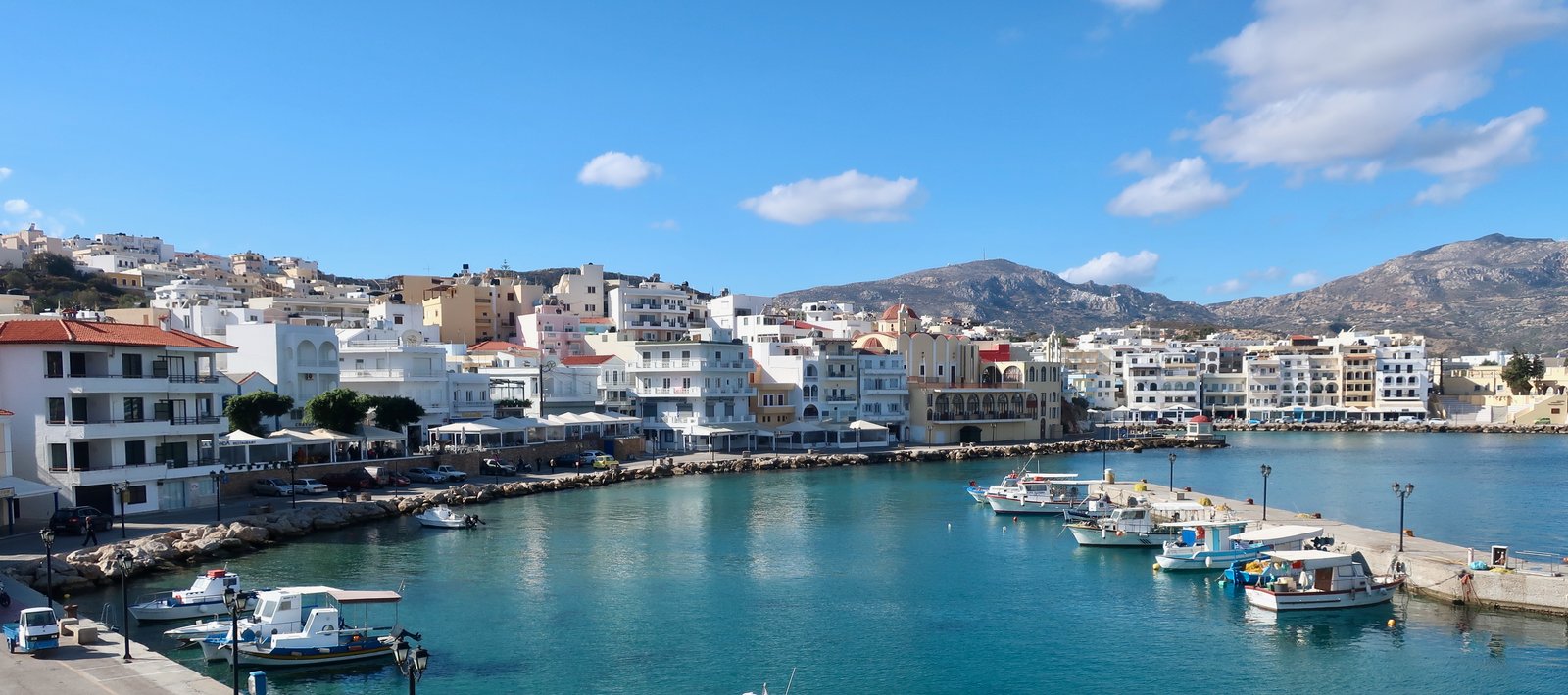
The illusion doesn’t last long. Pigadia in mid-Autumn is a quiet place where the weather will probably be great, there’s a long beach on which you can swim and days slip by with just enough people to fill the terraces of a couple of cafes in the oily late afternoon. This is already something. On many islands filling a seafront café any time in October or November would be impossible.
In summer there are tourists of course, windsurfers and others. But not huge numbers. Quite a lot come from Italy for no better reason than it was theirs for a while. In the endless smash and grab of Aegean politics, after the Italo-Turkish war of 1912, Italy provisionally claimed the Dodecanese, which had remained under Ottoman control when most other islands became part of the newly-formed Kingdom of Greece. Soon afterwards came the defeat of Greece in the Greco-Turkish war of 1919-1922 – The Great Catastrophe, as it’s known in Greece, a direct consequence of the ill-fated Great Idea, the theoretical incorporation of the Greek-speaking peoples of the Ottoman Empire into a greater Greece. At which point Mussolini took advantage of Greek fragility to make provisional into permanent. Meaning, in the end, just over thirty years. All over the Dodecanese there are greater and lesser traces of italianness: some architecture, a slight linguistic leaning, and here and there tumbledown hilltop outposts, deserts of rock to which Italian recruits were posted as lookouts in world war two, there to be dazzled by the heat, the light, the emptiness, the incessant, thumping wind.
Most of the rest of the population live in a number of villages either in the hills or on the coasts of the southern half of the island. They’re tidy places, with white houses and big marzipan churches. The far south of Karpathos is flattish, for a Greek island. The middle, accessible more easily from the south than the north, is mountainous, with Kali Limni (1215m), one of the highest mountains in the Aegean outside Crete. Almost no-one lives in the mountains.
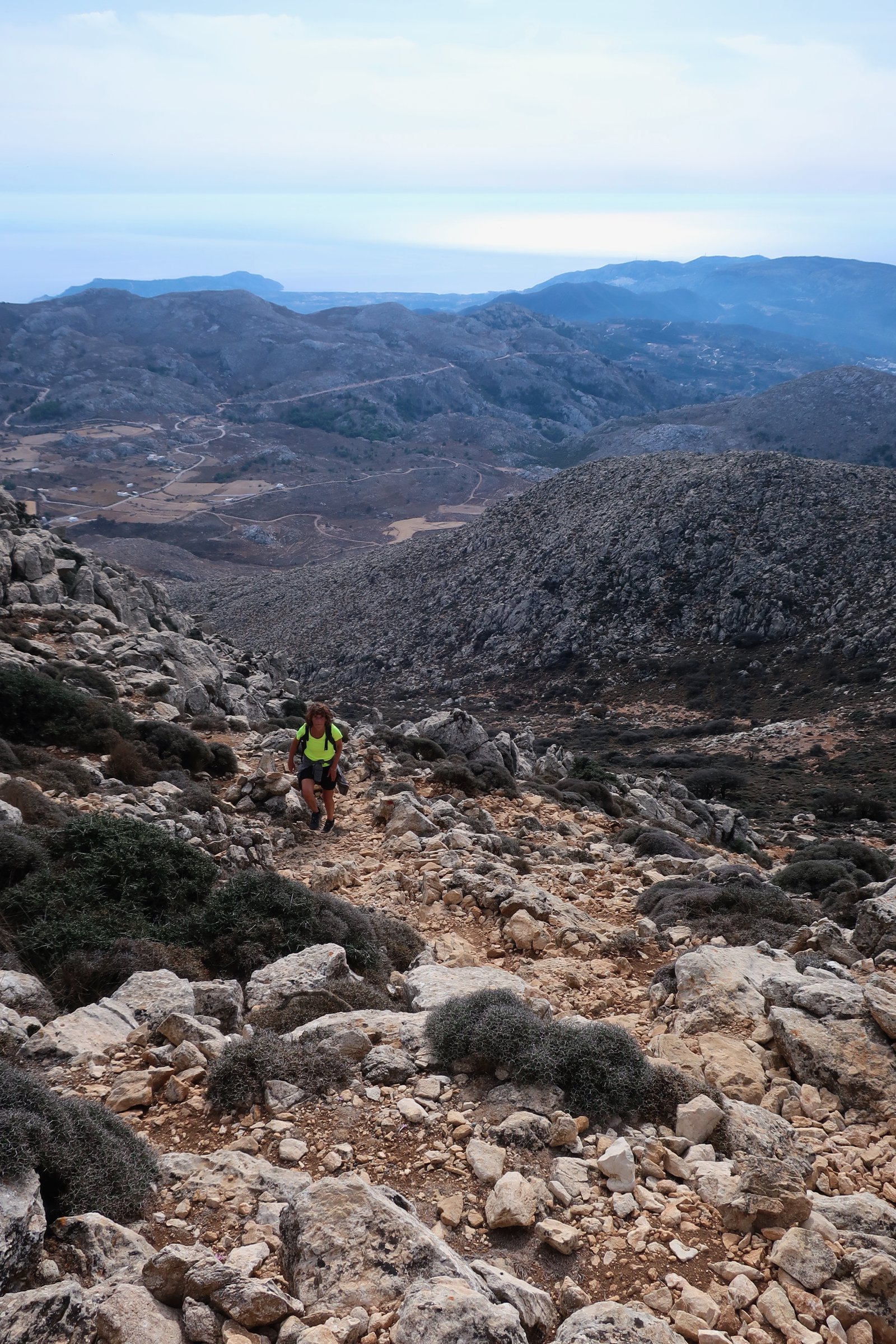
On all sides the slopes are steep. The road wraps around the whole range, east and west, as if hugging it, coming together again like fingertips just below Spoa, where the long, thin, northern tail of Karpathos begins. Up there it’s a different world. There’s one road, a vein. At last time of looking there were two buses a week, bottom to top. Otherwise it’s the ferry from Pigadia to Diafani, as quick or quicker than the bus.
There are only three villages in the north: Olympos, Diafani and Avlona. But really they’re all Olympos: Olympos-village, Olympos-port, Olympos-farm. Many of the few hundred people still living in the north have homes in all three. There are more houses than people now. If not to the big cities of mainland Greece, many have gone to the US and particularly to Baltimore. The same story as elsewhere: one person leaves, or a first small group. Wherever they end up becomes the place into which friends, family, future generations are sucked. In Olympos and Diafani we came across a black-and-white picture book, Fifty Years of Olympos in Baltimore. Photos of men with old-fashioned island-moustaches, people dressed in village costumes dancing with their arms around each others’ shoulders, enlaced like cut-out Christmas garlands, keeping the idea alive.
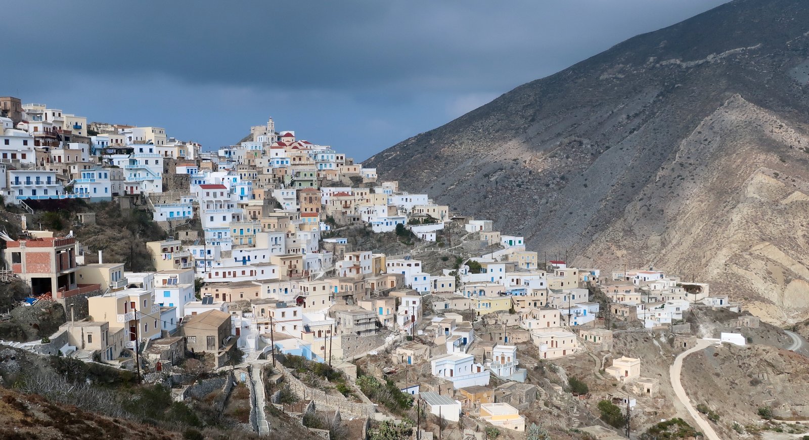
When people talk about the north of Karpathos, they invariably use the word traditional. Not long after we visited Olympos there was a story in the New York Times about the twilight of traditional Greece. There in black and white was a picture of the lady we stayed with. Olympos was singled out among island villages. Some of the women wear traditional clothes – white dresses, dark and flowery headscarves. A handful of windmills still function. There are several communal ovens in the streets where bread is baked; guffs of black smoke swirl through the narrow alleys, carrying hints of cinnamon, cumin and clove.

Olympos sits on a dry, grey mountain-ridge between higher peaks. In early November, even close up you couldn’t say for sure if the slopes were rock or dust. The village spreads mostly over the inward-looking slopes, but looks over the ridge too, out to sea. With its pale-washed homes it could almost be pretty, if two hundred white and off-white houses with blue shutters and doors built on what might be a heap of dust can be.
The north of Karpathos is a small, barely-open window onto the past, to a way of life that almost overnight has become so remote, so quaint, that the New York Times comes to write articles and take photos, irresistibly offering one last peep before the view definitively closes. All over the islands these glimpses: land that has barely changed beyond the fact of its abandonment; all the different ways in which people are racing to embrace change, or being left behind, or trying to hang on to something, or just getting old. The stretchy glue of a physical closeness to the land that tugs at the guts, the heart.
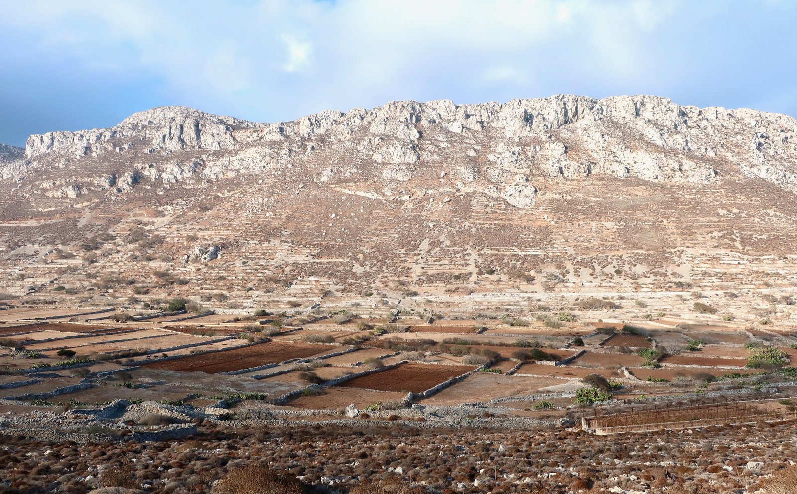
Avlona is a few kilometres from Olympos. It was the grain basket for Olympos and before that probably for Vrikous, the classical Greek city-state of the northwest of Karpathos that preceded it, whose trace is still there on a long heel of rock sticking out into the sea. At Avlona there are a few dozen low cube-houses in a long valley which in November is as dry as bone. The floor of the valley is segmented into enclosures. The slopes of the hills around, where rock permits, are scarred by ancient terraces. Less than ten people live there permanently now. It seemed bereft when we passed through, a forsaken place.
Recently I came across a picture by the photographer Julia Klimi. An elderly lady all in black is standing with her two donkeys on the western slopes of the valley, looking down on Avlona. Under her feet and all around her the ground is thick with grass and buttercups and asphodels in flower. And the valley floor! It’s a patchwork of bright green, the fields are pools, divided up by stone walls that from distance look like lines of ribbed knitting. It makes me want to rub my eyes, and then also to shake my head for falling into the trap again of imagining some fixity in what we briefly pass through, imagining that because of the extremity of this island terrain, the rocks and spikes, there isn’t here too the seasonal transformation we see elsewhere.
A satellite image of the north of Karpathos shows the great emptiness. Just occasionally, in among all the valleys and ridges and peaks and the fading telltale scoring where once there were productive terraces, there are small areas of land that are discernibly still farmed, the recognisable patchwork of active fields. The two biggest of these areas are at Avlona, in the valley, and just a little further north on the trail from there to Tristomo. You have to see them from above to properly understand the oasis-like beauty, the aesthetic of shape and subtle colour-change, the way they fit snugly between the hills.
One day when we were in Olympos there was to be a feast at a small, remote church belonging to a family from Baltimore who come back every year at the same time for this saint-day. Then suddenly we heard there were two feasts on the same day, another one at Tristomo in the very north of the island, farther north even than Avlona and Vrikous, where no roads go, where I think no-one lives now but where there are a few houses and a church around a small beach. Of course a church, always a church. Wanting to be hospitable, to us, the only visitors in Olympos in November, people would stop us in the streets and recommend their favourite, you must go to this one or you must go to that one. Someone will give you a lift. Or, Boats will go from Diafani. Yes yes, there will be a place to sleep when the music stops. When we ask where? it’s Maybe a house, maybe the deck of a boat… For people who live here, everything and everyone is familiar, there is a unity, an unshakeable at-homeness.
In the end we were whisked to the Baltimore-church. In the car the man who squeezed in next to me wanted to tell us in his Baltimore-English how when he was at school in Olympos there were two hundred children. On the way back we got a lift from someone else who told the same story. Both of them wanting us to know that this fading Olympos now with hardly any children in the village is not the Olympos of their hearts.
At the feast two hundred people were served goat stew in bowls, through which bones poked, as if all the bowls were stone-age cauldrons in miniature. Two priests ran the show with their seriousness, their beards and pillbox-hats. Exceptionally there was no dancing or music because two days later there was to be a funeral. Instead they intoned, the priests, church music, mournful, exalting, that everyone knew and some joined in or hummed along with.
The funeral when it happened involved every single person we had seen since we had been there. The dead man had been born in Olympos but died decades later in Baltimore. The body was returned to the rocky ground and heat and wind of home. People came from as far away as Australia.
When you board the ferry from Diafani you cannot not imagine the leaving, all the leaving. The leaning on the guard-rail to watch it disappearing, the indelible shape of the mountains.

***
In Olympos they told us:
- My father lives in Avlona. He thinks it is paradise. He will never leave.
- Avlona, Diafani, Olympos, there is no difference, we are all from Olympos.
- Every family used to have its own windmill. Every family used to have its own church.
- Every family had its own church?
A smile. Maybe one church for two families.
- That’s me, the photo, forty years ago.
She’s picking olives. The strength, the uprightness, the power of it.
- (An elderly lady to a little boy.) I have something for you.
Carefully she slips the lid off a cardboard box and puts her hand in. When it comes out she’s holding, ever-so-delicately, a giant moth by the wings. The little boy’s face is a picture of delight.
HIKING
If you like the Greek Islands and you like hiking, you should go to the north of Karpathos. Stay in Olympos, get up early with the sun and set off to the tip of the island. No dawdling, it’s a long round-trip. You won’t be disappointed. And if you are, well, one less reader for us, one less like mind, and sorry, inevitably there’s a level of subjectivity in all of this. (Still, if you are disappointed, why?)
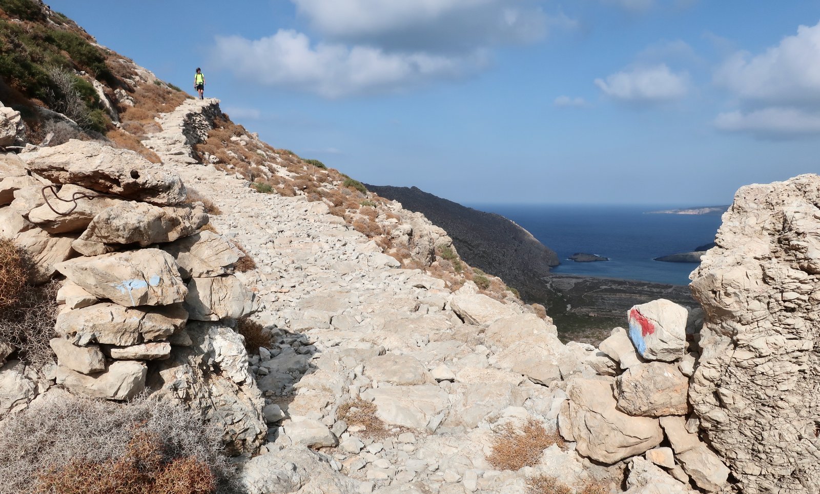
No, I get it. To some extent we all have different preferences. Some people above all like really long hikes. Some want a hint of danger – cliff-walks, ridge-walks, headspinning heights. Others are drawn to hikes with history, visits to ancient sites along the way. For some it’s the paths themselves, the stonework. Or it’s the churches and monasteries they pass. Or it’s the remote beaches and coves at which they swim. Or it’s something else entirely. Quite often we find it’s not possible to say exactly why, just that we’ve had an especially good day. Maybe we got up and felt particularly good even before we began to walk. It happens.
I’m not advocating northern Karpathos compared to other options. These island hikes are not in competition. For us they are objects of delectation, each with their own unique characteristics. But northern Karpathos, well, you should go.
***
According to the Terrain map there are one hundred kilometres of waymarked trails in the north of Karpathos, one hundred and fifteen in the south. The south, for hiking purposes, includes all the high mountain terrain in the middle of the island.
(For waymarked, understand waymarked-ish. In the unlikely event that Karpathos is your first Greek island, don’t go expecting to have it all laid out on a platter. This is Greece, not Switzerland. Sometimes, some islands, some paths, you’d really have to make an effort to get lost, sometimes though you’re on your own. In which case, make sure you have a map, some means of locating yourself – google’s blue dot – a compass, if possible, (digital, on your phone, will do). And food and water. And arm yourselves with logic. Karpathos is reasonably well-organised, but can surprise you.)
We’ve only done about half the dotted trails on the Terrain Map of Karpathos – two longish hikes in the south, two hikes in the north, one of them very long. Before long we’ll go back and do the rest, and I’ll be able to erase this confession of incompleteness.
It’s not possible to do everything from one base. For the north – and not just for the hiking – Olympos is the place to stay. For the south, probably Pigadia. The windsurf-beaches are too far south, and although some of the other villages are big enough that there may be somewhere open, it’s far from sure. Aperi is well-placed and one of the most populous, in theory with a year-round population of about four hundred. When we walked through in the last days of October the only person we saw was one woman hanging washing on her balcony, curious enough about our passing to lean over the balustrade. I asked if there was a bakery. No. A minimarket? No. Would we find anything open in the neighbouring villages of Volada and Othos? She shrugged, she didn’t know. Go to Pigadia, she said.
And there will be wind. Unless you happen to be in Karpathos during the short summer of Aghios Dimitrios, there will be wind.
THE NORTH
HIKE 1
Olympos – Avlona on Trail OL 5 – Tristomo on Trail OL 8 – Aghia Ekaterini at the tip of the island on Trail OL 11A – back down the east coast as far as Agii Anargyri on Trail OL 11 before cutting inland up towards Avlona on Trail OL 10, taking a left somewhere back to Olympos (there are alternatives).
About 40 kilometres, perhaps more, depending on diversions
This is one of the most memorable hikes we have done anywhere in the islands. However, forty kilometres, when there are only ten daylight hours, is not straightforward, particularly when going into unknown, remote terrain. It would not be a good idea to be caught after dark halfway down the east coast, on the narrow path between Aghia Ekaterini and Aghii Anargyri/Ananda Bay.
If necessary therefore, instead of walking back to Olympos, the hike could be shortened by five or six kilometres by taking the coastal path from Aghii Anargyri into Diafani, and then a taxi home. If you can find a taxi.
We set off at first light from Olympos. A couple of barking dogs and some chickens saw us go. Like all mountain villages Olympos is a place of sunrise and sunset, light that in the evening snaps shut like a curtain then comes like a searchlight in the morning.
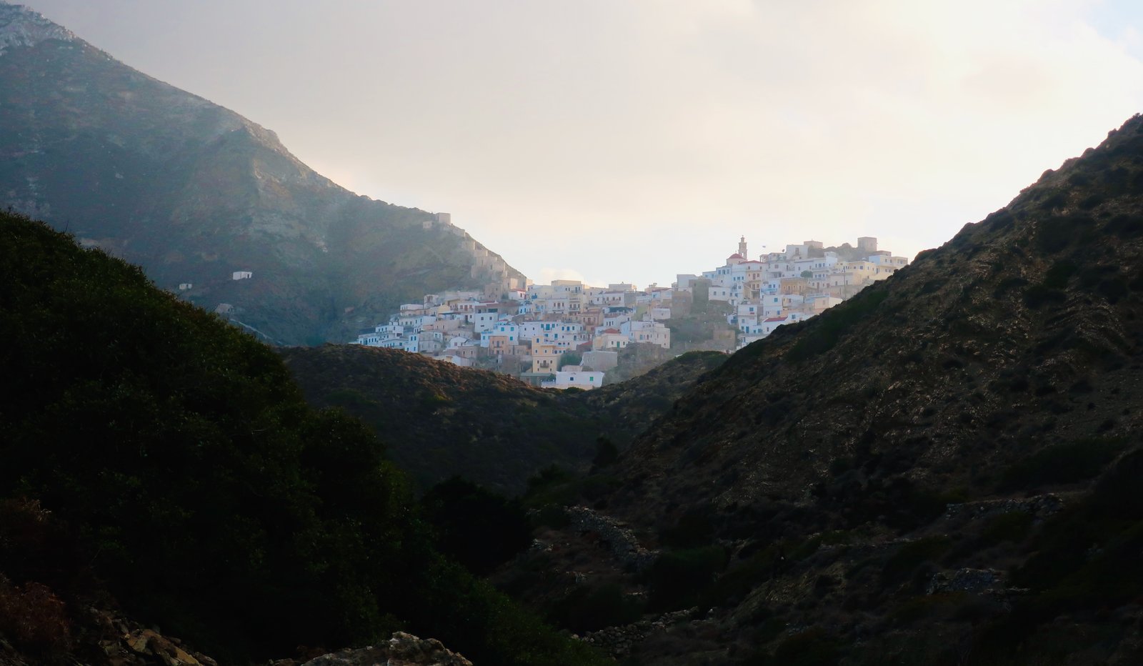
Leaving early, walking between hills, up and down and round with the terrain, you move in and out of pools of orange light.
The trail turns to cobbled path soon after leaving the village. Some of the stone sections even before Avlona are as good, as well-made as anywhere in the islands. People came to live on the slopes of Olympos as early as the seventh or eighth centuries CE. For more than a thousand years they walked back and forth to Avlona. Olympos was a place of safety, away from the pirates that had driven them from Vrikous in the northeast, but hardly a place to farm. The best land is around Avlona, in the valley itself, and just beyond in a second valley on the path that leads from Avlona to Tristomo. There must have been a permanent flow of people and donkeys in both directions.
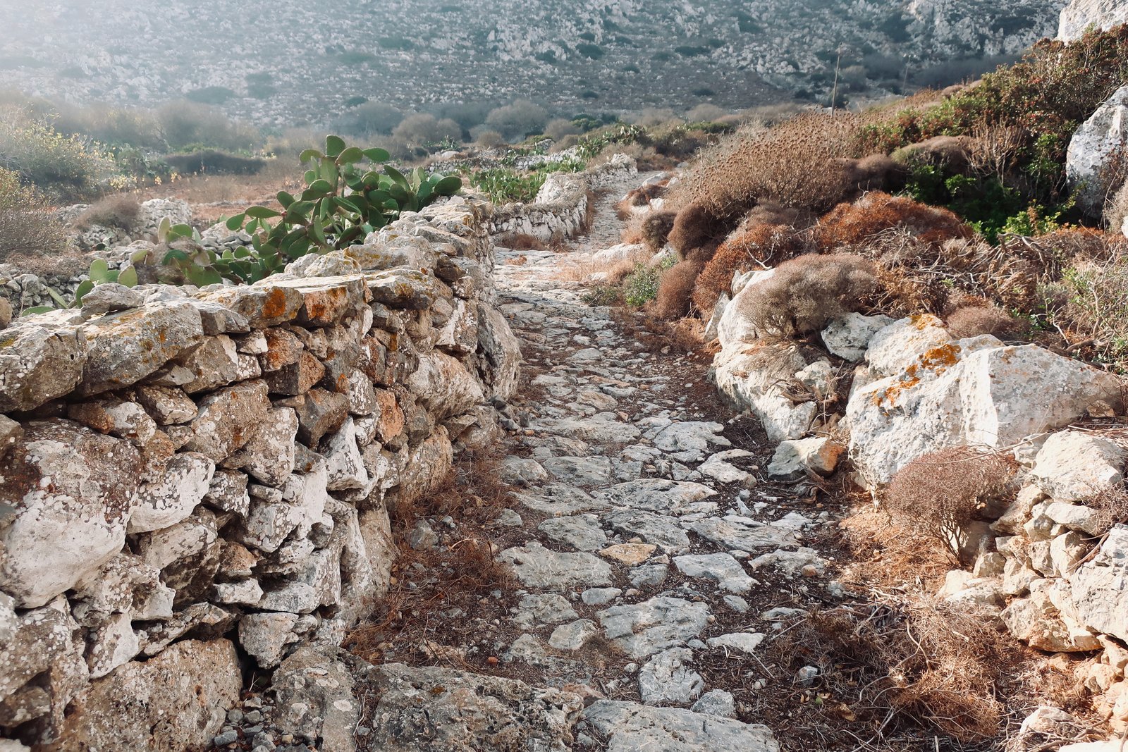
In early November, still not recovered from the heat and dry of summer, everything is cracked and brown. Before the rains come, the only things to disturb the impression of earth, dirt, stones, are occasional thick, dusky green clumps of prickly pear; desert-fruit.
Once the granary for the north of Karpathos, some corn is still grown in Avlona. They still thresh it by hand in old threshing circles, we are told, before taken it to be milled in Olympos. They are balancing now between tradition on one side, folklore and performance on the other.
Trail OL 8 leads northeast out of Avlona valley. After a short section of narrow orangey dirt, the old stone-laid path can clearly be seen ahead, as if it was the beginning-point of an ancient stone moving walkway.
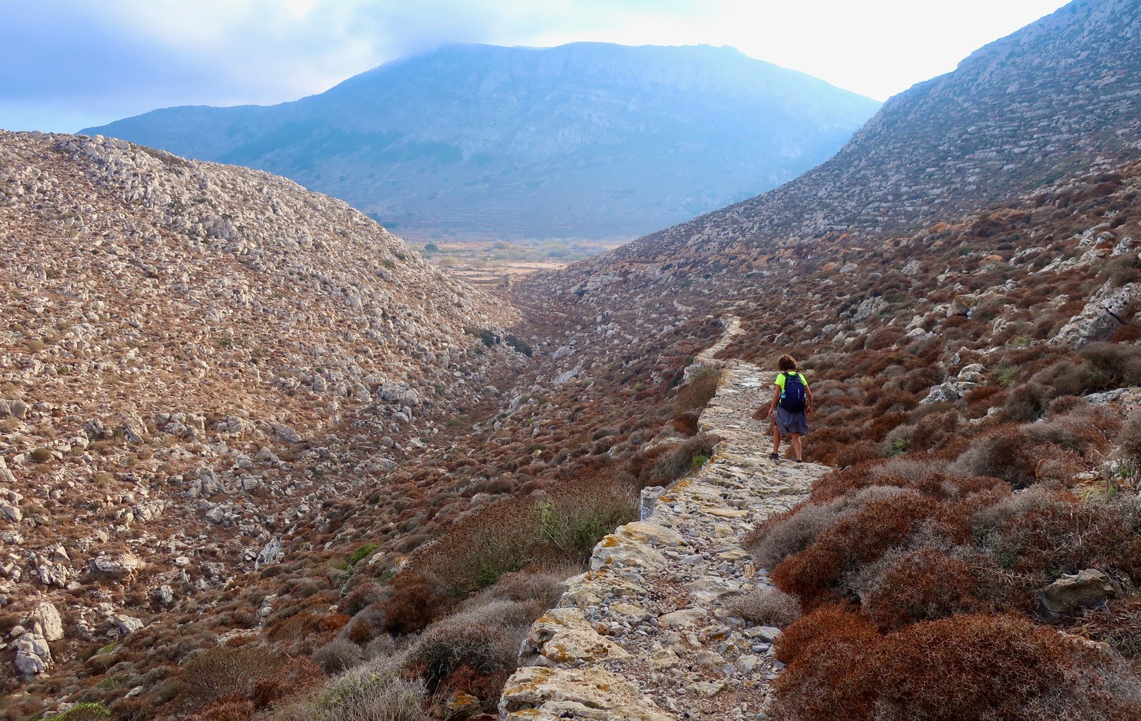
It ccontinues through the second, triangular, section of farmland, where there are neat stone walls, a few fig trees, some sheep. All possible fertile space has been used. The enclosing hills rise up to six or seven hundred metres. There is a surprising dampness, almost a slipperiness, moss and algae on the path, on the walls. Similarly in Olympos at night, even when there’s no rain there’s a humidity that’s almost tropical. Sheets, pillows, clothes, everything is soggy, clammy to touch.
Soon after the farmland the dirt road that accompanies the path comes to an end, but the cobbled path goes on. Beyond this point the only way into the far north is on foot – or by boat into Tristomo. When you leave the valley the thin path-line stretches ahead across grey-brown hillsides, with the rock of Saria Island rising fiercely up in the near distance to over six hundred metres.
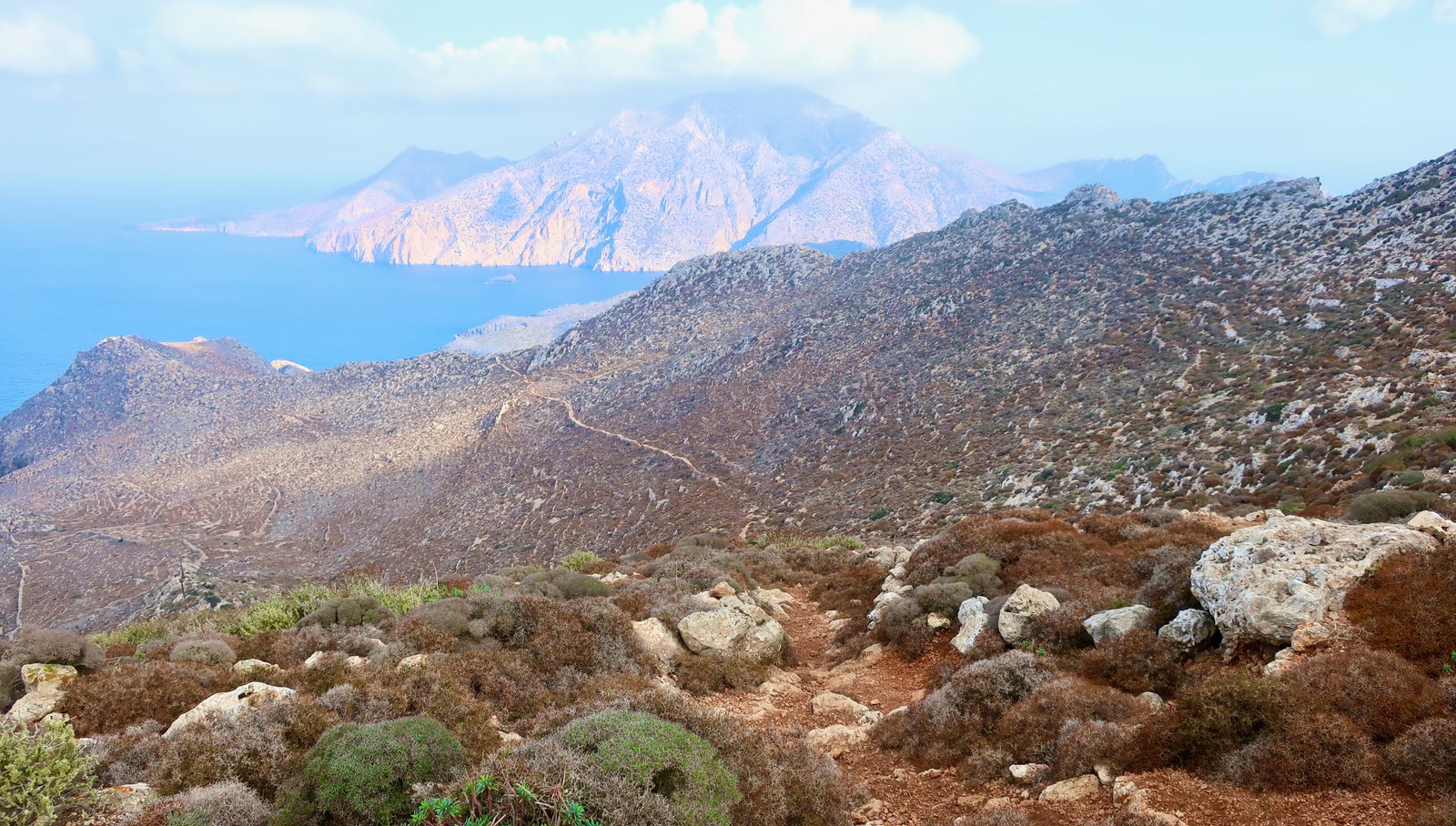
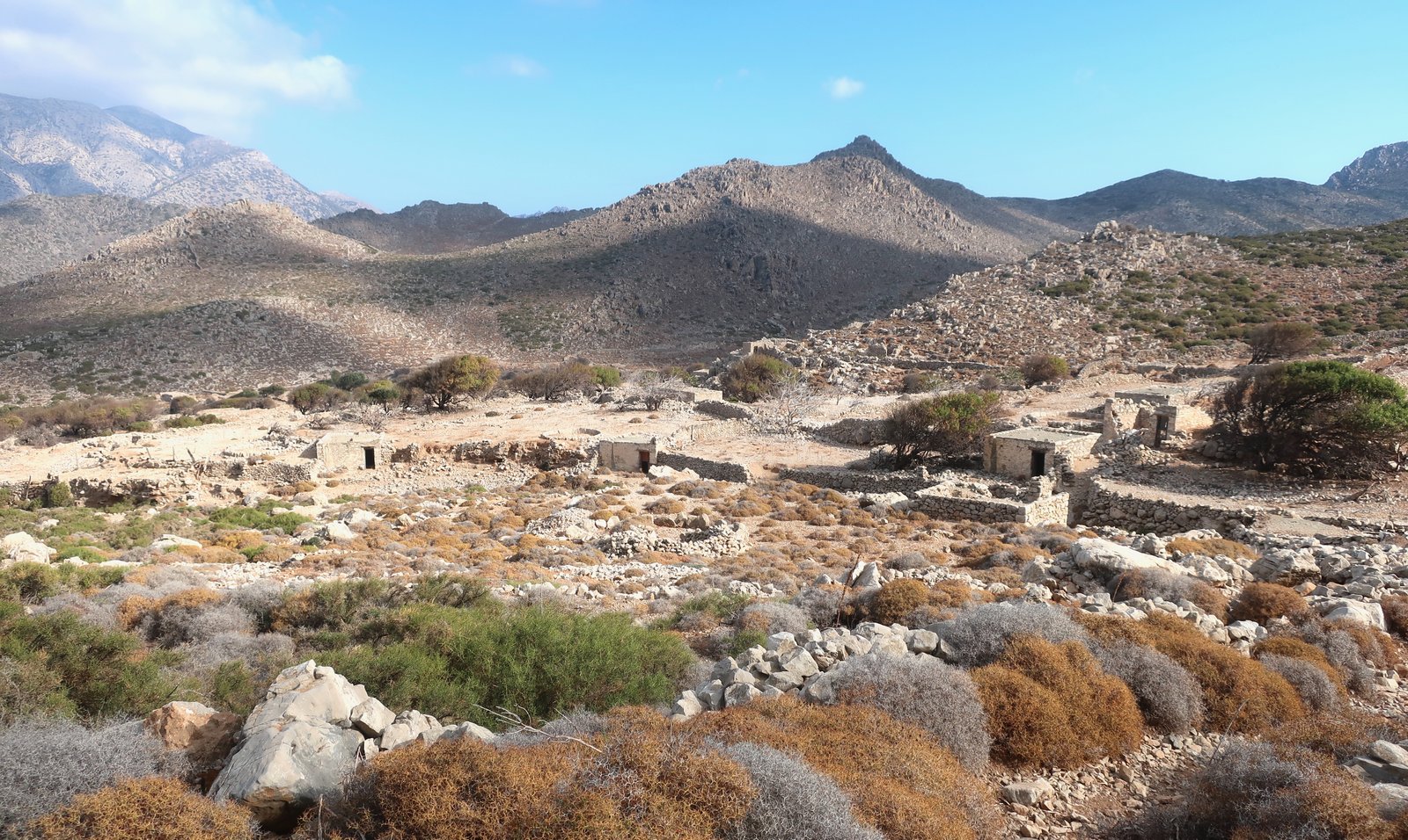
A kilometre or two more, after a sharp ridge, the trail descends into the valley behind Achla Bay, which in turn divides into two shallow valleys between ranges of hills. Here the land is either cut into fields or into low, barely-stepped terraces that are long, looping pools of pale brown. At the confluence of these two valleys and going down towards the beach are the remains of a village, a gathering of stone boxes. It’s impossible to say when this place was last inhabited. There’s nothing here but heaps of stone and a vague feeling of catastrophe. A few sheep grub for food. The entrances to the houses are all doorless, gaping black mouths. We’re walking over the village, Yvonne says, not through it. Running between the buildings is what must have once been a watercourse, a channel that now is a stone-course, full of nothing but rocks the size of human heads, a great solidified movement of them. All around are threshing circles ringed by stone teeth. Every hut seems to have its own. This ruin must once have been a place of abundance.
There’s a large pool of brackish water just behind Achla beach past the tumblings of old walls, windblown trees. The path continues around into Tristomo bay, a deep hook at the top of the island with a small settlement at its end. From a distance the setting is idyllic. Close-up, there’s a scruffy beach, a church, a house that may recently have been renovated. A dozen empty buildings. Utter silence.
Between Tristomo and the lonely church of Aghia Ekaterini at the tip of the island, almost all the land was once either divided into fields or terraced. Now there’s nothing and no-one. At the narrowest point there are only one hundred and fifty metres between Karpathos and Saria island, on which no-one lives, to which occasional boats from Diafani do tours in the summer, on which according to the map there’s also a trail, running from the southern tip just across the way from Aghia Ekaterini right up to the ancient city of Nisyros and the ruins of Argos, a Saracen pirate village.

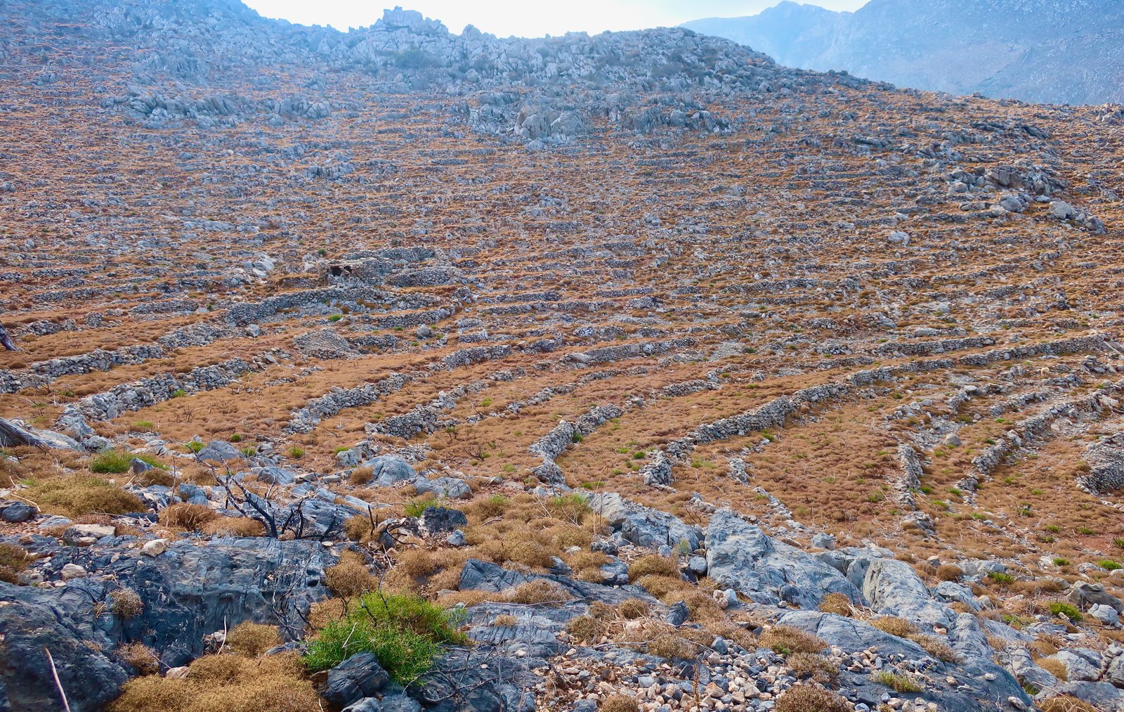
At Aghia Ekaterini the path turns almost one hundred and eighty degrees to double back down the east coast. At first it continues still through abandoned farmland, with occasional buildings in ruin, houses, animal pens, old ovens, their stones melting back into the rock of the island from which some day soon they will be indistinguishable. There are grandiose views to the west back down over Tristomo Bay. Further on, a circular valley opens to the east coast, all of it terraced; it might be the wreck of a monumental amphitheatre within which thousands upon thousands of people could once have gathered.
After this, the trail changes dramatically, from a path through old farmland to a path that runs along steep coastal slopes. It’s an access-path running between the port and the north of the island, a shepherds’ path. A secret path. The waymarking is just about enough that it can be followed. It’s not well-maintained and at times winds across very steep slopes. At one point a stone stairway has been cut through a little gorge. There’s no other way to go. You pass through with nothing ahead but the gape of sky.
The view opens up and stretches down the north east coast of Karpathos in the dazzling mid-afternoon light. There are sections where the trail thins and disappears, before reappearing around a corner, a little higher up, under a crag. This is a wonderful, wild trail, entirely different from the paved, agricultural path on the other side of the hills.
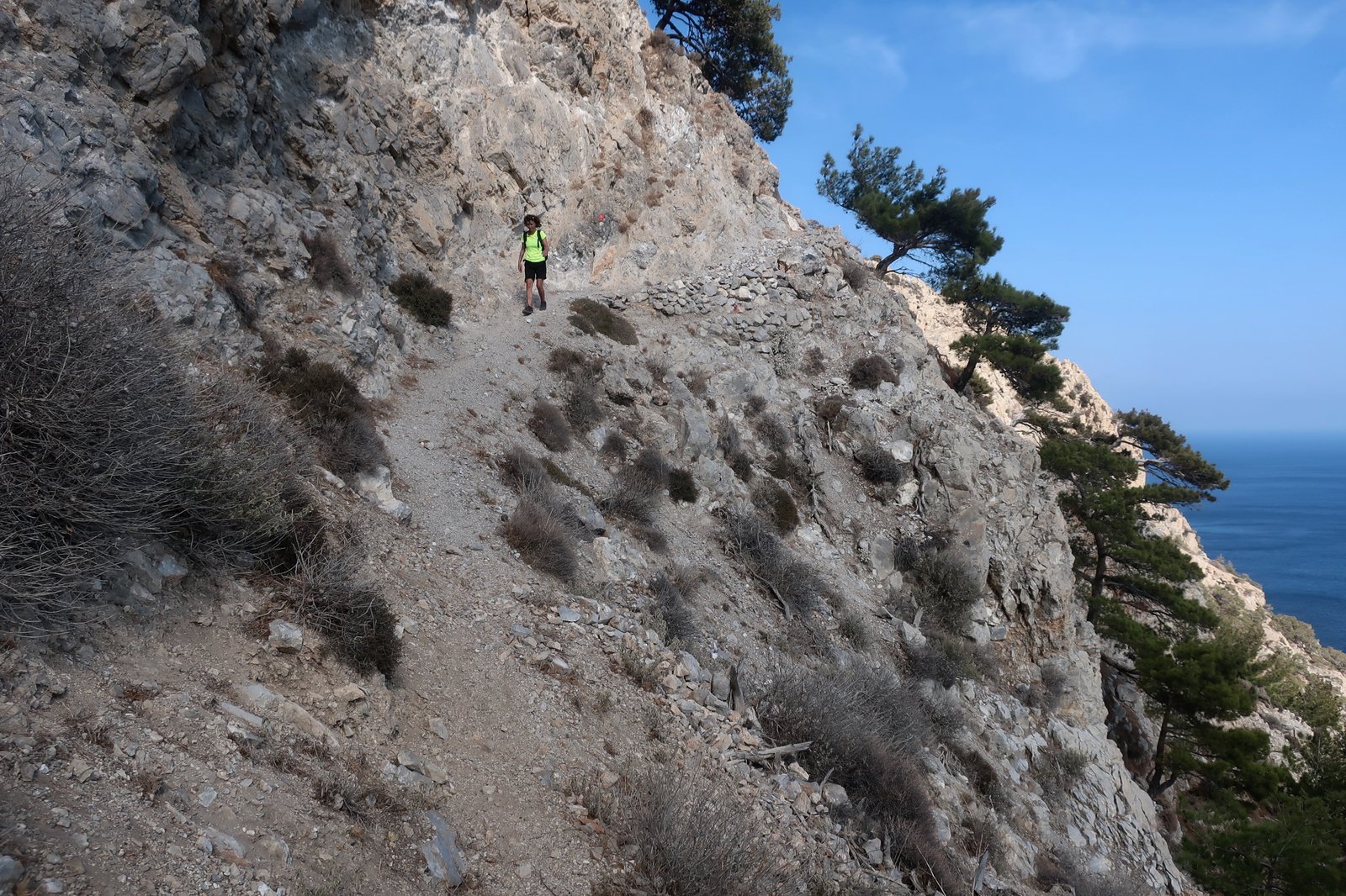
In and out of pine forest, we smell the trees before we see the concentration of them, all of them leaning to the east, crook-backed, as if on every day except this one the wind has never stopped blowing. They grow almost-horizontally, creeping instead of aspiring to the sky. Cliffs loom above. The skeleton of a goat is splayed at the base of one. Mixed shadow and light filters through the pine trees. And always the bright blue sea below, aquamarine in the shallows, white at the fringes.
After the path has come out onto a dirt track and reached Aghii Anargyri, Trail OL 10 takes a right turn towards Avlona. The way is difficult to find at first, then leads quite steeply uphill until a left-hand turn onto a perfect section of old stone path, probably an intact segment of the ancient path that used to connect Diafani to Avlona. It feeds onto an unpaved, wide dirt track, that leads back up to an intersection with the Olympos-Avlona path. It winds through wooded hills, snaking and climbing and dusty and hard at the end of a long day. The sun had set by the time we climbed up to Olympos, getting back just as the shadows were thickening into full darkness.
HIKE 2
From Olympos to Avlona on Trail OL 5 on the Terrain Map, as above, then Avlona to Vrikous/Vourgounda on Trail OL 9. Return the same way.
About 20 kilometres
This trail, half of which is a repeat of HIKE 1, is in its own right a great hike, despite being an out-and-back path. (According to the Terrain map, there’s an alternative, unnumbered section on the ridge of hills along the western side of Avlona valley. It may be possible to do this in one direction, with views down into Avlona one way, over the sea the other, and in so doing partially modify the route.)
Leaving Olympos, again. For a thousand years the steep downhill out, knowing that whatever sort of day it was, at the end it would be steep up at the end. Coming home puffing, heavy-legged, every single working day of life.
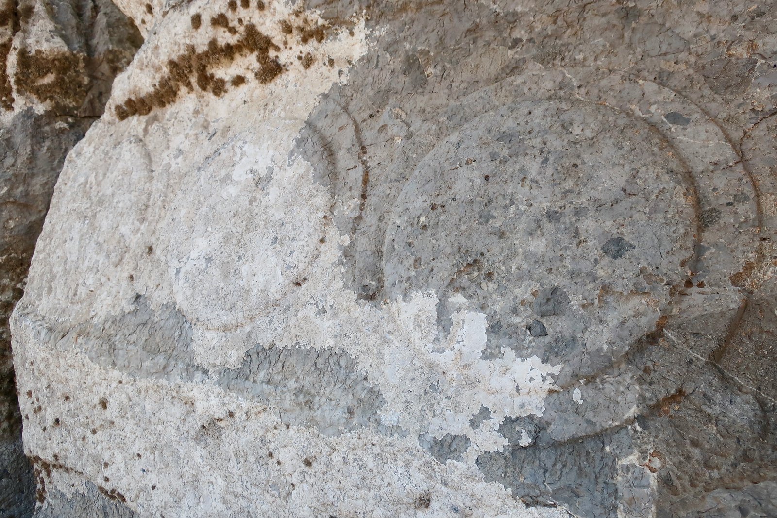
Most of the path from Avlona to Vrikous is ancient cobbled stone, as hard as iron. It pours out of Avlona valley and at a certain point begins to zigzag downhill into Vourgounda Bay. Towards the bottom it passes a number of rock-cut tombs, some decorated with two-thousand-year-old carved reliefs. There are sections of massive stone wall.
On the right hand side of the bay the land drops in what looks like great ocean-swells towards the shore. In front of the first wave, the lowest level is perfectly flat, a huge, wide platform that stretches on and on north around the corner. For anyone looking to land, there could be no better place. An army of thousands could gather here.

The scale is difficult to understand. Coming closer, moving back and forth down the path, the scarring of terraces on the flat land between the shore and the first wave plays tricks on the eyes. Distance gets hazy. One moment the land stretches away like a continent and the wave-fronts are cliffs, thousands of feet high, the next you refocus and can imagine tall men standing on the flatland at the bottom hauling themselves up to the next level in one movement.
According to legend, Karpathos was the birthplace of the Titan Iapetus, father of Atlas and Prometheus. Coming to a place like Vrikous you could believe it. It is out-sized, not of normal dimension.
On the left of the bay is the long spit of land on which in the classical era, three or four hundred BCE, the city of Vrikous was built. On a satellite view it’s a nest of shapes, house or temple foundations, stone-laid streets. Later there were animal-pens, herdsmens’ huts. Most of it is unrecognisable now. Layer upon confusing layer for a thousand years. There are pieces of column, snatches of inscription, shaped stones – jigsaws from which most of the pieces are by now missing or broken. Without a team of archaeologists to pick out the different time-periods, to show how the stone was repurposed again and again, it’s impossible to make sense of it beyond the obvious fact that people lived here. In places like this the stone is analogous to stardust, atoms: so much has been something else before.
At the end of the spit, in a cavern several metres underground, is the cave church of Aghios Ioannis Theologos. Inside there’s a freshwater spring that goes part way to explaining why a city was founded here. At some time in the early Christian era, the pagan sanctuary was transformed into a church. Like many other remote churches in Greece, people come here still, once a year on the feast-day of the saint for whom the church is named. They eat and play music and keep alive ceremonies that have existed for ever.
Even with the spring, it’s hard to understand why this site would have been chosen. In the islands few places were constructed without a first thought for defence. The city of Karthaia on Kea is the exception that always comes to mind, a luxurious place in a coastal valley with a beach-port, that can only have been chosen for the abundance of the location. But here, now, there is only bleakness.
Towards the end of the long history of Vrikous, from classical Greek to mid-Byzantine, everything changed. Saracens from North Africa flooded the Aegean in the sixth and seventh centuries CE. They raided all over the islands. A group established a base on the island of Saria. The ruins of their village are there still, tiny houses built in domed Saracen style.
It’s impossible now to know the order of things, whether they raided Vrikous or came to Saria first. It’s impossible to know how many times Vrikous was attacked during how long a period. What is certain is that at some point the inhabitants made the decision that life there was no longer tenable. One thousand years of continuous habitation, where a thousand years might as well have been a million, the past melting into myth.
Ever since going to Vrikous I’ve had images in my head of men, women and children, carrying everything they could, everything they had left, in a straggling, desolate column up the winding stone path away from Vourgounda Bay.
Vrikous then is the matrix. People in the north of Karpathos say We are all from Olympos. I wonder when last anyone thought, We are all from Vrikous.
The choice of Olympos, or what was to become Olympos, had probably already been made. A ridge behind which to hide, with a spy-view down over the sea. They built walls. They hoped to be safe. There are still traces of entrance-gates, fortifications.
There are Ancient cities like Vrikous all over the Aegean. Archaeologists and historians have become practised at understanding their bones. They read clues in the stones. Founded in the year X, approximately. Inhabited for so many hundreds of years. Science and learning give us timelines and logic. In a sense it has become easy. Or at least doable. More difficult are the inhabitants. We want so much to understand them yet as soon as we try to imagine real people, their lives, the way they thought, we come up against a crushing darkness.
Very occasionally there are moments of illumination, through which we see not historical paradigms but life, in all its wonder:
– When Pindar says what a great place Karthaia in Kea is, that he wouldn’t swap it for all of Babylon, we feel that it comes from the heart, even that maybe he’s thinking about old age, himself, how it would be to live there.
– The fresco of the fisherman from Akrotiri in Santorini. Three and a half thousand years ago. Two armfuls of fish. The abundance of it. The simple joy.
– And from Vrikous, kindness, decency. The Dorian Resolution of Karpathos, a stone inscription tablet thought to be from the second century BCE, was found at the site. It’s still there today, with alongside it stone-carved translations into modern Greek and English. The following is the full text of the inscription:
‘From Vrycus, proposed:
Menocritus, Metrodorus’ son from Samos, a public doctor for more than twenty years, had always been curing everyone, showing willingness and honesty, and he had been faultless in both his professional ability and behaviour in general.
During the epidemic, when many people not only among the citizens but also among the foreigners who lived in the town were in danger, he became their saviour, showing public spirit and disregarding fatigue:
Even before being employed by the town as its doctor, while living in …., he saved many citizens from deadly diseases without pay;
And he would always visit the houses of the people at the outskirts in justice and good will;
For these reasons, and so as to show gratitude and to honour the good doctors, let the people of Vrycus after having approved this decree praise Menocritus, Menodorus’ son from Samos, and crown him with a golden wreath and declare during the Aesculapius Games:
“Vrycus people praise and crown Menocritus, Metrodorus’ son, from Samos, with a golden wreath because of his experience and good nature”
Furthermore let Menocritus be admitted to the festivities of the Vrycus people.
The money needed for the wreath will be paid by the Treasurer.
Immediately after the approval of this decree let the people elect a man, and let the elected man ask the assembly to give the wreath and put a stone in strait Neptune’s temple, and on the stone write the decree with which the people of Vrycus have honoured Menocritus, Metrodorus’ son from Samos.
The expenses for the wreath and the stone will be paid by the Treasurer … son of … from Vrycus has been elected.’
THE SOUTH
HIKE 3
A bus to Volada at 07:00 from Pigadia – path KA 11 to Lastos – path KA 15, the beginning section of it, to the peak of Kali Limni – back down to Lastos on the same path then KA 12 east out of Lastos to the church of Aghios Nikolaos – dirt track to Aperi, a stroll down the road back to Pigadia.
About 23/24 kilometres
We caught the early morning school bus, that goes around the villages picking up students on the way to the secondary school in Aperi. Often on the slightly bigger islands these inland villages are handed a lifeline through the gift of, or maintenance of a school, creating anomalous concentrations of young life in the foothills even as the populations dribble down towards the coast, leaving mostly the old behind.
Patches of still-worked farmland out of Volada, a cluster of small churches, then steeply up on the trail, KA 11, a climb from five to nine hundred metres, before joining a thin tarmac road blanched by the heat as pale as tarmac can be. The road markings along the centre of the carriageway are erratic, drunk, as if someone had simply strolled along with a pot or two of paint and improvised, their mind elsewhere.
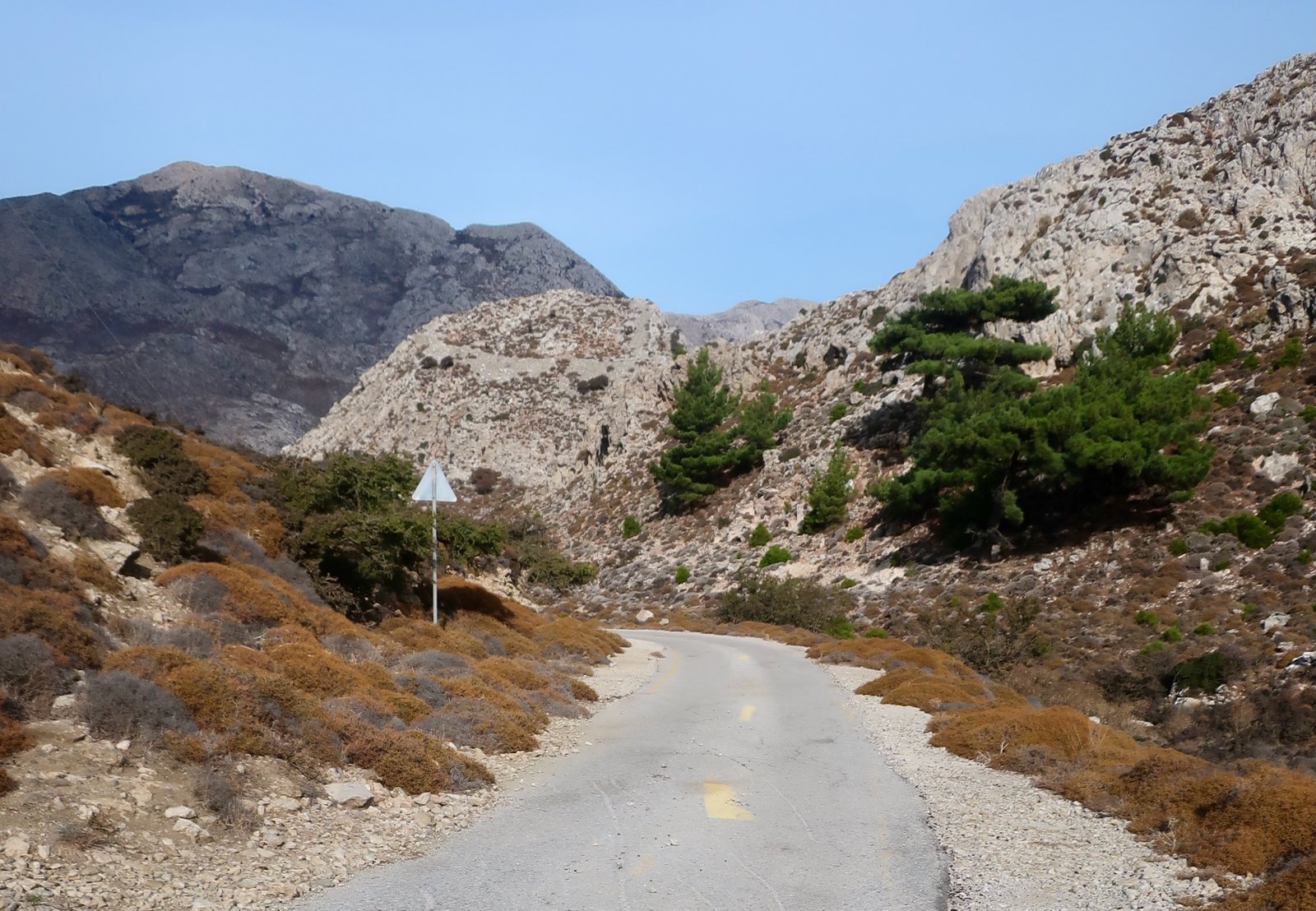
Lastos must once have been an agricultural heartland, spreading on a wide plateau at about six hundred metres, mountains all around. Parched now. We saw not one sign of life. No movement, no vehicles, nothing open. Someone has written a greeting on the road as it enters the first of the buildings. Welcome. And the word Lastos enclosed within the symbol of a heart.
The trail to the top of Kali Limni climbs six hundred metres in two kilometres, steep, not-steep, steep, not-steep, on and off bursts of effort. We expected to be blown off our feet at the top. Instead the silence, the absence of any air movement was like coming into a vacuum. Views in one direction to Kasos and Crete, the other way to Rhodes, Chalki, Tilos. A bird’s-eye view of the shape of the north of Karpathos, the mountains, the pleats and folds. Hard to believe it would be possible to walk the length of it in two days.
Trail KA 12 to Aghios Nikolaos is an escape-route from the plateau, a dirt and rock path through a greybrown, inhospitable landscape.

After the church, for a while it’s a wide, soft, brown pine-needle path through forest before opening up again and continuing, a wide track that drops down into Aperi, with views over the east coast to Kyra Panagia and Katodio. From there, it’s a careful five kilometres down the mainish road to the beach, then four more along the sand home.
HIKE 4
From Pigadia north around Vrondi Bay to the church of Aghios Nikolaos. From the church, straight uphill (instead of going around the coast) on a dotted, unnumbered path, until reaching Trail KA 6A (Terrain Map). Aperi – Volada – Othos – cross-country back to Pigadia.
Around 30 kilometres
On discovering that we hiked, our host in Pigadia had said: You must meet Giorgios, he hikes too… He, Giorgios, told us about the path that runs low around the coast from Aghios Nikolaos to Achata Bay, that he strongly recommended. Why then we chose not to go around the promontory to Achata Bay but straight up the hill from Aghios Nikolaos, I can’t say. This whole walk is one of the blurriest of all the hundreds of Greek island walks we have done.
From the church of Agios Nikolaos we climbed about four hundred metres straight up. At the beginning there was a path, but we soon lost it. In places the slope, through woodland, was very loose, uncomfortably steep.
Where the land flattened out we came across a path, the 6 A I think, which we followed until it turned into a dirt road and led into Aperi. (Above Aghios Nikolaos we should probably have gone up to Profitis Ilias and down the ridge. To tiptoe along a ridge is invariably a pleasure, and a ridge is easy to follow.)
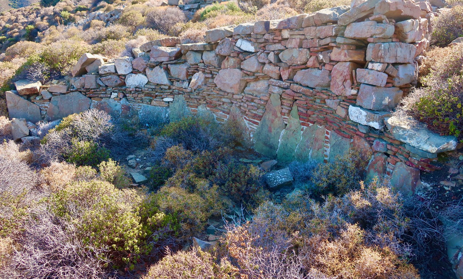
Aperi, Volada, Othos, the three villages sound like the chiefs of marauding Germanic tribes. Just past Othos we headed cross-country. We were hoping to find the KA 7 to Menetes, but didn’t. I have no idea where we went wrong. There were bits of path, bits of wide dirt track. We scrambled. We came across a threshing circle that had been repurposed into the circular base of a wall, red bricks filled in like shading between the tooth-stones around the threshing floor.
This whole walk comes back in subliminal flashes. We idled around and went home to our apartment overlooking the port and had dinner and a beer and thought we should have gone all the way around to Achata Bay, and thought we should have gone to Profitis Ilias and thought we should have gone to Menetes and didn’t understand why we hadn’t.