
On our first visit to Nisyros, we stayed with a woman who had arrived on the island in the 1950s as a young girl. Her father had come to work at the pumice and perlite quarry on Gyali island, four kilometres off the coast between Nisyros and Kos. Coming in on the ship she couldn’t understand it, she said, the island was covered in snow. When she got closer she saw it wasn’t snow at all. The almond blossom… I’d never seen anything so beautiful.
The population of the island was a lot larger then. Two and a half, three thousand. Most of the men worked in the quarry on Gyali. After the almond harvest the women would sit outside their houses cracking open the nuts. They’d spread them over the rooves to dry. From above, the whole town a panorama of brown, drying almonds. Most of the almond trees are gone now.
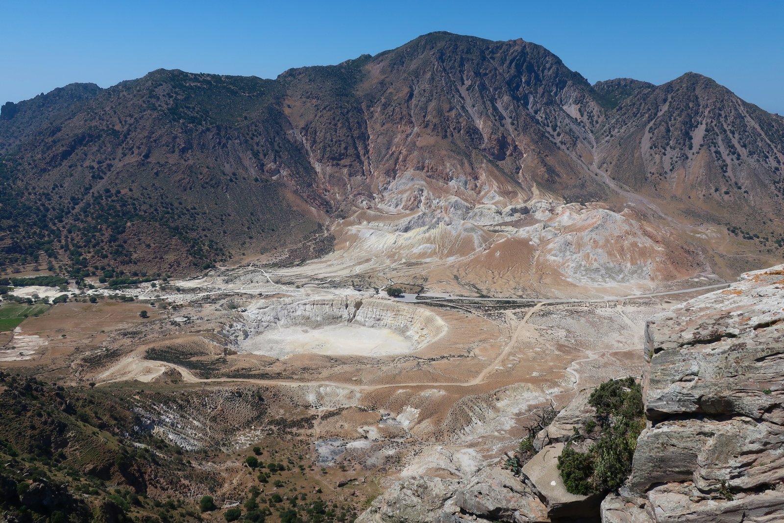
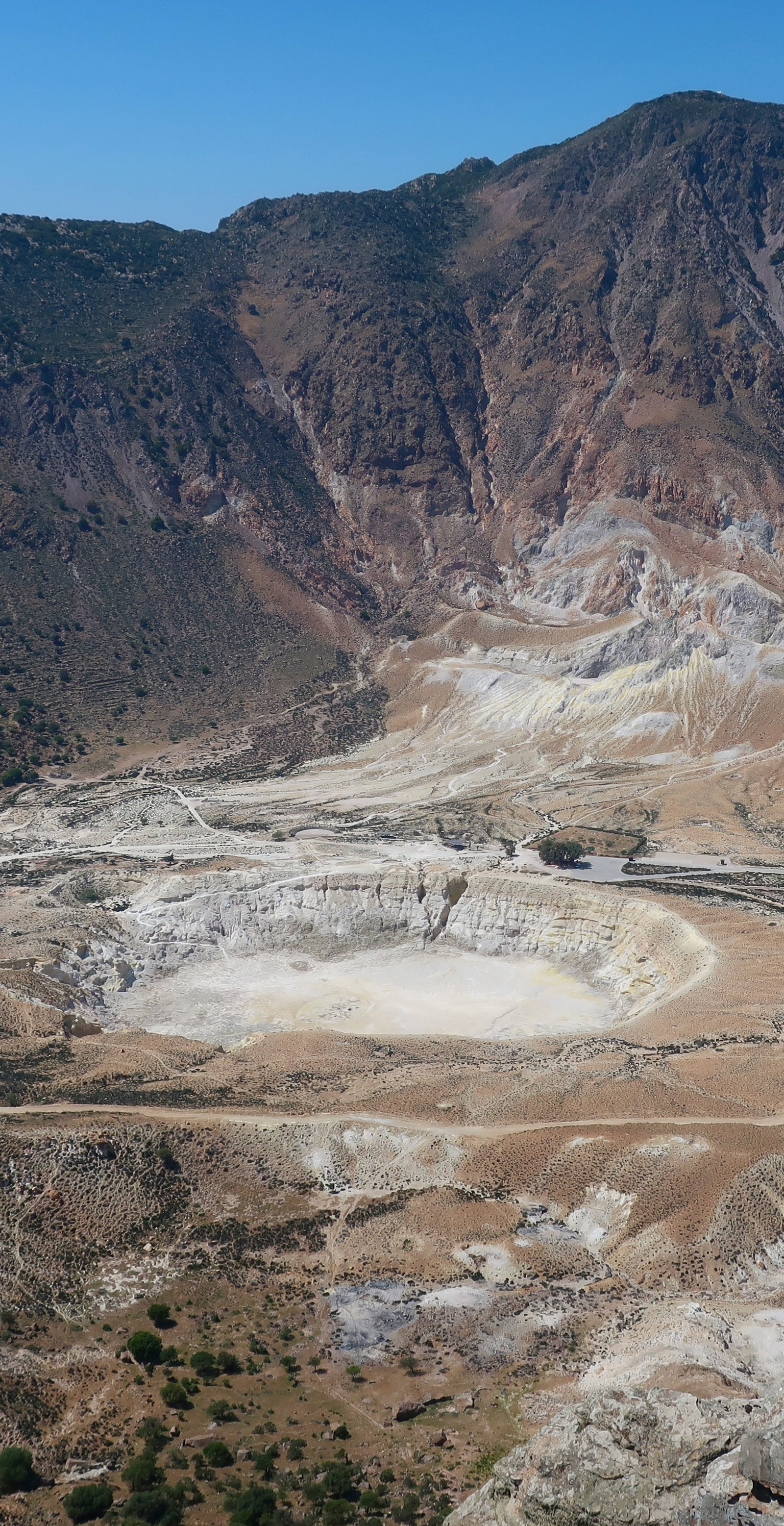
Nisyros is the remnant of a huge volcanic explosion that happened one hundred and fifty thousand years ago. Like Santorini, the legacy of cataclysm is the richness of soil. (The Turkish name for the island is Incirli, meaning With Figs. Fig island.) The early Greeks had their own creation story: Nisyros they say was formed when Poseidon tore a massive piece of rock from the island of Kos, just to the north, and threw it at a fleeing giant. The recurrent rumbling and shaking is Polyvates, the giant, still trapped underneath.
It’s pretty much a picture-book volcano, rising up on all sides towards the rim of the central cone before plunging down into a wide crater. In a quiz in which contestants had to put names to Greek islands from 3D representations, Nisyros would be easy.
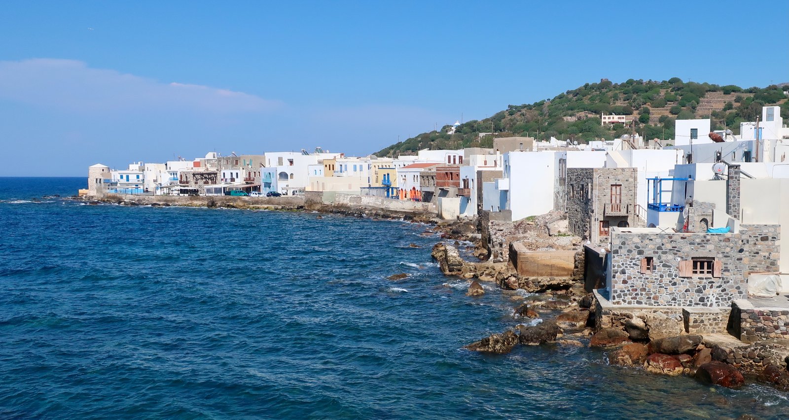
Sitting on the terrace of a small café in Mandraki, the main town and ferry port, on a windy day the air’s thick with moisture. Just a metre or two away waves slop against the sea wall. Many Greek island ports have been nudged away from the sea by the interposition of waterfront roads and promenades, new dock areas, beaches that used to be places onto which fishermen dragged their small boats, but which now are plumped up for the tourists. They are gradually abandoning their proximity to salt-spray, becoming less wild.
Not so Mandraki. The line of buildings along the seafront, with their scruffy flat rooves and Barbary air, traces the shape of the coast.
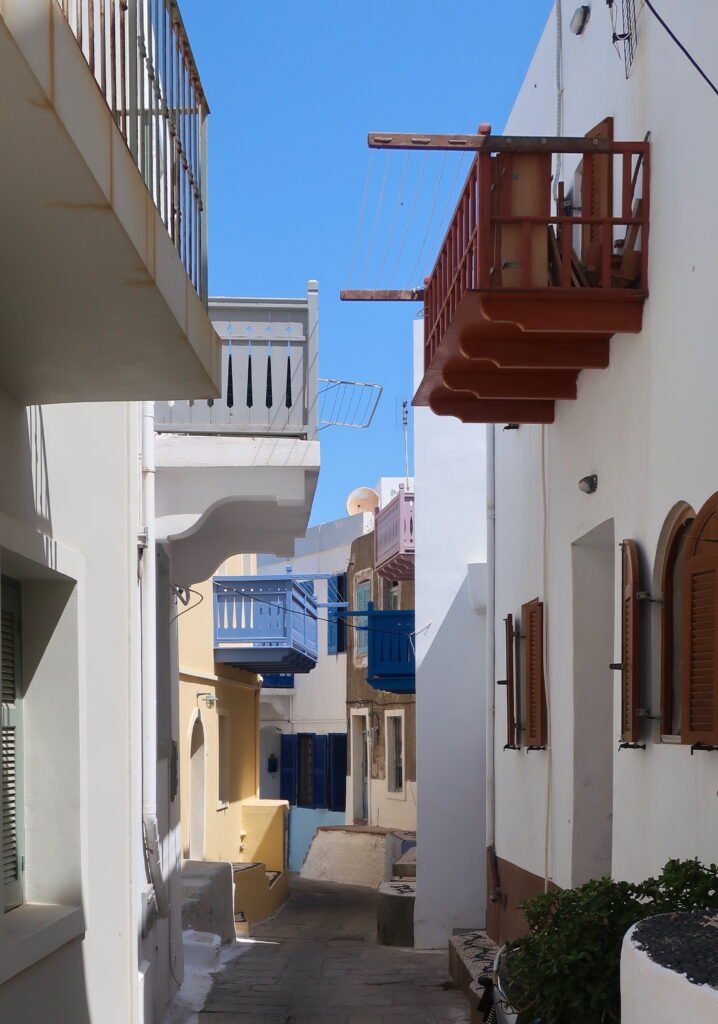
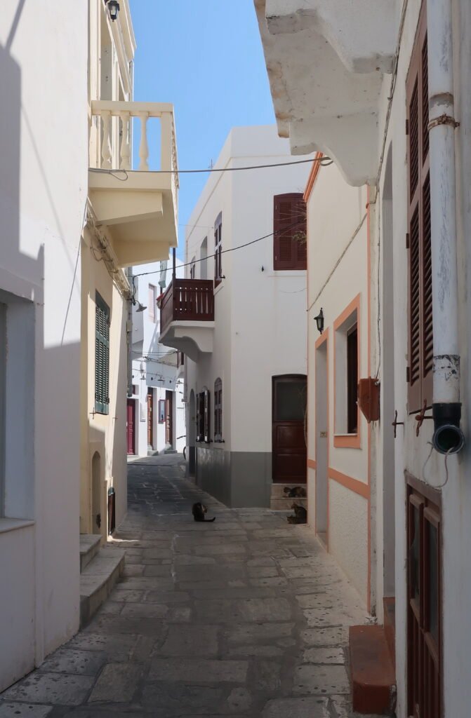
From inside it’s no longer scruffy, but still piratical, with narrow winding streets and coloured wooden balconies that seem too big for the houses from which they project. From one side of the street to the other they practically touch. Such animation there must have been in the past when these streets were full, such theatre.
At one end of town, imposing on its rock promontory, the monastery of Panagia Spiliani sits amid the ruins of the castle within which it used to be enclosed. Around the bottom of the promontory there’s a footpath that has nothing of the fault lines and layers we see in so many coastal places, where cliffs that once were flat land, having been forced up by pressure, now show stripes of geological time at crazy angles. The path under the monastery was poured. Molten rock has congealed into a close-up elephant-skin of waxy iron knots and bubbles.
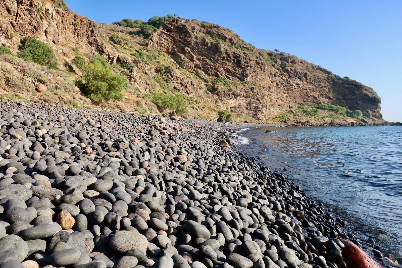
Just around the corner is the town beach, a strand of large dark pebbles enclosed by steep land on all sides. Weather permitting – it faces north, towards the prevailing winds – it’s a good place to swim, though a lumpy, uncomfortable place to sit. Gliding back to shore, the wet beach is photo-art, glinting, black and textured.
There are four settlements, two on the coast, two on the rim of the crater. Most of the island’s one thousand permanent inhabitants live in Mandraki. A few live in Pali, several kilometres along the coast, where a breakwater has been built behind which locals tuck their fishing boats and visiting yachts shelter. There are no good natural harbours on the island. Emborios and Nikia, the rim-villages, are mostly white-Cycladic. The Dodecanese are not like the Cyclades, they have no uniformly distinct architectural style. Some islands are more Cycladic, while others – Kastellorizo, Chalki and Symi – have neo-classical houses and pastel colours not unlike the watercolours you might find for sale in the piazza of some provincial Italian town.
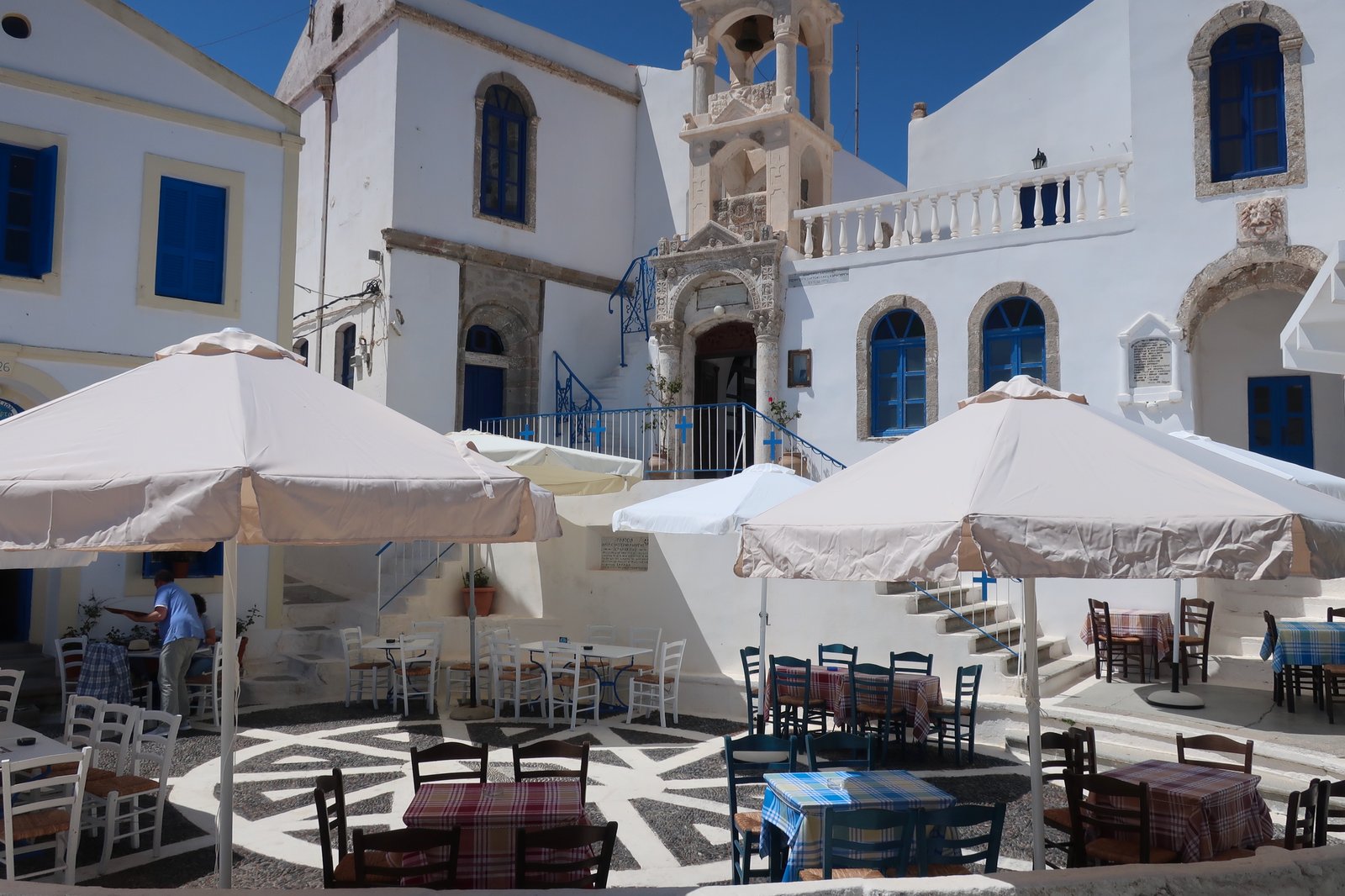
Only a few dozen people live permanently in the two high villages these days. Passing through Emborios in mid-April we saw no-one. The only signs of life were the sound of a television and a set of keys dangling in a door. Nikia is a little bigger. It has a miniature piazza we have seen described as one of the loveliest small squares in the Aegean. It is a picture, a tiny, scaled-down version of a perfect southern European outdoor space, tiled in black and white beach pebbles, ringed by houses that are neo-classical, but white, as if they couldn’t decide. On one side there is an elaborate church and tower.
In season some tourists do stay on the island – a few foreigners, returning locals – but residential tourism is comparatively undeveloped, still not as economically important as the quarry on Gyali island. Volcanic day-trippers from Kos are more numerous. Small ferries drop them in Mandraki, where buses are waiting. A good tourist road takes them into the heart of the crater. They go to the square in Nikia, where two small cafes face off, where after refreshements they go to a lookout at the end of a small alley just behind the square, there to take photos of the cluster of craters-within-the-crater, the largest of them a few hundred metres straight down below the village. Later they’re taken back to town, where they eat at one of the tavernas and buy trinkets before being whisked back to Kos. Always the same routine, a choreography of sun-hats, shorts and sandals, slow inspection-strolling like insects about the main crater. Given thousands of years the same tourist paths they all take will erode a print of their passing.
Not only the outer slopes of the island, but also the inside of the crater is unusually fertile. Much of it, particularly around Nikia and Mandraki, used to be intensively farmed. The slopes are sliced and walled, from rim to valley floor, the terraces still obvious, covered in olive groves. Elsewhere, on the outer slopes of the volcano there’s an enduring impression of abundance; some remaining almond orchards, some vines, figs that everywhere in the islands are as easy to grow as roadside weeds, and more olive groves. As on all the islands, the terraces of cereals have gone; threshing circles have been abandoned, leaving only tooth-stone rings to mark them, while grass sprouts across the threshing floors.

Aside from Mandraki with its seafront and its alleys, and the island itself – the volcano, the many fine stone-laid paths around the crater – Nisyros has at least two more reasons to be uniquely memorable. One is the high, secret valley in the centre of the island. (See hiking.) The other is the Kastro, the ancient citadel that overlooks Mandraki. It’s one of the most dazzling classical sites anywhere in the islands. Two thousand and more years later, the state of such sites is very often contingent upon the accident of the type of rock available for construction. On some islands the stones are so soft that time has all but erased them. We have seen ancient walls gutted, hollowed out by wind and rain. Once, sitting on its own on a bare hillside where there had been an ancient city, we came across a butt-end of pale column, the final testament, one small piece that looked as if it had been sucked like a boiled sweet, that soon will be nothing more than a smooth rock on which to rest.
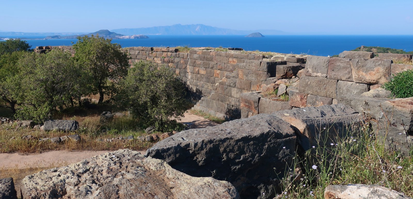
On Nisyros however the rock is basaltic andesite, a dark grey or dark brown volcanic rock harder than iron. Giant, individual stones look today much as they must have done when the city was built in the fourth century BCE by Mausolus of Caria, whose tomb at Bodrum/Halicarnassus on the Turkish coast was one of the Seven Wonders of the Ancient World. Though built for what reason, here, such grandeur, such effort, such a small island, no-one knows.
Some restoration work has been done. In places the fortifications are five or six metres high. There’s an intact, monumental entrance doorway. There are steps up to the top of the ramparts, the joined sections of two long perpendicular sides, but the complete shape of the original city has been lost. Within the walls new paths have been made for the few tourists who come. There are wild flowers in springtime. Agricultural terraces long ago colonised the city-space, confusing the understanding of it, from martial, with perhaps some farmland for production in time of siege, to fully agricultural land marked by the indelible presence of these gargantuan walls.
HIKING

All trails on Nisyros are informed by the volcanic shape and nature of the island. They curve around the rim of the cone, down into the crater, up out of it. They descend the outer slopes of the volcano, ease along the dark sand volcanic beaches of the east coast.
The Terrain Map of the island we used has eleven trails, none of them longer than 3.8 kilometres. For practical purposes, they need to be creatively sewn together, the resultant hiking routes often interspersed with sections of road and track.
Public transport goes from Mandraki up to the rim villages. In April, possibly the only resident visitors on the island, we took the bus from Mandraki to Nikia. Two days later, when we wanted to take it again, it had broken down. They came for us anyway, a small private car as replacement, and no, no of course no charge for the service, the bus isn’t working, how could we…
As on other intensely cultivated islands, there was once a dense network of stone-laid paths. Between villages, to and from churches and monasteries, above all to and from work, the fields and terraces. Many of these paths still partially remain. Others are slowly being cleared, repaired a little, made passable. The signing is often haphazard, but it doesn’t matter. It’s not a big island. With a map and a blue google dot it’s easy.
The following hikes are hypotheticals. We’ve done them all, but the choice of exactly how to do them, in what direction, which paths to combine or separate, is open. There is no right way to walk the island.
HIKE 1
Public transport from Mandraki up to Nikia. A path down and to the left (west), around the southern flank of the crater. Leading onto dirt road, asphalt road, and then a stroll all the way back into Mandraki. An optional, logical, stop at the citadel, and the small footpath from there down into town.
About 15 kilometres of easy walking
The path leaves from the crater-lookout point behind the square in Nikia. It heads west, is mostly stone-laid, stone-edged, until after less than two kilometres it hits the road. It is very lovely, sculpted onto the slopes of the crater, winding back and forth with views down, inside.
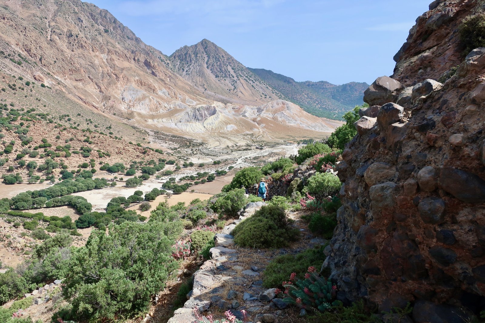
This is mostly a road-walking day, but gives a feel for the shape of the island. It’s anyway the only way to get around the western side, with an obligatory stop at Siones church, inexplicably omitted from the Terrain Map. It’s roughly halfway around, on the right and less than two hundred metres from the road, and is said to be the oldest church on the island. It resembles a miniature fortress-complex or tiny monastery, all arches and ovens. The central structure has crumbling, ancient frescoes that elsewhere would be treasured. The small valley in which it sits, once agricultural, is wrinkled now with leftover shaping, walls and low terraces. Only goats go to the church now, they pour like burglars from an upstairs window as you enter.

HIKE 2
Public transport from Mandraki up to Nikia. From Nikia to Emborios on the high inside-the-crater path, then back on the road towards Nikia until a point at which you dive down towards the Panagia Kyra monastery. From there down to the east coast and a longish walk home via beaches, small coastal road, Pali and the main road for the last few kilometres.
Around 20 kilometres
The trail between Nikia and Emborios was once the main road – footpath, goat-path – between the villages. It traverses the high internal slopes of the volcano, anciently terraced, and is very, very beautiful. Some sections are still stone-paved. The waymarking is poor.
Roughly-speaking the trail, which on the map looks more or less straight, is a series of three curving traverses, that loop one after the other across a series of scalloped valleys. There are many trees. Vestiges of agricultural usage are everywhere. Birdsong, patches of bright green ferns. We came across a wild pig rooting about up there. Not a bristling, tusked boar, but a dirty pink escapee, or descendant of escapees. Grasshoppers fire off at every footfall. There is a lushness, an impression of abandoned plenty.

On the Terrain Map a trail is marked that leaves the main road part way between Nikia and Emborios. It dives down over the exterior slopes towards the Panagia Kyra monastery. It’s quite steep, but the monastery is only a few hundred metres from the road. We found only a few waymarks and soon were wandering in a rough direction. But it’s not difficult to approximate a path, back and forth, dropping down over terraces.
The monastery is another place of abundance. No-one lives there now, but like most such places in the islands, it’s well-maintained. There are large seating areas and courtyards, where people would have gathered together to eat and play music and dance, with no way of knowing that that their cyclical life of harvests and feast days would not go on forever. The most lovely courtyard is a closed space with stone benches and tables and orange trees and rampant vines overhead. In the springtime it made a transparent roof of light and green speckled by the bright studs of bitter oranges.
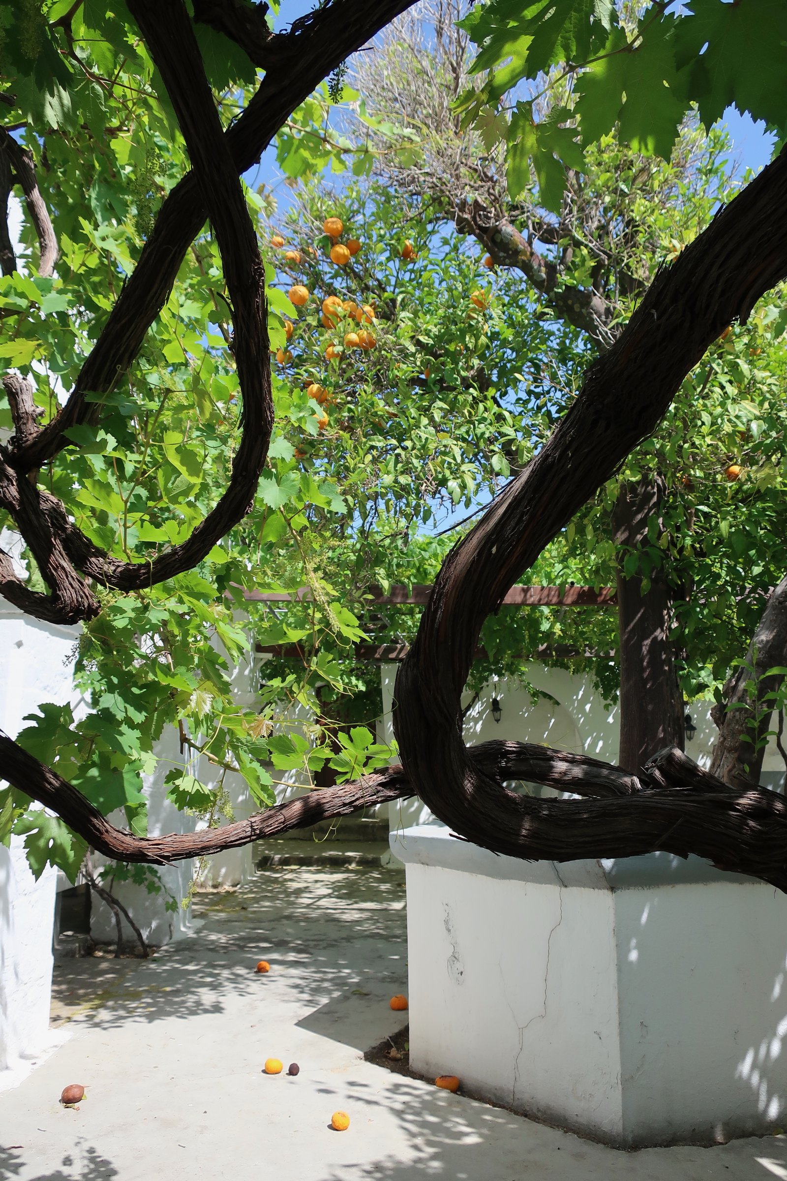
Elsewhere there are ancient kitchens, with ovens, and pots for storing wine or oil, a locked church with a white-painted stone-tiled roof, a bell turned blue-green with verdigris, arches and passages and steps and shapes and shadows and locked cells. On the monastery’s far side are more vines, more gardens. There’s a feeling that the owners might just have popped out. As if whoever looks after it cannot believe in the end of things, cannot let go.

The trail that on the Terrain Map continues on down to the coast after the monastery has no waymarks, but the way is easy enough. In places it’s a slipping heap of volcanic clinker, or pumice, that tinkles lightly underfoot, a confusing mix of light and heavy.
At the bottom is Pachia Ammos beach, not quite sand and not quite pebble. It is only accessible by footpath, though the easiest of the two access-paths is not the downhill one we took but the one along the coast, only a kilometre from the point at which the road ends.
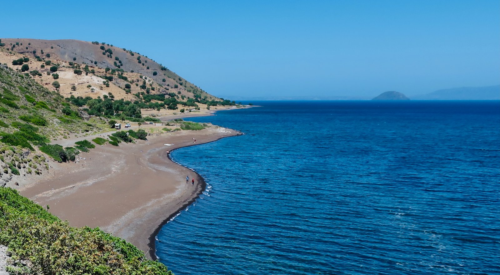
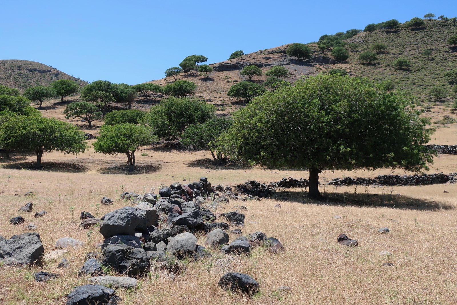
Following the coast, the first half of the way home is a stroll to Pali along a line of beaches or the thin, barely-used tarmac road behind them. Most of the way there’s nothing built, only the coastline and the land that climbs gradually at first up towards the rim of the crater. An early summer landscape of desiccated grass. And trees, not gathered together into a forest but separate, like a grazing herd, each one standing in the pool of its own dark brown shade as we passed. Looking only to the left, away from the sea, there’s an impression of size; prairies, the crisp Disney colours of the Lion King.
Pali is a minor yachtie stop-off, mostly closed out of season. The huge, abandoned thermal resort of Loutra is halfway between it and Mandraki. This same story of thermal dereliction is repeated on many islands. Warehouse-like buildings with facilities for hundreds of visitors; here, on Ikaria, Kythnos, Santorini and so on. All of Greece is volcanic. People have been using the hot waters of Nisyros since Roman times, but the great days of thermal tourism were the first fifty years of the twentieth century. In season, three ships a week would bring visitors to Loutra from Europe, the Middle East and Egypt. Nowadays the size of the buildings, the extent of the desolation, is hard to believe.
HIKE 3
Nymfios
Mandraki to Emborios by public transport or on foot. For the latter, there are various alternatives but the most obvious is the rim-walk from the Evangelistria Monastery. From Emborios down into the crater. Along the road inside the crater, then a sharp turn to the right up onto the inner slopes. After one kilometre, left towards Nymfios Monastery. Various alternatives from there back down to Mandraki. A possible diversion to Profitis Ilias. Passing by the Evangelistria Monastery again, the option of several paths from there back to town.
Hikes 1 and 2 above make a rough circuit of the island, around the west, around the east. This one cuts through the middle.
The best way to get to Emborios is a stroll from Mandraki to the Evangelistria Monastery, then the old rim-walk to Emborios. This adds a few kilometres and a climb of 450 metres to the day.
From Emborios down into the crater there is a high-sided, old stone trail, a shady work-path through mostly olive trees and old terraces, with various small stone agricultural buildings along the way.

Once down, about 800 metres along the main crater-road there’s a right-hand turn up, approximately in the direction of Mandraki. There’s a small sign at the bottom. A rough path climbs steeply through groves of almond and olive, across a shifting basalt scree slope, becoming more defined and flattening out at about 300 metres.
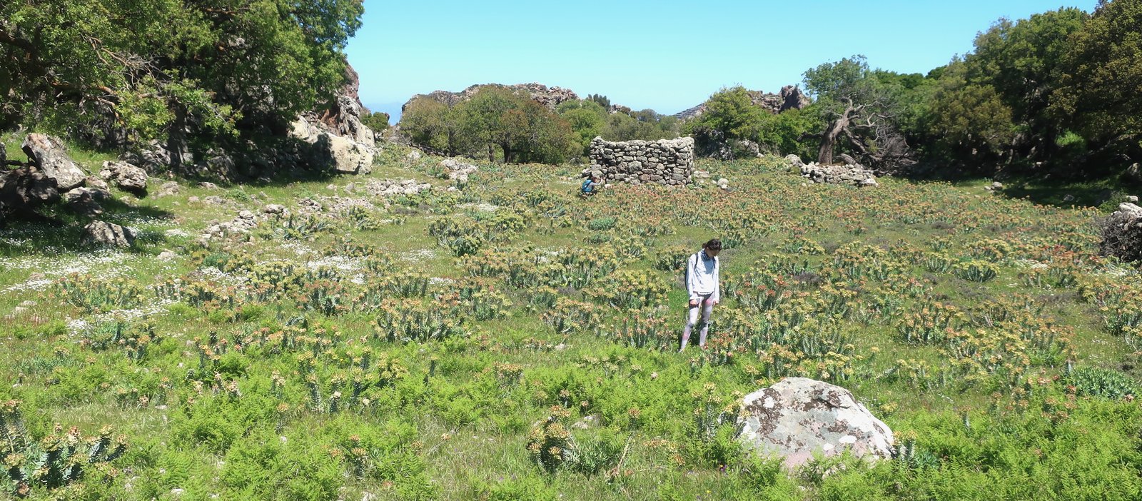
After little more than a kilometre on this path there’s a turn to the left, marked on the Terrain Map, easily missed. The continuing upward trail from there is indicated by paint-marks on large rocks. It snakes back and forth, between the rocks and a multitude of high, electric green ferns. From below it is invisible. But then this must have been the point. It comes out into a beautiful hidden plateau/valley, enclosed by Profitis Ilias, the island’s high-point at 700 metres, and two other peaks, both of them over 500 metres. Without making the climb up, you’d never imagine this secret place existed.
The abandoned monastery of Nymfios is at the entrance to the valley on the left, but it’s hard to see the cluster of cave-like, low, stone buildings as a monastery. Some stone arches, two low doorways to duck through, no more than a metre twenty high. It’s more a poor, secret, stockade/church hybrid, half-built, half excavated. No-one goes there now. It sits open with its ragtag collection of icons, candles, a thurible hanging on the wall ready for use, and a white stone altar with a faded purple cloth lain over it.
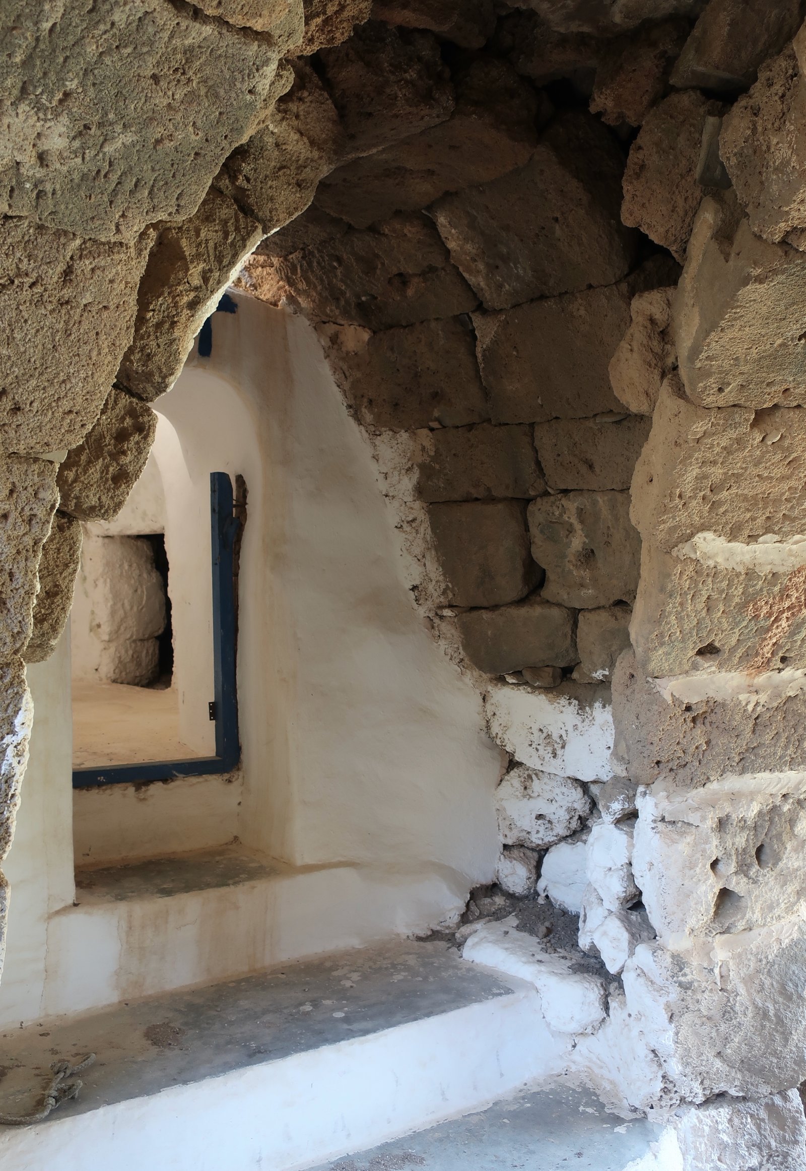
Three thousand years ago there was a Mycenaean settlement in the valley. Long before that a prehistoric community, hiding away up there. On the islands the usual solution to violence, the chronic precarity of life, was defensive. People built their homes in steep places, inaccessible places, hard-to-attack places. This valley is different. Instead of a fortified place, it’s a hidden place, a very beautiful, very sheltered haven.
We’ve been three times and each time wonder about cooking fires, telltale smoke columns. Perhaps for longer than the entire history of the modern world people were secretly living in this valley. Generations and generations of people living their silent lives. You can hardly move up there now for the concentration of ghosts.
At the opposite end to Nymfios and the valley-entrance, there’s a spy-place, an opening in the hills with a view down into the crater. There’s also a back way, a subtle path that sneaks between Profitis Ilias and one of the other two peaks, opposite the crater. All good hiding places need a second way out. Otherwise they are not hiding places but traps.
It leads around the hill down to the Evangelistria Monastery. There’s a trail up to Profitis Ilias too. From the monastery there are various trails back to Mandraki.
For us this silent valley, where almost nothing remains, is clamorous with its stories.
OTHER HIKES
We’ve never taken the path that runs from Nikia down into the crater. We’ve never taken the short, steep trail up to Emborios from roughly the direction of Pali. And most of all we’ve never taken the trail that leads to Avlaki, Nikia’s abandoned port on the southern side of the island. These are all to be discovered.