

In order to escape his death foretold at Troy, the great Achilles hid away on Skyros dressed as a girl. Had Odysseus, craftiest of the ancient heroes, not found him there and tricked him into giving himself away, there would have been no Iliad and probably no Odyssey either.
Achilles is eventually said to have set out for Troy from what is now known as Achili Bay, roughly in the middle of the east coast just below Aspous. There’s so much concrete there now that on a small, laptop-sized computer screen you can pick it out on a satellite image zoomed out large enough to also show Alonissos, sixty-five kilometres to the northeast. A concrete pad of seven or eight acres, most of it nominal parking lot, encloses a rectangular marina. Except the word marina implies something more than just concrete and at Achili Bay there is nothing more. The only person we spoke to about it was scathing: It doesn’t even work, he said. When the wind blows strongly from the north, the boats aren’t safe. Besides, there can hardly be enough fishing boats in all of Skyros to fill it. In this out-of-the-way place, once a lovely beach and bay, potentially a point of some notoriety for the island – and how the islands like to brandish their classical credentials – it’s a disaster.
The presence of Achilles on Skyros might also be reverberating still through the annual Goat Festival. Every year just before Lent, men, their faces hidden, dress up in furry goat-skins and hang up to fifty kilos of bells around their waists. The costumes are part creepy, part lunatic. The women who take part in the festivities also cover their faces – a nod to Achilles, perhaps – and dance around the streets with the goat-men. The festival, with its pagan, Dionysian roots, is unique in Greece.
Apart from Achili Bay, for which Skyros is not famous, and the festival for which it is, a little, Skyros has one of the largest Greek air force bases in the Aegean. Tourism is less developed than on most islands, the economy of the island on which three thousand people live all year round is propped up by the knock-on effect of the military presence. Members of the armed forces are a constant in the cafes and restaurants of the Chora, smart-looking, confident, Topgunnish.
Most of the islands have military infrastructure, few as important as Skyros. On some there’s little more than a rusty compound, a handful of homesick boys in uniform. From time to time while hiking we’ve been blocked by remote bases and had to turn around, or have come across groups of uniformed men setting up camouflaged guns in groves of trees, eyeing us warily as we saunter past. The neverending cold war with Turkey is at the root of this paranoia. But whereas in Turkey you have the feeling that the on/off military brinkmanship with Greece is a mix of political theatre and nationalist chest-thumping, in Greece, as well as deep historical bitterness, there is genuine anxiety. How else to explain the young family we stayed with on Astypalaia who were stocking up on baby milk, readying for when they come.
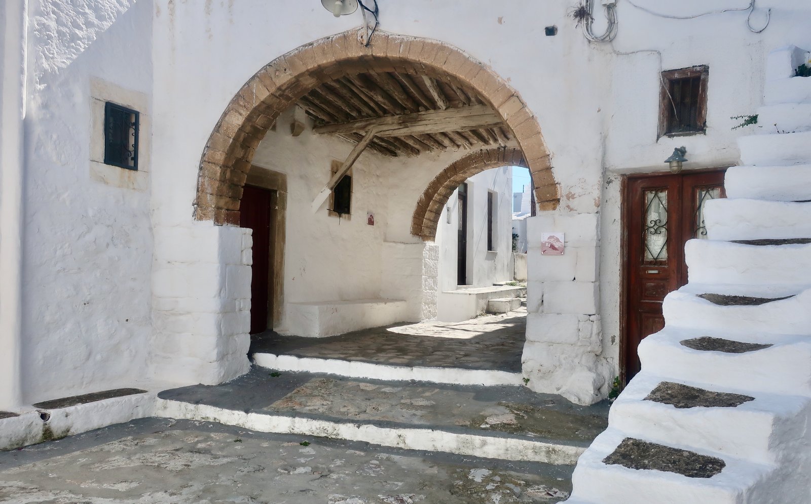
Skyros divides perfectly into two more or less equal-sized halves. Were it to snap around the midriff, the two resulting islands would have little in common. The north is hilly, largely forested, and resembles the other three islands of the Sporades. The south is mountainous, barren, empty, clearly Cycladic. The Chora, wrapped around a pointed hill just in from the north east coast, is in the wrong half. It’s a white building-block Cycladic village of churches and alleys and archways and sudden courtyards with flowers, with the remains of an old Byzantine castle on the top.
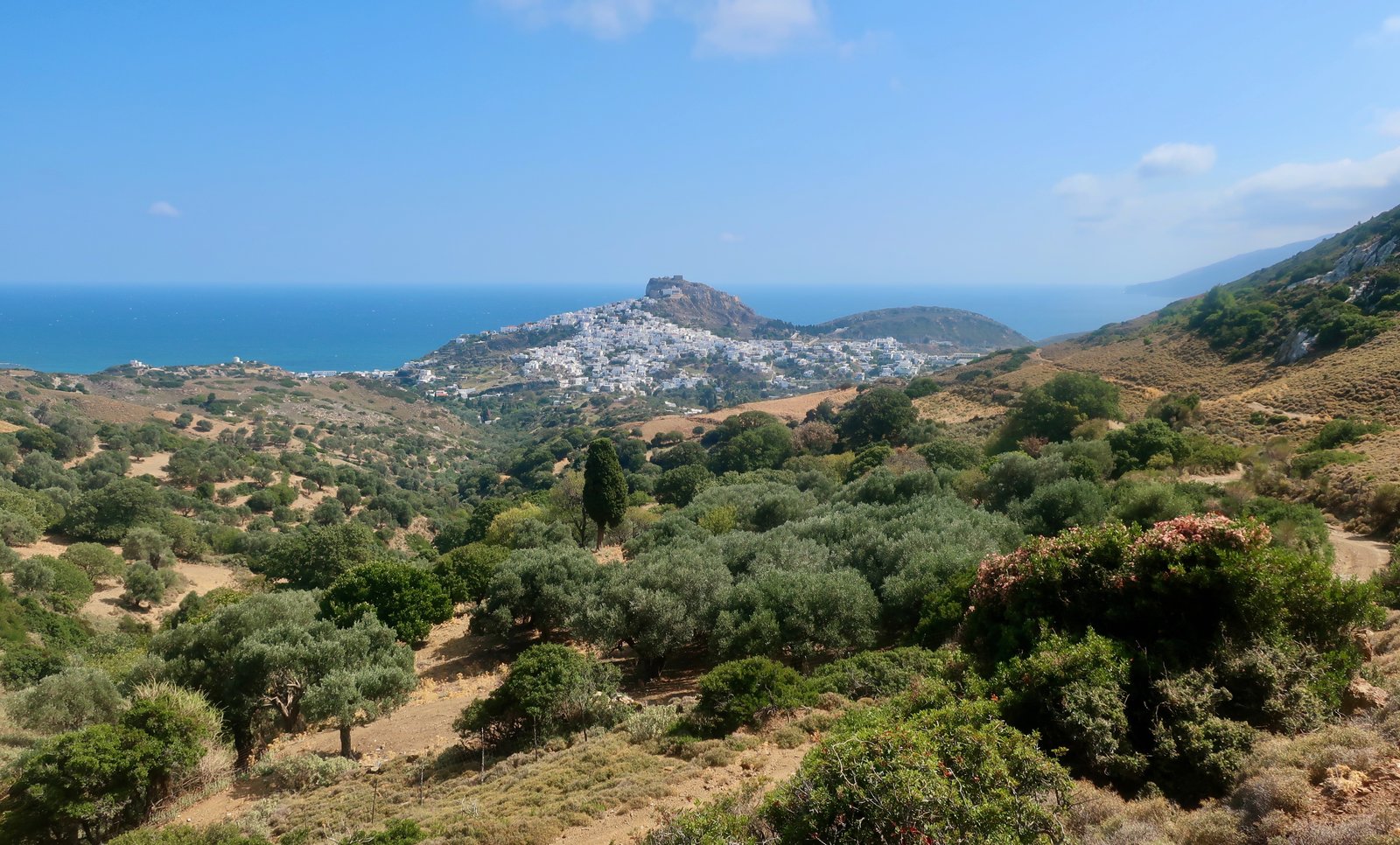
Looking north from the Chora, Skyros’ new tourist strip occupies a small, roughly triangular patch of flat land, latterly prime agricultural, nowadays bustling beach for a few summer weeks.
On the other coast, Linaria, where the ferry comes in, is a characteristic Greek island port. There are some tavernas and cafes, a bakery, a couple of badly-stocked minimarkets, no beach, some fishing boats and a few places to stay. We watched two fishermen there bashing lumps of congealed mud from tangled fishing nets, leaving piles of dust on the jetty. They were both sat in that hinged position into which fishermen unthinkingly fold themselves, their toes holding the net. If from time to time we’ve briefly wondered how it is they come to this simplest of metiers, these men, the almost-certain answer is obvious: as boys they will have watched their heroic fathers going out to sea and will have dreamed of little else until that first glorious time they went with them. How they must have swelled in the tiny island school the next day, boys like men, too big for their desks. The little boats are heirlooms, the knowledge of wind and waves a birthright.
People who particularly appreciate Skyros might be: those who like islands that comparatively few people visit; ancient-Greece enthusiasts, ethnologists, others, who visit the island specifically for the goat festival; people who go to the Skyros wellness centre, an alternative holiday place that focuses on solo travellers, where they can meet others perhaps like themselves and do workshops on yoga and creative writing and self-development and so on. Alternative holidays on an alternative island. Someone’s good idea.
We met an American on the ferry over. He said, This is the Greece I first visited forty years ago. It’s unspoilt. I love it. He was allergic to noise, he told us, really physically allergic, and was looking for a quiet place. When, after a few days, we came across him sitting on a café-terrace, he lamented that in the apartment he had rented high in the Chora, even with his earplugs there was some disappointing filtering-through of background pollution – the terrible intrusion of people talking, church bells, footsteps on the stone paths.
Perhaps a few, very few, people, who like poetry, who are enamoured of the poet Rupert Brooke because of his naïve war poetry/despite his naïve war poetry (If I should die think only this of me…) or who have been swayed by his romantic good looks – W B Yeats once described him as The handsomest young man in England – will particularly remember their trip to Skyros because it’s on Skyros that Rupert Brooke is buried. His tomb is in an olive grove on the southern end of the island near the Bay of Tris Boukes, far away from everything. He died from an infected mosquito bite in April 1915 on a French hospital ship moored in the bay. This quote from a friend who was with him:
I sat with Rupert. At 4 o’clock he became weaker, and at 4.46 he died, with the sun shining all round his cabin, and the cool sea breeze blowing through the door and the shaded windows. No one could have wished for a quieter or a calmer end than in that lovely bay, shielded by the mountains and fragrant with sage and thyme.
What comes to mind now is the loneliness. To be there forever, with only the goats for company. No houses, no view of the sea even, nothing but an occasional summer visitor, most of whom anyway come because they’ve rented a car for the day and it says on the local tourist guide that it’s a thing to do – Who anyway is Rupert Brooke? five minutes, Is that it?, in the heat, with the cicadas. Day in, day out, seasons coming and going, for ever and ever. It’s heart-breaking. I cannot help thinking: If it was my child.

***
Skyros is difficult to get to. In the high season, ferries run from Alonissos. All-year-round they go only from Kymi, on Euboea, by way of the Skyros Shipping Company. The bus from Athens to Kymi takes about four and a half hours. There’s no boat connection with Piraeus at all. None of the Sporades have a connection with Piraeus. They are a little Greek-island family unto themselves, within them Skyros a relative once removed.
We arrived on the 24th September, staying first in Aspous, on the western side of the central belt, afterwards in Acherounes, a fifteen-minute walk around the coast from Linaria – easy for the ferry out, no taxis or buses. The grass in Acherounes was trimmed perfectly short and green, as might befit something more than a short-season, one taverna, holiday resort on Skyros. A Greek navy vessel hovered out in Acherounes Bay for two days. We often see them. They come and go, in and out of the islands, full of meaning yet ultimately purposeless.
In Aspous we were their last visitors for the year, they told us. The orange rising sun came streaming through our balcony door in the morning. Ten metres away the beach was covered in huge piles of seaweed like sun-bleached tickertape. The municipality wouldn’t help them get rid of it, they said. We trod through it, soft and sinking, on our way to an early morning swim. There was that thick, morning silveriness on the flatcalm water, like swimming in cool mercury.

Every new island is mysterious. We are surprised, again and again, how quickly they are resolved. After the after-dark port arrival, next day a swim and a walk to the Chora, an hour on foot north of Aspous. In the evening the view from our accommodation toward the mountains of the wild south. And Skyros is ours.
HIKING
According to the notice board in Linaria, there are six hiking paths, one in the north of the island, one (very short) in the middle, four in the mountainous south. But three of the southern four are really one, with variations. Hiking as an organised activity has hardly come to Skyros.
For access to all the marked trails, north and south, plus reasonable proximity to the Chora, Aspous is the logical place to stay. (Although beware, Aspous is still five kilometres from the Chora, so a stroll there and back adds ten kilometres to the day.) Aspous even has a good supermarket and at least one open taverna. Otherwise, if you can find somewhere open, a few days anywhere close to the empty south of the island would do, followed by a few days in the north, in the Chora or in a cheap, out-of-season tourist studio on the coastal strip.
Even if Skyros is not an organised hiking island, the southern half has real grandeur, and is barren enough that much of it is passable without a proper trail. You could easily spend a week wandering around down there, finding your own ways, your own bays and beaches, your own pleasures. A private emptiness, loneliness.
We did just two proper hikes on Skyros. Trail number 2 on the Anavasi hiking map of the island, the classic northern hike that loops around from the Chora, and one very long walk in the south.
HIKE 1
Aspous to Achili Bay and on to Agios Artemios. From there up into the highlands, Mt Kochylas, Vouna Peak, and down to Ari. Rupert Brooke’s grave near Tris Boukes Bay. All the way back to Aspous on the road.
What with getting lost several times, somewhere between 35 and 40 kilometres
Looking down on it, the new concrete port in Achili Bay is like a piece in a child’s wooden puzzle. It appears to have been slotted in, an exact, clunky fit. The next piece will fill the other half of the bay. Then on around the coast like tetris.
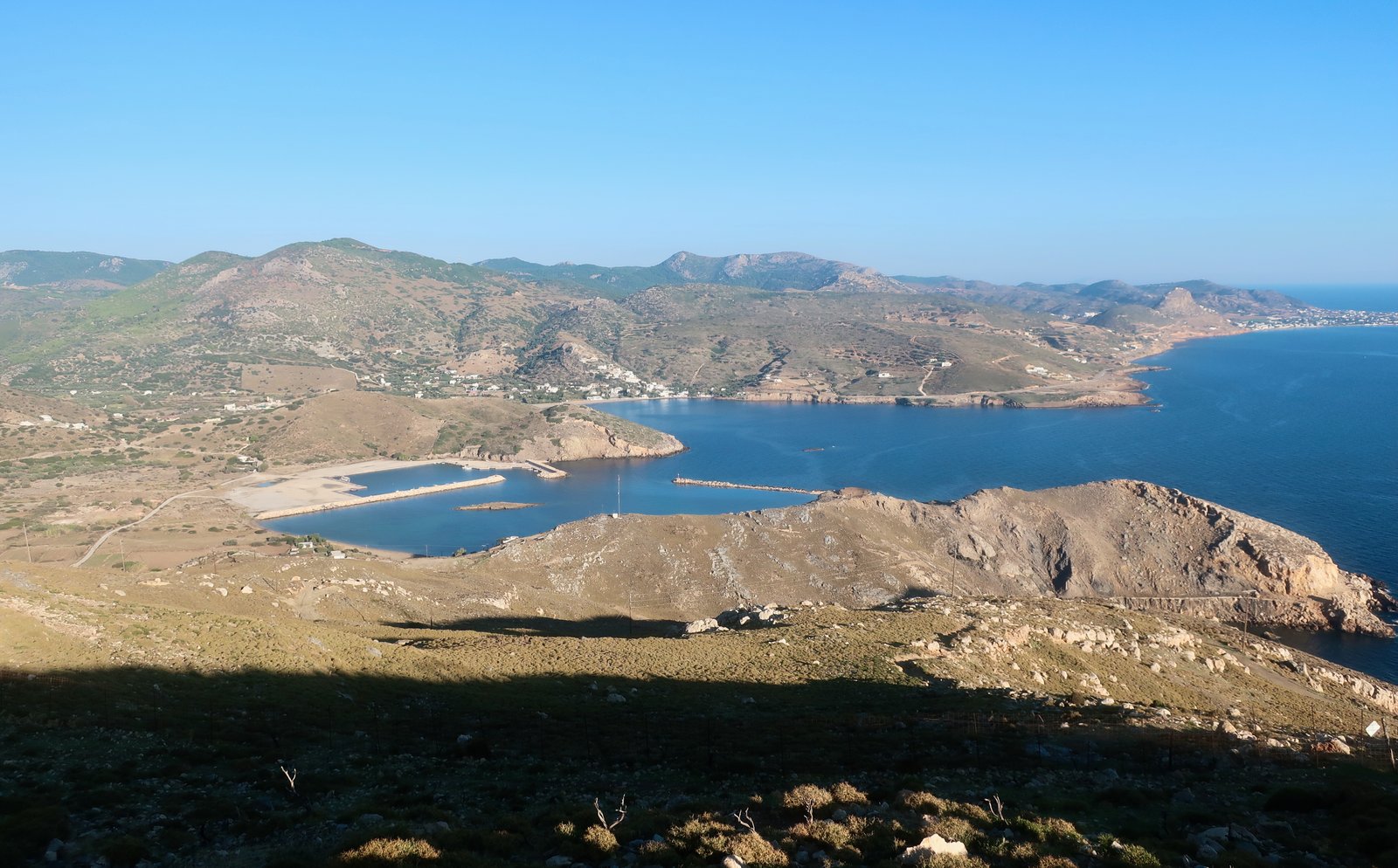
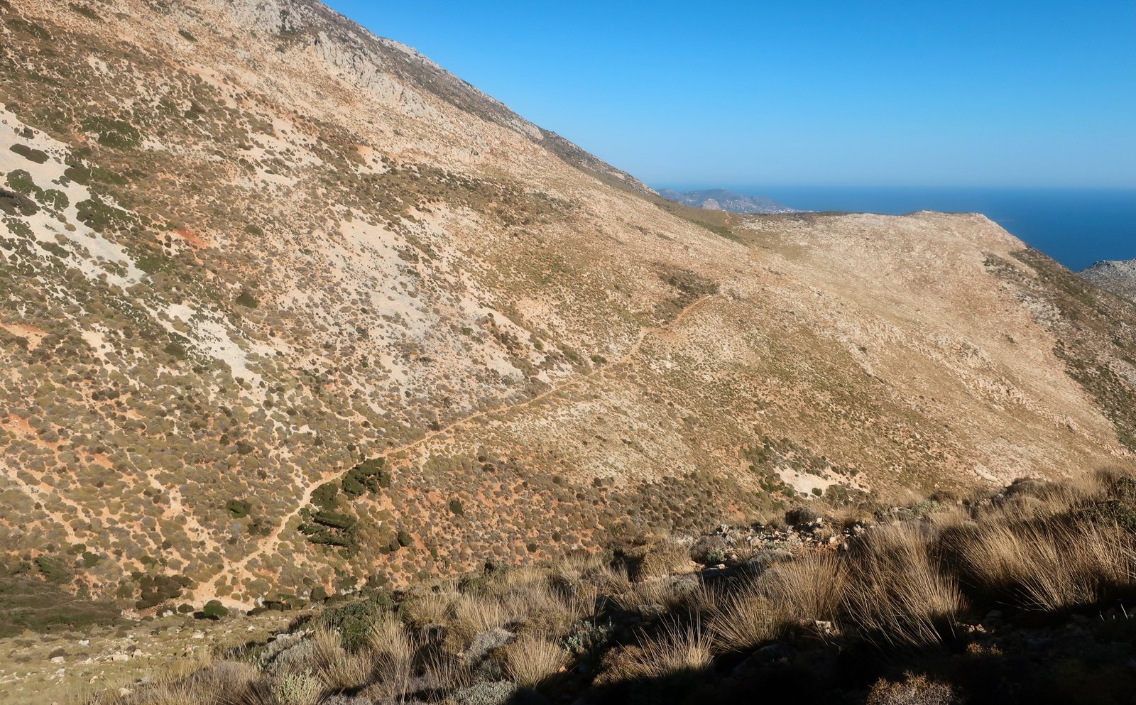
Anavasi Trail 5 takes the dirt road up and away from the remnants of the bay until a right hand turn onto the path proper, marked on the map. It runs around the barren eastern slopes. But everything here is barren. In a place where productive land has always been so precious, little of this southern half-island can ever have been farmed. Some small parcels along the western coast. The rest of it for the goats, whose stomachs are adapted to these thin pickings.
The path leads to the poor, damp little church of Agios Artemios, built around a small spring, squeezed in under a rocky overhang. There may be miracles associated with the church. Water, in such places, gives rise to stories of magic.
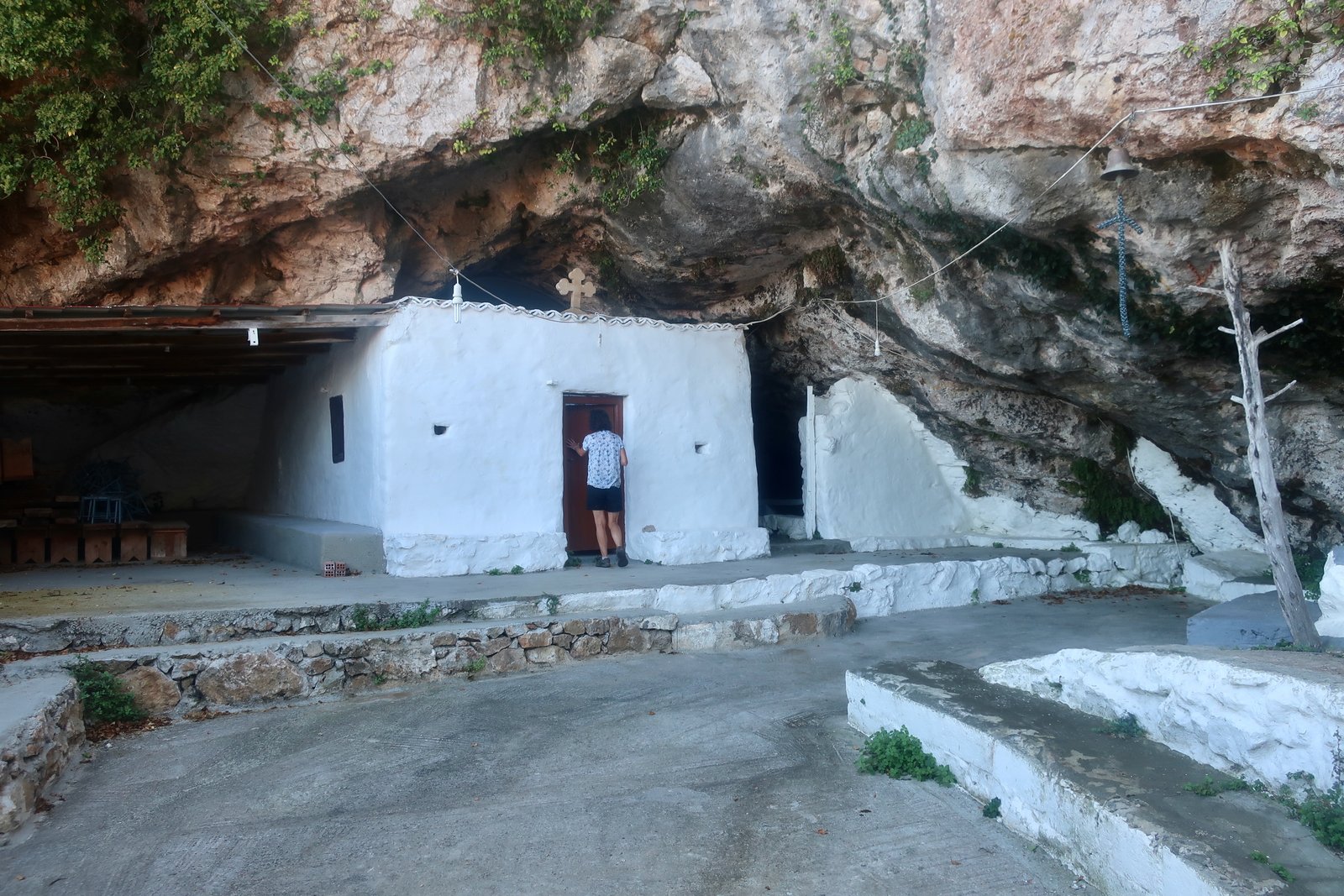
From there, the old Terrain Map (but not the newer Anavasi) shows a steep, curving path leading up to tracks on the highlands above the church. On the map it looks straightforward, such a small distance. Except that there’s a gain in altitude of over a hundred metres, precipitously steep with no visible path. If you can find it, you will have done better than us. The alternative is to double back a short distance from the church, get onto the dirt track and follow it up to the top.
On the Anavasi map, the end of Trail 5 flows into Trail 1. Sparse Markers, it says. When we were there, there were none at all. The trail is supposed to lead to the top of Kochylas Peak, at nearly 800 metres the highest point in the southern Skyrian range. But there are peaks all around that compete for the illusion of pre-eminence. From a certain angle, at a certain distance, one seems obviously higher. Then as you move towards it another, behind it, to the right or left, rises up. Even if you’re used to this effect of angles and distances and points of view it’s still confusing. It’s easy to do as we did, and become lost wandering around the lovely violence of the highlands, until eventually making better use of phone GPS and the map to set yourselves back in the right direction.

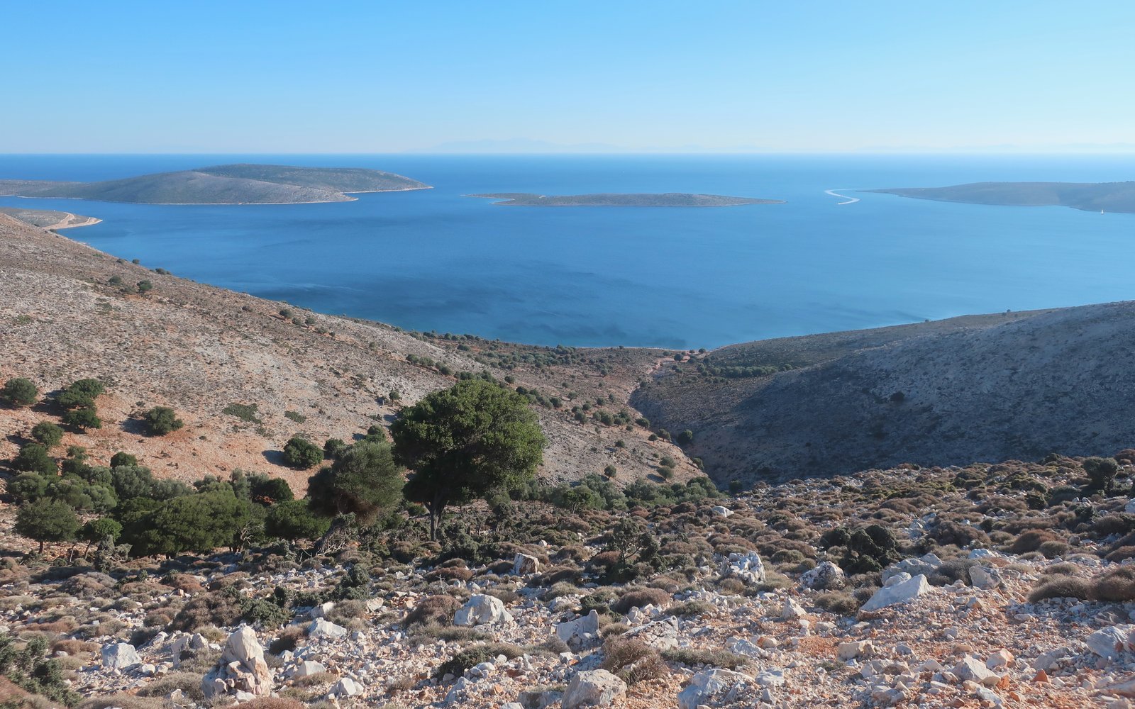
From the top of Kochylas the theoretical Trail carries on towards the peak of Vouna, almost as high, down and up again. The terrain is very rugged, a brutal wasteland of stones that move underfoot. There are a few goats. Some crows. Some lizards. An occasional bird of prey. In late September, there was heat. In peak summer it must be an oven. Because of the prevailing winds, the whole landscape appears to be leaning, or moving. Trees, plants, everything is locked in a permanent sideways slurred photo image. It drags you to the right as you walk, wanting to push you towards the huge bay of Tris Boukes down below, where two islands block the bay-entrance, leaving three narrow entry-straits and a wide, protected anchorage inside. This is where the French hospital ship on which Rupert Brooke died had moored. The low land all around it is gently humped. From above it is bare and pock-marked like plucked chicken skin.
Aside from the blue-marked Trail on the Anavasi map, there are a number of others to be investigated, black dashes or simple dots suggesting theoretical size and visibility. There are more still on the Terrain Map. You could spend days up here.
From Vouna down to Ari there are a few metal poles that mark where a path has been. Most of the way now there’s no actual evidence of a walked trail. The metal poles have become pointers marking bare direction. Just occasionally, there’s a hint of the old path, like a burnt-on shadow.
Here, again, the ground is treacherous underfoot. The stones are loose. Everything moves, trembles.

Just before Ari the way leads through a grove of holm oaks on a hillside, a rare place of shade. It’s so surprising to be in half-light that it’s easy to infer a dampness that in September at least doesn’t exist.
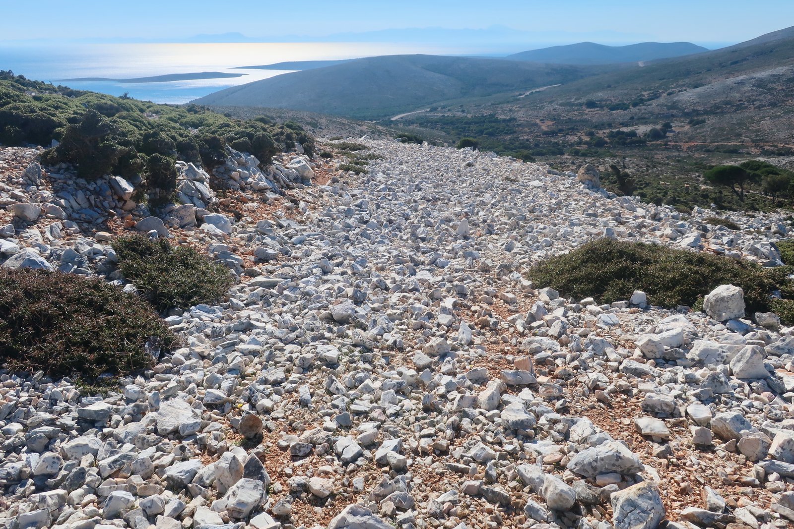
From Ari to Rupert Brooke’s grave, there’s a choice between tarsealed road, and the thick black line on the Anavasi map, marked as a narrow earth road. We chose the latter. There’s nothing earthy about it at all. It’s a pure river of hot, white stones, one of the most uncomfortable short sections we’ve done anywhere in Greece. The land on both sides is impassably dense with spike plants, so there’s little chance of veering off. The stones, mostly between the size of a fist and a small head, are sharp and unstable. At every footfall there’s movement. It’s like a terrible test, an episode in some dystopian gameshow over which competitors would have to run, full pelt. At the end, the way would be littered with casualties.
Rupert Brooke’s tomb is on the left of the road that leads down to Tris Boukes Bay, set back from the road and a kilometre from the water.
From Rupert Brooke’s tomb back to Aspous is a fifteen-kilometre walk on tarmac road. Three hours of fast-walking on a Greek island with glorious views left over the sinuousness of the coast and the sea. If you’re lucky, if you care, you may get a sight of wild Skyrian ponies, indigenous and rare. We had half-expected to spot them in the highlands but eventually saw a small group at the roadside just before we reached Kalamitsa Bay.
It was fully dark when we got home. We are almost never so late unless, as here, the end is on backroads, not mountain-paths, so that it hardly matters.
HIKE 2
Trail 2 loop, the Chora and inland.
About 26 or 27 kilometres and seven hours, but only so long because we began and finished in Acherounes, an additional 12 kilometres
From Acherounes a stroll on asphalt road as far as the reservoir at Ferekambos. Then dirt track around the reservoir – a blue thing on the Anavasi map, but at the end of September, after the Greek summer, inevitably a dirty brown hole with only a few puddles of shallow water.
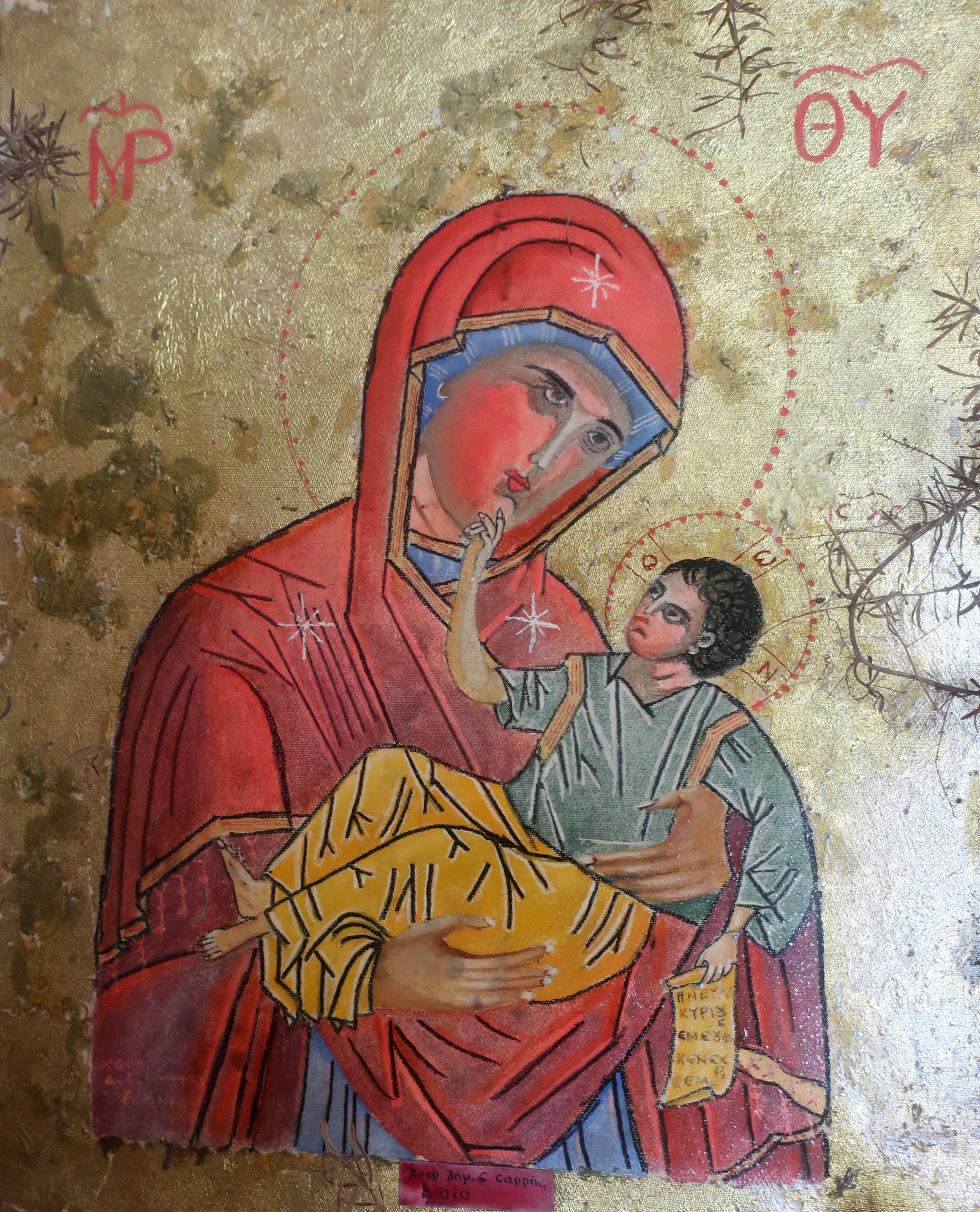
Trail 2 is a 14-kilometre loop beginning and ending in the Chora. Much of it’s through pine forest, climbing up as high as the church of Panagia Limbiani, tucked away at an altitude of around 400 metres. Within, yet another tiny Jesus man-child is cradled in the arms of yet another small-mouthed, thin-nosed Modigliani-faced Madonna.
The trail is easy to follow, much of it typical Sporadean forest path that could be on Skiathos, Skopelos or Alonissos, utterly different from the south of the island.

From time to time, and in particular on the last section, an alignment of angles opens up a view towards the Chora.
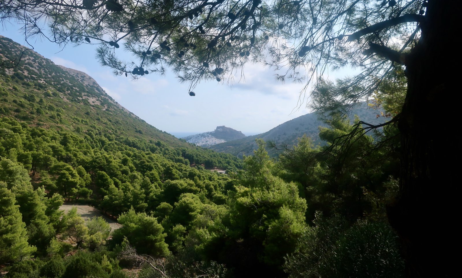
The final, northern section of dotted trail into the Chora is through open farmland, or what was farmland, much of it now dirt, covered with spike plants. The lines of old terracing are just about visible on some of the slopes.
Near the beginning of this last section we asked directions from a farmer, alerted to our presence – we were hanging around on the edge of his yard – by his dogs. He was surprised we were walking into the Chora, surprised we were going this way cross country. Standing there in his Skyros sandals – slabs of leather bound to the foot by strips of leather lacing, props from ancient Greece costume dramas sold mostly now to tourists in the Chora – he explained the way to us, how many agricultural gates exactly we would have to go through: he counted them off on his fingers, opening and closing his hand as he did so.