
It doesn’t matter how many islands we visit, every time still the same anticipation.
These lines from C P Cavafy’s poem Ithaka:
May there be many summer mornings when, with what pleasure, what joy, you enter harbours you’re seeing for the first time.
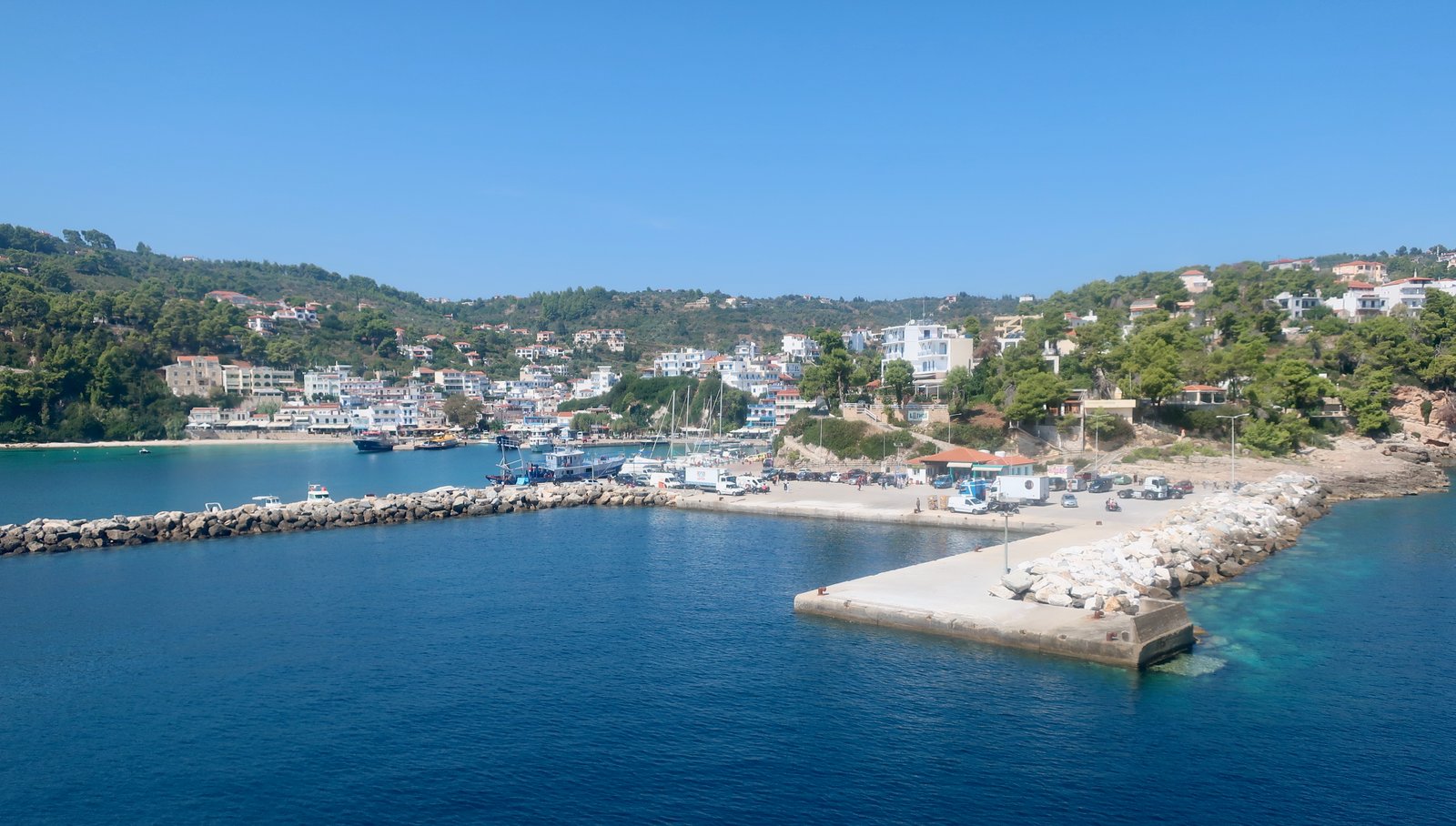
The ferry port on Alonissos is called Patitiri and is only half an hour from Skopelos, one of the shortest island-to-island hops anywhere. Between Skopelos and Alonissos the ferry’s trail leaves a backwards S in the water from port to port.
Just as in the other northern Sporades, the architecture is not Cycladic. If Cycladic is the classic idea of what Greek islands are, the Northern Aegean is different. But then the Ionians are different too. The Dodecanese, the southern Dodecanese in particular, are different. And even among the Cycladic islands, differences only multiply with familiarity.
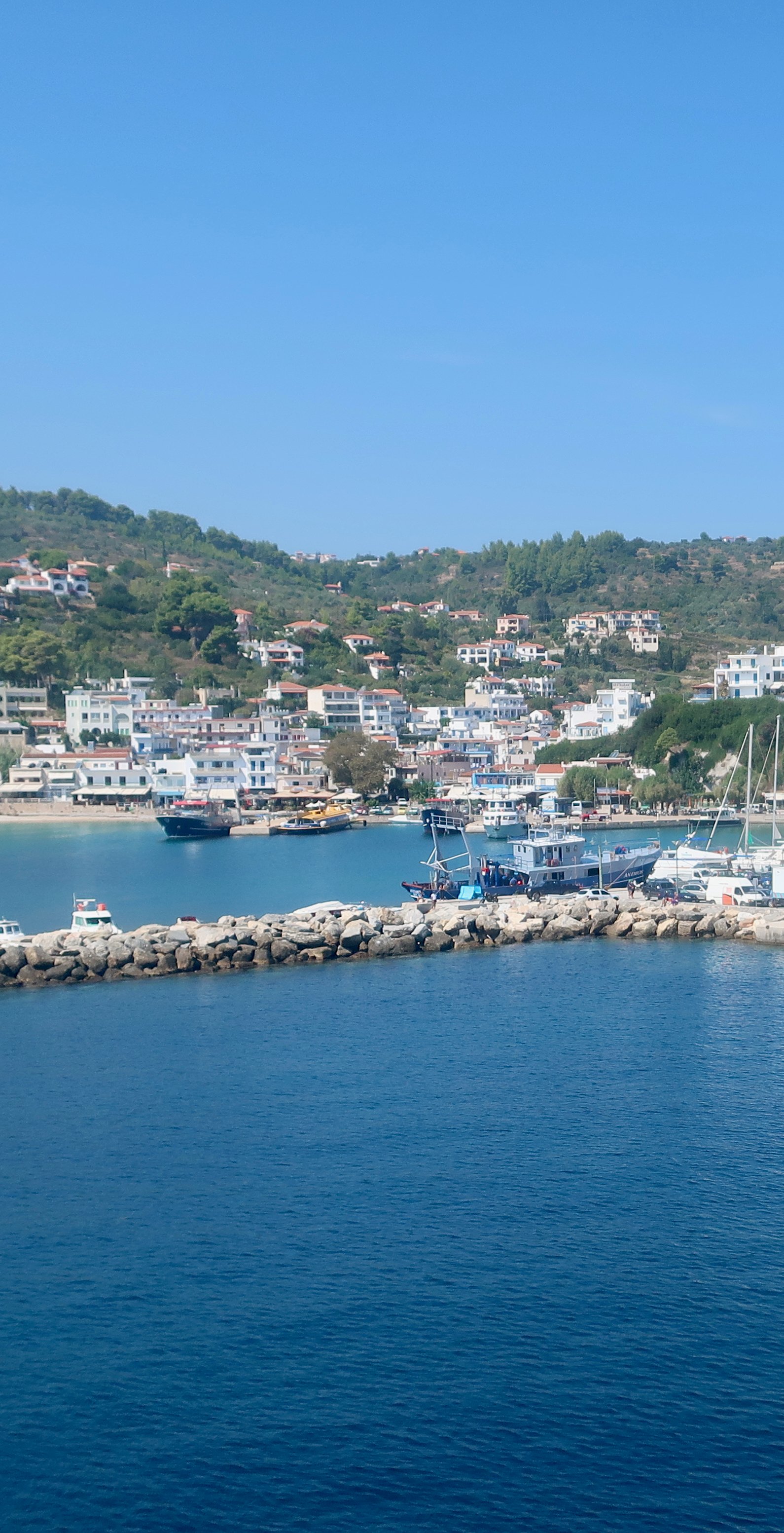
There’s a large sheltered bay, a wide town beach to the left of most of the buildings, and an absence of ostentaion. Cafes on the seafront. A dive shop which always seems to be busy, people coming and going importantly, efficiently, with oxygen tanks, to and from the marine park. A few metres above port level on the right, the eastern side, there’s a raised walkway, that runs in front of half a dozen guest-houses, with seats out front and flowers and a view over the port. It’s a little like the front row of the circle in the theatre, one of those myriad Greek island places, not especially fancy, not overdone, oriented somewhat towards the new world of the late twentieth/early twenty-first century, where you can sit at the end of the afternoon with a glass of beer, or wine, a cocktail, whatever, and feel that life, for now at least, is pretty much perfect.
Patitiri is probably a decent place to stay, although we didn’t. There are three adjacent bays on the southeast coast. We stayed in Rousoum Gialos, the middle one, a little scruffier, with a small beach and a few cafes/tavernas, but might have stayed either side in Patitiri or Votsi, since on the map all of them appear deep and well-sheltered for swimming. Often the final choice is a rapid sweep through price and availability. Having stayed in Rousoum Gialos we’d choose it again though. We liked the enclosedness, the way it’s protected by low cliffs on both sides. We liked swimming along the cliff that cuts sheer into the water, different from most other swimming spots where the land inclines gradually. Here, there’s a feeling of safety and at the same time that you could be anywhere, off any coast, away from all civilisation.
When we were there, a priest would come down to the beach in the evening, and with his great beard resisting the water, slowly stroke out into the bay. Each evening the same tourist stood on one leg with his hands joined and was a statue. And we would swim, or play backgammon in one of the cafes, or read, waiting for the sun to set.
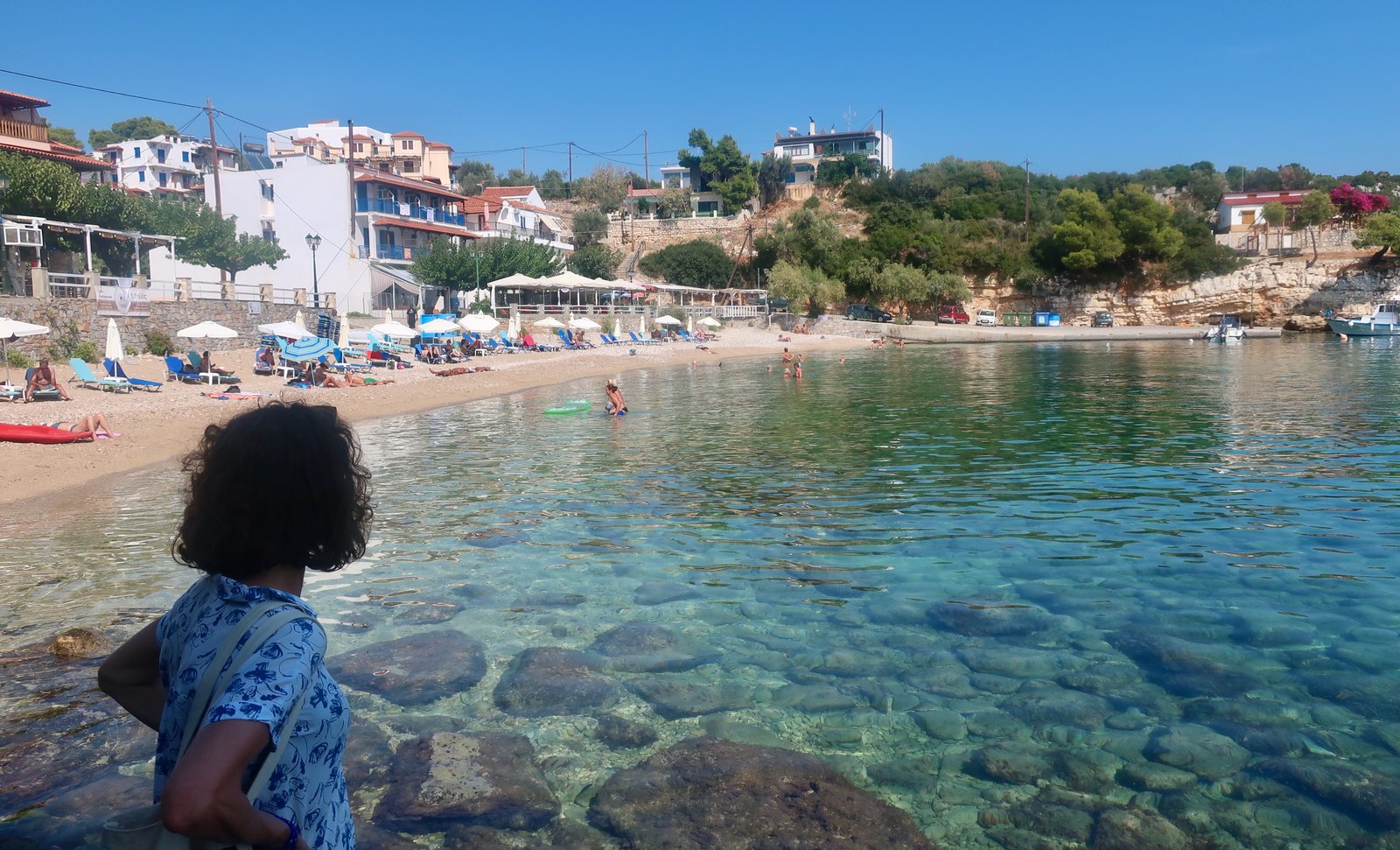
In mid-September there were some sunbathers on the beach during the day. There will be more in August. Unless you’re absolutely allergic, I don’t suppose it matters. For our part, we see enough deserted beaches and are happy to share.
Provided an island is not so big that staying inland is a must in order to be able to hike, we almost always stay on the coast. You’re in Greece, on an island surrounded by transparent water. Why would you not? Besides, there’s something so pleasing about ports, the way they represent literally and figuratively the link between each island and the outside world of other islands, other places. Ports are the zero points from which webs of lines – history, words, trade goods, fear, hope, love, everything – fan out.
***
Alonissos is one of the elegant/stylish islands. Hydra, Paxos, Sifnos… When we start naming them we get into a conversation about what elegant means in this context. And about subjectivity. And about the speed of transformation, the possibility that elegance might be just a brief stop on the way to somewhere else.
It has the feel of Folegandros, the style. But with even more exceptional beaches and a lot more trees. Really a lot more trees – in late September, when you’d expect everything to be sunburnt pale brown, crisp underfoot, the hillsides around the port are so overwhelmingly green that the buildings appear to be held, enclosed. Shake a Northern Aegean wand over Folegandros, meaning pine trees that come down to the water and – perhaps you’ve seen the posters – a little bit of Mamma Mia, the impression that everywhere you look there’s a cinematic contrast between too-green pine and too-turquoise water, stretch the shape of it a little, haul it three hundred kilometres to the north and you might get something like Alonissos.
Even the two island capitals have something in common. In a set of Greek Island Trumps, one of those card games in which perhaps cars, or Star Wars characters, or Wonders of the Ancient World, or spiders or really anything at all, are given points in a number of categories and made to play off against each other, the Choras in Folegandros and Alonissos would be well-matched. Both are small, both particularly stylish. They are two-seater sports cars, or spiders with a deadly bite. You’d be pleased to have either one in your hand. But while the Chora on Folegandros is Greek-chic, on Alonisssos sixty per cent of the houses in the Chora belong to foreigners. It has been colonised.
In 1965, after the earthquake that destroyed much of the village, the inhabitants abandoned what was left and moved to Patitiri. Some years later, mostly foreigners began buying up and renovating the old houses.
Like many ruined Greek villages, it must have resembled those Romantic paintings of the 18th and 19th centuries, images of ruined buildings often in lush, botanical settings: piles of old stone on a low hilltop; crumbling walls with narrow lanes running between them; a profusion of creeping flowers and vines and wild fig trees. We’ve seen places like this on other islands, in states of abandon that are also measures of time passed since some catastrophe or other. It’s ironic how captivated people are by the beauty of such places only to immediately change them, once appropriated, into something other than the ideal of romantic dilapidation that has initially bowled them over.
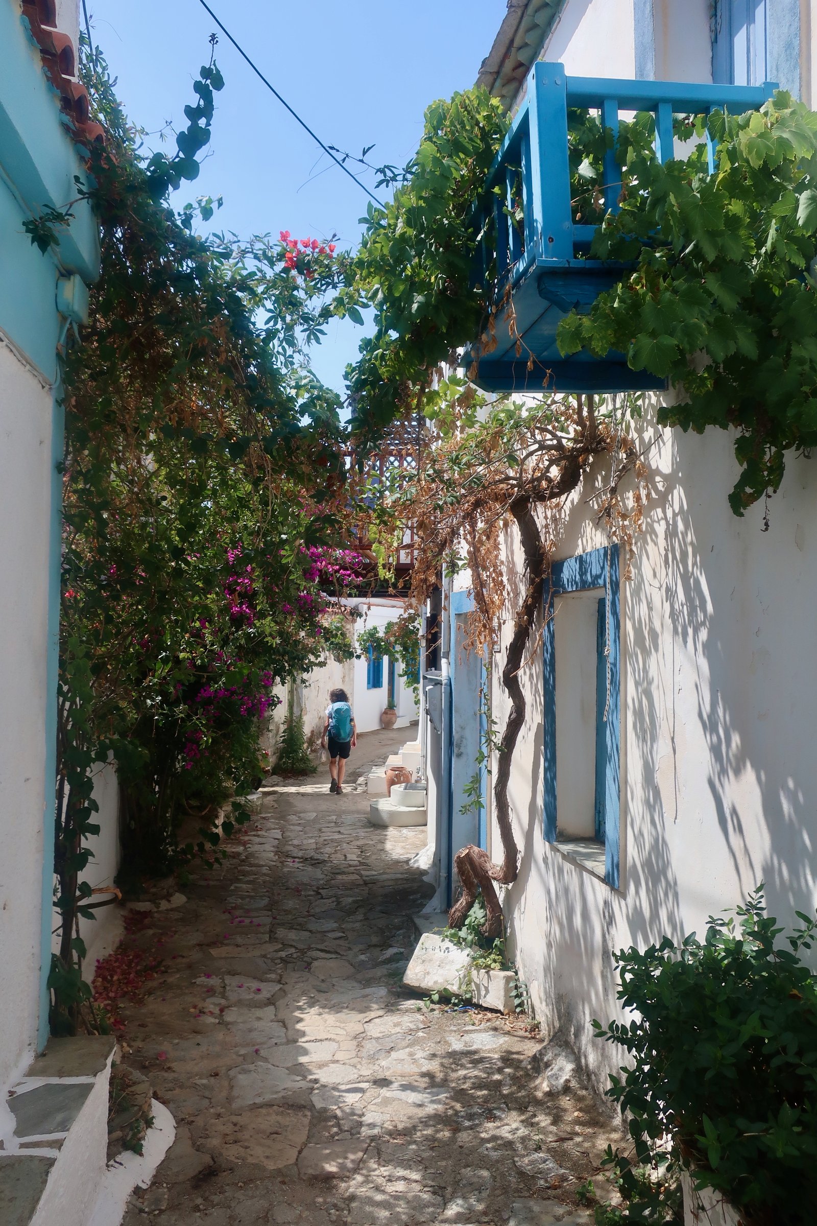
Nowadays, while there’s still some evidence of the quake, most of the village has been restored, winding alleys and balconies and colours and everywhere explosions of flowers and greenery.
Maybe you’re thinking, all those foreigners, that word colonised, it must be swamped. But no, this is Alonissos, the third and final of the three stepping stones that make the northern Sporades. The only way to get there is to take a ferry from somewhere that isn’t Piraeus, isn’t anywhere near Athens and isn’t easy to get to – Agios Konstantinos or Volos on the mid-eastern mainland coast, roughly equidistant between Athens and Thessaloniki, or Mantoudi port on Evia – and then to ferry-hop, either Skiathos – Skopelos – Alonissos, or, summer only, Skyros – Alonissos. It’s a minor endurance test and most people don’t have that much endurance, let alone the extra time it takes, which they’ll have to deduct from the sum of their already too-short holidays. There is the airport on Skiathos with direct flights in season from various northern European cities, but even then it’s still a double ferry-hop out to Alonissos.
A similar double and triple ring of protection prevents most Greek islands from being inundated but also hinders their out-of-season development. Short breaks when the weather’s good, which it so often is during the transparent days of spring, or the slow, warm-water, drawn-out autumn? Or even in winter, when there are weeks so exceptional you cannot believe your luck just to be there? Unless there’s an airport that can handle direct flights from outside Greece, it isn’t possible. You’d spend most of the time travelling.
We walked into the Chora one sunny mid-September morning. Tourist shops were putting out their wares, overflowing onto the narrow streets. Restauranteurs were preparing tables; in cafes checked cloths were being palmed flat. Everything in the village centre seemed to be something. Except that there were no tourists. Perhaps it was too early and a few would wander in later, but it was hard not to see a place that has become a little carried away with itself. At the same time, how much these people must look forward to coming, at some point transferring quite involuntarily the idea of real life to time spent here, with the doors and windows all open and the flowers in bloom and seats on the terrace and neighbours with whom they’re on first-name terms, and almost certainly much, much better weather than wherever it is they come from. And a calm, that induces inevitable comparisons with whatever it is people do elsewhere that enables them to have these places.
The Chora is no longer exactly old Greece. But since, almost everywhere in the islands, the way of life has changed radically in the last fifty years, from agricultural and inward-looking to tourist-orientated, looking out, hardly anywhere is. Although it might not suit everyone, it is something. And it is very, very pretty.
***
Looking at a map of the island, it is immediately clear that without a rental car/motorbike or efficient public transport/a taxi, it isn’t possible to stay in one place only and hike all over. Alonissos is long – about twenty kilometres – and thin. Patitiri, Rousoum Gialos and the Chora are close to the southern end. When hiking, we quite often use public transport for early starts, where public buses tend to be school buses that tour inland picking up children in ones and twos from lonely farms, pre-dawn villages. These buses don’t work during the school summer holidays, although, depending on the island and the number of visitors, other buses sometimes replace them. On Alonissos the buses mostly run between Patitiri and the Chora, up and down the hill, and never go further than Steni Vala, barely halfway along the island. Tickets can’t be purchased on the bus, they have to be pre-bought at one certain point (minimarket, kiosk, shop) in one of the three end-of-line destinations. The ticketless traveller is plunged into small-time bureaucratic confusion.
We spent a few days in Rousoum Gialos and hiked the bottom of the island, then a few more in Agios Petros, a small bay just before Steni Vala, almost exactly halfway up the southeastern, leeward, coast. There’s hardly any accommodation there and nothing else besides, but the walk to Steni Vala only takes five minutes.
Agios Petros is quite perfect. There, pleased as can be with our good fortune, we took pictures of ourselves sitting on our terrace overlooking the water, and sent them to friends, Look at us, here we are, isn’t this something, barely a hint of misrepresentation in the photos.
Around the corner, Steni Vala is in the process of being transformed into one of the northern Aegean’s minor yachting places-to-be. Since, however, it can only accommodate about a dozen yachts, for now it can only go so far. There are a handful of cafes/restaurants, a small supermarket and some places to stay.
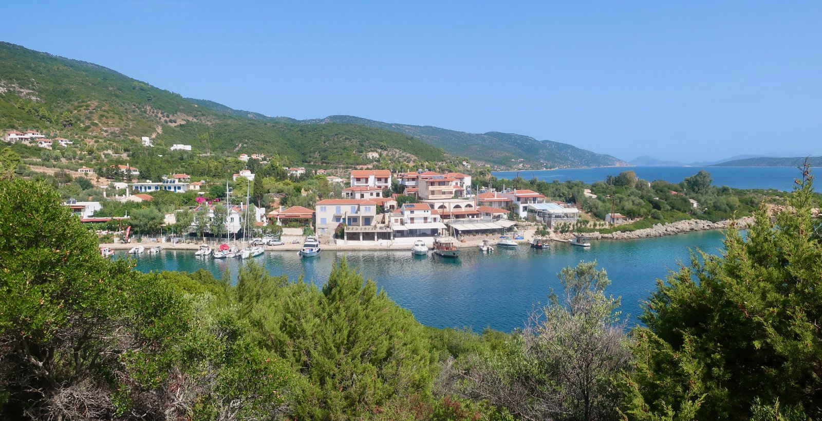
The northern end of the island is sparsely inhabited. A few houses run along the leeward coast. Summer rental car visitors might call in to tiny Kalamakia port, the closest point to the Marine Park that takes in the northern end of Alonissos, all the offshore islands and a large area of sea, and is (perhaps) home to the rare monk seal, whose hypothetical presence is mentioned on so many of the islands. Since fishing isn’t allowed in the park, it’s a pristine environment for snorkelling and diving. If not Kalamakia, car rental day-trippers might find somewhere quiet to stop for lunch, they might explore the farthest beaches, or because they can, they might just drive from one end to the other.
HIKING

Hiking on Alonissos is part typically northern Aegean through pine forest, part more general Greek island. There are old stone paths, mostly radiating out from the Chora – a consequence of the best farmland being in the south of the island, close to the centres of population. There are some sections of trail that seem to have been borrowed from more southern Aegean barren highlands – although the land here isn’t high at all, never reaches even five hundred metres. There’s a surprisingly intense, steep-sided gorge walk, closed enough to confer the claustrophobic feeling of being trapped, far enough away from the villages on the southern end that if you do it you’ll likely have it to yourself, only the gorge-goats balancing across the rock walls overhead.
Most of the significant trails are through dense pine forest in the centre of the island, up and down between Megalo Xorafi – a gathering point where half a dozen numbered routes are pulled together, stitched into a bouquet – and the west coast. They aren’t paved. There were probably never enough users to warrant the effort of laying stone here. With the old life of the land having gone, no-one would make these slight paths now. Their purpose has faded. They persist for the time being, for occasional hikers, the memories they harbour still alive for as long as a trace remains. In contrast, the stone path between the Chora and Patitiri, the capital and the sea, fizzes with all the thoughts and feet and purpose of its history, its crowds of users.
There isn’t a lot of information on the net, although someone has apparently published a small guide. If you spent ten days on Alonissos, walking one day on, one day off, you’d be hard pushed to get it all done. Because there’s such a lovely string of beaches along the southeastern coast, because the Chora is a little polished, because Steni Vala is getting to be fancy too, because while there are hiking trails on near neighbours Skiathos and Skopelos, those islands are weighted towards a different sort of tourism, you wouldn’t expect the hiking on Alonissos to be as nice as it is. We didn’t, that is. We’re so often surprised. Imagining the next island, it’s like trying to predict the future.
(The Trail numbers refer to the Terrain Hiking Map of the island.)
HIKE 1
Rousoum Gialos up to the Chora on the old stone path. From the Chora to Vrysitsa Beach on a narrow track through scrub and woods. Back up to the Chora on the road. From the Chora to Mikros Mourtias on a stone path, and back up. From the Chora down to Megalos Mourtias, then around the coast on path and road back to Patitiri and Rousoum Gialos.
Approximately 16 kms
Much of the day was spent back and forth, in and out from the Chora on paths that on the map are like wonky bicycle spokes. There was also the path from the Chora to Kalovoulos Summit, an additional three kilometres we didn’t do, an additional spoke. It’s a sunset spot, they say.
The path connecting Patitiri to the Chora is the remains of a wide, stone-paved kalderimi, the island highway from capital to port. The bottom section has been swallowed by the growth of the port, run over by new roads.
We were there on the day the trail between the Chora and Vrysitsa Beach reopened after a two-year covid-break. Two men with chainsaws were clearing all the new growth. Just as we passed them they swiped aside the last of the intruding branches and it must have seemed we had been waiting breathlessly for this moment. We poured past them along the unblocked path that leads through mostly dense shrubland halfway to the beach. The bottom half of the trail is on the road.
Even though it’s on the wrong side of the island, open to the north wind, when we were at the beach it was a day for skimming stones, no join-line at the horizon between sky and water.
After swimming, a road-walk back to the Chora. Two hundred metres altitude sharply up after the two hundred metres sharply down. From the top you look back and have knowledge not just of the path and the road, but of everything in-between. Walking does this. It brings into focus the real meaning of height, or incline. It shows actual distance, the angles of the route, heat, cold, but also the places where dogs bark, where there are walnuts on the ground to be gathered. Walking fills in the details.
The natural state when strolling through a reasonable-sized Greek hill village is that of being lost, or at least semi-lost. We rarely spend enough time in them to properly grasp their layout. So it was in the Chora on Alonissos. On the map there’s a trail spitting out from a low-point in the south of the village, but without the pressure of time we aimlessly allowed ourselves to be diverted, to really go around the houses, before finding it, stumbling upon a clear exit and the bend of a perfect stone path just there below us. With the old stone paths it’s often steps and corners that set the heart racing, paved paths that twist their way through rugged highlands, the sheer unignorable art of them.
The path that leads down to Mikros Mourtias beach begins with bends but after that for most of the way it’s narrow, straightish, but delicate enough, well-enough built that you wonder why? Perhaps there was once a functional port, closer than Patitiri.

Possibly there was also a stone path down to Megalos Mourtias beach, that has long since been overlaid by the road. There are clues, flashes of paving.
The beach at the bottom is thin, not as idyllic as the east coast beaches. There’s a restaurant, and sunbeds. Hot and dusty, we snuck down to the far end and stripped off feeling like ruffians, children, and plunged in.
Afterwards the walk back to town is dirt track and road, past a couple of secluded beaches, a resort tucked among the trees at the end of a small lane, and very little chance of any traffic at all.
HIKE 2
From Rousoum Gialos up to the main road, then along the road as far as a turn-off to Isomata. A woodland path to Isomata and a stone path to Agios Petros. Around the bay to Steni Vala. Paths and road all the way back to Rousoum Gialos, calling in at various beaches along the east coast.
Approximately 30 kms
On the right-hand side of the main red road that runs along the centre of the island, there’s a hiking board at the turn-off for Isomata. From Rousoum Gialos or Patitiri or Votsi to the turn-off it’s about five kilometres, either along the main road or on a couple of parallel diversions to the left.
The trail from the turn-off to Isomata runs through open woodland. There are intermittent red dots on rocks, their frequency just enough that they can be followed. Still, it feels like Hansel and Gretel, a purposeful, secret leading.

At Isomata there are a few agricultural dwellings. There are old olive groves. There’s a nice, elderly man whose dog will bark, who’ll come out to see what’s happening and like so many of his generation all over the islands will want to tell you of his seafaring days, where he has been. He will tell you that now, finally, he has come home to his dogs and his goats and his land.
Another day on Alonissos, on another path, we met a resident foreigner – the only other walker we met on the island – who wondered if perhaps we were interested in land in Isomata. He told us the story of friends who had arrived on Alonissos and been so taken with it they’d almost immediately bought a plot there with olive trees and space for a house. From time to time we come across home-made notice boards advertising such and such an acreage, a certain number of olive trees – I don’t believe the sign-writers fully understand how the idea of owning olive trees makes northern European hearts flutter – perhaps some citrus, and we too have been briefly hazy.
Trail 10 from Isomata to Steni Vala, via Agios Petros, is mostly stone, and easy to follow. Agios Petros is not sandy like some of the beaches along the east coast, but is a small miracle – the bay, the headlands either side, the colour of the water, the pine trees, a house half-hidden in the trees on the southern side, a rock in the water just off the southern headland and a traditional fishing boat that moors up in front of it, the way the sun sets over the island of Peristera just offshore, the stretched shadows of trees over the water in the morning, the dark reflections of the headlands in the water at sunset, the stone path that leads to Steni Vala around the coast… the disposition of all the above, the way everything by chance harmonizes with everything else, each element is exactly right.
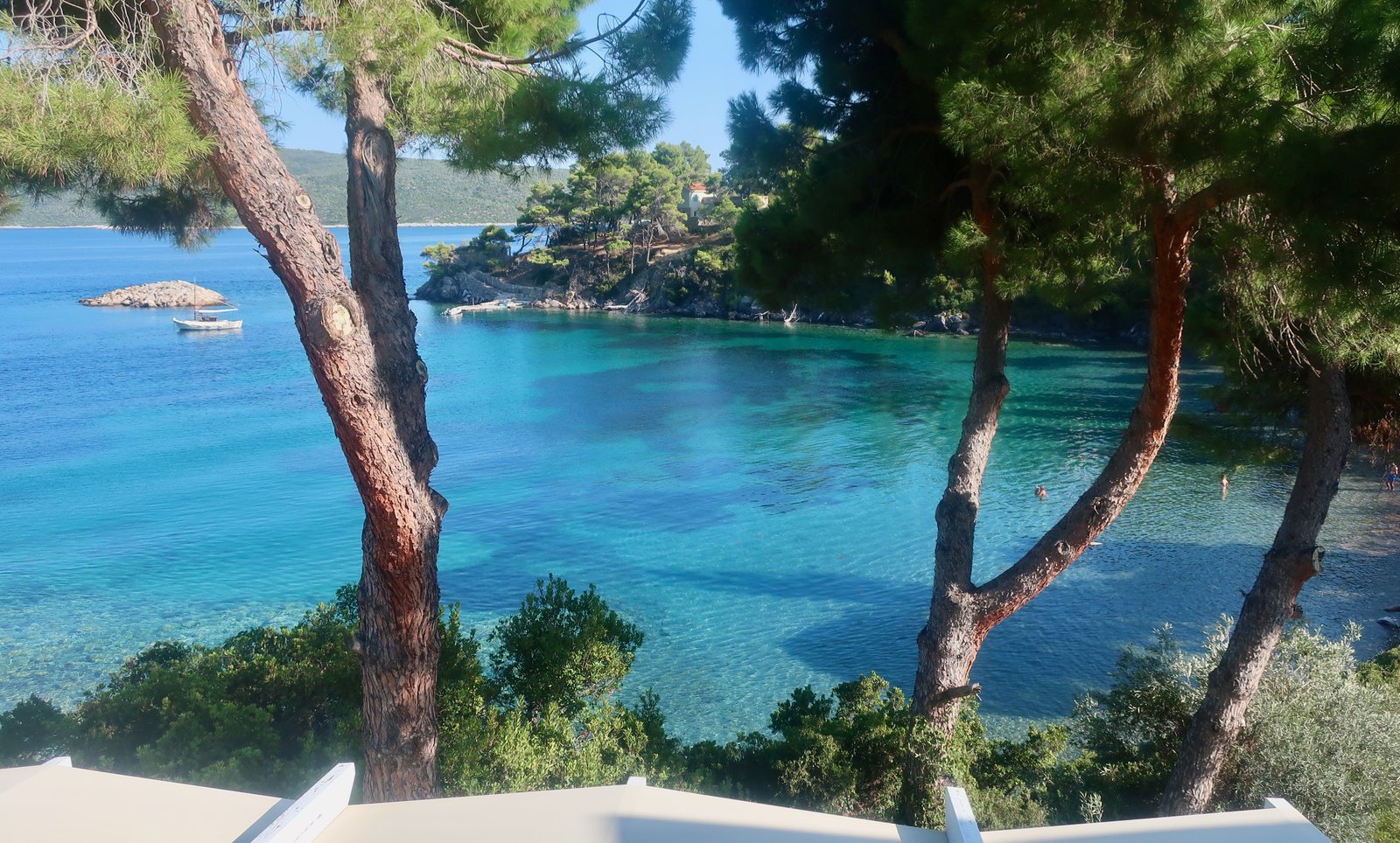
In other words, on a good day – of which there are very many in the islands – with the sun shining, the water made transparent, the whole place as if painted, and above all with the right state of mind, it has the potential for something like perfection.
From Steni Vala you can walk all the way back to Rousoum Gialos or Patitiri and call in at many of the beaches along the way. It isn’t a hike on paths, more a stroll on dirt tracks and mostly tarmac, back and forth between the main road and a succession of lovely indentations. The roadsides are soft with heaps of russet-coloured pine needles. All the beaches along this coast are worth visiting, some of the loveliest anywhere in the islands.
HIKE 3
From Agios Petros to the main road on Trails 9 and 10. Trail 5 to Agioi Anargyri. Trail 8 to Megalo Xorafi. North on Trail 6, then Trail 13 past Agios Konstantinos to Meleghakia. As far as Dhiaselo on the main road, then on dirt trail to the reservoir. Trail 15 through the gorge of Kastanorema. At the end of the gorge, a long walk south along the coast on a path through olive groves, on dirt track and on tarmac, all the way back to Steni Vala and Agios Petros.
At least 36 kilometres, depending on deviations
A very long day’s walk. Stone trail – deciduous woodland trail – tarmac dirt track – forest path – highlands barren path – gorge walk. An almost-everything sort of Greek island hiking day, except that even with such variety it’s all fairly gentle, nothing precipitous, no cliffs and no mountains.
Walking Trails 9 and 10 in reverse – the same trails we’d taken a couple of days earlier on the way to Agios Petros from the main road – we passed the same seaman/farmer at Isomata, who not having seen anyone pass through his smallholding on the road to nowhere for months – he said – and certainly not foreigners, scratched his head to see us again, as if we must never stop, back and forth, up and down the island, in and out of his world.
Trail 5 leads to the church of Agioi Anargyri on the northwestern side of the island, with views along the coast in both directions and back to Skopelos. The northwest coast is the bristling back of the island, that suffers the weather. There are cliffs and steep inclines. Hardly anyone lives on this side.
If you have the Terrain map, the dotted path-lines in this part of the island are not all accurate. Here they don’t exist, there the way is blocked by a fence, a drop of several metres, private property. A way leads down to a small cove but doesn’t continue on around the coast. There’s a gap to fill in, between either Agion Anargyron or Tourkoneri Beach and the beginning of Trail 8, with various possibilities that involve doubling back or carrying on down and up.
Trail 8 slinks into the dark woods and heads along a roughly-cleared pinewood track towards Megalo Xorafi. When we were there, soon after the covid hiatus, fallen branches and trunks made obstacles along the way. Two winters, wind and storms. Two more without any maintenance and it would be on the verge of disappearance.
From Megalo Xorafi Trails 6 and 13 head north, past Agios Konstantinos, where goats congregate, and Meleghakia. Up high the trees thin out, a skin of rock pushes its way through the shallow soil. On a hot late summer day the air smells of caramel. At times, instead of following a path, you follow the thread-like browning of the land made by the passage of hooves.
The path comes out on the main road. Two kilometres later, at Dhiaselo, we turned right towards the reservoir. (Or you could turn right immediately onto the main road, then left after a kilometre or so, and come to the reservoir in just about the same time.)
Reservoirs on Greek islands are invariably ugly. At best they’re patently artificial bodies of water around which the land has been hacked to pieces. But often there’s no water, or very little, and the bed of the reservoir is visible with all the charm of a building site after rain.
Trail 15 leaves from one corner of the reservoir straight into the Kastanorema Gorge. Gorge walks are unusual among island walks in that they aren’t man-made, but borrowed, for adventure, for fun. Made paths are not so purposeless. Even those on Alonissos that seem now to plunge into pine forest just for the pleasure must once have had a logic.
The path through the gorge is very tortuous. It will take longer than you expect. Like other gorge walks, it becomes a little oppressive. Several times you’ll see the end, the bend that leads the gorge down to the sea, only for the way to turn back again inland and continue. And there will be goats, balanced overhead on the sheer gorge-sides, sending down occasional stones as they skitter along, staying out of your way.
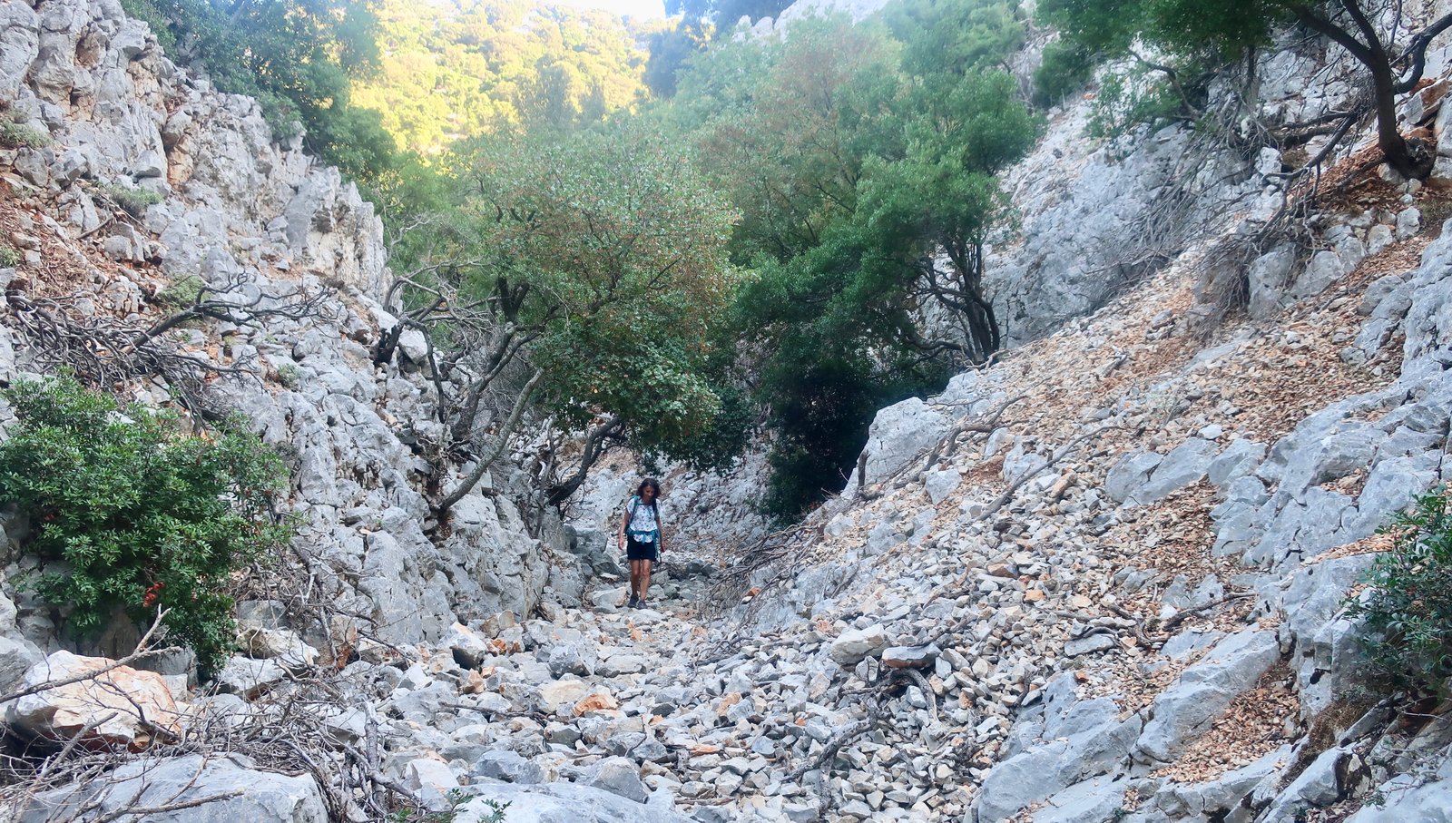
If ever you’ve wondered how it is that goats never fall, with their hooves that seem at first so unsuited for extreme balancing tricks, the answer is, they do. In gorges like this, a small number of goat-corpses line the way in varying states of decay, from newly-dead and stinking to stripped bare two-dimensional skins with skulls and grimaces.
Eventually the gorge-sides widen and become lower and the path comes out onto the coast. From there it’s a long walk, on a path just above the water through olive groves, onto dirt track and then on road, all the way back to Steni Vala. Having set off early in the morning, we were in Steni Vala as the sun was setting. We sat for a beer, still dusty and sweaty, and watched with everyone else the minor drama of the last yacht of the day coming in, nervous one-week summer sailors trying to back onto the jetty with the added complication of an audience.
HIKE 4
From Agios Petros west on Trails 9 and 10 past Isomata. Megalo Xorafi. Trail 7 down to the west coast. North on the road. Trail 14 back uphill to Megalo Xorafi. Home to Agios Petros.
Approximately 16 – 18 kilometres
All of these central island forest walks that come together at Megalo Xorafi can easily be accessed from Agios Petros or Steni Vala. Much of the day’s distance is done back and forth between Agios Petros/Steni Vala and Megalo Xorafi.
Trail 7 is similar to Trail 8, but steeper. It descends from about 350m to just under 100m, much of it a thin pale orange-brown line. There’s nothing here but shades and shapes of green and the path, and views ahead to Skopelos and beyond, the mainland, the Pelion Peninsula coming down like a Greek version of the heel of Italy.

After reaching the coast, the way turns north on the road, dropping right down to sea level at Agioi Anargyri Beach, a tiny sheltered bay, the kind of which there are thousands and thousands in the islands. The road ends here. It feeds the four or five houses that exist, historically, because of the olive grove within which they sit.
On a satellite map olive trees show up as dusky green stitches sewn onto the land, with precise gaps between them. Olive groves are always places of sunlight. In contrast the pines are greener, and often form unbroken blankets. Or they are patchy, uneven. The bulk of the grove is the parcel of land within which the houses have been built, bordered by the road and the sea. But from there it continues into the fold of the valley up towards Megalo Xorafi, the longest, narrowest olive grove we’ve seen in the islands, a river of olive trees. As the valley climbs, every couple of dozen metres there’s a small step up, a wall like a miniature dam, with on the high side a pool of stones level with the top of the wall. The walls stretch across from one fold of the valley to the other. Each level is full of more stones, more olive trees. There’s no hint of a water course, no thread along which water might flow.

Because of the extreme terrain on the islands, and a system of agricultural exploitation fashioned entirely around the labour of men and donkeys, there are endless places where we can hardly believe the efforts to which people have gone just to survive. Island people are stone people, as hard as the land itself.
Here the toil is so visual, so clear. In and out, up and down this narrow grove, from sea level up to nearly three hundred metres and back down again loaded with sacks of olives. Again and again and again.
Near the top of its course, where the grove widens a little and some olive trees are also planted on the left-hand slopes, the path turns right towards Megalo Xorafi. It’s easy to miss, but relatively easy too, using the map, and phone GPS, to approximate direction. Away from the path, the woods are dark and deep. Visibility is limited. Progress can be slow.
The slightly exaggerated warning sign, below, was at the bottom of the path.

From Megalo Xorafi back home to Agio Petros/Steni Vala is a stroll along the roads, or a re-doing of Trails 9 and 10, yet again.