
We’re in Agkali, Folegandros. I’m drinking cappuccino in a cafe next to the beach, trying to read but being distracted by a conversation between two Australian couples from just across the otherwise empty terrace. They’re comparing where they’ve been in Greece. Most of the talk is being done by younger Australian male A, in conversation with older Australian female B. Younger Australian female A says little, but is at hand with her phone when photos are called for. Older Australian male B says not one single word.
Yvonne arrives. I’d left her draped over a large rock right on the water like a basking pinniped. (I confess I’ve just looked this up. It’s the generic name for anything in the seal family, from walruses at one end, on through eared seals, and eventually to earless, or true seals. Pinniped means flipper-footed. Nice. If a little fancy.) I’d left Yvonne stretched seal-like on a rock and headed off to the cafe to read. Then these Australians arrived. This island – that restaurant – great food – have you been? – you must. They left the best of friends, with loose promises to meet up for drinks.
These two couples – or the public face of these two couples, younger male Australian A and older female Australian B – were as if batting a projectile back and forth, both sides going for a winning shot in their game of Greekisland.
Do we do things for the moment of doing them or so we’ll have them stored away, for us, for later, like squirrels? Yvonne wonders, having caught the end of the conversation, a little bit thoughtful after her basking. Or do we perhaps do them for being able to say we’ve done them?
Not much later, we caught the bus with younger Australian couple A, from Agkali back up to the Chora. They were talking about the older Australians. Did you hear what she was saying about hiking (to such and such a restaurant)? said younger female A, who had become much more voluble since leaving the cafe. Bullshitttt! She stretched out the word. Hiking my arse, she had no idea even how far it was…
***
There are at least three possibilities for the etymology of the name Folegandros: it may be from the Phoenician, meaning Island of Stones; it may be from the name of a son of King Minos of Crete, a mythical early settler; or, because in the far distant past it was (purportedly) inhabited only by shepherds and goatherds, it may once have been known as Poly Andros – a lot, man. Poly Andros → Fole-(g)-andros. The transformation is practically effortless. A modern English version might be, Lotsamen, or Loadsablokes, neither of which survive linguistic transposition with any charm intact.
***

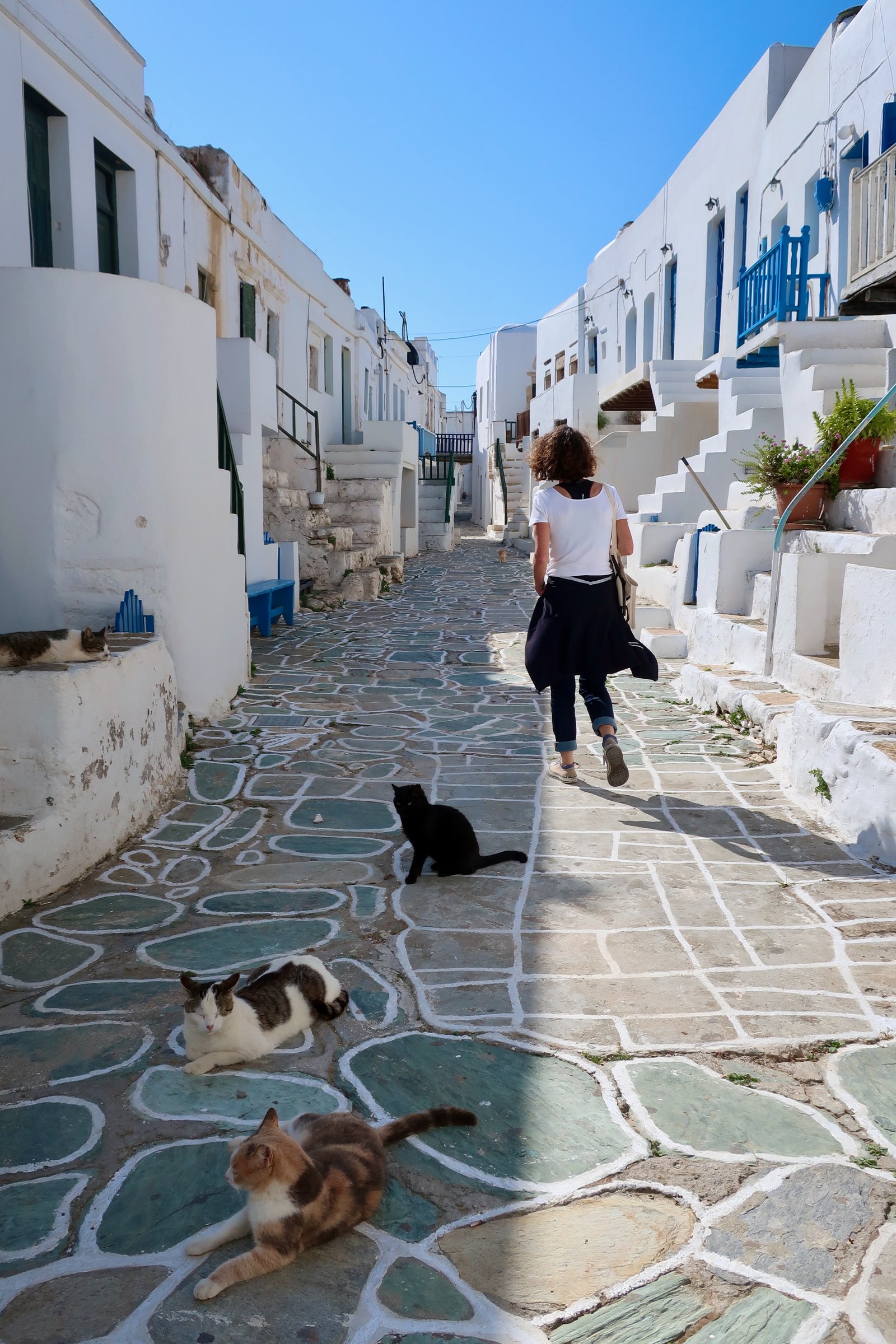
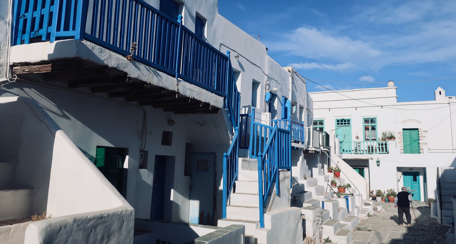
Talk to anyone who’s been, they’re almost bound to jump straight in with the lovely Chora. Not only does it sit on the edge of a cliff two hundred metres above the sea, it also has perfect white-Cycladic island aesthetic. The individual ingredients are not necessarily better than elsewhere, but it has them in particularly fortuitous disposition: there are little squares and open spaces, with shade trees and flowers and terrace tables and chairs; there are the usual low white houses and narrow lanes; there are elegant small white churches; there are cafes and restaurants and bars – although not so many that the relaxed feel of it is overwhelmed; plus, at its heart, it has the old Kastro, remarkably similar to the Kastro on Sifnos, it too built by the Venetians in the 13th century, that period just after the conquest of Constantinople by the Christian armies of the fourth crusade, during which the ex-Byzantine Aegean islands were up for grabs. The later village has wrapped itself around the Kastro, grown oyster-like layer upon layer. Visitors enter through one of several antique gates, once a last rampart against attackers, these days permanently open. In the modern world, parameters have been so upended that in an architectural sense the structures we now see as desirable were very often conceived with martial intent. It’s a tight, clenched, nest of a place, still free of shops and restaurants: a couple of narrow streets, a piling-up of steps and balconies, the dab of colour of painted balustrades and shutters. It oozes history.
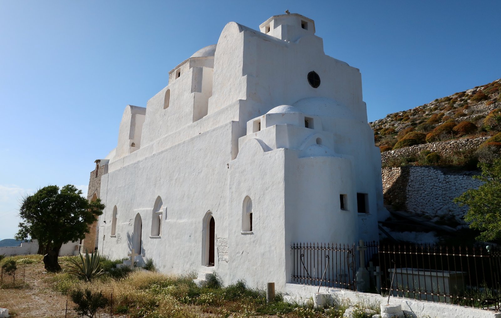
Still, most people who go to Folegandros will remember above all the view from the edge of the Chora: the sheer drop, the spectacle out across the Aegean to Sikinos and further, to Ios, Paros, Naxos. They’ll remember also the classic zigzag walk up from the Chora to the Panagia church. Even people who don’t usually walk are drawn to it at the end of the afternoon, with holiday-sundowners tacit for when it’s done. The views from up there are worth the not very great effort. Down below, the buildings of the Chora are like a herd of abstract shapes moving across a plain – having come to an edge, river or cliff, they’re compacting, getting ready to jump. Beyond it the deeply-indented coastline, the sun and smoky-blue contrast of shadow and terrace and hill all the way to the end of the island. In the other direction, the end of the path, the Panagia church is a gathering of architectural forms all thrown together. Looking down past it to the port it’s a drawing by Escher with Greek-island-colour added. Looking up at it the other way, it’s cubist.
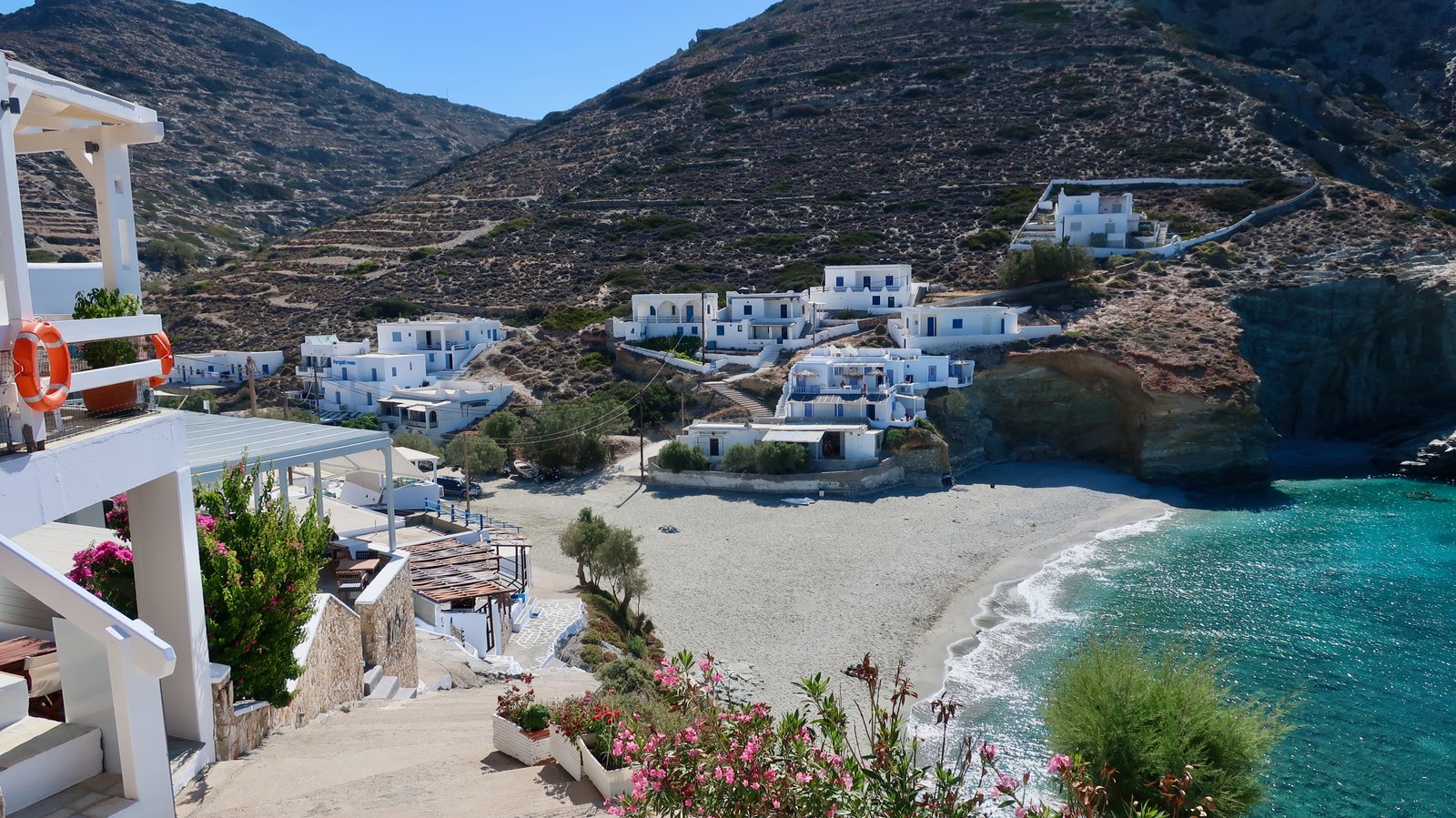
Twelve kilometres long by roughly four wide, Folegandros is one of the smaller islands. About seven hundred people live there all year round. With few exceptions, those not in the Chora live either in Karavostasis, the port, or Ano Meria, a disjointed, linear settlement stretched along the northern spine. Plus in the summer there’s Agkali, on the opposite coast three kilometres or so from the Chora. Aside from the port, it’s Folegandros’ only beach resort, although hardly a resort, so very small and laid-back, so very 1960s Mexico in the way the few dozen buildings melt into the sand and the sand then melts into the water, which happens to be more than usually aquamarine. This isn’t the way things are usually done. More commonly, a road reaches a beach village or port, then runs along the sea-front, where there’s a line of buildings, nowadays mostly restaurants and bars. And even when there’s no road right on the front, there’s almost always the line of tavernas, with the road just behind. Here, Agkali, it’s open, just sand. The whole beach is as if taking a breath. The road comes to an end a hundred metres back. Either side of the beach, climbing, a dozen or so buildings – a few tavernas and some accommodation. It seems of a different age. A regular bus trundles back and forth to the Chora, a practical beach-shuttle service for a capital village without a beach.
With its distinctive Chora, its recent burgeoning of gourmet restaurants, a number of almost-equally lovely and very Instagramable places to swim, plus its pretty, traditional little port, Folegandros has become over the last few years a little bit glamorous. It also has the good fortune to have a surprisingly good network of hiking trails, although such things are still so niche it seems unlikely they can yet have any impact on visitor numbers.
The first time we went, more a pop-in than a proper visit, just like everyone else we gawked at the view from the Chora, then stayed just long enough to get the wrong impression that it might all be a bit too fancy for us. We have since become a little a little better at not jumping to conclusions. We’ve written about this elsewhere, but one of the lessons learned from so much travelling in the islands is that almost without exception the island you find is the one that suits you. Our Folegandros is not the same as anyone else’s.
HIKING
We recently met some people at the craggy castle on the northern end of Kythnos, and got to talking about different islands, particular hikes and places. Such meetings are infrequent, invariably agreeable. When we told them we were heading to Folegandros, they nodded approvingly. Lovely island, they said, really nice. The Chora… Not a hiking island though is it.
But it is. You can go to Folegandros, before or after the busy weeks of July and August and have it all: the style of the Chora; hard-to-believe transparent water; and the paths, sections of them as finely, anciently, paved as any in the islands.
The hiking divides into two halves, northwest (above the Chora), southeast, (below). The southern loop is brooding and stark, about 20 kms. There’s little complication, and only minor alternatives. The other end of the island is softer but more complicated. Not because the walking itself is ever very steep or high or impassable, but because to do most of it in one go would be a lot. To do all of it, really all of it, in one day, would not be possible.
According to the Terrain Map there are fifty-six kilometres of trails. Not all of it is waymarked. Probably some parts no longer exist. In the islands the old paths, when there is still a trace, have gone from island highways to heavily dashed lines on a map, to paler dashed lines, and finally to dots, the latter usually meaning, It was here, it may still be or it may have disappeared, there is for now at least the memory of a route. In the end invasive flora overwhelms the old stones, prises them up, overturns them. Poured surfaces, concrete or tar, succeed them. Digging machines come in and obliterate all trace.
At a couple of places on Folegandros there are clear municipal noticeboards showing thirty kilometres of numbered trails, plus several other unnumbered that must bring the total length close to Terrain’s fifty plus.
On our second visit to Folegandros we did two full hikes, taking in most of the island, north and south, east and west.
HIKE 1 (southeast)
From the Chora on Trail 6 to Petousi, Livadi, Katergo beach, Karavostasis (the port). From there, halfway back up the hill on the road, then without trail on the hill to the Panagia church at the end of the zigzag path, and home.
Roughly 20kms
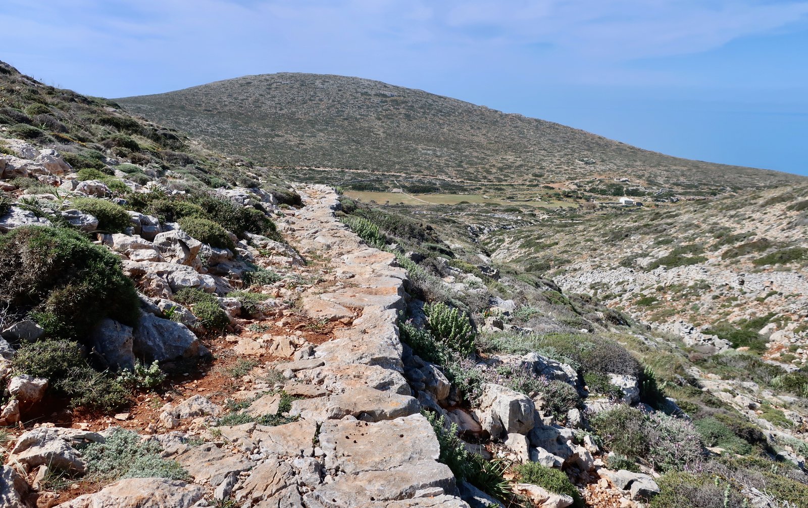
Having left the Chora and crossed the main road, a dirt stone track heads towards a col between hills, where Trail 6 proper starts. It bends around to the left towards Petousi, wonderful and clear and stone-laid, with a surface whose contours are impervious to any wind or rain erosion. Underfoot we feel everything, the rugged skin of the island. A diversion leads to the small church of Agios Nikolaos, just down to the right on the floor of the valley.
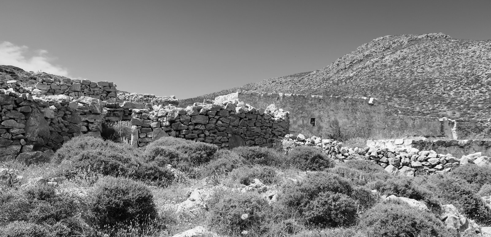
Despite the brown stain on the municipal map that would seem to imply otherwise, Petousi is not a village, but rather the tiny rump of an agricultural settlement, half a dozen buildings now surrounded by the shapes of abandoned fields. Between Agios Nikolaos and these buildings there’s a line of fields along the small valley floor that on a satellite map look like a segmented worm, alongside which the trail runs.
The path from Petousi to Livadi passes between low hills. Rock-hard ground, uneven, walls that are badly-constructed compared to many we’ve seen – the stones here are like small meteorites, as if melted, without the flat faces that would make them easy to stack up.
Livadi is at the head of a wide, shallow valley that funnels down towards the sea. The valley-sides make a low vee, a wide rifle-sight aimed directly at Sikinos.

Most of it has been divided into fields. The hillsides are still striped with old terracing. There are only a few inhabited houses. More numerous are the dwellings of the old village, the petrified shapes of rudimentary stone homes that might have been lived in fifty years ago and might be a thousand years old. Passing through the valley to Katergo beach, only accessible on foot, there are more ruins, some that once were substantial farmhouses, with a few olive trees, prickly pear in clumps, walls that year by year are slumping, and spreading. Staring at a door-lintel that’s barely supported now, I have the unexpected feeling of being in someone’s private space, imagining the struggle to lift it and fit it and the utter incomprehension those who did would feel if they could see us passing in our curious hiking shoes, see the lines of camera-wielding tourists zigzagging up to the Panagia church above the Chora in the evening, winding their way back down in their best holiday pastels.
Katergo beach is at the bottom of a steep path, a fine, protected place to swim, with Katergo Rock beginning one hundred metres offshore, pushing straight out a further two hundred metres.
On the Terrain Map the path, marked with danger signs, theoretically continues on around the coast. But there really is no path any more, just an occasional coloured waymark. The route is a little hazardous. There have been landslides. Just past the beach the terrain is steep, loose, uncertain. I hesitate even to mention this section, except that there are maps on the internet that make no mention of the (minor) danger.
After this short passage, the rest is easy. Walls have been built between the upper and lower cliffs to make a remote pasture. The path continues on around to Karavostasis, where we once spent a night, and were thrilled to find pistachio trees in the garden outside our door. (To get to Karavostasis from Katergo, it would be quicker, and easier, to take Trail 6 back from Katergo beach towards Livadi, and then take the road on down.)
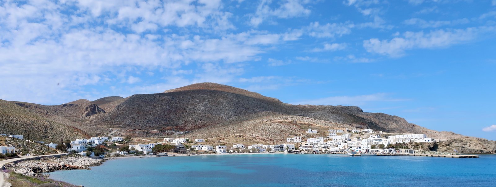
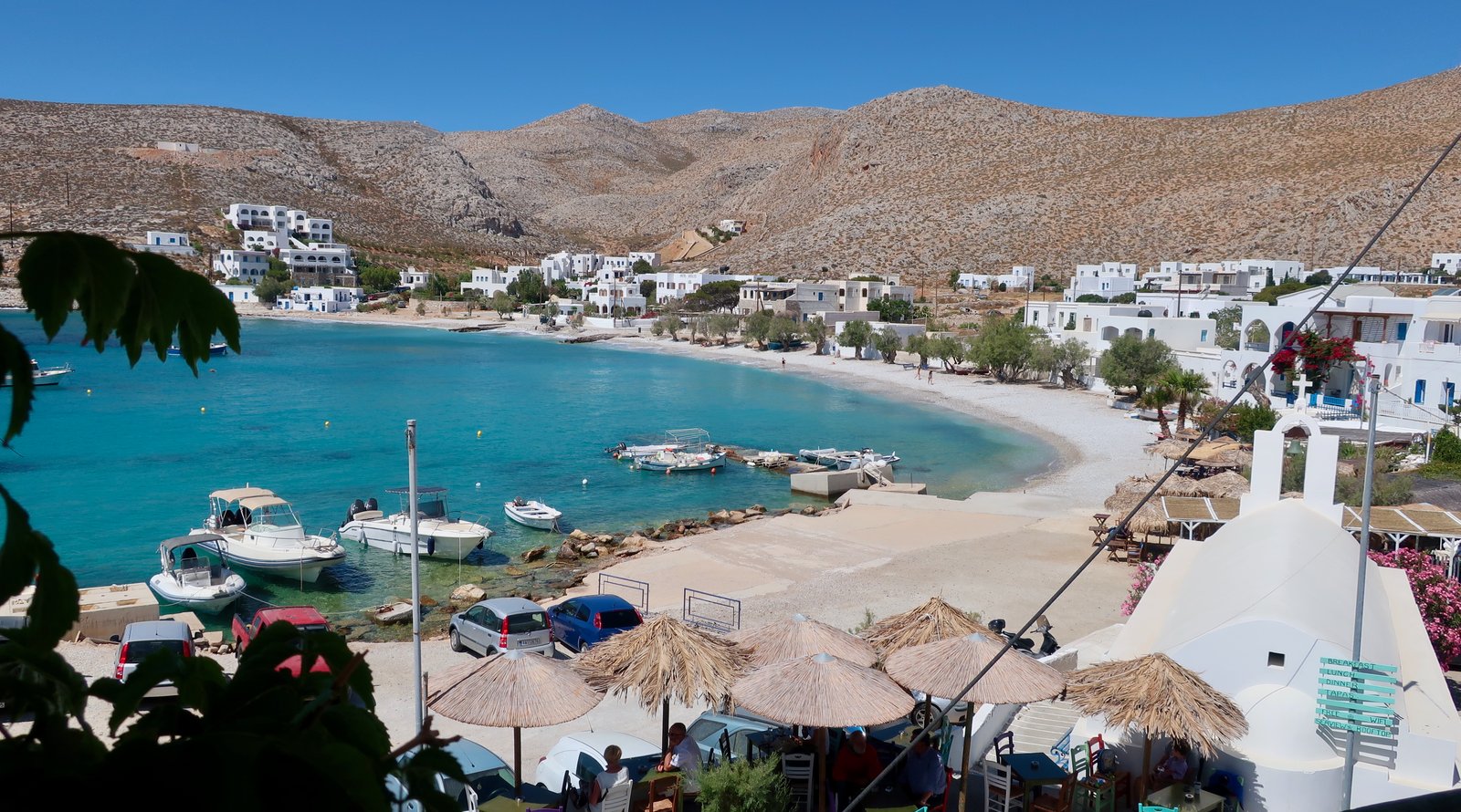
Karavostasis, built in a wind-sheltered bay, is nice, but without the style of the Chora. There’s a beach, a couple of tavernas/bars, some accommodation. It’s a place of arrival and departure, a sort of ante-room for the rest of the island.
On the municipal map, from a point halfway up the main road linking Karavostasis and the Chora, there’s a faint path that strikes off due north. It begins where on both left and right of the road there are tiny churches, and although it soon disappears completely, the terrain is easy to walk on. You find your own direction.
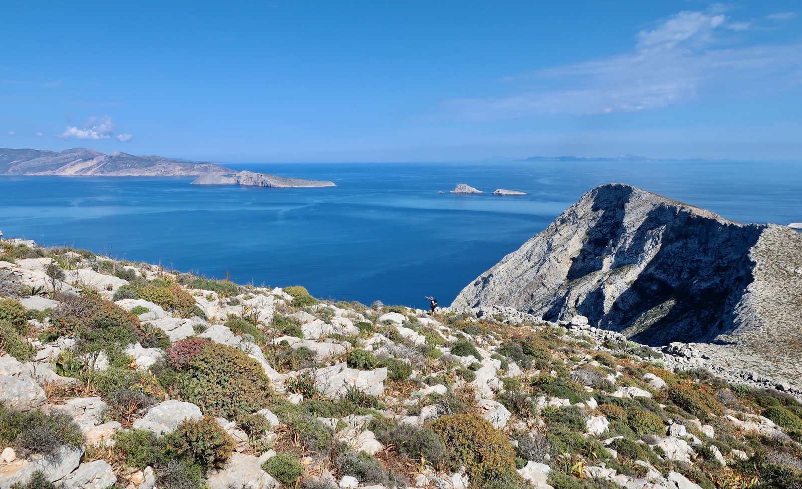
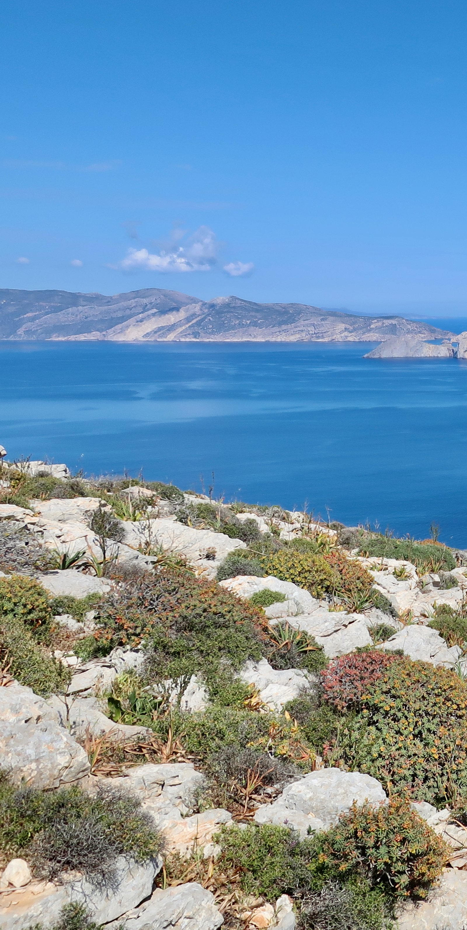
This stroll, up to the high-point, then left along the ridge before eventually dropping down to the Panagia church, is stunning. At hardly more than three hundred metres, you’re on top of the world, with the best views in Folegandros, everything from Santorini southeast to Milos almost due west. The ancient city of Palaiokastro was on this ridge, although there’s nothing left of it now. When we were there, there was not a breath of wind, water below like glass, a passing ferry making an arrow-tip in the sea.
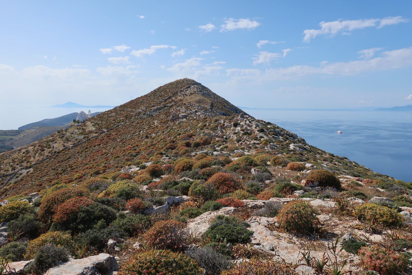
(If, when, we go back to Folegandros, it will in part be in order to try and walk, carefully, on or near the ridge, from a point near Cape Demeneau on the tip of the island next to the port, all the way up to the Panagia church. It looks straightforward, and would be far better than doing half the distance between Karavostasis and the Chora on the road.)
HIKE 2 (northwest)
From the Chora to Agkali and Agios Nikolaos on Trail 1. A small section of Trail 2, then Trail 2A and Trail 5 to Livadaki Beach. From there to the end of Trail 5, then left and down on Trail 4, looping up to Chrissopigi church. Down the road to Ligaria and Agios Giorgios beaches. Trail 3 back to Ano Meria until the point at which Trail 3A diverts off to the left on the municipal map. Down and up Trail 3A to Ano Meria. From there, home to the Chora any way you like. There are various possibilities.
At least 30 kms
This walk takes in the top half of the island. If you would rather not do thirty kilometres, there are all sorts of ways to chop it into smaller pieces. But the fact that you can do all of this, from the Chora along the west coast to the top of the island, with various loops down to the water, and still only do about thirty kilometres, is a measure of the small-scale of Folegandros.
For much of the day the trail passes through very beautiful ex-agricultural land, up and down to beach and bay, and eventually to what must be one of the most backwater fishing ports – barely a port, not even close to being a village – in the islands.
If you do all of this, or something similar in route and length, you will have seen more of the island than most visitors to Folegandros will ever see, and will perhaps feel you have earned an evening on one of the Chora’s smart terraces.
Out of town and down to Agkali on Trail 1. This would once have been the main way between the Chora and the west coast. There are curving sections of perfect old stone path. There’s the Christos church, from where you can see towards Agkali and further, the shape of the coastline around to the beach of Agios Nikolaos. The last section of the path to Agkali is a light scramble around the coast, up and over rocks, ill-defined in places, but easy to follow.
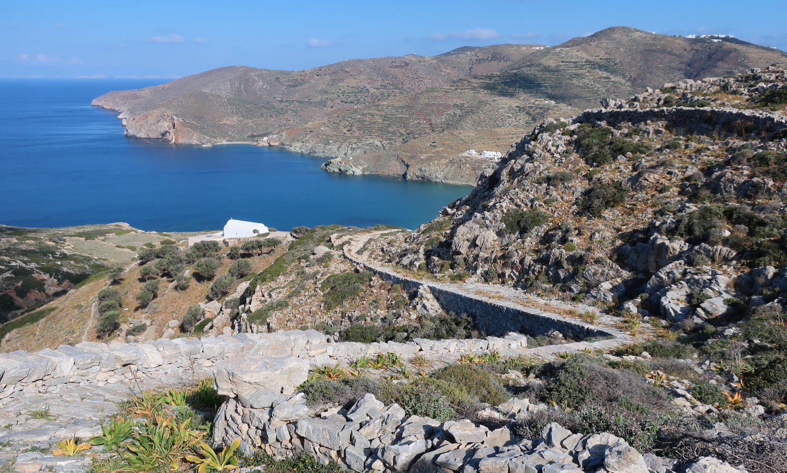
Folegandros isn’t a high island, but looking up to the clear outline of the northern ridge, the shapes of white houses that belong to the village of Ano Meria, you get an idea of the steepness of the land, the way the sea laps at it. On still days in the islands it is unclear whether the land is the pinnacle of invisible underwater slopes, or if, rather, it begins at the hilltops and plummets down through the skin of water.
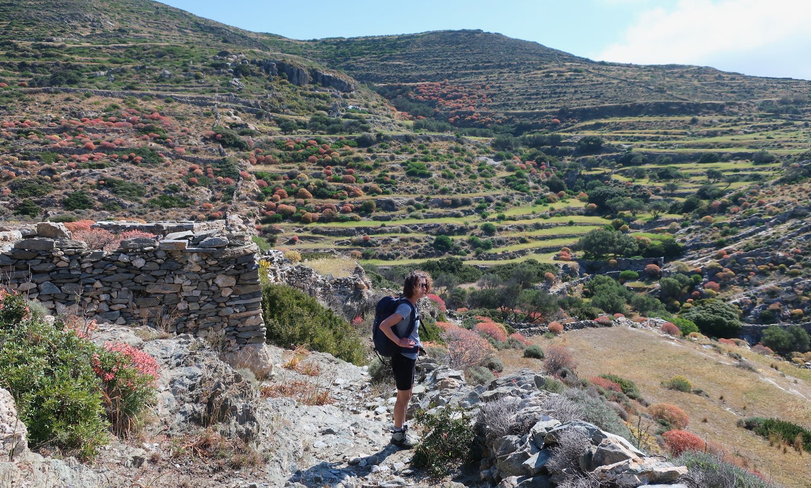
The slim footpath from Agkali to Agios Nikolaos runs ten or twenty metres above the water, past the tiny beach of Galifos. Behind the beach at Agios Nikolaos, Trail 2 climbs up through the valley towards some ruined buildings halfway up the slope. The diversion from Trail 2 to Trail 2A is a hard left just before these buildings, in a landscape of terraces and drystone walls that continues unbroken all the way to the ridge of the island, much of it now colonised by a swarm of orange-pink balls of euphorbia.

Between Agios Nikolaos and Livadaki beaches, there are stone paths and walls and terracing and rocky outcrops here and there, and patches of olive trees that follow the course of seasonal water down the folds of valleys. There are the ruins of old stone buildings, the stones in their walls a patchwork of grey and beige. The colours of it all, every shade of green, from the pale watery grass of less-invaded terraces, to the smoky green olives and plastic green mastic bushes, and everywhere the pinkish euphorbia, is sublime, a perfect remnant of the more gentle, once-cultivated landscapes of the Cyclades.
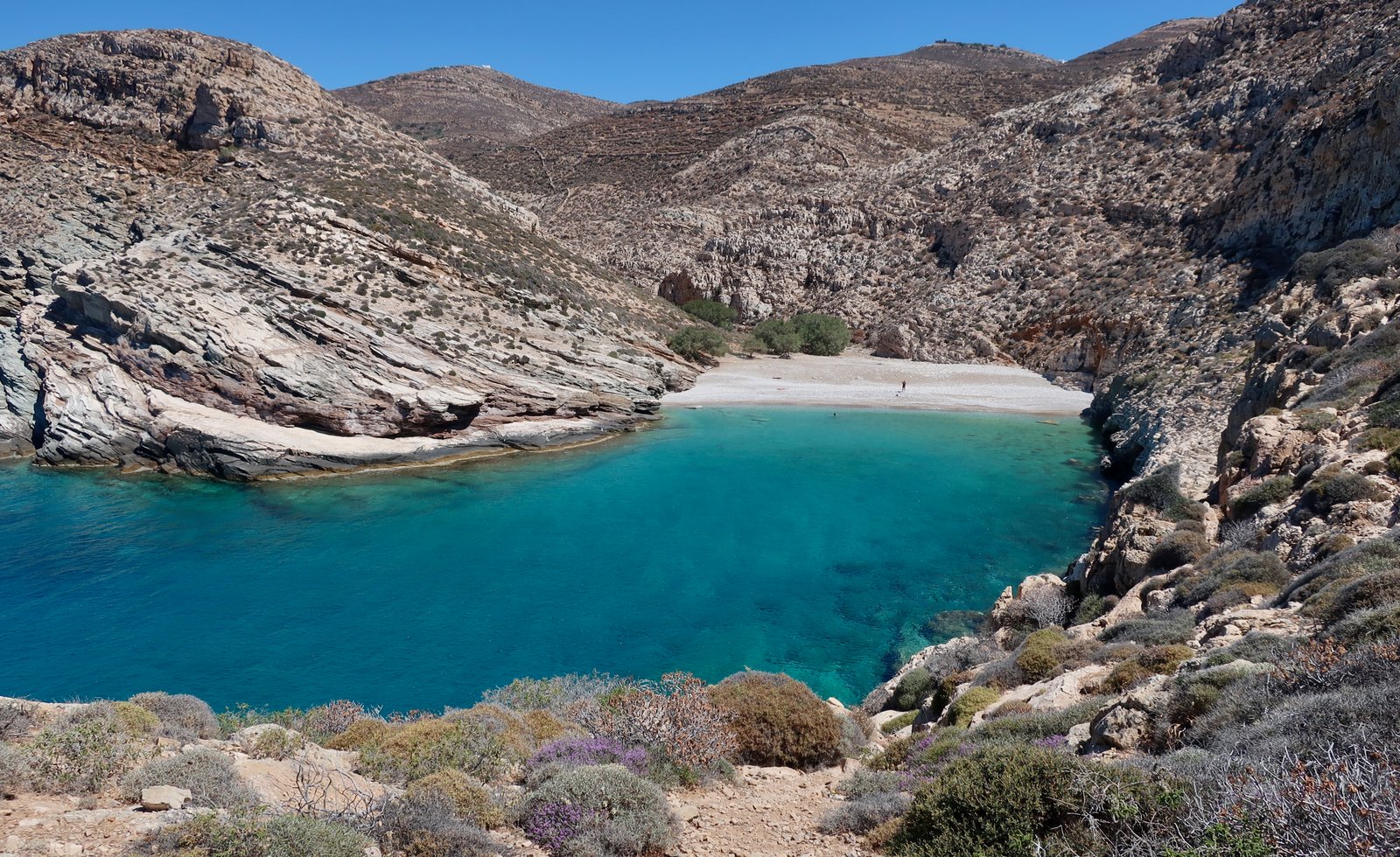
At the end of path 2A there’s a left turn onto Trail 5. With a view further left to the lighthouse of Cape Aspropounda, the path rounds the tip of the southern headland that leads to Livadaki beach. Approaching the beach, a stone pathway has been cut into the rocky slope. There are no roads to the beach. The shortest way in is a walk of a kilometre or so from the other, western side. The combination of rock pathway from the southern side and then Livadaki beach itself, stunning and remote, make it something like a stylish beach equivalent of the Chora. We’ve been there twice, once in April, once in May and both times had it completely to ourselves.
Trail 5 climbs two hundred and fifty metres up towards the spine of the island. You hit the road, turn left and immediately left again on Trail 4 to drop again past Agios Panteleimon to the small beaches and mostly rocky coves of the northwest coast.
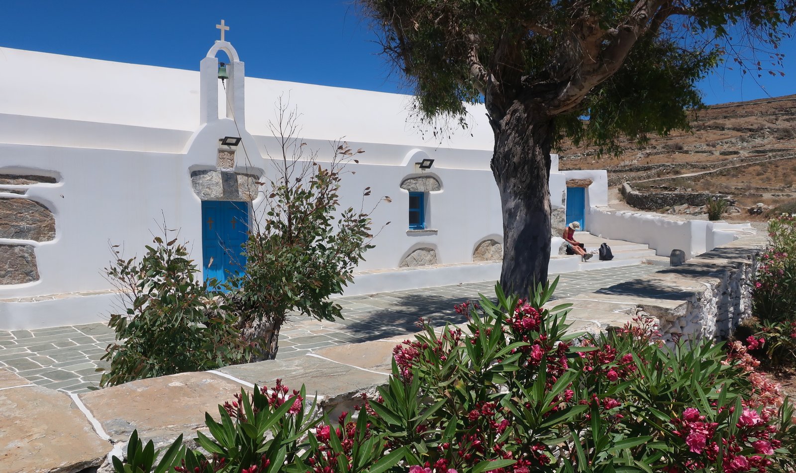
This Agios Panteleimon too is paradigmatic. It is to small Greek island churches what the Chora is to small Greek island capitals. The church itself, its proportions, the picked-out exposed stones, the side entrance with the arch and bell over the door, the courtyard, its shape and dimensions, the places to sit, the tamarisk tree even – like a select few of these small churches and unlike most built structures in the wider world, every single detail is, by what must surely be chance, aesthetically perfect.
The lane outside the church was once a full-width cobblestone road. As it peters out, there are stone-laid paths left and right to Ambeli Beach, a tiny strip of shore so small you could hop, skip and jump from one side to the other. But the bay is deep and protected, and the water, again, seems unnaturally crystal clear.
From there the path continues on around the coast on dirt road. When it bends to the right, inland and up, there’s an alternative to the left, which appears at first to come to an end after a hundred metres or so, just behind a smallholding where fruit and vegetables are being grown. The path in fact curls around the back of this property then continues along the coast to Dendro Bay, where there is nothing but rock and more extraordinarily turquoise water. At the bay’s far side a couple of tamarisk trees have somehow forced their roots into a solid wall of rock. They lean out over the water, making shade for the flat basking-stones underneath.
The next part of Trail 4 leads inland. Soon there’s a short, straight section of stone-laid path, that climbs but without steps, like a petrified moving walkway. I can’t think of anything else in the islands quite like it. When the walkway comes to an end it turns to the right and follows in style the short ridge to the end of the path at Chrissopigi.
Just after the church a dirt track turns left down towards the end of Trail 3 and the beach of Agios Georgios. There are alternatives here. Having later seen the way up from the other end, if we were doing it again we’d probably go to Karkana and take one of the dotted paths that lead to the beach, both of which are old kalderimi running between parallel walls. From the bottom both look passable.
Agios Georgios is the exact opposite of a boutique beach. It’s an old work-place, exposed to the north wind, with half a dozen small boat-garages, half a dozen almost equally small rudimentary box-dwellings, and a church, barrel-roofed and neat.
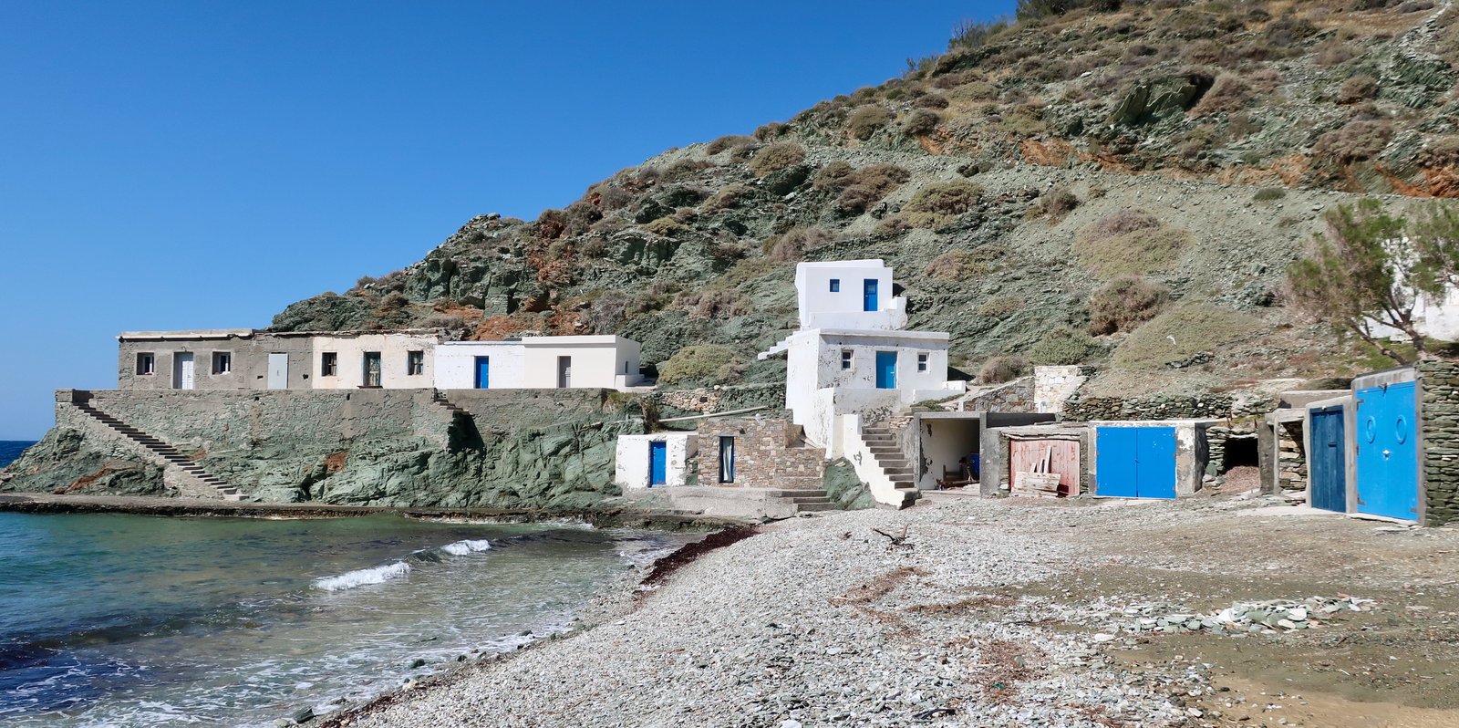
The road up from the beach used to be another full-width cobbled street. Unfortunately, concrete has been poured over the old stones, a minor vandalism to make the going easier for the construction of a large house a couple of hundred metres up the hill where the road ends.
Between the end of the road and the point at which we turned left onto Trail 3A just before the church of Agios Sostis, the path is beautiful old stone, a narrower continuation of the cobbled street from down below. It’s becoming a little overgrown in places, but for now is perfect.
The 3A down to Serfiotiko is another treat. Much less well-defined than the path up from Agios Georgios, for most of the way down it follows a ridge thick with undergrowth, before turning back on itself.
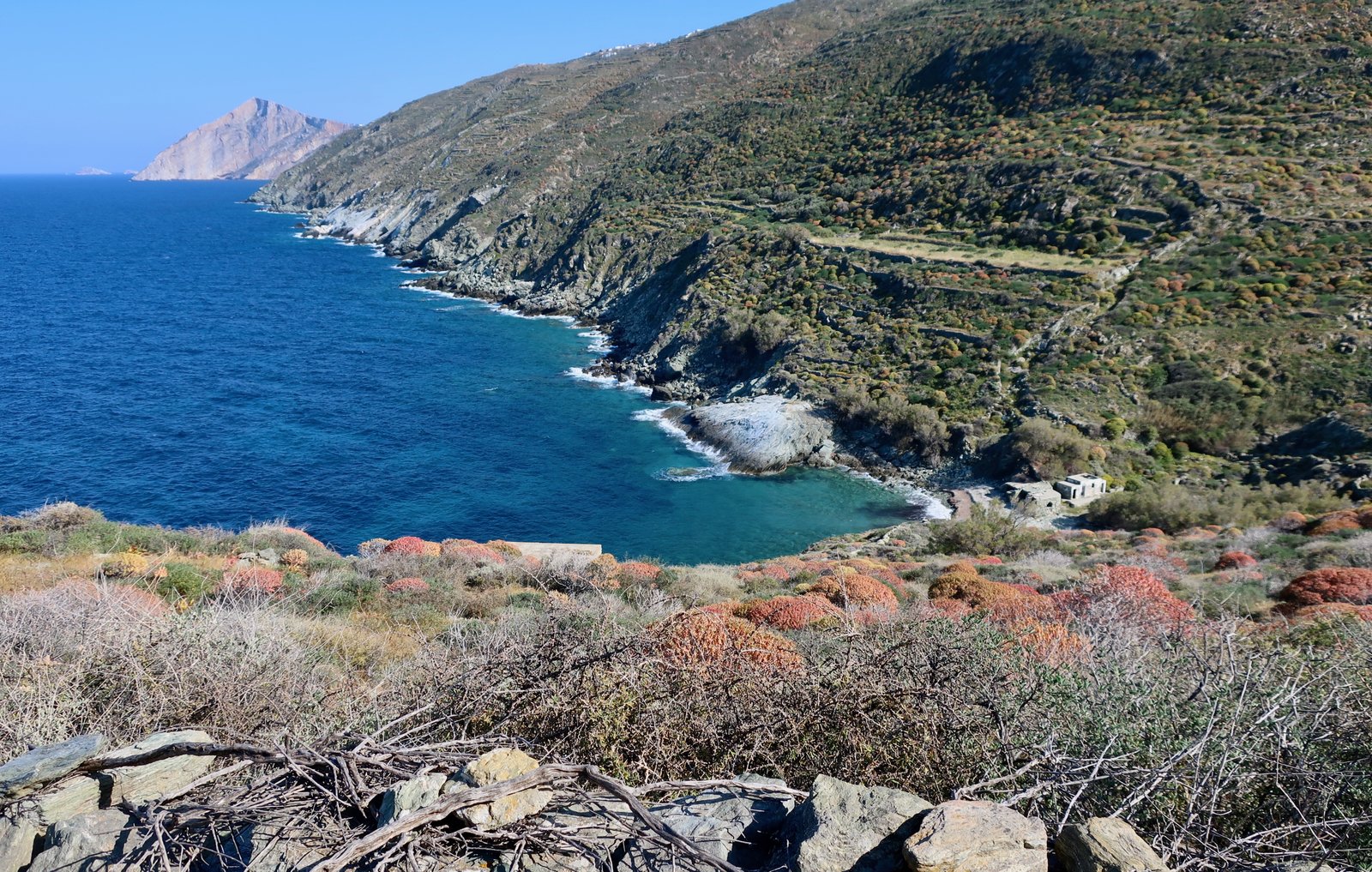
At first it seems there’s no safe way this path can go all the way down. But down it does wind, with just a few sections of stone steps remaining. Without maintenance it soon will be impassable. For now you have to be careful at the beginning to follow the map and believe the direction.
The path up from the bottom is more defined, a wandering old stone path through hillsides cut into terraces, on which all that remains are a few olive trees.
After climbing up to Ano Meria, there are a number of possibilities for the way back to the Chora. We did the main road all the way, at speed. If we were to do it again, I think we’d divert off onto Trails 2 and 1B, a little less than two hundred metres down and up again.
HIKE 3
This is not so much a hike as an idling. One afternoon, in civvies, not even hiking shoes, we wandered over the steep slopes underneath and north-northwest of the Chora down to the church of Panagia Plakiani. The way in or out of the northwestern corner of the village is a wide, well-constructed, cobbled pathway. It seems more like the entrance to one of the old castles scattered about the islands than it does the entrance to a village. The slopes, level after level of collapsing terrace, none of which are used any more, are more ancient archaeological dig than farmland. Looking down to some of the lower, steeper, sections, close to the water, it’s hard to believe, again, the effort involved.
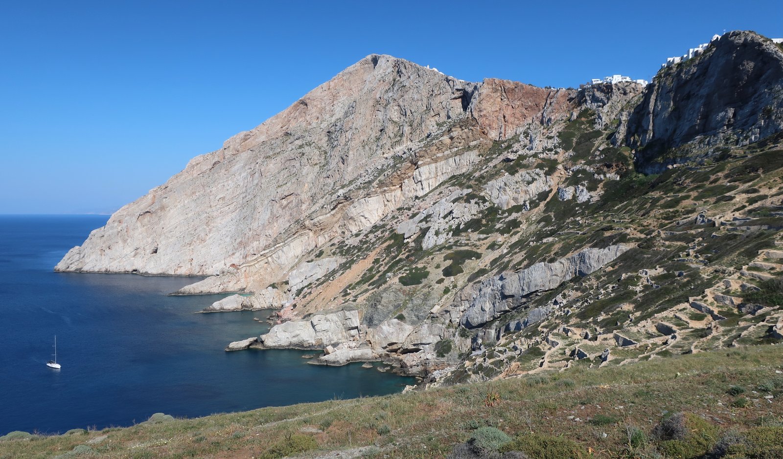
Just after the church there’s a gorge to be (easily) avoided. We wandered, cross country, back uphill from the church, finding our own way up and over level after level of terrace. The way back is not exactly straightforward, not exactly difficult either.