
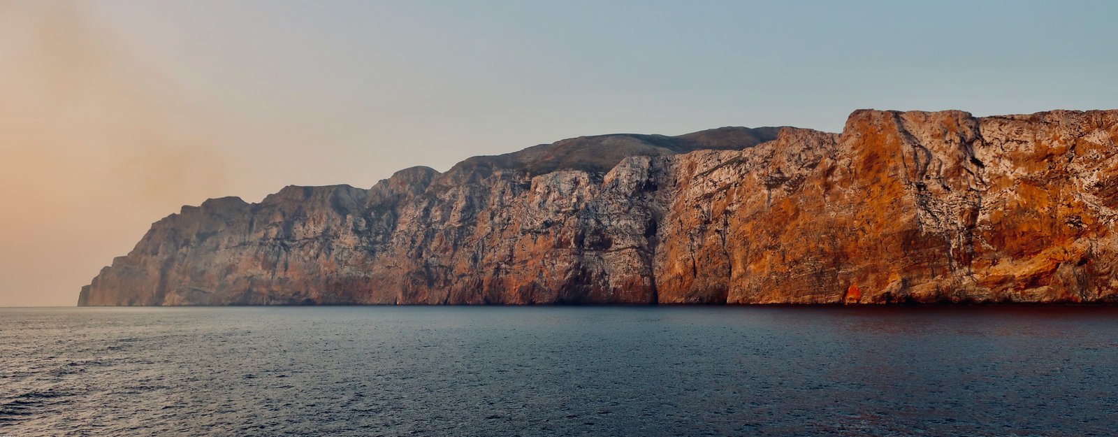
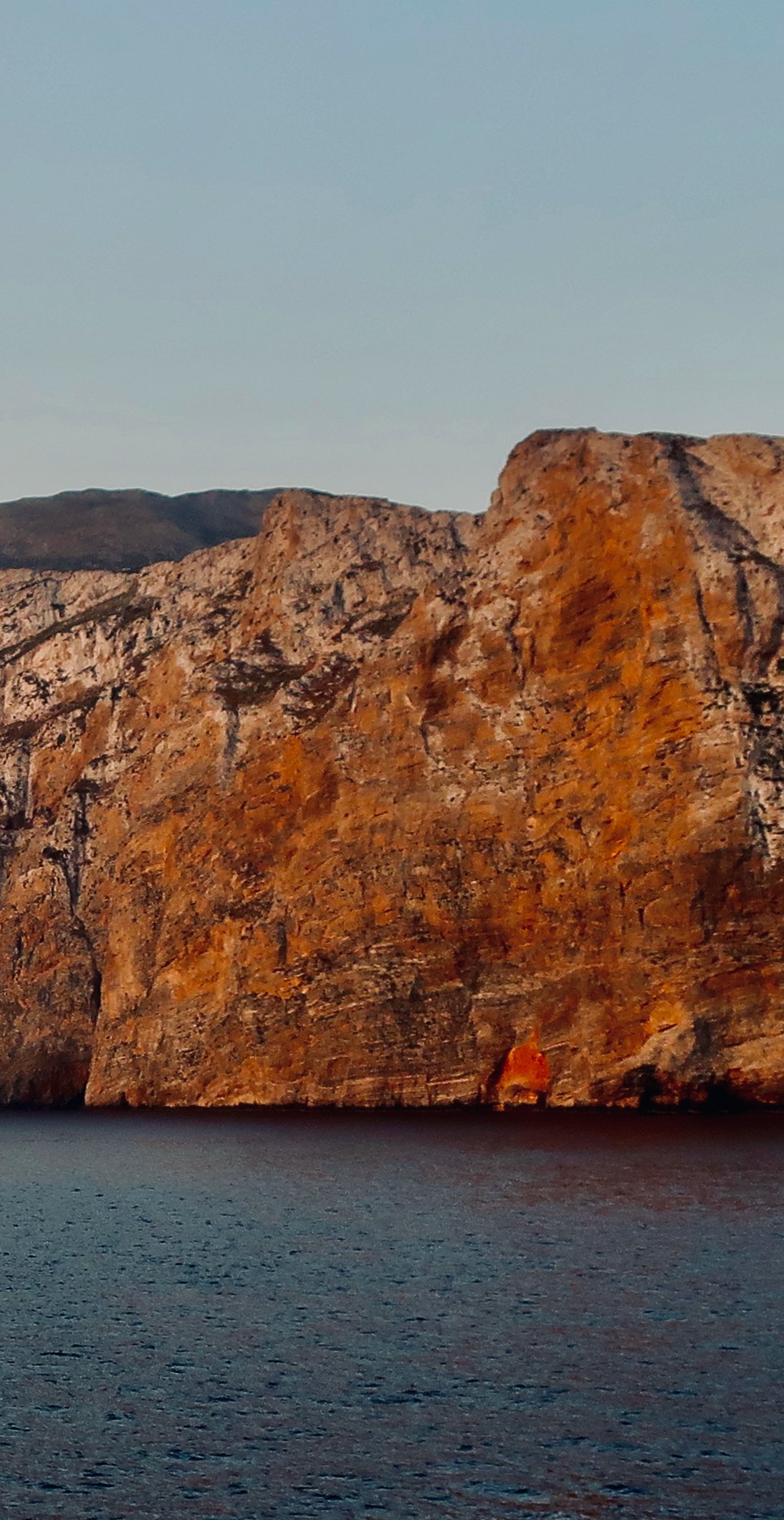
Having boarded an almost empty Blue Star ferry in Astypalaia in the pitch black, rounding the top of Amorgos one hour later dawn was breaking, the cliffs of northern Amorgos lit orange by the rising sun. There was no-one on deck but us, hardly believing our luck at being there, having it all to ourselves. It seemed extraordinary. If ever we do a piece just about arrivals, this will be in there.
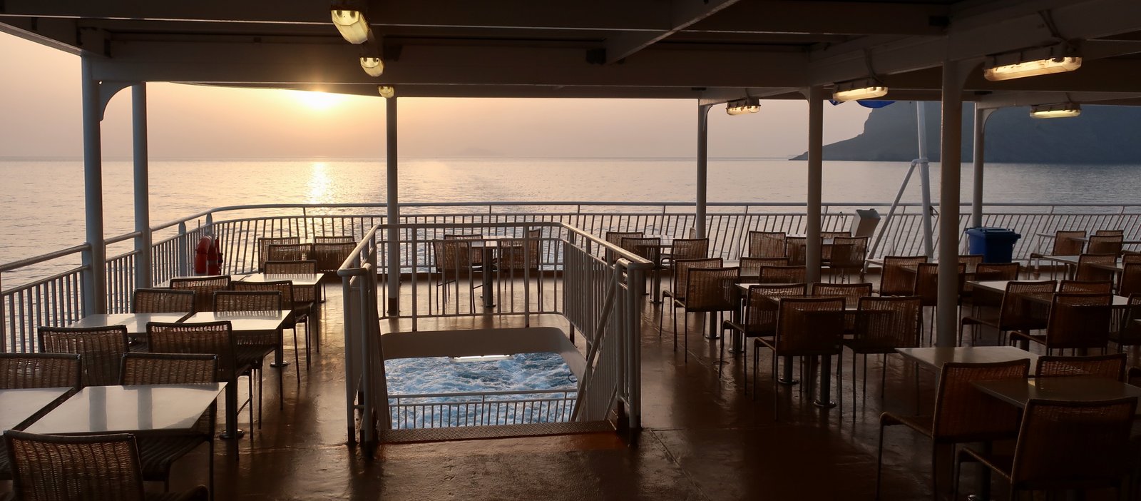
There’s no sign of life all along the north coast, and nothing along the northwest either until shortly before arrival a few white houses come into view, high in the hills. Then you’re round the corner into the bay, the village of Aegiali on the right-hand shore but also straggling along behind the beach.
We were the only people to disembark. The weather was typically beautiful, sun and twenty-three degrees, the water typically cool – spring water temperatures lag behind the weather. A couple of tavernas were half-heartedly open. A café/bar or two. A bakery. A minimarket. Seven hundred metres of beach and not a soul. Water in blue-green glassy patches. The last of the wildflowers in the hills.

You think the Greek islands are oversold, a chaos of package holidays, fancy villas, sunbeds squeezed cheek by jowl like colonies of sea mammals? But no. This is what they’re like.
We imagine that in the science fiction future there’ll be instant travel. A button pushed and whoosh, you’re there. From London or Madrid or New York it’s weekends on Anafi, Serifos, Hydra. A restaurant in Platis Gialos on the southern end of Sifnos for dinner after an afternoon on the beach. Away days on Amorgos. When the future happens there’ll be nothing to slow up the flood of visitors. No more planes to Athens followed by gloriously slow ferries back and forth across the Aegean. But until that time, this is it. Aegiali at the beginning of May.
***
Thirty kilometres long, an average four wide, the central ridge running all the way, top to bottom, Amorgos is one of the islands whose topography is most easily defined. One side – south and east – is mostly inaccessibly steep. The other – north and west – is comparatively more gentle. The lump of land at the top end, which rises to over 800 metres, the highest point on the island, looks on the map almost exactly like the head of the Road Runner in the old Looney Tunes cartoon. You would say Amorgos is sprinting towards Turkey.
The permanent population of about two thousand are mostly divided between three main villages – Aegiali, Katapola, the Chora. Because of the inaccessibility of most of the wind-sheltered southeast coast, and despite the routinely thumping north wind, almost all significant habitation is situated on or around the wind-exposed side, although one way or another most of it is sheltered by headlands, deep bays, ridges of higher land. The exception is the old capital, the Chora, which like so many historical capitals is in the hills, there to offer some protection from raiders. From the Chora they could scan the sea both east and west. It sits under the sharp edge of the long spine, a curled-up nest of a place with its back turned north for the wind to slam into. In the narrow alleys of the village, deserted for most of the year, bursting with bougainvillea and shadows in season, there’s shelter. Poke a nose around the edge, past the end of the lower square into which buses come, and you may have to lean to stay upright.

In the late 1960s during the dictatorship of the Colonels, Giorgios Mylonas, a prominent Greek politician, was exiled to Amorgos. He spent a winter in the Chora before escaping. Afterwards he wrote a book about his time on the island. It was colder than he expected, he said, with almost always a strong wind blowing. It’s baffling that Greeks, mainland Greeks, can be blithely unaware of this central reality of island life.
Mylonas reckoned perhaps one hundred tourists passed through his island-prison during the whole season, most of them sailing in on private yachts. There were no tarmac roads on the island, and just one car. The first general electrification took place in the Chora while Mylonas was there in 1969. One of the deep attractions of the Greek islands is the proximity of the past, this straddling between then and now. We walk all over the islands and it’s as if the layers of history are still tender.
Amorgos divides neatly into sections: the top end with Aegiali; the middle, with the Chora and Katapola, the main port; the long tail, which fades on and on, past the ancient sites of Minoa and Arkesini, past Instagramable Mouros beach, past the shipwreck of the Olympia all the way to Kalotaritissa bay.
One long road runs the length of the island, with occasional spurs off – to Katapola on one side, to Mouros Bay the other. Near the northern end it passes Nikouria Island just off the coast, accessible by tiny ferry in summer, even if the beach to which people come is really just a thin strip of shadeless dirt. At Aegiali the road bifurcates to feed the pretty mountain villages of Tholaria and Langada. The road network could hardly be more simple, more binary.
In the short high season regular buses run up and down. Out of season you have to adapt, check the timetables, get a car or moped, walk. Walk. As on most islands, tarmac has superseded the footpaths. Unlike on many islands the road here more often than not does not follow the old routes: it takes the coast when the hiking path goes over the top, it goes over the top when the paths take the coast or wind through the southwestern hills. Because of its elongated shape, the way the island threatens to stretch itself to breaking point and come apart, on Amorgos the old trails seem even more than elsewhere skeletal, the bones that hold it together.
If there’s a focal point it’s the thousand-year-old Hozoviotissa Monastery, one of the most recognisable buildings in the Aegean. It’s a thin white slab of a thing, not so much constructed as smothered onto the bottom of a cliff. Below it the land slopes down to the sea, a little less vertically than above, but still beyond the point of practical usage. The monastery looks North African with its tiny windows, as if made of mud before being painted glaringly white. It’s a barren place, the Greek Orthodox habit of extreme abnegation in construction taken to its end-point. Only two monks live there now. In the high season they can have little time for contemplation, given the amount of visitors who pass through. Available at the entrance, shapeless pieces of material must be wrapped around shorts or little summer skirts to preserve the historic modesty of the place. Tourists pass through a small, stone-carved entrance, make their way up a steep staircase and are processed past the most important relics. During the long hot summer days it’s a perpetual motion machine, early industrial in its simple efficiency.
A large percentage of these visitors will be French. Amorgos is a French island: French people who know Greece, French people who know movies, French people of a certain generation know Amorgos through Luc Besson’s film Le Grand Bleu (1988), which in France has cult status. The island has been adopted. In particular the Hozoviotissa Monastery, but also Shipwreck Bay at the far southern end, where the wreck of the merchant ship Olympia lies close in to the shore and a scene from the film was shot.
In the small galaxy of the Cyclades, Amorgos is furthest east. (How, deep in the past, did they do that, The Cyclades, implicit in the name the idea of centrifugal motion? For us, being able to look down from the skies, it’s clear. This sort of early cartographic awareness, the ability to visualise, seems miraculous.)
Because the hiking is beautiful it’s one of the islands to which we come with friends and family at any time of year. Because we like Aegiali so much we’ve also been in August, when the ferries that glide into the bay disgorge minor crowds of people: young Greeks with backpacks heading for the campsites behind the beach; older French to their studios. As elsewhere, even if you don’t see the ships coming you hear the sound of the anchor chain, like a rushing of rocks as it drops into the water to tether the bow when the stern nudges up to the dock. It’s always surprising how quickly the newcomers melt away and the usual sounds return – childrens’ voices on the beach, the thwacking of a ball game back and forth. Later, in the evenings, there’s the partial coming-together that creates the summer little-city hum common to resorts. For a few brief weeks the lights are on in Aegiali. By the time September comes most everyone has gone again for another year.
It’s one of our favourite beaches anywhere in the Aegean. What makes a good beach? It’s not always clear because as soon as you think of a rule there’s sure to be somewhere that breaks it. It’s probably the place more than the strip itself, although it’s certainly a plus that Aegiali isn’t organised – that there are no ranks of sunbeds – and that it’s long enough – seven hundred metres across – that even in summer it’s never crowded.
The swimming’s good, but not the very best in the Aegean. I wear goggles but quite often the visibility’s blurred because even a couple of dozen metres away from the shore the water’s shallow enough that the sea-bed can stir to a liquid sandstorm. Large rocks appear to be moving below, sliding across the sand. The sand-ripples on the sea-floor tremble in and out with the current. Where there’s seaweed, the way it chaotically, sinuously churns can cause disorientation, a loss of direction – one moment you’re heading south to Karpathos, next you’re only ten metres from the beach and are being rolled by the small breaking waves. Still, here in the protected bay it’s a mild slopping, nothing like the north wind. You have to have been hit by the summer meltemi anywhere in the Cyclades to understand how overwhelming it can be, especially for swimming, but also for hiking and general day-to-day living. On Amorgos we’ve gone from relative calm in Aegiali to a gale blowing in the Chora, people tutting, stopping strangers to tell them that it’s too dangerous to go out on scooters.
***
On early morning summer Aegiali beach the same perfectly-suntanned girl in a bikini pounds back and forth along the small wavefronts. You hear the echoless thud of her bare feet in the damp sand. A couple of elderly Germans are first in, they stroke out a little way then hang suspended, chatting, as the sun rises on them over the hills to the east. There are often a handful of skinny-bathers at the far end, taking advantage of the low sun and the absence of people. There’s a man in a high-backed wicker chair in the second-last café, reading a book – a prince, a man at peace. And although there are signs saying No camping on the beach, there’s usually one or two, bleary, curled up: those with no place to go; those who have somewhere to go but only made it this far in the small hours; those who can’t resist the chance to spend a night on the sand, with only the stars and the sound of the waves.
HIKING
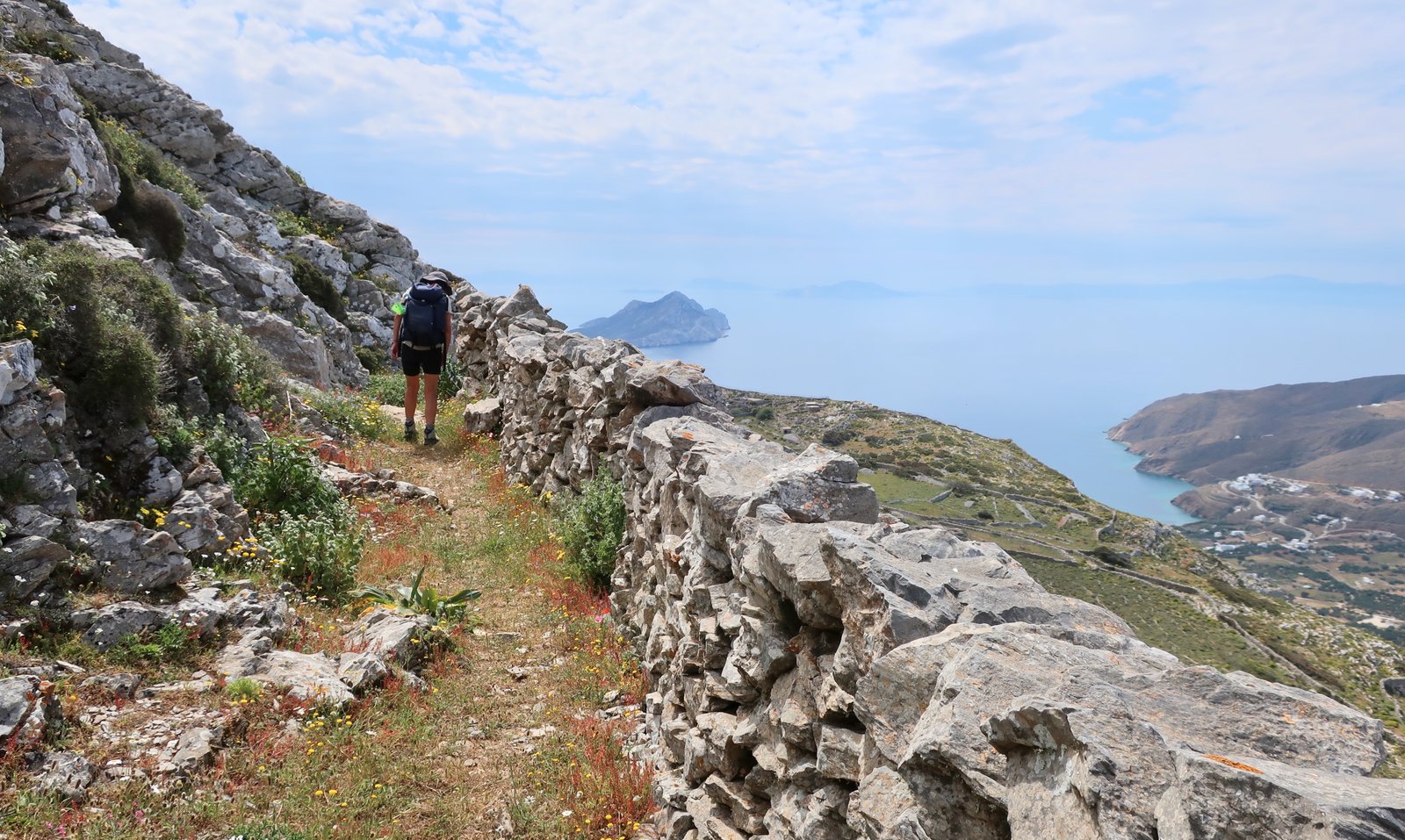
Often, at the same time as we’re writing these pieces specifically about hiking, we browse through google for supplementary detail. Almost always we’ll come across someone describing the island, whatever island it is, as The hiking island. We used to scoff, but have come to realise this just means the writer has done little hiking in the islands and that they’ve been bowled over. They haven’t understood that what they presume to be exceptional isn’t at all. It’s what the islands are like. The ancient stone-laid trails. The extraordinarily beautiful landscapes. The Mediterranean, the water always there, enfolding. The bays and beaches. The churches and monasteries. Wildflowers in spring. The hills so baked in summer and autumn you can smell them as if cooked. The narrow-alleyed villages. The ports. The history. The history, through thousands of years and settlements. A history of stone and heat and wind, the trails a code to understand it, written on the land. If you think to read it. If you take the time. These little islands that visitors nowadays so often reduce to beach and taverna, once at the heart of the world.
When someone says that Amorgos is the hiking island, it isn’t true in the way they mean it. It is true that on Amorgos the hiking is classic stone-paved, rugged, small-island Cycladic. There are only eight numbered trails, plus some short add-ons (and the unnumbered paths), but within a total length of seventy-five kilometres plus, it is wonderful and it has everything. But even were this not so, even if it had nothing but the one path, the northern loop, it would be worth going to hike on Amorgos.
The loop begins and ends in Aegiali, passing by Tholaria, the monastery of Agios Ioannis Theologos, Stavros, the high ridge of Krikellos, then back down to Langada and Aegiali, and is one of the very best mid-length (20 kms) hikes anywhere in the islands. If you go to Amorgos and walk it and don’t fall pretty much head-over-heels in love with Greek island hiking, you might as well stop. Go somewhere else. Do something else.
From a base in Aegiali, using the Terrain Map of the island, sometimes taking the bus in one direction or other, all the numbered trails are accessible. There are other paths on the map, dotted but without numbers. Some of them, their points of departure at least, are clear and obvious on the ground. Others less so. The path that continues from the end of Trail 5 at Stavros, the high section of the northern loop, is one of the dotted unnumbered paths we have done, but we’ll almost certainly never do them all. Unless an island is particularly poor in paths, unless we’re prepared to ignore the powerful attraction of all the other islands, there’s never enough time to do everything.
There are lovely trails in the north in particular, but also in the central and southern section from the Chora and Katapola down. And there’s the famous Strata spinal path between the Hozoviotissa Monastery and Aegiali/Langada.
Realistically, it would take seven to fourteen days to do all the Trails – seven days would be full-on every day without a break.
As usual, the numbered trails can be chopped, combined, done partially or completely, lengthened or shortened to suit individual preference and available time.
For simplicity, the island can be divided into three sections:
A – The large top section around and north of Aegiali
B – The Strata trail between Aegiali/Langada and the Hozoviotissa monastery
C – The rest, from roughly the middle of the island down to the southern end
***
The Trail numbers on the hikes below correspond to the numbers used on Terrain Maps hiking map of the island.
A – AROUND AEGIALI
There’s a particularly dense network of paths in the north. Many of them are not numbered. Others, such as the rocky ascent/descent between Langada and the ruined windmills on the ridge of Mount Krikellos 300 metres above, are marked with residual numbers from some past hiking network.

At various times, on various visits, we’ve done the following:
HIKE 1
Aegiali – Tholaria – Aghios Georgios (Trail 4) – Aghios Ioannis Theologos Monastery – back to Aghios Georgios (Trail 5a) – Langada (Trail 5) – Aegiali (Trail 4)
16 – 17 kms
HIKE 2
Aegiali – Tholaria – Mikri Vlichada beach – Tholaria – Stroumbos church – Langada (Trail 4) – unnumbered path up to the windmills on the high ridge above Langada – back down the same path to Langada – Aegiali (Trail 5)
17 – 18 kms
HIKE 3
Aegiali – Trail 4 along the beaches on the far side of Aegiali bay – unnumbered path to Tholaria – Stroumbos – Langada (Trail 4) – Aegiali (Trail 5)
17 – 18 kms
HIKE 4 – The Northern Loop
Aegiali – Tholaria – Agios Georgios (Trail 4) – Agios Ioannis Theologos – Stavros (Trail 5) – the high ridge to the ruined windmills – down to Langada (unnumbered) – Aegiali (Trail 5)
20 kms approx
***
Tholaria and Langada, through which many of the paths pass, are both full of summer Cycladic charm. In Langada in particular, cafes overflow into the narrow streets and small squares. For much of the year though these are hushed places, old agricultural settlements making two points of a roughly equilateral triangle with Aegiali, these days inhabited mostly by those elderly people left behind by the great draining that has seen island populations slide down towards the coasts.
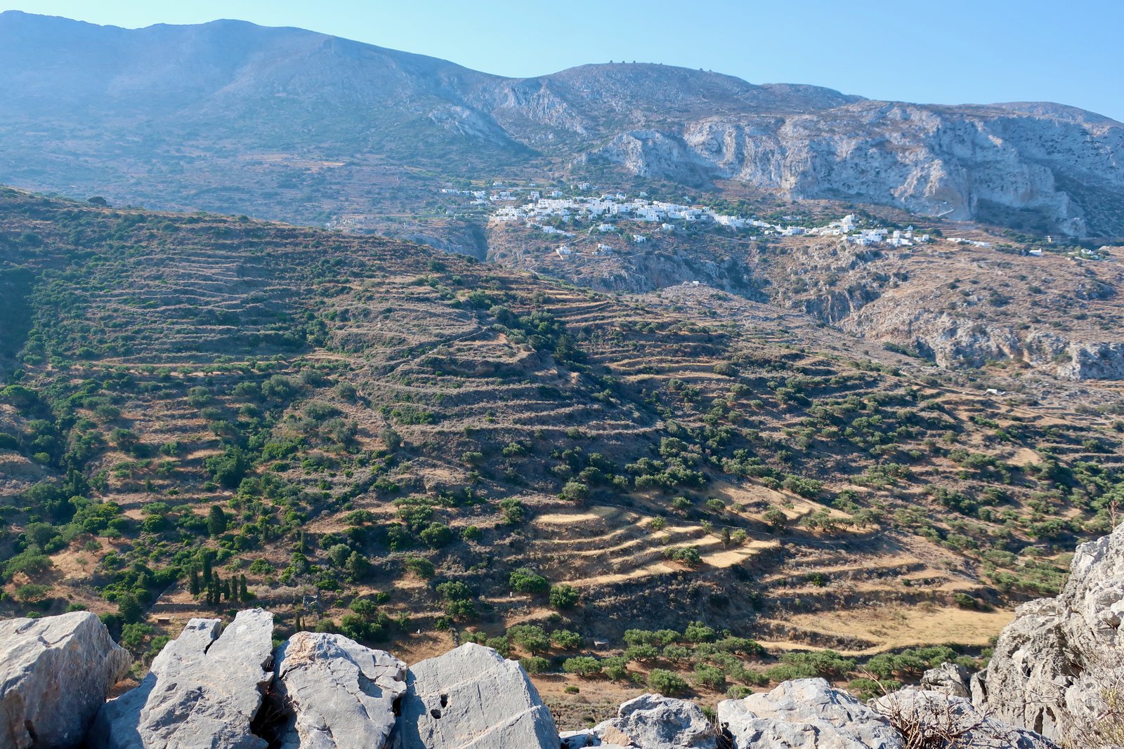
Much of the network in this upper end of Amorgos is stone-laid, the sort of Greek island paths that weave through land once intensely agricultural. They go from village to village, village to work-place, through the endless abandoned terraces that are as indelible as tattoos. Some of them here, in particular the sections Tholaria – Stroumbos – Langada, or Langada – Agios Ioannis Theologos, are especially sumptuous.
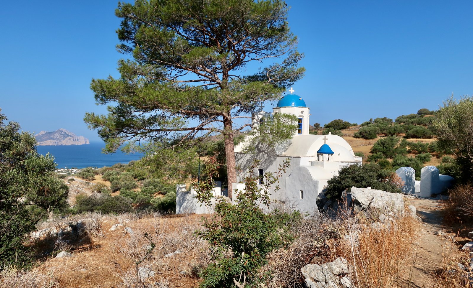
A breakfast we had one early summer morning at the church of Aghios Georgios near Stroumbos has, with time, swollen, so that now it has come to represent a sort of ideal. We had already been up for a couple of hours before we got to the church. In summer, because of the heat, days have a different rhythm. We wake around dawn and are out by the time sunlight bursts over the hills. There’s a suspension that happens on really hot days, as if everything is holding its breath, knowing what’s to come. We had walked through still-sleepingTholaria village, down to the sombre, pebble beach of Mikri Vlichada, still in shade and anyway much too blustery to even consider swimming – which was what we’d thought we might do – back up to the village and along old stone paths to the rocky outcrop of Stroumbos, once a small community, these days a couple of habitable houses, a gathering of ruins, a blue-domed church. The heat was already unlocking the sweet smell of the pine trees around the church. We had hot coffee from the flask, fresh bread, fig and pomegranate jam, the latter purchased for an eyebrow-raising price in a fancy local-produce shop where they sell items to tourists – me on this occasion – so overcome by the smush of being on holiday, they pay no heed to cost. Looking down over Aegiali bay, we were conscious, even while we were there, of feeling exceptionally contented, not in fact all that far away from actually living in the moment, cliché for something pretty much universally unattainable, rarely even glimpsed.
On our HIKE 1 (above), the looping trail behind the Aghios Ioannis Theologos Monastery that the map calls 5A doesn’t, or didn’t yet, fully exist when we were there in 2022. It comes and goes, over terraces, along old stone walls. But the way is easy, the terrain without the moments of precipitousness that make some other imperfectly-marked paths inadvisable.
HIKE 3 (above), goes along the water all the way around the far side of Aegiali Bay (the side opposite the village of Aegiali), until Trail 4 comes to an end. It then makes use of an unnumbered path – theoretically present but which we didn’t find (we had an easy scramble over terraces) – as it curls up and around towards Tholaria.
On the northern loop, (our HIKE 4 above, mentioned earlier), there are various possibilities for getting to the Agios Ioannis Theologos monastery, the start-point for the main part of the hike. The most comprehensive version of this loop would go from Aegiali to Tholaria, then probably Trail 4 to Langada. After that, Trail 5 to the monastery, lush in springtime with bright red poppies, yellow buttercups and white daisies splattered onto a background of green. Stone walls line much of the way, with olives and oaks and fruit trees.
The section from the monastery to Stavros is breathtaking, a narrow thread on a steep slope between five and seven hundred metres above the water. Anyone with a bad head for heights might balk at the view of the path stretching out ahead across the bare, rocky slopes. It’s a little vertiginous, very wonderful and best not done in a strong wind.
The chapel at Stavros, planted on a clifftop, the backdrop all sky and water, planted it almost seems, in the sky, is a pure expression of shape and colour: a tiny courtyard with crazy paving and seating, a curved roof, a small white cross against the blue sky. There’s absolutely nothing to it yet the aesthetic is miraculous.

The way from Stavros to the windmills above Langada is at first an easy stroll almost up to the top of Chorafakia (823 metres), then a walk along the ridge of the Krikellos range down to the mills. There are cairns, not always easy to follow, but it doesn’t really matter since at a point just after the peak you have no choice but to get onto the ridge itself.
Because there’s no clear trail you have to be prepared to scramble a little, sometimes right along the backbone, sometimes a little to one side or the other. There are infinite views in all directions – left to Astypalaia, south along the humped-sea-monster-length of Amorgos, right to the Lesser Cyclades and Naxos, further right to Mykonos and then northeast to Ikaria. Below, in the bay of Amorgos, is the island of Nikouria, on a calm day the water around it stretched taut.
On the Terrain Map danger signs mark the length of this ridge section, with an explicit warning not to do it on a windy day. The wind bursts here can get so strong as to throw you off the cliff, it says. Even if this makes it sound much scarier than it is, it wouldn’t be a good idea to do this walk on a really gusty day.
After the third danger sign on the map the ridge spreads and flattens. Then it’s the windmills, another place of ruination, which must have been much-frequented in the agricultural past but now is wholly abandoned, visited only by very occasional hikers.

From the windmills there are at least three ways to join the main (unmarked) path down to Langada, one of them going past the tiny church of Stavros. Another Stavros, not the previous one in the far north at the end of Trail 5. This one is tucked into a jagged part of the slope, another rudimentary church that seems not so much a place of worship as proof of vigour. Like so many of these impossibly-built churches, it’s hard to separate what might be called faith from a demonstration of sheer bloody-mindedness.
Some of this downhill path is pretty rock-and-rolly underfoot. No dangerous drops but easy to twist an ankle.
B – THE RIDGE WALK
Aegiali – Kato and Ano Potamos – Hozoviotissa Monastery – the Chora
Roughly 17 kilometres
This is the Strata trail, Trail 1 on the Terrain map and the best-known hike on Amorgos. It used to be the main artery linking Aegiali/Langada to the Hozoviotissa Monastery and the Chora.
The first time we were in Amorgos we put off doing this path because the weather wasn’t great and we weren’t sure we had time. We had exaggerated both the length and the difficulty. In fact it’s not a difficult hike at all. Our seventeen kilometres include a certain amount of idle wandering, plus the stroll up from the monastery to the Chora at the end. At no point does the path climb much over four hundred metres. We did it in under four hours, including a stop for breakfast. (It can be done in either direction, northeast to southwest or vice versa.)
A large portion of the way is paved in old stone. It seems remarkable now that much of the high land along this spine was once intensely farmed. The ground is scarred still, sometimes with the relics of terraces, often with walls. They make irregular shapes – best visualised on google maps or some other satellite app – whose random forms are like drawings by Miro, or works by Paul Klee.
In midsummer the slopes are barren, with not a hint of green. It is very hard to imagine this rock-land being agriculturally productive.
Sometimes other stone paths, unnumbered, divert off from the main path, mainly heading down towards the steep, southeastern face of the island. There are a couple of ancient settlements, whose age, archaeological or historical, is impossible to guess at. At roughly halfway along the path, a point accessible by car coming up from the north coast, someone has made a café/tavern in the bleak nothingness, a rough, unlikely transplant. Presumably the idea is to take advantage of the flow of hikers. In August we crossed one group of four heading the other way. There are no fortunes to be made.
Coming from the direction of Aegiali, the final part of the way is on a narrow dirt path that traverses a steep slope to finish at the monastery. It’s a nice, short section that again would not be a good idea to do in a gale. You lean in towards the slope, especially where the path crosses loose scree. Arriving from this direction, you get a better idea of the craziness of the site of construction of the monastery.


And then a short road walk down to the monastery car park and the zigzagging, steep stone path up to the Chora, which in summer is a chocolate box of trellises and cafes and colour, with the last time we were there the smell of cinnamon saturating the narrow alleys.
C – THE REST OF THE ISLAND, FROM THE MIDDLE TO THE BOTTOM
HIKE 5
Trail 3, Katapola – the ancient site of Minoa – Lefkes – Aghia Thekla – Kamari – Mouros beach – back to the Chora (on the road)
24/25 kilometres
A morning bus from Aegiali to Katapola, another back from the Chora to Aegiali. To do it busless from Aegiali, there and back, would be an impossible addition of approximately forty kilometres.
The ancient settlement of Minoa was inhabited from the 11th to the 4th century BCE. It may or may not have had some connection to Crete – the name causes a jumping to conclusions. The second of Amorgos’ three independent ancient city-states after Aegiali in the north, before Arkesini a little further south, it sits on a small hilltop overlooking the bay of Katapola. The site is palest, driest brown in summer, almost ashen, with scattered remains – some columns, bits of a classical temple, classical and earlier geometric walls. In the heat of summer the dried stalks of asphodels are rare evidence of plant-growth, their dead leaves splayed out like desiccated seaweed.
Trail 3 proper begins just after Lefkes, where an old path runs parallel and to the right of the road, almost to Aghia Thekla. It then dives down and left into the brief, flat plain behind Aghia Thekla beach, past Aghii Pantes, a pale stump of a church that appears to have been moulded more than constructed. Even the roof is made of stone, heavy slabs smoothed and bound together.

This trail between Aghia Thekla and Kamari, which goes down to the beach then up over a ridge, before going down and round and up again, is a long filament of stone lain through the dry, empty hills, another of Amorgos’ main arteries. Much of the original surface is intact.

We turned off the trail to go to Kamari and then down the road to Mouros Beach, a steep, hot summer descent with quite a bit of passing traffic. Mouros Beach is very small and in the high season far too pretty for its own good. Dozens and dozens of people hop around the tiny strip of scorching rock and pebble, looking for shade as if playing some evolutionary survival game. Competition is intense for uncomfortable pitches, tucked under an overhang of a rock, around a small corner, any tiny spot with shelter from the sun.
After a brief stay at Mouros we walked back up the hill and then along the road into the Chora to catch a late afternoon bus back to Aegiali. There are about thirteen kilometres of tarmac-walking. We’re often quite happy to finish a day with a high speed leg-stretching road-walk, but this is not ideal. There are no pavements and in summer there’s regular traffic.
If we were doing it again we would either:
follow the main road only as far as the Trail 6 turn-off, turn onto it and follow this path back down to Katapola,
or
instead of going to Kamari etc, continue along Trail 3 as detailed below, (HIKE 6), having timed it so the summer end-of-island bus will pick us up and take us back to the Chora in time for the bus back to Aegiali. Or, if this isn’t possible, still get the bus back to the Chora and then a taxi back to Aegiali, reluctantly. Out of season I’ve no idea if the bus even goes to the end of the island.
HIKE 6
The second half of Trail 3, Kamari – ancient Arkesini – Vroutsi – Rachoula – modern Arkesini or Mavri Myti and Kolofana.
Somewhere between 8 and 14 kms
Instead of going down to Mouros Beach and then along the main road to the Chora, this is the hike that ideally we would tack onto HIKE 5 above. It would be somewhat shorter than the 24 or 25 kilometres of HIKE 5 and much nicer. However, we did this as a short hike, having first taken a bus from Aegiali to the Chora, then another from the Chora to Kamari. Either way, Trail 3 is easy to follow, much of it stone-laid, much of it pinballing along between stone walls. The land is largely agricultural, no really steep sections.
Ancient Arkesini is the third of Amorgos’ city-states, dating back to the 3rd millennium BC. It was continuously inhabited for thousands of years in one form or other, from fortified citadel to farming village. It sits on an easily-defendable steep-sided rock with broad views over the sea, ancient terraces all around, potential for a small port in the bay just below. It’s easy to imagine how it was, why it was. On top now there’s a church and the remains of a later narrow settlement. In times of peril it must have been a haven to run to for all those who lived close by and farmed the land.

All around are the stony remains of the ancient city, or succession of cities, left to erode over millennia or repurposed into endlessly evolving places to live.
The church of Agios Ioannis, inland on a hilltop opposite Arkesini, is a good place to stop for lunch, coffee, a rest, with shade.
At modern Arkesini village there’s a 4th century BCE tower and stone walls beautifully built in the geometric style. Few stones are rectangular. Those that are are often rhomboid, or have one diagonal and one straight end. The walls are an artist’s doodle of interlocking angles, subtle incursions into what at first sight appear to be regular rows. Extra little angles increase the number of faces of many of the stones, and necessitate precise slices and fillers to even up the puzzle.

After a cold lemonade in one of the cafes, almost certainly closed for most of the year, we caught a bus back to the Chora. Depending on bus times, it would instead be possible to continue on Trail 3 as far as Mavri Myti, then dive back to the main road around Kalofana and pick up the bus there.
HIKE 7
Numbered Trails 2, 7 and 8, around the Chora and Katapola. Plus 1a, to Profitis Ilias.
Numbers 2, 7 and the section of 8 that goes west rather than east, are all nice old paths through what was once mostly agricultural land. All of them are worth doing.
The Chora is an easy starting and finishing point for making a couple of simple circular routes of all of these paths, including 1a to Profitis Ilias, at 700 metres the highest point not on the far northern end of the island. From the top, Amorgos stretches out east and west, the whole shape is there. On a clear day half the islands of the southern Aegean are visible.
When we first went to the Aegean we were surprised by its relative smallness. Even the most remote islands – Ai Stratis, Skyros – are visible from a number of others. There are no secret islands on which to hide away, only secret places on islands, large swathes of so many of them being accessible only with great difficulty, their coastlines an endless succession of cliffs and bays and inlets. The landscapes, their ruggedness, are a mirror to the lives lived on them.
Trail 8 (west) and Trail 1a make an obvious loop.
Trails 2, 8 (east) and 7 (plus eventually 7a) make another.
There are many other possible combinations.