

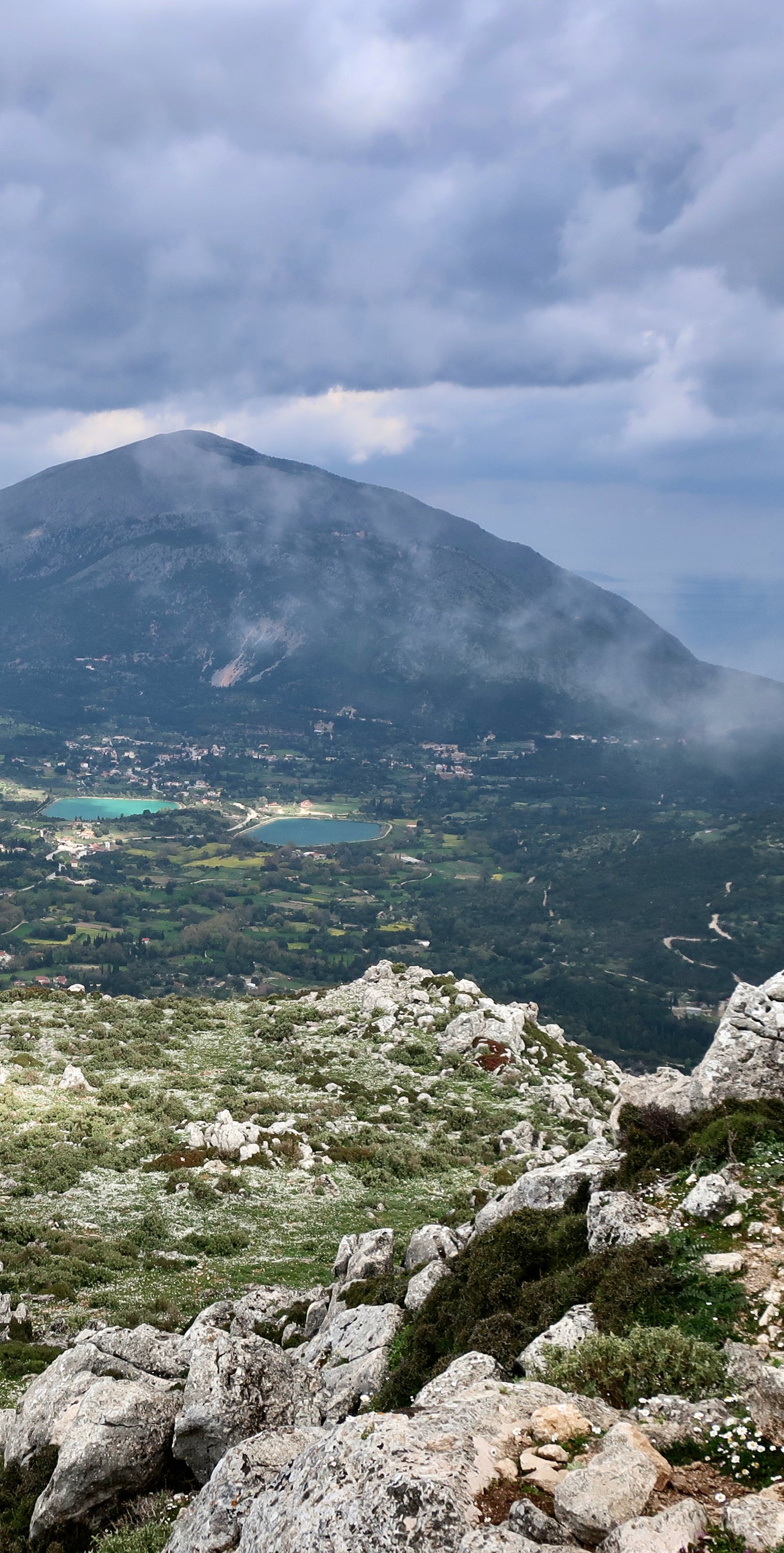
Mt Ainos, 1628 metres, is the tallest mountain in the Ionians. Because it’s so conspicuous, it’s easy to disregard Kefalonia’s other peaks. Near the port of Agia Efthimia, Agia Dynati rises to over 1100 metres, a line of wind turbines on its bare spine. South of Sami, past the ancient city of the same name now swallowed up by thick forest, past Antisamos beach where dark green tropical hills plunge into the sea, is Avgo, 930 metres. Further down the coastal range there are more summits, 1080 metres, 890 metres. Rising up almost vertically from the valley that practically severs the top of the island from the main bulk, another range climbs to over 900 metres. On a topographic map of the island the far south hardly registers, but the hill on which the ancient settlement of Paleokastro was built rises to almost 600 metres. Even down there, the lower end, the land is deeply rucked. And there’s so much more. The long central ridge around Mt Ainos is punctuated by mini-summits at 1500 metres, 1300 metres, 1500 again, 1100.
The highest mountain in the whole of England is Scafell Pike, 978 metres. Snowdon, the high-point of Wales, is 1085 metres. In Ireland, in the singingly named MacGillicuddy Reeks, there are three peaks at just over 1000 metres. Scotland’s Ben Nevis, 1345 metres, towers over them all.
Kefalonia measures 50 kilometres north to south, 30 east to west. It’s a whole continent in miniature.
The Greek islands are compact bundles of drama, cliffs and crags and peaks, with way down below beaches and bays and rocky spits and transparent blue-green water. Even without the thousands of years of history, the head-filling mix of thyme and sage in the hills, the uncountably numerous churches encrusted into the landscape, they are by any standards extraordinary.
***
On successive days in the highlands we met old Greek Americans guys. These wanderers who have returned home, all they want to do is talk. They want to tell you about leaving, It was the civil war, times were bad, there was no work, everyone was going. My father said to me, Leave. They want to tell you about that other life. It was in New York. It was in New Jersey. It was in Pennsylvania. There was work in the bars on the border between the states in those days because in New York you could drink at eighteen. Kids came from New Jersey, just across the line. They want to tell you about the wives they left behind. I married a Mexican, she was a good woman. I married a woman from Lixouri, she was crazy. A divorce here, a divorce there. I have two kids. They don’t come here. I have a boy, buried there, he got sick, and a son here. They want to tell you about coming home. I never stopped thinking about it. I didn’t come back for twenty-three years, not even a visit. I have land here. I returned for my son and he doesn’t like it, he says he’s going back. No-one bothers you over there, but these people here, they don’t make life easy. Me? I’m not going back, how could I afford it? I have nothing there now. They stick their hands out to shake and ask what we’re doing up here, out here, where there’s only ever them and the animals. Wossya name? they ask, and they introduce themselves, the names they were given over there. I’m Mickey, I’m Jimmy, I’m Nick. They ask where we’re going and they want to help, to show us the way. They point, and search for the words, but they don’t know them in English. They don’t know the word for gate or path or trail or stream, or turn at the almond tree, there in blossom, because those words they never used in New York or Pennsylvania or New Jersey. So it’s all pointing and hand gestures, down and round and this is the way you go good luck good luck.
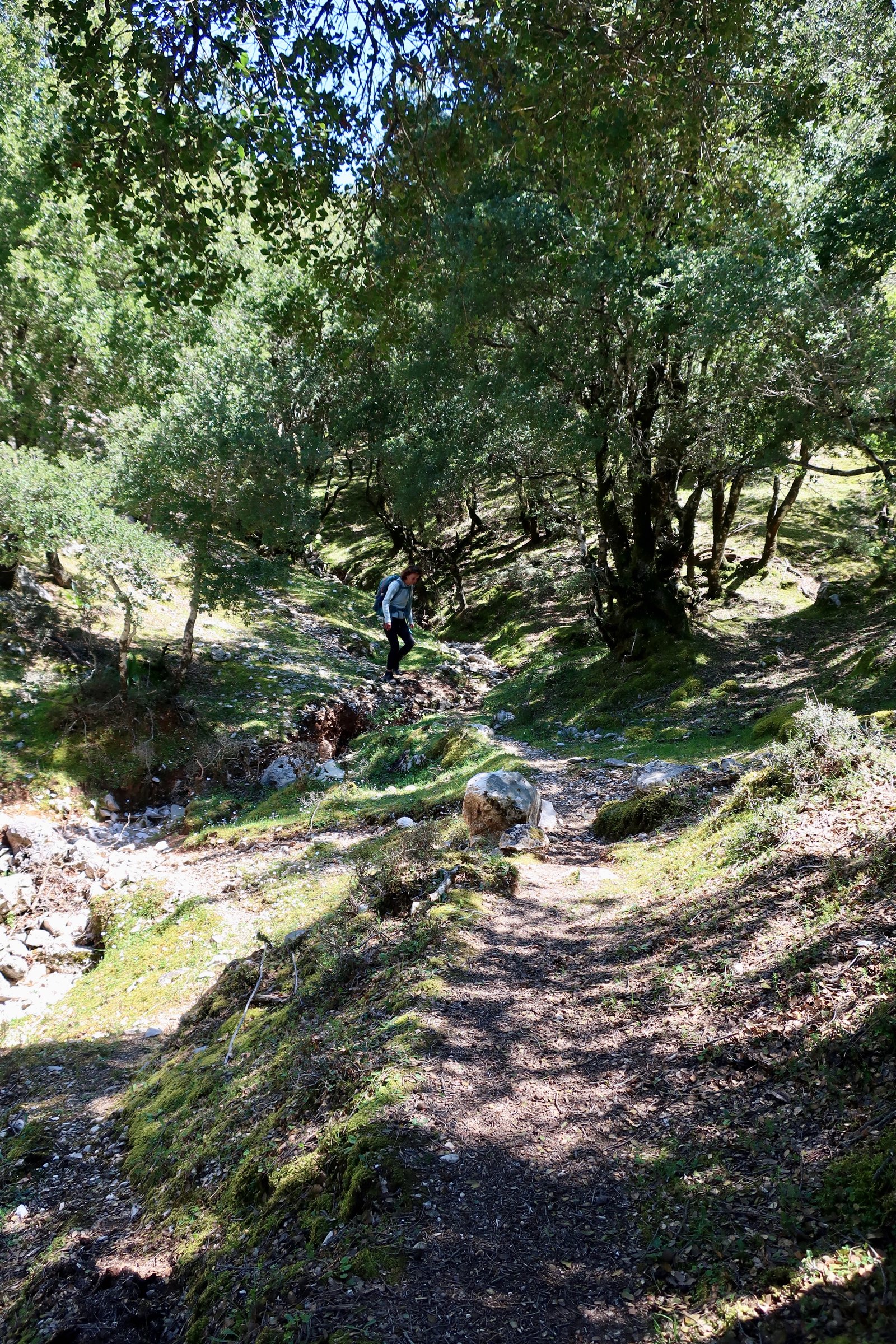
Kefalonia has ghost towns. The Greek islands are full of ghost towns and ghost villages, but Kefalonia more than most. In 1953 a huge earthquake killed six hundred people and damaged or destroyed most of the buildings on the island. The whole island was lifted by 60 centimetres. Lifted. In places around the coast they say you can see the old water marks on the rocks. Only the far north, Fiskardo, was relatively spared. Some places they rebuilt. Elsewhere they built new villages with the same name alongside the ruins, leaving the previous incarnations to fade away; the walls, the sucked-in rooves, the fallen beams speared into the earth, the old roads that never did get to see tarmac, the stone doorways still complete but there’s nothing inside if you go through them. The softness, the melancholy. The erosion, you can practically watch it happening.
Thirty-five thousand people live on the island, half of them between Argostoli, the capital, and Lixouri, just across the water from it. The rest are spread around. Argostoli on the map is a port, a great natural harbour, but when you get there the imagined bay past the town is more like a municipal duck pond it’s so shallow. Halfway down it there’s a footbridge, 700 metres from one side to the other. People stroll across in the evening. Runners jog it. Argostoli’s yacht marina is on the far side, separated from the town, a soulless place. The town was rebuilt after the earthquake. It’s busy. It’s clean. It’s hardly Greek.
The port of Fiskardo in the north, spared by the earthquake, is well on the way to becoming a parody of the prettiest, most perfect little Ionian fishing village. Just what you might see in a film. At ten in the morning at the end of April it’s bustling, being arranged for the day to come. Restaurants and gift shops and bars are polishing and ordering and organising. Already, the end of April, there are yachts in the marina in the film-set sunshine. At the same moment in Sami, the main port with ferries to Ithaka and Patras, there is the most profound sleepiness.
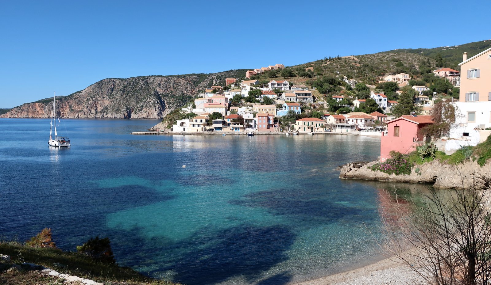
Assos, a little further south on the west coast is pretty too, but not as pretty, and besides, it has no marina. The position is wonderful, it has a cute bay, and past it, extending out, a thin-necked peninsula that swells to an almost-island on which there are the impressive remains of a huge Venetian castle, a whole circuit of walls. You can bring your yacht into the bay, but here’s the thing, be careful, watch the weather, it’s on the wrong side, completely open to the wind.
Poros-Lefkes in the southeast, the second port after Sami, takes ferries from Kyllini in the Peloponnese, just around the corner from Patras. On the Poros side of the almost twin-village there’s a long beach and holiday accommodation. Then, after a short interruption there’s the Lefkes side, with the port and houses built around a bowl of higher land that stretches out onto a stubby promontory. In Spring both sides are mostly still closed.
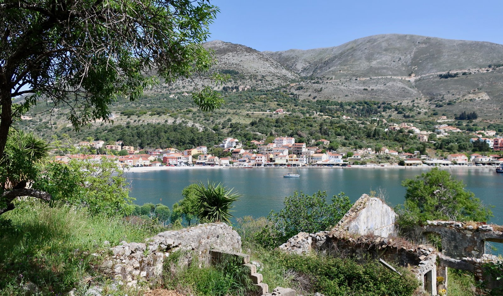
After the resorts – Skala, Lixouri, a few others dotted around the coast where there are beaches, and Agia Efthimia, a small, sheltered fishing port on the opposite side of Sami bay – there’s finally Sami. The town is nondescript, the position splendid again, a huge bay looking over to Ithaka, only half an hour across on the small tub-ferry. There were two visiting yachts in April, just two, each carrying seven or eight elderly Italians. Such a lovely babble they made in the taverna in the evening.
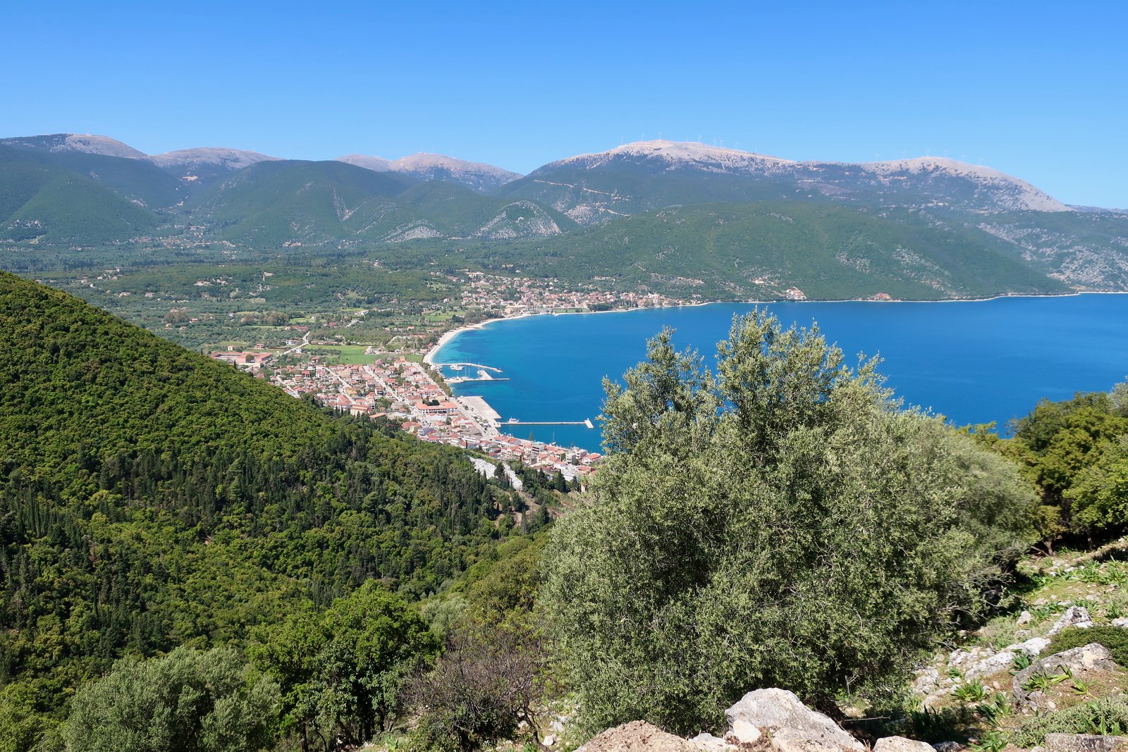
In Sami on Easter Sunday we went out for a drink expecting animation but struggled even to find somewhere open. Eventually we found a bar, where the barman said, I can give you a beer, but you’ll have to drink up. The church service began at eleven. All the old people were there of course, but also all the children, the middle-aged people, even the teenagers. Far too many to squeeze inside. Everyone but teenagers old enough not to have to stand with their families had a candle, one hand cupped about it to keep the flame from the wind. Our barman from earlier in the evening stood just in front of us, he too with a candle. The priest’s robes glittered. We all processed down to the seafront at midnight, the whole town chatting, meandering, protecting our candles. All the icon-kissing in the church having been done, all the silent prayers having been said, it was on the seafront that on the stroke of twelve the priest intoned Christ is Risen, Christ is Risen. The crowd mumbled the response and the few boats hooted their klaxons and the teenagers let off handfuls of bangers.
Then the bars were full. A long night in Sami. Hours later in bed we could still hear the strains of it.
In the Greek classical period Kefalonia was dominated by four independent cities, the Tetrapolis. One city in the south, one in the north, one each east and west. No doubt there were periods of accommodation and periods of conflict between them. In the north, near Fiskardo, there’s little left. In the south, at Palaeokastro, nothing but a hilltop. In the west near Argostoli are the sparse ruins of the city of Krani, some sections of classical wall that climb up a shallow hill, others bits of wall that are geometric, polygons or polyhedrons, with irregular-shaped but perfectly interlocking stones. The finest remains are at the ancient city of Sami, overlooking the modern port. Two hilltops, with a slinking, low valley between them, down which at least one length of wall still plunges. The full area occupied by the city must have been enormous. You walk around it trying to make sense of it, to make of it more than just these last few most resilient pieces of stone, but as always, there’s no comprehensible place for actual people to live among the leftovers.
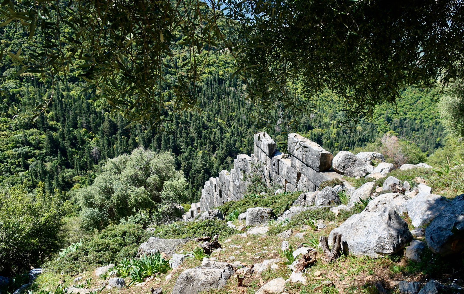
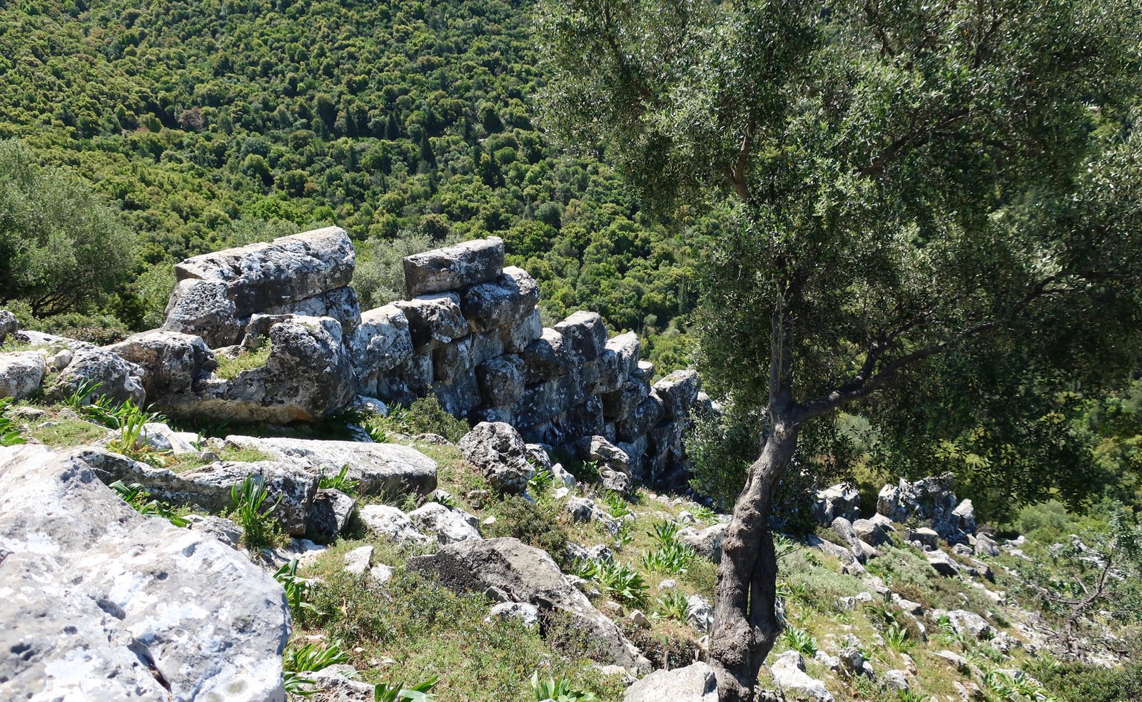
The ruins on both hilltops, but particularly to the east, are mostly in forest now, that opens and closes around lines of walls, wall-foundations, open paved stone floors. Branches thrust their way between courses of stone. The hillsides are lumpy and green, a skin having formed over the tumbled, dislocated bits of city. On the way down to Sami from Fanente, the more western hilltop, there are short sections of ancient wall randomly hidden in the forest.
There’s so much to Kefalonia. We’ve been twice and haven’t seen it all. You could cut it into pieces and make several normal-sized islands. The tacit logic of this almost corresponds to the Tetrapolis of ancient times, except that Paleokastro in the south shouldn’t be where it is, but on the Paliki peninsula in the west, which some scholars have suggested was actually ancient Ithaca. Who could have imagined, more than three thousand years later, Odysseus being placed and replaced, as if the gods were still moving him like a game-piece in an old film, his path, his landfalls and here even his island-home.
HIKING
Kefalonia is a badly-organised hiking island. It’s light years away from Kea or Sifnos, Tinos, Andros or Kalymnos or so many others. In spite of this it’s a wonderful place to go walking. The concentrated drama of so many mountains in such a small area, the unreliability of the dotted Anavasi paths but also the fun of them, never quite knowing what they’ll be like, the adventure of it, makes for a different sort of Greek island hiking.
The only map we found was an Anavasi, on which there are seven marked trails, none of them longer than 7.5 kilometres. As well as being short, they aren’t practical in a hiking sense in that most of them are linear. A way has to be found to make loops of them, or to organise drop-offs, pick-ups. Even then, a five or six kilometre stroll is not quite hiking, and all seven trails can’t possibly be done from one base. Kefalonia is too big and the bus network too poor, mostly fanning out from Argostoli, the most unsuitable of the main settlements from a hiking point of view.
In addition to these seven trails, the Anavasi map has at least two dozen dashed/dotted but unnumbered trails of varying length, about which it’s not possible to presume too much. We did several of them and each time found some markers at least, that petered out or led us astray. Others may exist fully, partially or not at all.
On the internet there are various offerings. The Kefalonia Geopark site proposes five short walks in the vicinity of Mount Ainos. Alltrails is messy as always, full of repetitions, inconsistencies, confusion. Topoguide isn’t much different. A few local operators offer guided walks.
There are almost no stone-laid paths left on the island. Before going we read that they’d been covered up, implying a wholesale flurry of destruction. Possibly this eradication was framed around the need to modernise. Possibly it wasn’t framed at all, just mechanically done in that window between the end of all-consuming agriculture, which represented stability and immutability, and this new, brash, holiday-tourism world, within which as the past has disappeared, there’s a dawning awareness of cultural loss, historical value. A too-late poignancy.
The hikes we did were mostly, though not exclusively, based on the seven hikes of the Anavasi map. Sometimes we added sections before the Anavasi hikes begin. Sometimes we added sections after. More often than not we added bits before and after in order to make them circular, or at least so that we could, one way or another, do the hikes and manage to get to and from wherever it was we were staying.
The following are in no way definitive. They could be done quite differently, and there are very many more possibilities.
Take the Anavasi map, with its yellow trails, its black dots and dashes, and make your own.
HIKE 1
Poros to Anninata and Paleokastro on asphalt road, dirt road, track, cross-country. Then to Spathi. From Spathi to the coast on Trail 6 of the Anavasi map. Along the coast on the road all the way back to Lefkes-Poros.
About 30 kilometres
This is mostly track and road, not trail. It’s the only way to do a loop from Poros-Lefkes and take in the southeast of the island, including Paleokastro and Trail 6.
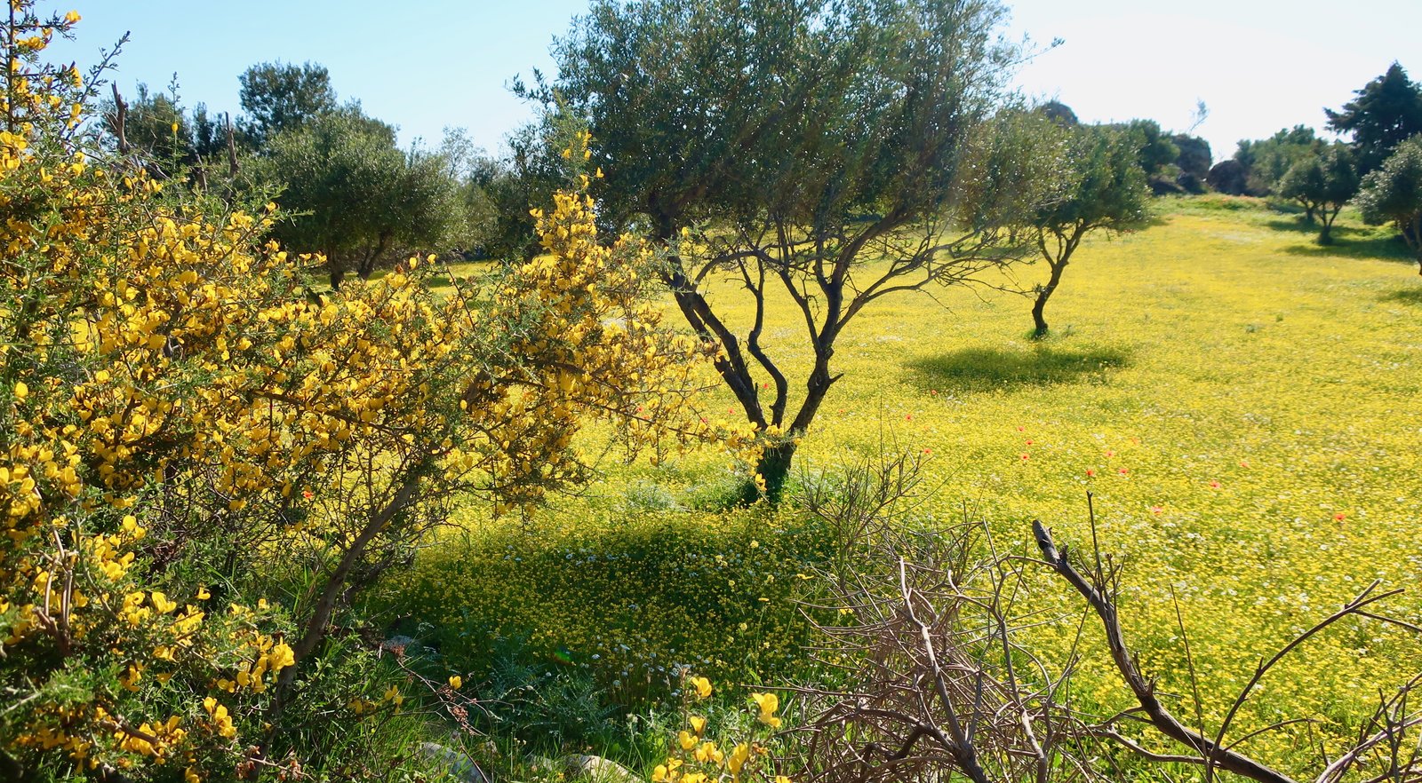
Early April in the Ionians, going due south out of Lefkes towards the village of Anninata, there are olive trees in fields of yellow Bermuda buttercups as deep as duvets. Unlike most of the abandoned villages on Kefalonia, Anninata is in good order. A farmer we met told us everyone had gone to Poros, as if Poros was the great metropolis sucking them in. When we said we were going to Paleokastro, he shook his head. (People who belong to the places we walk through always, always want to know where we’re going. The oddness of strangers out there in their world is hard to fathom.) He said it was high, that even he had never been. We looked across at it, no more than two kilometres in a straight line, the summit less than 600 metres. You really would have thought, at some point in a long life spent right here, there would have been an occasion…
On the internet we’d seen a photo of bits of massive classical wall, marking where the ancient city used to be. We looked and looked and found nothing. Days later we realised the photo we’d seen was of the walls at Krani, near Argostoli, wrongly labelled. It doesn’t make any difference, we’d have gone anyway. To walk through the site where the city used to be is enough. And the view from the rocky top of the hill is fine, down to the village of Agia Eirini, the twin green lakes near Tzanata that are like eyes. Behind them the moulded shape of the whole coastal range all the way from Poros to Sami.
Rather than go back down the way we came, we went cross-country from Paleokastro to the lane that leads to Spathi. It’s not as easy as it looks. You can get through, but it’s Greek-island tricky in places, steeper than you’d think, the undergrowth more dense.
From Spathi we didn’t find the beginning of Anavasi Trail 6. But on the map it clearly follows the water course much of the way to the coast, so that’s what you do. After the hilltop at Paleokastro, a landscape of rock and stone and wind splattered in springtime with white daisies, within a couple of kilometres you descend to this plush, green stream, with pools deep enough to plunge into and stones and logs to hop across from one side to the other and moss everywhere.
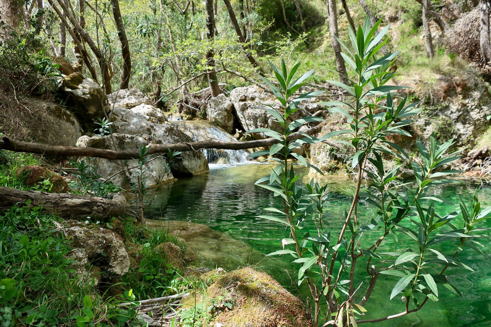
When the sides of the small gorge begin to close in, becoming awkwardly steep and narrow, Trail 6 diverts off to the left and becomes a dirt track down to the coast.
The walk back to Lefkes is along a classic, driveable coastal road, past the ancient Doric temple of Agios Georgios, where there’s nothing but the ground-level sketching of some walls. Seven kilometres, flat, quiet, always on the sea, the sort of road that might fill the title-sequence of a 1960s film, Cary Grant in sunglasses on a Mediterranean holiday sweeping back and forth in a soft-top sports car.
HIKE 2
Along the coast on a dirt track that goes north out of Poros until a point at which a faint dotted line on the Anavasi map climbs steeply up to about 600 metres. Left onto a track at the top of the path, then a right-hand turn at the end of this track down another trail to Monastiraki. From there a climbing trail around Mt Atros, up and over a col at about 600 metres, to the Theotokos Monastery. Then down another dotted trail almost to the coast and in to Poros.
Approximately 22 kilometres
(There’s a coastal path that goes all the way from Poros to Antisamos Beach, via Trail 4. From there you can walk in to Sami. We’ve separately done the top section and this bottom section and would like to do the whole thing. The problem is, it’s about twenty-four kilometres to Sami, and then you’re stuck. There are no buses in either direction, at any time of day.)
From the centre of Poros, we followed the coastal track north for about five kilometres, then turned left at the point on the Anavasi map at which, in theory, a dotted path heads straight inland uphill. There is no marked trail. If you don’t have the Anavasi, it’s where the coastal track makes a clear W or M-shape.
The lower slopes are the graveyard of a very old, terraced, olive grove. Some of the terracing is still intact, but much of the stonework has slumped with gravity and time and become dispersed over the slopes. Here and there are the ruins of old stone buildings. All of it is white and sun-bleached, like bones. The olive trees here are among the biggest, oldest we’ve ever seen. We saw one in particular that has split into three separate trunks and is at least six metres across at the base.
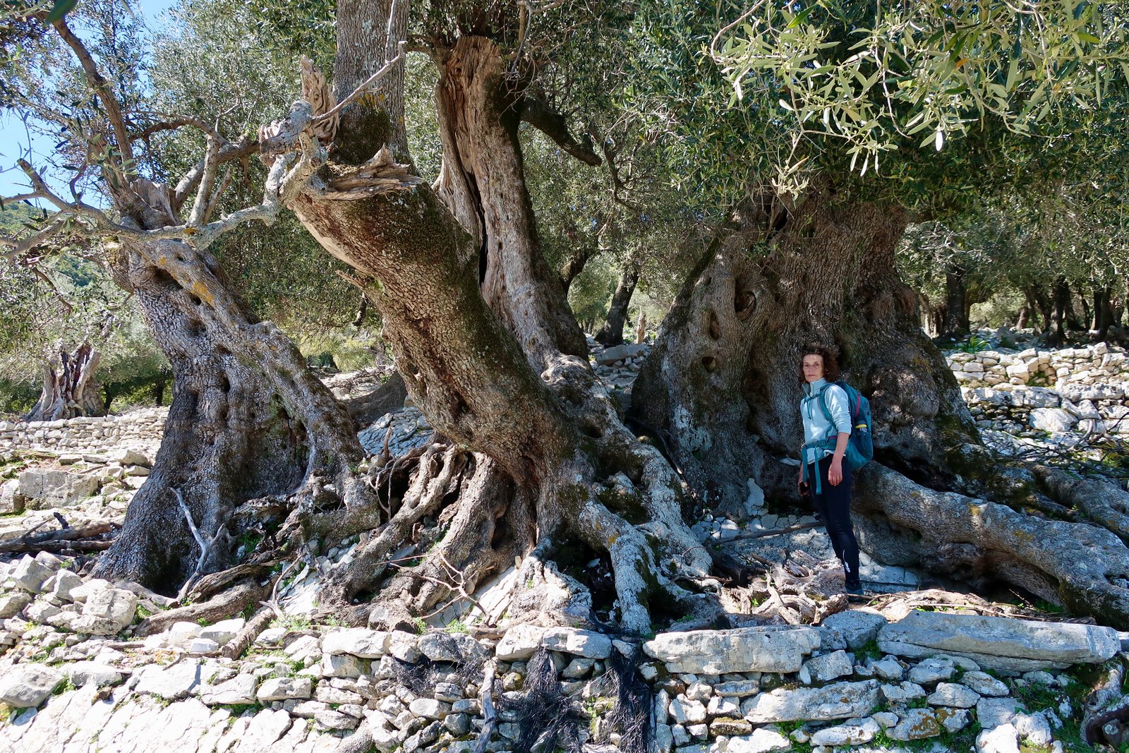
With logic and a bit of luck we managed to cross the faint cleft of the shallow fold on the left of the olive grove, just visible on the map, at exactly the right place. Here it makes little difference because the fold isn’t deep and you could just as easily cross higher or lower. But all through the islands there are crossing-points over similar rucks or folds, where often you have no option but to find a precise spot. Sometimes, having lost the path, or the so-called path which has actually long ago ceased to exist, we’ve had to walk up and down along the edge of a ruck, which may have taken on the quality of a small gorge, with little cliffs, scouring the sides for the way through.
The scale of the map is really too big for this much detail. To stay on course you need to make use of contour lines, bearing, and probably phone GPS.
Soon after, having moved from olive grove to open woodland, we found ourselves on the remains of a beautiful old stone-laid path. It zigzags its way uphill through the woods. Sometimes it becomes faint and you have to concentrate not to overshoot the sharp corners as it climbs through mixed olive, holly oak and scrub.
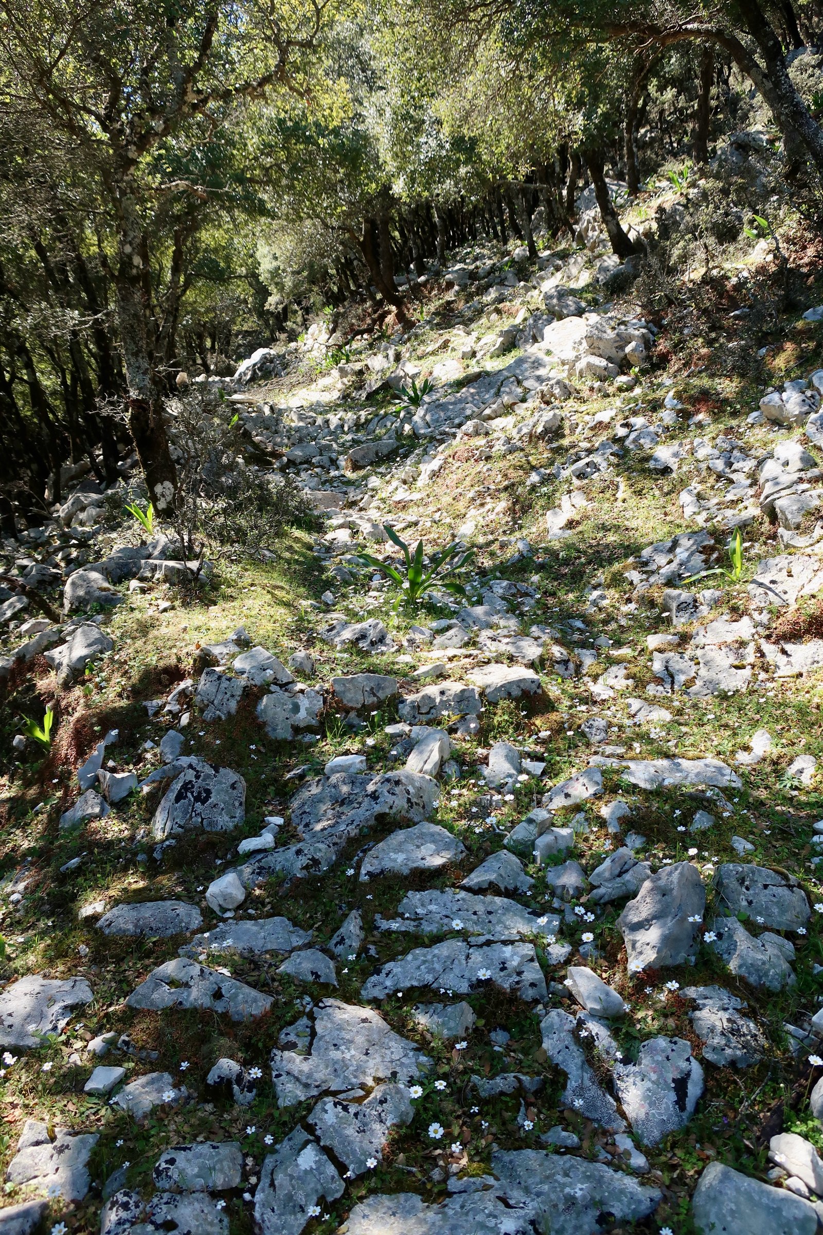
If you hike in the islands, once in a while you may be lucky enough to come across an old trail like this, quite unexpected, that feels thrillingly like a thing unearthed, a lost city, a tomb. Perhaps very rarely an old farmer still comes this way. Perhaps not even. Sixty years ago there were two hundred olive mills on Kefalonia. Now there are a dozen. The farmers go, the paths fade, but the olive trees persist, impervious to abandonment.
At the top of the slope is a small green plateau. A short distance after it a dirt track, marked on the map, that runs through the high forest. We turned left onto the track, past the church of Agia Paraskevi, went to the track’s end where there’s a small agricultural dwelling, and dived down right towards Monastiraki through woods studded with olives and clumps of almond trees. The path follows the vee of the valley. It bends left towards Monastiraki in a deeper fold, coming out of the cleft on the left-hand side of the gorge as the view opens up towards Kefalonia’s central valley, the long ridge of Mt Ainos national park in the distance.
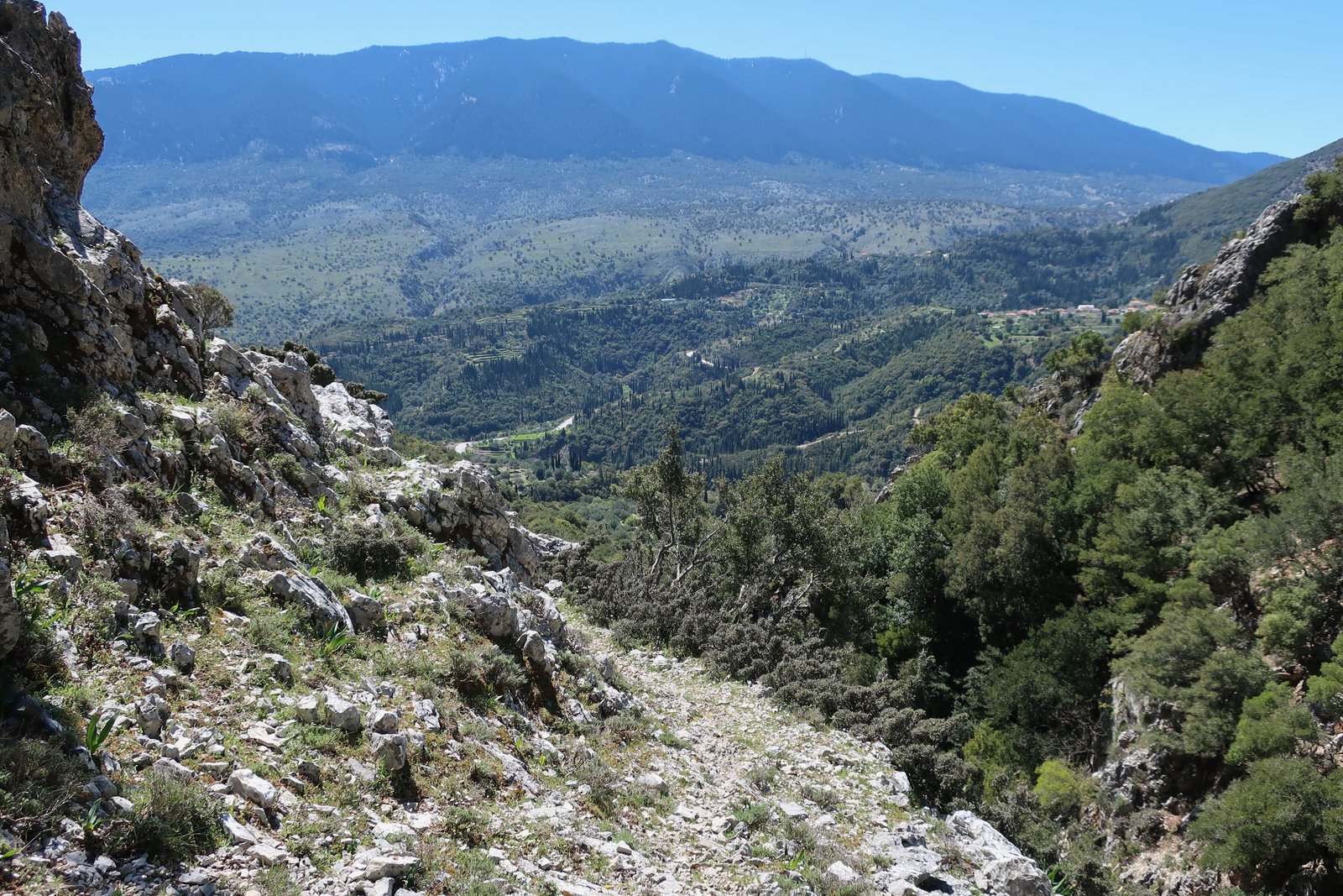
It led us directly into a smallholding at Monastiraki, almost a farmyard. I think maybe we should have turned left a short distance before. To try and reconnect with the dotted path on the Anavasi map that goes to the Theotokos Monastery, we went over a fence into the grounds of an abandoned church/monastery, avoided a small bull, got lost in the thick woods behind, climbed over several more fences, up steeply through the woods in approximately the right direction and, eventually, came out onto more open land. Again, it’s map, contours, GPS, logic. There are no ravines or cliff-edges to worry about.
And then the miracle of red dots marking the way. Almost a thin orangey-dirt path even, between rocks and thyme bushes.
The previous day from the top of Paleokastro we’d looked across at this last low hump before Poros. But it’s impossible to even begin to understand what this land is like, how unexpected and wonderful. Climbing up through rocky terrain, there’s plateau after plateau, perfectly flat green spaces, like pools, or bizarre sports terrains around which neolithic spectators might sit to watch some prehistoric mountain game. Level after level, more green pastures and sometimes clumps of strawberry trees just coming into blossom.
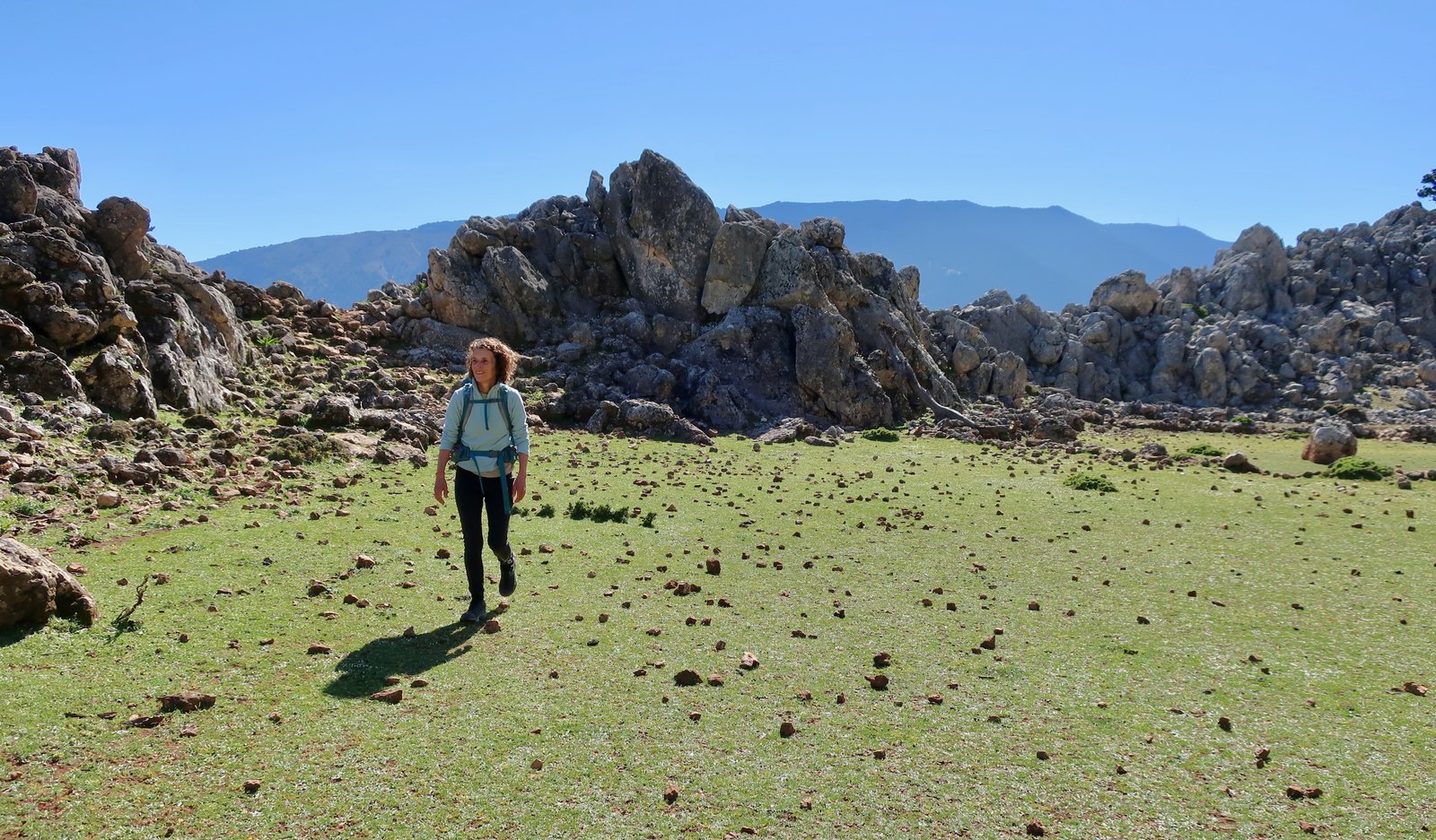
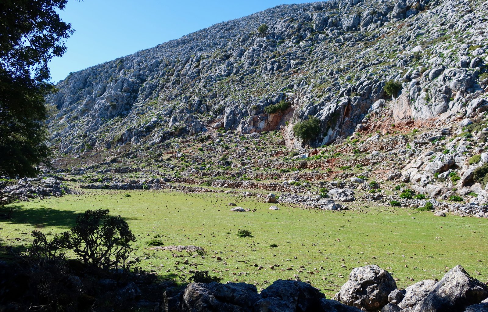
Finally, we entered a thick, dark forest, thinking we must have gone wrong, but in a few minutes came out on a slope above the Theotokos Monastery, at an altitude of 760 metres. It’s the oldest monastery on Kefalonia, dating back to the 8th century. Some of the buildings are in ruin, others still habitable. It looks more like a great lord’s manor than a monastery and has panoramic views down to Poros and over to mainland Greece.
The dotted route on the map down to the coast begins behind the monastery and precisely follows the valley, straight down. There’s no actual path and no markings. It’s quite steep, through heavy, damp woods, back and forth across the base of the vee, slipping and sliding on piles of leaves and soft dirt.
***
At the beginning of the day we had no intention of even going up into the hills. We were just going to take a stroll along the coast. We spent much of the day not knowing quite where we were, and much of it not on any recognisable path. But we went over the bare bones of an ancient olive grove overlooking the sea, stumbled onto a stone-laid path through the woods, took the luscious trail down the valley to Monastiraki, went through pools of green climbing up towards the Theotokos Monastery and then down the steep, dark path down to Poros.
Such variety in one day. And all of it unplanned.
HIKE 3
The early morning bus from Poros to Atsoupades, a small village on the way to Argostoli from Poros. From there to Kolaiti, then on the dotted trails of the Anavasi map up to the ridge of Ainos National Park. Along the ridge to Mt Ainos (1628m). Down Trail 5 as far as Pigadia. Right onto the forest track at Pigadia. Back to Poros/Lefkes via tracks and lanes and eventually the main road.
Approx 40 kilometres, with about 1400 metres altitude gain
This was close to the upper limit of what is possible on a casual hike. The distance is challenging, the altitude gain is not inconsiderable, and the section between the church of Zoodochos Pigi and Mt Ainos National Park, where we didn’t find a path at all, is very steep and difficult.
You don’t have to do it all. The long walk home at the end of the day could be eliminated if some way could be found to get back to wherever it is you want to get back to from wherever you are when you finish walking.
Or the day could be otherwise organised. You could go up or come down another way. You could do it in reverse, although the absence-of-path we came up on I think would be even more difficult on the way down. Usually, when there’s exposure or complication or just when a path is particularly steep, up is easier than down. This seems counter-intuitive until you think about it, taking logic to its extreme, and imagine a cliff.
Just, before chopping this hike into several easy pieces, there is a link between effort and satisfaction. It isn’t hard and fast, but is very often clear enough to be compelling. It’s okay sometimes to be utterly, memorably, exhausted
***
The path from Kolaiti to the church of Zoodochos Pigi at about 800 metres is a lovely, traversing, climbing, mountain trail. The beginning is easy to find, exactly where the Anavasi map says it should be on the switchback corner of the track above the village.
The green arrows that at first mark the path pretty soon die out but are replaced by red dots. Follow the red dots. At a certain point the red dots too disappear. But it doesn’t matter because by then the path has become obvious, swinging around the slopes then moving into deepish, lowland forest, which is light and green and sunny, nothing like the heavy blue-grey of the second part of the ascent to come.
Maybe the last few hundred metres before you hit a small lane and then the church are a bit confusing. But only a bit. Keep on heading up. There really is no easy way to go wrong.
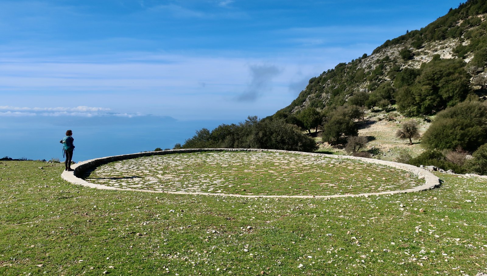
The church is in a flat grassy place. Nearby is the biggest threshing floor we’ve ever seen. Looking due south in the direction of Zakynthos, there’s a wide, flat coastal plateau of farmland down below. All of it is still cultivated, meticulously partitioned into hundreds of irregularly-shaped fields and orchards and olive groves, as perfect and neat as embroidery.
Between the church and the entrance to the National Park, which is about seven hundred metres higher and probably less than three kilometres in a straight line distance-wise, we saw not a hint of the path that the map says is there.
This whole section up to the top is through heavy pine forest, and is very tough. The incline in places is about as steep as possible without having to use hands for scrambling. Unusually for Greek island walking, where the land is most often baked rock-hard, there’s little firmness to the slopes. Sometimes there’s a stone or a branch to use as a platform, but much of the way is on mulch, the undisturbed droppings of years, a soft and shifting layer of pine needles and dirt that moves underfoot. You step up, and as you put your foot down it slips backwards a certain distance, before the piling up of soft matter reaches a critical point and brings you to a halt. Pushing off is the same. Often the foot left behind slips a little backwards during the transfer of weight. It’s like a sand dune, or fresh snow, on which it may be better to take exaggerated zigzags rather than trying to plough straight up.
For someone pretty fit, and willing, it’s fine. I don’t want to exaggerate. But it’s quite hard work.
If you stay on course, which means staying close to the ridge of the mountain, not clearly defined, eventually you’ll come to a point marked as the entrance to the Park – which is like every other point except for the little sign telling you you’ve arrived. I have no idea if we were lucky, astute, or whether perhaps the topography naturally funnels anyone coming up this side towards the right place.
The walk along the high ridge is exhilarating. The path moves through forest-and-rock at first, then bare rock, with patches of cloud hanging on the western flank. There’s a wonderful panoramic view south to Zakynthos, northeast to Ithaka, north to Lefkada and the smaller islands around it, east to the mainland. In April there were still shady patches of late snow, with brown pine needles embedded.
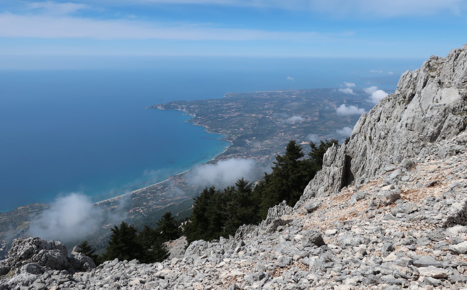
Despite the mountainous terrain everywhere in the islands, it’s unusual to get such an open impression of height. Lourda Bay, a 4 km curve of sandy beach, is straight down, with nothing in between to diminish the feeling of altitude except, when we were there, about halfway down a perfectly horizontal, patchy, torn, layer of cloud.
Trail 5, much of which is pole-log steps, descends about 800 metres through the trees to Pigadia. Then a right turn, then left, zigzagging down to Andriolata. This is a surprisingly nice track, in theory wide enough for a vehicle, but no-one ever drives here, so that really it’s just a broad footpath, with a lot of yellow-green euphorbia and holly oak and almond trees. There’s just a thin trace here and there through the layer of daisies to mark where someone, or something, has been before you.
The walk back to Poros is a bit of a slog but that’s okay, we’re good with slog, we actually like slog. I think it would be impossible to do all this if you weren’t okay with slog.
On the map there’s a track between Andriolata and Tzanata, but I think it no longer exists. We had to muddle through, eventually finding some red dots that led us into Tzanata. The Mycenaean tomb between Tzanata and Poros, marked on the map, referenced on the internet, which looks very impressive, was closed when we tried to visit. One of the occasional disadvantages of travelling out of season on Greek islands.
HIKE 4
From Argostoli down to Trail 7 that does a loop up to the ancient acropolis of Krani, and continues on a dotted line (on the Anavasi map) back to the end of the bay and on to Argostoli.
Maybe 12 – 15 kilometres, with some exploring of the old site included
A very gentle stroll, with little change in altitude. The walls of the old city are impressive, clearly-differentiated chronologically and aesthetically between geometric on the one hand, standard rectangular classical on the other.
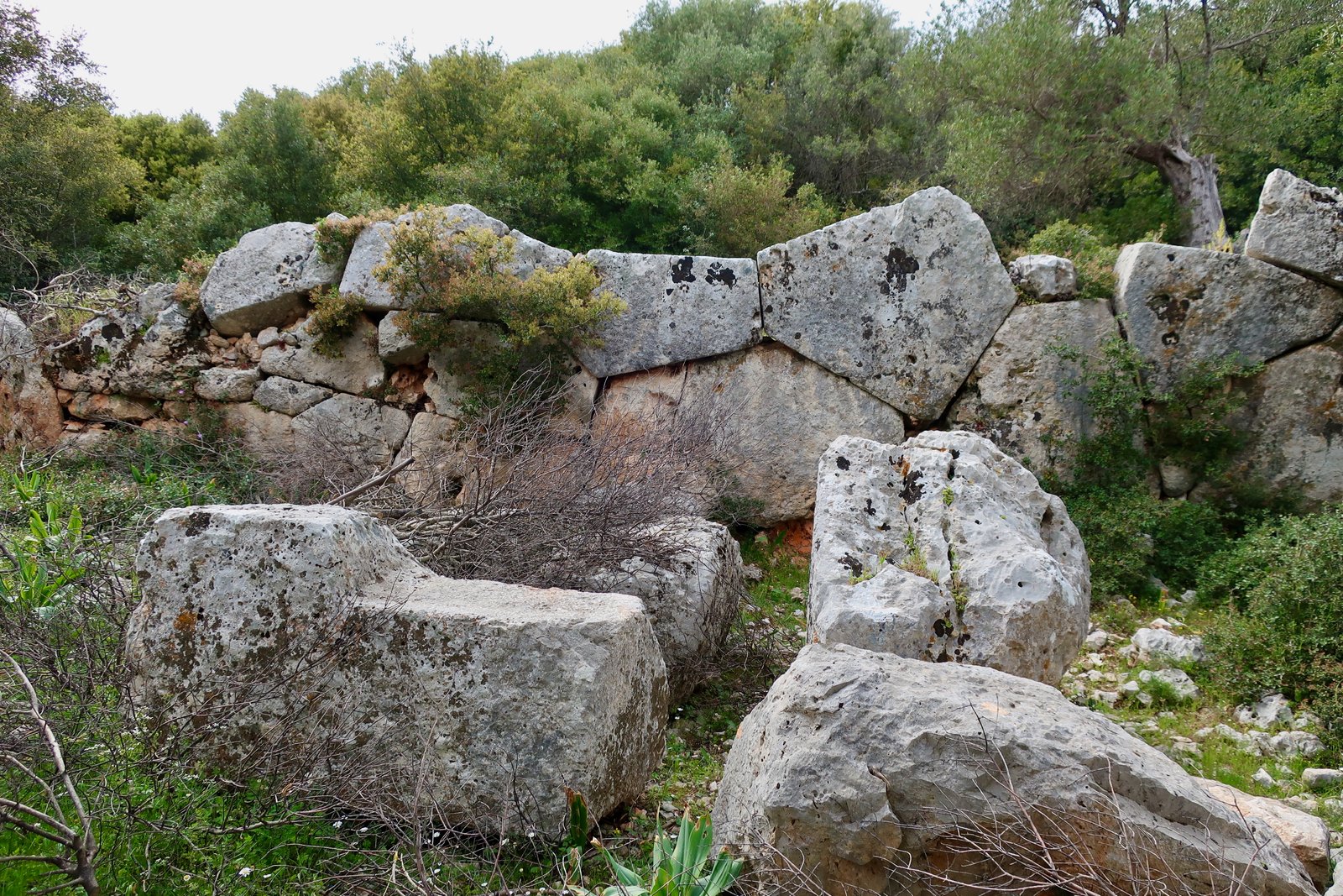
There’s a bat-cave on the path. You can climb down a metal ladder into a sinkhole-like depression. There were no bats.
HIKE 5
Around the coast from Sami on the road to Antisamos Beach, then Trail 4 as far as Koumaros. From there, straight uphill inland to the peak of Mt Kastri (909 metres). Then the left-hand trail of the two W/SW marked paths on the Anavasi map, to Palia Mouzakata and Palia Zervata. Back to Sami by some combination of road/track.
23 – 25 kms
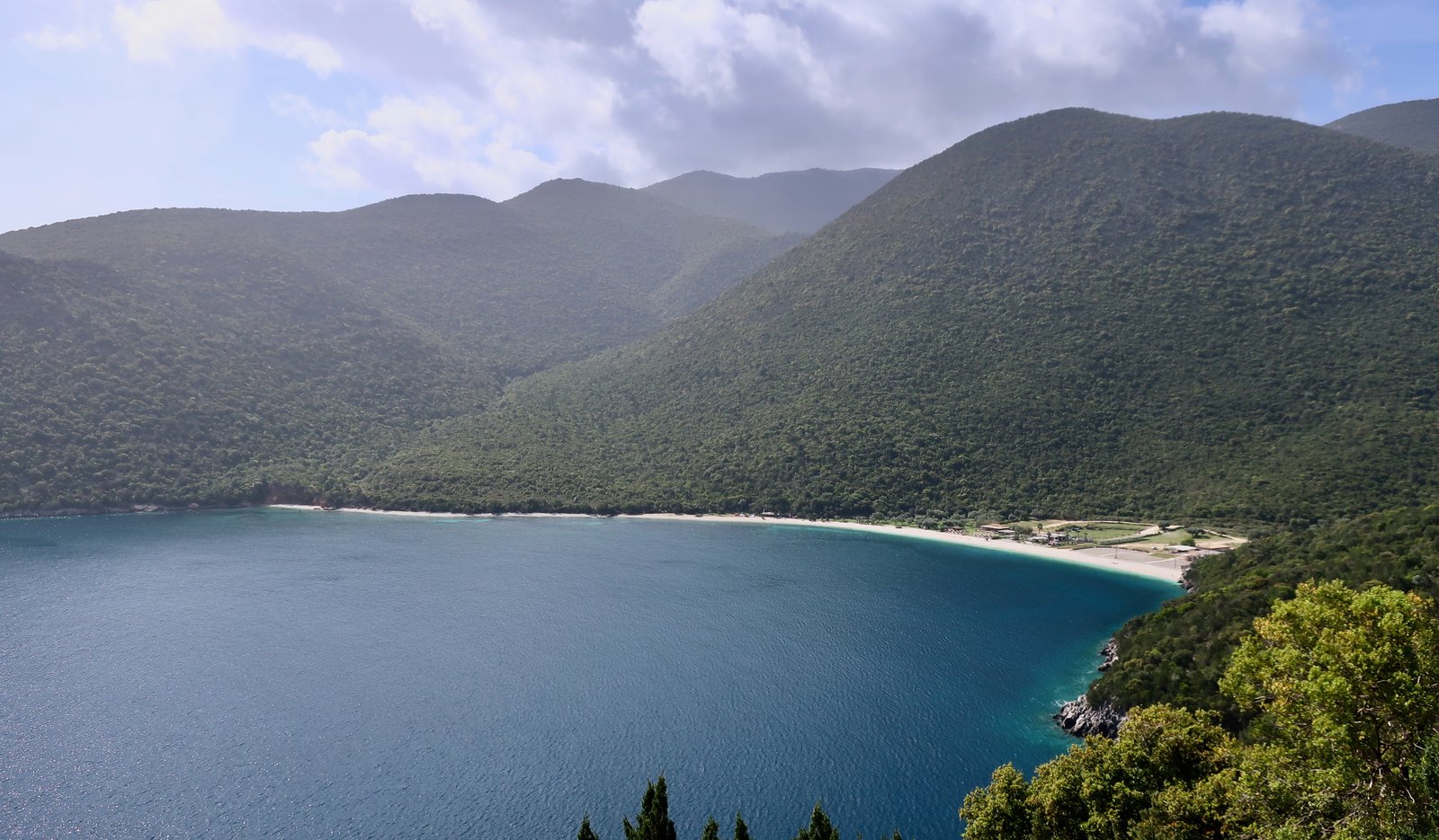
Trail 4 begins on very beautiful Antisamos Beach then climbs up through dense woods. The plan was to go to Koutsouria Beach, seven and a half kilometres down the coast, unreachable except on foot, there to swim, have lunch, sit around, then walk the same way back to Sami. Having arrived on Kefalonia on the early boat from Ithaka, too early to get into our accommodation, we’d left our bags in one of the ticket offices on the seafront, and needed to make sure we were back at the office before it closed. Just a gentle stroll then and a swim.
The trail goes from Antisamos Beach immediately into dense forest and low scrub. At Koumaros, inland on the ridge that goes out to the point of Cape Sykia, there’s a dotted line on the map. Predictably we changed plan and took it, thinking we’d go up this path to Mount Kastri and take it from there, depending on time – you never know what a path will be like, whether it’ll be quick or slow, whether there’ll be marks to guide the way.
At first, although the path barely exists, there are red dots, more or less followable with care. But it’s only really the presence of the dots that would lead you to believe there is a way through.
All the way to the first level, let’s say, we were finding dots. When they disappeared, we continued with the map and phone-GPS, saying
we’ll just give it five more minutes
ten more minutes
that ridge up there where the trees are thinner, we’ll see from there,
just around that corner
it’d be a shame to go back
we still have time.
At one point, in thick undergrowth, the rotting carcass of a huge horror-story billy-goat was suspended in a fig tree. It’s horns were hooked over the vee of two branches. It must have been tree-climbing, as goats do, enjoying a feast of figs, and slipped, and become trapped, its own weight forcing it down, with no purchase for its scrabbling feet.
The meadow at the top where we had lunch was a lovely Greek island high pasture, above the forest, open and green with a couple of big trees to sit under. The temperature was just perfect, sunny and warm but not hot. There’s a shepherd’s stone cabin up there, and sheep, so someone comes still. There was a skim of daisies. There was the curve of the land and the view over the centre of Kefalonia to the mountains on the other flank of the main valley.
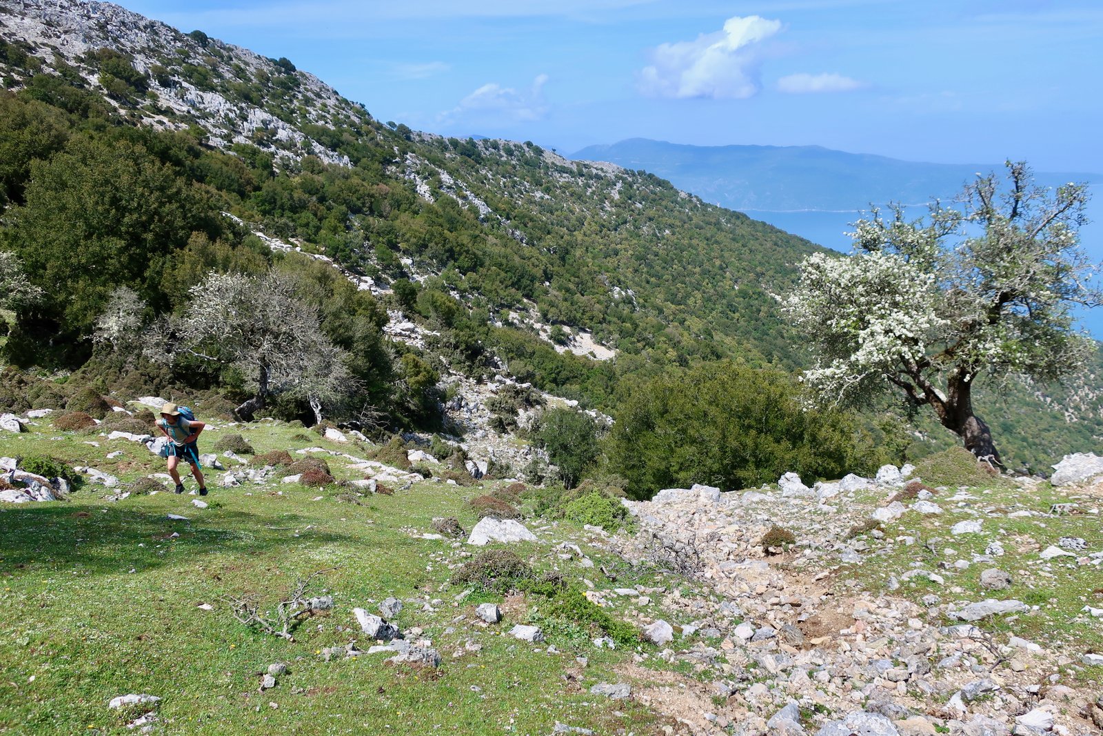
By this time we’d spent five hours walking, ten o’clock to three o’clock. The ticket office with our bags would be open until eight, then closed all the following day. Should we go back the same way or go forward, knowing the path was unlikely to be obvious? Going back is difficult. Fifteen minutes we said, just fifteen minutes, that’ll be enough to see how it is. We moved on at speed and took the left of two forks, not the one that goes to the summit of Mount Avgo, about twenty metres higher than where we were. There’s a red dot on top of the broad col and then a direction, straight down the joining-point of two slopes where after rain there must be a stream.
Just to the left of the vee of the water course there are occasional remnants of very old red dots, barely visible, more like lichen than paint. From time to time a blue dot too. The terrain is steep and loose, through thick woods with dense low growth. Without the hint of the path it would have been very difficult to follow. Near the bottom, after a rapid descent down to about 400 metres, the dots disappear, but it doesn’t matter because by that time you’re close to the crumbling village of Zervata, abandoned after it was destroyed by the earthquake in 1953. Eight or nine hundred people lived in the village until the quake. Now it’s melting fantastically back into the ground.
There are various ways back to Sami from Palia Zervata, track and road, depending on time. We hurried along the roads and were back by half past six after yet another day of getting lost, approximating a way through, map and GPS. Hiking on Kefalonia is big hiking.
(On the map there’s also a path that goes from Koutsoupia Beach up to Kastri. Further south there are more, presumably partially-marked, trails in the coastal range between Sami and Poros, that we had no time to explore, up around the peak of Kokini Rachi [1079m], and from there either to/from the coast or inland. You could even cut through the middle of the island up to Mount Ainos. There are very many possibilities.)
HIKE 6
From Sami to Agia Efthimia, to Drakopoulata on the road. Half of Trail 3, then a turn off to the Panagia Themata monastery. Road and track to the beginning of the dotted gorge walk down to Agias Paraskevi beach. Down the gorge to the beach and along the road back to Sami.
Approx 27 – 28 kilometres
More than half the day on tarmac road. The coast road between Sami and Agia Efthimia is nice if there’s was no traffic. There wasn’t much when we were there in April, but still some. In season it would not be good.
Agia Efthimia is a nice little fishing port, rebuilt after the earthquake. Drakopoulata, two kilometres up the road, is almost a ghost village. Just a few houses are inhabited, either by old people hanging on, or new people, who’ve come to bring the village back from the brink. But most of it’s in ruin: roofless two storied houses of consequence, with walls still enclosing overgrown gardens; stone paths thick with nettles, wild fig, wild flowers, run between the houses; a disturbed snake in its panic whisked right between my legs – I didn’t see it until it was past, but felt it winding around my ankle like a breath of wind.
Trail 3 out of Drakopoulata must in its lower section have been the main stone-laid path from the village to the monastery of Panagia Themata. It runs through open woodland and olive groves, airy land covered in wildflowers when we were there.
The trail climbs a little towards the small church of Profitis Ilias, where we lost it. On the map the continuation looks straightforward and besides, since the wind turbines that the path leads to on the hilltop ridge at 1131 metres are visible, it probably wouldn’t have been difficult to approximate a route. However, having set off not as early as we might have done, having spent time in Agia Efthimia, having sat at Profitis Ilias drinking coffee and talking to another couple of hikers – a rare occasion, on any island, at any time of year – we were thinking that we’d no longer have time to get to the top of the mountain, the end of Trail 3, as we’d originally intended.
Instead, we doubled back from Profitis Ilias and headed for the monastery, which it turns out was reconstructed after the earthquake and now, compared to many wonderful Greek monasteries, looks a little bit like a high-end monastery-style hotel with attached picnic-space.
The entrance to the gorge is, as on the map, at the point of the switchback on the unpaved road that runs between the monastery and Karavomilos. You never know what a gorge will be like. Sometimes the sides are high and narrow and claustrophobic. Sometimes even when dry they’re impassable, with three- and four- and five-metre drops that would be waterfalls after heavy rain, for which a rope is necessary. And sometimes they’re like this one, a river of stones. Not something that looks like a river of stones, but an actual river of stones, where the force of storm water has carried them along. Here and there the floodwaters, when they come, have eaten away at the banks, low and wooded, causing trees to collapse into the stony bed. Some trees have had most of the bank washed away from underneath them, and appear to be standing on tiptoes, like ballerinas, on the ends of fine roots that were never meant to be exposed in this way. Here and there the tips of branches stick up through the bed of the stone river, the stretched arms of a drowning man, or as if there was a whole world under there, filled up with these stones that have been poured onto it.
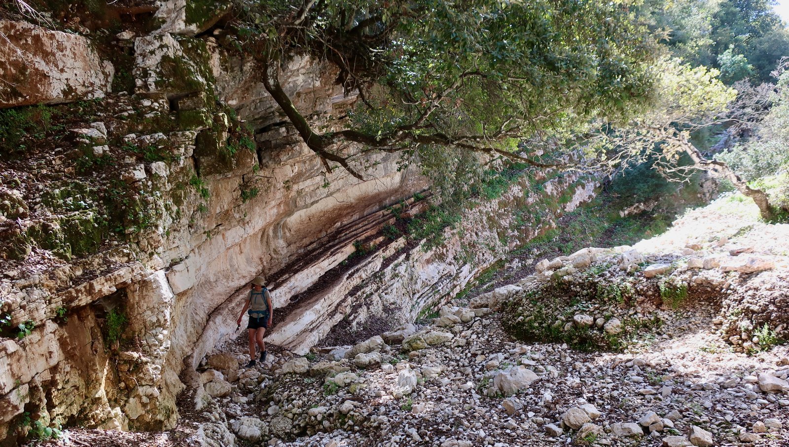
The land along the sides is mossy, damp. The walking is uncomfortable, the stones mostly too small for hopping, too big to be like beach-pebbles. There are venerable olive trees, the remains of old walls, the foundations of some circular stone constructions. When a full tree has tumbled across the course of the gorge, stones the size of hands, or skulls, pile up in its branches, caught like fish in a net.
At the bottom, near the road, we had to open and close gates. A farmer who looked as old as the olive trees, couldn’t understand that we’d come from the monastery, nor that we might have understood to close gates behind us. He went to check, muttering, imagining his goats, his sheep, lost and scattered through the hills.
HIKE 7
At the top of the island around Fiskardo there are maybe fifteen kilometres of trail. It’s all pretty flat, in a couple of places climbing briefly up to 200 metres. There are some nice short sections of stone path. Kimilia is stunning, beach and rocks for sitting and swimming. These are good holiday-walks.
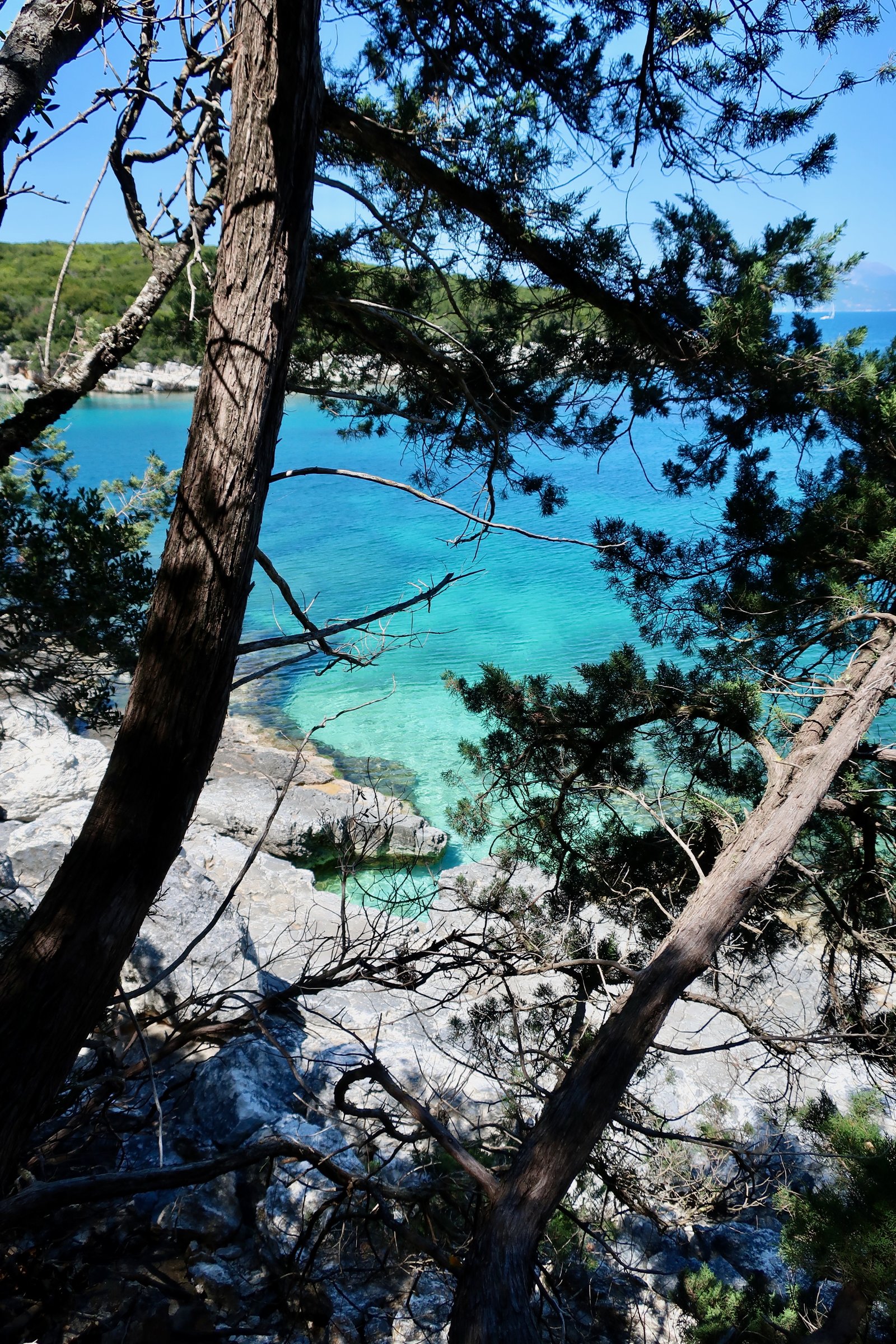
As mentioned previously, Fiskardo is very pretty, very popular, no doubt expensive. Extensive building is happening on the outskirts of the village. A couple of kilometres from the port a trail runs through the old village of Psilithrias, abandoned after the earthquake. It’s now in the process of being renovated, building by building, I suspect mostly by foreigners. It’s a very lovely spot, a foreign person’s dream of Greece, quite irresistible in its perfect state of dilapidation.