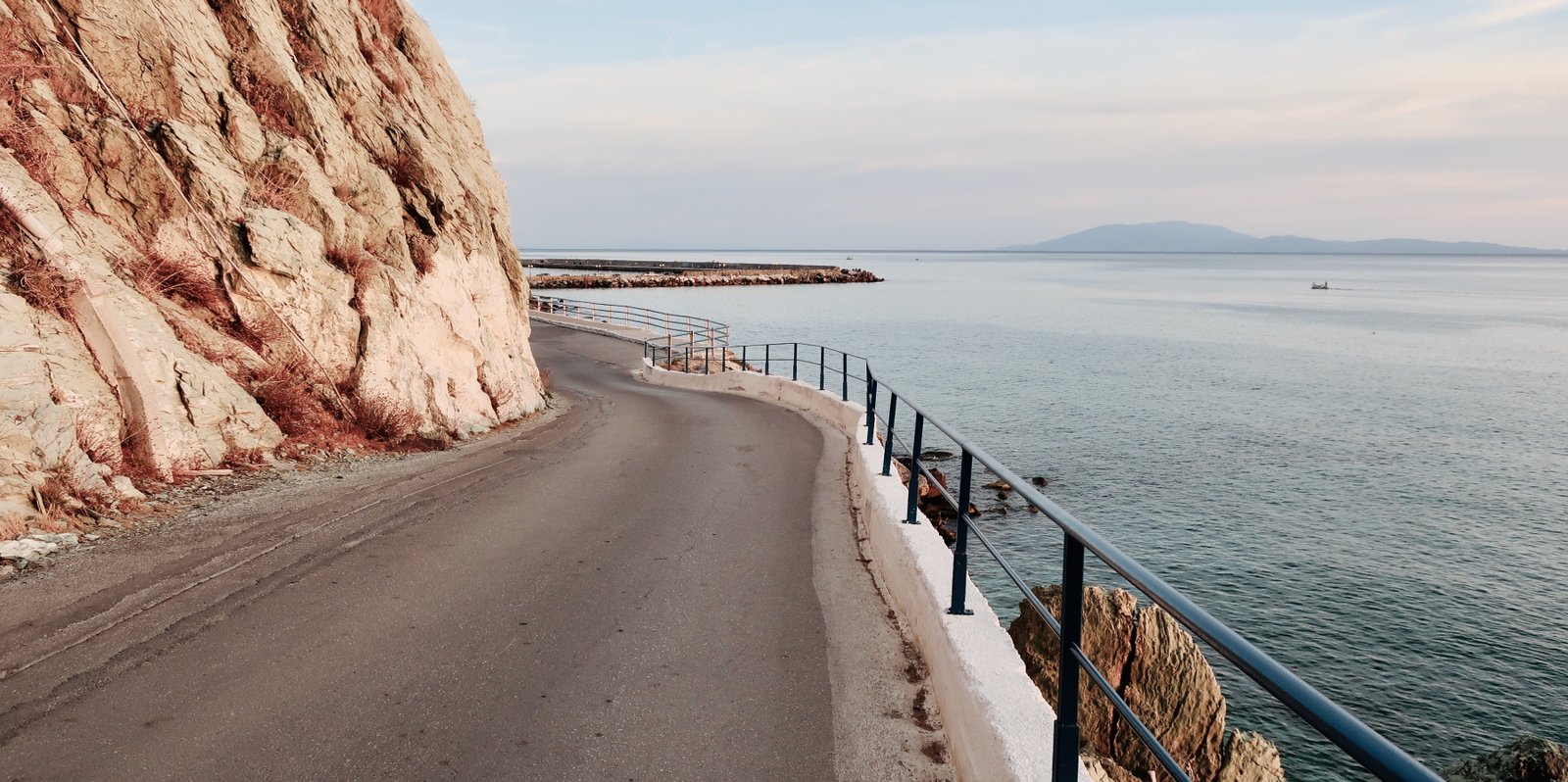
We knew surprisingly little about Lesbos before going:
– that it’s in the Northern Aegean, of course
– that it’s big – in the Greek Island hiking world, where size makes for logistical complication, Lesbos is a giant
– and that it’s one of the most tourist-oriented of the islands – not Santorini or Mykonos, but Kos perhaps
With only three hard facts – and incidentally the third one turned out to be wrong – we unthinkingly extrapolated a pre-visit reality. It’s not the first time we’ve done this. Whether it’s a Greek island or Paris or Tierra del Fuego, (we haven’t been, it must be cold and windy), it happens of its own accord.
When we eventually got there, by which time we’d been to almost all the islands – the only sizeable exception being Samothraki (partly because it’s hard to get to, partly just because somewhere has to be last) – it turned out that Lesbos, despite being big and in the Northern Aegean, wasn’t at all like we thought it would be. No island ever has been.
I recently came across an article by Victoria Hislop, who as well as having written about the islands, has lived in and travelled much among them. Such a shiver of confraternity when she writes that no two Greek islands are the same, that in fact they’re about as alike as Stratford-upon-Avon and Stratford in East London.
If you’ve not been to the islands, perhaps this is hard to believe. After all, the clichés of Hellenic insularity – the blue water and little ports, the common flora and fauna and landscapes, the overlapping histories, summer heat and tavernas with blue and white tablecloths – might be expected to outweigh any differences. But as other Greek-island obsessives will tell you, the difference is in the detail. Try as one might, it is impossible to accurately infer the soft, cobbled paths of Lesbos, the piratical ruckus of Fourni, the great guffs of grey cloud that wash up against the ridge of Ikaria. You have to go. You have to see it and feel it. Thankfully, there is no way around this.
***
Lesbos, having now been:
OLIVE TREES ABOVE ALL
Perhaps more than any other island – and that includes the great olive islands of the Ionian Sea – Lesbos is a land of olive trees. The production of olive oil, not tourism, is still the main source of income. When we were there in early autumn, preparations for the harvest were well under way, the nets into which the olives are made to fall spreading like an unnatural shadow through the groves.
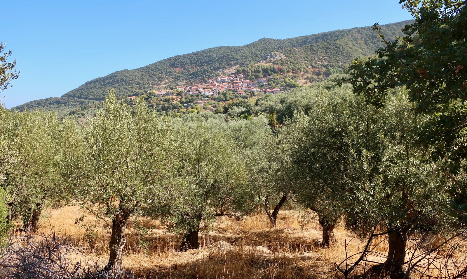
Maybe it’s because of the continuing importance of olive oil that lowland settlements like Kalloni and Agia Paraskevi seem petrified, singularly fixed in a pre-modern past, like dated old snapshots rarely these days pulled from the box of memories. The hill villages though are the same as other hill villages in the islands. Most of their inhabitants have leaked away. It needs more than just the olive harvest to hold them together. Passing through at the beginning of October, at most we see a few old people. Hiking, one day, we met a young Dutch couple, their first time in the islands. They were bewildered by the air of abandonment. They’d hiked to Assomatos near Agiasos in the southeast and found the shutters all closed. No café, no bar, one old lady feeding the cats. What happened? they asked.
Where to begin? The modern story of the islands starts with the opening up, after thousands of years of insularity, of all these closed worlds, the first apprehension of other opportunities beyond the endless toil of island agriculture – all that up and down, all that scrabbling through stony soil, the cycles of good and bad years. Even on Lesbos where the production of olive oil is still central to the economy, almost everything has changed.
COBBLED PATHS
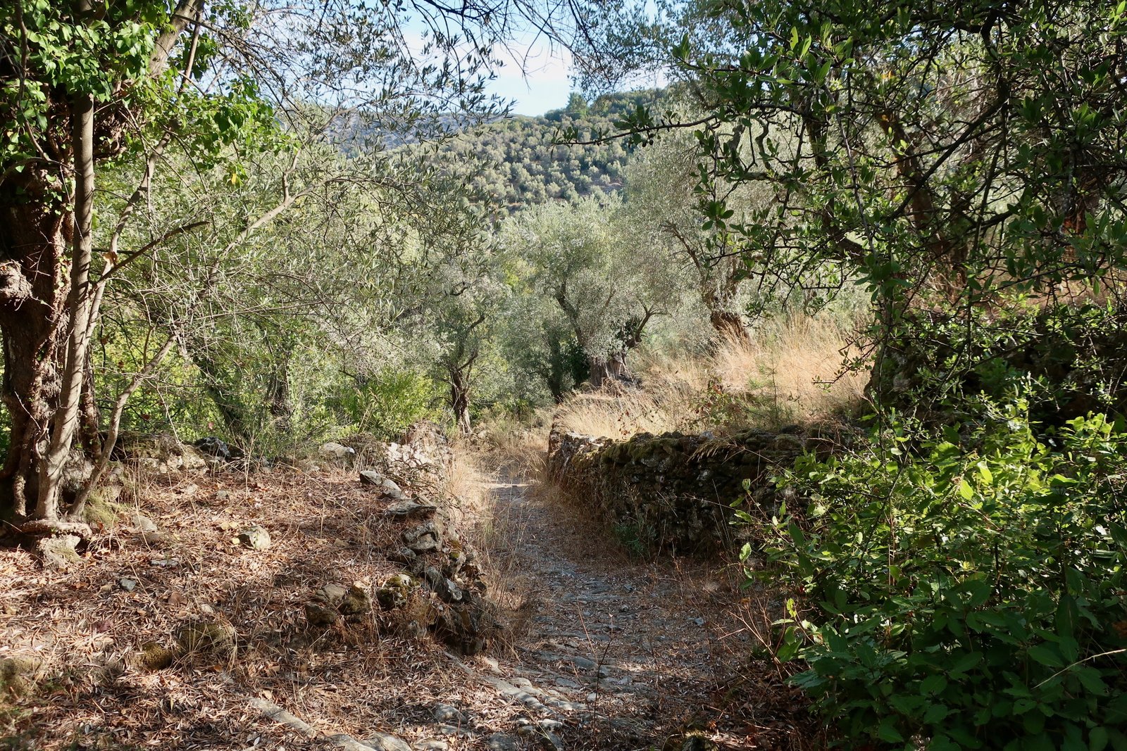
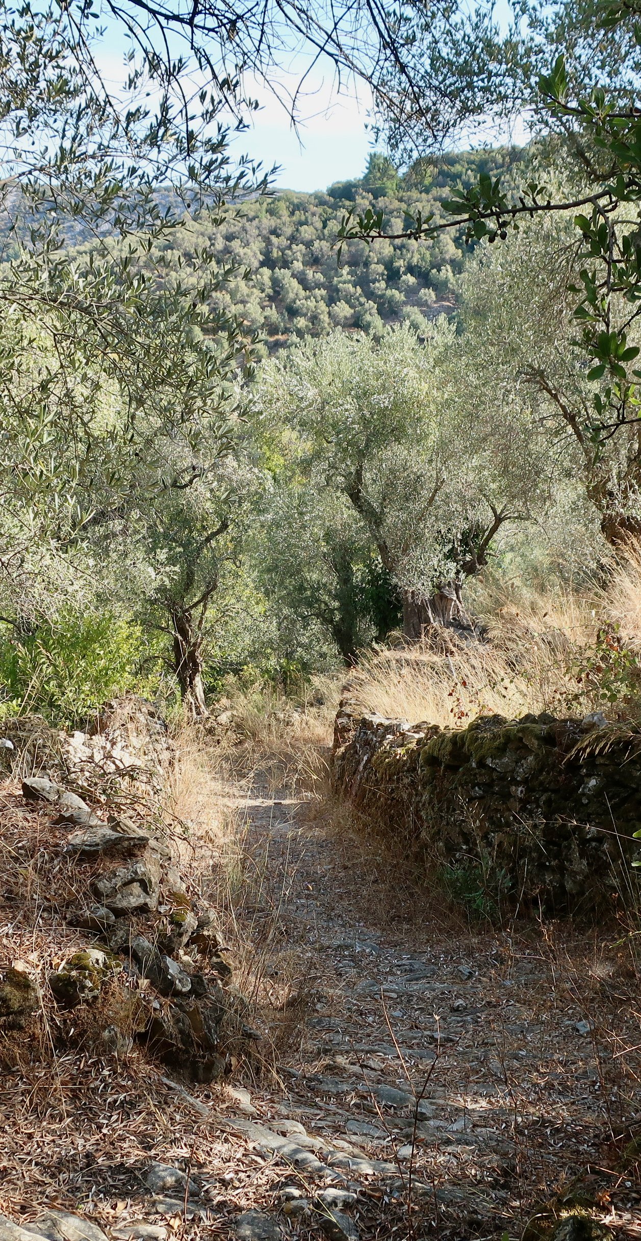
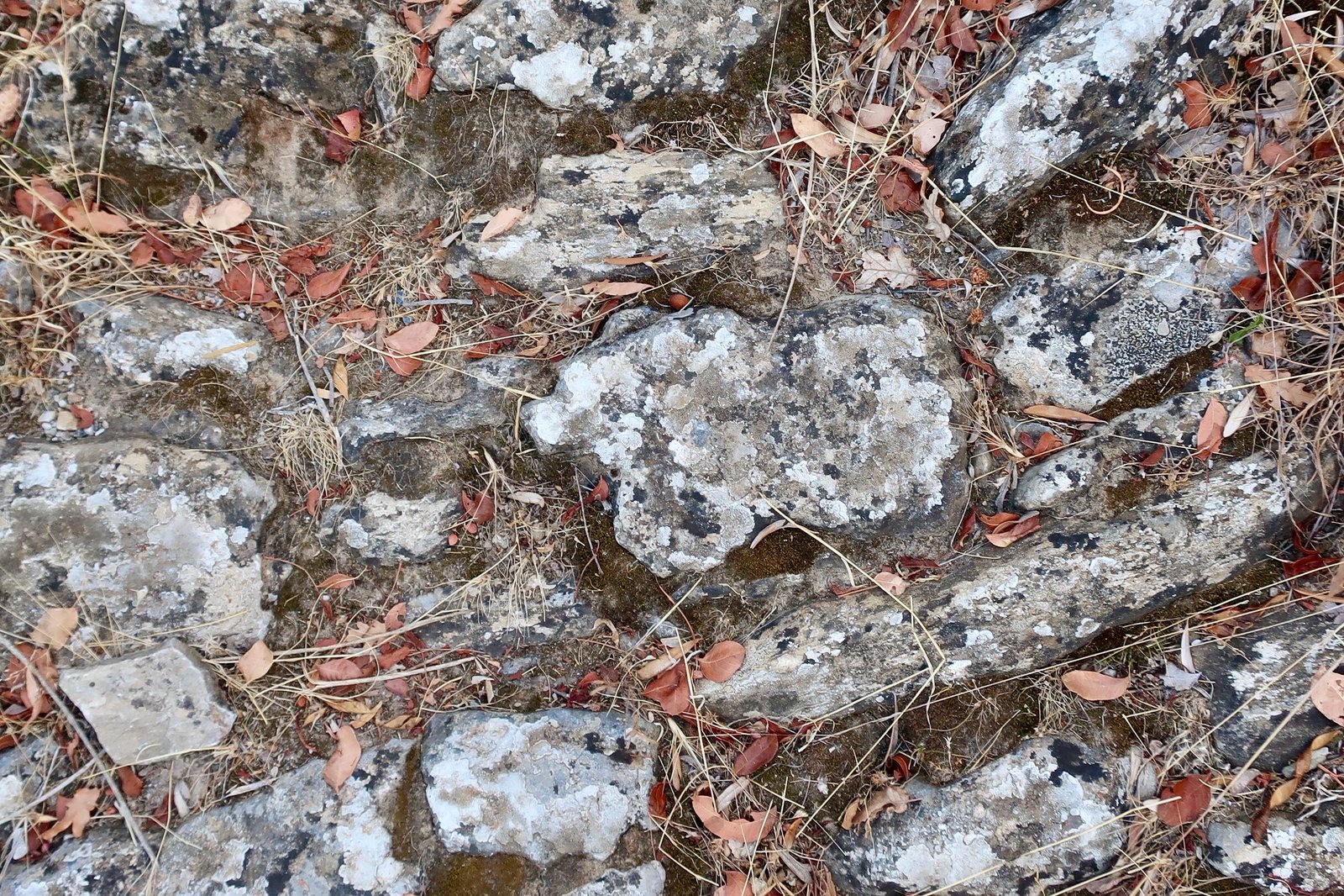
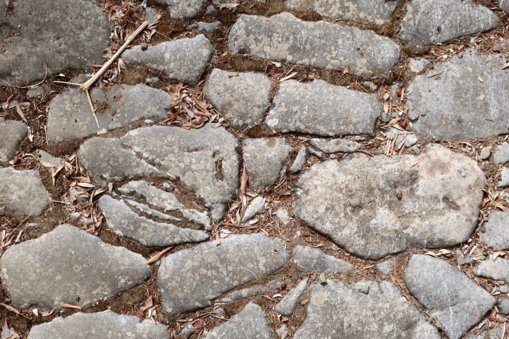
Lesbos has one of the most important extant networks of grand cobbled paths in the islands. Most of them once had agricultural purpose, but there are also the great stone paths between the monasteries of Panagia Mysriniotissa near Dafia, St Ignatios at Leimonos and the monastery annex, or retreat, of Agioi Anargyroi at Metochi.
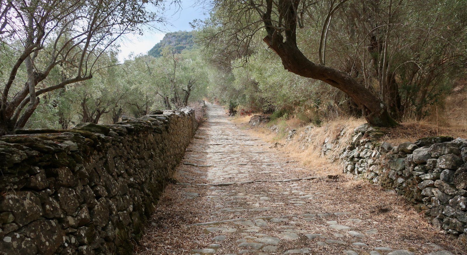
Around Agiasos, in addition to wide cobbled highways, there is an exceptional network of smaller stone paths. Here or elsewhere, these paths, whose construction is so labour-intensive, can only have been created if there was a sufficiently large population, the wealth that goes with productive agricultural land, and above all a belief in an unchanging future, implicit or expressed, within which the important facts of life will never change.

SIZE
Lesbos is huge. Apart from Crete and Euboea, the first more like a whole country than an island, the second practically indivisible from the mainland, it’s the largest of all Greek islands. But it’s the scale of it compared to most that’s so striking. Take Sifnos, in the same size-family as many islands. While it isn’t easy, and you need to get up early, in a day it’s possible to walk from one end to the other and back. The total surface area of Sifnos is seventy-three square kilometres.
Lesbos has an area of one thousand six hundred and thirty square kilometres. It’s of a different order entirely. Naxos, the undisputed giant of the Cyclades, could fit four times into Lesbos. Karpathos, lounging at the bottom of the Dodecanese, is fifty-seven kilometres long, but by square kilometres you’d need five times Karpathos and then some to make Lesbos.
THE SHAPE OF IT
It’s a piece from a puzzle. It’s the shape of half a fig leaf. The two deep gulfs, Kalloni and Geras, that make the particularity of Lesbos, are the leaves’ deep indentations. On the map they look exciting, but as is often the case with such sack-like bodies of water, the thrill of the coastline is largely absent. Their narrow necks turn them into almost-lakes. They fade into shallow shelves, sludge, salt pans, hybrid things between lake and open sea.
THERE ARE TWO DISTINCT HALVES
Most of the larger eastern half is forested, above all olives, but not only. There’s also pine, especially in the hills. There’s oak, holm oak, and walnut. There are strawberry trees and countless pomegranates and forests of plane trees. There are more sweet chestnut trees than we’ve seen anywhere, great orchards of them, hillsides of them.
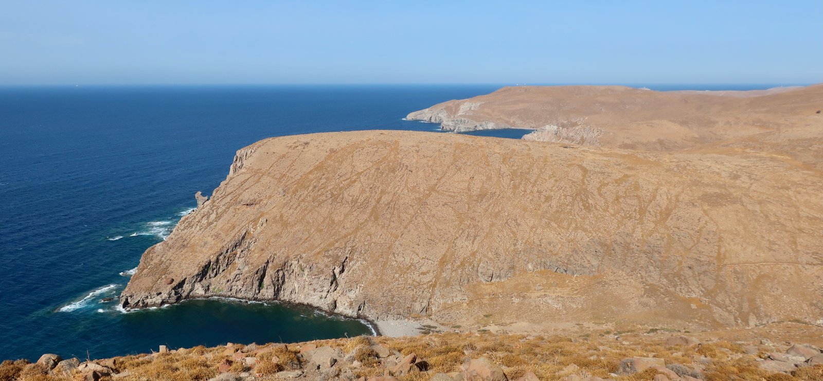
The west of Lesbos is mostly barren. There are pockets of growth, notably the valley that stretches out behind Skala Eressos, but overwhelmingly it’s bare valleys and hills, the contours made more salient by the absence of vegetation. Several eastern Lesbians we spoke to about this difference were dismissive, as if the lack of vegetation was a local addition to the long list of attributes people the world over emphasise to mark the qualitative difference between us and them.
TOURISM
As mentioned above, we’d thought, well, Kos. Planeloads. A wholesale touristic adoption.
Instead there’s Petra, where we first stayed. At the beginning of October, daytime temperatures still peaking at over thirty, we caught it readying for annual closure, its final weekend before shutting up shop for the winter. With just enough tourists to make it worthwhile, there was a last flurry of activity. Dutch were the largest group. It’s well-known in the Netherlands, we were told, a place people go in the shoulder season, cheap and sunny. Petra, pretty much skin deep along the coast and beach, would perhaps be a bit much midsummer, but as with many resorts is very comfortable in the half season.
A couple of kilometres further along the coast there’s Mithymna/Molyvos, wrapped around its looming, greystone castle. The castle first was classical Greek, then Byzantine. Finally, now, most of the remaining structure is Ottoman. Tourists file through before settling in one of Molyvos’ many restaurants. The town is picturesque, fancier than Petra – a little more boutique – no doubt a hive of tourists in season, but the beach for summer visitors they say is poor. Day-trippers from Turkey come, boat and coach and boat home, with a stop in the Monastery of the Archangel at Mandamados on the way back, where, despite the jostling crowds, the skimpy holiday outfits, the shoulder to shoulder packing them in and marching them through, the presiding priests ignore the melée and carry on with their performative business in quite timeless fashion.
After Petra and Mithymna/Molyvos, there are minor tourist centres – Skala Eressos (windsurfing, laid-back vibe), Skala Kalloni, Plomari, some thin settlements along the coast north of Mytilene, peaceful Vatera Beach in the south. And Agiasos, in the hills in the southeast, frequented by a very small handful of hikers, plus some few who like the islands but make a point of doing without coasts and water. In Petra we several times heard it called traditional. In the saying, the Petra-ites are admitting, above all to themselves, We are not, no more.
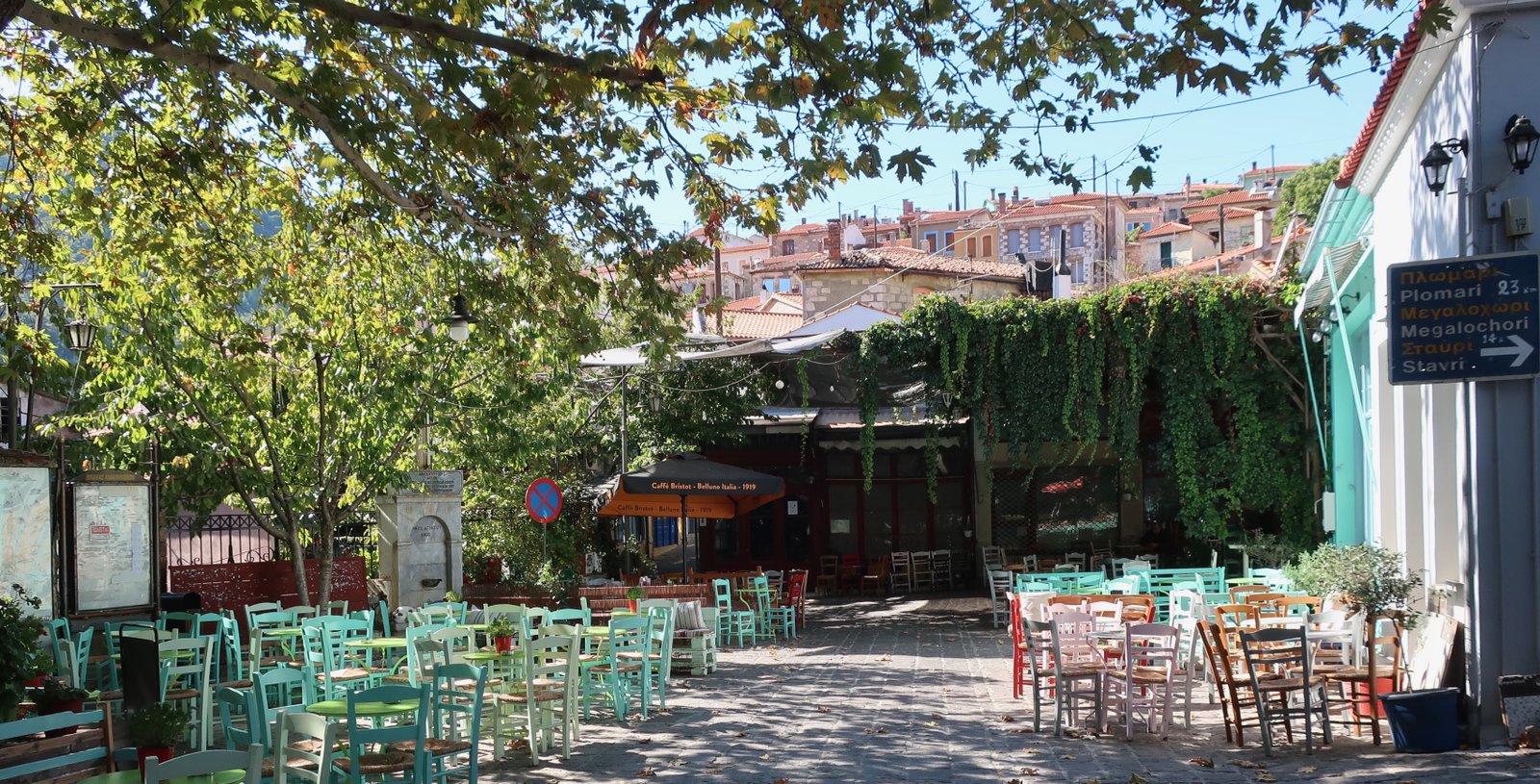
MYTILENE
In the narrow streets behind the front where olive oil used to be negotiated, it’s a struggle now to find a five-litre can. Oil leaves the island these days by more industrial methods. Tourists who pass through – Turkish day trippers, others – stroll these streets while waiting for the ferry. It’s a slow, residential town, but not a tourist town, not an olive oil town and no longer strategic – the old castle/fort is enormous, one of the biggest in the Aegean. It’s, a conduit, through which visitors flow, the past flows.
THE EMPTINESS OF LESBOS
Pick a hilltop, and there are many to choose from. The land rises to almost a thousand metres in the north, Vigla and Lepetymnos. Towering over the village of Agiasos in the southeast, Olympus peak is almost exactly the same height. There’s Liakas above Assomatos, a knuckle of bare rock. The sheer lookout at Roudi hilltop with views down to Petra, Molyvos and all the northern coast. Profitis Ilias in the middle of the west, above Vatoussa. Even the low hill out along the coast west of Skala Eressos, yet another Profitis Ilias. Go and stand on these or on others we didn’t get to, and what you see is the human vacancy of the islands. A rare village here and there. Trees. Contours. Space. Weather. The scrape-marks of history.
HIKING
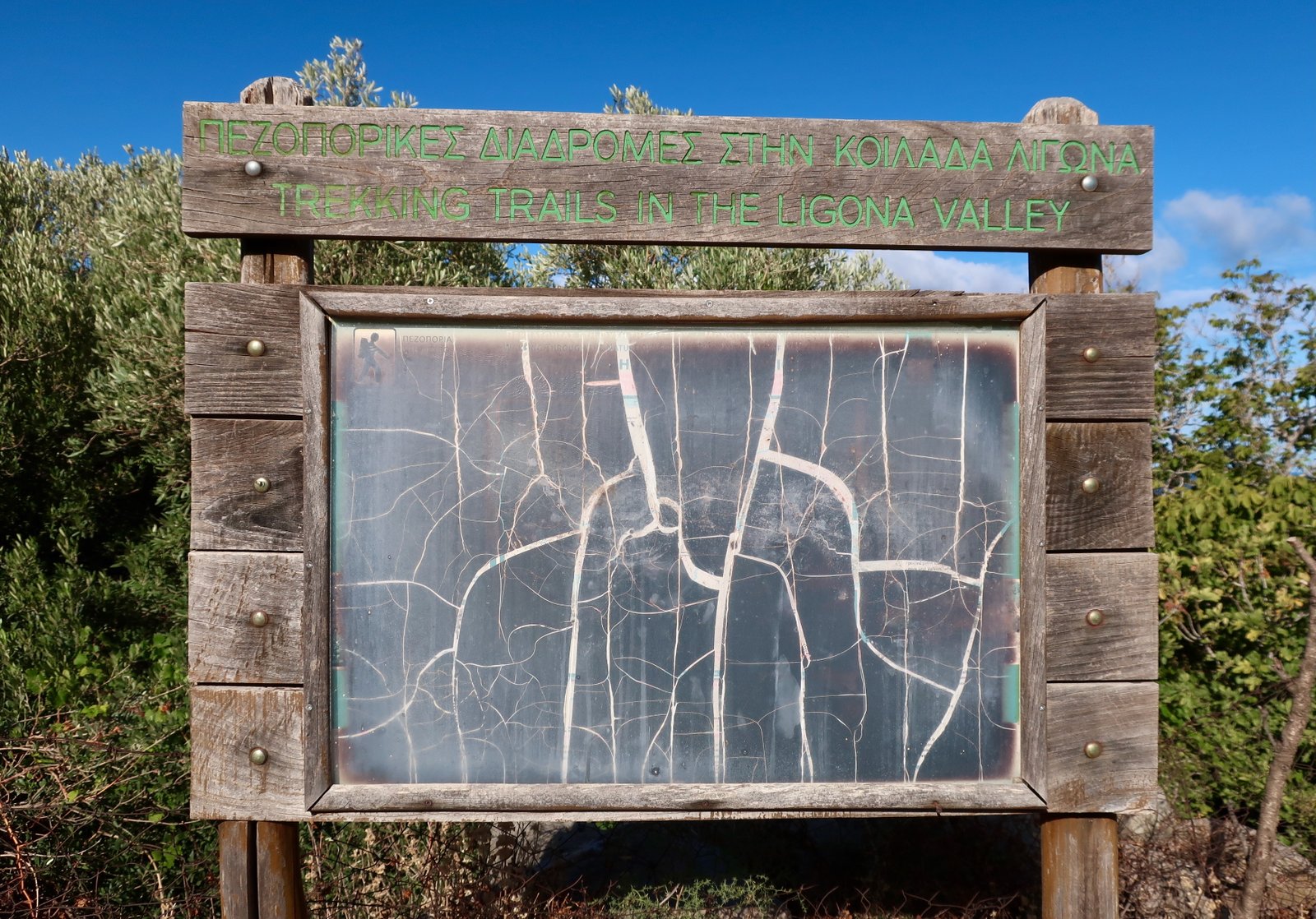
For hiking purposes, there’s no Anavasi or Terrain Map of Lesbos, but there is the lesvostrails.gr site. It’s one of the best online guides there is, even if it doesn’t always exactly correspond to reality – as if it had been made by very competent site developers who are not hikers – even if the signing has not been properly maintained since the creation of site and network some years ago: on some routes there are few path-markers, while on others the markers are erratic enough to be of little use.
Because of the size of Lesbos, we stayed in three places – Petra, Agiasos and Plomari – plus we rented a car for a couple of days during which we got up early and made as much use of time as possible.
We haven’t done all the trails, but have tried to do most of the interesting ones. There’s always an element of chance in this.
If you stay in one place only, it should probably be Agiasos. There’s nothing, elsewhere in the islands, quite like the wealth of paved trails that fan out from the village and spread through the landscape of mostly olive groves. A week wouldn’t be long enough to do them all. After Agiasos, Petra. There are several hiking routes around it, plus it’s on the coast. Always the pull of the water.
HIKING FROM PETRA
HIKE 1
Petra – Petri – Ligona’s Spring – the Byzantine church at Monastirelia. Monastirelia to Vafeios on a linking path between hikes. Down to Molyvos past the church of Agios Ioannis. Molyvos to Agia Fotia. Left into the Valley of the Mills and a slow climb almost as far as Upper Ligona’s Spring. From there, across to the other side of the valley and down into the valley steeply on a zigzagging old stone path. Back to Agia Fotia. Petra.
28 + kms
This is a sewing-together of two lesvostrails routes: North Lesvos 1.2 and North Lesvos 1.1 (no. 4, Molyvos). On the website, the Molyvos trail is unhelpfully tagged on to the end of Mt Lepetymnos Trails.
We went in an anticlockwise direction.
***
Part of the way runs through the fertile land behind Petra and Molyvos. Near Petra in particular much of it still given over to the cultivation of olives. There are also figs and walnuts, mulberry and vines.
The turn-off from the tarmac road a little over a kilometre from the seafront is unmarked. There probably used to be a post. Trust the website map.
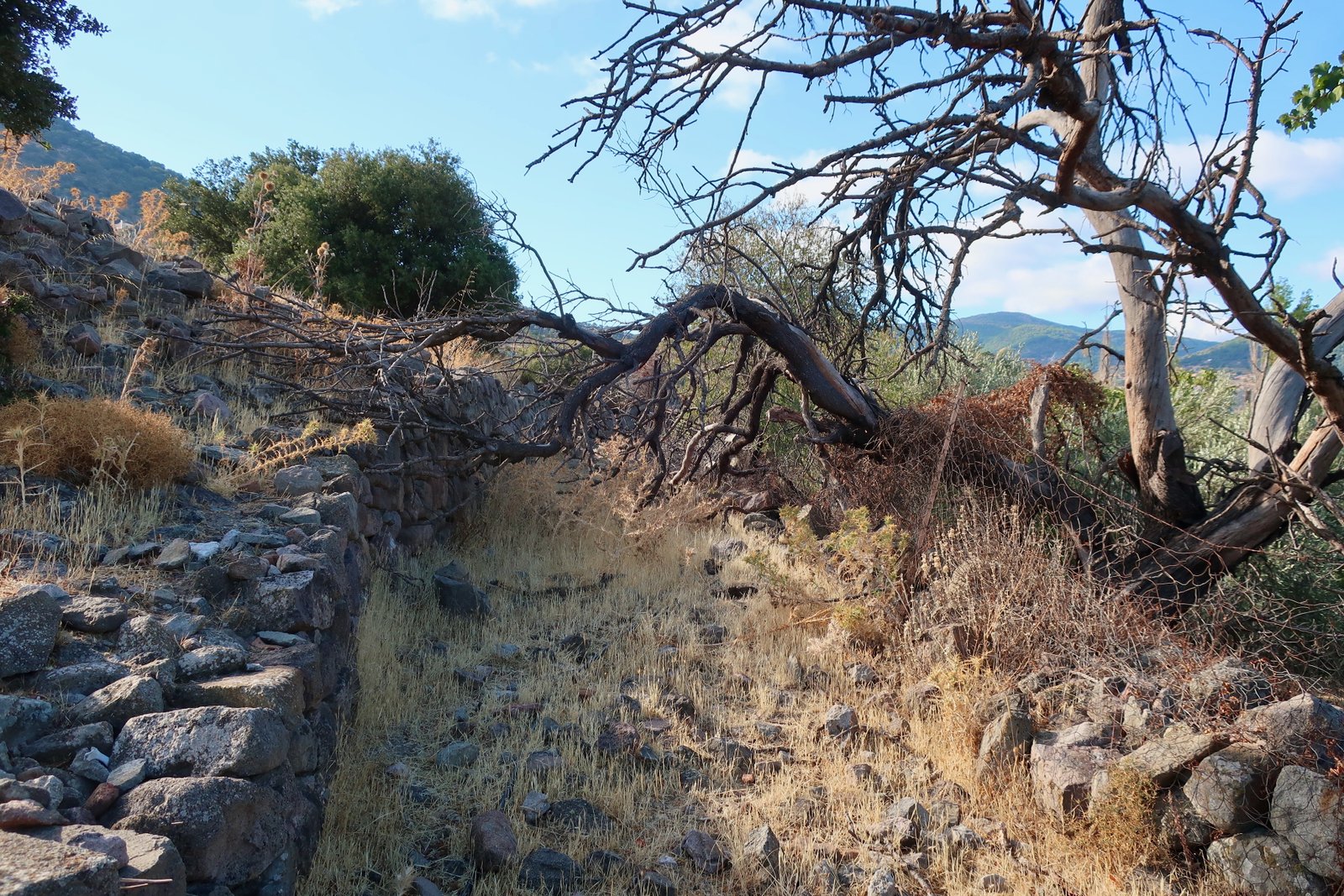
The following kilometre, once part of the main paved path between Petra and Petri, is a muddle: on and off an old stone trail, (no choice, the path is blocked in places), through thick undergrowth, (we may have taken a wrong turning), into a ‘field’ behind a barbed wire fence (possibly our fault, possibly the contemporary configuration of the land).
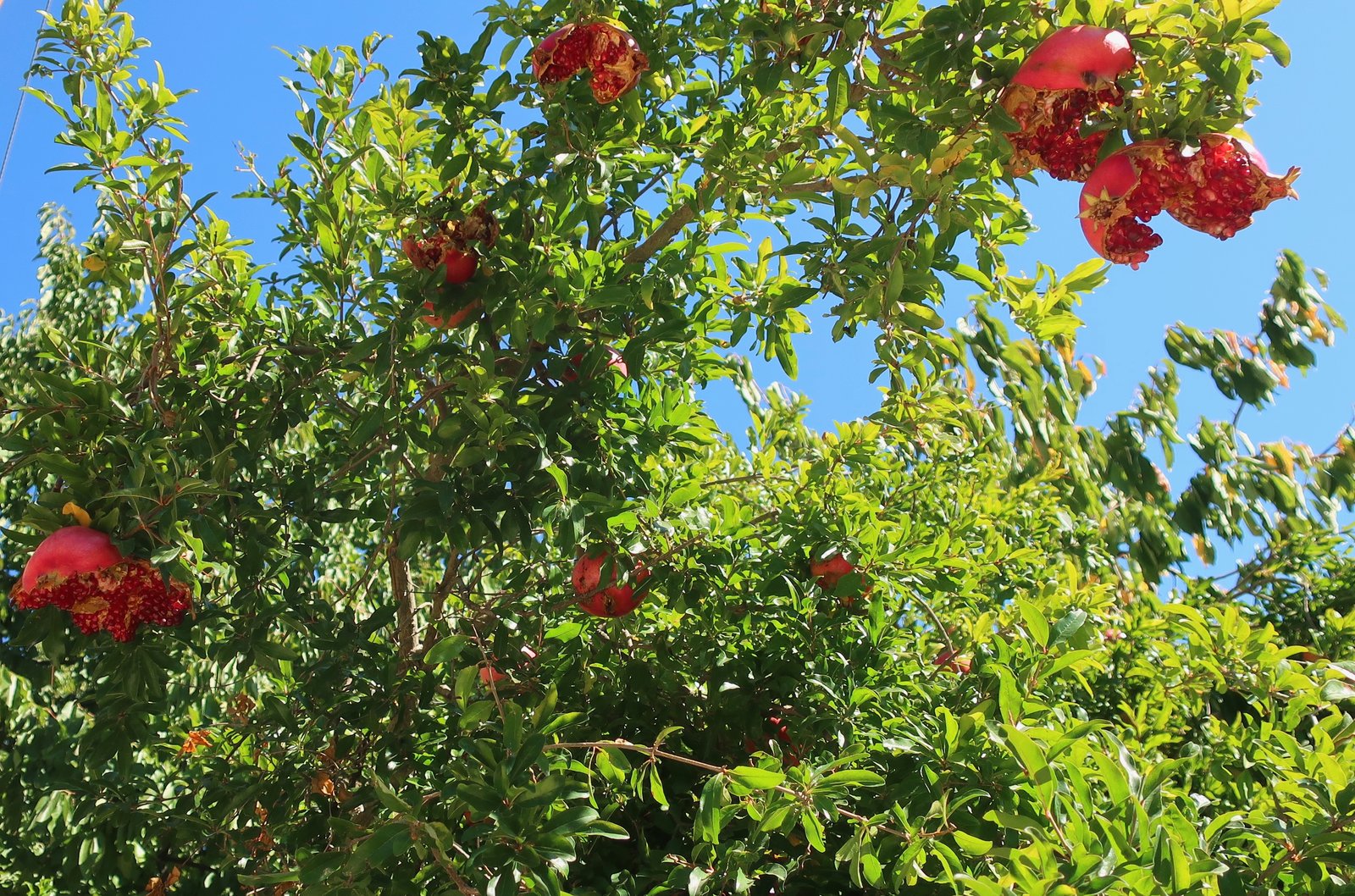
Briefly back onto a narrow asphalt lane before taking a nice footpath into the low-hill village of Petri, where the only sign of life in early October is the sound of sweeping from a small courtyard behind a closed gate. Overripe, unpicked, pomegranates gape in the gardens.
Ligona’s Spring is in an oak forest. The water source itself, which must have been so precious in the past, feeding mills all along the valley leading down towards Petra, is now enclosed in a miniature stone hut, a watery prisoner.
From there a trail leads up to Monastirelia and the small Byzantine church of Agios Dimitrios. Around it an abandoned garden, with vines, figs, walnuts, several mulberry trees and above all quince, their branches when we were there visibly slumping under the weight of too-heavy fruit.
A dirt track leads all the way to Vafeios, another dormant village, then on to the church of Agios Ioannis. From there a thread-like path winds gradually down towards Molyvos and the coast, four or five kilometres through a landscape of low spike plants that at the end of summer was uniformly canvas-coloured. In the distance the village of Molyvos, its layout perfectly medieval.
On the way back to Petra, having passed the reservoir, we turned left into the Valley of the Mills. This would have been part of the shorter route from Petra to Ligona’s Spring and back (North Lesvos 1.2). A little over a hundred years ago there were still more than a dozen stone-built grain mills here. Now the tumbled ruins blend into the stony landscape. There are paved paths along the sides and down into the valley. The remains of the mills are like giant stairways.
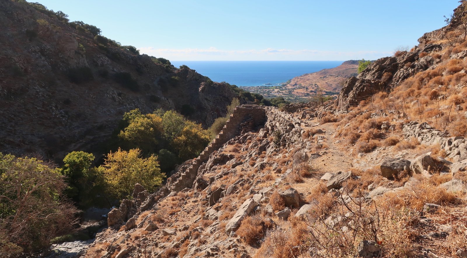
On the lesvostrails map of the Petra-Ligona’s Spring hike, a squiggle marks a stone path that diverts from the main route to plunge into the valley. It leaves from just alongside a lookout notice-board on the southern side of the dirt road from Petri, 100 metres above the stream bed, descends steeply, then rejoins the path on the other side. It’s a lovely thing, a brief venturing into an ancient civilisation.
From Agia Fotia, the path back to Petra is marked on lesvostrails as stone-paved, but in fact is not nearly as fine as the paved trails around the mills.
HIKE 2
Trail 1.3 on the lesvostrails.gr site, circular from Petra to Lafionas and Roudi hilltop, then back to Petra with a small diversion to Anaxos.
Approx 16 kms
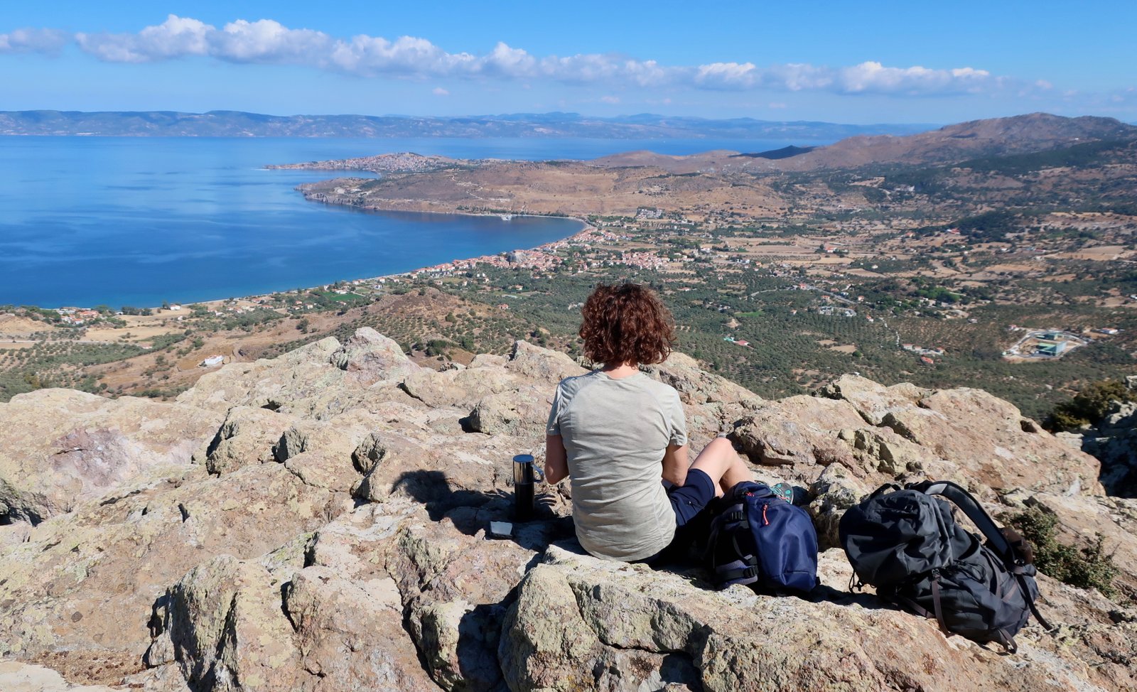
A very nice shortish hike from Petra up to the lookout point of Roudi Hilltop. Beware, there are sheer rock cliffs at the top. The view is panoramic, down to Petra, Molyvos, along miles of Turkish coastline.
The first part of the trail runs through olive groves. (If you’re in an olive grove, you’ve probably gone wrong, we tend to presume. On most islands this holds true. Lesbos is an exception.) The way is marked by red triangles tacked to the trees, a slalom through the trunks. On the dusty ground there’s little or no discernible path.
After the olives, what is left of an old, walled, paved path begins at a gate at the lower end of an open field.
The high road to Agios Alexandrios out of Lafionas is well-signposted, a narrow, stone-paved/dirt-and-stone path through oak and olive woods.
A couple of hundred metres after Lafionas, there’s a choice, one path straight ahead, the other left and up. Both lead to Agios Alexandros and Roudi Hill. The left-hand fork soon crosses a dirt road and continues onto a soft and winding woodland path that feels higher than its 350m or 400m.
After Roudi Hill, at Agios Alexandrios, of what was once a flourishing community there’s nothing left but a small, modern church building and the sparse ruins of an older church. Time-lapse photography of the last 1600 years would be like a speeded-up film of biological decay – the brief bloating of neighbourhood, its sinking back into the soil, then for long centuries little discernible movement but the life and death of trees.
On the way back down towards the coast, the path turns left by a wooden gazebo, over open stony land into pine forest and onto another lovely path that morphs into olive groves.
At the end of the circuit there’s a short, bare section of dirt and dust.
Anaxos, a small diversion to the left, is a not very interesting little appendix beach resort to Petra. The stroll back to Petra is on tarmac, with no pavement most of the way.
HIKE 3
Pelopi – Profitis Ilias circular route. Trail 1 in Trails of Mt Lepetymnos in North Lesvos on lesvostrails.gr
In theory 11.4 kilometres
It is possible to walk from Petra (or Molyvos) to Profitis Ilias. There’s a signpost at Vafeios, 6 kms from Petra on HIKE 1 (above), so in theory there’s a route, possibly marked. But then what? It would be very difficult to do more than the loop around the highlands, passing by Vigla Peak, before returning to Petra. To add on the (very nice) section of this hike between Ano Kampos and Pelopi (there and back) would probably make for too long a day if planning to return to Petra.
Alternatively, a longish linear hike could be an interesting option, all the way from Petra to Skala Sykamias, where several tavernas cluster around the tiny port. Transport home would have to be organised.
We chose though to rent a car. We drove to Pelopi, did this hike, then drove to Sykamia and Skala Sykamias and did some walking there too.
***
The two lesvostrails options out of Pelopi come together at the same point about 500-600 metres further on. From there the path continues uphill on the remains of an old paved path, twisting and turning between stone walls like a toboggan ride. Walnut trees everywhere, quince and fig.
At Koutsomyloi there’s a left/right choice. The longer right-hand path is much the better of the two, a hard stone pavement above a dry water course. Most of the paving is gone. The stone edging is intact.
The next section climbs steeply through oak forest. There are trail markers on trees, and occasionally on stones. If you go more than a couple of minutes without seeing one, you are probably lost. Go back, try again.
Coming out of the forest, the trail turns right onto the high plateau, heading for a wooden signpost at Ano Kampos where the circuit of the highland peaks properly begins. Do not mistakenly turn a little earlier where there appears to be a marked path diving left and downhill. Ano Kampos is in a col, a shallow dip, with higher ground on both sides.
From there, Vigla Peak is a more or less straight line up the bowed ridge of a hill, at first through trees, then across open ground. After a while, a line of old metal post path-markers appears. But even without them Vigla is obvious, directly ahead, the highest point on Lesbos, a rocky outcrop with the usual mess of aerials and antennae, a small concrete hut, and sky-high views in all directions. On a clear day you can see for miles and miles over Lesbos, across the Aegean, north and east into Anatolia.
The path from Vigla to Profitis Ilias is a dog-leg whose turn comes just before a prominent, spiky rock. It traverses a steep slope to the left of the spike. There are wild horses in the highands. We came close to a small herd, and were mutually wary.

On the return half of the loop from Profitis Ilias back to Ano Kampos we lost our way. The last 700 metres. The path goes down, across at least two dry watercourses, on slopes through woodland.
You’re thinking, Only 700 metres, how lost can you get? The answer, if you haven’t done this sort of thing before, is Very.
Trust the map. Be logical. Maybe you’ll even find path-markers. (We didn’t.)
lesvostrails says 11.4 kilometres and 4 ½ hours, Pelopi to Pelopi. We did about 16 kms for the same time.
HIKE 4
Sykamia – Lepetymnos circular route, Trail 2 in Trails of Mt Lepetymnos in North Lesvos on lesvostrails
8 kms
A gentle circular route between Sykamia and Lepetymnos, with about 300 metres of ascent. It can be done from a starting-point anywhere on the loop, and in either direction.
Before there was a tarmac road between Sykamia and the old village of Chalikas, these were the linking paths, high and low, between settlements. Most of the way is in shade, through woodland. The paved surface is largely gone now.
Lepetymnos is a new village built to replace Chalikas, abandoned mid-20th century because of landslides. The section of trail through the old village is deeply evocative, ruined houses along the way, constant evidence of past abundance: walnut and almond, fig, pomegranate and sweet chestnut trees.
Earthquake, disease, change of lifestyle away from the insular agricultural model, war and invasion, migration, extreme poverty, and here landslides. In the islands, the reasons for dereliction are multiple, the elegiac quality is common.
Unsuitable so far for tourism, agricultural self-sufficiency no longer having any appeal for the young, Sykamia is hanging on. Late afternoon, the small central square was marked by the shadows of a real and metaphorical setting sun.

HIKE 5
Kalloni circular route, Trail 3.1 in Trails of Central Lesvos on lesvostrails.gr
About 9 kms, because we chose to start and finish in Dafia, not Kalloni.
The lesvostrails guide doesn’t make clear how lovely this walk is.
***
The trail begins and ends in Dafia or Kalloni and connects three great religious houses – the monasteries of Myrsiniotissa and Leimonos, and the monastery/hermitage of Anargyroi Metochi. All three structures date back to the 16th century. The stone-paved paths that link them are wonderful.
Myrsiniotissa, on a low, wooded hillside just outside Dafia, is a typical garden-style monastery, the interior courtyards busy with greenery, trees and shrubs, pots of flowers and herbs.
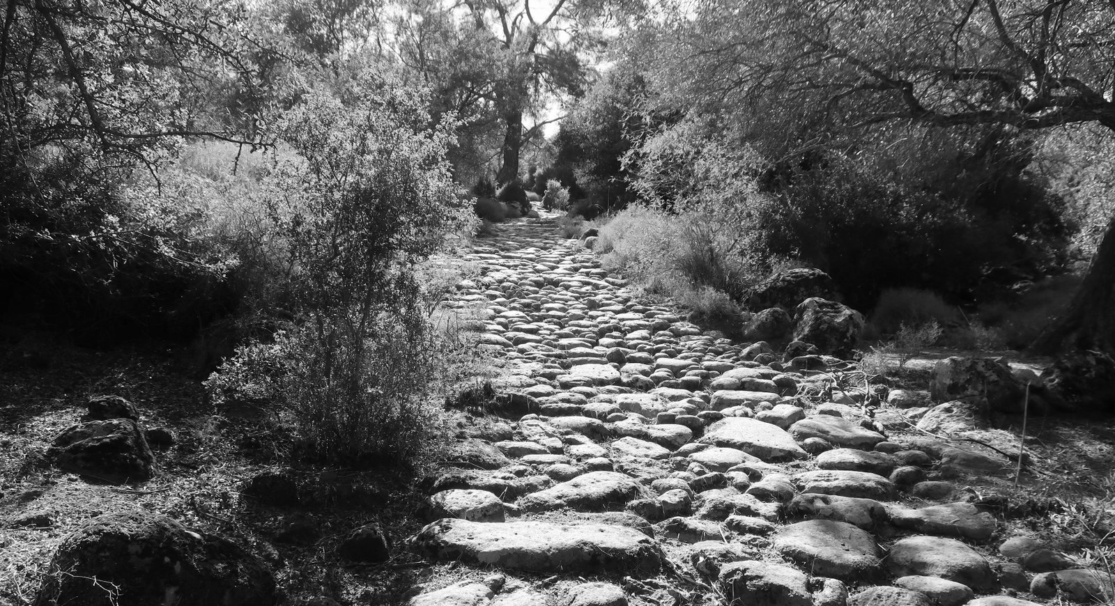
The trail between it and Leimonos passes through olive, pine and oak woodland. For much of the way it’s a three-metre wide stone path, in remarkably good condition. The run of it through the woods is magical.
Leimonos is a more imposing monastery than Myrsiniotissa, more unbending and serious, without the green extravagance. Outside the walls of the monastery are dozens and dozens of smaller structures – crypts, chapels – some tiny, a dome or simple barrel roof, some as large as a mid-sized church, with several domes. They seem exclusively to be burial places, endowed by families in order that their dead should pass eternity in close proximity to the sanctity of Leimonos. They look like nothing so much as bud-growth extensions from the main monastery, as if underground there’s a holy root-network from which they’ve sprung up.
The next branch of the hike, between Leimonos and Anargyroi Metochi, must once have gone from monastery door to monastery door. It now begins a few hundred metres from Leimonos in the middle of dusty, open wasteland. Suddenly a wide stone-paved path appears, as if unfurled there, a pontoon of stones in a sea of dirt. The way it begins, the way it disappears, winding downhill, you could almost believe it moves.
Within a few hundred metres it begins to descend and the paved surface changes, from dark, rounded stones to great flat slices of rock, mirroring exactly the changing geology of the surrounding land.
Anargyroi Metochi is no longer a religious house. For the last thirty years it has been attached to a Norwegian university that runs residential study courses and provides wellness accommodation. The door is open, the central area quiet and welcoming.
From there, a short stroll back to the starting-point.
SHORT HIKE – Skala Eressos
We took a car from Petra and went first to Skala Eressos in the southwest. There is a walk west from the town along the beach and up a small hill to the chapel of Profitis Ilias Thalassinos. A grey path runs through small rocks and low, spiny plants. It is as if a giant index finger had been dragged through the dirt.

Looking further on from the chapel, the hills are treeless, the coastline a succession of more or less inaccessible beaches.
It would perhaps be possible to wander without trail along the coast – probably forced in and out, to and from the sea, by cliffs and contours – as far as Sigri. Even with a lot of meandering it couldn’t be more than about 12 kilometres. How best to get back to Skala Eressos though? By road it would be at least 18 kilometres.
We strolled also up the hill on the eastern side of Skala Eressos. Overlooking the port up there are the remains of an old castle, plus some huge classical cut stones. Eressos, here, was one of the five ancient cities of Lesbos.
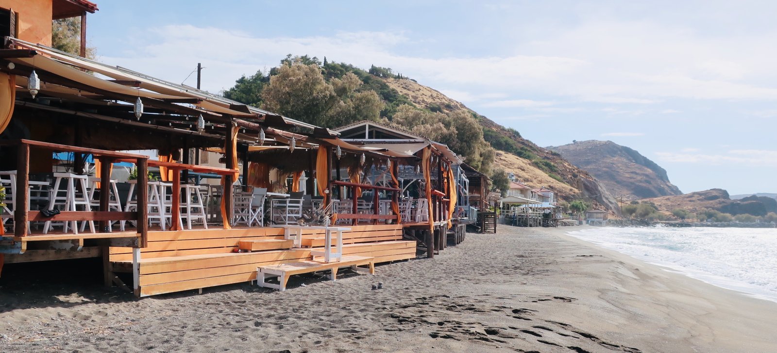
Cafés and bars are built right onto the beach, wooden posts and decks, colourful paint. Today in Skala Eressos the beach is everything.
HIKE 6
West Lesvos, 2.3, Rhododendron Trails on lesvostrails.gr
The guide says 15 kms. That might be a small under-estimation
A surprisingly challenging hike with at least 600 metres of climb. The steep parts are sometimes very steep. In particular, approaching Profitis Ilias it’s close to a scramble through pine forest on the way up, and a slipping, sliding mirror image down the other side.
***
Starting from Anemotia the hike is a figure of eight made of two loops, both of which can be done in either direction. As a general (breakable) hiking rule, if there appears to be a difference in complication between the journey out and the journey home, it’s better to do the harder section first.
Here, the guide says 5 hours total. We didn’t set off until gone two o’clock. By doing the main section clockwise, even if we got lost, even if the timing was way out, we’d be walking on wide dirt track for the final five kilometres back to Anemotia as dark began to fall. Not at all the same as being stuck in a forest/on a mountain-top/on a possibly barely-visible, possibly precipitous narrow trail.
Some remains of nice old stone path out of Anemotia. Down through agricultural land, much of it olive grove, to the mini-monastery of Monastireli. From there along a dirt road, then a turn-off left onto a trail that leads up through pine forest, and another shortish section of dirt track followed by a steeper forest trail.
There are many strawberry trees in the forest, in fruit when we passed. We gathered a small bagful and added them to yoghurt/fruit breakfast the next morning. They have seeds not unlike grape seeds, but the fruit is smaller than a grape, and grainier. They flatter to deceive. Stories of deliciousness are much exaggerated.

The smaller, second, loop that leads to Profitis Ilias is similar in that one side of it is mostly trail, (not all of it easily followable, even steeper than the lower trail), the other mostly dirt track after an equally steep descent. On the top itself – not a point, but a wooded plateau – there’s a messy little church.
(At Pigados, the beginning of the main 5 kms of dirt track back down into Anemotia, there’s an option to take a linking path to Trail 2.2 in lesvostrails West Lesvos. The link is about 5 kms. Trail 2.2 is an independent circular 11 kms. The write-up makes it sound very nice. Several sections of old cobbled path are marked.
Apart from a lack of time, there’s no reason not to separately do this hike. It would even be possible, though difficult, to do both of these hikes, 2.2 and 2.3, together. You’d have to walk the linking path twice, obviously, and the total length would be between 35 and 40 kms. So, a very early start. Sport hiking. Not for everyone.)
***
HIKING FROM AGIASOS
The hikes we did around Agiasos weren’t exact reproductions of lesvostrails numbered hikes, but splices and mixes, combinations of hikes, sections of hikes. They can easily be adjusted to suit individual preference re length, difficulty and so on.
AGIASOS HIKE 1
Agiasos to Karini on the Patoumeni – Karini to Panagia in Enthrono. From there to the Arches in Paspalas and on almost as far as Lampou Myloi. Then back to Paspalas, to Christos, and mostly dirt track as far as Agios Dimitrios. Home to Agiasos along the Perasias stream path, the more easterly of the two alternatives.
About 25 kms
The Patoumeni, that runs from the Stavri neighbourhood at the top of Agiasos, through hillsides of olive groves to Karini, is one of the finest broad cobblestone paths in the Greek Islands.
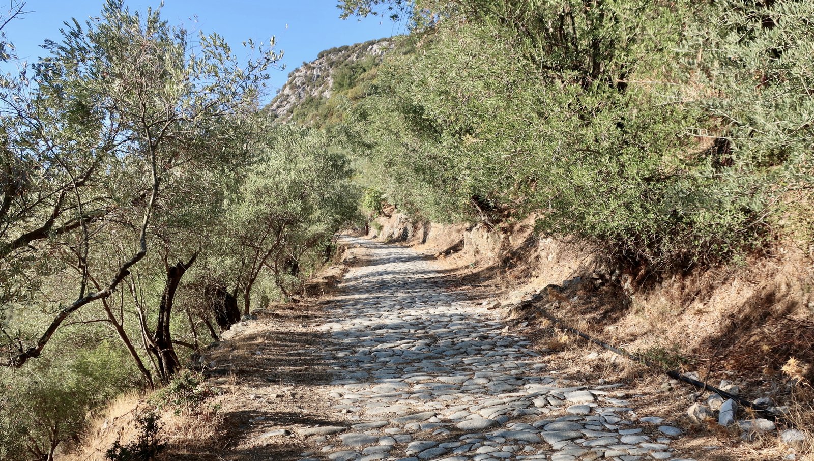
Even while we understand the old stone trails as they were conceived, as roads linking workplace and settlement, port and religious centre, we see them, we feel them, as works of art. The beauty is visceral. We pass through it, over it. Every single time we go out we are subject to the same miracle.
Today the functional purpose of the old paths is a glimmer of what it was. The beauty though continues to grow, having now become historical, elegiac, endangered. Layer upon layer upon layer.
The people who built the Patoumeni must have believed that almost any effort was worth it because it would make their lives better forever.
Instead their world turned upon its head. What remains is this aesthetic, and its underlying melancholy.
After the Patoumeni, after Karini and a further kilometre on dirt track, there’s a right-hand turn onto a narrow, stony path, which this time runs not between olive groves but right through them, winding among the trees, up and down levels of terracing.
By the time the path reaches Enthrono, where nothing remains but the indistinct, ruined walls of what was presumably once a church, the land is only about fifty metres above the wooded plain that stretches out towards the Gulf of Geras. And that seems somehow astonishing. Because even if Agiasos is at only 450 metres, it feels like mountain and it feels remote, and the whole way down to Enthrono from Agiasos is so gentle it hardly feels like a descent at all.
The Roman aqueduct on Lesbos used to run from Olympus Mountain, overlooking Agiasos, to Mytilene, a distance of 28 kilometres. The largest remaining section is at Moria, but at Paspalas there’s an extant bridge of arches over a small, steep-sided stream, a wonderful, incongruous surprise lost in the pine forest, the ruins of a lost civilisation. Trees grow out of it now, giant parasites, and the span is no longer intact; there are gaps, empty sections, so that it’s no longer safe even to venture out onto it.
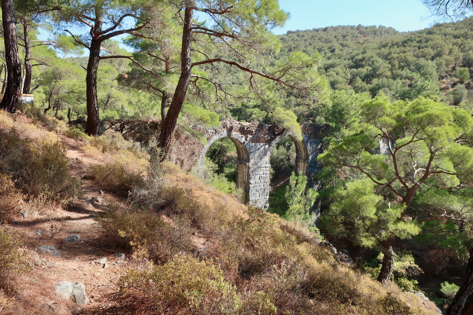
Having taken the eastern of the two paths to Paspalas, we crossed the stream bed at the point indicated on the lesvostrails map. This short path is no longer properly waymarked and is difficult to find but easy to do, since even if not found exactly it can be approximated. Crossing in the other direction, down from the western side, where there’s a marker at the beginning, would be easier still.
Continuing north, the path, narrow dirt, runs through olives again, with high, desiccated, pale grass glowing in the autumn sunshine. It hits the road about a kilometre short of Lampou Myloi..
The way back to Agiasos, via Agios Dimitrios is straightforward enough, a mix of wide dirt track through olive orchards, narrow trails, and in the final part after Agios Dimitrios, some paved sections.
AGIASOS HIKE 2
Agiasos to Profitis Ilias and almost back to the village. Then up the trail to Sanatorio, and back. (A linking of two short lesvostrails paths.)
About 16 kilometres
From Agiasos to the peak of Olympus (968 metres) is an ascent of more than 500 metres. Most of the way, apart from the last, short section up the bare, steep, rocky flank of Profitis Ilias, is through quite dense forest, sometimes on old stone path.
The peak, with views in all directions, is a particularly thorough mess of aerials, rough-built concrete structures and ugly wire fence.
The downhill path (clockwise) runs similarly through forest. The lower half is a fine old stone path which, just before reaching Agiasos, merges into the trail that leads up to Sanatorio. The lesvostrails guide talks about the ancient civilisation of Penthili that used to exist in the Sanatorio area, but doesn’t mention that this is a very lovely, narrow, cobblestone path running through a forest of sweet chestnut and plane trees, and the mixed terraces of what used to be prime agricultural land for the village. All of it is now abandoned. It hums with recent agricultural history. Our host in Agiasos said this was her favourite walk around Agiasos. Wild boar, reintroduced on Lesbos, apparently roam the area.
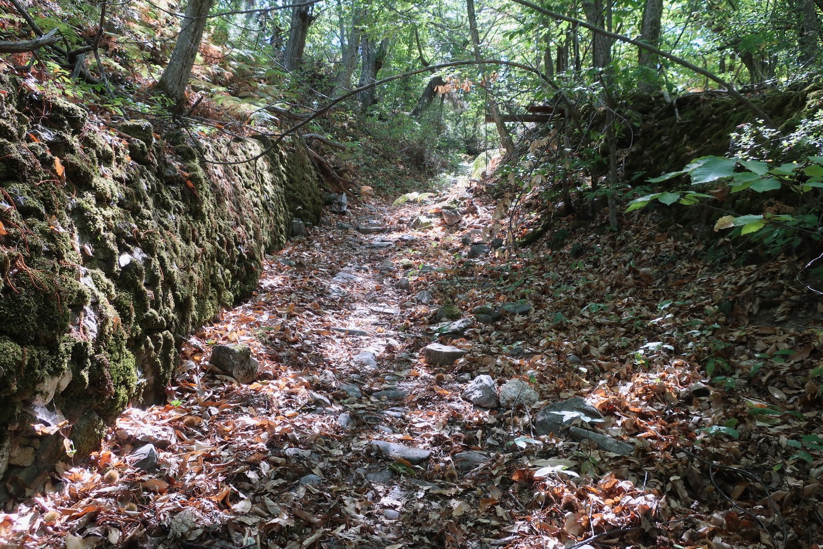

At the top of the trail there’s a small loop past the sanatorium, built in the 1930s after an outbreak of tuberculosis on the island.
AGIASOS HIKE 3
Agiasos to Patima and Taxiarchis. From Taxiarchis, south to Kordakia, then east to Agios Ioannis Theologos. Down to Mychou and the Taxiarches Byzantine church. A loop past Kato Tritos back to Mychou. Home in reverse.
About 25 kms
There’s at least 1000m of ascent over the whole hike: up, down, up, even further down, back up, down, up, down… A rollercoaster of a route.
The path that on the lesvostrails maps leaves due east from the centre of Agiasos, the church square, doesn’t exist. Where it should start, there’s an edge-of-the-village agricultural smallholding, with a horse in a stall, fences, no possible way through. You have to go up to the top of the village and turn hard right, back down towards Patima.
The beginning of the trail is a little messy, dirt and dust and farm-junk. Then, from Patima, the next 1500 metres (with a short break in the middle), is a stunning stone path. Unlike the straight, smooth Patoumeni, this one pours through steep, shady terrain, a descent of almost 400 metres, twisting and turning through a landscape of mossy stone and rucked olive groves.

From Taxiarchis, the bottom of the path, you then have to do two sides of a wonky parallelogram, either up/across then down, past Agia Marina, or down then up/across, past Kordakia. The end-point is the same. The high road is all dirt track, and as you cross the Antriotis Stream takes you past a Greek Island dog version of Scylla and Charybdis. If you’re made nervous by large, barking dogs throwing themselves at wire fences either side of you, just a few inches away, and even though there’s no actual danger at all, you should probably not go this way.
The church of Agios Ioannis Theologos, looking out over the far-off Gulf of Geras, is a good place for a pause.
The path continues on past the church, before descending on the far side (just) of a small valley-fold that leads down to Mychou.
The Byzantine church of Taxiarches near Mychou is one of the island’s oldest. The interior when we were there was a scribble of props and supports.
The loop from there back to Mychou is through intensely-cultivated agricultural land, olives and figs and grapes and pomegranates and so on, passing through the village of Kato Choria, a historical farming settlement that like other similar places is a thin shadow of what it once was. The one tiny village bakery, which hardly resembles a bakery, being just an open window on the street, with a shelf on which to display wares, was giving out free slices of honey and fennel toast when we passed.
AGIASOS HIKE 4
Agiasos to Flega/Kalami, then a short diversion up to Liakas Peak, overlooking Asomatos. From Liakas to Asomatos, and down the cobbled path to the Antriotis Stream. Along the stream almost as far as Taxiarchis, to cross it at the dog-gauntlet-running place, continuing on around the triangle on the far side of the stream to Agioi Anargyroi. Then to Nychtanta, Assomatos, and up the Patoumeni back to Agiasos.
17/18 kms
Yet another very nice hike. The diversion to Liakas Peak is well worth doing. It seems higher than its 511 metres, a bare scraped rock hilltop that dominates the village of Asomatos and looks out over much of the forested, rucked landscape of central Lesbos. To the east, the Gulf of Geras again, metallic blue in the early morning light.

In this region so rich in old stone paths there are two more of exceptional quality on this hike, one leading down from Asomatos to the Antriotis Stream, a woodland path, the other going back up from Nychtanta to Asomatos, very like another section of Patoumeni.
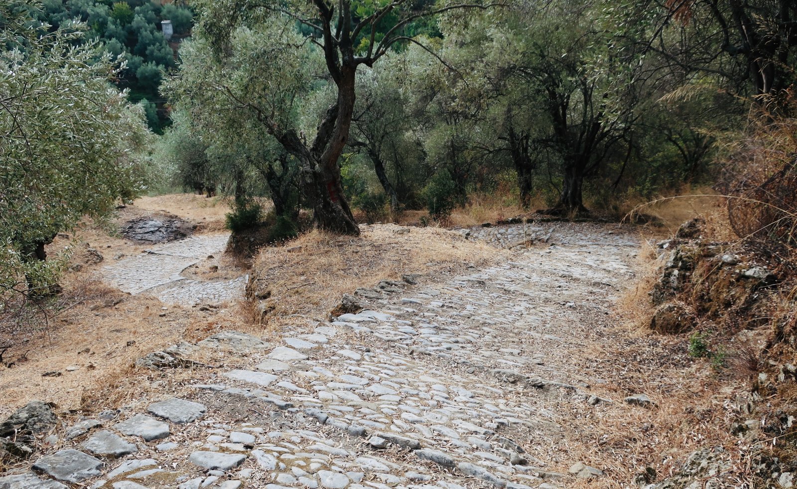
Apart from the brief diversion up to Liakas Peak, the rest of this route is through what was once cultivated land. Much of it is olive grove, but also, especially down near the stream, all those other fruit and nut staples found in such abundance on Lesbos.
The triangle that has Agioi Anargyroi to Taxiarchis as one of its sides, much of it remnants of paved path, also leads past the dog-gauntlet place from HIKE 3 above. It can be avoided.
At Nychtanta, in addition to a water-powered olive press, the remains of an Ottoman bath, a small domed building next to the road, are just about recognisable. It’s a dark, damp, uneasy place, in the process of being overcome by vegetation. It’s hard to believe there was once a well-enough established Ottoman settlement here to warrant the construction of a bath-house. Nothing remains but this soggy little building.
Asomatos, as the Dutch people we met on Mt Olympus told us, is a ghost town. Nothing was open when we passed through. At the end of the 19th century nearly 1000 people lived there. It is beautiful and melancholy.
HIKING FROM PLOMARI
Plomari to Kato Chorio, to Levra, then almost as far as Kournela. Turned left and down though olive groves just before reaching Levra. Down and up the other side to Palaiochori. Up to Rachidi. Back down to Palaiochori. Then to Kournela, up to Agia Eireni, to Kato Chorio again and home.
About 28 kms
This is a fairly strenuous long hike, with between 1300m and 1500m of ascent.
The path climbs up to Kato Chorio on mostly old stone, then heads east past Levra, parallel with but high above the coast. Here the specificity of Lesbos – the size of the island that means you’re often completely land-locked, the olive groves, the forests of chestnut and walnut and oak and pine, the extravagance of the agricultural stone paths, their length and width, the two huge gulfs like inland seas – everything is gone. You could be on any Greek island, walking just above the blueness of the Aegean on a narrow hillside path with mixed vegetation and bluffs of rock, the heat supercharging the air with the smell of the parched land and baked plants, barely a cloud in the sky.

Five hundred metres before the village of Kournela, the path on the lesvostrails map goes down and almost back on itself. It’s quite ill-defined in places, an on-and-off narrow stone path descending steeply through the olives. At the bottom, the wetland vegetation along the course of the Selandas stream is dense enough to block out the sun. The path turns right along the stream, crossing it a couple of times before diving uphill on the far side towards Palaiochori.
Sunday, mid-October, hot. One taverna was open. A few bemused elderly customers watched us pass. A very old lady shouted her dog away from us, Eh, Skiro! and waved, and smiled.
On opposite sides of Selandas valley, at approximately the same altitude, the villages of Kournela and Palaiochori face each other, both of them invisible from the coast.
From Palaiochori there’s a loop up to the hamlet of Rachidi on the hilltop above. Both sides of the loop – up/down, down/up – have cobbled paths. The side that sets off clockwise from Palaiochori is especially nice. The other side is fading – nearing the village on the way down it turns into a scree slope of small stones. Rachidi, once a farming hub, is now almost completely abandoned to the forest, the stone houses melting back into the ground.
From Palaiochori back down the same path to the Selandas stream, then north on dirt track to Mylos – nothing but a crossing-point of the stream – and up to Kournela, like a tiny version of Palaiochori, but much further along the path to dereliction. There’s an abandoned olive press factory at the lower entrance to the village – shady, brownstone, post-industrial. Even the local dogs were a ragged, failing gang, with not the energy, or curiosity, to follow us more than a few metres before slumping back down again in the afternoon heat.
We lost the path from Kournela to Agia Eirini. But it doesn’t really matter what you do; if you head up in the right direction, more or less, the little church will show itself.
Having, a hundred metres further on, turned left off the dirt track that passes Agia Eirini, the trail twists its way through olive groves all the way back down to Kato Chorio, then back down the hill, and the coast road to Plomari.